Download Agreement, Release, and Acknowledgement of Risk:
You (the person requesting this file download) fully understand mountain climbing ("Activity") involves risks and dangers of serious bodily injury, including permanent disability, paralysis, and death ("Risks") and you fully accept and assume all such risks and all responsibility for losses, costs, and damages you incur as a result of your participation in this Activity.
You acknowledge that information in the file you have chosen to download may not be accurate and may contain errors. You agree to assume all risks when using this information and agree to release and discharge 14ers.com, 14ers Inc. and the author(s) of such information (collectively, the "Released Parties").
You hereby discharge the Released Parties from all damages, actions, claims and liabilities of any nature, specifically including, but not limited to, damages, actions, claims and liabilities arising from or related to the negligence of the Released Parties. You further agree to indemnify, hold harmless and defend 14ers.com, 14ers Inc. and each of the other Released Parties from and against any loss, damage, liability and expense, including costs and attorney fees, incurred by 14ers.com, 14ers Inc. or any of the other Released Parties as a result of you using information provided on the 14ers.com or 14ers Inc. websites.
You have read this agreement, fully understand its terms and intend it to be a complete and unconditional release of all liability to the greatest extent allowed by law and agree that if any portion of this agreement is held to be invalid the balance, notwithstanding, shall continue in full force and effect.
By clicking "OK" you agree to these terms. If you DO NOT agree, click "Cancel"...
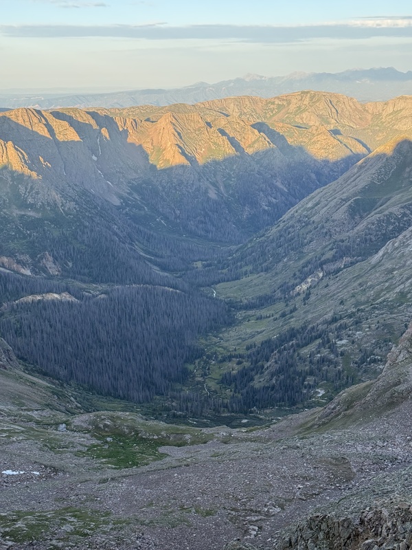
I successfully completed all of the Chicago Basin 14ers across 3 days (2 nights) on 17-19 July 2026. This adventure was a long time coming as I have had multiple Durango/Silverton train reservations over the years, as well as plans to hike via the Purgatory TH, that I had to cancel for various reasons. Ten years after my first attempt at catching the train ended in a car accident in my dad’s borrowed car outside of Fairplay (everyone was OK, but no matter how much of an adult you are, the call to Dad that you totaled his car sucks), everything came together and I was blessed with a personal and professional window that allowed this trip to finally happen. I also ended up being solo for this expedition, one of my longest back-country solo adventures, which amped up my anxiety leading to the trip. But as I soon found out, this area of the state is incredibly busy in the summer and while I was by myself, I was rarely alone.
There is a massive amount of information on these climbs available both on this website and elsewhere. Because of these amazing resources, I wasn't surprised by anything encountered on my journey. In an effort to not duplicate a lot of what's out there, I attempted to summarize my observations in a more concise "mini" TR format. But then all my notes, thoughts, and photos got away from me and this ended up being longer than I was anticipating. Oh well...
I've included links to some of the available resources that I found most helpful in preparing for this trip at the bottom of this report. Also included are my splits and my Windom Peak GPX track (for reasons discussed later). If anyone has questions, please don't hesitate to reach out.
Thanks for reading.
TRAIN LOGISTICS, NEEDLE CREEK, AND THE BASIN
I booked my train reservation for this July 2026 weekend in early May. I am not sure how many spots there were at the time I booked but Needleton access was definitely sold out the day of (the train limits the number of Needleton drop-offs to 40 a day). Consistent with the Route Description, I had to call the Durango & Silverton Narrow Gauge Railroad (D&SNGRR) to make the wilderness access reservation versus doing it online. Everyone I interacted with via phone and in-person at D&SNGRR was very professional, helpful, and friendly.
I had read parking at the train station could be dicey, even with a parking reservation which I purchased as part of my initial reservation ($10/day). This was further confirmed when D&SNGRR auto-texted me the day before my trip that long lines to park were expected. The lot opens at 0700 MT, so as a precaution, I showed up at 0630 MT. To an empty lot. No line. No workers. Nothing. Around 0645 MT, a car pulled up behind me. The parking attendants showed up a few minutes later and, after checking my reservation, pointed me to where to park a little before 0700 MT. It was then a 5-minute walk around a McDonald's to the train station. There was a short line of cars starting when I walked past on my way to station, but all that worrying ended up being for nothing.
A couple of friendly train station employees greeted me as I wandered towards the station with my heavy pack. One of them checked my name against her list, handed me my tickets, and gave me the spiel. I then wandered around without my pack for a half hour before boarding. The D&SNGRR museum is pretty neat.
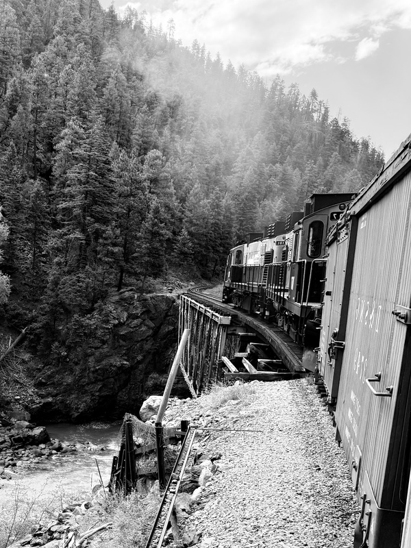
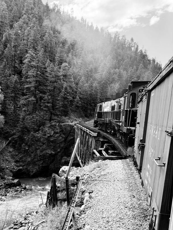
The train ride itself was long, diesel-fumey, and buzzing with anticipation. We were delayed during the ride due to an oil leak by about 90 minutes, but the conductor and other staff members were super communicative and assured us that our adventure had not come to an anticlimactic, early end. I was able to leave my assigned seat in the covered cab and wander into the open air area, and by doing so, I met a bunch of other hikers. It was fun to run into people from that initial train ride over the next few days.
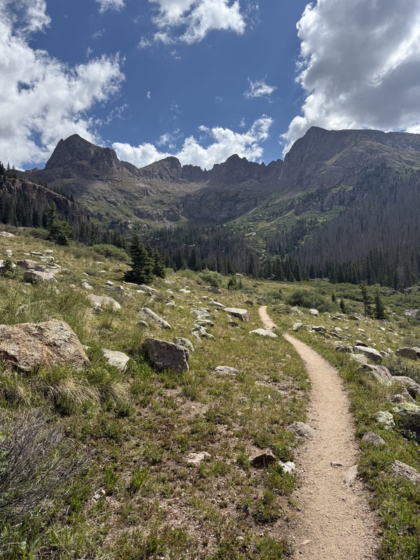
After getting dropped off at Needleton and retrieving my pack, I wasted little time, making quick work of the initial sub-mile stretch to the Needle Creek Trail split. From there, the excellent trail starts climbing and never really stops for 5 miles, getting especially relentless after the New York Creek crossing at mile 2. I was one of the first parties to arrive in Chicago Basin, almost 3 hours after I left Needleton. This was a beast of a trek, especially with a heavy pack.
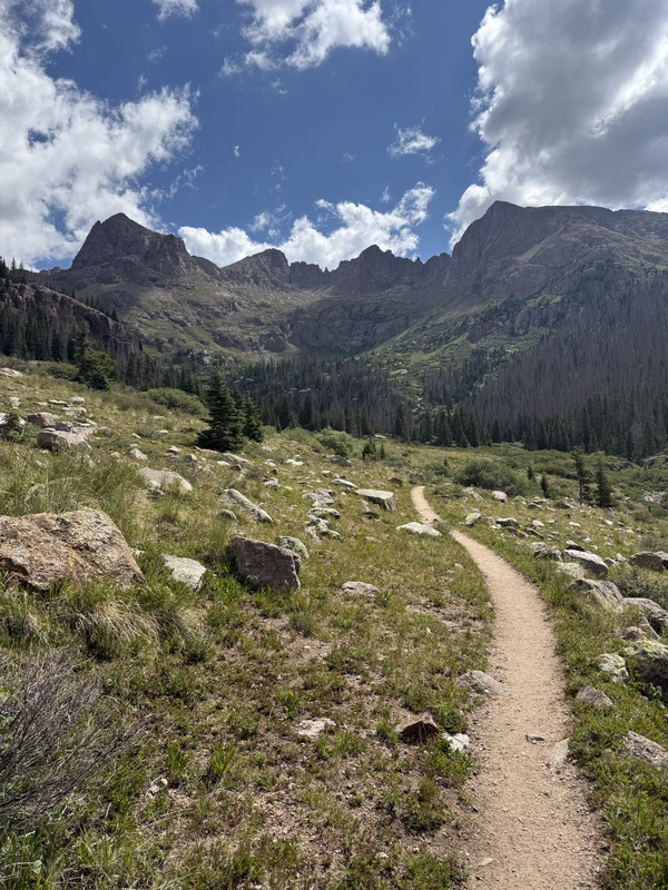
Once the trail hits the basin and the views opened up, campsites started to appear. However, from my research, I knew better sites were towards the end of the basin. So I walked another mile-ish, exploring a couple sites along the way, most of which were occupied or had close neighbors, until I found a good set of spots in the trees a hundred yards beyond the Twin Lakes trail split.
Thunder rumbled and it rained off and on the rest of the first evening, but I was able to establish camp, filter water from the very accessible Needle Creek, and get my gear ready for the next day without much weather drama. This would be the case for the remainder of the weekend. I think I got lucky; I've read of sustained thunderstorms blowing through this area during the summer, keeping visitors tent-bound for hours.
My original train reservation had me returning Monday, 20 July 2026, but due to my climbing productivity, I was able to catch the train a day earlier. D&SNGRR has no issues with this; I was told as long as you have a ticket (and you MUST have a ticket), you will get a ride no matter what day it says on said ticket. I was stuck paying for an extra day of parking I didn't use though. C'est la vie I guess.
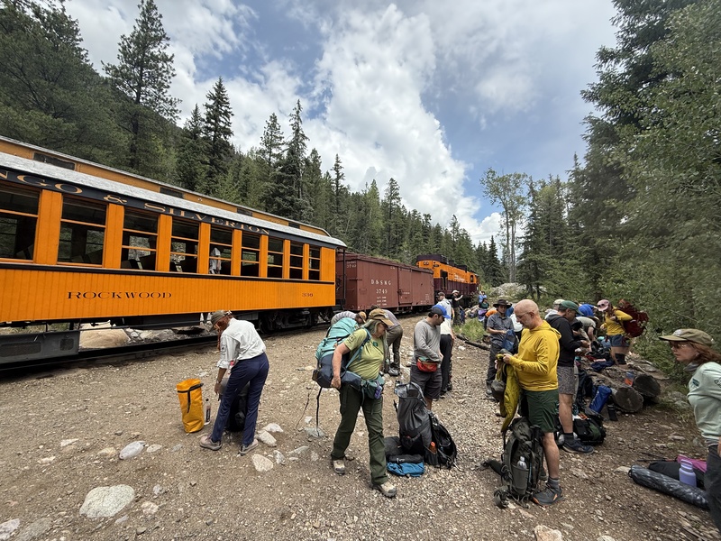
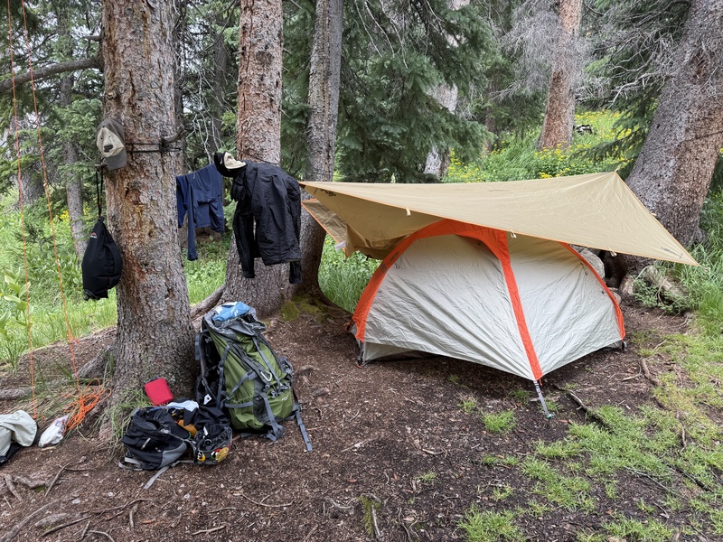
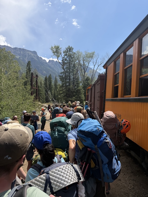
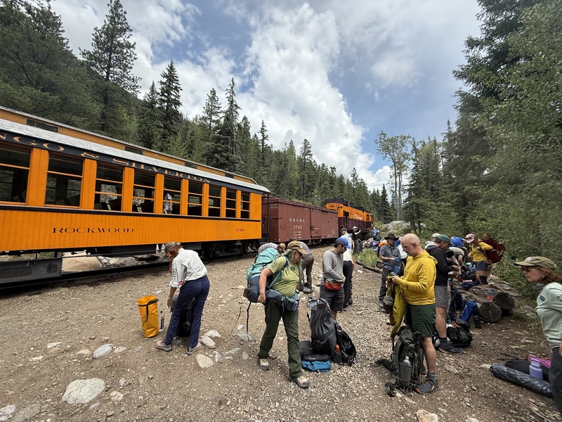
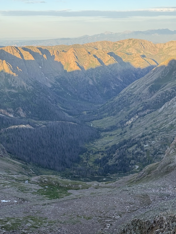
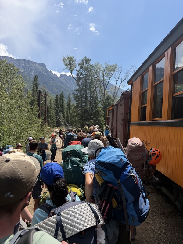
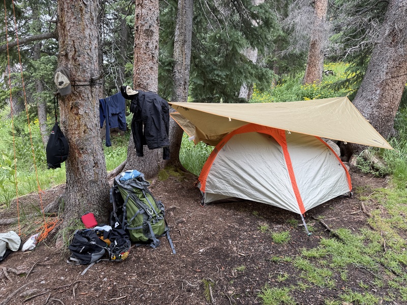
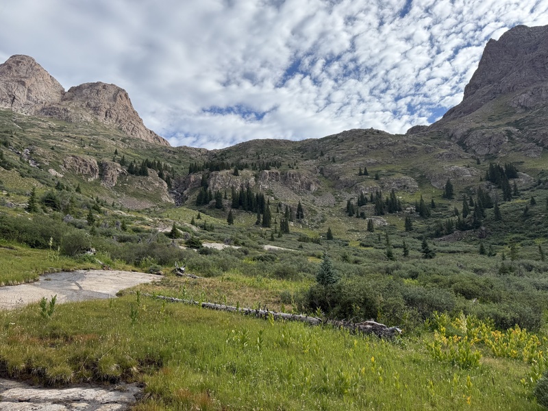
The rush to gear up and hit the trail at Needleton. Our train was delayed about 90 minutes due to an oil leak, and the conductor and staff were in a noticeable hurry to get us unloaded and on their way to Silverton. Chicago Basin is about 6 miles and 2,500 vertical feet from here.What a spectacular place, enjoyed exponentially more after shedding my 3,000lb pack. Peak Eighteen, Windom Peak, and Jupiter Mountain dominate the northeastern horizon from all viewpoints in Chicago Basin.My campsite in the trees at the far end of Chicago Basin, near the Twin Lakes trail split. There were more spacious sites around that could accommodate larger parties, but this worked for my 1P tent. And while lugging the additional tarp to the basin was probably overkill for the weekend I was there, I'm glad I had it as I've heard it's not uncommon for large amounts of rainfall to hit the area during the summer months.A view of Chicago Basin looking southwest from near the Windom Peak saddle. I found a bunch of campsites throughout the area, but the best spots are at the end of the basin. I pitched my tent near the Twin Lakes trail split in the group of trees at the bottom of this image.There were a lot of people catching the train back to Durango at Needleton on Sunday, 12 July 2026, certainly more than the 40-person limit D&SNGRR has for drop-off. But even with a ticket for the following day, I was able to secure a ride. The conductor told everyone to "just find a seat." I pitied the concession car worker though; she was absolutely mobbed by hikers craving something other than dehydrated camp food and filtered water.
SATURDAY, 18 JULY 2026: MT EOLUS AND NORTH EOLUS
I started both climbing days early, leaving my campsite by 0330 MT. This worked out great as storm clouds were rolling in by noon on the first day.
Minus a few early slab stretches, the trail up the headwall to Twin Lakes was easy to follow. I reached the Twin Lakes in less than an hour from the Needle Creek trail split in the basin.
The turn-off towards Mt Eolus was hard to identify in the dark and having the GPX file definitely helped. But once I crossed the creek, the trail into the Mt Eolus basin was well-defined and in great shape, including some awesome rock steps through the upper talus areas. I had no issues navigating by headlamp to the obvious "Ramp" identified in the Route Description.
The "Ramp" and upper basin was a mix of Class 2 and easy Class 3 scrambling. The rock was super grippy and fun to climb through here, and I topped out just climber's right (east) of the ridge notch at 0540 MT, a little over 2 hours after leaving my camp in the basin.
The various towers and infamous "Catwalk" towards Mt Eolus on the ridge were enjoyable and passed quickly. I honestly didn't even realize I was on the "Catwalk" until after I crossed it. I was surprised by how wide it was; wider than a sidewalk. There was one large rock along the stretch that moved on me going both directions, but otherwise, everything is very solid on the ridge despite what pictures may portray.
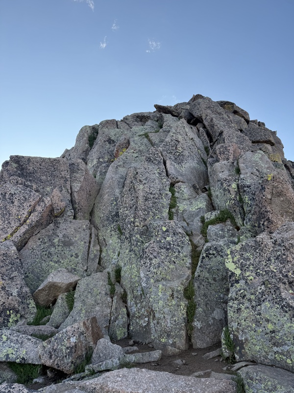
The East Face of Mt Eolus represented the most challenging climbing of the day, and probably of the entire weekend. The route-finding in particular was tricky through this stretch, and it was easy to fall into the trap of ascending a decent looking set of moves only to be faced with something much more sketchy. I followed the Route Description as best I could, angling climber's left below some cliffy boulders, before starting my ascent line. I saw some cairns, but they weren't consistent, so instead mostly used my wits to navigate the area. There was plenty of loose rock present so a helmet was a must.
I ended up topping out climber's right of the summit, requiring me to do a couple Class 3 moves on the back (west) side of Mt Eolus to reach the true summit. It took me a little over 20 minutes to gain the summit from the Mt Eolus ridge notch, about 2.5 hours after leaving the basin.
On descent from Mt Eolus, I took an even more southerly line (climber's left) down the East Face than on ascent, but I can't say this was all that much cleaner. I still had a couple instances of dropping down onto a promising ledge only for it to result in a challenging downclimb.
Back at the ridgeline, I chatted with some other climbers, gave them some (probably terrible) beta on the East Face, and made quick work back to the ridge notch. It took me about the same amount of time to descend this section as it was to ascend.
Gaining the summit of North Eolus was a breeze compared to its sister peak and I scaled it quickly, summiting my second peak of the day at 0640 MT, about 40 minutes after leaving the Mt Eolus summit and just over 3 hours from my camp. In contrast to Mt Eolus, I spent a little more time on the North Eolus summit, savoring the views of the surrounding Centennials as sunlight filled the area.
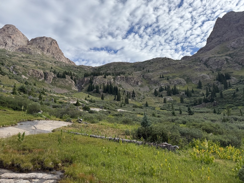
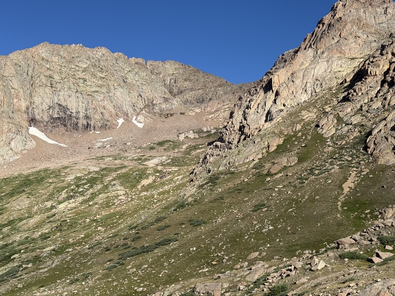
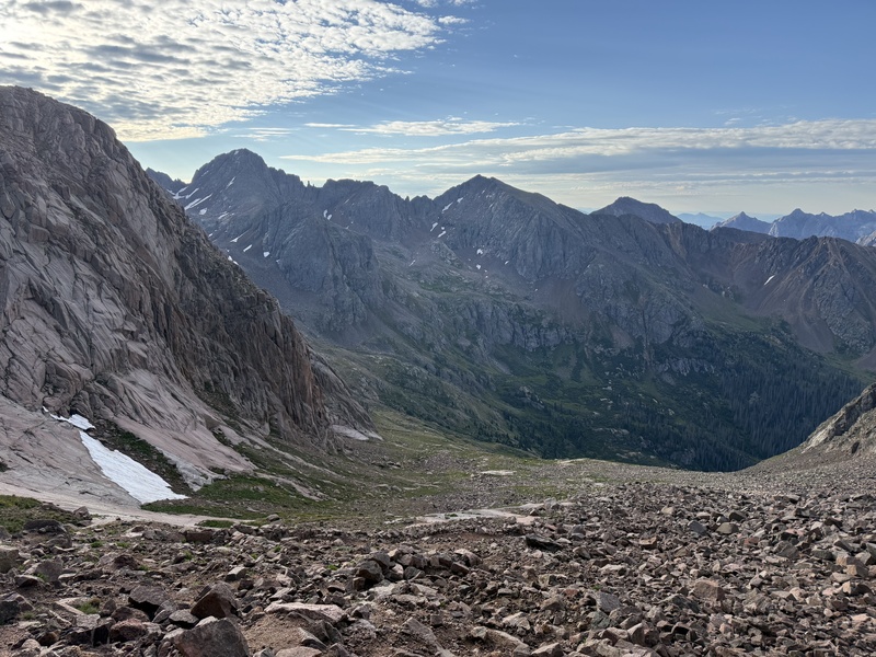
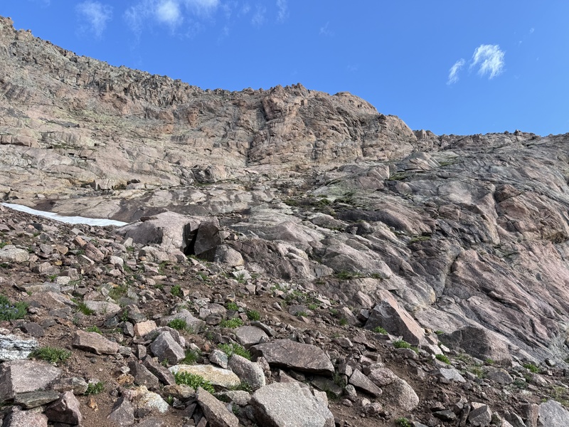
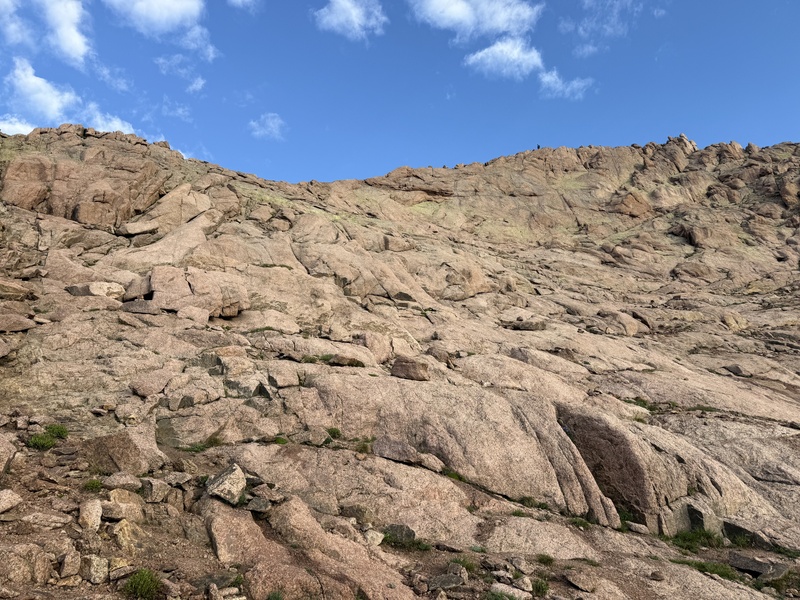
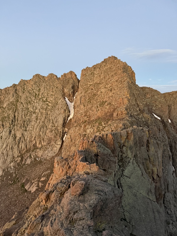
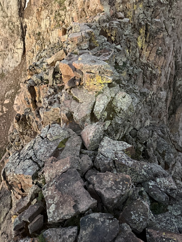
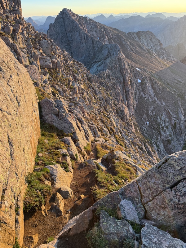
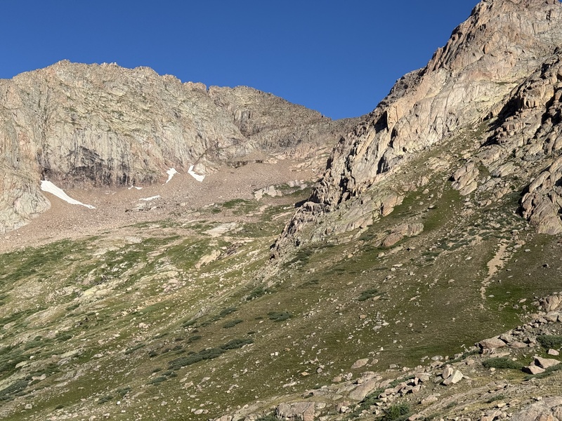
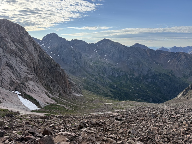
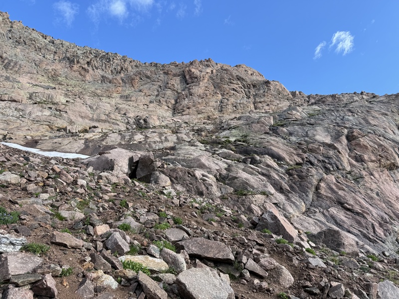
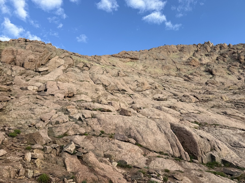
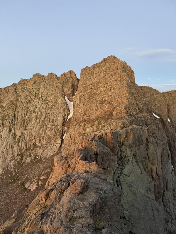
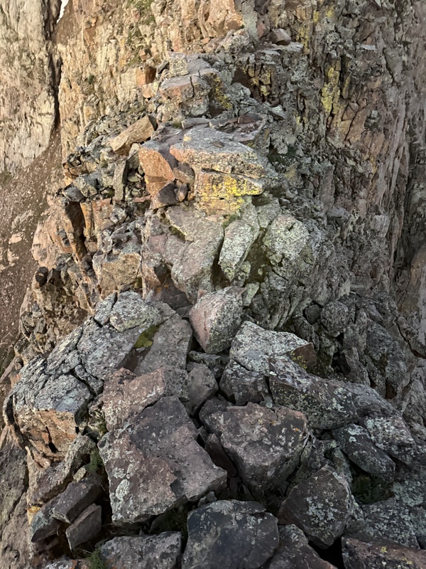
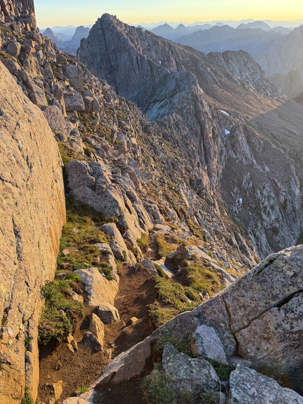
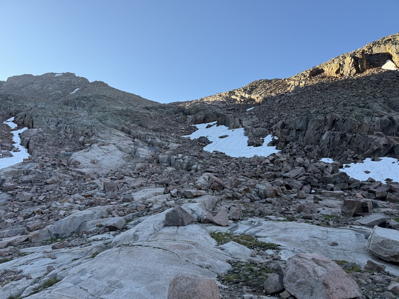
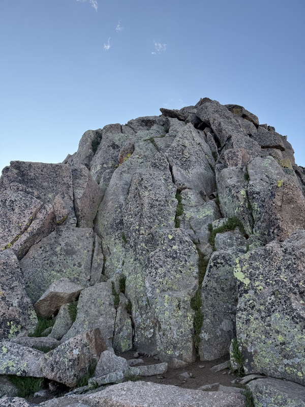
The headwall up to Twin Lakes was really pretty with multiple waterfalls and the last vestiges of spring wildflowers. Of course, I ascended this area in the dark so was only able to appreciate it later in the day. The trail is excellent minus a couple slabs down low that could be disorienting to navigate via headlamp. I made great time through this section, arriving at the lake in less than an hour from the Needle Creek trail split. (Photo taken on descent.)The excellent trail to Mt Eolus contours around the prominent rock face on the right side of this image and is well-established all through the subsequent talus garden. The Mt Eolus summit is visible on the center horizon of this photo. North Eolus is not visible from here. (Photo taken on descent.)The upper talus-filled area below Mt Eolus with Windom Peak and Centennial Jupiter Mountain in the distance. Again, there is an excellent trail through here. (Photo taken on descent.)The Mt Eolus trail peters out at the base of an obvious "Ramp" that marks the end of the Class 1 portion of the hike; the entrance is just left of the small snowfield in this photo. The "Ramp" cuts up and to the climber’s right to below the Mt Eolus ridge line. (Photo taken on descent.)The final stretch to the Mt Eolus ridgeline was straight-forward Class 3 scrambling with the easier route being climber’s right. The North Eolus summit is visible on the upper right of this photo, with a single climber descending towards the ridge line. (Photo taken on descent.)While the ridgeline towards Mt Eolus was enjoyable and easily navigated, I found the East Face of the peak to be arguably the most difficult stretch of the all the 14ers in the area. Consistent with the Route Description, I thought the best path to be further climber’s left, though there was still plenty of challenging route-finding through the maze of ledges and cliffs.I thought the infamous “Catwalk” feature to be underwhelming. It is wider than a sidewalk and the whole ridge line is very solid, despite how it appears in this photo. (Photo taken on descent.)An example of a promising ledge high up on the Mt Eolus East Face that undoubtedly leads to a sketchy set of boulders or cliffs. The Mt Eolus summit is not visible in this photo. North Eolus' tilted summit with the obvious Class 3 climbing line is in the mid-ground, along with the rest of the Mt Eolus summit ridge. The Grenadier Centennials dominate the northeastern views in this area, seen in the far background. (Photo taken on descent.)
SATURDAY, 18 JULY 2026 (CONTINUED): SUNLIGHT PEAK
I made great time descending from the Mt Eolus summit ridge, arriving back at the Twin Lakes just before 0800 MT. The morning clouds had cleared and I had plenty of food and water, so I decided to start plodding up the opposite side (east) of Twin Lakes toward Sunlight Peak and Windom Peak. This initial stretch from the lakes was definitely a slog for me, and I debated multiple times turning around. The trail flattens at the upper basin and I stopped at one of the large cairns to assess the weather and my energy. After watching a few folks climbing, I decided to give Sunlight Peak a go.
The gulley up to the Sunlight Peak shoulder is definitely loose, but the previous days' rains helped stabilize it some on ascent, and the stretch passed quickly. The next thing I knew, I was on the summit ridge, only about an hour after leaving Twin Lakes. The weather continued to hold and, with a renewed motivation knowing the summit was within reach, I approached the Class 3 upper reaches of Sunlight Peak.
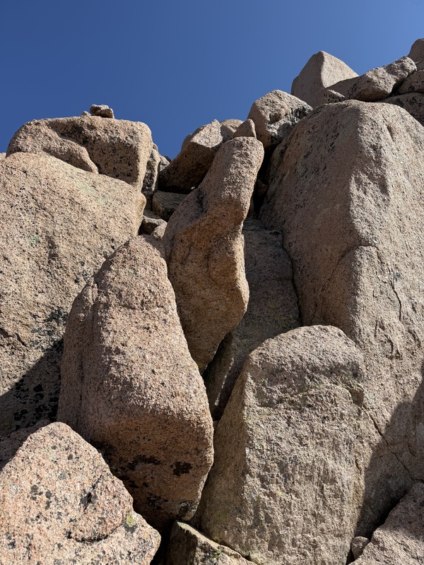
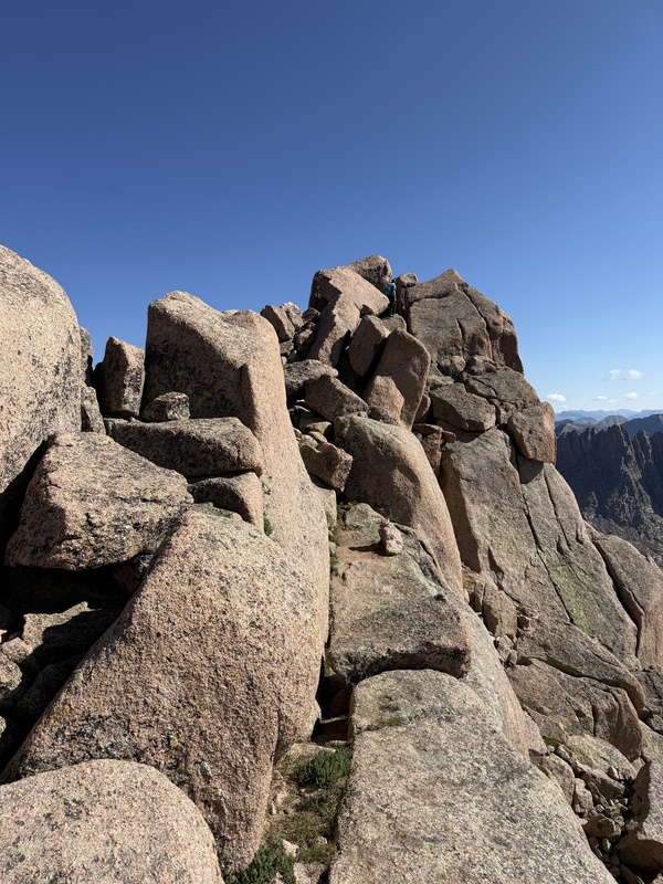
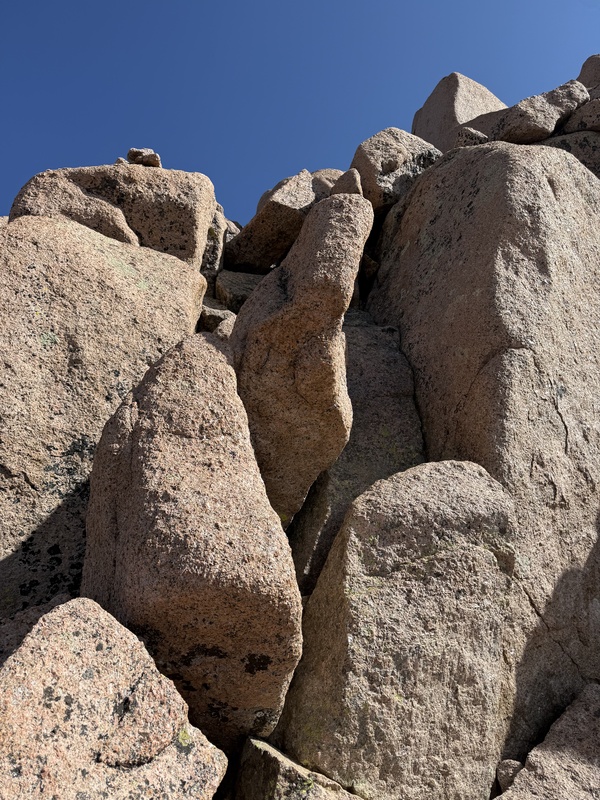
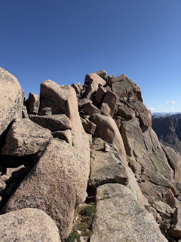
The initial sections above the Sunlight Peak gulley were a mix of Class 3 scrambling on grippy boulders and rock hopping, parallel to the boulders that wall off the eastern side of the peak. I had some trouble lining up the area with the Route Description photos, but none of the climbing was particularly difficult and it was mostly obvious where to go. Towards the top, I was able to identify the multi-path pitch from Photo 21 in the Route Description. I opted for the climber's left line, which worked well. I was shadowed by another climber who was a little shorter than me and took a slightly different line that also went. Every climbing surface in this area was super solid and a lot of fun.
After that final pitch, I punched through the summit hole, scampered along the final set of boulders, and made contact with the amazing Sunlight Peak Summit Block, about 30 minutes after reaching the top of the gulley. I watched another climber descend the Summit Block and, without thinking, went for it. What a cool way to finish a climb. The exposure on all sides was breath-taking, but the boulders are solid and very grippy. I did struggle making the final step up to the highest boulder, mostly because my legs were feeling the miles and altitude gain from the morning already, so ended up just mantling the thing with my torso and calling it good. I made the "leap of faith" and dropped quickly back to the summit marker for a much-needed Justin's peanut butter cup break.
I descended back through the Class 3 area and started down the gulley at around 1000 MT. I was staring over at Windom Peak, but with clouds finally gathering and exhaustion creeping in, I decided to call it for the day. I took my time crossing the basin, arriving at the Twin Lakes around 45 minutes later and then my campsite just before 1130 MT, making my 3-summit tour an almost 8-hour journey. The rest of the day was spent resting, re-fueling, and hunkering down in my tent during the rain showers that came and went all afternoon.
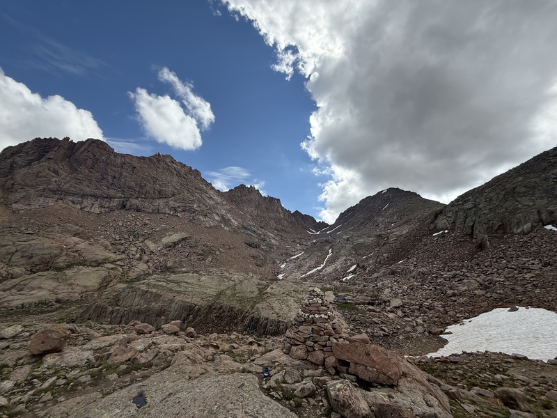
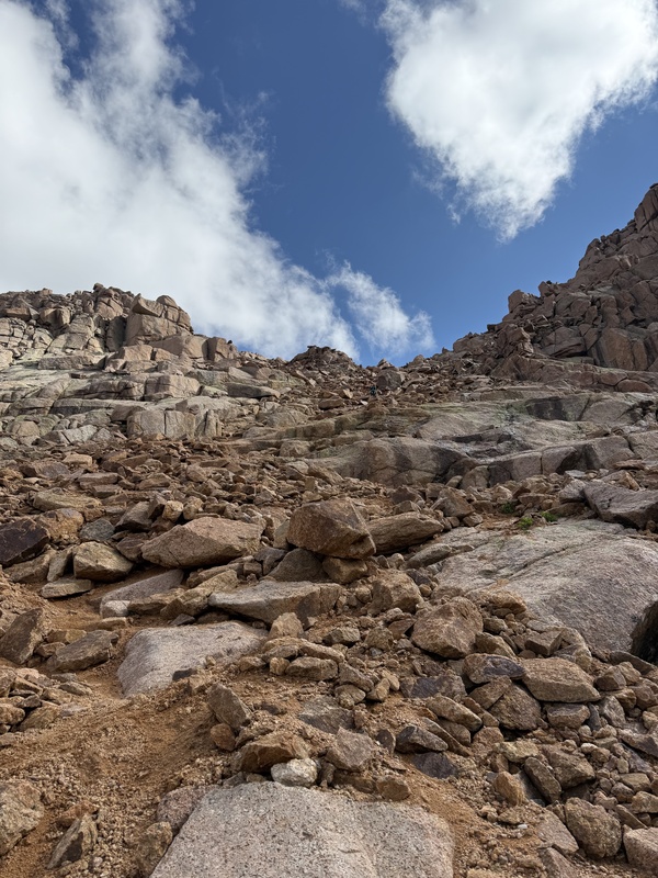
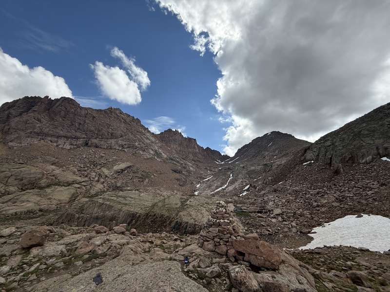
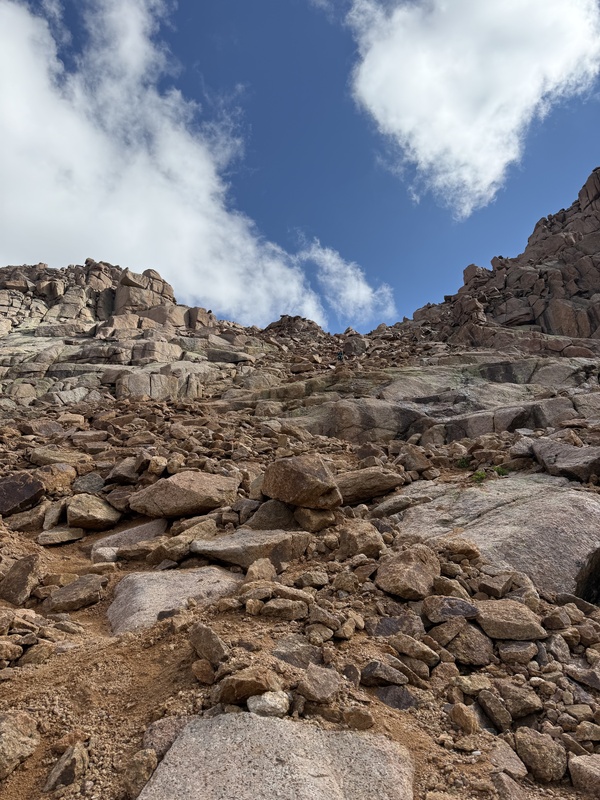
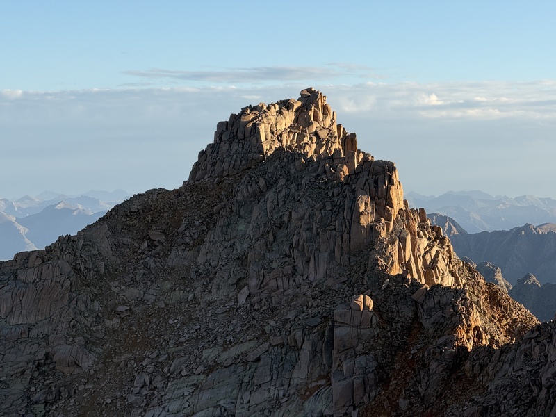
The eastern rock basin above Twin Lakes and below Sunlight Peak (upper left, north) and Windom Peak (upper right, south). There was a decent trail to this point and then a series of large cairns guided me to the base of the Sunlight Peak gulley, identified below the obvious weakness on the northern horizon. (Photo taken on descent.)The gulley leading to the notch between Sunlight Peak and Sunlight Spire. The gulley went surprisingly fast on ascent, with the previous days' rains helping consolidate the loose rubble. I reached the top of the gulley about an hour after leaving Twin Lakes. (Photo taken on descent.)The boulder jumble that makes up the Sunlight Peak summit as seen from Windom Peak. The route follows the shadowed side of the ridge (southwest) through enjoyable Class 3 terrain until reaching the infamous Class 4 Summit Block seen at the very top. Despite how it appears in this photo, I found most of the rock along this stretch to be super solid and grippy.The climber's left line (west) of the multi-path pitch from Photo 21 in the Route Description.After popping through the summit hole, I finally experienced the exposure on the east side of Sunlight Peak. The infamous Class 4 Summit Block was also visible, seen here with a climber considering the final set of moves to its pinnacle. I recommend not over-thinking and just going for it.
SUNDAY, 19 JULY 2026: WINDOM PEAK
Because I was able to bag 3 of the peaks on Saturday, I was planning to summit Windom Peak on Sunday and also break camp to hike out to the train, a day earlier than my original itinerary. I started early again, leaving camp at 0320 MT. I put my head down and motored up the Twin Lakes headwall, arriving at the lakes less than an hour later.
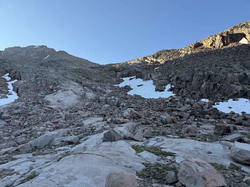
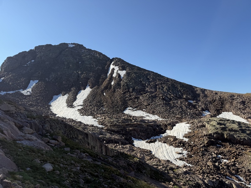
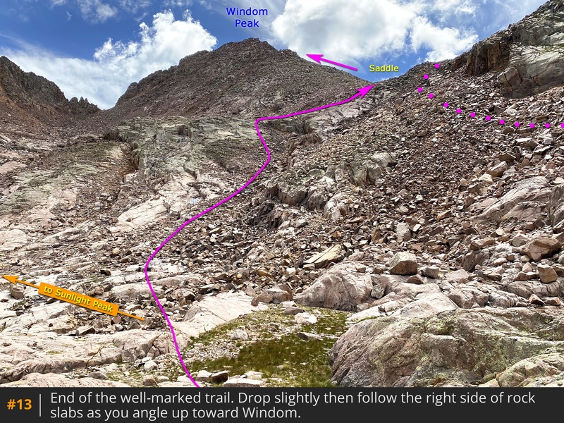
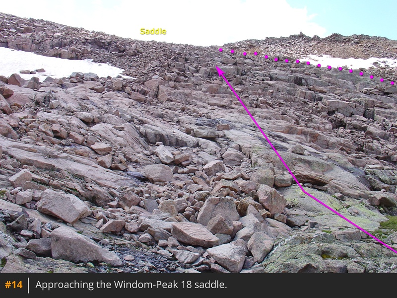
I headed up to the southern basin between Sunlight Peak and Windom Peak, and at one of the last prominent cairns, angled climber's right (south) towards the obvious Windom Peak saddle. The GPX track I had was pointing me towards a large snowfield surrounded by steep and haphazardly balanced talus. I instead angled climber's left (east) up some slabby ridges, finding the occasional cairn that re-vectored me to easier terrain. I was joined by a couple of climbers during this initial stretch, and we worked together to identify cairns in the dark and find the best/easiest way. The GPX track continued to show us a few hundred yards "off course" until it merged with our path on the saddle, almost two hours after I left camp.
On return later that morning, I stubbornly decided to take the GPX track down from the saddle and found it to be as tricky as I thought it'd be. I reviewed the Route Description once back at camp and the best I can figure is the GPX track matches the yellow dotted line in Photo 13 and Photo 14, but my ascent line followed the recommended path. I included my personal GPX track in this TR below because of this discrepancy.
Once on the saddle, I left the other hikers and started east up the steepening slopes of Windom Peak. There wasn't a trail through this initial section of easy talus grinding, but I did angle slightly climber's left near the top, following the occasional cairns, arriving at the prominent notch on the slope at approximately 0530 MT.
There have been many thoughts on this website about the rating of the Windom Peak route, and I tend to agree with the sentiment that an easy Class 3 rating is adequate. The initial, steep boulders above the notch are a good example of this. But the climbing is solid, and I continued to follow an enjoyable line all the way to the summit, topping out a little before 0600 MT, 2.5 hours after leaving camp that morning.
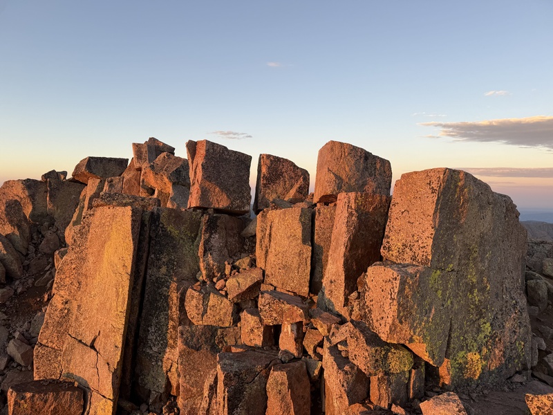
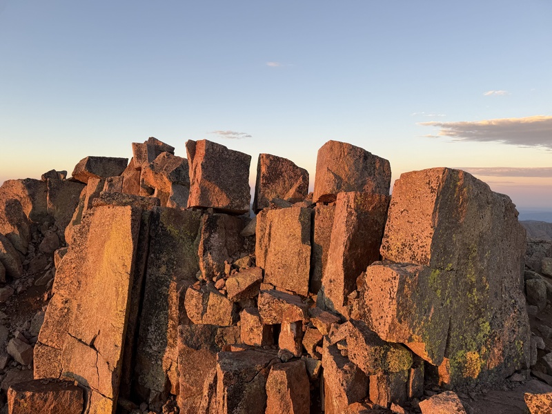
The summit area of Windom Peak is super unique: large, blocky boulders balanced on other rocks line the top, appearing almost like teeth. The true high point is on one of these blocks, and it took a bit to find and scramble up it. I puzzled over how such a configuration of rocks came to be, and on the very top of a mountain no less.
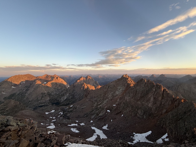
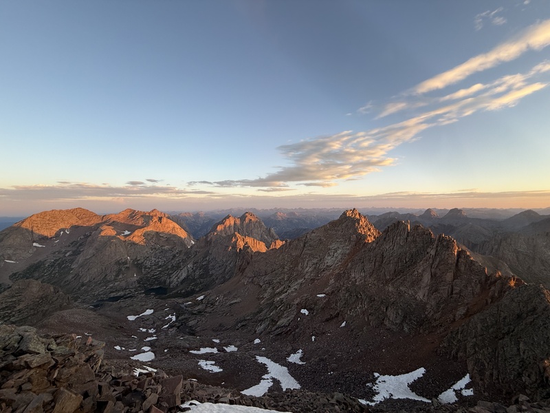
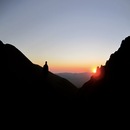
Knowing I had the time, I spent over an hour on the Windom Peak summit. I found a bench a little below the true summit and watched the sun rise over the prominent Mt Oso group and Rio Grande Pyramid to the east. The alpenglow was otherworldly on all the surrounding peaks, and I am not embarrassed to admit I was moved to tears. This was one of my favorite summits, not because of the climb itself, but because of how special that random July morning was, sitting in quiet reflection, observing the jagged edges of the Needle Range alight. It was both dark and bright. Calm and chaotic. Dead quiet and crazy loud. I don't think I'll forget that hour alone on Windom Peak for as long as I live.
Once moving again, I descended quickly, returning to the saddle 30 minutes after the summit and then to Twin Lakes 45 minutes after that at approximately 0800 MT. I savored my last views of this amazing place as the sun crested the surrounding peaks, and then made easy work of the trail back to camp. My total climb time was almost 5.5 hours, including my extended summit stay.
I leisurely tore down camp and started the 6+ mile grind back to Needleton. I must've got stuck in one of those Weminuche Wormholes because the hike out was definitely longer; those last few miles were torture. I finally reached the Animas River bridge a little before 1300 MT, with over an hour to spare before the train arrived.
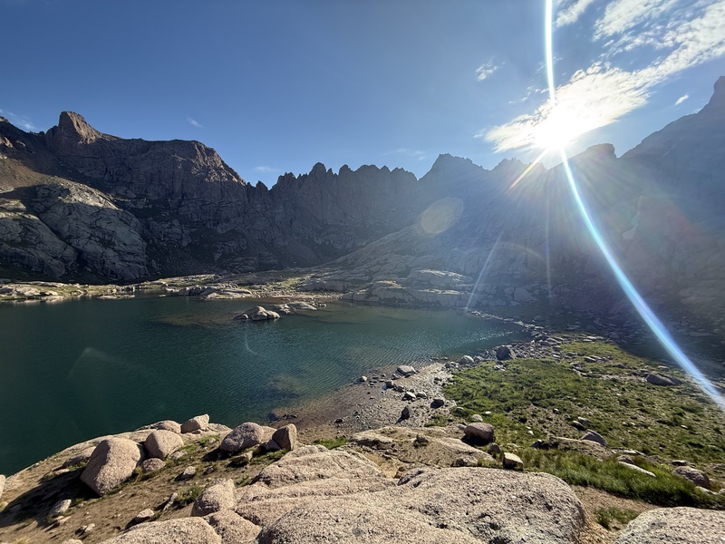
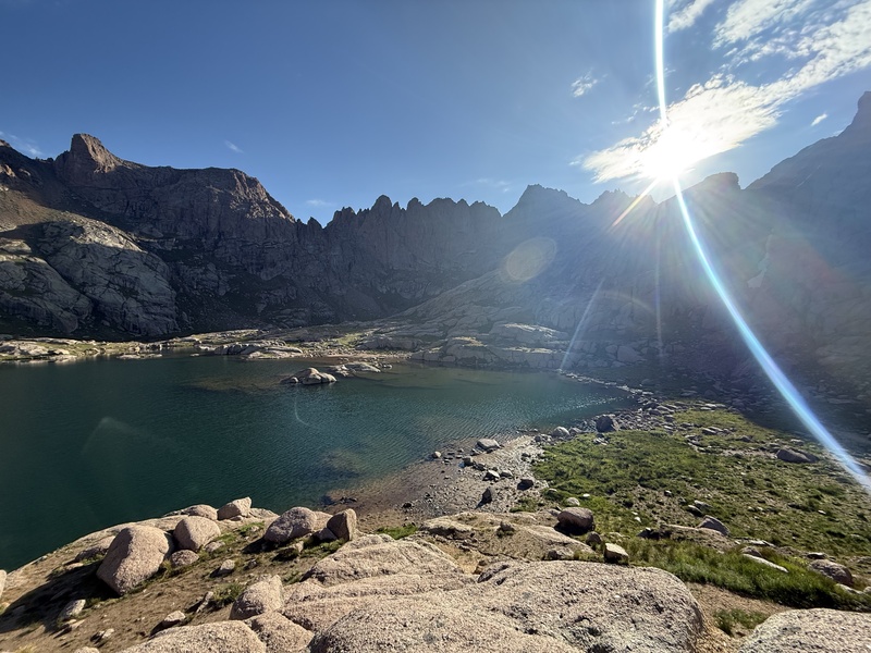
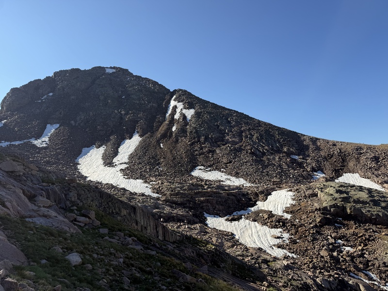
Gaining the Windom Peak saddle was trickier than I expected. The GPX track took me towards the prominent snow field in the center of this photo, but I instead elected to navigate the large slabs further climber's left (east), which aligns with the Route Description. There were cairns scattered around which helped. On descent, I stubbornly stuck with the GPX track which indeed angle me above the snow field below some cliffs on precarious talus. I recommend sticking with the Route Description line. (Photo taken on descent.)Windom Peak as seen from Sunlight Peak. The route mostly follows the ridge to the summit.An example of what I would classify as easy Class 3 climbing, just above the prominent notch on Windom Peak's ridge line. (Photo taken on descent.)The surreal summit blocks of Windom Peak catching the morning light. The true "summit" is on one of these boulders. After tagging it, I found this nice spot with a broader bench, spending over an hour in solitude watching the sunrise before beginning my descent.Twin Lakes in all its lens-flarey glory.
MISC NOTES
A note about the title of this TR: "Train Dreams" is an homage to a lovely 2025 film of the same name (based on an equally lovely 2011 novella by Denis Johnson) about an early 20th century man grappling with uncertainty and grief. Other than the obvious corollary in the title, the film's story resonated with the inherent lonely nature of my solo trip. There’s a line at the end of the movie that stuck with me while climbing these awesome mountains: “…on that spring day, as he misplaced all sense of up and down, he felt, at last, connected to it all." I recommend checking the movie out, it’s on Netflix.
A note about critters: I heard that Chicago Basin and the Twin Lakes are a mountain goat mecca. I, however, saw only one, single goat across the entire 3 days. I did have a run-in with a porcupine on my first night when the sneaky animal attempted to steal my sandals from under my tent vestibule not 6 inches from my face. I scared it off but learned my lesson: from then on, everything was either in my tent or hung in the trees.
A note about phone service: I lost Verizon phone service shortly after the train track diverts from Hwy 550, near the Rockwood stop. And I didn't have any service anywhere along the Needle Creek trail nor in Chicago Basin (though I do have a Garmin InReach which allowed me some connection with my family). I had decent cell service on the Mt Eolus group, no service on Sunlight Peak, and spotty service on Windom Peak. Our return train got awfully quiet once we hit the Rockwood stop as everyone's phones filled with all the correspondence we had missed over the last few days.
A note about climbing and catching the return train in a single day: Clearly this is doable as I was able to summit Windom Peak and had plenty of time to break camp and hike out before the train arrival at Needleton at 1500 MT. I likely had time to also summit Sunlight Peak, but would have been more hurried and stressed on the return trek. The Mt Eolus duo is probably easier to do and catch the train since the traverse between the two is faster, but an early start is a must regardless.
A note about climbing all of the Chicago Basin peaks in a single day: A lot of folks on my train ride had ambitions of doing all 4 14ers in one day (including myself), but as far as I know, none were successful. With my early starts (~0330 MT both days), I likely could have done it, but decided to stop after 3 on Saturday due to approaching weather and tired legs. On Sunday, I was passed halfway up to Twin Lakes by a lone hiker who intended to climb all 4 and I enjoyed watching his headlamp the rest of the morning over on the Mt Eolus group. I passed him again later in the day on his way to Sunlight Peak and given his pace, I think he was likely successful in his endeavor. All to say, with an early start, decent weather, and good fitness/speedy hiking, I think it's totally doable, even for a mere hiking mortal like myself. But it would definitely come at a cost. With such a packed itinerary, there may not be time to enjoy a summit sunrise like I did on Windom Peak, or horse around on the Sunlight Peak Summit Block, or sit for a quiet hour or three on North Eolus, or doze on a warm rock by Twin Lakes. Especially for my first time in this amazing place, I'm glad I took two days.
A note about solo expeditions: It was during my long afternoons at camp, both on the first day after hiking into the basin and then after the first big climb day, that I typically felt the most lonely, missing my wife and kids and questioning my selfish decision to be out here. I wandered around a bit, chatting with other campers, but often a passing rain shower or thunderclap would chase me back to my tent. 14ers.com user yaktoleft13 has an amazing TR from a 2024 solo adventure into the Weminuche Wilderness where he ponders the reasons for leaving his family to climb. While his solo adventure far surpasses mine in difficulty and isolation (I was in the super busy Chicago Basin for chrissake), his feelings of loneliness resonated with me. All to say, more than on the climbs themselves, I missed having a partner (and a cribbage board and a couple cold ones) during the long camp downtimes.
CONCLUDING THOUGHTS
This expedition was a stretch for me, and one I'm glad to have taken. This trip really felt like an adventure. Getting dropped off by the train in the middle of nowhere without easy access or contact with another living soul (minus 39 other hikers) was eerie and thrilling. And the subsequent days of further isolation, while lonely at times, only added to that sense of adventure.
The beauty in Chicago Basin and the surrounding Weminuche Wilderness is unmatched in Colorado, and once up high, the proximity of all the high peaks I've obsessed over for years is awe-inspiring. And then there is the climbing. The four 14ers accessible via Chicago Basin are unique, providing different playgrounds for all the basic mountaineering skillsets. I will forever treasure the route-finding on Mt Eolus, the slabby climbing of North Eolus, the awesome boulder-hopping on Sunlight Peak, and the therapeutic sunrise from Windom Peak. All of these peaks have amazing resources available which I leveraged heavily in preparation, and having unsurprising climbs helped me appreciate the beauty and remoteness of this area even more. I strongly recommend using this website and those that have come before.
With most of my climbing trips, time tends to warp perspective. The struggles and mundane elements fade while the moments of exhilaration expand until they cover the entire memory. Not so with this adventure. The stuffy train cars filled with anticipation and easy conversation. The slog up (and down) Needle Creek with more gear than I really needed. Sinking into a slight depression over the disconnection with my wife and kids while listening to the patter of raindrops on canvas. The feel of my pack on sore shoulders as my headlamp illuminated the early morning darkness. Stumbling on talus while watching marmots scamper along the trail. The warm small talk with other hikers. For some reason, these moments have stuck with me from my time in the Chicago Basin as much as the climbs themselves. And I think I'm better for it.
Thanks for reading. Cheers.
SPLITS
Friday, 17 July 2026
D&SNGRR Train Arrival at Needleton (after 90-minute delay due to oil leak): 12:04 MT
Needle Creek Trail Split: 12:33 MT (00:29)
New York Creek Crossing: 13:16 MT (01:12)
Chicago Basin Entrance: 14:55 MT (02:51)
Campsite near Twin Lakes Trail Split: 15:22 MT (03:18)
Saturday, 18 July 2026
Start from Campsite near Twin Lakes Trail Split: 03:30 MT
Twin Lakes: 04:24 MT (00:54)
Base of Mt Eolus "Ramp": 05:12 MT (01:42)
Notch on Mt Eolus Ridge: 05:40 MT (02:10)
Summit of Mt Eolus: 06:03 MT (02:33)
Departed Summit of Mt Eolus: 06:10 MT (02:40)
Notch on Mt Eolus Ridge: 06:35 MT (03:05)
Summit of North Eolus: 06:40 MT (03:10)
Departed Summit of North Eolus: 06:58 MT (03:28)
Notch on Mt Eolus Ridge: 07:05 MT (03:35)
Twin Lakes: 07:52 MT (04:22)
Top of Sunlight Peak Gulley: 09:00 MT (05:30)
Sunlight Peak Summit: 09:28 MT (05:58)
Departed Sunlight Peak Summit: 09:37 MT (06:07)
Top of Sunlight Peak Gulley: 09:53 MT (06:23)
Twin Lakes: 10:47 MT (07:17)
Campsite: 11:25 MT (07:55)
Sunday, 19 July 2026
Start from Campsite near Twin Lakes Trail Split: 03:19 MT
Looking at that pic with all the people looking like the 6 Train in NYC, Would you do the train again or just walk in from Purgatory? Seems the latter would make for a more peaceful and predictable trip.
Thanks for the kind words. And thank you for your trip report from 13 (!) years ago - I referenced it in my report and in my pre-climb research. The weather you had on your Mt Eolus climb was crazy.
The Durango train approach has had personal, Colorado backcountry notoriety since I started really exploring the state 15 years ago. I think that and the sense of adventure I felt at drop-off really added to my experience, and therefore I'm happy with my decision to take the train this time. Of course, it is pricey and inflexible - though being able to catch a return whenever you want, regardless of what your reservation says, helps with that latter piece a bit. I have had previous plans to approach via Purgatory (and then Kennedy Pass which has received some attention lately, most recently in this 2026 TR) for the reasons you indicate, but they fell through for XYZ reasons. The Purgatory approach looks like an absolute butt-kicker of a hike; I met a fit-looking guy in the basin my first night who came in from Purgatory that day and he looked wiped. Heck I was wiped after the 6-mile trek from Needleton.
But all that being said, think for my next visit to the area, when I wouldn't in theory be as summit-hungry, I would opt for a casual Purgatory approach, spending a night somewhere along the Animas before continuing up into the basin. And I'd also bring a friend or two.
Sounds good and thanks for the kind words, your report will be a good resource as well for future climbers. I like how you added "managing young children" as part of your fitness regimen. Ain't it the truth!
Caution: The information contained in this report may not be accurate and should not be the only resource used in preparation for your climb. Failure to have the necessary experience, physical conditioning, supplies or equipment can result in injury or death. 14ers.com and the author(s) of this report provide no warranties, either express or implied, that the information provided is accurate or reliable. By using the information provided, you agree to indemnify and hold harmless 14ers.com and the report author(s) with respect to any claims and demands against them, including any attorney fees and expenses. Please read the 14ers.com Safety and Disclaimer pages for more information.
Copyright: Route information, text, risk factors, maps, GPX files, charts, photos, 14ers.com-created map imagery, flythroughs, and other content provided in this route description are copyrighted by 14ers.com and may not be copied, reproduced, republished, distributed, modified, or used to create derivative works without prior written permission.
Please respect private property: 14ers.com supports the rights of private landowners to determine how and by whom their land will be used. In Colorado, it is your responsibility to determine if land is private and to obtain the appropriate permission before entering the property.