| Report Type | Full |
| Peak(s) |
Culebra Peak - 14,053 feet Red Mountain - 13,911 feet |
| Date Posted | 08/18/2024 |
| Modified | 10/27/2024 |
| Date Climbed | 07/19/2024 |
| Author | The_Ramp |
| Riding the Serpent |
|---|
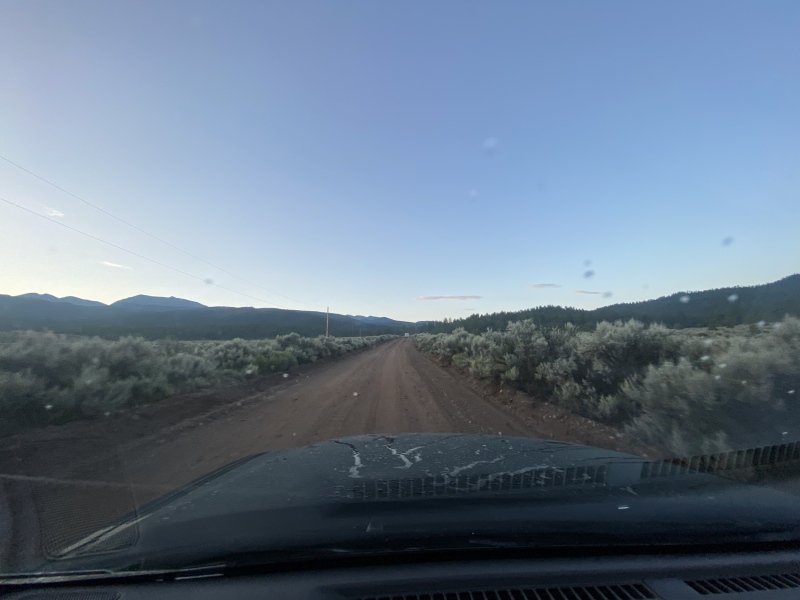
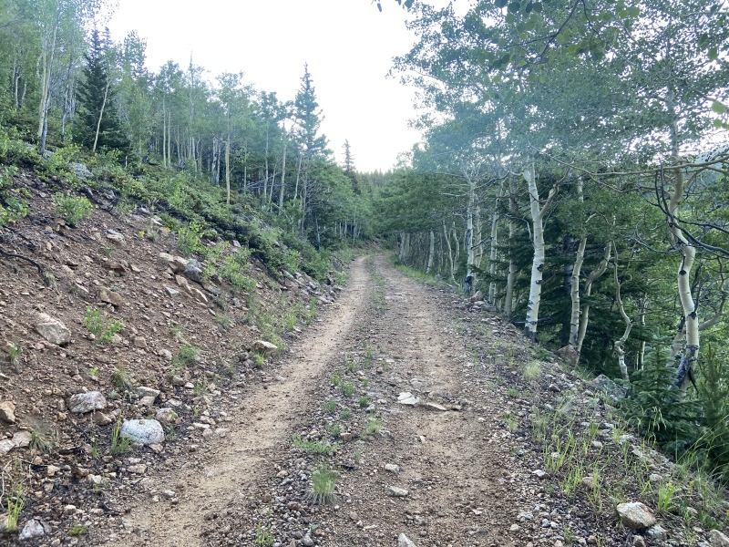
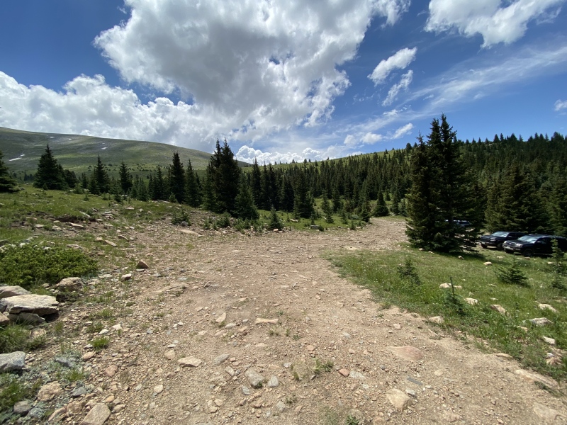
OVERVIEW: I successfully climbed Culebra Peak on Friday, 19 July 2024 along with Red Mountain and Punta Serpiente. This was a very unique climbing experience, notably due to the location of Culebra Peak on private property. Access to the peak is controlled by the Cielo Vista Ranch and entails a pre-arranged reservation, climbing fee, and dedicated starting time. Additionally, there is no established trail to the summit; instead hikers take a general heading to gain a ridge before traversing along this snake-like crest to the mountain top. Culebra means "Serpent" in Spanish and it's this ridgeline that gives this peak its name. There isn't a whole lot to this hike in terms of climbing difficulty or route-finding; I was able to keep the difficulty at Class 1 with a couple low Class 2 stretches. And getting lost in the summer with clear weather would take some serious effort. But Culebra Peak more than makes up for the lack of challenge and excitement. Because of Culebra's isolated nature and strict access, the beauty of this mountain and surrounding area is absolutely pristine. Combining that with the limited number of climbers and a choose-your-own-adventure style of ascent, this made for a truly personal climbing experience. I typically provide multiple cross-references to other user Trip Reports and helpful photos within the body of climbing reports, but given the relatively straight-forward nature of this climb, I don't think there's a whole lot of benefit in doing that here. I did review a handful of Trip Reports prior to my climb and include links to the more useful ones at the bottom of this write-up. As always, this website continues to be an absolute treasure in community resources associated with accessing and climbing mountains in Colorado. I strongly encourage folks to use those that have climbed before, even for the "easier" climbs like Culebra. In addition to useful links, I've included my climbing splits and other reference notes at the bottom of the Trip Report. Thank you for reading. CIELO VISTA RANCH ACCESS As everyone is aware, Culebra Peak is located on private property and access is tightly controlled through the Cielo Vista Ranch. Climbing is only permitted Fridays, Saturdays, and Sundays from January through July. As of 2024, a pre-arranged reservation is required along with a $150 fee. Hikers can make reservations through the Cielo Vista Ranch website. The reservation window starts in December for the following year. And, as it states at the very top of this webpage, a Waiver must be filled out, signed, and submitted as part of any reservation request. I believe folks can make reservations for multiple people. However, a Waiver for each climber is required at the time of the reservation. I made my reservation for my Culebra Peak climbing bid in late December 2023 and there were minimal summer spots left at the time of my booking. I jumped at an opening in late July but then hit a webpage error at the paywall and had to start my reservation over, this time with success. A week later, however, I looked at my credit card statement and saw I had TWO charges from Cielo Vista Ranch! I reached out via email to the Ranch to correct this. Carlos responded almost immediately and confirmed my reservation and helped me with the double-charge. I was truly surprised and impressed by this responsiveness, a big shout out to Carlos and the team for their customer service! On the day prior to my climb, I left Denver in the early evening and didn't arrive at the Ranch gate until well after dark. The directions on this website were spot-on and I was able to navigate through the desolate roads on the outskirts of San Luis without issues. I arrived to a handful of cars parked outside the gate and quietly retreated to my sleeping bag in the back of my car for a few hours of sleep. The next morning, folks started stirring at 0500 MT and, with the sun rising, I was able to get my bearings a bit. On the other side of the Ranch gate is a meadow for pitching a tent and a porta-potty, both of which can be accessed by scaling the fence on the side of the gate (note there is no lock on the porta-potty). At 0600 MT sharp, three vehicles arrived and a handful of Ranch employees jumped out to open the gate. There were about 15 cars loitering outside at this point and we courteously took turns entering. Once it was my turn, the Ranch employee validated my ID against a hand-written list of names and I was given directions to follow the road to the Ranch HQ compound. Once through the gate, it was a two-mile drive to the Ranch HQ along an easy dirt road. However, due to the previous night's storms, the road was incredibly muddy and very slick in spots. A truck in front of me with a cab-top camper almost slid off the road completely before gaining traction at the last second. I found 4WD was useful but still took the turns slowly. Once arriving at Ranch HQ, I parked, exited my car, and another Ranch employee gave us a 90-second spiel on where to go, safety considerations, and how to exit the property when we were done. It was helpful that they did this in waves of vehicles, otherwise we would've been waiting there for everyone to get through the gate and drive to the Ranch HQ. Once dismissed from the Ranch HQ compound, the other hikers and I caravaned up the road towards the Upper Trailhead. The road is rough and quite steep, but in good shape and I saw plenty of Suburus and 2WD SUVs make the trek with no issues. The road is also very narrow in spots but that concern is mitigated considering there are only 15-20 cars allowed on the mountain any given day and it is unlikely you would encounter a car going the opposite direction. At 0630 MT, approximately 3.5 miles from the Ranch HQ, I arrived at the "Four-way" and parked (I wanted to get the full "3k of vert" experience). Because this was much later than I normally like to start climbs, I didn't dawdle in setting off. After a mile of easy road walking, I arrived at the Upper Trailhead ~20 minutes later. 

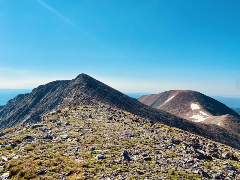
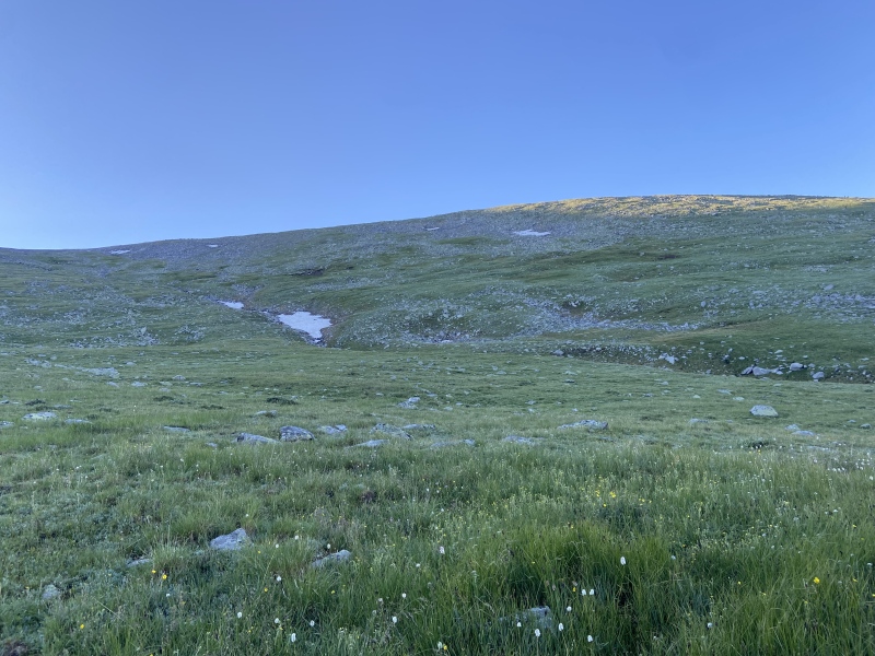
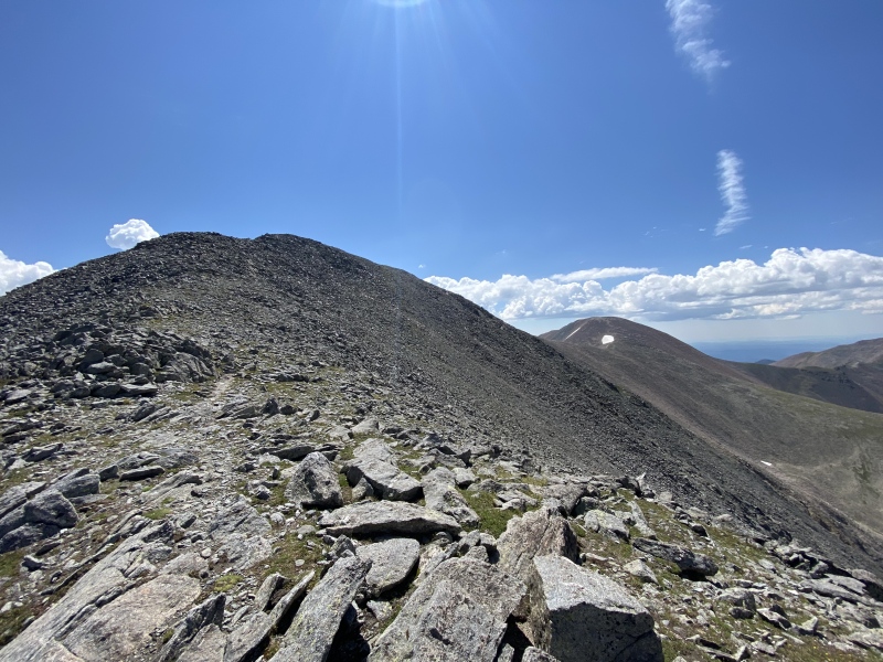
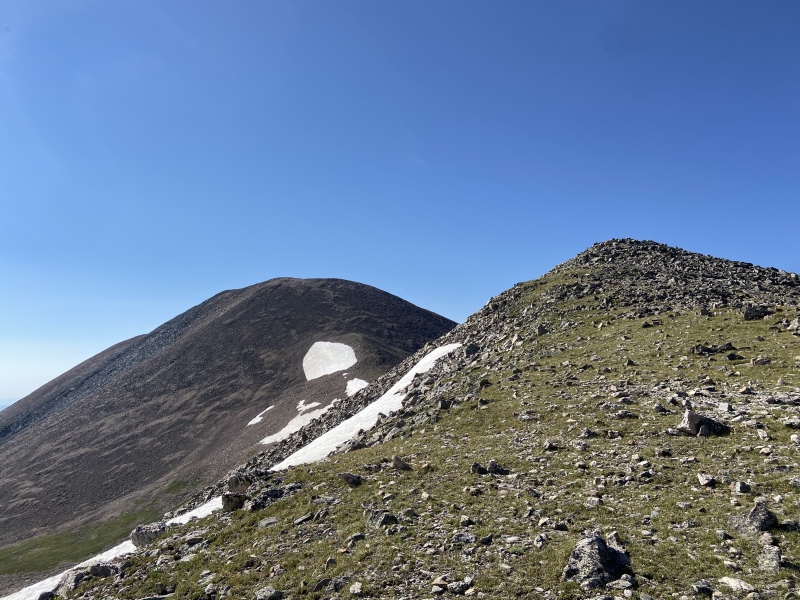
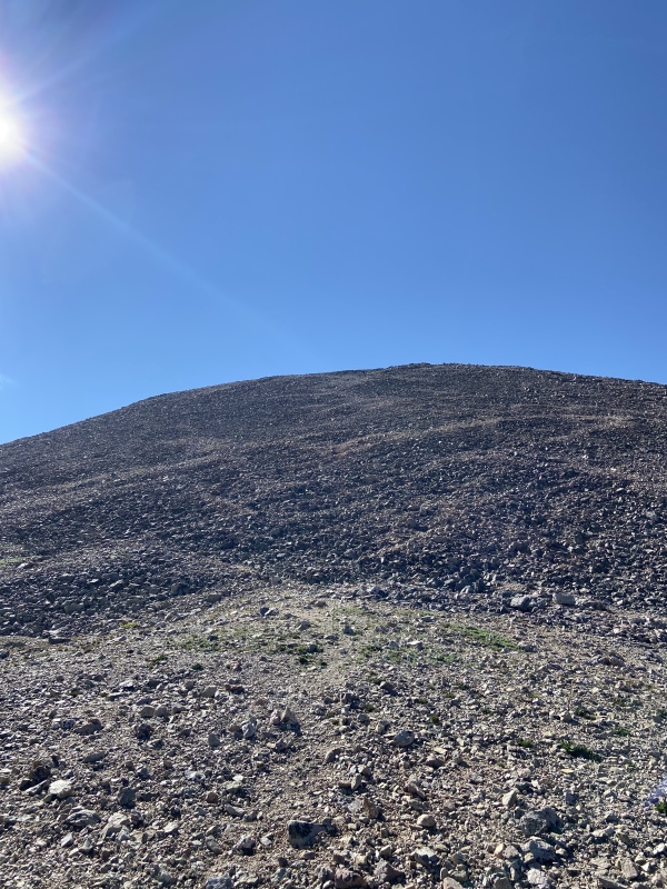
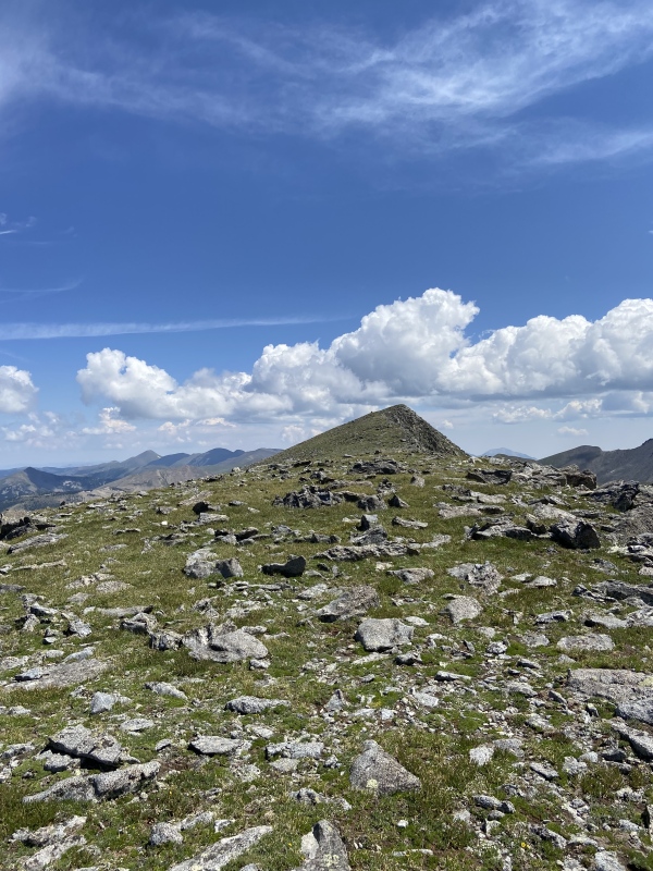
GREEN HILL VARIATIONS, RIDGELINE, AND SUMMIT The route description on this website gives two options for starting the journey up the Green Hill from the Upper Trailhead. But in actuality, there are limitless options. Because there is no established trail, something that was emphasized during the Cielo Vista Ranch orientation at the HQ building, climbers are free to forge their own paths. (Interestingly, the background photo on the Cielo Vista Ranch website of hikers on a high alpine trail does not exist on the mountain anywhere that I saw.) It seemed that most folks elected to descend slightly south from the Upper Trailhead and cross a creek before mounting a direct assault on the southern shoulder of the Green Hill. I, instead, followed the remnants of an old road that branched off from the main road just above the Upper Trailhead. This is identified in the Route Description as the secondary option. This approach kept me parallel to the creek at a mellower angle towards the main Green Hill pitch. I followed the pieces of this old trail up until about tree-line when the road petered out. At this point, I knew the goal was just to make the ridgeline at the top of the Green Hill so I took a more direct line up the face, ultimately aligning myself with the path of most of the other climbers. Later on in the day, after summiting and on my descent, because I swung further north on the ridge towards Punta Serpiente (more on that below), I took an even further north line down the Green Hill where I found additional evidence of this old road. This provided a decent line of descent with its mellow switchbacks in the upper and steeper section of the Green Hill. It was definitely a longer route distance-wise, but my legs were grateful and I was able to avoid stepping on a lot of the high mountain tundra. Of course, avoiding the vegetation completely is just not going to happen on this hike, but following this old road helped a little. I think think this route up and down the Green Hill has its advantages, and I do recommend it for folks who want a more scenic, milder, and more environmentally-conscious climbing experience. Back on my ascent line, near the top of the Green Hill, I approached the famous Culebra Peak Cairn which marked the "right turn" to start following the ridge. This thing is a beast and has to be one of the largest cairns on any Colorado mountain route. With its sharp corners and dominant presence, I was reminded of the half-mechanical, half-organic Shrike creature from one of my favorite science fiction novels Hyperion. The Cairn remains visible for most of the remainder of the hike and, though I had a sunny morning, I could see how it could be useful when navigating in heavy cloud cover or when escaping foul weather. Once on the ridgeline, this peak's namesake really comes to light (Culebra means "Serpent" in Spanish). The entire crest resembles a serpent's spine as it undulates before culminating in the "head" towards the summit. From the large cairn, the route continues to the climber's right (south) over some chunky rocks before descending to a low point in the ridge. I followed the ridge, picking up pieces of worn social trails before re-climbing back towards the summit. Throughout this area, the route never exceeded Class 1 unless I wanted it to. I continued following a path of least resistance along the ridgeline approaching the prominent false summit. There were a couple instances where the easier path lay further southwest than on the ridge proper, but I had no issues with whatever line I chose. The Class 1/low Class 2 scrambling continued up towards the top of the false summit. Given the hidden nature of the true summit, I can see how easy it would be to trick oneself into thinking the false summit was the actual goal, and finally topping out only to see the Culebra Peak summit proper a quarter mile or so further did give me a brief, disconcerting pause. But I forged ahead and, after dropping slightly over a flat area and pushing up the final, steep pitch, I arrived at the Culebra Peak summit at 0848 MT, a little over 2 hours after leaving the "Four-way." 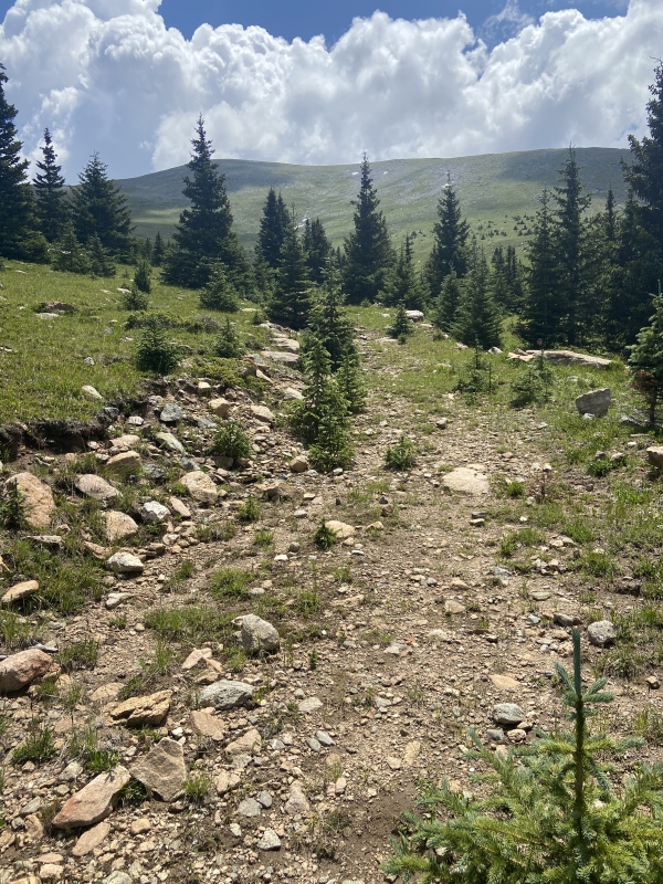
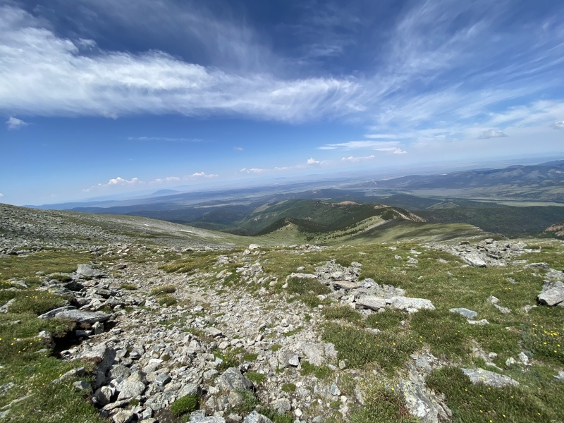

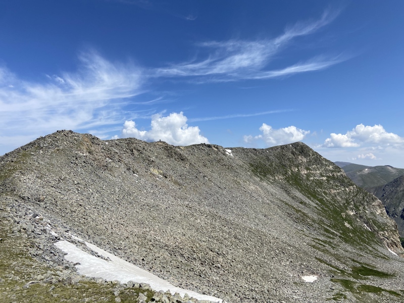
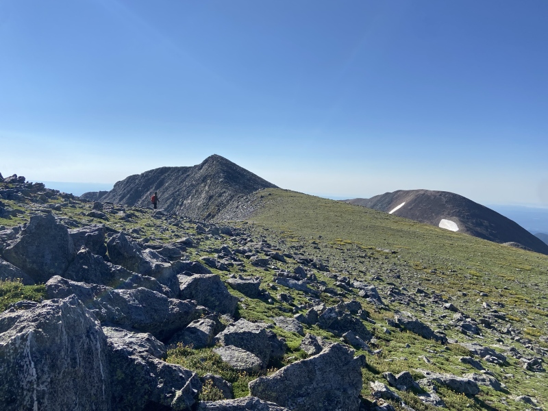
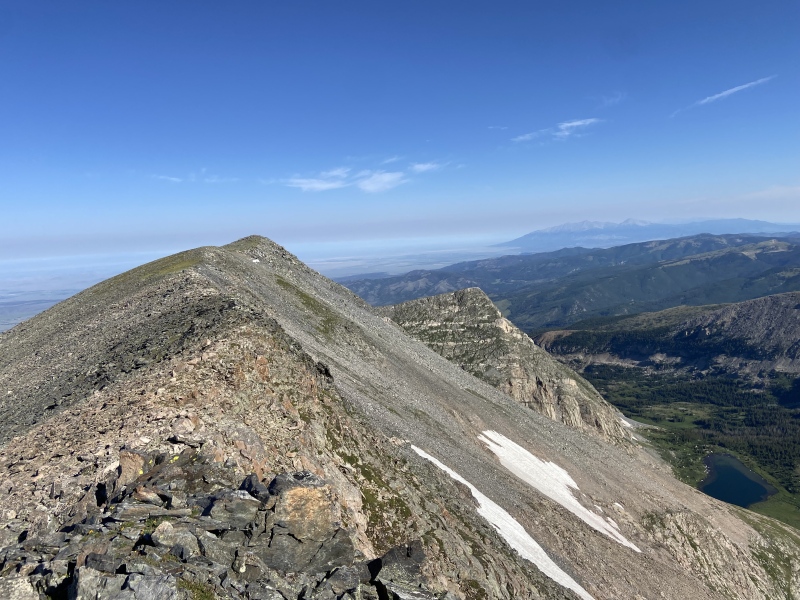
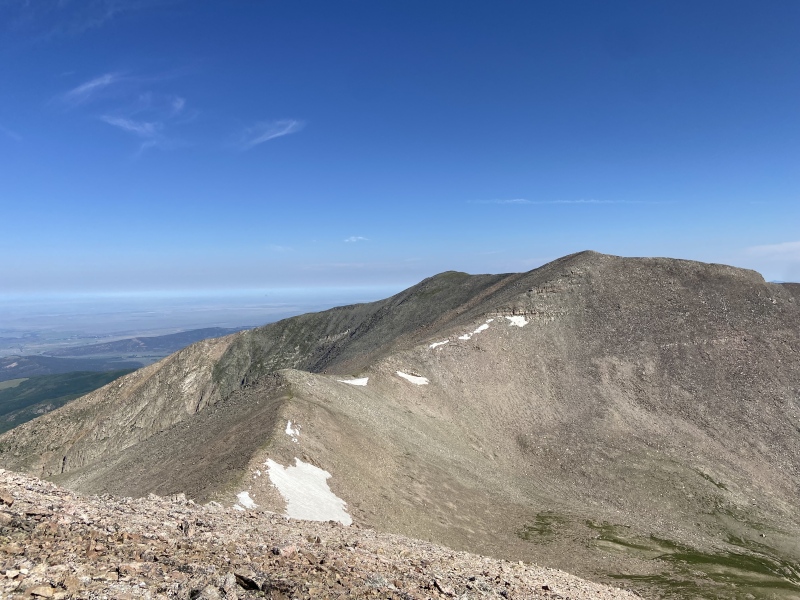
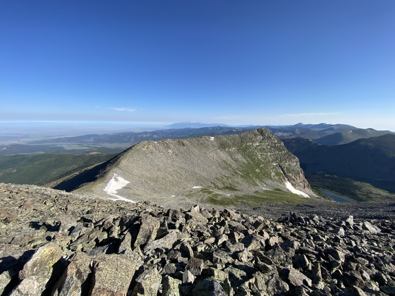
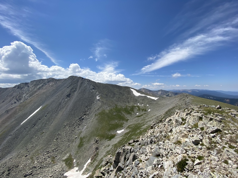
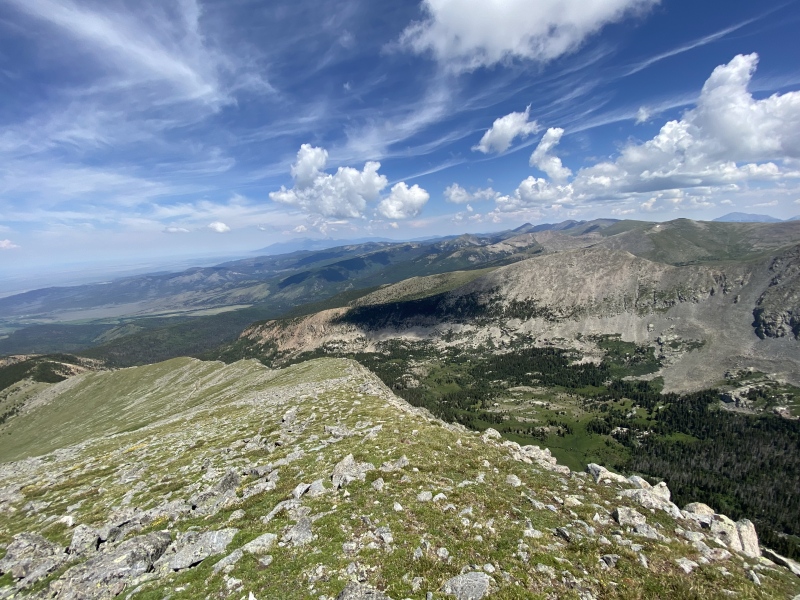
EXTRA CREDIT: RED MOUNTAIN & PUNTA SERPIENTE With the later-than-normal start to the climb and a likely chance of thunderstorms in the afternoon, I spent no time on the summit of Culebra Peak before starting down towards the Red Mountain saddle. The route between Culebra Peak's summit and the Red Mountain saddle represented the most challenging climbing of the entire day. I worked quickly through the steep, Class 2 talus, arriving at the saddle 15 minutes after departing Culebra Peak. There are actually two saddles to cross to access Red Mountain which are bi-sected by a small, rocky hump. It was difficult to tell which saddle was actually lower so I identified both in my climbing splits below, the "first" saddle being the one below Culebra Peak and the "second" saddle being below Red Mountain. I did not need to climb the boulder mound in between the saddles, electing instead to traverse it on the climber's left (east) side with no difficulty. Once beyond the second saddle, the climbing began again in earnest, though there is a series of social switchbacks going up Red Mountain that made ascending fairly trivial. And before I knew it, I topped out on the summit a little after 0930 AM, 45 minutes after leaving Culebra Peak and almost 3 hours from my "Four-way" parking spot. The wind on Red Mountain was intense, really only picking up just as I crested the summit rise. This was in stark contrast with the calm conditions less than a mile away on Culebra Peak. The mountains are weird. I snapped a few photos from the Red Mountain summit and then scampered back down to the saddles, steeling myself for what I knew would be the hardest part of this entire route: the re-climb to Culebra Peak's summit. This was a definite butt-kicker, but I made decent time up the Class 2 talus pitch, actually moving quicker in the reverse direction than my initial descent. I reached the summit of Culebra Peak for the second time 40 minutes after leaving Red Mountain. I spent a little more time on Culebra Peak this time, changing out my water bladders, snacking, and taking in the views of the Spanish Peaks and Blanca massif to the north as well as the southern Sangre de Cristos as they continue into New Mexico. After 20 minutes, I started my descent, following the ridgeline back to the large Cairn. From here, rather than descending the Green Hill like most of the other climbers that day, I continued along the ridge to the far point: Punta Serpiente ("Snake Point" in Spanish). This was an easy hike and well worth the effort as I could view the entire "Serpent" ridgeline, including both the false and true Culebra peak summits, as well as a dramatic vantage over Carneros Lake 2,000 feet below. From here, I meandered down the northern side of the Green Hill before intersecting and following the remnants of the old road as indicated earlier in this report. I arrived at the Upper Trailhead at 1218 MT and then at my car at the "Four-way" 20 minutes later, making my total climb time at just over 6 hours. 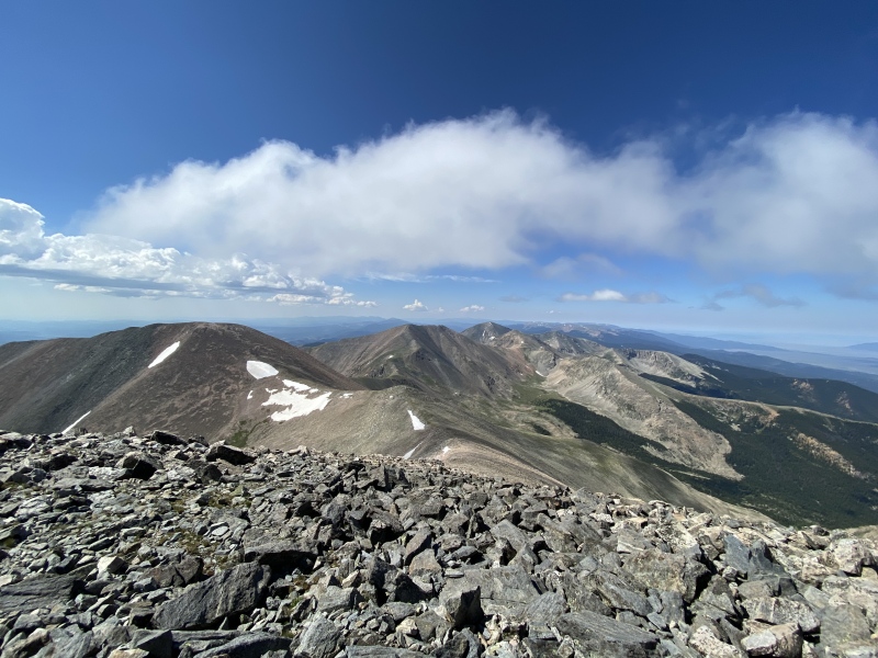

CONCLUDING THOUGHTS Culebra Peak is a very special mountain. Untouched by the weekend crowds, beetle kill, or any significant public works, the beauty of this area is truly unmatched. And because I was essentially turned loose once accessing the Cielo Vista Ranch, I felt free to explore the area a little more than had there been an established route with a number of other climbers. As described above, with nowhere to be and a good weather window, I took my time and chose to tack on Red Mountain and Punta Serpiente to make this a memorable trip. Culebra Peak has a paywall and a limited reservation window which makes compulsive planning for this mountain likely untenable. And yes, the climbing itself is about a "nothing-burger" as it gets; it's easy to keep Culebra at a Class 1/low Class 2 with minimal route-finding, even without a trail. Add in that this mountain is about as far a drive as possible from the Front Range for a non-San Juan 14er, and I can see why folks are deterred from attempting it. But after climbing it, none of those things bothered me as much as they did before the hike, and I've found myself thinking of Culebra Peak as less of a "check-the-box" mountain and more of one worth re-visiting. Thanks for reading. Cheers. 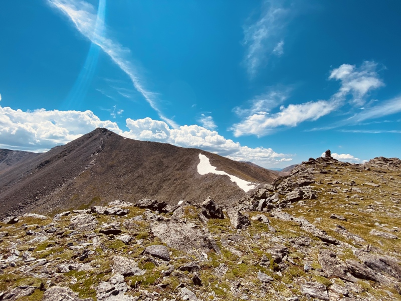
SPLITS: Friday, 19 July 2024
HELPFUL TRIP REPORTS & LINKS:
CLIMBING RESUME:
PREVIOUS 14ER TRIP REPORTS:
Thumbnails for uploaded photos (click to open slideshow): ")
")
")
")
")
")
")
")
")
")
")
")
")
")
")
")
")
")
")
")
")
")
")
")
|
| Comments or Questions |
|---|
|
|
Caution: The information contained in this report may not be accurate and should not be the only resource used in preparation for your climb. Failure to have the necessary experience, physical conditioning, supplies or equipment can result in injury or death. 14ers.com and the author(s) of this report provide no warranties, either express or implied, that the information provided is accurate or reliable. By using the information provided, you agree to indemnify and hold harmless 14ers.com and the report author(s) with respect to any claims and demands against them, including any attorney fees and expenses. Please read the 14ers.com Safety and Disclaimer pages for more information.
Please respect private property: 14ers.com supports the rights of private landowners to determine how and by whom their land will be used. In Colorado, it is your responsibility to determine if land is private and to obtain the appropriate permission before entering the property.


