Download Agreement, Release, and Acknowledgement of Risk:
You (the person requesting this file download) fully understand mountain climbing ("Activity") involves risks and dangers of serious bodily injury, including permanent disability, paralysis, and death ("Risks") and you fully accept and assume all such risks and all responsibility for losses, costs, and damages you incur as a result of your participation in this Activity.
You acknowledge that information in the file you have chosen to download may not be accurate and may contain errors. You agree to assume all risks when using this information and agree to release and discharge 14ers.com, 14ers Inc. and the author(s) of such information (collectively, the "Released Parties").
You hereby discharge the Released Parties from all damages, actions, claims and liabilities of any nature, specifically including, but not limited to, damages, actions, claims and liabilities arising from or related to the negligence of the Released Parties. You further agree to indemnify, hold harmless and defend 14ers.com, 14ers Inc. and each of the other Released Parties from and against any loss, damage, liability and expense, including costs and attorney fees, incurred by 14ers.com, 14ers Inc. or any of the other Released Parties as a result of you using information provided on the 14ers.com or 14ers Inc. websites.
You have read this agreement, fully understand its terms and intend it to be a complete and unconditional release of all liability to the greatest extent allowed by law and agree that if any portion of this agreement is held to be invalid the balance, notwithstanding, shall continue in full force and effect.
By clicking "OK" you agree to these terms. If you DO NOT agree, click "Cancel"...
On this trip to Colorado, I rented a 4WD vehicle and planned to climb three 14ers which would be made easier by having access to 4WD trailheads. First up, after having a few days to get used to the higher altitude, was Culebra Peak. Culebra is privately owned and requires prior reservations and a climbing fee. I reserved my spot way back in May for July 31, which happens to be the very last day the ranch had the peak opened to climbers this year. Be sure to reserve early.
When I got to the ranch, my name was somehow not on the list. The ranch hands, who were super nice and helpful, admitted that sometimes people's names get left off. I showed them the receipt they texted me and they added me to the list right away. Be sure to have a copy of your receipt handy just in case the same thing happens to you!
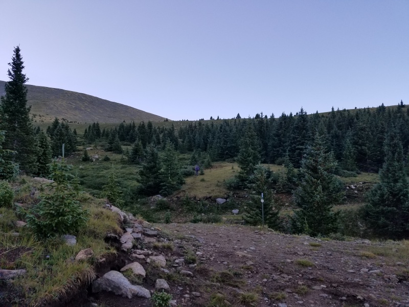
Once you enter the ranch, you'll drive to the ranch HQ for a quick meeting. Any car can make the drive to the HQ building. The road is dirt but very smooth. Beyond that, however, you will need a 4WD to continue. The road isn't a terribly rough 4WD road. The roughest / steepest part is between the HQ and the junction called Four Way (which is clearly marked with a sign). If you get to Four Way, you'll make it to the upper trailhead. From the upper trailhead, it's less than 2 1/2 miles to the summit.
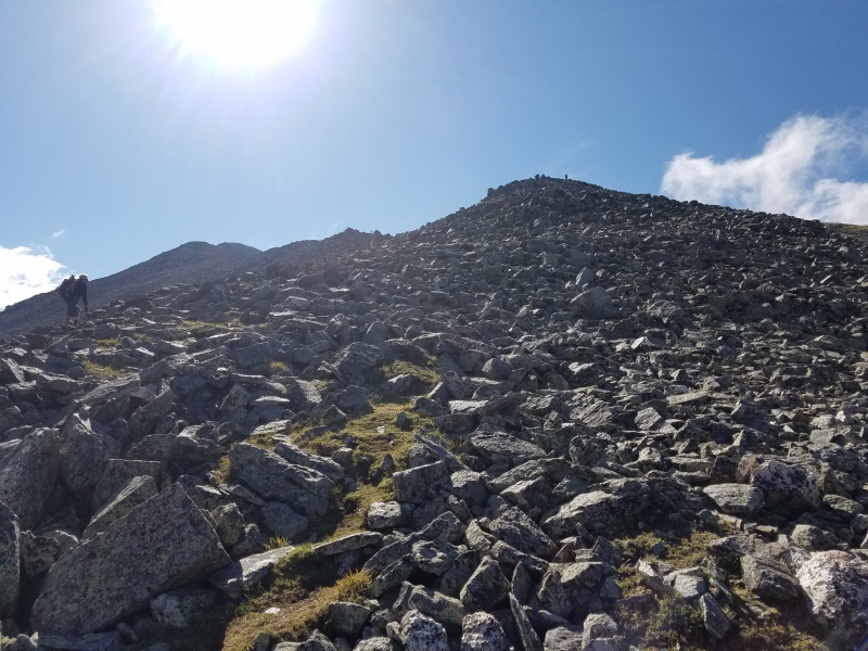
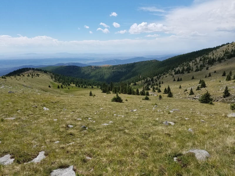
View from the upper trailhead
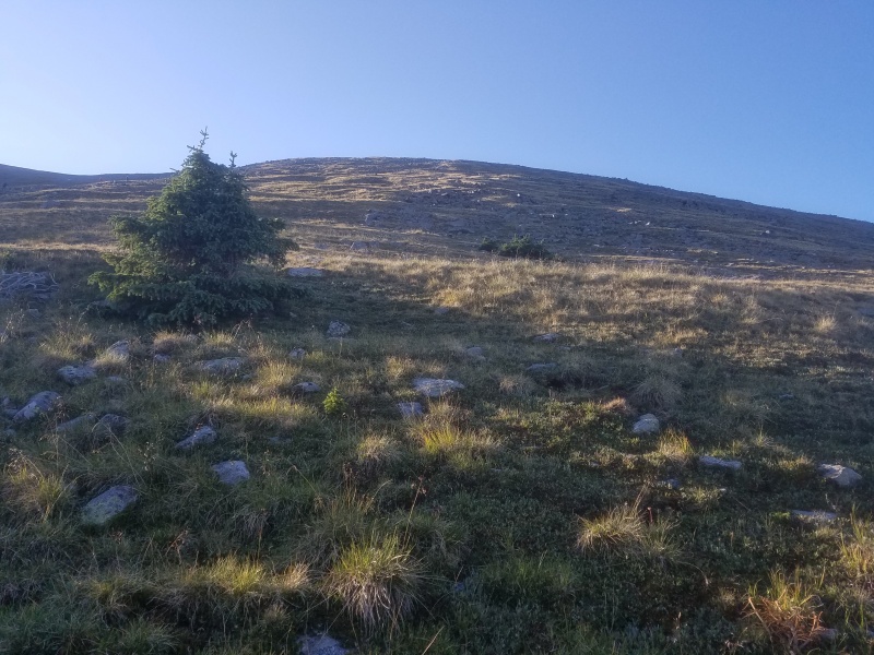
From the 4WD trailhead, the first half of the hike goes up a grassy hill to the ridge. The second half follows the rocky ridge and is mostly class 2. Despite what you may think, the first half is by FAR the more difficult. The grassy hill looks easy, but is much taller and much steeper than it looks. Most of your elevation gain is right here.
Looking up the initial hill. Much more tiring than it looks.Closer to the ridge, looking back down.
There are no trails on Culebra, so pick your own route to the top. You may want to angle right, since that is the direction you'll be moving along the ridge once you get up there. As you climb, keep looking behind you to make certain that you'll be able to find the trailhead on the descent later. You may also want to make you own switchbacks back and forth across the slope to keep the steepness down. The distance of this climb is short, so adding some distance isn't going to make it particularly harder.
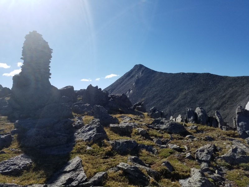
The huge cairn, with Culebra's false summit behind it. Turn right from here.
Once you reach the top of the initial hill, you'll emerge on the ridge near this huge cairn, which is the only marker on this trail. It will be helpful on the descent to remind you where you need to leave the ridge. You'll turn right and the route should be crystal clear. The high point you see ahead is actually a false summit, but the true summit is right behind it.
The terrain at the start of the ridge
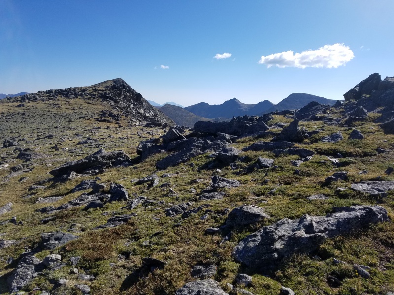
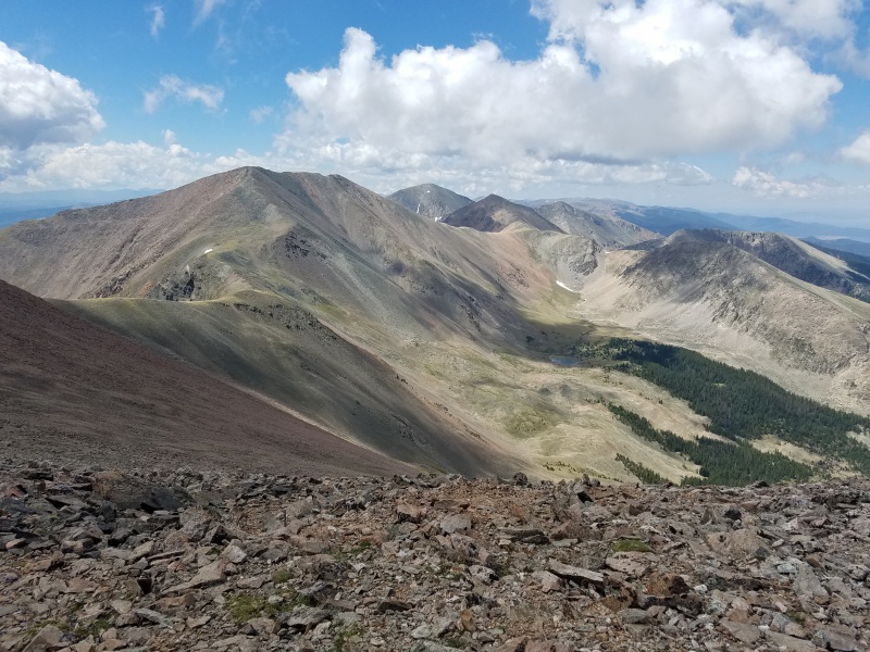
A view of most of the rest of the route to the summit.
The ridge may look tougher, but as long as you're OK with class two scampering, it's much easier than the steep hill you've already climbed up. The ridge is not as steep and the scrambling is simple and solid.
Part of the ridge
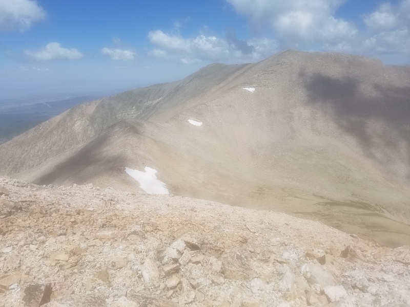
View from the route
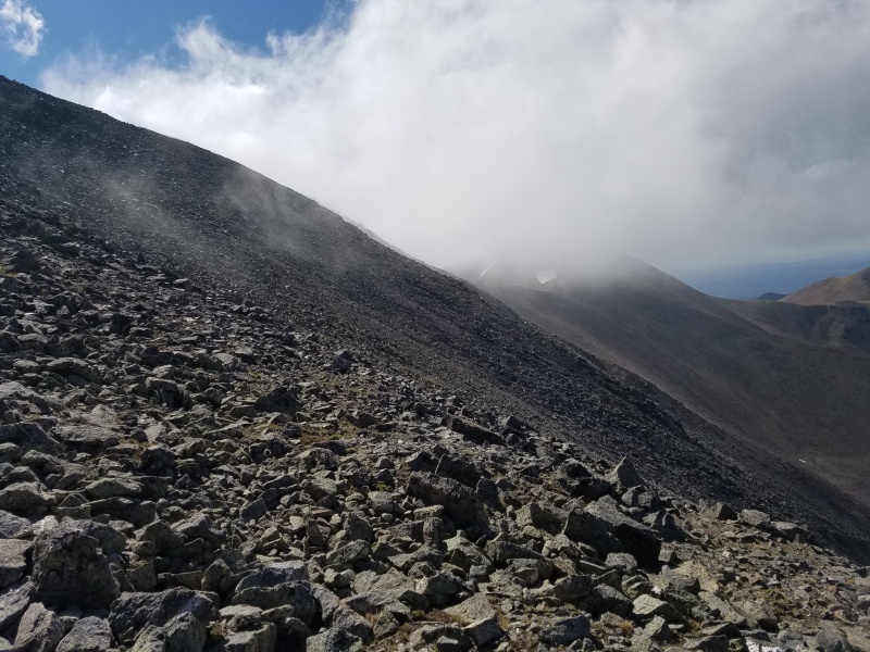
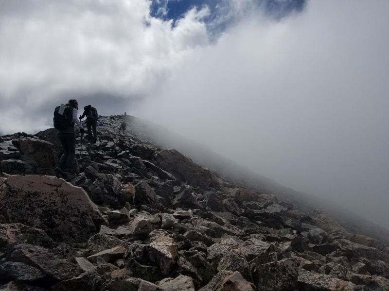
Clouds are rolling in
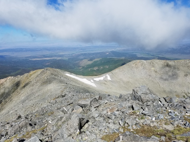
Another amazing view from the ridge
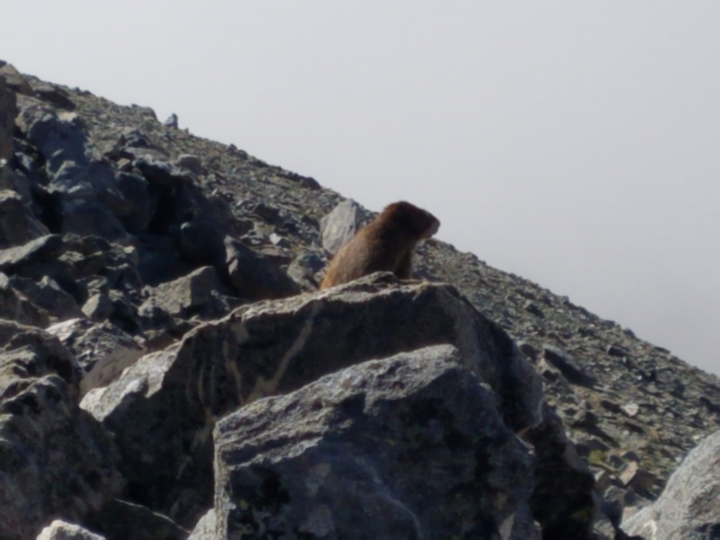
There is plenty of wildlife on this route: here's a marmot.
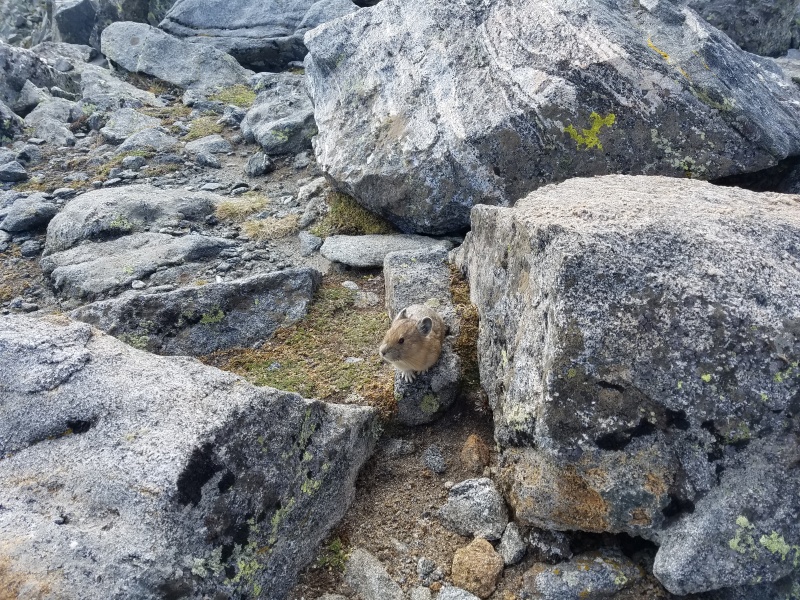
...And here's a pika who wasn't too shy with people.
You'll hike over the false summit that you've been seeing since you reached the ridge, and the true summit is just beyond it.
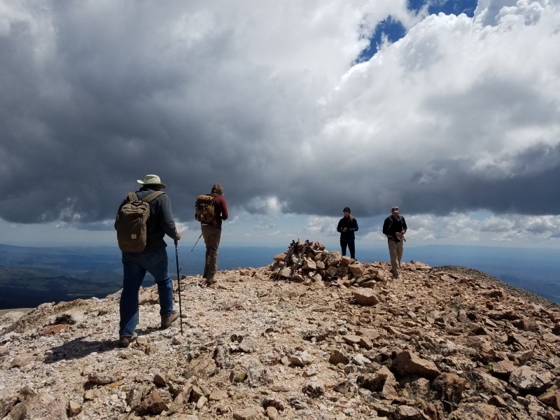
Approaching the summit
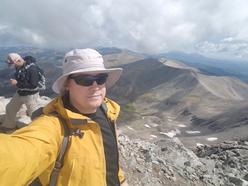
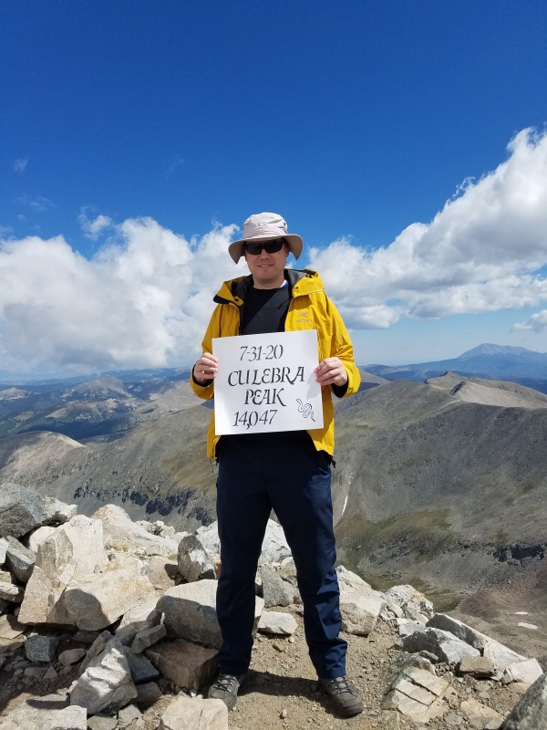
On the summit!
Someone brought a sign and was kind enough to let me use it.
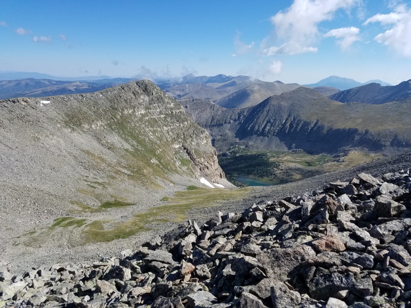
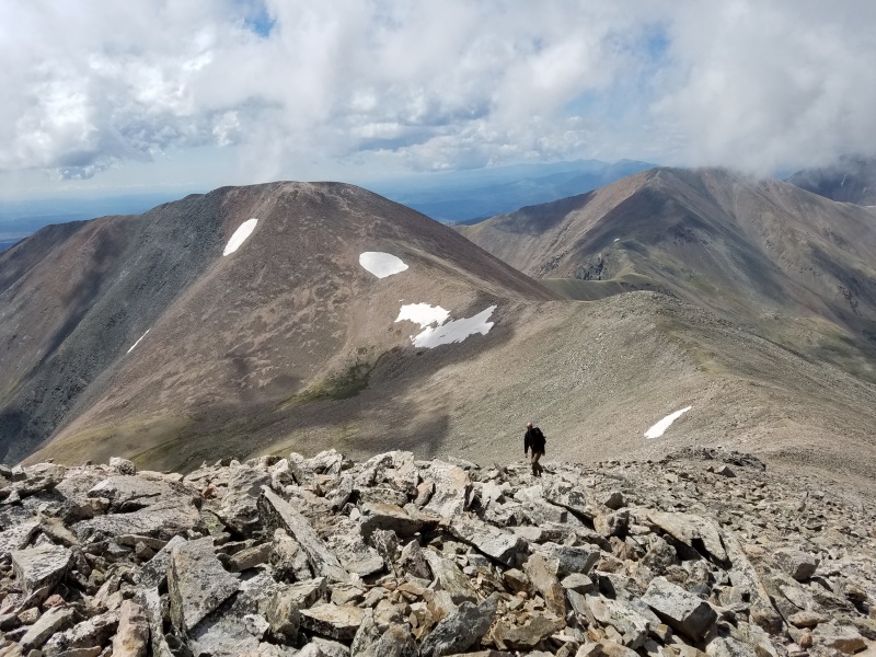
After reaching Culebra, you can turn back. OR you can continue on to Red Mountain, a 13er that is one of Colorado's 100 highest peaks. The only way to reach Red is by climbing over Culebra, so it's now or never.
Looking over towards Red mountain.
Red is just under a mile south of Culebra, and the route there is easy to see from Culebra. Just follow the connecting ridge, skirting around the bump in the middle to save yourself some elevation gain. There's nothing particularly difficult about Red, but adding it does add about 2 miles, 1000 feet of elevation gain, and slightly more difficult class 2 movement. I wasn't very tired upon reaching Culebra's summit, but adding Red turns the day into a much longer, more strenuous hike. There was a faint path leading up the steep side of Red to its summit.
Views on the way over to Red
Nearing Red's summit, looking back at Culebra
On Red's summit
I wasn't the only one who wanted to check out Red as well!
Starting back down towards Culebra
There's plenty of wildlife on these peaks. Besides lots of marmots, birds, and pikas, while traversing the ridge back to Culebra I came upon a black bear! It was on the saddle just past the bump, and we startled each other when I came around the bump. The bear immediately took off down the slope, and I wasn't able to get a picture.
From Red, all there is to do is turn back. (As of now, your fee for Culebra covers Red as well, but those are the only places you're allowed to climb.) Note that you don't have to climb all the way back over Culebra's summit: You can save yourself some elevation gain by contouring across the side of the peak and aiming for the low point of the ridge between Culebra and its false summit. This is what I did, and I'm not sure that it was any easier. Yes, it saved some elevation gain, but it was also tougher class 2+ / 3- scrambling.
Either way, retrace your steps to the huge cairn, then descend the grassy hill back to the parking area. The hill, again, looks easy but is so steep that it's even tiring to walk down it.
Looking back down the hill at the end of the day.
Culebra is one of the tougher 14ers to plan since you have to plan well in advance and pay a fee to the landowners. However, the trailless path is beautiful, the wildlife abundant, and the views incredible. It's also a relatively quick, easy 14er if you can drive to the upper trailhead.
Thumbnails for uploaded photos (click to open slideshow):
Hi, the ranch charges $150 for the chance to climb Culebra and Red. I also climbed Uncompahgre and Snowmass. For Uncompahgre, I drove up the rough 4WD road to the upper Nellie Creek trailhead and that makes the hike ~7 miles. As far as 14ers go, Culebra and Uncompahgre are both on the easier side. Snowmass is much tougher, both the drive and the climb! I drove from Marble through Crystal and up the hill to the Lead King Basin trailhead, then scrambled up Snowmass' west face.
Caution: The information contained in this report may not be accurate and should not be the only resource used in preparation for your climb. Failure to have the necessary experience, physical conditioning, supplies or equipment can result in injury or death. 14ers.com and the author(s) of this report provide no warranties, either express or implied, that the information provided is accurate or reliable. By using the information provided, you agree to indemnify and hold harmless 14ers.com and the report author(s) with respect to any claims and demands against them, including any attorney fees and expenses. Please read the 14ers.com Safety and Disclaimer pages for more information.
Please respect private property: 14ers.com supports the rights of private landowners to determine how and by whom their land will be used. In Colorado, it is your responsibility to determine if land is private and to obtain the appropriate permission before entering the property.


")
")
")
")
")
")
")
")
")
")
")
")
")
")
")
")
")
")
")
")
")
")
")
")
")
")
")
")
")
")
")
")
")
")


