| Report Type | Full |
| Peak(s) |
Crestone Peak - 14,299 feet |
| Date Posted | 10/27/2024 |
| Modified | 11/11/2024 |
| Date Climbed | 08/30/2024 |
| Author | The_Ramp |
| Crestone Peak Triumvirate |
|---|
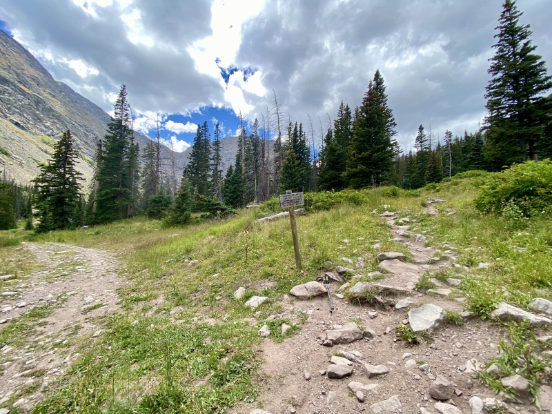
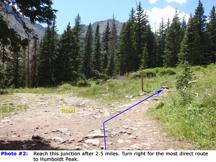
SUMMARY & INTRODUCTION I successfully climbed Crestone Peak on Friday, 30 August 2023 from the South Colony Lakes Upper TH. I also added on sub-summits East (E) Crestone and Northeast (NE) Crestone. This was a challenging and rewarding day in one of my favorite spots in the entire state. It was fun to return not only to the South Colony Lakes area but also gain a new appreciation for the amazing prominence that the Crestones and surrounding mountains have within this geographically narrow strip of Sangre De Cristo mountains. The nature of these peaks with plenty of chunky holds and steps on conglomerate rock is always a treat to climb, and while Crestone Peak doesn't have nearly the amount of scrambling as its neighbor Crestone Needle, adding the sub-summits quenched my thirst and then some. The most helpful form of preparation I have found for climbing the Colorado 14ers is in reviewing other user Trip Reports on this website. There are a plethora of smart write-ups out there for every route, approach, and trail nuance; it is a shame when folks approach their climbs without leaning on those who have gone before. I especially want to give a shout-out to daway8 who has a handful of TRs documenting his experience on Crestone Peak that I leaned on heavily, especially this one. My report below, along with all of my other reports, is intended to compliment and honor all the other amazing user work that is out there. I would not have had success on Crestone Peak or any other challenging 14er climb without them. I've included cross-references to useful TRs throughout this write-up, along with the "raw" links at the bottom. Also at the end of this report are my climbing splits, GPX file, and various other reference information. Thanks for reading. APPROACH & HUMBOLDT SPUR RECOMMENDATION I arrived at the South Colony Lakes Upper TH a little after 1830 MT on Thursday, 29 August 2024. The road from the Lower TH to the Upper TH is definitely gnarly but doable with 4WD, decent clearance, and a keen eye. I didn't have any issues in my stock XTerra, but it was slow going as I was constantly toggling between 4HI and 4LO depending on the difficulty. I've been to this TH on a busy weekend with minimal parking available, but on this overcast Thursday evening, I had my choice of parking space with maybe 4 other vehicles in the lot. I parked, finished pulling together my gear for the morning, sent some texts (decent Verizon service in the lot!), and quickly crashed in the back of my car. Shortly after I fell asleep, it rained and hailed and lightninged something fierce for about an hour, and I felt for the folks in tents up by the lake who I expect got hammered. My alarm went off at 0300 MT on Friday, 30 August 2024, and I was moving twenty minutes later. I usually do a great job freaking myself out when solo hiking in the early morning darkness, but I kept my head down with some Fantasy Football podcasts and motored. The wideness of the road definitely helped minimize the sense of claustrophobia and, before I knew it, I was at the Humboldt Spur split 2.5 miles from the Upper TH an hour after starting out. Having gone both ways in the past, I whole-heartedly recommend taking the Humboldt Spur route to the base of Broken Hand Pass versus the "standard" approach. There has been some dialogue in the 14ers.com forum in the past regarding trade-offs with either route, but the most obvious reason for taking the Humboldt Spur is it reduces the trek to the lower South Colony Lake by about half a mile. And while the standard route is indeed super mellow, the spur is a well-maintained trail with only one or two minor spots of steepness. The other point of contention with taking the Humboldt Spur variation is in locating and the navigating the unmarked turn-off below the lower South Colony Lake to re-connect with the standard route at the base of Broken Hand Pass. But I found it relatively easy to identify and follow, even in the dark:
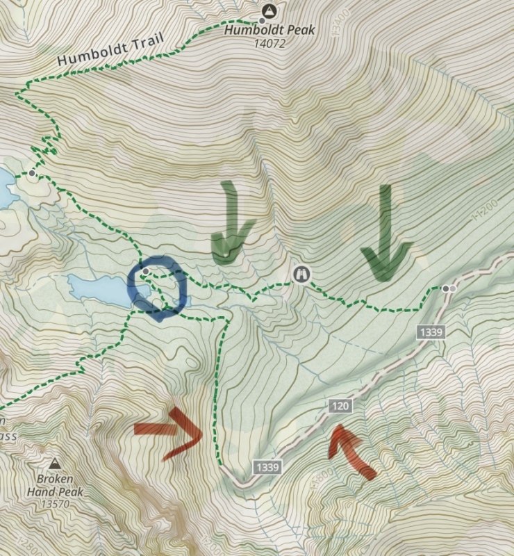
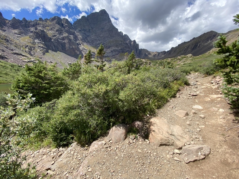
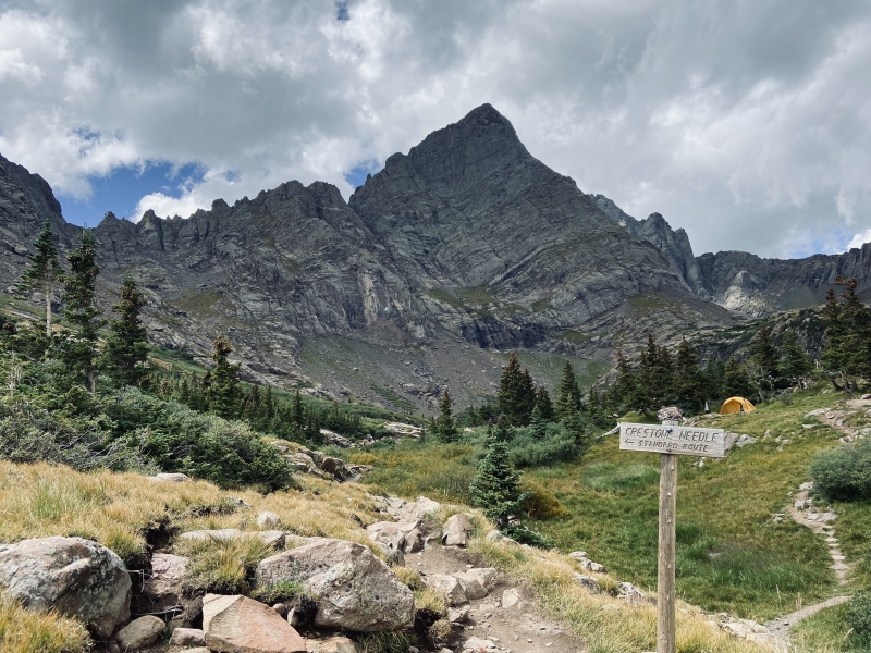
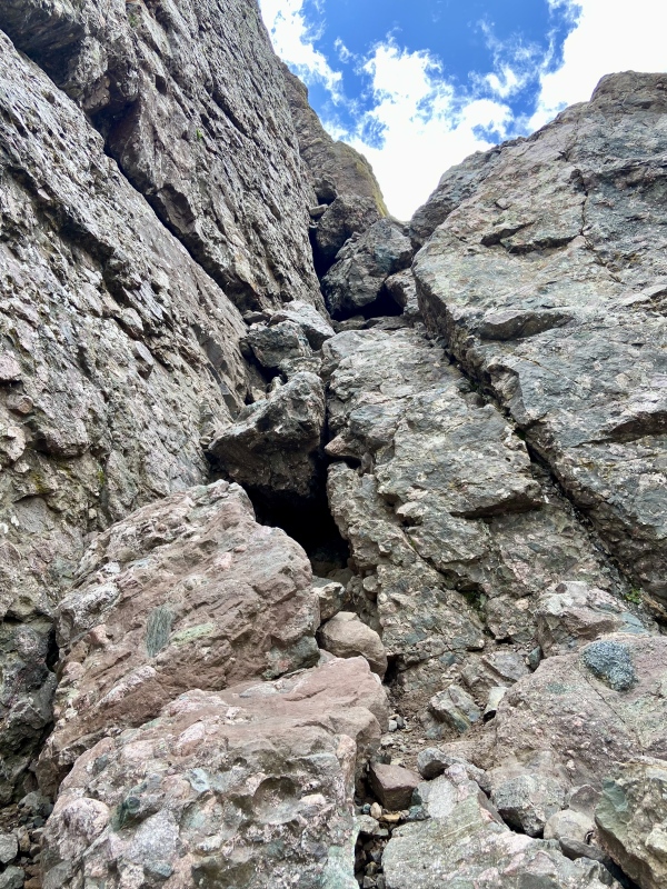
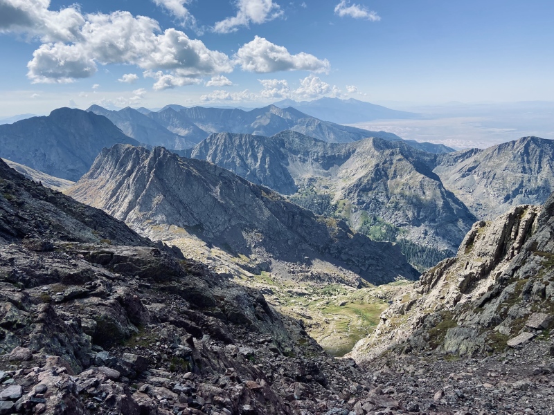
BROKEN HAND PASS The initial segments of Broken Hand Pass consisted of easy trail leading away from the lower South Colony Lake. But before long, the route started traversing through undulating talus along the steep flank of Broken Hand Peak. There were plenty of cairns though and route-finding was never an issue. The rock slowly turns from stable talus to crummy scree as the route steeply approaches a prominent gendarme, marking the crux of the pass. This area has given many climbers navigation difficulties in the past. Based on my pre-climb research, I angled for a set of chockstones to the climber's left (south) of the prominent gendarme. There is a Class 3 move to get to a shelf above these chockstones, but the large boulders and the wall on the climber's left have solid features. Once above the difficulty, I took a hard climber's right turn (north) and scrambled up the shelf and along a dirt path to the base of the gendarme. This is a key route tip when returning as this dogleg going north/south is not particularly obvious from above. On one of my previous treks into this area, I encountered a hiker, slightly delirious with altitude sickness, stumbling about trying recall her descent line through this area and approaching a dangerous cliff (we helped get her back on track and she was OK). With that memory in mind, I made particular note of my ascent line for later in the day. One of the best visual aids I've found associated with navigating Broken Hand Pass is this YouTube video starting at the around the 26-minute mark. From the gendarme, the trail continued up (west) steeply on some loose, Class 2 trail segments. I finally topped out on the pass a little after 0600 MT, almost 3 hours from the Upper Trailhead. I paused for a snack and to soak in the view below and beyond as the alpenglow started lighting up the Crestones, flaunting their rugged western backside down towards Cottonwood Lake and the San Luis Valley. 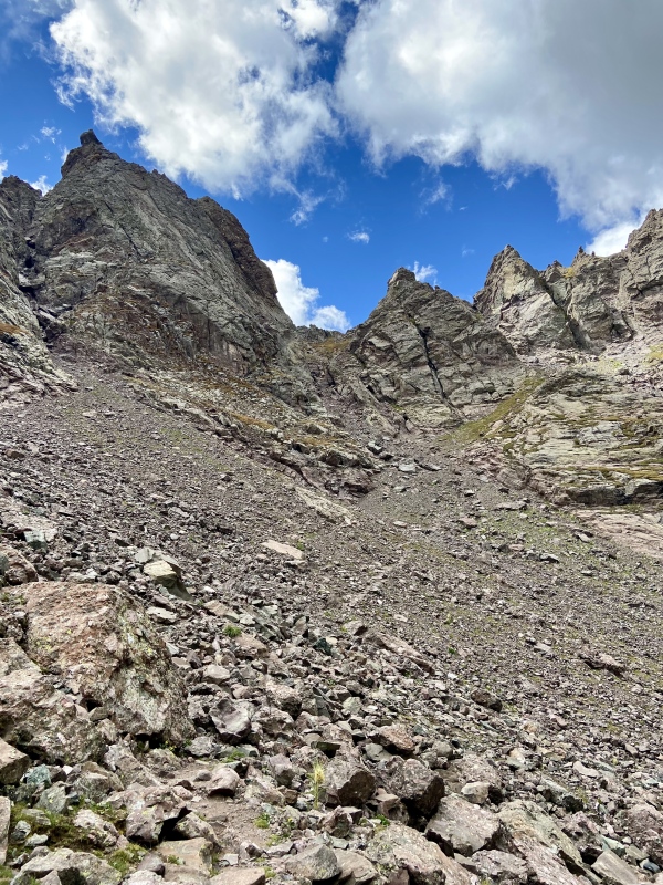
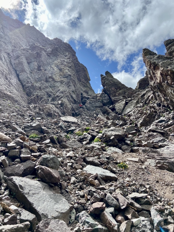
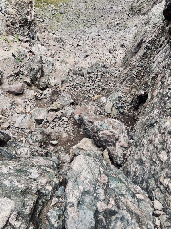
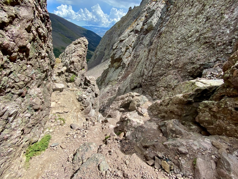
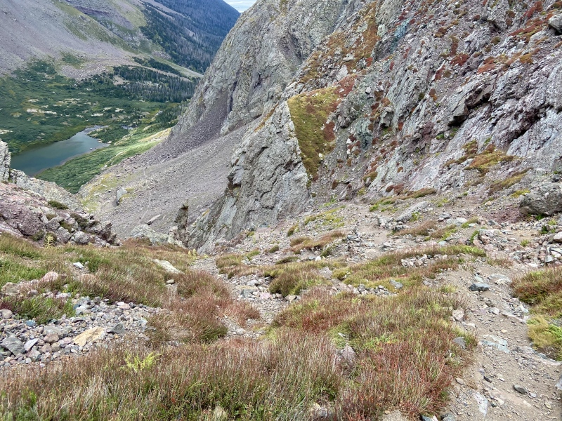
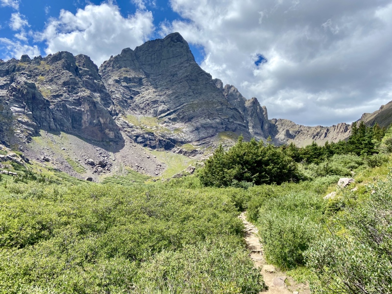
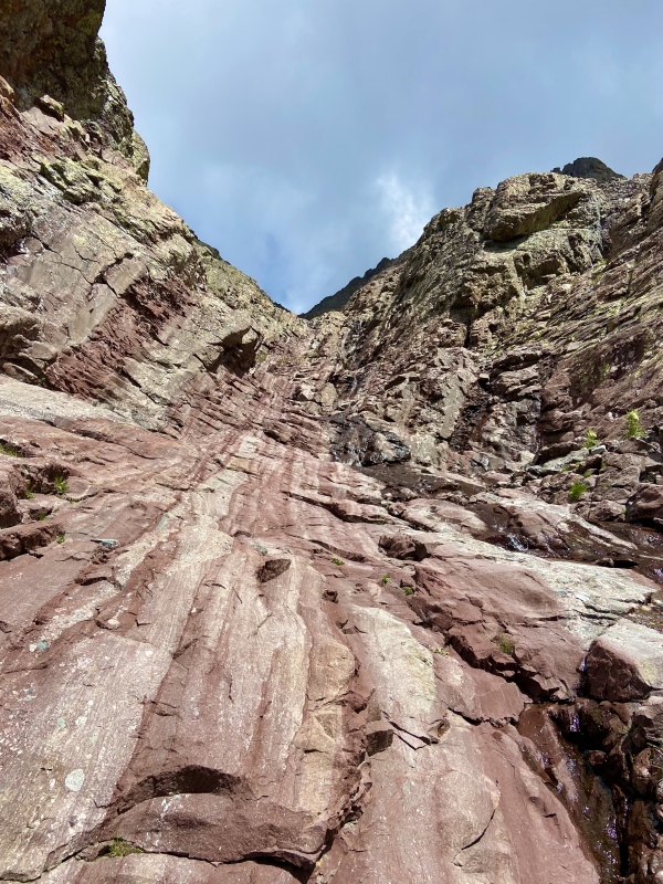
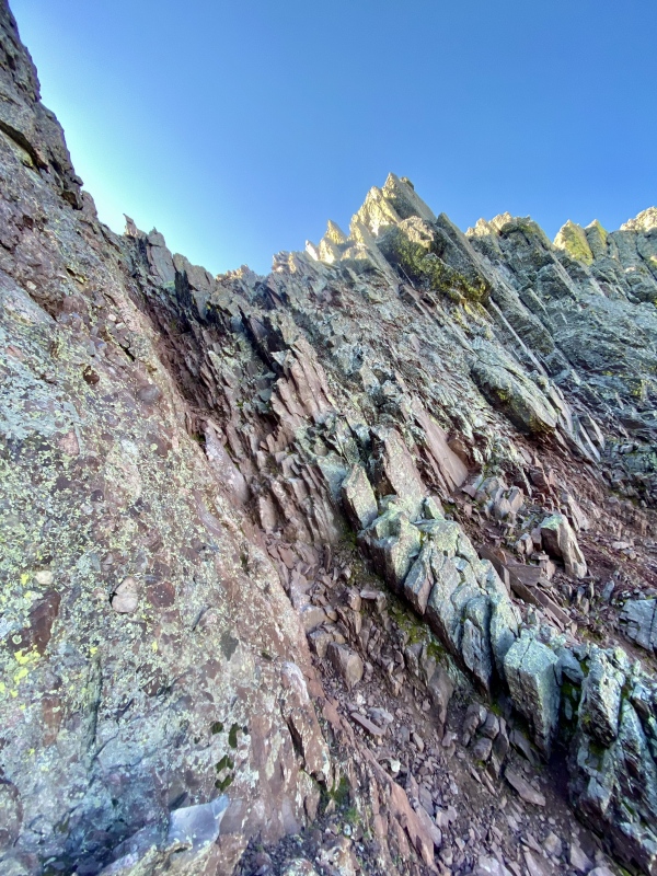
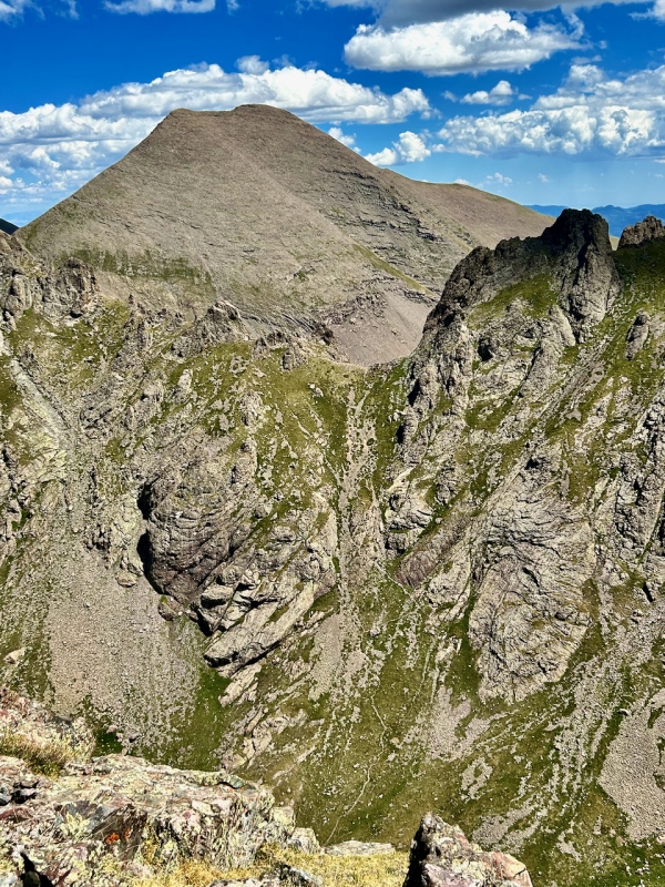
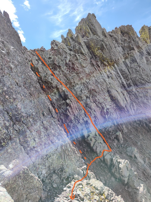
THE RED GULLEY It was a little under 600ft of elevation loss to reach the Cottonwood Lake basin from the top of Broken Hand Pass, and though it was steep, the western face of the pass was much easier in comparison to the opposite side. 13er Crestolita looms large above this portion of the hike and there have been some amazing photos taken of the Cottonwood Lake basin and surrounding peaks from its summit. See Marmot72's Crestolita TR, including this awesome perspectives of the west side of Broken Hand pass. The easy trail continued around the northern side of Cottonwood Lake, through some muddy willows, before turning a corner north below the rugged southern face of Crestone Peak, the Red Gulley finally visible as a dark scar against the lighter-colored surrounding rock. The route continued its northern bend along a trail below the Red Gulley, steepening towards a east/west grassy ledge that provided access to the gulley. JacerJack has a helpful photo in his TR showing this switchbacking ledge leading to the base of the gulley. There was a waterfall to cross just below the red gulley starts that provided an obvious identifier later in the day on where to exit this lower part of the gulley. From here, I turned north and started scrambling up through the smooth and very red slabs that make up the lower portion of the Red Gulley. This area, along with a short pitch near the top, represented the steepest portions of the gulley. Once past the slabs and some small headwalls, the gulley opens up a bit and the pitch angle mellows. I kept to the climber's right (east) side of the gulley during this section of my ascent as the rock was more solid, albeit steeper than in the middle and climber's left. I could see how rockfall might be a concern through this area on a busy weekend, but since I was mostly by myself all day, I had no issues and continued climbing up, finding paths of least resistance towards a final, steep pitch. Climber's right continued to offer the best lines with it's more solid rock at the cost of being slightly steeper. Frequent breaks allowed me to gawk at the awesome view behind and below me (south) at the surrounding peaks, Sand Dunes, and Mt Blanca massif. Crestone Peak is the 7th tallest mountain in the state, and as I worked through the upper portions of the Red Gulley, I gained new respect for how just a few additional 100s of feet increased the sensation of being "way up there." 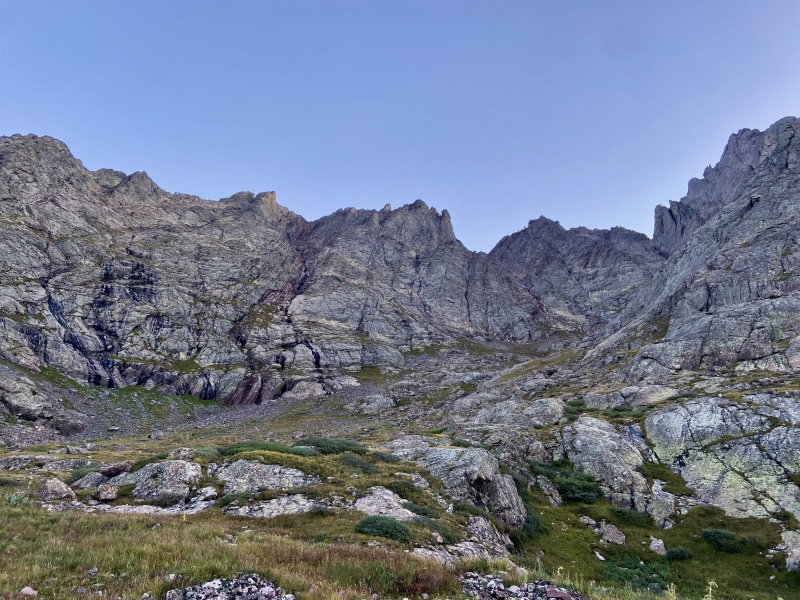
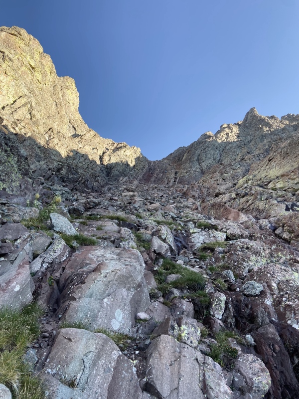
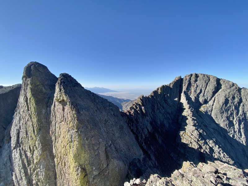
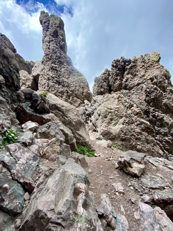
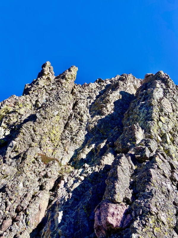
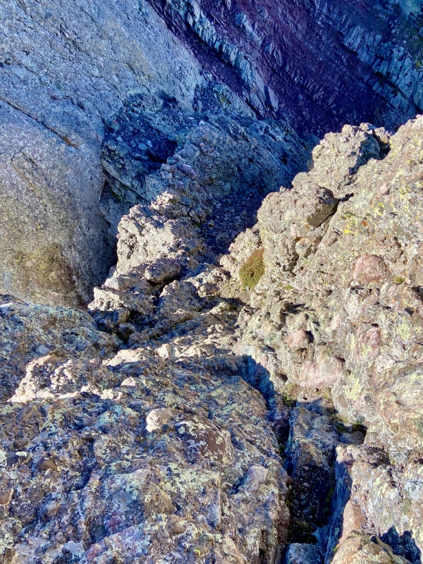
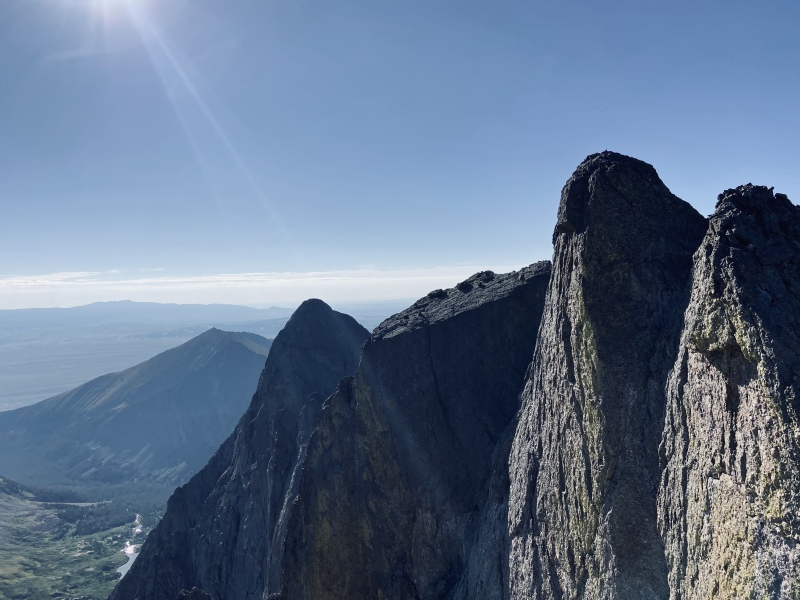
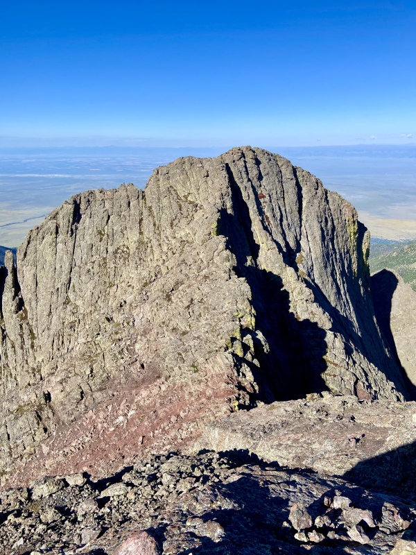
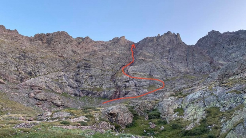
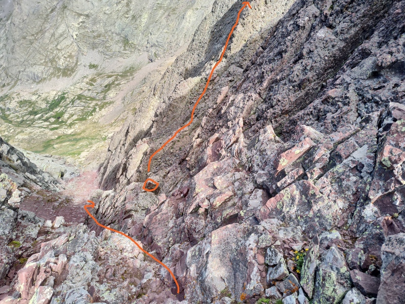
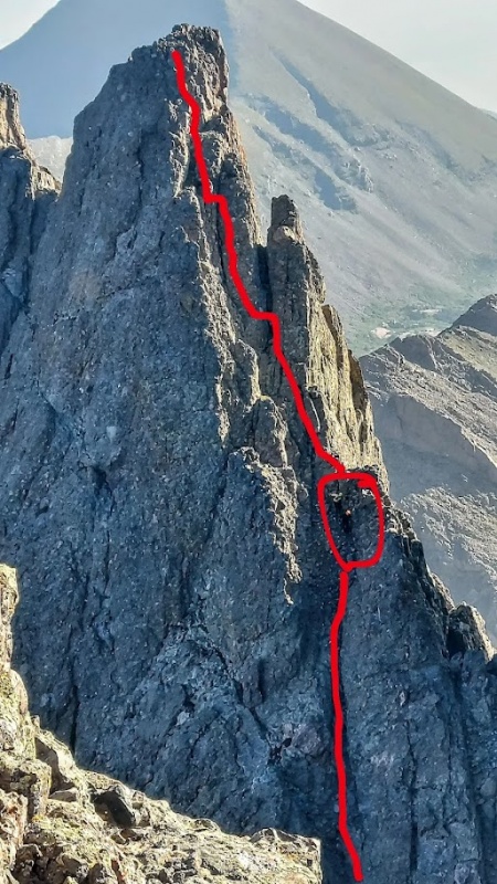
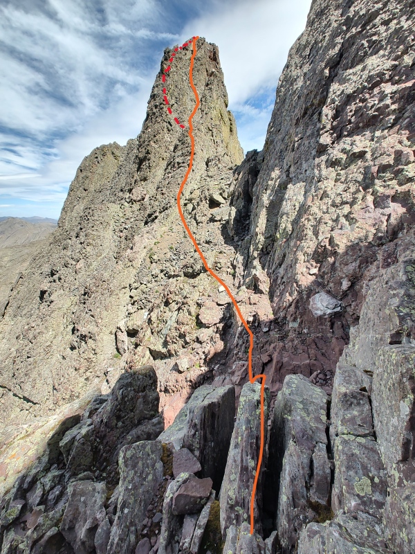
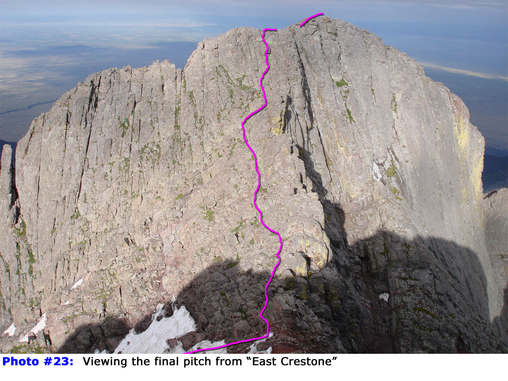
THE TRIUMVIRATE - NE CRESTONE, E CRESTONE, & CRESTONE PEAK I reached the top of the red gulley almost 90 minutes after starting up and here I was presented with a choice. The true Crestone Peak summit was to my left (west) up a series of jumbled shelves. The primary sub-summit, E Crestone, which is only a few feet lower in elevation than Crestone Peak, was to my right (east). And in front of me (northeast), partially shaded and looming ominously, was NE Crestone. I knew from my research that NE Crestone represented the most serious of the three summits so, not wanting to lose my nerve and with my energy high, I steeled myself and stepped forward. For those interested in tackling NE Crestone, I strongly encourage you check out daway8's excellent TR; this is the DEFINITIVE guide to climbing this sub-summit. It is gloriously detailed and all of the key features highlighted were still present at the time of my hike. The route to NE Crestone from the top of the Red Gulley involves descending a steep gulley before traversing an obvious shelf, and then scaling the intimidating NE Crestone south face. The initial descent provides a few options, but I followed daway8's recommendation and took the more western gulley. This is a very steep line and some of the rock is loose, though I never felt the climbing exceeded hard Class 3 intermixed with a few Class 4 moves. In a couple spots, I would start descending one way, only to hesitate, back-up, and try a different approach. Part of the issue was likely due to my height. At 5'10", a couple of the trickiest parts involved steps that were JUST out of my reach and I had to find an alternate contortion of my body or intermediate series of holds to feel comfortable. See this photo from above and this photo as seen from on NE Crestone for this initial descent from the top of the Red Gulley; both photos are from daway8's TR. There was an obvious landing area leading to the base of NE Crestone where a small opening in the northwestern rock perfectly framed Humboldt Peak across the valley beyond. From here, it was a straight shot up the very steep southwestern face of NE Crestone. The rock was the glorious, chunky conglomerate notorious for the Crestone area but the difficulty was most definitely sustained Class 4. The exposure was never crazy, but I was alone and being over-careful, ensuring every move was solid and had a known second or third step if necessary. I topped out on NE Crestone 30 minutes after departing the top of the Red Gulley. This photo from goingup's TR and this photo from daway8's TR show the general line up NE Crestone's Class 4 pitch. The descent from NE Crestone was the most thrilling aspect of my climbing day, and I had to spider-monkey faced-in a few times to safely lower myself. There were again a couple moves that I had to pivot away from midway to feel comfortable, taking a slightly different line to the climber's left of my ascent line. The ascent back up the steep, shaded gulley to the top of the Red Gulley went quickly and I topped out with my heart rate pumping 20 minutes after leaving NE Crestone. Again, I can't emphasize it enough, daway8's awesome TR is an amazing resource for NE Crestone, including details on descending NE Crestone's face and re-ascending the steep pitch to the top of the Red Gulley. Happy to have the hardest of the 3 summits behind me, I immediately turned east and clamored up E Crestone. This was far and away the easiest of the three summits, never exceeding easy Class 3, and I was standing at the top only 5 minutes later. This photo from daway8's TR from a previous Crestone Peak climb show the nature of the E Crestone pitch. I lingered long enough on the summit to ogle the NE Crestone profile I had just conquered as well as the true Crestone Peak summit to the west that could've fooled me into actually being lower than E Crestone. I quickly descended E Crestone, never having to put my hands down, and, after hitting the top of the Red Gully again, I started up the actual summit pitch to Crestone peak. This was a step up in route-finding from E Crestone and even NE Crestone, though the difficulty was easy to keep at Class 3 with some basic line selection (I mostly followed the 14ers.com route description). I traversed the blocky ledges and the large gap to the true summit, exhaled, and dropped my pack for a much-needed break at almost 0930 MT, an hour after starting my summit tour from the top of the Red Gulley and 6 hours after leaving the TH. 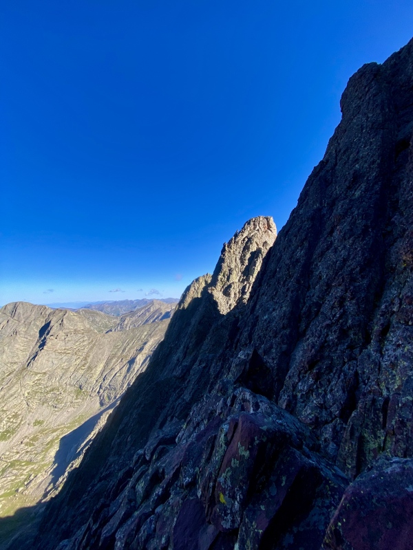
DESCENT & CONCLUDING THOUGHTS It took me about 90 minutes to descend the Red Gulley after leaving the summit of Crestone Peak, and, after chatting with a few other ascending climbers, I made quick work of the lower area around Cottonwood Lake to the base of Broken Hand Pass. I put my head down and powered up the steep but short pitch to the top of the pass, turned on my route-finding brain to navigate the Class 3 crux by the prominent gendarme, and and was back by lower South Colony Lake around 1230MT. After stopping for another break, I grinded back down the Humboldt Spur trail and the main road, returning to my car at the rapidly-filling upper TH a little after 1430MT, making my total climb time at just over 11 hours. Crestone Peak is an awesome mountain. The tallest peak in the area (it's 100 feet taller than its neighbor Crestone Needle), it's complicated and multi-faceted summit is unique among the 14ers and provides a playground for climbers, all on the fun, chunky conglomerate rock iconic for this area. Tacking on E Crestone, and especially NE Crestone, turned a big day into something even more epic. And while I stopped short of hitting Crestone Needle or attempting the traverse, it never felt like I left anything on the table. This marked my fourth time in the beautiful South Colony Lakes area and it never fails to take my breath away. This is one of my favorite places in the world. Thanks for reading. Cheers. 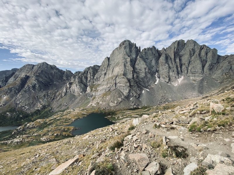
SPLITS: Friday, 30 August 2024
HELPFUL TRIP REPORTS & LINKS:
CLIMBING RESUME:
OTHER 14ER TRIP REPORTS:
Thumbnails for uploaded photos (click to open slideshow): ")
")
")
")
")
")
")
")
")
")
")
")
")
")
")
")
")
")
")
")
")
")
")
")
|
| Comments or Questions | |||
|---|---|---|---|
|
Caution: The information contained in this report may not be accurate and should not be the only resource used in preparation for your climb. Failure to have the necessary experience, physical conditioning, supplies or equipment can result in injury or death. 14ers.com and the author(s) of this report provide no warranties, either express or implied, that the information provided is accurate or reliable. By using the information provided, you agree to indemnify and hold harmless 14ers.com and the report author(s) with respect to any claims and demands against them, including any attorney fees and expenses. Please read the 14ers.com Safety and Disclaimer pages for more information.
Please respect private property: 14ers.com supports the rights of private landowners to determine how and by whom their land will be used. In Colorado, it is your responsibility to determine if land is private and to obtain the appropriate permission before entering the property.


