| Report Type | Full |
| Peak(s) |
Broken Hand Peak - 13,575 feet "Crestolita" - 13,264 feet |
| Date Posted | 09/03/2023 |
| Date Climbed | 08/19/2023 |
| Author | Marmot72 |
| Broken Hand Wrap Up |
|---|
|
With a sudden change in the forecast for sunny skies in the Sanges, I welcomed the chance to finish the 13ers in this range. (Afterward, Benners kindly reminded me that, with Lidar updates, I still have Maxwell to do. Swell.) Having read Doggler's report of his traverse from the Crestones to Milwaukee a few times over the years, the south ridge of Broken Hand intrigued me, and with the Telluride Mountain Race only a week away, I opted for the closer approach from South Colony over the longer and rougher trek up Cottonwood Creek. I was surprised by the number of cars at the 2wd parking lot and passed several parties as I drove up the road toward the upper lot. The road varied between smooth easy sections and rough rocky sections that seemed almost always to be on inclines. With careful maneuvering of my stock '18 Subaru Forester, I made it to a nice camping spot on the right about 1/4 mile from the upper lot, and just before the final rocky upslope. The beautiful morning held promise, and I was glad to be to South Colony again. As I walked up the road, I reminisced on my prior visits here. The first time, in 2007, was before the original trailhead was closed. I was new to class 4 scrambling and chose the NW buttress on Crestone Peak- some introduction! Still one of my most memorable scrambling days, but I messed up the traverse: I left the red gully too early. Then I returned twice in 2010: July up the standard route on the Needle with an attempt to traverse to the Peak, staying as high as possible, and in September to finally just do the traverse between the two peaks the regular way. My last visit was less exciting: a walk underneath Humboldt to the Bear's Playground to get Obstruction in April 2018, which was a dry winter-spring. My first two visits had coincided with fatalities - talking to SAR on recovery missions at the trailhead on my exit. So I looked forward to this, my fifth trip to South Colony, to be the tie breaker. Turning from such morbid thoughts, I jogged from the junction of the Humboldt and Crestone Needle trails, eager to see the turn off for the basin to gain Broken Hand's south ridge. I found it soon enough - a shallow bend in the road. Also, as I quickly spotted and detoured slightly north to explore a mine (marked on the topo), it is likely just as easy to continue up the road and look for the old track that leads to the mine. 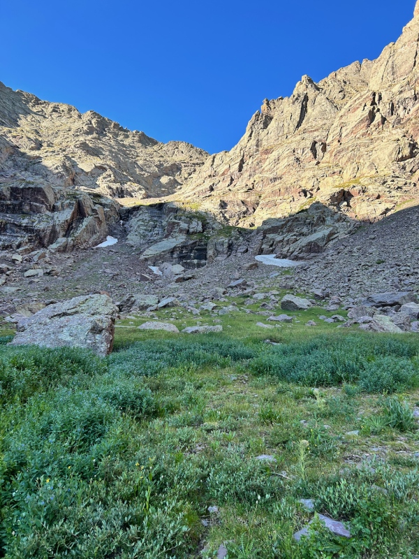
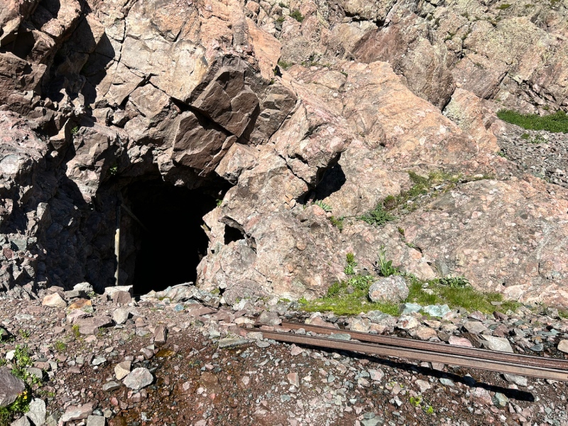
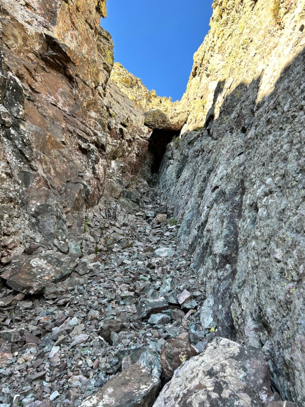
I was in a more exploratory mood than usual, so I made the (likely unwise) decision to enter the mining tunnel just to look around a bit. I only walked in about 40 feet or so, the tunnel continued well beyond. 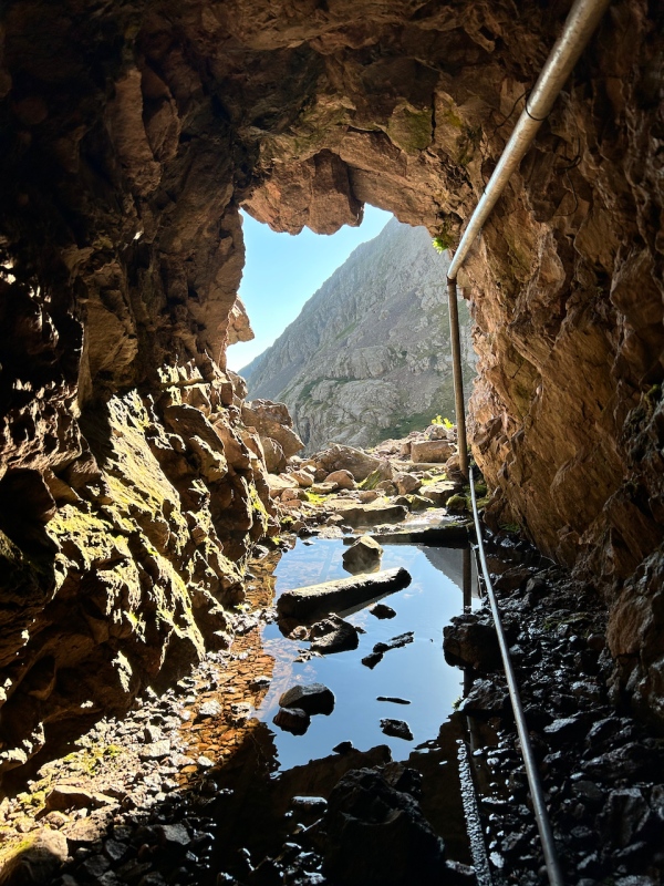
After this little detour, I turned my attention back to the matter of getting up the basin. The traverse around the SE side of Broken Hand's wrist appeared simple, but consisted of broken ground: shallow gullies between knobby and slabby bulwarks. Thus I found myself going up an initially easy chute that soon turned spicy. I found a sling near the bottom and figured it must have fallen from its original placement in a snow slide. Soon I found the terrain where the sling must have been. 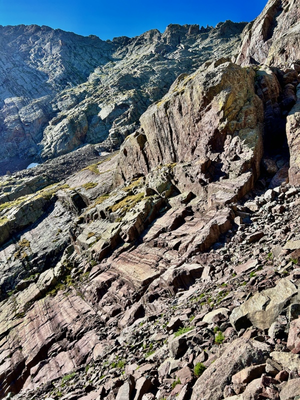
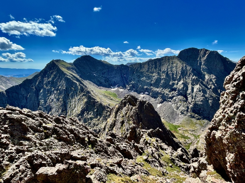
Ahead, the "U" in the skyline revealed the saddle between Broken Hand and the southern ridge that then splits in a "Y" to continue to Music and Milwaukee. The foreground presented a simple walk; further up, more conglomerate outcrops appeared.
Anticipating the views from the saddle, I hurried forward and entered the shallow chute between ribs in the middle of the picture above. About a third to half the way up, I paused to take in the view ahead and behind. 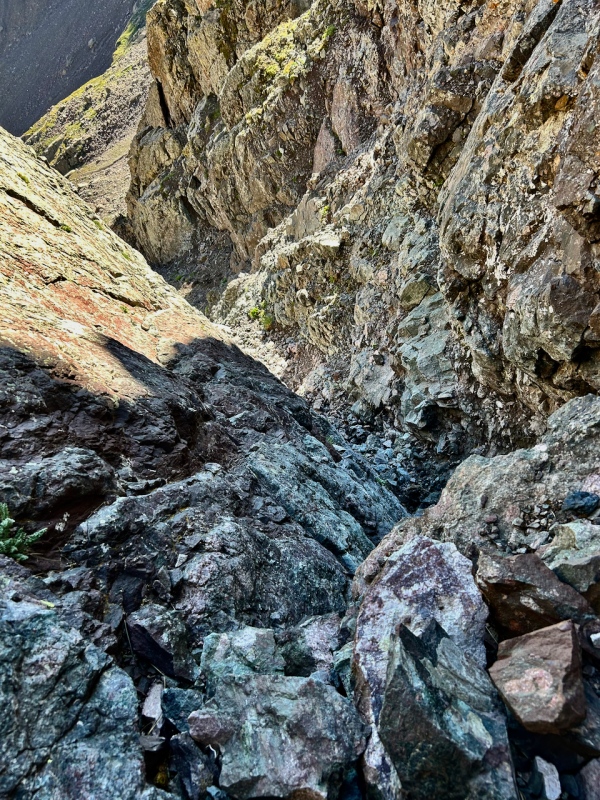
Nearing the chockstone, I coined it "the marmot's squeeze" and hoped I'd find a way to contort myself underneath it to emerge above. Reaching it, I looked and felt around for holds, and decided to abandon the enterprise, because the slab underneath pitched at an ungainly angle. Scanning the wall to the right, I found a way up and around the chockstone. I would call it 5.0. 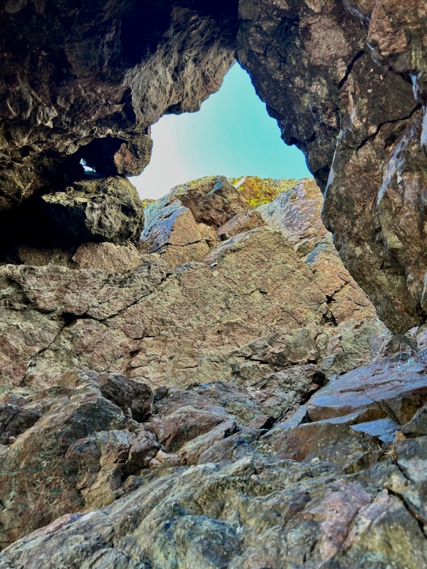
With this difficulty behind me, a short, nondescript walk lead to the saddle, and the view did not disappoint, as I gazed into the basin on the other side, and to Pico Asilado on its far side.
Now I had the ridge ahead of me to the north and I anticipated more scrambling on solid conglomerate joyfulness, but not before one more view to the south to Milwaukee Pk. It's no longer ranked due to Lidar findings, but I felt glad to have had a fun day climbing it with monster5 and furthermore a decade or more back, before that was known. 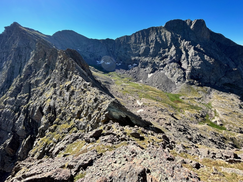
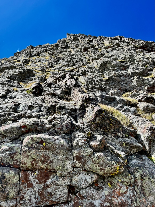
Turning northward to my objective, the scrambling began in earnest. I sought to explore the ridge that Doggler negotiated on his way in the opposite direction: I did not spend time looking around on the west side of the ridge crest to find easier passage. My impression, though, both from the map and my time here, is that this section immediately south is a cluster of knobby pinnacles. I dubbed the area "the Severed Fingers." (No I don't think I'm finding untrodden ground; I just approach obscure mountain routes with the same sense of discovery as when I hopped on boulders as a child - it's both happy and freeing.) 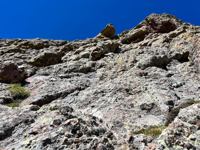
Soon after the initial steep but easy climb, where holds had been both juggy and abundant, I. found myself with a puzzle. A promising reddish ledge along the east side seemed to lead nowhere. I spent 15 minutes or so walking to and fro, up and back down along it, to find a way up. Perhaps I needed to go around to the west at this point.
Anyhow, I found a way. This was mostly enjoyable and not too stout class 4; it just took a quick sequence to get to that was not probably harder than "5 easy" but was just exposed. 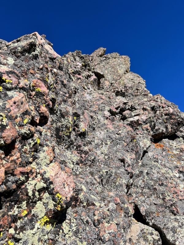
I found myself atop the first gendarme, the largest of the severed fingers, a minute or two before ten. I'd left the mine at 8:30. I'd covered not even a mile in that hour and a half.I decided to pay more attention to "path of least resistance" and bypass future gendarmes where it seemed intuitive to do so. 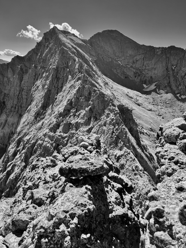
Moving on, I soon caught my first glimpse of Broken Hand's summit. The faulting of the Sangre de Cristo creates some striking lines and I admired the stark vertical lines falling away to the east from the summit.
I was at the top of another finger, and the way down its north side was overhung, so I opted for an easier but more exposed bypass on ledges just to the east.
Now the terrain eased dramatically: class 3 scrambling interspersed with simple walking. From here, it took only 33 minutes to reach the summit. 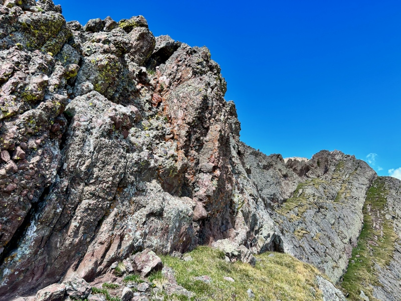
Reaching the summit at 10:54, I sat to enjoy an early lunch and soak in the views. First to one of the most aesthetic of the Rocky Mountains, Crestone Needle, and then to my next destination, Crestolita, a low-lying peak among grander neighbors. During my brief rest here, I heard a whoop of someone who had just summited the Needle, along with a couple shouts of "rock!" I later spoke to a hiker on the road, who said that there had been twenty people on the peak during his summit pitch. A busy day across the valley. 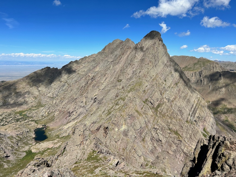

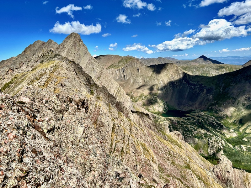
The descent off the west side of Broken Hand went swiftly and uneventfully; it's a gentle slope of mixed grass, scree, and rock ribs. Soon I peered upward at Crestolita to choose my ascent route. I had some familiarity of the Northeast ridge route from reports by Jason Halliday (summit post) and Natalie Moran (this site, with reference to Jason's). I think that route is the far right ridgeline in the picture below. I opted to take the line this side of it: the face leading to the summit that is just above the broken buttress that lies one third the way up center-right.
In contrast to the south side of Broken Hand, which appeared easier than it was from a distance, this route up Crestolita proved easier than it looked. Small, grass-covered ledges permeated the conglomerate and became both larger and more predominant toward the top. It took only 35 minutes to get to the top from the base of this dwarf on the shoulders of giants. 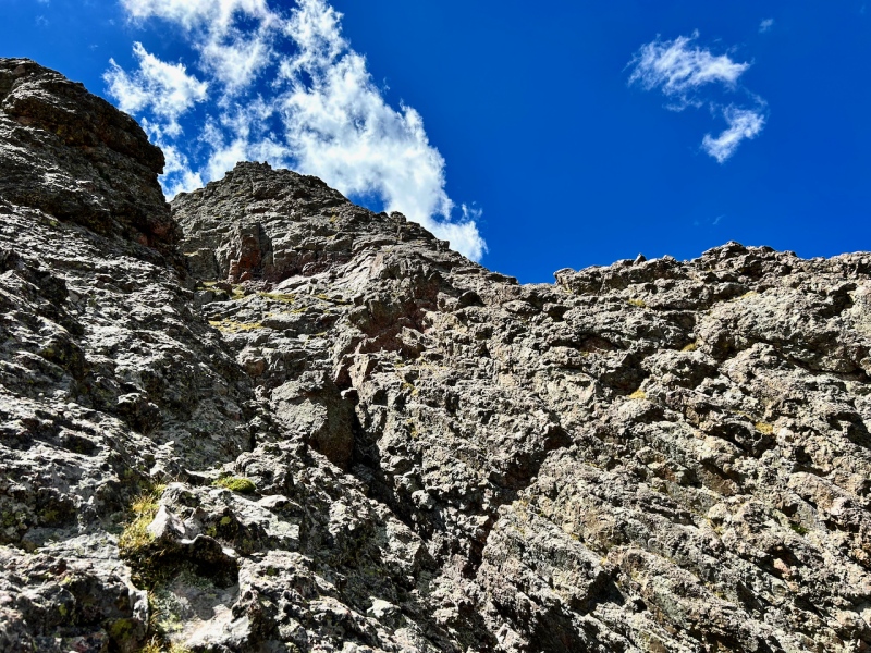
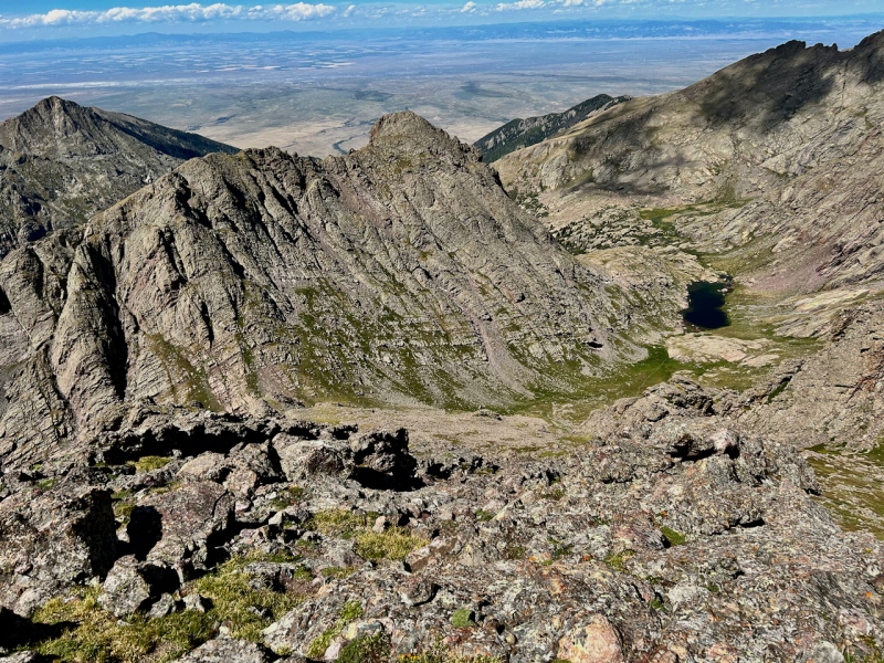
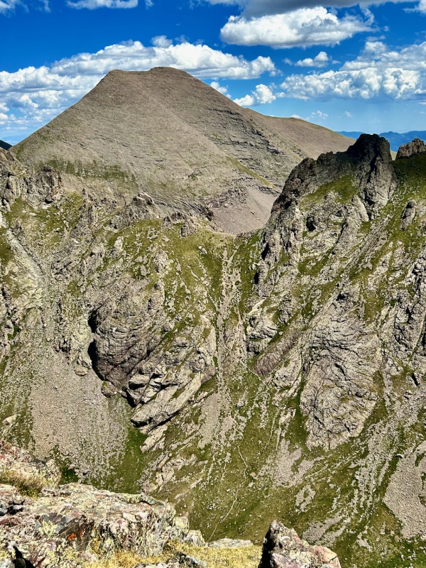
Views from Crestolita did not disappoint. Aside from the Crestones, of course, I also was impressed by the steepness of the trail zigzagging up to Broken Hand Pass from Cottonwood Lake basin. 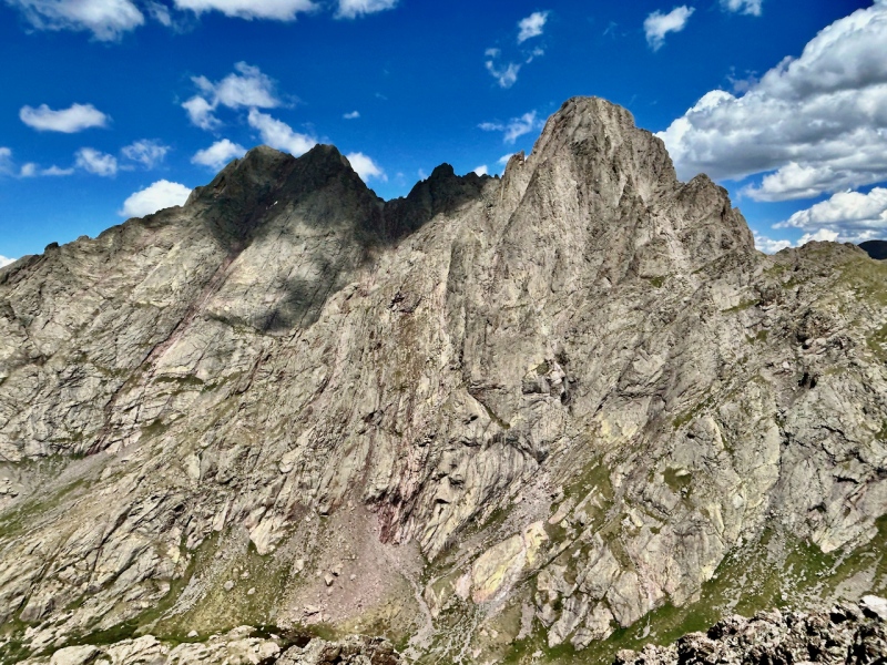
During my walk off the back of Broken Hand, I'd scanned along Crestolita, considering where to descend it from the ridge that runs south from summit. Several gullies carve this face and most appear grungy. I had read the report by kwhit24, and I picked out what I think was the route he described, which is really a series of ledges between two gullies. Departing Crestolita's summit and heading south, I quickly saw a broad scree slope lying below the ridge ahead. Glancing downward, I could see that it narrowed to a gully a hundred or so feet below. Walking toward it but trending left (east) instead of south, I came to this area shown below.
The grassy terrain held much greater appeal than the grungy gully to the south, but would it go? I'd take a look and find out. I did, and again the question:
I walked across this miniature putting green and peered down. Yes, ledges would afford some quick class 2+/class 3 access. 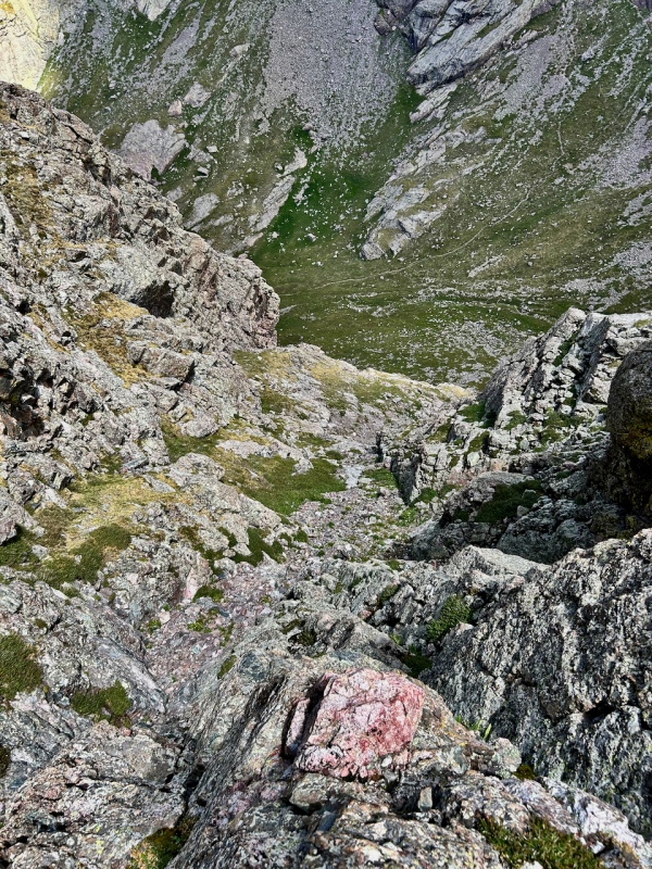
I reached the base of Crestolita, finding myself only a bit south of my line up the mountain, and in about the same amount of time (30-35 minutes). Now I walked toward the trail leading up to Broken Hand Pass, musing whether to get a third climb of the Needle. I told myself I'd need to scan the skies again from the pass, but decided against it while sweating my up the many switchbacks up the steep slope: at only one week out from my half-marathon, I needed to manage my efforts. Picking my way down the east side of Broken Hand Pass for the first time in five years, I was struck by how eroded it seemed. Down on the South Colony trail, I saw several tents between the trail and the lake. The nearest of the tents sat only thirty feet off the trail. Next to it, a man lounged, reading book, with his dog by his side. Looking to the south side of the trail, I was astonished to see these characters:
Nope, they didn't mind the dog one bit. And, evidently the dog was not at all interested in them. Chuckling to myself and heading down the trail, I stopped by the weathered sign to take one long look to drink in the splendor of one of my favorite places in Colorado.
The end of this report. But assuredly not the last time I'll be here. Thumbnails for uploaded photos (click to open slideshow): ")
")
")
")
")
")
")
")
")
")
")
")
")
")
")
")
")
")
")
")
")
")
")
")
")
")
")
")
")
")
")
")
|
| Comments or Questions | ||||||||||||||||||
|---|---|---|---|---|---|---|---|---|---|---|---|---|---|---|---|---|---|---|
|
Caution: The information contained in this report may not be accurate and should not be the only resource used in preparation for your climb. Failure to have the necessary experience, physical conditioning, supplies or equipment can result in injury or death. 14ers.com and the author(s) of this report provide no warranties, either express or implied, that the information provided is accurate or reliable. By using the information provided, you agree to indemnify and hold harmless 14ers.com and the report author(s) with respect to any claims and demands against them, including any attorney fees and expenses. Please read the 14ers.com Safety and Disclaimer pages for more information.
Please respect private property: 14ers.com supports the rights of private landowners to determine how and by whom their land will be used. In Colorado, it is your responsibility to determine if land is private and to obtain the appropriate permission before entering the property.


