Download Agreement, Release, and Acknowledgement of Risk:
You (the person requesting this file download) fully understand mountain climbing ("Activity") involves risks and dangers of serious bodily injury, including permanent disability, paralysis, and death ("Risks") and you fully accept and assume all such risks and all responsibility for losses, costs, and damages you incur as a result of your participation in this Activity.
You acknowledge that information in the file you have chosen to download may not be accurate and may contain errors. You agree to assume all risks when using this information and agree to release and discharge 14ers.com, 14ers Inc. and the author(s) of such information (collectively, the "Released Parties").
You hereby discharge the Released Parties from all damages, actions, claims and liabilities of any nature, specifically including, but not limited to, damages, actions, claims and liabilities arising from or related to the negligence of the Released Parties. You further agree to indemnify, hold harmless and defend 14ers.com, 14ers Inc. and each of the other Released Parties from and against any loss, damage, liability and expense, including costs and attorney fees, incurred by 14ers.com, 14ers Inc. or any of the other Released Parties as a result of you using information provided on the 14ers.com or 14ers Inc. websites.
You have read this agreement, fully understand its terms and intend it to be a complete and unconditional release of all liability to the greatest extent allowed by law and agree that if any portion of this agreement is held to be invalid the balance, notwithstanding, shall continue in full force and effect.
By clicking "OK" you agree to these terms. If you DO NOT agree, click "Cancel"...
I know there are quite a few trip reports for the Chicago Basin 4, but I'm hoping that this one will give some different insights and details. At the end of the report I have a section that details some notes and insights that I gained from reading other wonderful trip reports and forum comments, talking to people, and my own research that I found helpful.
When my friend Lena messaged me mid-June and said her and her friend Sarah (thePhoenix) are going to Chicago Basin from Purgatory for the 14ers and asked me to join, I was hesitant if I could get into shape and make it happen it was so close but said yes! It was a great opportunity to do my first longer backpacking (camped a bunch and overnight backpacks but never 4 nights) and get the 14ers...and then I realized I needed to get into shape and fast. After hiking up Tab's West Ridge with Stu (GreenOnion) and then over to Pikes Peak a few days later (3rd time up that one, great peak from Crags, especially when the International Hill Climb is doing test runs) I felt good and ready. Got my 45/55L pack all packed with food, water, sleeping bag, camp shoes, day bag (REI Flash is only 9oz!), first aid kit, etc.; we were off!
The Short Story: All stats are from Gaia and times include all breaks, stops, etc. More details in each section below. *I have GPX files of all of the routes we did each day, but I could only upload one. If you want any, please let me know, and I can send them. - Mon 7/5: Left Denver in the morning and drove to Purgatory - on the trail at 3:15pm and camped 4.4mi in. - Tue 7/6: Left camp at 6:30am to head into Chicago basin and arrived at 1:30pm: 10.4mi, ~4,200' gain - Wed 7/7: Sunlight & Windom: 4:40am start, Sunlight summit 8:25am, Windom summit 11:30am, back at camp 2:40pm: 6mi, ~3,700' gain - Thu 7/8: N. Eolus & Eolus: 4:35am start, 8:10am N. Eolus summit, 9:30am Eolus summit, 1:30pm done; Hike out part way: Leave campsite in Chicago Basin 3:30pm - 7:45pm campsite - ~8mi - Fri 7/9: Hike to Purgatory 8.6mi, 4hours, ~2,400' gain and drive back to Denver
Week's Totals: - 44.25 miles - 14,200' gain - Total recorded time in Gaia 37 hours (hikes, breaks, photo stops, summit leisure time, etc.)
Mon 7/5 - Tue 7/6 - Denver to Purgatory to Chicago Basin Camp Chicago Basin from Purgatory Days 1 + 2: 15.6mi, ~4,500' gain
We left Denver in the morning and arrived to a fairly open parking lot at Purgatory by 3pm and were on the trail by 3:15 after getting our shoes on, gear together, and donning our rain jackets and sleeves. Yep, we started in the rain.
Rainy start, midway to our campsite Monday afternoon
The Purgatory Trail was easy to follow, and you'll do well to remember you immediately start by going down - you'll have to go back up at the end of your trip. Oh, and there were some mosquitos. We made it down, through the meadow, down through some trees, across a river and the train tracks, and then found a camp spot. We hiked about 4.5mi in and found a lovely campsite by the river, off the trail. It was helpful to have waypoints in Gaia so we knew where campsites were and how far we wanted to go that afternoon - plus, it was even more helpful on the way back on Thursday for where the campsites were along the entirety of the trail and where we'd want to stop. I'd recommend making the waypoint location markers en route so you have them handy on the way back. You can even add pictures!
Campsite off Purgatory Trail/Animas trail
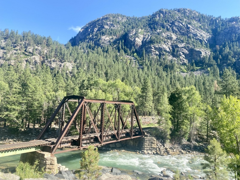
The next morning, we woke up with the sun and took a little time getting ready since the main objective of the day was be at Needleton way before the train (before 11am) and just take our time since all we had to do was get to Chicago Basin and set-up camp. We were on the trail by 6:30. It's beautiful! Winds next to the river, ups and downs, and some more ups and down, maybe a few flat spots, then some more ups and downs... and then cross the river on a lovely bridge, and you're at the Needleton stop!
Trail along the Animas
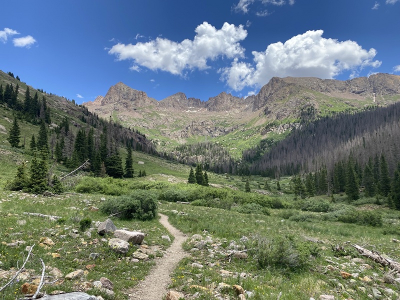
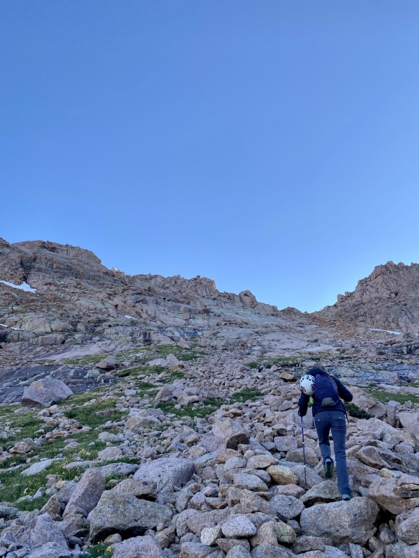
We hit Needleton train stop / bridge at 8:20am. After filtering some water and a break, we were off by 8:50 on the Chicago Basin Trail. The name of the game on this trail: LOGS (and downed trees, including some large aspens). So many logs to get over, around, above, below - you name it. Now do it with a pack. Gaining elevation. Enjoy! We chatted with a family we ran into, and their young son was counting the downed trees and was around 35 when we ran into them. We took our time on this trail - the plan was to be at the junction early and take our time going up the 3k' gain. It was also quite warm the last few miles in the basin that having the extra time and starting early was worth it.
Logs on Chicago Basin trail / basin approach
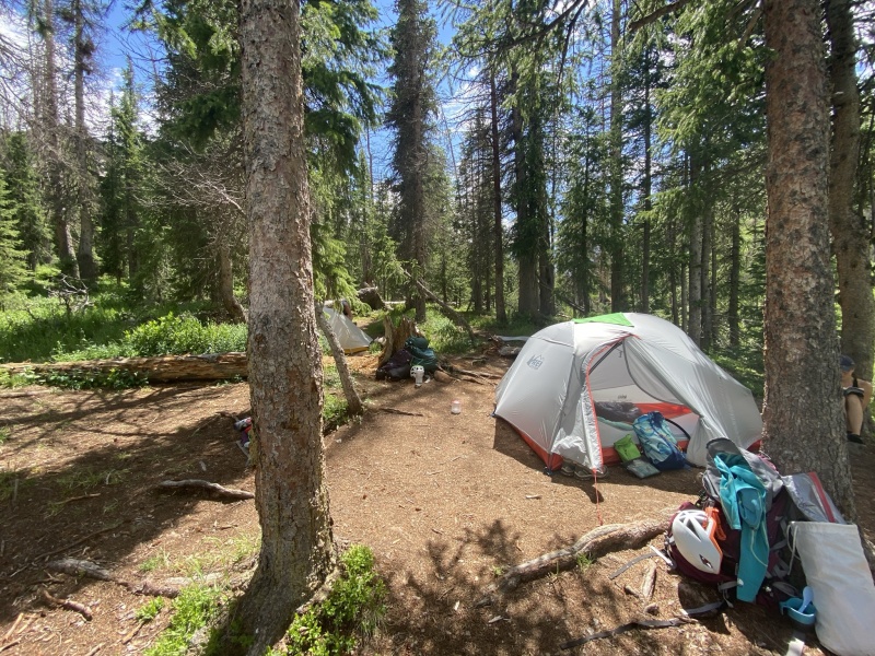
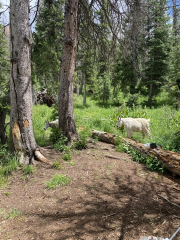
Come 1:30pm, though, we had located a campsite at about 11,050' on the other side of the creek that runs through the basin, and we were setting up camp. We were warned about the marmots and goats (mostly the goats). The goats presented themselves quite quickly - they know humans = urine = salt, so they'll keep tabs on you. Go on rocks if you can to help prevent them from digging up the soil and plants. We hung our food every night in a food tree and then our bags in separate trees as well (I put mine in a large garbage bag in case it rained over night (it did not)).
The rightfully cliche photo of Chicago BasinCamp in Chicago Basin with the explosion that is unpacking and setting up camp
Waddup camp goats! (not sure why this photo is pixely)
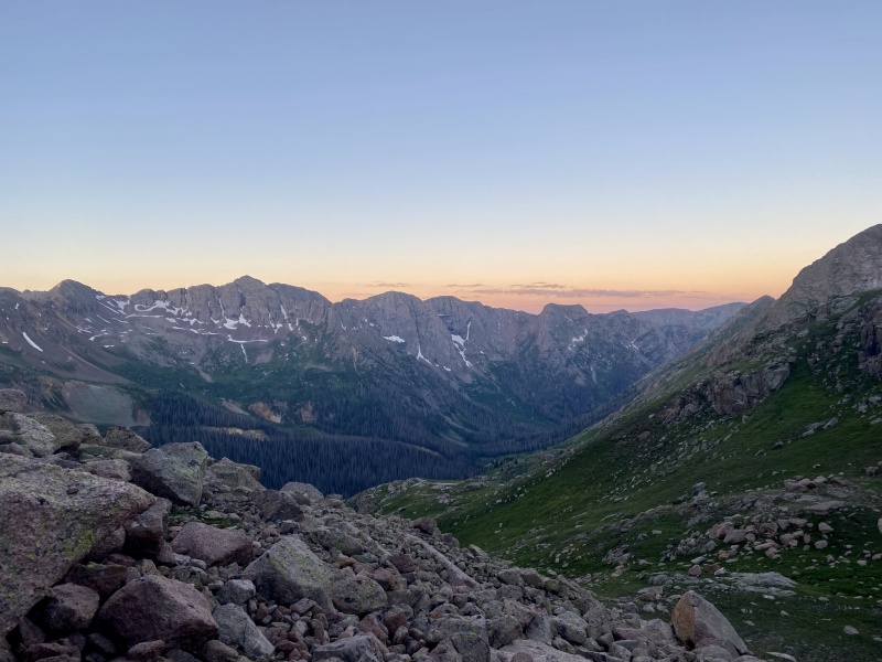
The plan was set - We were going to do Sunlight and Windom the next day and start by 4:30am to be by Twin Lakes around sunrise and give us plenty of time with any potential storms to get over to Windom.
Wed 7/7 - Sunlight Peak 14,059' and Windom Peak 14,082' The stats: 4:40am - Leave camp 5:50am - Twin Lakes 6:50am - 13k 7:40am - Top of Gully/notch 8:25am - 8:50am - Summit of Sunlight! 9:35am - Notch 10:10 - Low point between Sunlight and Windom 11:30am - 11:50am - Summit of Windom! 1:35pm - Twin Lakes 2:40pm - Back at Camp Total: 6mi, ~3,700' gain, 10 hours including breaks, photo stops, time on summits, etc.
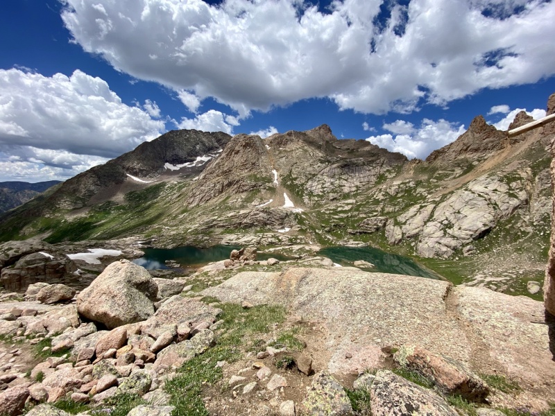
The morning started out by following a porcupine up the trail from essentially the trail by our campsite up past the trail junction. He set our pace because nobody really wanted to pass the waddling prickly fella. Our camp was near the middle/lower middle side of the basin, so we had a little more mileage/gain than listed on the route descriptions. The trail was easy to follow and the waterfall crossings were of no issue. We hit Twin Lakes right at sunrise, though, which was just stunning.
Sunrise with twin lakes behind us and looking over the basin
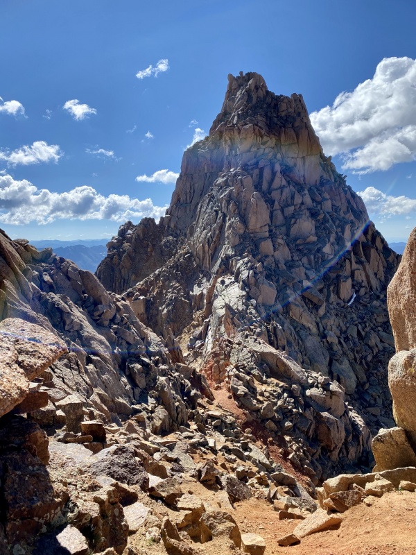
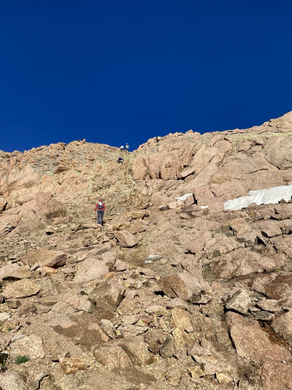
Past the lakes, the trail was easy to follow the whole way to the base of the gully on Sunlight. There are a few massive cairns showing where the split to Windom is too. The gully on Sunlight however, was not as pleasant. It's lose and steep. Early in the morning it was still damp, so that helped keep the dirt and scree in place.
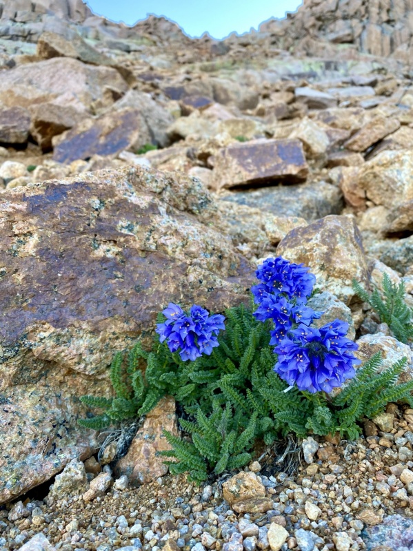
Heading up - You can see the gully up to the right of Lena's head.Beautiful flowers at the base of the gully - nature will find a way!
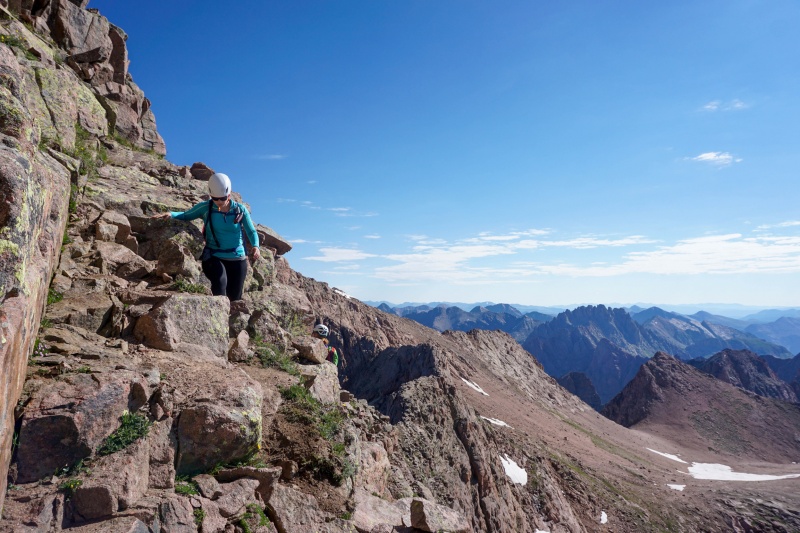
After the gully, we took a quick break to put on our helmets and eat a snack before heading up the solid Class 3 section of Sunlight. There were cairns to follow and the route description was on point. There were two tougher sections for people with shorter legs (*ahem me*), but I found a way with some butt scootchin (No, I'm not above doing this) and careful handholds. It wasn't a terribly long section and was fun. The route-finding wasn't too bad either.
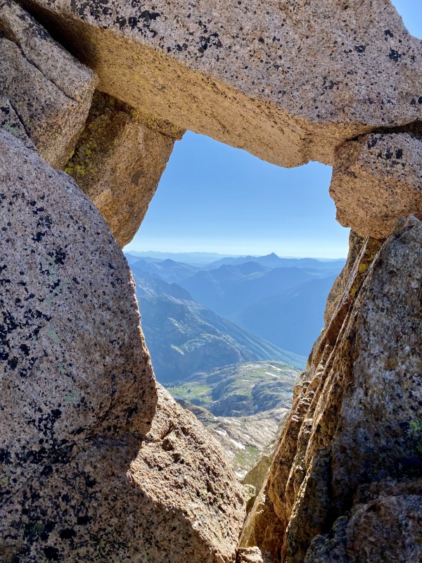
Along the route in Photo 17 on the description, after the notch and scrambling before the hole belowView from the hole in the rock referenced in Photo 18 of route description.
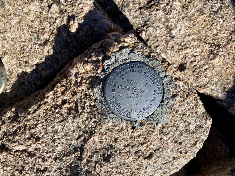
From the hole in the rock, keep going to find and go through the chimney. Some steeper and fun climbing here. Turn left and there's the summit! Well, the summit marker, my summit, and then the summit block. I was playing it by ear on if I would do the summit block or not - and when I saw it I said "nope." I could probably get up it, but getting down is what scared me. Plus, it seems that a lot of the people that say "trust the leap of faith between the rocks" have longer legs and are taller - my two friends both agreed that it's a bit more of a jump and trust than they originally thought. So I sat and enjoyed the summit by the summit marker and took lots of photos of them crushing it!
(For all of you out there that probably claim I won't have the "official summit" of Sunlight, that's ok. I'm not going for any records, nor claiming I'm going for any superlatives of climbing. In my book, I am counting the summit - while that may irritate others, my list is mine and how I want to approach it. I was not in the right mindset to go for it - maybe I'll go back in the future (when I go back for Jupiter maybe), but if not, I'm a-ok with how Sunlight went. From everyone I talked to that was going for Sunlight or completed it, it was probably a 60/40 mix of summit block vs. no summit block).
And now for some pictures of Sarah and Lena's summit block adventure:
Summit marker below the summit blockSarah cruising up and over the 'jump' section.Woo! She made it!Lena starting up and overMade it!
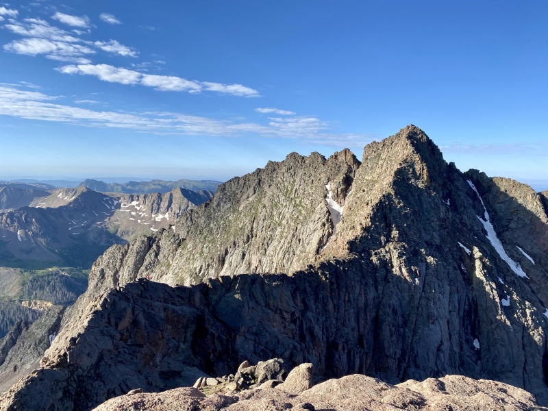
After taking lots of pictures on the summit and enjoying the sun (sun on sunlight, see what I did there?), we went back down to the notch and gully, where we got a beautiful view of both Sunlight Spire and Windom - our next objective.
Sunlight Spire from top of gully/notch coming down from Sunlight PeakLooking over at Windom. We traversed over and went up to the right of the two "dot" snow fields between the two large ones.
Time for Windom!
We dropped down the gully (and left our helmets on as people were coming down behind us - and there were definitely a few shouts of "rock!" and "clear!"). We decided to go across the mini high basin between Sunlight and Windom and go up Windom aiming left of the saddle. If you look at the photo above, we didn't have to cross much snow - just a little bit near the rock outcroppings at the bottom middle of the photo then up between the two larger snowfields. We had carried our microspikes from Denver and up today out of caution as we weren't sure what the snow situation would be like since it tends to hang out here, but it was melting fast this year! We didn't need them. We picked some sturdy lines heading up to the ridge.
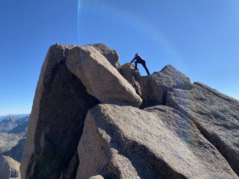
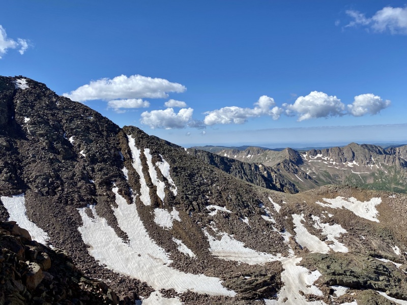
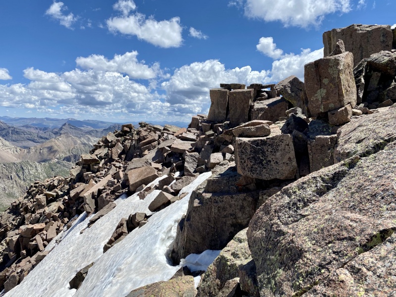
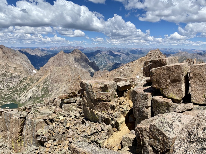
The route description calls Windom a Difficult Class 2. All 3 of us and most people we talked to agreed that it should be a 3 or "Easy 3." We were confused how the top section of Windom is a difficult 2 while Garfield is an easy 3. For most parts above 13,800', where the notch is, you want to be careful with your footing, use hand holds, and take some scrambling steps. All of it was pretty sturdy. There are also two sets of cairns - we were advised to take the higher ones to avoid a snowfield, which worked out well. The blocks on this mountain are so neat! I haven't seen neatly stacked rocks like that before, let-alone on a summit.
Above 13,800' notch, nearing the summit.
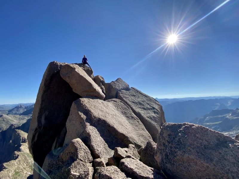
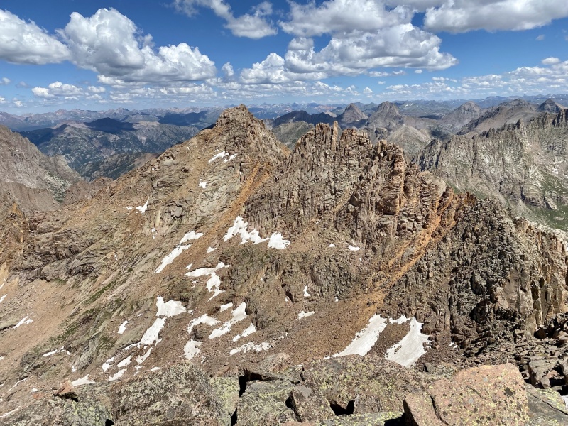
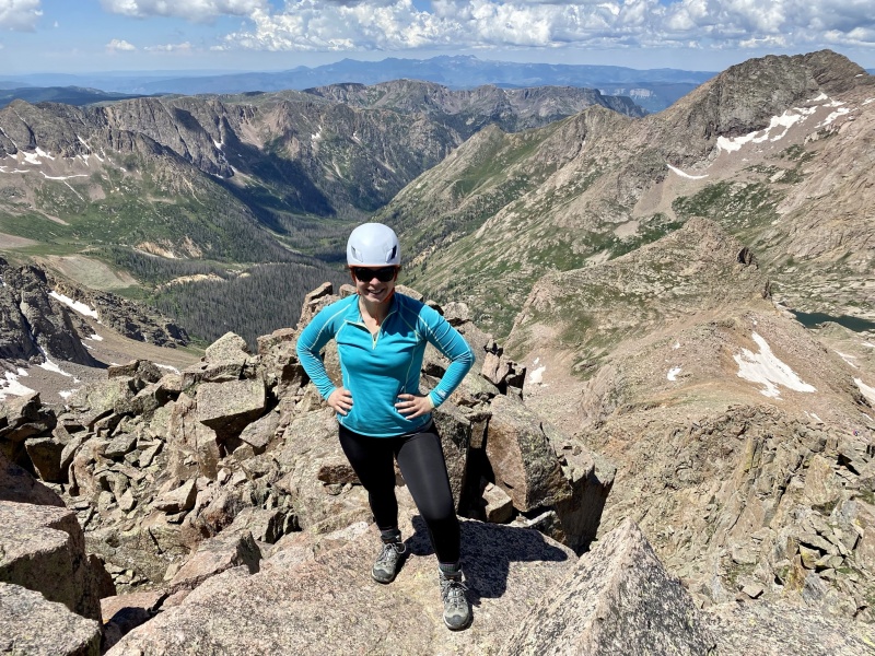
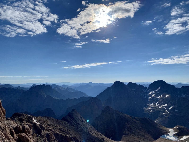
We reached the summit and enjoyed taking in the views while looking over at Sunlight and the rest of the San Juans. It was super clear that day, and the clouds were holding out.
Hi Sunlight!Standard summit picThe square blocks!
After spending some time on the summit, we headed down. We all went different ways as Lena wanted to retrace her steps to see if she could find a trekking pole she lost (no luck), whereas Sarah and I went more of the standard route down. The standard route was not very sturdy, so it made for some lose, slow stepping... but we made it. The views overlooking Twin Lakes on the way down, though, were just stunning - the blue skies, clouds, clear water. I could just keep staring at it! I am too - it's now my computer background.
Twin Lakes on the way down from Sunlight & Windom.
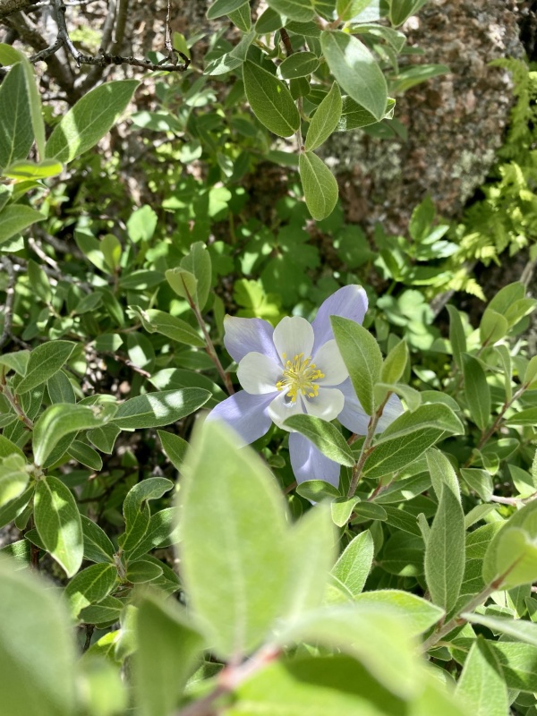
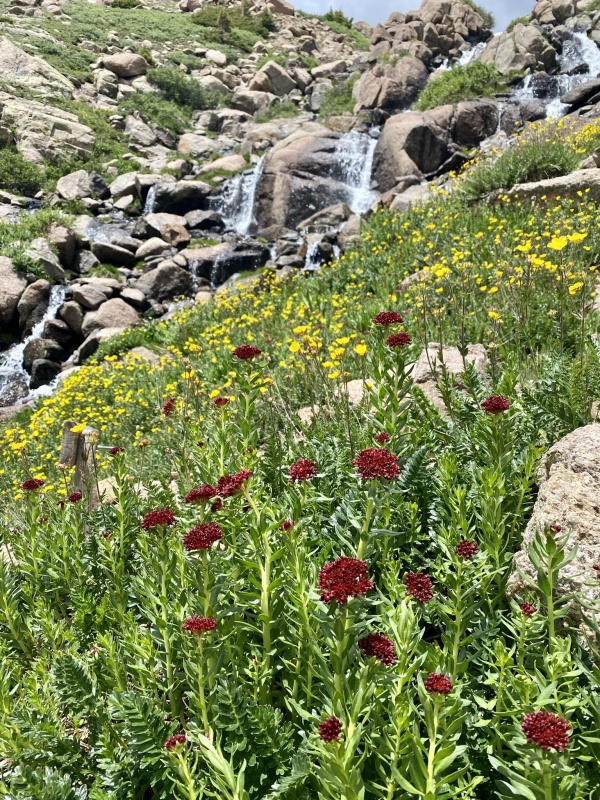
The flowers - oh my! It's prime time for wildflowers in the San Juans, and Chicago Basin didn't disappoint! The columbines! Old Man of the Mountains! Paintbrushes! Kings Crown!
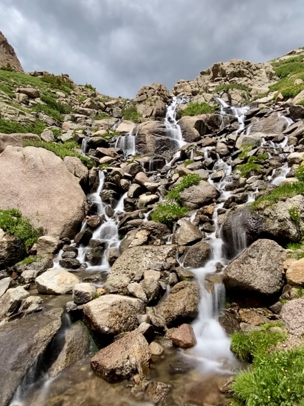
Hi Columbine!King's Crown (also known as: stonecrop or roseroot) with yellow silverweeds (goose grey or cinquefoil) in backgroundWaterfall on the way down into the basin - thrilled with how this iPhone Live Photo turned out!
We made it back to camp and then promptly changed into camp shoes and doused ourselves in bug spray. The mosquitos were out with a FORCE this week. We also ate - a lot. Dehydrated meals, salty jerky (vegan jerky for me), gummy bears, banana chips. And then played some cards and rested before turning in before it got dark. We had another early morning ahead of us!
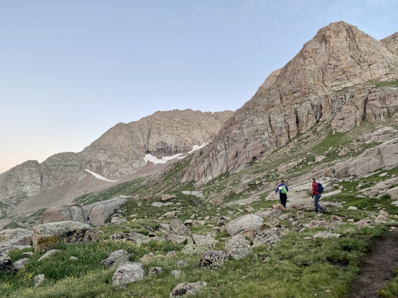
Thur 7/8 - Mt. Eolus 14,083' and "N. Eolus" 14,039' + Hike Out Pt 1 The stats: 4:35am - Leave camp 5:50am - Twin Lakes 8:10am - Summit N. Eolus 8:30am - Notch between N. Eolus & Eolus 9:30am - 10:20am - Summit Eolus! 12:30pm - Twin Lakes 1:30pm - Camp Total: 6mi, ~3,330' gain, 9 hours including breaks and time on summits
The morning was pretty standard - get our food bags down, ensure our headlamps are working, and set out for the day. We didn't have a porcupine buddy this morning leading the way, though, so we set out on our own pace, which ended up being similar. It was an easy, familiar trek up to Twin Lakes, and we turned left instead of right to head to Eolus. As the sun was rising we could tell the basin would be filled with flowers that would burst into color as soon as the sun hit - we knew we'd take our time coming down as there would be photo taking.
Right after Twin Lakes, heading left over to Eolus
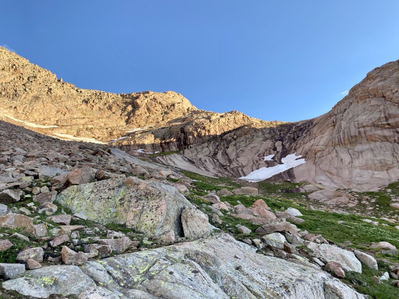
The trail was easy to follow. There were plenty of cairns, lots of rock steps (thanks CFI for all of your work! incredible), and straightforward. The ramp/ledge around 13k' was fairly easy to spot and go up, too, which was a nice change of pace.
Looking up and over at the rock ledge for the ramp - essentially where the sun/shadow meets.
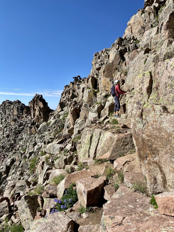
Next was climbing up the green gully, which is the first of the class 3 section. We probably should've put our helmets on at the base of this, but we didn't until we reached the notch for the Eolus/N. Eolus split. All 3 of us went right up the middle of the gully - it was a little steeper than I anticipated - going up I went to the left on the slabs; going down I went in the little notch/chimney, which I preferred.
Green gully - Lena heading up with some hikers already near the top. To the right of the guy on the gully is the little chimney I went through on the way down
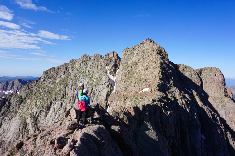
Once we got up to the notch, we decided to go up N. Eolus first rather than Eolus. It was a short offshoot and good warmup before heading over to Eolus. We also thought when we were done with Eolus we'd want to just head back to camp for the day, so we may as well go for N. Eolus first and start out strong. At the notch you get some great views of the route up Eolus, though.
View of the route up Eolus from the Notch/heading up to N. Eolus. You can see some climbers on the ridge right before the catwalk on the left side.
N. Eolus was a short and fun scramble. The rock is grippy and sturdy. Before you know it, you've reached the summit!
N. Eolus summit views.
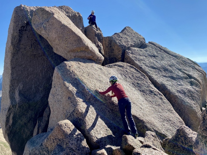
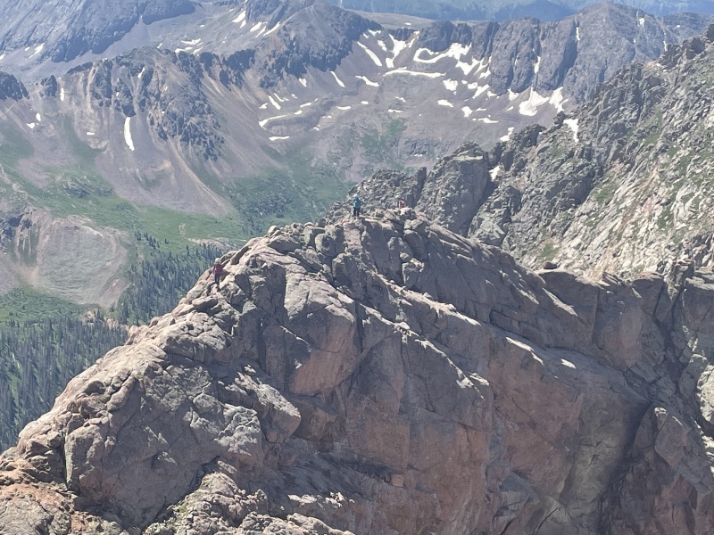
We took some photos, looked over at our next objective, and started down and over. After the notch, you gain the "bump in the ridge" before the catwalk. It's all solid class 3 scrambling from here until the summit. There are a few oddly unstable rocks in this section, though, so be aware of your footing and steps. The catwalk was straightforward and not too bad. Make sure to pay attention to where you exit the catwalk and head up the final pitch (photos 23-26 in route description).
The start of the catwalk
There are a few ways to head up this final pitch - we found some cairns and zig-zagged up. One group we met up with (who you saw in the photo of the catwalk and green gully) didn't do as much zig-zagging and just went more or less up. The zig-zagging was more straightforward route-finding with better-to-me/us handholds and route, though, so we opted for that. The ledges are narrow but not uncomfortably so with some exposure, however, there are great steps and holds: you should feel somewhat secure. Similar to the bump in the ridge and catwalk, some of the seemingly-secure holds still may be a little wobbly so just test them out. All of this climbing and scrambling was fun but does need some good attention to detail and respect, though. You'll want to pay attention to where you are for the way down.
I believe this is after the catwalk and starting the final summit push of zigging & zagging.Lena on the final summit push zigging and zagging. Note the flowers between all the rocks.
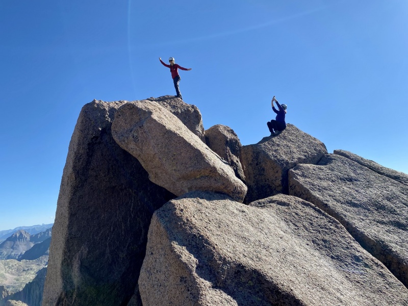
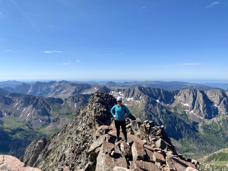
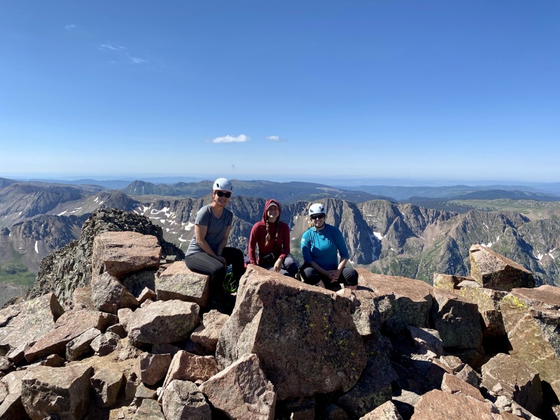
We gained the summit by going straight up, though on the way down from the summit we went a different way. Like the description says, there are a few different possibilities up and down, so go with what you're comfortable with. But we made the summit! It was a beautifully warm, sunny day with no wind - we spent almost an hour up there! We had some company partway through by a couple that crushed it and ran up in less than 3 hours.
Yep, another summit photoA non-selfie of us 3 on Eolus - myself, Lena, SarahSummit views! Sunlight Peak, Sunlight Spire, Windom, Jupiter
It was time to head down. The views were breathtaking, but we had some downward scrambling to do and some wildflowers to see. We ran into a few other hikers coming up as we were going down that went too far to climbers' left as they were heading up and got into sketchier terrain. It's key not to zig left more than zag right when heading up that final pitch. I think overall we went down a similar line to what we scrambled up but definitely some areas that we adjusted our route on. I do think climbing up vs. down requires some different moves, though, so it makes sense that we altered course a bit.
The couple that we talked to on the summit passed us and headed over to N. Eolus. As they were climbing up the unranked peak they took some sweet photos of us on the catwalk though, which they sent to us! Very kind of them to do. And now we have some pretty epic shots.
At the end of the catwalk going over the bump in the ridge - Lena going down in front, myself in the middle, Sarah in the back.
The trail was easy to follow on the way down after the green gully - go through the rocks in the basin and meet up with a well-defined dirt trail flanked by wildflowers before meeting up at Twin Lakes.
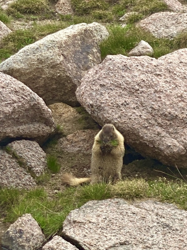
On the way down we discussed either Jupiter and heading out the next day or just starting the trek out that afternoon - we decided on the latter. So we took a little break at Twin Lakes - watched a marmot enjoy a snack as well - and then headed back to camp for a little rest, lunch, and pack-up of camp.
Marmot nomming on some vegetation.
Hike Out of Chicago Basin Pt 1 We had some lunch, gave our feet a rest from hiking shoes, packed up camp, and set off! We decided to make it to at least Needleton and see how we were feeling - if we wanted to continue or camp there for the night. We did have to go back across all those logs and downed trees... Which actually wasn't nearly as bad going down as it was going up - gravity working with us? Lighter packs? Who knows.
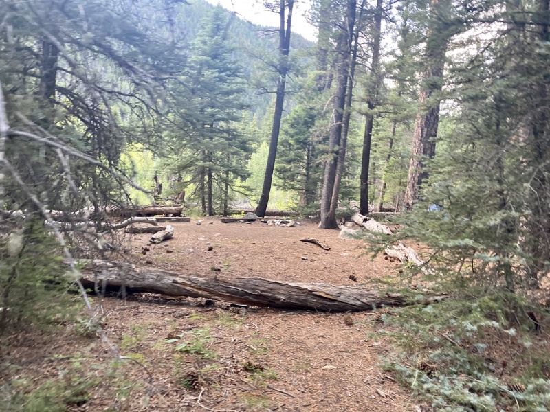
We filtered some water at Needleton and decided we wanted less pain the next day, so we continued on a few more miles to find a camp spot down the trail. Overall, we went about 8 miles from Chicago Basin in a little under 5 hours and set-up camp. It was helpful to have those waypoints that we marked on the way into the basin so we knew where spots were and how much farther we had to go. Our campsite looked a little like this (not our site, we kept going a little further past this one, but this is generally what they were like).
Campsite example along the trail
We set-up our tents, made some dinner, and stayed up the latest we had all week - past dark! After 9pm! We're party animals!
Fri 7/9 - Hike Out Part 2 + Drive back to Denver ~8.6mi, 4 hours, ~2,470' gain
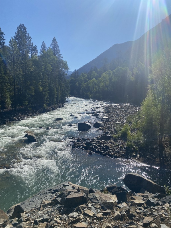
We had more of a leisurely morning but still got on the trail before 8am. We had beautiful views of the river though before the elevation gain and hot meadow hike...
River views
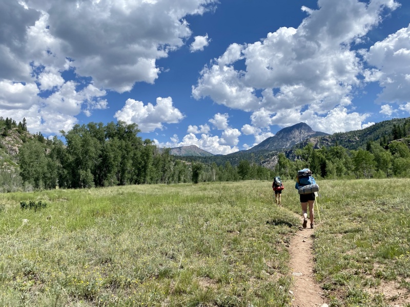
The rest of the Animas River Trail was uneventful - some ups and downs but no significant gain. It was when we got back to the Purgatory trail and hit the meadow that we all just put our heads down and went for it. It was hot that day too, so that made the meadow and the inclines a bit more miserable (I mean FUN, it was FUN). Crossing the train tracks and hearing the train in the distance was quite lovely and a good waypoint marker.
Traintracks over AnimasThe meadow
Before you know it you're heading back up the incline and can see and taste the trailhead and your car! Oh, but it did start raining again. Start in the rain and end in the rain. It was refreshing, but I still put my rain cover on my pack because if I kept everything dry this long I wasn't going to let the last 2 miles drench it! You'll find a good burst of energy during the final ascent back to the trailhead, especially when you start to hear cars and construction vehicles. I never thought I would be happy to hear those, but I was. I was also happy to remember I brought a change of clothes and left it in the car for the drive back!
44 miles later, we reached the car and had completed the Chicago Basin 4! We only got rained on at the start and end - not in the basin (we got lucky) and successfully climbed the 4 peaks. What an amazing week!
The Nitty-Gritty Details and Insights: As I mentioned in the beginning of the report, I found a lot of different trip reports, forum threads, websites, etc. helpful. I compiled some of the information that I found most useful and what I would do again and not do again. Hopefully this will help add some color to anybody's future trips!
Forum Thread - “5 Things for Chicago Basin” - Key takeaways: - Goats! Pick and know your campsite based on the critters and be animal-aware - just because there aren't many reports of bears doesn't mean you shouldn't still hang your food, clean up your site, etc. - Start early - just because you're in the basin doesn't mean you still don't have elevation gain and afternoon storms to worry about. I'm glad we started at ~4:30am every morning - it made the day less stressful and rushed and put us ahead of most people - Rain shelters apart from the tent - If I go back I want to do this - bring either a tarp or paint drop cloth or old tent material and some paracord - hang up between trees so you have somewhere dry to hang out and be rather than just in the tent in case of rain. Given the amount of downtime in camp, this would be a wonderful luxury - Route finding on Eolus is key - Sunlight and Windom combo is a longer day but doable in a day - I'm glad we did this rather than separating them. They're so close together, and you'd have to regain a lot of elevation and ground if you split them up. - Needleton trail has lots of downed trees - as I *may* have alluded to in my report above. - Hang everything during the day. And PLEASE be aware and cognizant of the extra paracord you have. Do not leave it hanging down ready for a critter to get tangled in. When we were there a poor goat got his hoof all tangled in someone's orange paracord. He was limping and had minimal use of his hoof - he will have a very hard time surviving now. We used some of our Garmin texts to contact our friends to call the ranger station and let them know of a goat in need in the basin - hopefully a ranger or wildlife official was able to help them out. It was so sad and tragic to see. Remember that we are visitors in their territory - not the opposite. Be cognizant, aware, and respectful. - Bring a day pack and camp shoes. These are worth the weight - your shoulders and feet will thank you. - We brought a deck of cards and a book to read, which was actually quite nice. My kindle weighed less than a paperback, so I brought that in a dry bag. - Charging devices: Sarah had a solar charger that she would put out or wear on her pack; I carried a battery brick. It was heavy, but since I use my phone for navigation (I have a Garmin InReach too, but I like Gaia on my phone) and photos, I wanted to make sure I wouldn't have to worry about the battery life. It was worth the weight for me.
Food: I'm a vegetarian, so finding effective (high protein) lightweight food is a bit more challenging but doable. We had planned for a weather contingency day, so we all had extra food (weight) by the end of the trip - I'd prefer that though as opposed to not enough food.
I had a few freeze-dried meals and tortilla for dinner, bagels and PB for lunches, protein bars for breakfast, vegan jerky and banana chips for salty snacks, gummy bears and wafer cookies for dessert, and trail mix. Target also had some fake tuna packets, which were packed with protein and salty deliciousness. It was a perfect addition for lunch. Next time I'd bring more salty snacks - that's what my body was craving, not necessarily trail mix. I'll have a better mix of it all going forward.
Gear Shout-Outs: - We all had water filters - I had a Sawyer, Lena a Swayer Mini, and Sarah a Platypus gravity 2L filter. The last was the winner. We had a lightweight 5G collapsible jug to fill up at camp (along these lines), and it was lovely having a store of fresh water readily available. - The stove was worth carrying for freeze dried meals and tea (MSR Pocket Rocket deluxe) - Trekking poles, helmet, microspikes (we didn't use them, but it was early season so we brought them) - Sunscreen and bug spray - while we all have our own opinions of Deet (myself included), you'll want to suck it up and get the strongest you can find. The mosquitos were out with a FORCE while we were there. Even covered in bug spray we still each got 20+ bites after spraying ourselves and clothes multiple times. They then also just hovered around you even if they didn't land on or bite you. Do yourself a favor and wear lots of sunscreen - don't be like me and not put enough on the tops of your hands and wrists with trekking poles and have some awful sunburns on your hands. - Extra baggies of all sizes and/or large trash bags - You never know when you'll need extra baggies, and it's something I always carry - Extra batteries - I hung all my food in an Ursak bag rather than just a sleeping bag stuff sack
- Unused gear I brought: beanie, lightweight puffy - it stayed warm, like mid 30s-40 at night. Probably still better to have the layers in case it did get colder, but I guess I at least had a nice pillow.
- Camp luxuries that I mentioned but will put in a nice list: camp shoes, day pack, baby wipes, dessert or enjoyable food item (or if beer is your jam, go for it - we did see people sling them into the creek in a trash bag to keep them cool), 5G water jug, seat pad (I have this one, and it's so nice coming back to camp and not sitting on the ground or a log)
The End Overall, this was a wonderful 5 day trip. I know we probably could have done it faster in shorter time, but I'm pleased with how we split up the days, especially with the long drive from Denver and our pace up and down the mountains. We were able to enjoy our time out there and still be successful. Hopefully this trip report will give some additional insights and compiled information that others will find useful!
My GPS Tracks on Google Maps (made from a .GPX file upload):
Caution: The information contained in this report may not be accurate and should not be the only resource used in preparation for your climb. Failure to have the necessary experience, physical conditioning, supplies or equipment can result in injury or death. 14ers.com and the author(s) of this report provide no warranties, either express or implied, that the information provided is accurate or reliable. By using the information provided, you agree to indemnify and hold harmless 14ers.com and the report author(s) with respect to any claims and demands against them, including any attorney fees and expenses. Please read the 14ers.com Safety and Disclaimer pages for more information.
Please respect private property: 14ers.com supports the rights of private landowners to determine how and by whom their land will be used. In Colorado, it is your responsibility to determine if land is private and to obtain the appropriate permission before entering the property.


")
")
")
")
")
")
")
")
")
")
")
")
")
")
")
")
")
")
")
")
")
")
")
")
")
")
")
")
")
")
")
")
")
")
")
")
")
")
")
")
")
")
")
")
")
")
")


