Download Agreement, Release, and Acknowledgement of Risk:
You (the person requesting this file download) fully understand mountain climbing ("Activity") involves risks and dangers of serious bodily injury, including permanent disability, paralysis, and death ("Risks") and you fully accept and assume all such risks and all responsibility for losses, costs, and damages you incur as a result of your participation in this Activity.
You acknowledge that information in the file you have chosen to download may not be accurate and may contain errors. You agree to assume all risks when using this information and agree to release and discharge 14ers.com, 14ers Inc. and the author(s) of such information (collectively, the "Released Parties").
You hereby discharge the Released Parties from all damages, actions, claims and liabilities of any nature, specifically including, but not limited to, damages, actions, claims and liabilities arising from or related to the negligence of the Released Parties. You further agree to indemnify, hold harmless and defend 14ers.com, 14ers Inc. and each of the other Released Parties from and against any loss, damage, liability and expense, including costs and attorney fees, incurred by 14ers.com, 14ers Inc. or any of the other Released Parties as a result of you using information provided on the 14ers.com or 14ers Inc. websites.
You have read this agreement, fully understand its terms and intend it to be a complete and unconditional release of all liability to the greatest extent allowed by law and agree that if any portion of this agreement is held to be invalid the balance, notwithstanding, shall continue in full force and effect.
By clicking "OK" you agree to these terms. If you DO NOT agree, click "Cancel"...
A version of this trip has existed in my mind for the better part of two years. I almost made a run at the Heisspitz-Peak Seven ridge two years ago when I climbed the Trinities, thinking a day trip from Vestal Basin was a possibility (thank God I didn't, I can't imagine more of a sufferfest), but the forecast held me back. The following spring my wife and I had a daughter, and backpacking trips were put on the back burner. That didn't stop me from drawing out large linkups on the map, with draft one being an 18 peak linkup from Beartown that would had me carry my pack over far too many peaks. I was dissuaded by smarter minds though, and I started looking at other ways to get to the heart of the Weminuche. I tinkered with a Lake Silex camp, but it didn't quite fit the bill. Finally, I decided to do what I knew: an attempt to reach Balsam Lake from the familiar Molas Pass section of the CT and to climb everything around it.
As this plan came together, a stroke of luck: k_fergie and sbenfield did a version of the trip I had sketched out and posted a tremendous trip report on it: https://www.14ers.com/php14ers/tripreport.php?trip=22317. It answered a lot of the questions I had on the route, and they were kind enough to answer the rest and share their gpx tracks for the trip. I ended up using a fair amount of their ideas--some were great, some were less--but without their info this trip may not have materialized as well as it did. After modifying a few things to better fit my plans, I was ready.
A huge thank-you to my wife for taking on sole parent duties for a few days to let me gallivant around the mountains.
Once my wife and I finished work on Friday, I said goodbye to her and my daughter and began the long drive out to Molas Pass. I rolled in at about 10 PM and promptly crashed in the back of the 4Runner, with a 2:45 alarm waiting to greet me. After what felt like 15 minutes, my watch was buzzing me awake. Time to go.
Day 1
Peaks climbed: Electric Peak, Mt. Garfield, failed attempt on Point Pun, pack into Balsam Lake
Distance: ~19 miles
Gain: 7,300
Difficulty: class 3
Time: 12:30
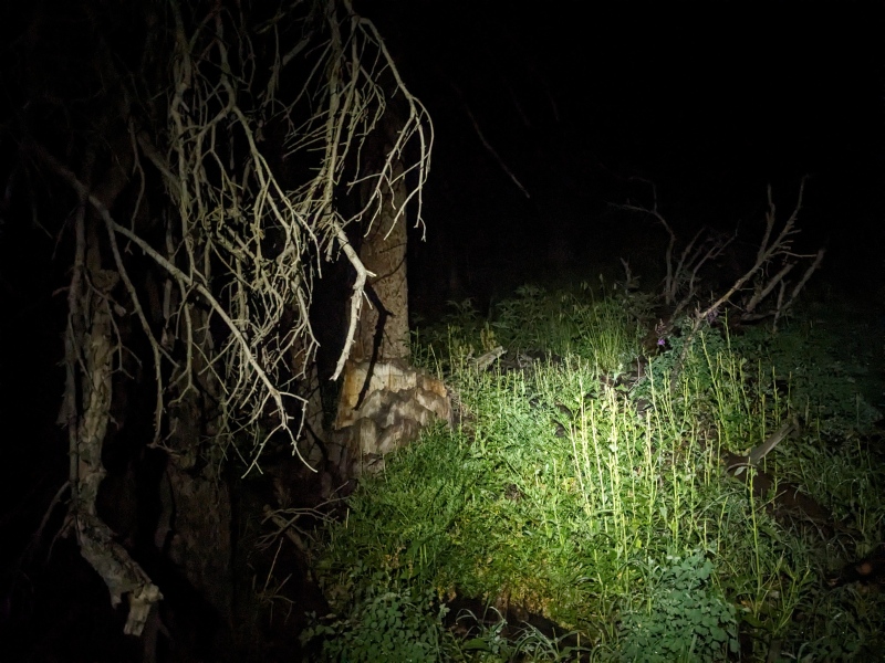
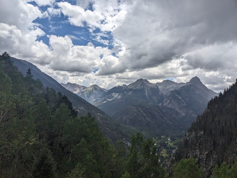
I was on the trail by 3 AM, following the now-familiar CT down to the Animas River with a semi-heavy but tolerable pack on my back. My bear-deterrent was my phone speakers playing Armchair Expert episodes loudly enough that any surrounding predators would think I had a full posse with me, and it was effective; I only encountered deer on my way down to the river. In the dark, I missed the near-immediate left turn for the CT while on the railroad tracks, but course-corrected quickly and set off for the beaver ponds. Other than a couple of short sections, the trail is very mellow built for speed. I arrived at the beaver ponds at 5:45 and saw a few tents with lights on inside, the last signs of people I'd see for days.
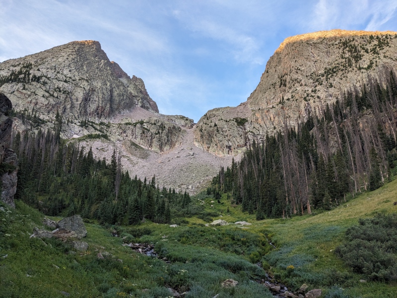
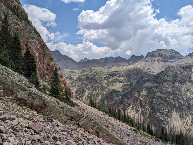
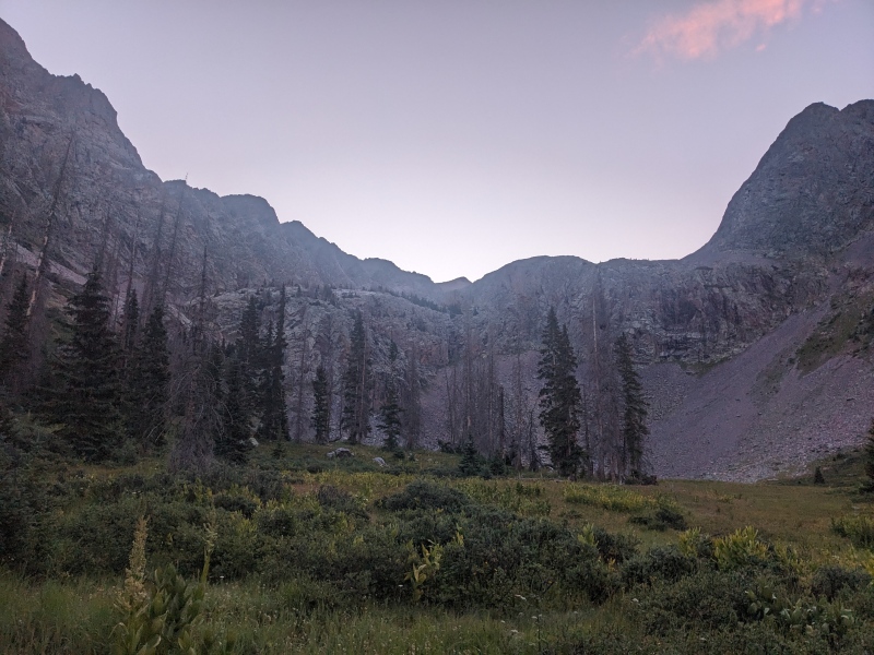
I took the turnoff for Vestal basin behind the large rock at the end, crossed the creek, and started up the trail. The trail to Vestal Basin seems to be in better shape than in prior years. Hikers are rerouting around the deadfall, and there hasn't been much new that's fallen since the last time I was up there. A little overgrown, but that's really only a hindrance if it's wet, and it wasn't (...on the way in). Rather than taking the trail all the way into the basin as in prior years, I turned off at the grassy meadow after the trail drops 100 feet just before the basin and aimed for the gully between Arrow and Electric.
Vestal Basin trail turnoff. I'll miss you, trail...
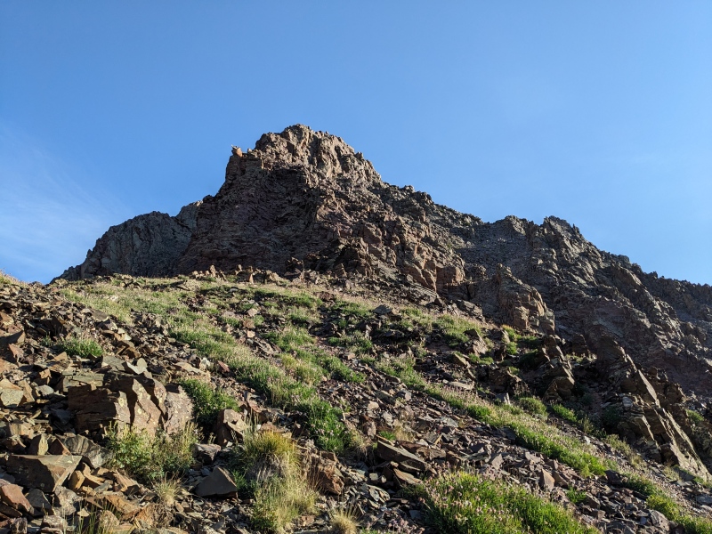
The gully was semi loose and went on forever (definitely not the worst of the trip), but after sneaking between the snow and the wall of the gully, I popped out up top into a world of talus. There's a surprising amount of distance between the top of the gully and the Graystone/Electric saddle, which was my next goal. I sidehilled under Electric for a while to avoid loosing too much elevation and made it to the saddle. I dropped my full pack in favor of the much lighter day pack, prayed to the marmot Gods that they'd spare me, and turned to ascend Electric.
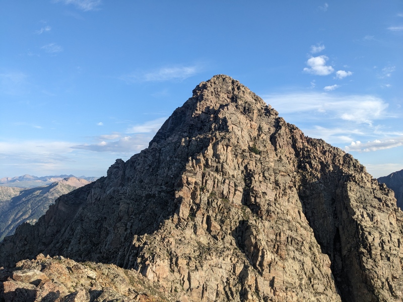
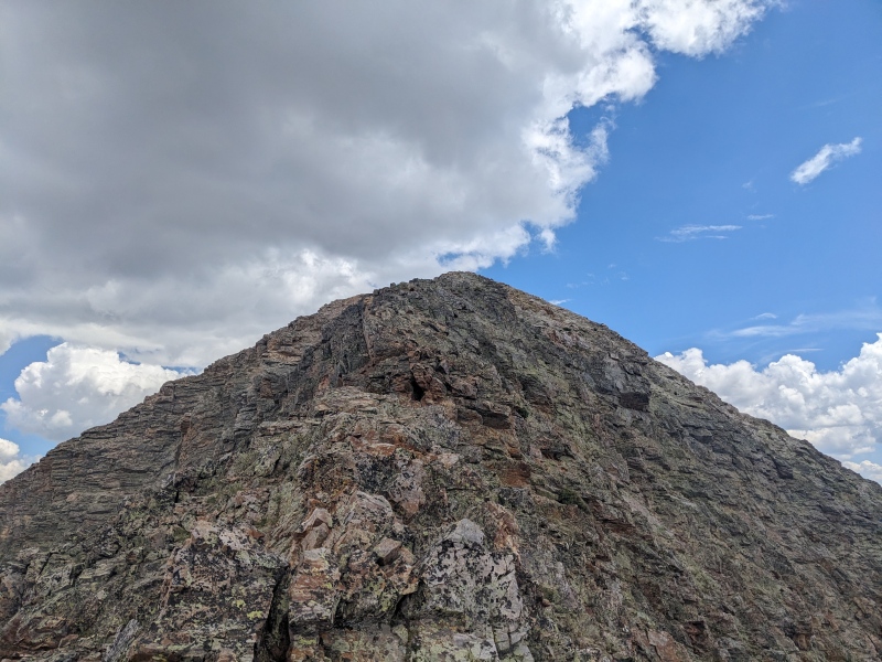
Electric was a bit of a choose-your-own-adventure peak. There's a gully to the right side that if you traverse to pretty quickly, you can avoid most of the scrambling and just hike it mostly as a loose and un-fun walkup. That being said, I chose to scramble where I could, which was more exciting and pleasant experience. I still generally trended to the right on my ascent and did have to backtrack once to find a better route, but after a short climb I reached the top of Electric, peak number one of the trip! I had a lot more ground to cover, so I didn't linger long and descended back to my pack. On the way down, I took the gully a bit longer before traversing over to my starting point. Certainly a more expedient way down.
Looking up at Electric, climbed up to the right of the ridge
Now at my main pack, I had some decisions to make. Do I go up Graystone first, try to traverse to Garfield, then come back and ascend the pass to reach the Tenmile drainage? Do I do an out and back on Garfield, then come to the pass and do Graystone? Do I leave my pack here or do I bring it with me? Ultimately, I decided that I would bring my full pack over to the ridge between Point Pun and Garfield, drop it and climb Garfield, then try to traverse with the full pack over Point Pun and over to Graystone.
I set off across the slabs toward the lake below Garfield with my full pack, cursing every extra ounce I brought. Once at the lake, a steep but mercifully short grass/talus/scree gully deposited me on the ridge, where I dropped my pack and tagged Garfield. Garfield, despite being a scramble, was largely uninteresting. It wasn't super fun, exciting, or unique; it was just there. It went quickly though, and while I was certainly starting to feel the over 6k gain I'd done to this point, I was feeling good to get over Point Pun to Graystone.
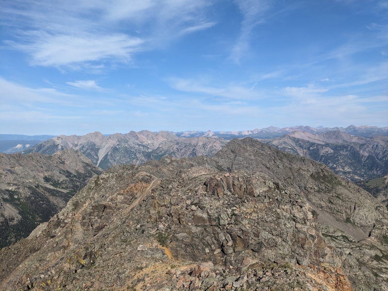
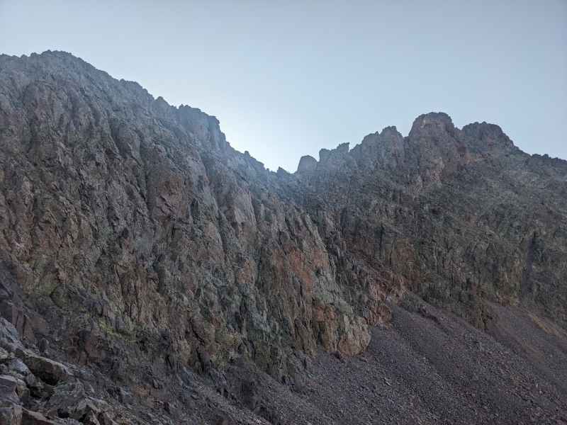
A look at Garfield from the Graystone/Electric Saddle. Ascent slopes/gully are out of sight to the left behind the slabs.
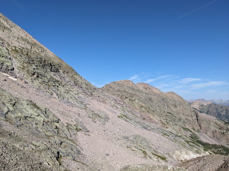
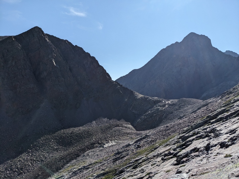
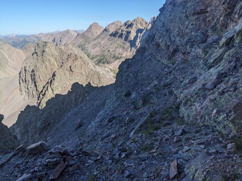
I started toward Point Pun feeling good and making good time. The ridge was blocky and slabby with solid rock, yet surprisingly gentle; perfect for travel with a heavy pack. But as I approached the base of the tower that is Point Pun, I found myself cliffed out, with no way to reach the saddle that leads up to the unranked 13er. I looked around for a while, but didn't see anything that I could attempt with my current gear situation. I spied a bypass, but that bypass required at least a 10 minute backtrack and a hundred or two feet of elevation loss. I looked at the fluffy white clouds starting to build and my watch, and made the call that while I wanted to explore that full traverse, I needed to prioritize getting over the pass and to Balsam Lake. Mildly annoyed, I retreated to the slope I used to ascend, pointed my tips down, and went back to the lake. I returned over the slabs to the Graystone/Electric saddle, then pounded up the steep, loose gully (theme of the weekend) to the pass between Arrow and Graystone, now with over 7k of vert in the bag.
On the slabs looking at Electric (left) and Arrow (right). The pass used to get to Tenmile drainage is just out of sight to the right.
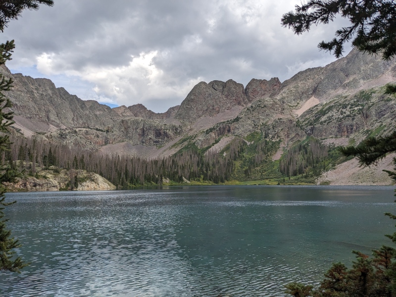
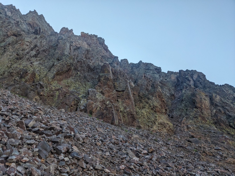
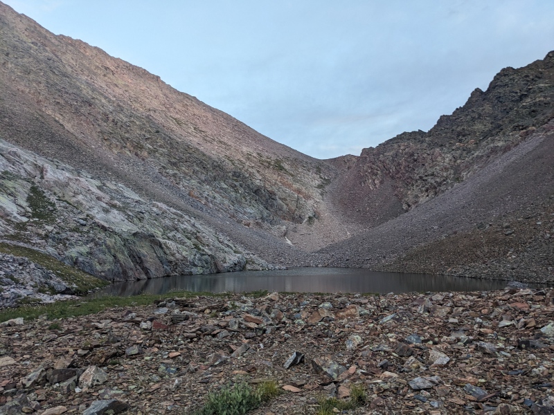
The descent from the pass toward the Tenmile drainage took me underneath Arrow and Vestal, past an isolated little lake, and down a lengthy talus slope. Once I exited the talus slope, I quickly found out why no one uses this route to access Balsam Lake: this outlet is, like, 2 miles of sidehill bushwhack away from Balsam Lake. The gpx tracks I had from the boys last summer indicated there were game trails up high on the slopes between the trees and the cliffs, but I found none. Just waist-high grass covering loose rocks and dirt. I made horrifically slow progress, as I slipped on the grass-hidden rocks on the slope nearly every step, and somehow managed to lose my sunglasses and snap a pole in the process. Eventually, I had enough. I dropped straight down to the valley floor, and after just a couple of minutes I found a faint trail! It seemed to be a game trail, but I'm guessing it's periodically used by people as well. Occasionally it would disappear behind deadfall, but by going to where it was heading, I almost always found it again. This trail mentally saved me, and even though it overshot the lake by a couple of hundred feet, it saved me tons of time, and once to the lake I found what may be the best camping spot in Colorado. I set up camp, ate food, read on the kindle, and reflected on the day.
This was my first solo backpacking trip, and this first night was a tough one. I struggled mentally with how difficult the approach was, especially knowing I would have to do it all again to get out. I missed my wife and daughter. The weather forecasts weren't great and I'd have to race the sky to get my objectives done. I had very real thoughts of packing up camp in the morning and just going home. As thunder and lightning rumbled above me, I told myself I'd see how I felt in the morning and figure out what to do from there.
The drop into Tenmile Basin...I don't recommend the sidehill
But man the campsite is otherworldly. The photo doesn't do justice to how blue the water is because of the clouds, but it's almost Ice Lakes blue.
Day 2
Peaks climbed: The Heisspitz, Peak Four, Peak Five, Peak Six, Peak Seven
Distance: ~9 miles
Gain: 5,400 feet
Difficulty: 5.0
Time: 7:55
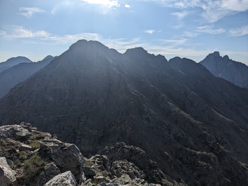
My alarm went off at 5 AM the next morning. I was feeling better; not 100% by any means, but the prospect of getting to go a full day with just the daypack and with minimal bushwhack put me in a much better mood. I got ready and was moving by 5:30. I had gpx tracks from the boys for this day and I was optimistic that they would lead me through the confusing walls of the Tenmile Basin toward The Heisspitz without too much trouble. One of the changes I made from their plan was to reverse the direction of the traverse and start with The Heisspitz. A couple reasons for that: one, it left the day open-ended, so if the weather was good and I was feeling particularly spritely, I could continue on and add any of Eight, Nine, or Storm King; and two, the trickiest routefinding seemed to be between Four and Five, so by reversing the route, the hardest part is now an upclimb instead of a downclimb. I think this is the right way to do it, but I guess the choice is yours. One unexpected downside: once on the ridge, you're traveling east the entire way, which means the sun messes up every picture. Oh well, no one has accused me of being a talented photographer anyway.
Shortly after leaving camp, I pulled out the gpx tracks and adjusted myself onto them, and suddenly found myself on a trail! And not just an "oh, 3 elk walked here 10 years ago and you can kind of see their footprints" trail, a real one! I followed it for its entirety, and it did its job: it put me above the cliffs near the lake below Four and Five. From there, I navigated through the meadows, up and down a couple of terrain benches, turned left, and ascended oh, go figure, another loose gully to reach the ridge between Four and The Heisspitz.
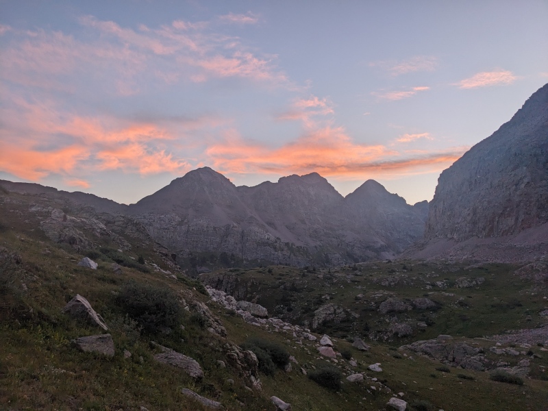
First light over the Trinities in the basin below Five and Six
The Heisspitz's twin summits in the distance, lots of terrain to cover first
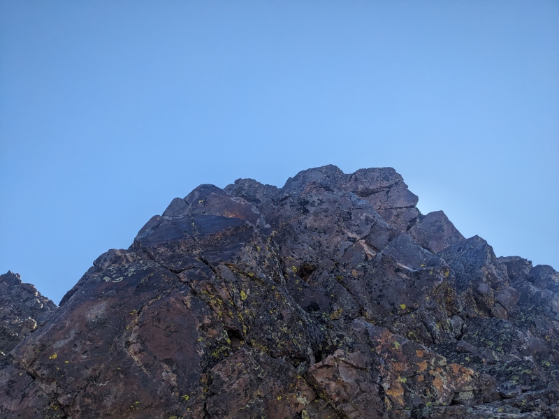
Upon reaching the ridge, I turned right and eyed the ascent. A blocky ridge stood between me and the summit. I tackled it largely head-on, with occasional but brief forays to the sides. Scrambling was in the high 3rd/easy 4th range. Nothing too bad, pretty fun. It was further away than I had anticipated, but I eventually reached the summit. I then traversed to the other summit and back, since LIDAR doesn't know which one is taller. I snapped a few pictures, ate a bit of food, and surveyed the rest of the day. One thing was clear: this ridge was going to be LONG!
Summit pitch on the 'Spitz
Top out!
I retraced my steps back to the low point between the 'Spitz and Peak Four. To be honest with you, some of the terrain on this traverse blended together, and Four in particular I remember almost nothing about. I remember there being a false summit, and the true summit was quite a bit further along the ridge. I remember climbing around to the right of the main ridge and linking up scrambly sections, but that's about it. I believe it was all 3rd class. I made it, checked the skies, and things were still looking good!
A look towards Four. True summit is not the prominent point on the left
Headed up Four's false summit. I went around to the right at some point and scrambled up there.
On top of Four, looking back at twin summits of the 'Spitz
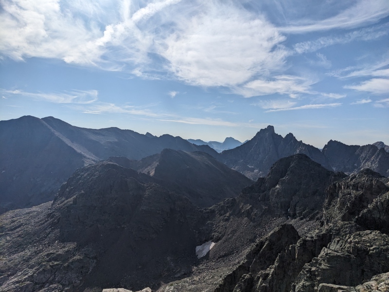
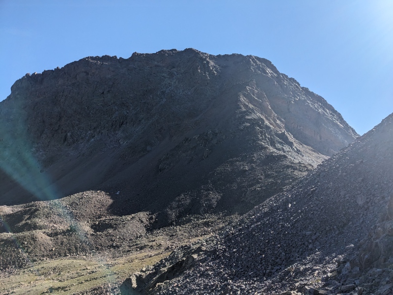
The traverse from Four to Five was what I'd been waiting for, as I knew it held some of the most complicated terrain of the day. I took a look ahead to plan out my course and I was taken aback at how tall, inaccessable, and far away Five looked! I double checked my GPS to make sure I was looking exactly in the right direction, since I felt like if Five looked like that, more people would talk about it. It was just so epic and and inspiring and jagged......oh....I was looking at Jagged! I reassessed my bearings, found the actual Peak Five, and breathed a little sigh of relief. Way closer!
I had the tracks from fergie and benfield and elected to follow them for a bit. They (and I) followed the ridge down Four for a bit, but when a tower loomed in front after reaching a saddle, traversed underneath on the north side of the ridge, taking a direct line on sidehill talus to another saddle that would lead to the lake below Five. The towers looked navigable, but gratuitous. Gratuitous was not in the cards with the forecast for the day. The sidehill talus was loose and sucky, but pretty short, and after five or so minutes I was standing at the saddle, staring at the lake and the complicated cliffbands on Five.
Coming down Four, looking at Five and Jagged and the ridge.
Why climb towers when you can sidehill talus!
There's no way to avoid giving up a chunk of elevation here (unless you attacked the ridge directly, which no one seems to do), so I gave it up quick and picked my line. There were a couple of breaks in the cliffs, but I spied one that would let me climb loose talus (YAY) as high as possible, then scoot up a short chimney/crack to reach a left-angling ramp. That ramp would then lead me to another ramp, this one angling to the right, which would deposit me on the much gentler SW slopes below the summit. The plan went beautifully. The chimney held a couple moves of 5.0, but the rock of the sidewalls was solid and perfect for stemming. The only bad thing: as I powered up off my right foot to exit the chimney, I felt the unmistakable feeling of a blister tearing on my right toe. Ugggggghhhhh! I was wearing a pretty new pair of La Sportiva Ultra Raptor IIs, but I've had nothing but problems with this pair. My last pair was perfect. Never blistered once. This pair, every time I wear them I get something. Might have to look at the rest of their lineup to see if another model fits better. Taking suggestions!
At the saddle, looking at Five (and Jagged!) A few breaks in the cliff. I went middle left of the pic to a left angling ramp, then up to a right angling ramp that led to the summit slopes. Hard to see because of the stupid sun but it's there.
The short 5th class chimney. Go left before the big blocky rocks at the back.
After the chimney, the ramps connected me well to the upper slopes. A short hike put me on top of Five. Three down, two to go! Fluffy clouds were starting to build, but weren't a threat yet. I ate a bit more food, then took off toward Six.
Five! Side note, a broken pole still functions as a pole, as I learned. It was a clean break, and it somehow it worked just as well and didn't get damaged any further the rest of the weekend.
Six was by far the least exciting peak of the traverse. The downclimb from Five to the saddle with Six held some 3rd class scrambling, but much could be dodged on the south side of the ridge. The ascent up Six was basically a class 2 talus hike out on the SW face, unless you reaaaaaally felt like contriving something on the ridge. Five to Six was the only traverse between peaks that took less than an hour. Did I mention this ridge is long?
Six from Five. Not a crazy interesting ascent
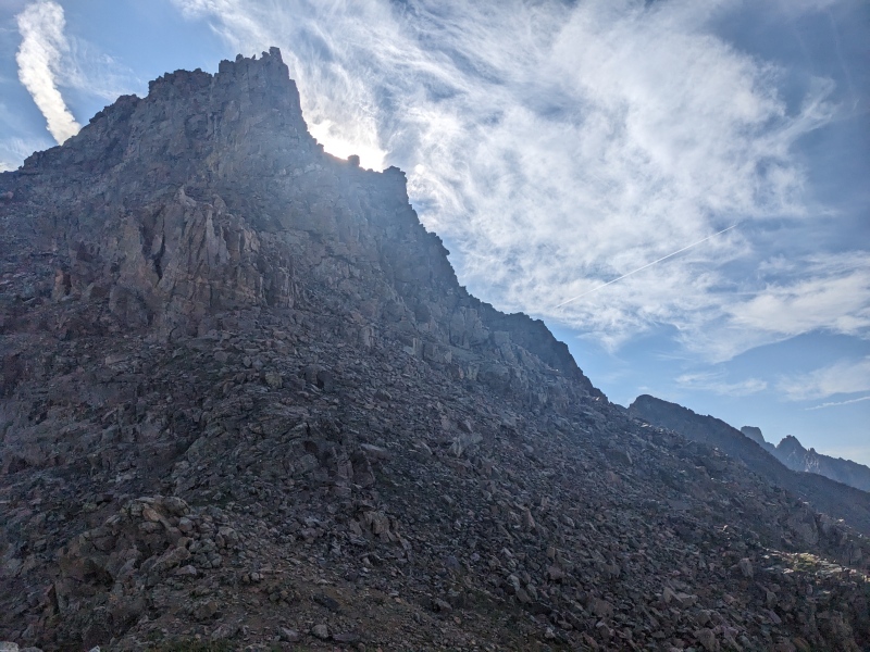
On top of Six, I took a look behind me and realized all the nice little fluffy white clouds were suddenly looking a little less nice. Despite feeling pretty worked, I hustled off the summit toward the spiky ridge leading to Seven. I had every intention of scaling this ridge, but the clouds behind me were an ever-present reminder that I was on a time crunch, and the tracks I had from the boys showed that they started to head from Seven to Six, cliffed out, and backtracked down a gully and underneath the difficulties on, you guessed it, sidehill talus. I was fairly confident that even though they cliffed out going down, I could probably find a way through it since upclimbing is easier than downclimbing, but I just didn't have the time to explore that I wanted. Somewhat reluctantly, I elected to take the bypass under the ridge difficulties.
Seven from Six.
I descended the ridge from Six to where the difficulties up high kicked up a notch. At this point, I looked across and noted there were three options: a low traverse deep into the basin avoiding absolutely everything, a middle traverse on sidehill talus in between cliff bands, and a high traverse on what appeared to be a narrow shelf that hugged the upper cliffs. I elected for the latter, hoping it would be slightly less angled. I set off on it, and while covered in absolute garbage like every other part of every mountain in this area, it was a little more ledgy and flat. One might even call it a "ledge system". It seemed like this was possibly a goat route or something similar. It was typically 2-3 feet wide, and while careful foot placement was necessary due to the loose rock on top, It felt better than more sidehill talus. At a couple of spots, it narrowed to step-around moves, and eventually the main path terminated and required a 25 foot loose 3rd class downclimb to reach the next tier, but I'm guessing this was the best way to bypass the ridge proper. At the end of the ledge, another loose gully appeared, which took me right to the ridge.
The high bypass. Junky, but at least not at 45 degrees sideways.
When I hit the ridge, the cloud situation was becoming truly dire. I still had a good amount of gain to reach the summit, but it seemed like time was running out. I put my head down and powered up the 2+/easy 3rd ridge to reach the summit of Seven, periodically raising my arm above my head to see if I felt any buzzing. I never did, so I topped out, took 3 pictures, and peaced. I didn't even take the time to sign the summit register. As I turned to leave, I felt a few drops of rain, then nothing.
Ridge up Seven. Clouds becoming angry.
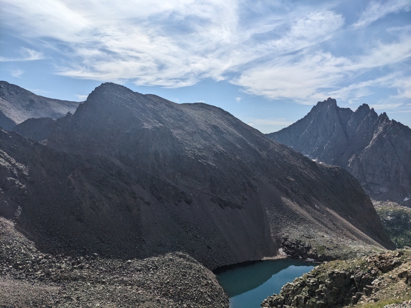
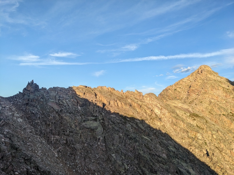
Seven Summit, looking at Trinities and Vestal. Graystone at the far end of the ridge.
My original descent plan was to take the north ridge of Seven, then drop east to the Seven/Eight saddle and descend the way I'd come up the next day. However, on the way up, I hatched another plan. I returned down the SW ridge of Seven to the gully I used to gain the ridge. I took that gully all the way to the bottom, where a small lake lay on the shelf above Balsam Lake. I knew that most of Balsam Lake was guarded on this side by serious and sometimes overhanging cliffs, so a direct descent wasn't going to work. But it looked like I could sneak below the rock buttress on Six on (yep) sidehill talus to reach the area where my ascent trail took me up this morning. I headed that way, and when I reached the slopes below Six's buttress, what did I find? A talus and grass slope heading directly back to Balsam Lake!
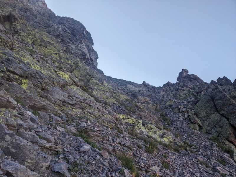
View from top of ascent/descent gully, Balsam Lake at the bottom.
I immediately shifted my plans and went straight down the slope. The top 100 feet was the absolute worst hardpan, loose scree I encountered on the whole trip, which is really saying something. But that yielded to more talus and scree, and eventually to grass! I took it straight down to the lake and was able to stay primarily on grass all the way to the lake's edge. A short jaunt along the shore brought me back to camp, just over an hour from leaving the summit. Somehow, the weather held, and those few drops of rain on the summit were the only ones that fell until after 3 PM, at which point some rain fell and thunder rang out.
Express route to Balsam Lake! Ignore the sucky hardpan
Getting all 5 of these peaks today was a huge weight off my shoulders. These 5 are the hardest of the trip to get to and orphaning one or more would have meant massively changing plans for the upcoming days. At camp, though still quite homesick, I felt much more at peace with being there, and felt confident that I'd be able to accomplish the rest of my goals. I read a lot on the kindle, braved the rain later at night to choke down some food, and went to bed again as nighttime fell.
Day 3
Peaks climbed: Peak Eight, Peak Nine, Storm King Peak
Distance: ~6.5 miles
Gain: 3,400 feet
Difficulty: class 4
Time: 5:30
Originally, I had planned on doing Eight, Nine, Storm King, Silex, and The Guardian this day. After much internal debate, I chose to drop Silex and The Guardian and have a much easier day, almost a "rest day". Silex and The Guardian would have added about 3 1/2 miles and 3,400 vert to the day, and to be honest, I was really vibing the idea of getting to camp early, getting to relax during the afternoon with a book, and saving my energy for the long day tomorrow with a full pack. So up I got and hit the "trail" (yeah I wish) at the leisurely hour of 6 AM.
One of the most frustrating things about Balsam Lake is the navigation around the lake itself. Most lakes, even the most remote, have some sort of trail system around the shore. Not so here. The closer I got to the lake, the more of a bushwhack it became. It took about 25 minutes to fight my way from my campsite at the western terminus to the marshy meadow on the east side, as well as quite a few leg scratches. As I exited the marsh and headed up the gully to reach the upper basin below Seven, Eight, Nine, and Storm King, a strong trail materialized that made the climb smooth. It dissipated quickly once above the headwall, but it was still much appreciated. A series of gentle grassy benches led to the talus slope below Eight, my first target of the morning. This talus slope was one of the best of the trip, and I promptly reached the beginning of the gully/rib that bisected Eight's face.
Finally past the lake, ascent route through cliffs behind the trees on left.
Eight is great!
Eight was a peak I'd been looking forward to climbing for quite a while, and boy did it not disappoint! From the moment I reached the rock rib, solid 3rd class climbing on bomber rock began in earnest, and continued all the way to the summit. A solid 400 feet or so of joyous climbing--never too hard, never too easy, never any breaks. I topped out an hour and twenty minutes after leaving camp. Surprisingly, I had service through AT&T on Eight, Nine, and Storm King, so I was able to send a few texts before shooting down the gully (fun way up, easy way down, that's the motto) and scampering over to the Eight/Nine saddle.
Loose gully or bomber rock? Take your pick!
Wonderful scrambling
Big views! Vallecito and Leviathon, and as it does in every picture, Jagged sneaks in the back.
Once I reached the Eight/Nine saddle, I took a look at the peak in front of me and sat there for a second, mildly confused. I know people talk about a ledge system on the SW face of Nine, but as I studied the terrain, I saw no such ledge system. I pulled out my phone and reviewed the trip reports and gpx files I had for the peak, and it was clear that everyone else was as confused as myself on the route, as everyone mentioned a ledge system but people seem to take many different ledge systems and pop up on the ridge at seemingly random places. One group even went four tenths of a mile past the summit before hitting the ridge. I am usually a "look for 5 seconds, but don't waste too much time routefinding" kind of person, since things tend to reveal themselves as you progress, but I sat there for probably 15 minutes near the saddle, staring at my phone, then the mountain, then my phone again, never seeing this "ledge system".
See the ledge system? Yeah me neither
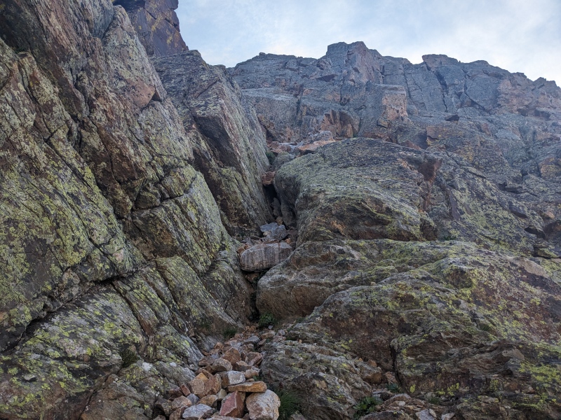
Eventually I decided screw it, I'll just find my own way up the peak. I dropped down a bit and climbed talus until I reached two different options to get up onto the face: a chossy 2+ gully, or a solid 3/4 climb 40 feet to its left. I took the climb, and once topping it, scrambled fifty or so feet further up the peak before stopping and reassessing. I was able to head to my right and up slightly, crossing gullies and ribs at weaknesses, all over a bed of loose rocks. After a short bit of this, I stumbled on a cairn. Is this the ledge system? Can't be, right? "Ledge" denotes a certain well-defined blockiness and flatness to the feature, and this had neither; it was just slightly less steep sections of the same loose face. But another cairn appeared behind it, and another, and I came to realize that while I was in the right area, clearly no one who came before me had carried a thesaurus to find a more suitable word than "ledge".
Initial scramble up from the talus to reach the face. Essentially, go up till you can't.
Probably the most defined part of the "ledge system". Note the cairn.
Here's the secret to understanding this peak. The "ledge system" doesn't begin at the base of the face. You have to get up high before it becomes apparent. That was the key for me and what unlocked the route. It's also why I spent so much time staring at the mountain trying to figure out where to go. I misunderstood where to begin. Once on the face and the "ledges", I followed the logical route the terrain presented, terminating with a short 4th class climb to reach the ridge, just 50 or so feet below the summit. I traversed back to the west and stood on top, happy to have cracked the code.
Terminus of the "ledge system", climbed up the chimney in the middle and turned left to the summit.
SK from Nine
I reversed my route down the ridge, down the chimney, and onto the "ledges". Nine was the least fun peak of the weekend, and gave me harsh whiplash from Eight, which was unequivocally the best. Not enough can be said about how miserable it was on this sharply-angled "ledge system", covered in loose rocks. It never got better either. Just loose and sucky, from start to finish. On the way down, I was able to follow the "ledge system" (okay I promise, I won't say those words again in quotes) just fine, but my descent route took me down the gully instead of my way up. The gully was nasty, but short, and all that remained of the peak was a climb back to the Eight/Nine saddle.
Sucky ledges
Back on the talus, the two options to gain/descend the face: Right is gully, left is climb.
To reach the SK/Nine saddle, I had to descend a bit off the Eight/Nine saddle. I stayed a bit higher than advisable and sidehilled on talus to avoid losing much elevation, but by this point I was immune to sidehilling talus. The saddle came quickly, and I began the 900 foot climb up SK. A climber's trail appeared from the saddle and took me to the left of the ridge. I followed it for a few hundred feet, until a small saddle dead-ended me into the upper scrambling on the ridge. At this time, I heard what sounded like voices below me...another climber? I looked down and saw a twosome cresting the SK/Nine saddle, the first people I'd seen for over two days! I watched them sit on the saddle and take a break. I headed up the ridge, and the next time I looked down, they were gone, and I was never able to locate them again, even in the expansive basin. Must've had a portal gun or something. Disapparating hikers aside, the ridge scrambling on SK was quality, and there were a couple of tricky moves that upped the difficulty a tick. I was having fun up there, and thus I ignored the cairns trying to get me to enter the broad upper gully, opting to stay on the ridge all the way up. About an hour after departing Eight, I made the final moves over to the summit of SK and sat down to relax and soak up the sun and scenery.
SK on the way to the saddle.
Fun scrambling on the upper mountain.
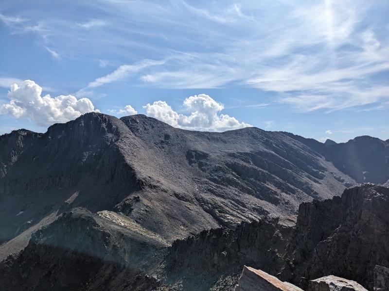
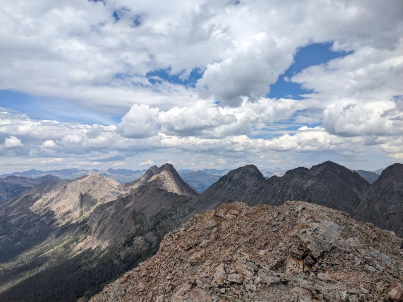
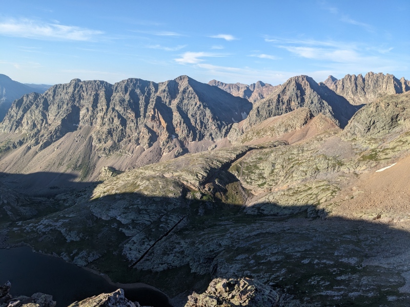
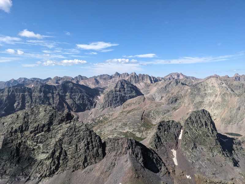
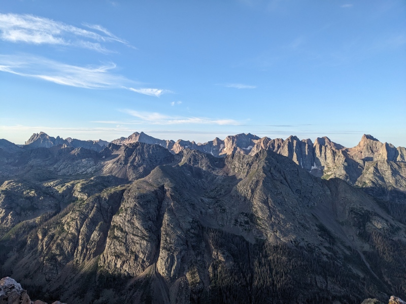
The views from SK were nuts. Hard to find a better angle from which to view the Wemi.
The heart of the Wemi: layers and layers of peaks. Nine and Eight dominate the foreground, Vallecito, Leviathon, and Seven a row back, then Jagged, Chi basin peaks, and infinitely more.
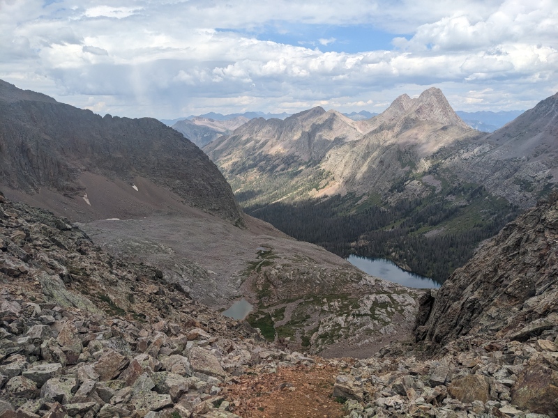
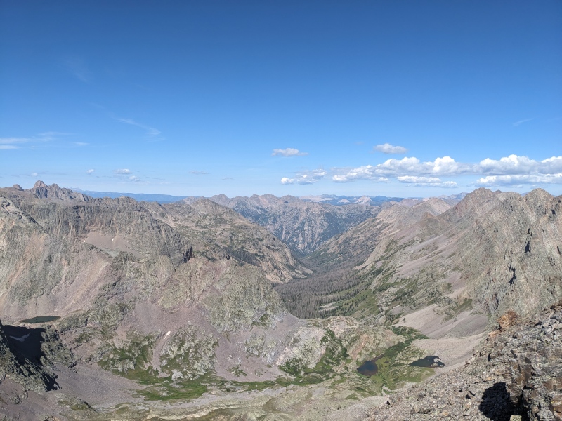
Looking down Tenmile Creek drainage. Balsam Lake hidden behind Seven's jaggedy-waggedies on its northern ridge, Grenadiers to the right.
All too quickly, it was time to come down. Sticking with the "fun up, easy down" mantra, I descended south off the summit, then cut into the broad upper gully at the best chance I saw. I followed that for a few hundred feet before cairns to skiier's left pulled me onto the exit ledge. A short scramble down took me back to the climbers trail, and that led to the saddle. I headed back down the basin, descended the gully, fought my way around the lake, and made it back to camp, still comfortably in the AM hours.
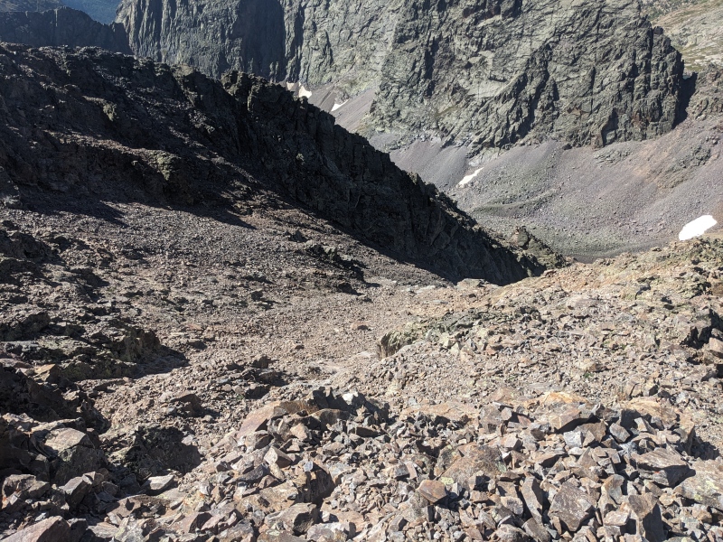
Descent gully on SK. Ascent ridge in the shadows.
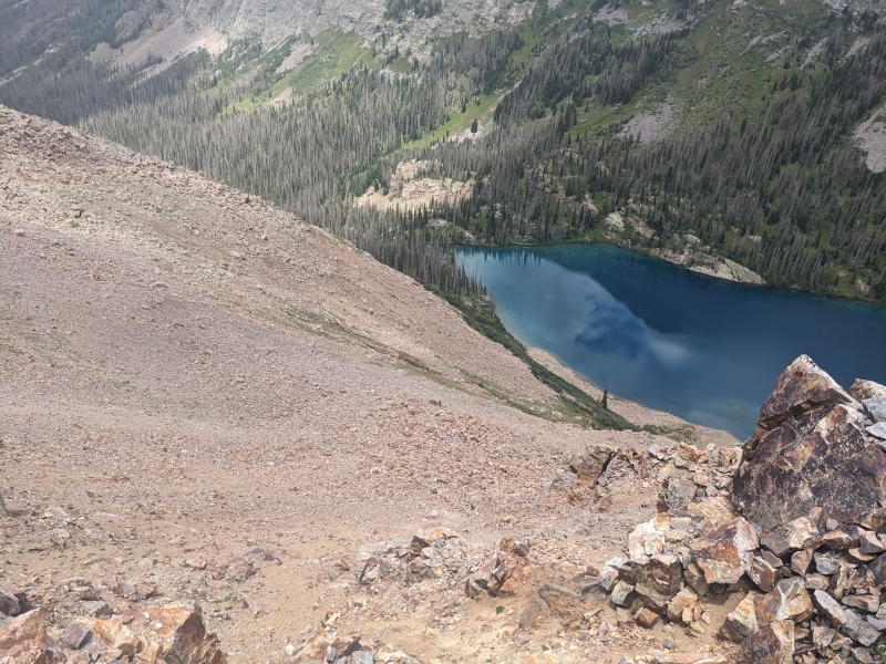
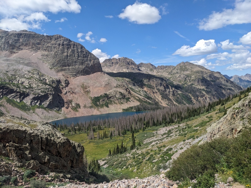
Beautiful Balsam Lake from atop the gully that leads to the upper basin.
I had a lot of down time to kill that day, so I rehydrated, drank a ton of water, and read. The weather held off until after 3PM, at which point rain fell and thunder rumbled, a little more aggressively than the prior two days. Out of an abundance of caution and knowing I had to hike over a 13k foot pass and climb one more mountain on my way out, I used my inreach to pull the weather forecast for the next day. To my horror, it returned a 40% chance of lightning at 8 AM! WHAT? What was supposed to be a stress-free, if not semi-grueling, hike out suddenly got more dramatic.
Day 4
Peaks climbed: Graystone Peak, pack out to Molas Pass
Distance: ~14 miles
Gain: 4,600 feet
Difficulty: class 3
Time: 9:20
In light of that bulls*** weather forecast, I decided an early start was warranted. Unfortunately, that meant I'd have to bushwhack down the Tenmile drainage to the basin that leads to the Graystone/Arrow saddle in the dark, and I was in no way confident that I'd be able to find the same trail I had previously found solely with the light of my headlamp, especially since that trail had taken me about 200 vert above the north side of the lake on the way in. As it turned out, that lack of confidence was very correct. I found nothing.
To make matters worse, I'd woken up at 2:30 AM to the sound of rain falling on my tent. I never managed to fall back asleep, and the rain fell until 3 before finally petering out. I got out of the tent at 3:30, packed up as quickly as I could, and started moving at 4. I made every attempt possible to find the trail. I went down toward the center of the basin, up higher on the northern slopes, zigzagging around, but all I was able to find were a few game trails, never lasting more than a few steps. If that wasn't bad enough, the terrain in the first half mile near the lake had large hills with rocky sides, and I ended up gaining and losing a bunch of unnecessary elevation trying to navigate through them. Oh, and remember that rain that had only stopped an hour before? Everything was dripping, and I was soaked from the beginning. I hadn't worn them this whole trip, but before leaving I wisely put on my tights, which at least spared me the unpleasant feeling of cold, wet flora brushing my legs. I felt like I was in a car wash, and everything around me was spinning brushes. After a long while, I gave up looking for the trail and decided to just make progress down the basin as best as possible, through whatever terrain lay in front of me, by whatever means necessary.
After an hour and twenty minutes or so, I'd made some progress and stumbled onto a talus field. I was sick of stepping on slippery sloped logs or on wet, steeply sidehilled grass, so I decided to just take it upward and hopefully get above the trees. I didn't really get my wish, but I got something better. After exhausting the talus slope, I came upon a faint goat trail. Huzzah! It was faint, and it was only the last quarter mile or so before the entrance to the basin I was heading toward, but after bushwhacking for an hour and a half through chest-tall wet grass and 10,000 fallen trees, it was heaven! I followed it until it faded into the talus of the Vestal/Arrow/Graystone basin. I was finally free of Tenmile Creek!
Bushwhack conditions. Honestly less bad than most of it. Picture more sidehill and a couple extra downed trees.
My spirits picked up immensely once on the talus (not a sentence you read everyday...). I was able to make quick time up to the little lake in the basin, and the climb up to the Arrow/Graystone saddle is one of the more mellow talus slopes I encountered. Once there, I dropped my overnight pack for the last time, grabbed the daypack, and headed up the slope to my eleventh and last peak of the week, hoping the marmots would spare my gear one last time.
At the small lake, looking up the climb to the Arrow/Graystone saddle.
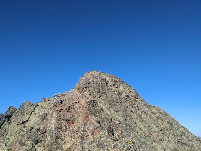
Graystone began with a quick jaunt up a class 2 talus slope. Once past that, the business end of the peak appeared. A quick descent on a spiked ridge that looked much harder than it was led to the summit pitch. The summit pitch was generic blocky scrambling, all to the left side of the ridge proper. I summited a little over 3 hours after leaving camp at Balsam Lake, and with that was finally ready to head back to the car.
The good part of Graystone
Blocky scrambling
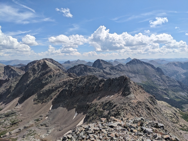
So many good peaks and memories in this shot.
I descended Graystone largely the way I came up. Do take note that to get to the right descent gully, you have to cross one to the left shortly off the summit. Also, if you go too low, another gully materializes between gully #1 and the right one, but it is clearly not the one to take, as it is steep and leads, cliffily, right back into Tenmile Creek. Back at my marmot-ignored pack, I descended the steep north side of the Arrow/Graystone saddle, endured the seemingly endless talus mounds to reach the basin entrance, and scooted down one last gully to reach the Vestal Basin trail, which of course was still wet from the night's rains and resoaked me, this time shoulders to toes.
Beaver pond shot.
Even though Molas Pass is infamous for the 1700 feet of gain in the last 3 1/2 miles of the hike, just being on trail felt like a blessing and gave the legs new life. The regain at the end was welcomed, as it gave my knees and toes a break from the constant downhilling of the day thus far. I hiked the last hour up to the car in a thunderstorm, as rain lightly fell around me and thunder rattled above. When the car came into sight, I was happy, but not deliriously so. There's a phenomenon I've experienced in hiking that no matter how far the hike is, I'm equally excited to reach the car; whether it be a 5 mile lake hike with the family or a near 50 mile, 4 day, solo backpacking trip. I was relieved to confirm I had not lost my key in the woods, so I cleaned myself up, changed clothes, and drove to Silverton, where I ate 12 wings, a burger, and fries. Sometimes you gotta.
For a first solo backpacking trip, I could not have picked a more remote and helpless place. And while there were struggles, both physical and mental, I'm proud to have pushed through them and accomplished so much. Might need a quick break before the next one though...
So long, Wemi
My GPS Tracks on Google Maps (made from a .GPX file upload):
Since I had kids I have had a similar feeling several times in a camp away from them. When I'm climbing the peaks on the agenda I am able to get lost into that but in camp I often miss the boys and my wife a ton and feel bad for being away from them and have to fight the urge to just pack up and go home especially if faced with some difficulty. Fortunately, my wife seems to be like yours and encourages these adventures because overall I'm a better dad after my soul has been recharged in the hills.
Often have a buddy along helps me push through that desire to go home so to do this route solo is impressive. Well done and glad you are still crushing it since the addition of a daughter!
Corey
What a great adventure you had. This area is my all time favorite place to be. Haven't been in the area for about 5 years now. Getting old and not sure I have what it takes to get into some of the places you were. Reading your trip report helped me relive some of my past adventures. Thanks
Do not talk about the fight club. Don't you have some ridges in the Gore(ing) range to run?
P.S. Looks like an epic trip! I do recall solo camping in Wemi can feel a bit out there. And I did love peak 9, as much as peak 8. Not sure what we did (stuck to the ridge probably?), but it was enjoyable.
@Dobs supportive family and friends goes a long way! If you ever need a partner who seems to be in the same stage in life, hit me up!
@rose LOL I'll make sure my next trip report goes into excruciating detail on my failed attempt of Pennsylvania Mountain a few years ago
@nick Thanks! Appreciate the support!
@Kansan Glad I could bring back some good memories! I'm sure you'll go make some new ones soon.
@natalie I regret not at least exploring the ridge on 9. It could only be better than the face. And funny you say that, I could run a Gore ridge or two...shouldn't you be out climbing Peak R?
When Vera and I did Nine we did like Natalie - stuck to the ridge from the top of the eastern gully. It was quite nice and we found it didn't really match with Nine's reputation. It was a fair sight better than the photos of the ledge system you took, though it's still not a peak to underestimate.
Anyway, one last, good ledge system for you... ledge system.
The lower "traverse" ledge is way off to the right and out of frame in your image #31, its lower than you think. We missed it too, had planned on Nine/Guardian/Silex but skipped Nine and then went up Seven on he way back to camp and could see where we were supposed to go to get on it. We ended up getting Nine with SK the next day. There is a small class 3 gully to get on it that was cairned but easy to miss if you are looking too high. It does go way past the summit before going up to the SE ridge and backtracking to get to the summit. We started on the ridge crest but bailed at a stiffer step. You might have scrambled all the way up to the upper ledges! Hard to tell, but based on how high you got before finding a cairned ledge it would not surprise me. Your GPS track is not helping me with how steep everything is haha.
EDIT- I switched to the topo map view and yeah, you were way above the ledges we took. Those are grassy and much lower!
I see. I had tracks that went way under and and way past the summit, but that seemed like a waste of effort when certainly people had climbed close to the summit. If I did it again, I'd definitely explore the ridge. I think id take my route again before going that far past the summit.
The ledges we took are grassy and go quick. I think going past the summit but having better ledges is probably worth it unless that NW ridge direct route is any good. The SE ridge was exciting scrambling, its fun before it gets scary haha. Tough peak, one of the toughest of the non-5th class 13ers I'd say.
I loved this report, because it took me back to one of my favorite trips, when I hit some of these same peaks with benners. Piggybacking on what Chicago said, yes, it was apparent to me right away that you were way above the start of the "standard" route for Peak Nine. That starts with a prominent grassy ramp that rises on the east side of a gully. It was easy for us to find, simply because we had not done Eight first, but approached Nine from the small lake that sits between it, Eight, and Seven. Anyhow, that route on Nine is pretty fun.
Happy I could take you back! Yeah I'm learning I missed the standard, but I'd definitely rather take a more direct route than not, even if it's a little more sucky. Next time (even though there probably is no next time) it'll be the ridge!
Caution: The information contained in this report may not be accurate and should not be the only resource used in preparation for your climb. Failure to have the necessary experience, physical conditioning, supplies or equipment can result in injury or death. 14ers.com and the author(s) of this report provide no warranties, either express or implied, that the information provided is accurate or reliable. By using the information provided, you agree to indemnify and hold harmless 14ers.com and the report author(s) with respect to any claims and demands against them, including any attorney fees and expenses. Please read the 14ers.com Safety and Disclaimer pages for more information.
Please respect private property: 14ers.com supports the rights of private landowners to determine how and by whom their land will be used. In Colorado, it is your responsibility to determine if land is private and to obtain the appropriate permission before entering the property.


")
")
")
")
")
")
")
")
")
")
")
")
")
")
")
")
")
")
")
")
")
")
")
")
")
")
")
")
")
")
")
")
")
")
")
")
")
")
")
")
")
")
")
")
")
")
")
")
")
")


