| Report Type | Full |
| Peak(s) |
Jupiter Mountain - 13,838 feet Peak Eighteen - 13,474 feet Peak Eleven - 13,530 feet Glacier Point - 13,710 feet Hope Mountain - 13,020 feet |
| Date Posted | 04/03/2023 |
| Modified | 04/05/2023 |
| Date Climbed | 07/17/2021 |
| Author | supranihilest |
| Additional Members | whileyh |
| The Quieter Side of the Windy City | ||||||||||||||||||||||||||||||||||||||||||||||||||||||||||||||||||||||||||||
|---|---|---|---|---|---|---|---|---|---|---|---|---|---|---|---|---|---|---|---|---|---|---|---|---|---|---|---|---|---|---|---|---|---|---|---|---|---|---|---|---|---|---|---|---|---|---|---|---|---|---|---|---|---|---|---|---|---|---|---|---|---|---|---|---|---|---|---|---|---|---|---|---|---|---|---|---|
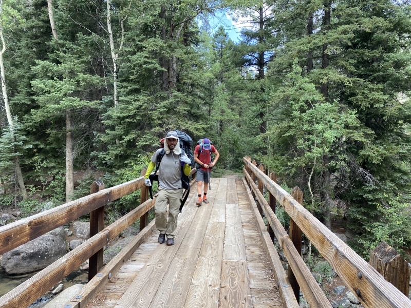
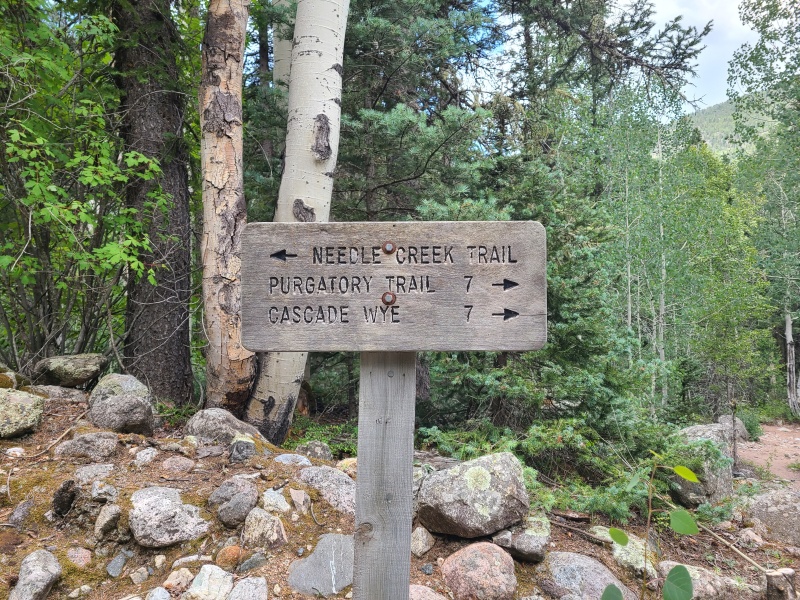
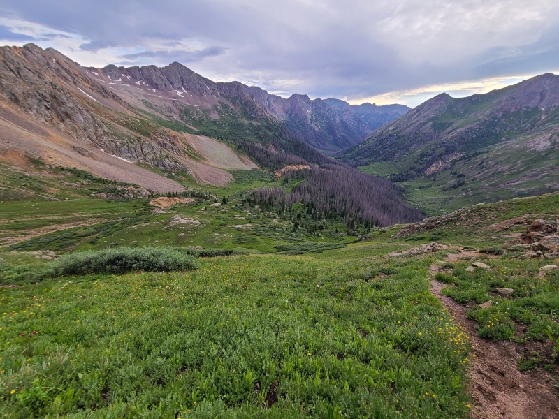
Table of ContentsIntro and Full Trip Statistics Whiley and I only made one trip into the Weminuche in 2021. That's unfortunate because the Wemi friggin' RULES. We made good use of our trip though, opting at the last minute to do a one-way backpack from Purgatory through Chicago Basin, which I hadn't been to since 2016, up and over Columbine Pass to Hazel Lake, then down Johnson Creek to Vallecito Creek, nabbing every non-technical thirteener along the way. We had enough vehicles to make this happen, and both trailheads being easy 2WD accessible helped. Whiley's friend Luke joined us (this was my first time meeting him), and he makes Whiley and I look like chumps in the mountains. We were glad to have him along for the trip, as he added a great vibe to our group, and we've since done plenty more in the mountains with him. Here's the usual collective stats for a big, multi-day trip: Number of days: 4 Saturday, July 17, 2021: Day 1 - Approach from Purgatory to Chicago Basin, Jupiter Mountain On our starting morning we'd all slept over at Vallecito Creek trailhead outside Durango. We loaded our packs into Luke's car, left mine and Whiley's at the trailhead, and drove over to Purgatory Flats trailhead. Fortunately there were spots there, since the parking lot is small. Our packs weren't that heavy as we left the trailhead with the minimal gear and food we'd need for four days in the wilderness. 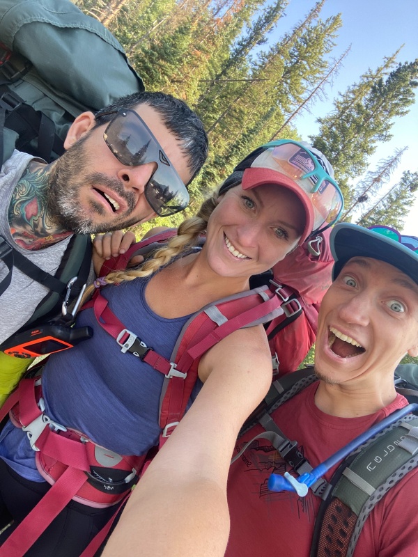
Purgatory Flats trail has a reputation that precedes it. It's not particularly hard, at least not in my opinion, but it's stupid long and goes downhill, not uphill, from the trailhead. In fact, aside from a short section that gains elevation along a shelf trail above Cascade Creek, it drops something around 1,500 feet to the Animas River before meeting up with the eponymous Animas River trail. If using Purgatory as an out-and-back hikers and climbers have to regain all that at the very end of their trip. In that sense it's similar to the Molas trail to Elk Creek and Vestal Basin, or any approach from Beartown - uphill on the way out. Of course, being in the Weminuche it's a ridiculously spectacular trail and well worth the extra effort. We made great time down the first few miles. 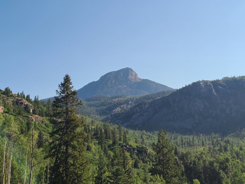
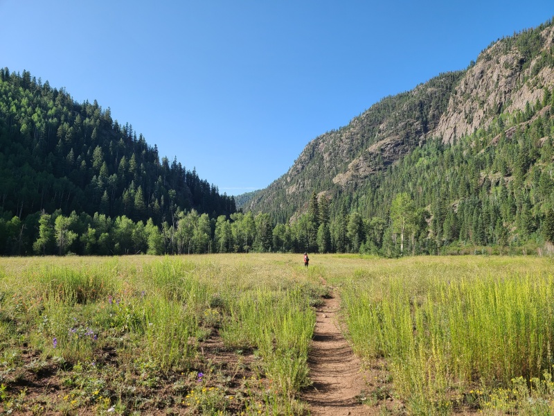
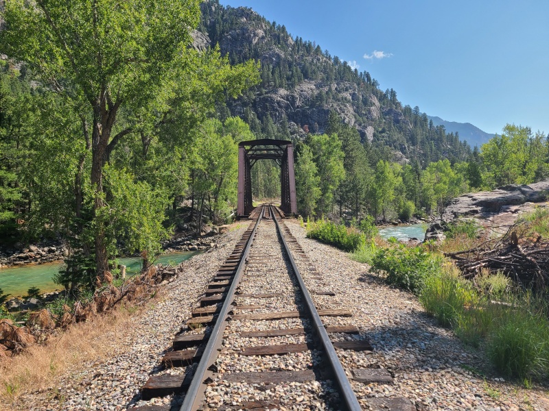
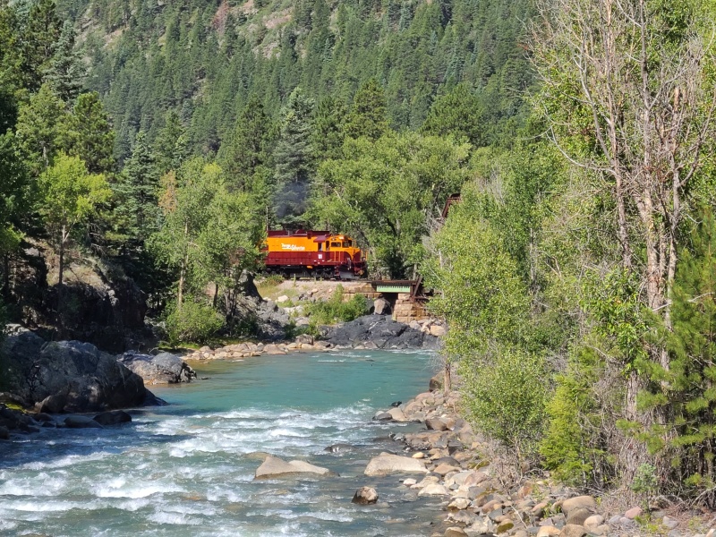
It only took us about an hour and a half to reach the bridge across the Animas, where we crossed and joined the river trail on the river's southern side. Along the way we got to enjoy the shade of the trail, and had a fine view of the train as it passed by on its way to Silverton. 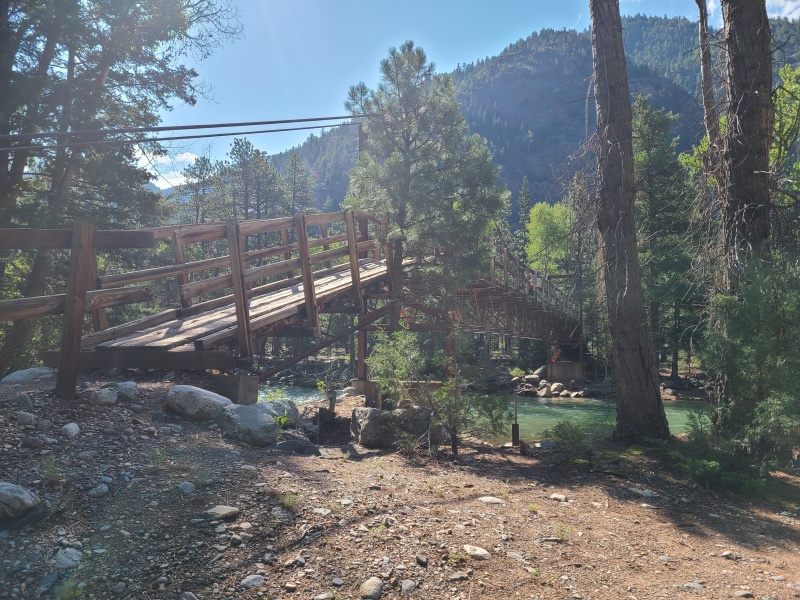
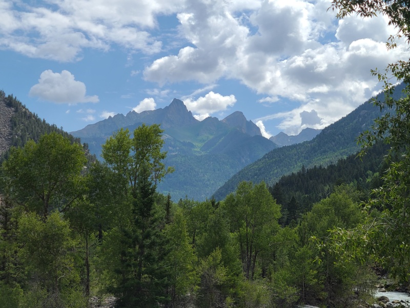
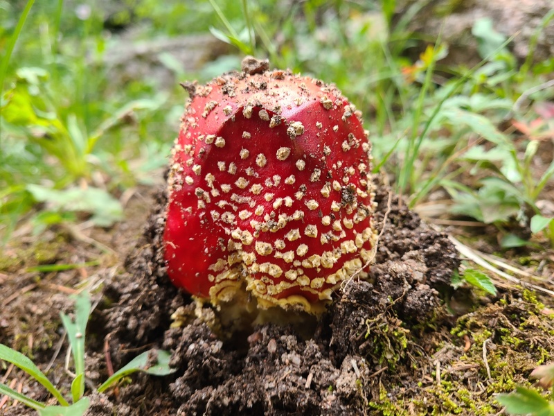
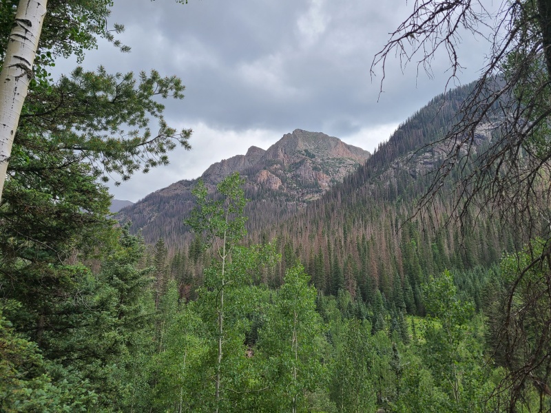
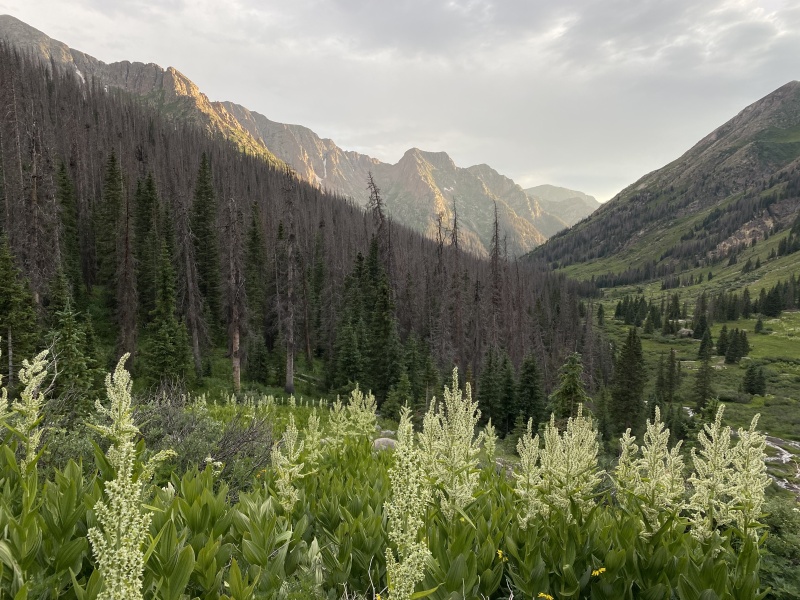
The trail was busy and we passed numerous people along the way to Needleton. Mushrooms sprouted everywhere. Though it was overcast and threatening it didn't rain all day. The Needle Creek trail was a mess of downfall that undoubtedly took longer than normal. Aside from being irritating though it wasn't much of an impediment. We continued passing people on the uphill and reached a high camp six and a quarter hours after leaving the trailhead. Having not been in Chicago Basin since 2016, two years before I started climbing thirteeners, I loved being able to identify the numerous thirteeners on the hike in, some of which Whiley and I had done the summer before. We quickly set up camp anticipating rain and then sat around. 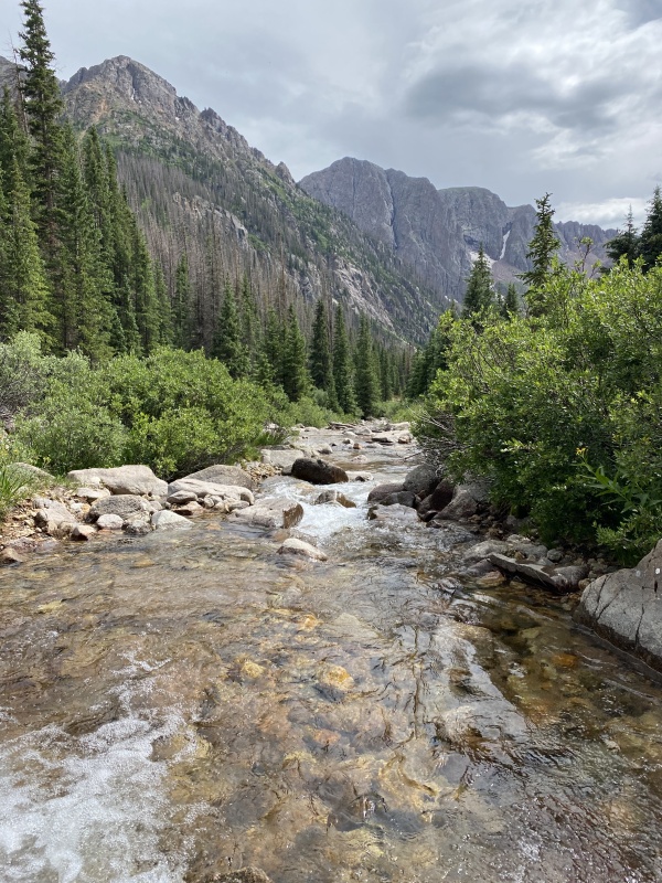
After a while, having not actually gotten the rain we expected, we decided to go climb Jupiter Mountain to get it out of the way. It was the one peak on the western side of Columbine Pass that we planned on doing that didn't easily fit with the rest, so doing it early just made sense. And by early, I of course mean starting at 5pm. 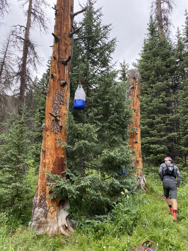
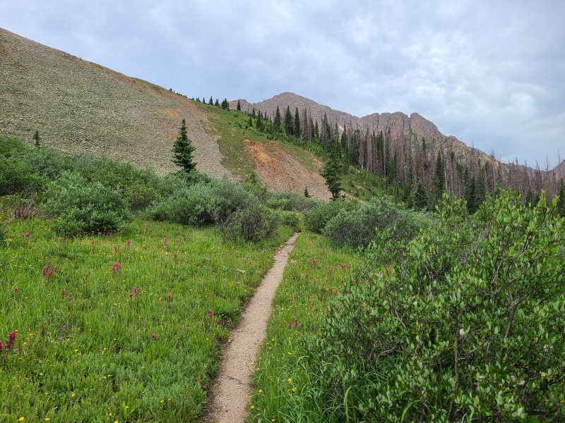
We took the Needle Creek trail up higher until we met with the Twin Lakes/Columbine Pass junction, which is signed. We went right towards the pass. The amount of traffic in this area provided a great trail which was easy to follow, leading to a climber's trail up Jupiter's southwest slopes, blanketed in granite-studded tundra. 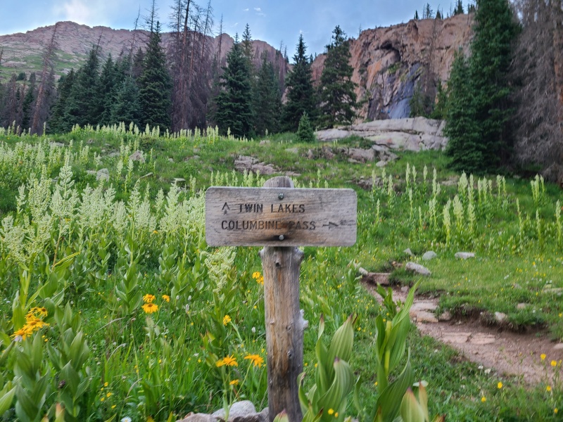
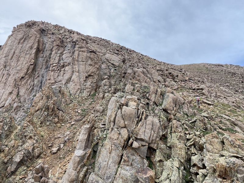
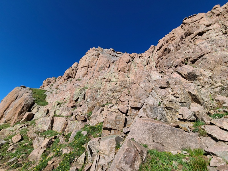
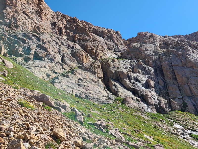
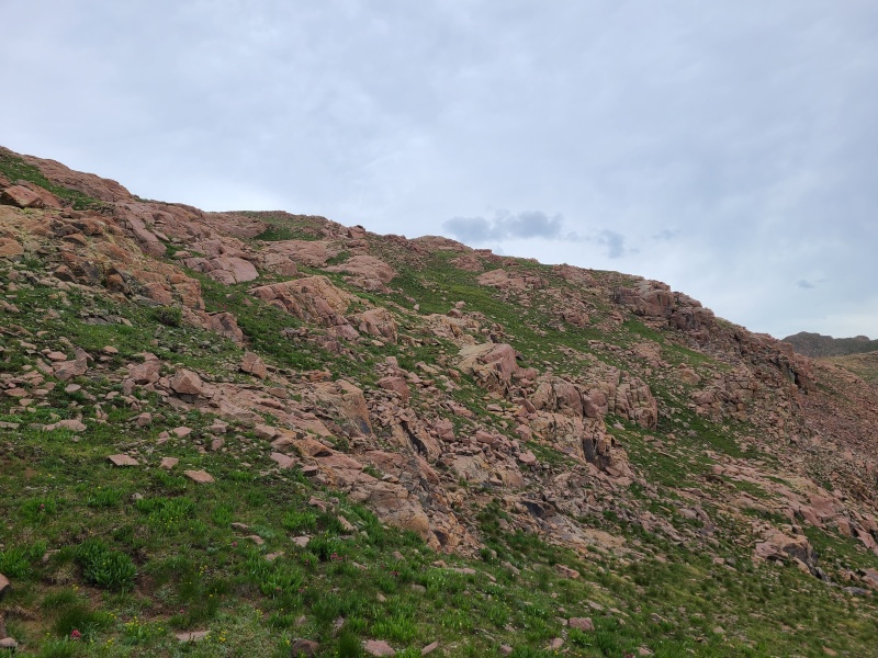
Starting off easy, the route up Jupiter is relatively straightforward, with most of the ascent being up grassy strips between rocks. Only when it gets to the upper stretches and final summit ridge does it rise in difficulty above a stroll. Cool air and towering stone beckoned us upwards. Eventually we could no longer go straight up the middle of the peak. Grass ramps to our left merged with stone. 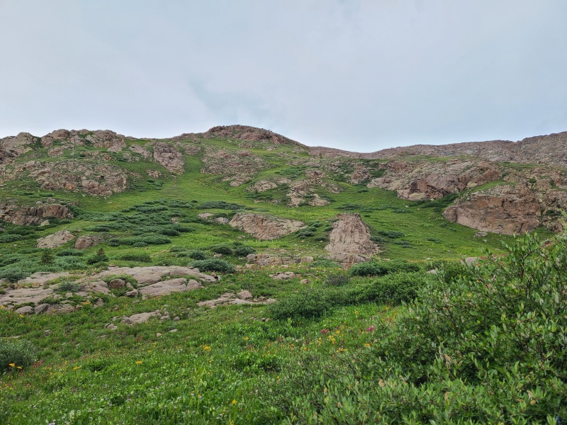
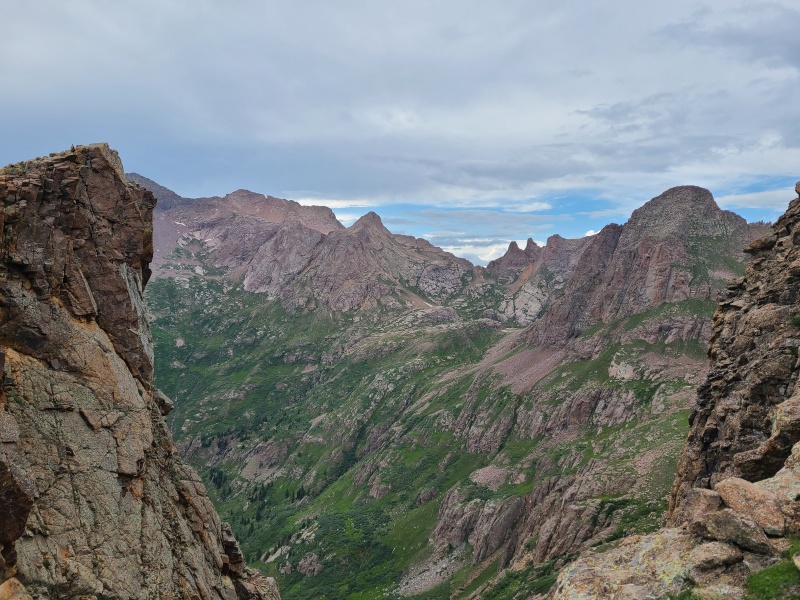
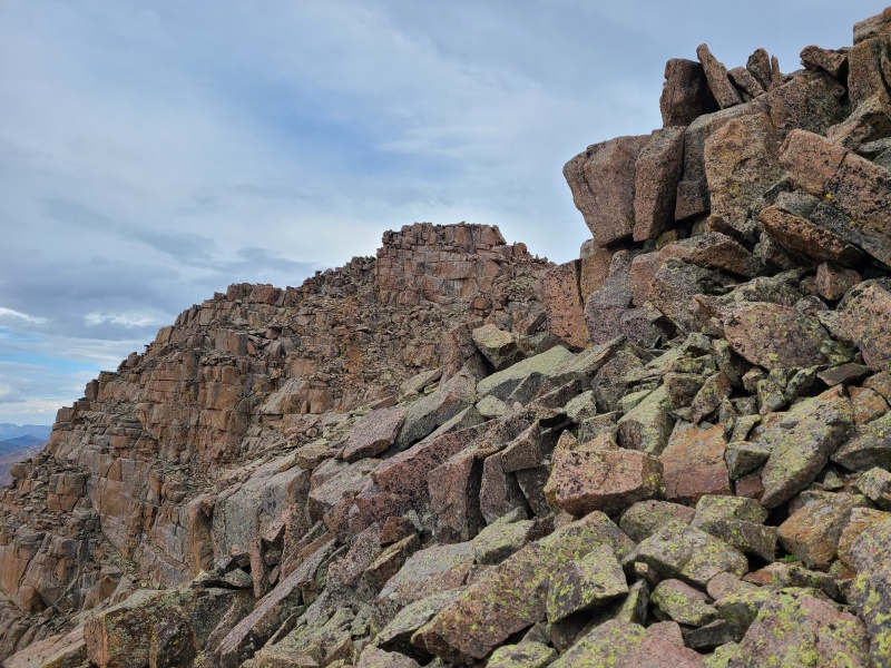
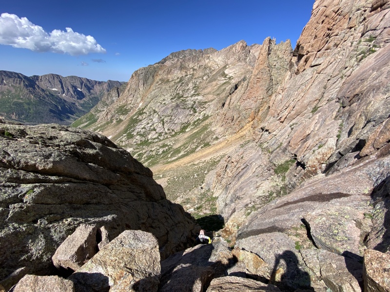
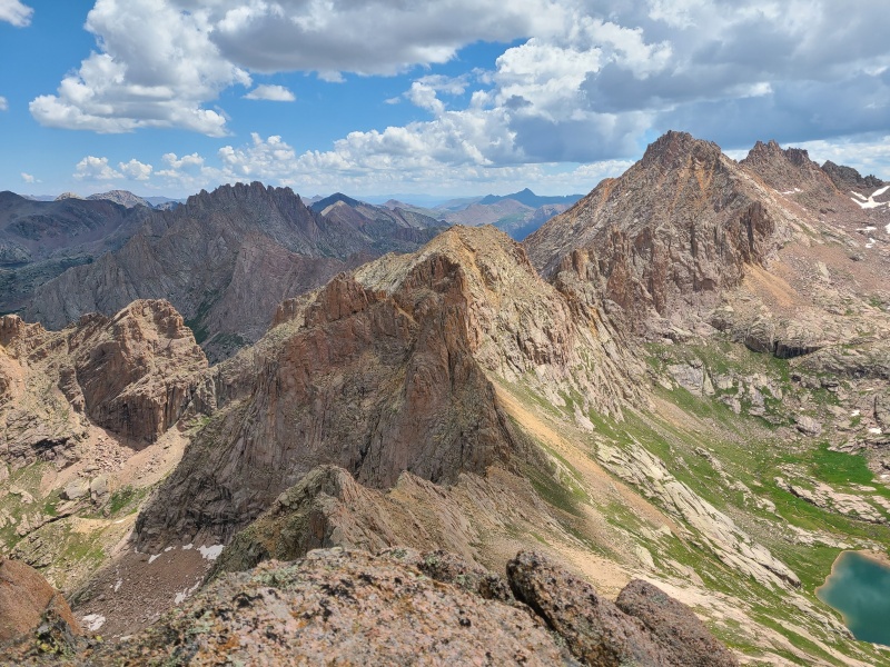
As we climbed higher the blocks became scrambly. Nothing difficult, Class 2+, but our progress slowed as we clamored up and down these Jovian stones. To our west gaps in the ridge showcased Chicago Basin. 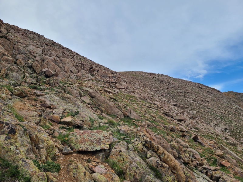
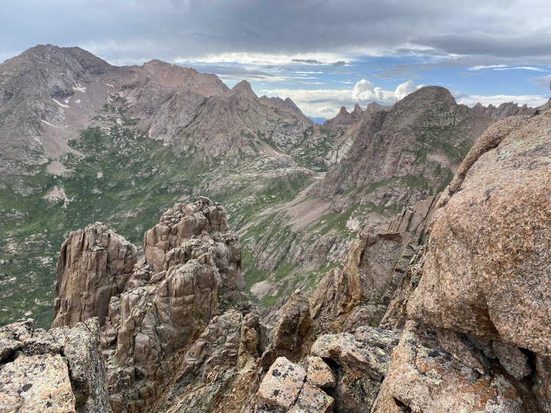
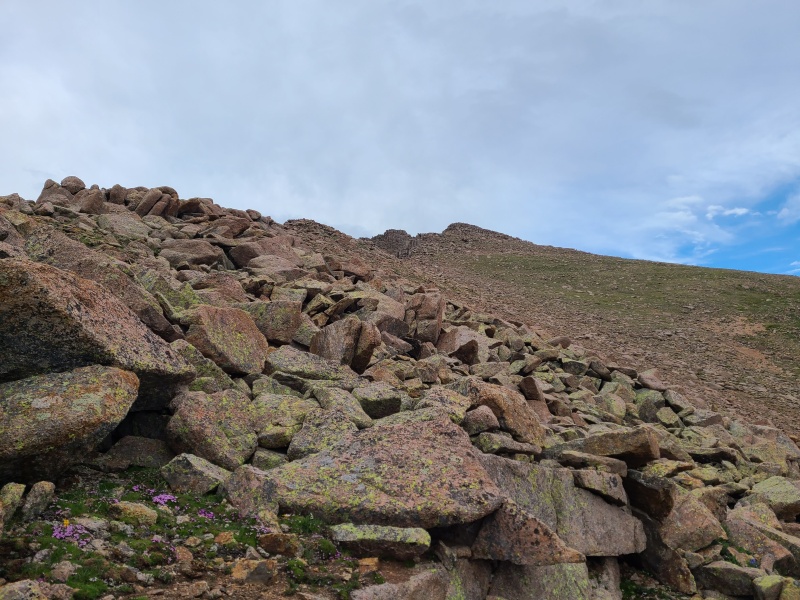
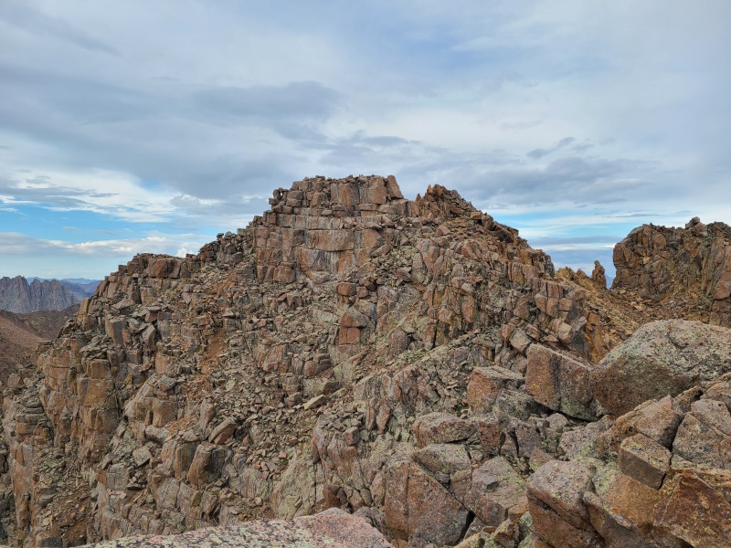
Upon reaching the point we'd been chasing we realized it was a false summit. The real work began here. Wonderful blocks snaked across the sky, stacked upon each other, sometimes disorderly and other times quite orderly, in a way. We scrambled along the ridge crest where we could, and to the west where we couldn't. The rock was as good as it comes in the Weminuche, and the exposure was moderate. Scurrying along the rocks was joyful. Silence held until we reached the incredible summit of Jupiter, which indeed felt like another planet. 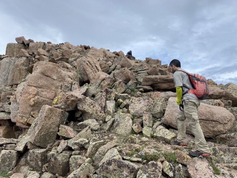
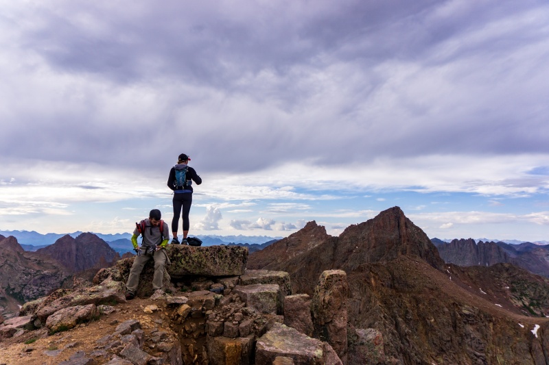
Now a few minutes before 7pm, the sun was getting low. We had three big days ahead so we soaked in the soaring granite that we love, then reversed the scramble back to the upper slopes, then down the grass. It was about a half hour from the summit to the climber's trail, and another half hour to camp. Glowing peaks welcomed us back, though we hadn't been gone long. 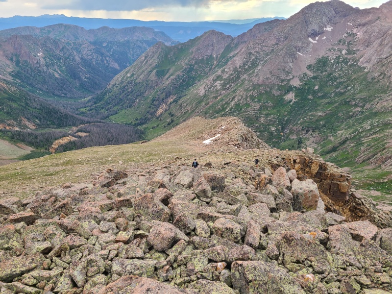
Freeze dried meals were cooked and scarfed. We re-hung the bear bag and crawled into our tents. Without the heavy packs we could have day tripped Jupiter, had that been our sole objective, but more peaks awaited the next day, and the next, and the next... Day 1 StatisticsClimbers: Ben Feinstein (myself), Whiley H., Luke G-W.
Splits:
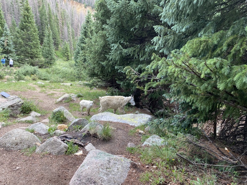
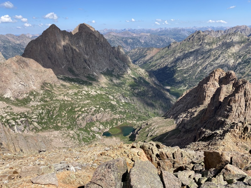
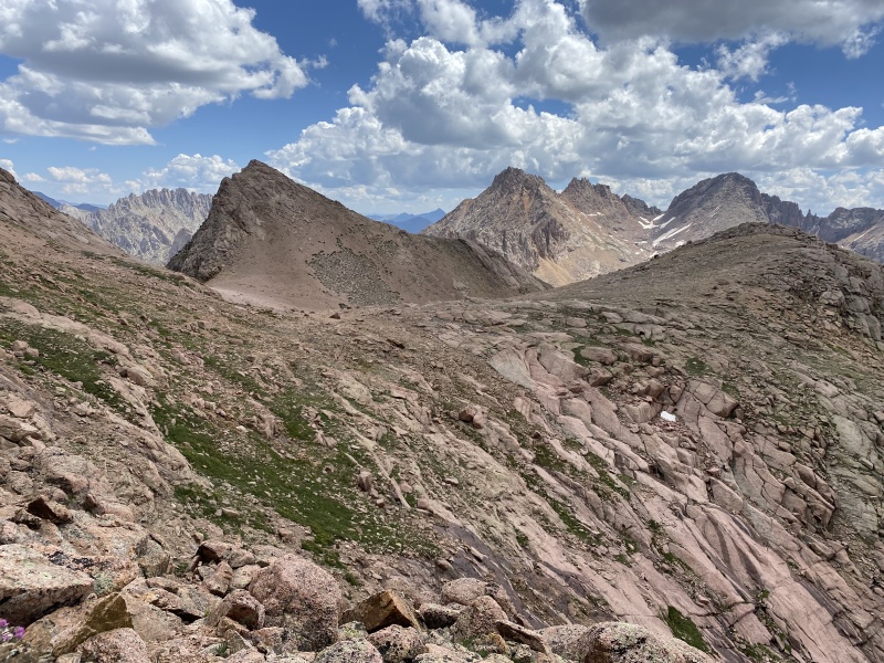
Sunday, July 18, 2021: Day 2 - Peak Eighteen, Peak Eleven, Glacier Point, Backpack to Hazel Lake, Hope Mountain With one relatively standalone peak done we could presumably condense our trip some. It would have been possible to climb Jupiter as we backpacked over Columbine Pass to Hazel Lake, but that would make today, which was a big day, even bigger. We had rain coming in overnight so we got up a bit early and were heading up to Twin Lakes along with over 9,000 other hikers. Except we weren't doing any of the peaks they were doing. Instead of doing the Chicago Basin Four we were going to do Peak Eighteen, Peak Eleven, and Glacier Point. The unranked technical summits in Chicago Basin would have to wait. We made good time to the lakes, which were already crowded with people and goats, and departed the trail east as if we were heading to Windom Peak. 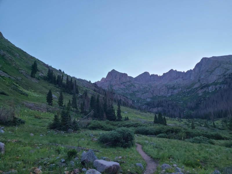
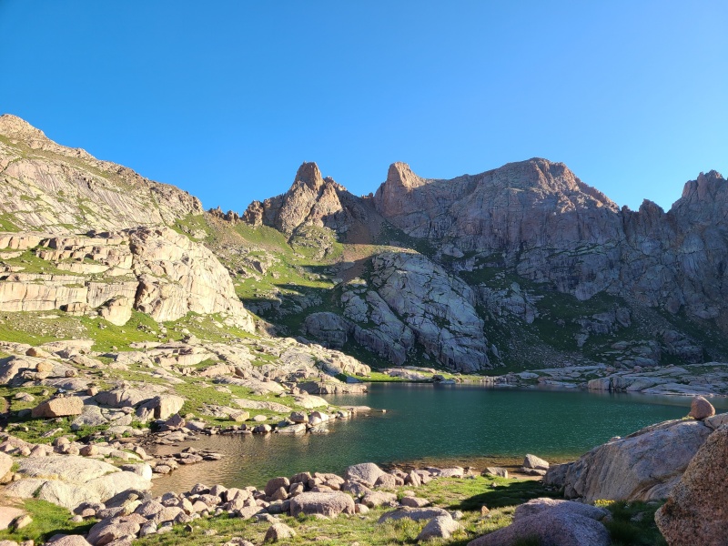
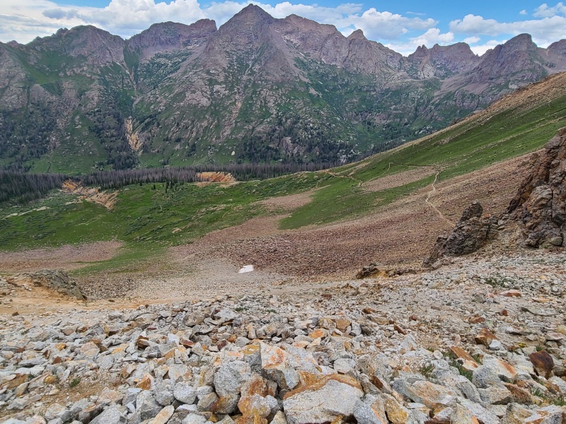
The terrain here was relatively mellow - grass and nice slabs - and Chicago Basin of course was stunning. The last time I had been here, in the summer of 2016, it rained til something like 10am and stayed cloudy and gloomy after the rain stopped. I still raced 'round the basin and got all four fourteeners but it wasn't the nicest day for such a splendid area. Today was different. We had blue skies instead, and once we left the crowds at the lake had more space to ourselves. Our hike took us to the Windom Peak/Peak Eighteen saddle, and the slope to gain the saddle was some of the only junky stuff we had to deal with on the trip. 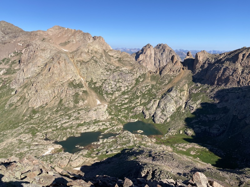
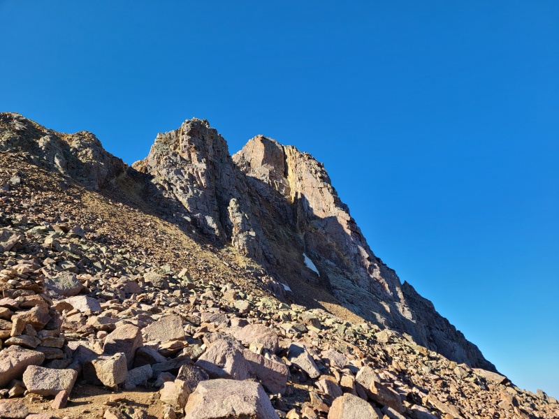
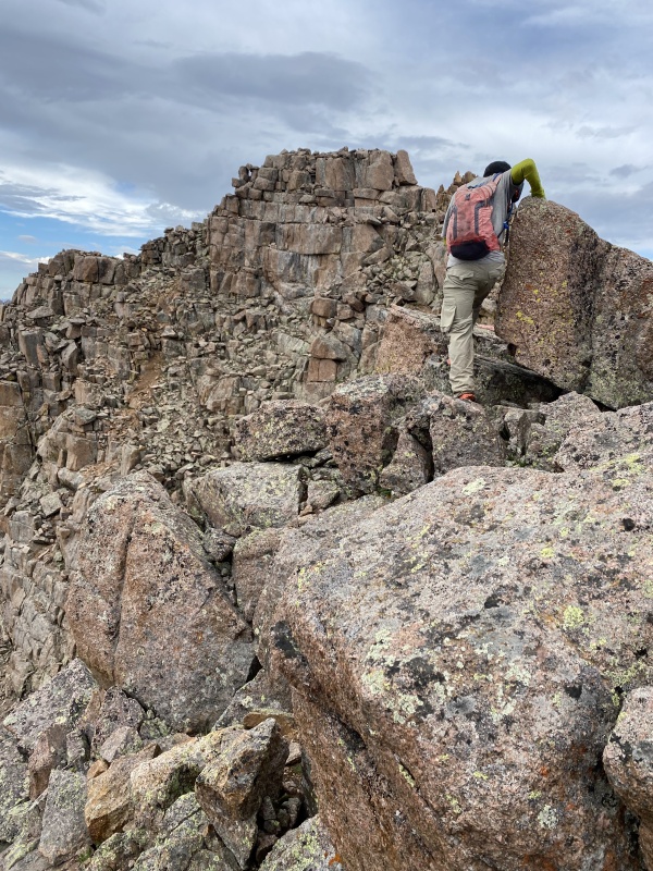
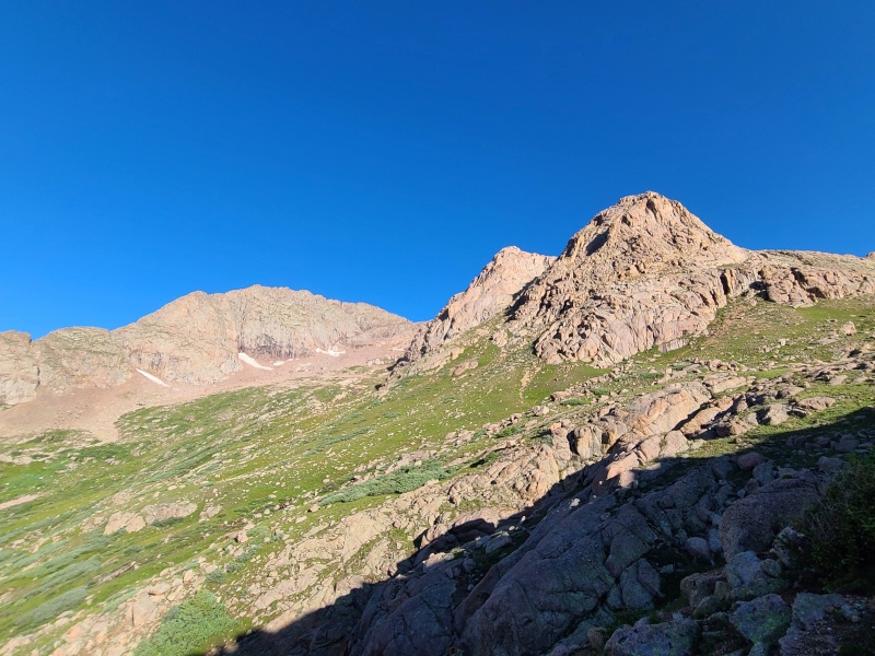
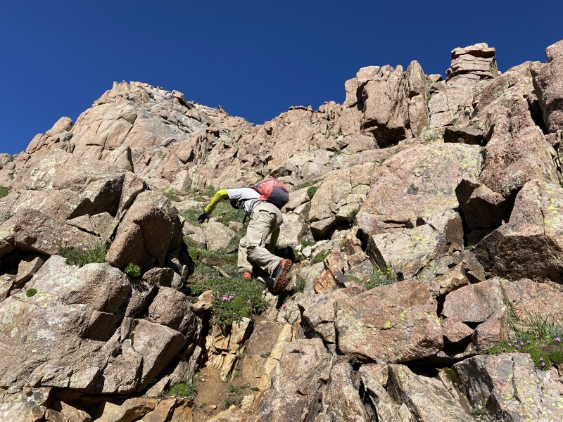
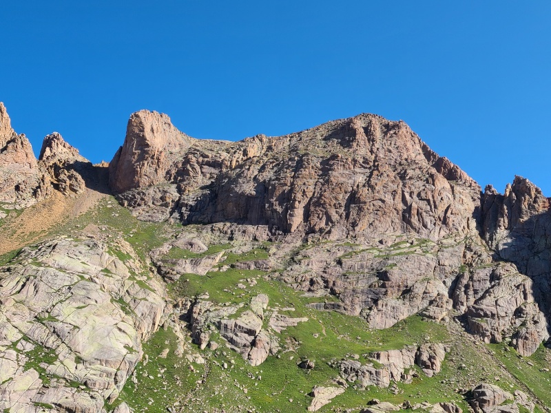
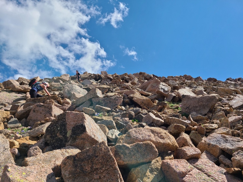
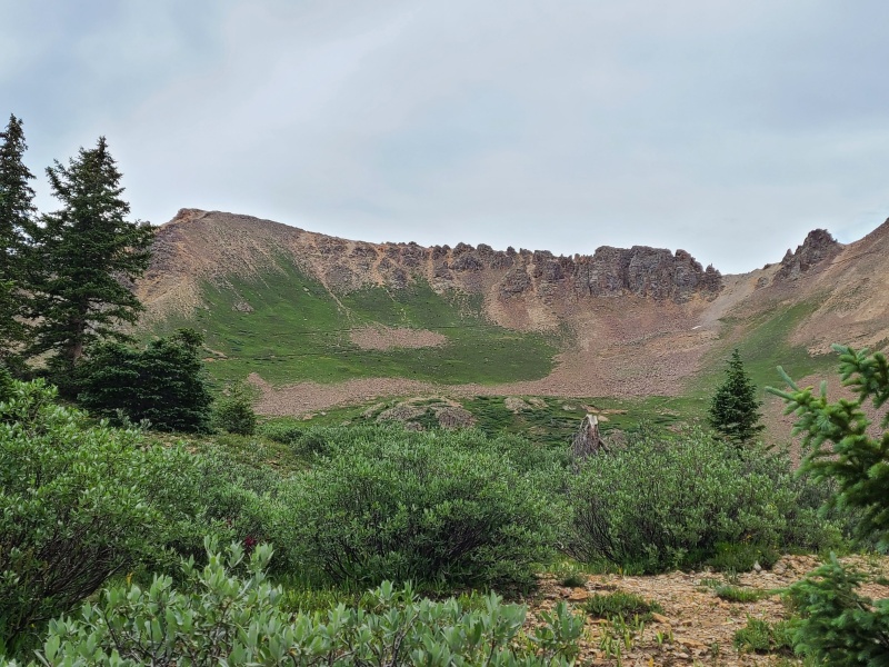
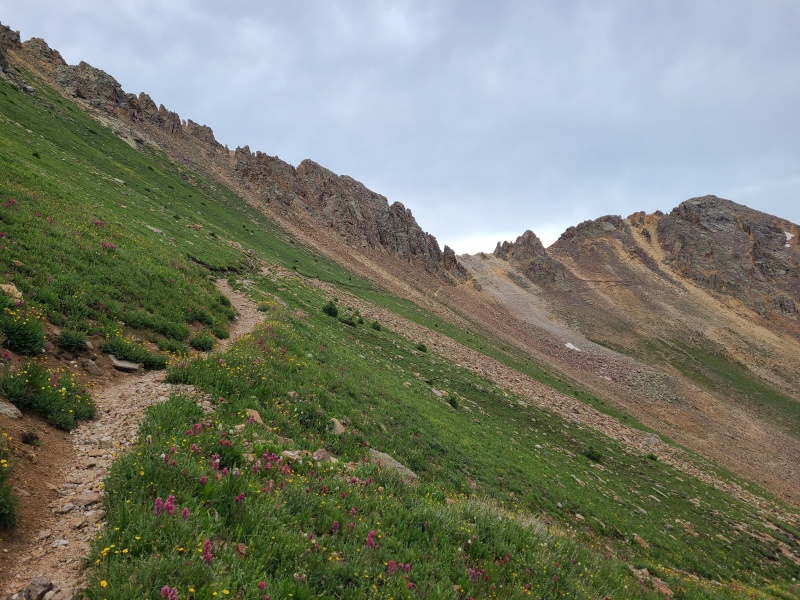
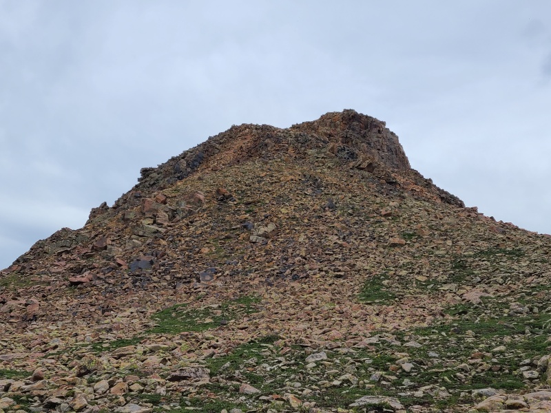
We trudged our way up the loose junk to the saddle then headed west towards Eighteen, a glowing set of gendarmes mashed into a single peak. Due to the infrequency of climbers on this peak we had to be aware of loose rock as we ascended the many ramps and ledges to the summit. Overall the scrambling wasn't hard - Whiley and I took a sinuous Class 3 route, Luke a more direct Class 4 route - but it was enjoyable. Most of our route ended up being long stretches of grass with a few short scrambly moves in between, and the rock was typical Needles granite. An excellent warmup for the day, and a peak that more people should be aware of and take the time to climb. 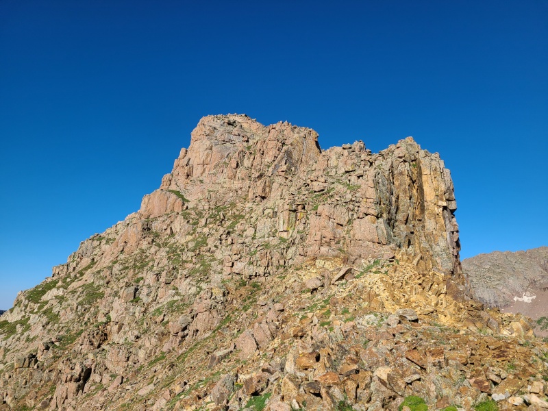
Our stay on Eighteen was short, since we still had to go down to the lakes again before ascending either of our next two Chicago Basin peaks, then return to break camp and hump over Columbine Pass (with yet another peak along the backpack). We were a bit more careful descending since a slip on the steep grass would send us hurtling down the ledges, but Eighteen isn't that big and we were down quickly. Whiley and I began heading back towards the lakes while Luke literally ran up Windom. Yes, he's a monster. 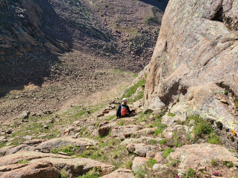
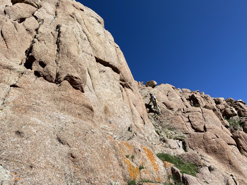
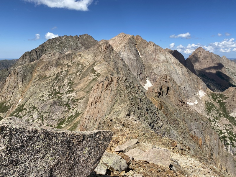
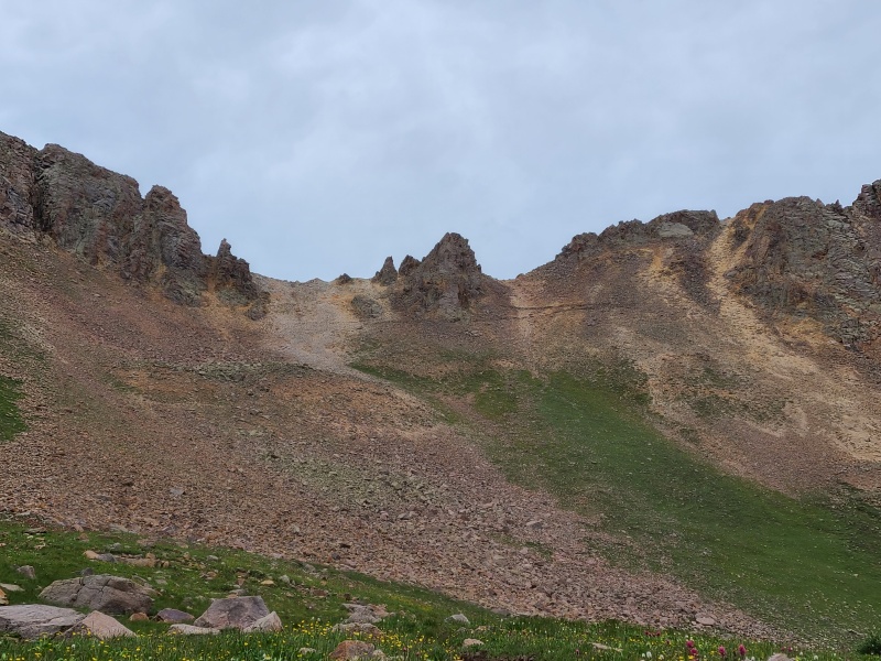
We took our ascent route back to the lakes and waited only a few minute before Luke met up with us, out of breath (but not for long). We fueled up, hiked between the lakes, and then took a less steep grass ramp along larger and steeper slabs towards Peak Eleven. Eleven is mostly guarded by sheer walls but there's a convenient ramp that cuts across the south face that provides the only logical access to the peak. 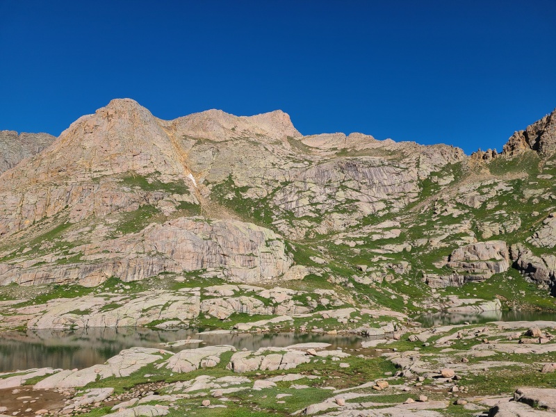
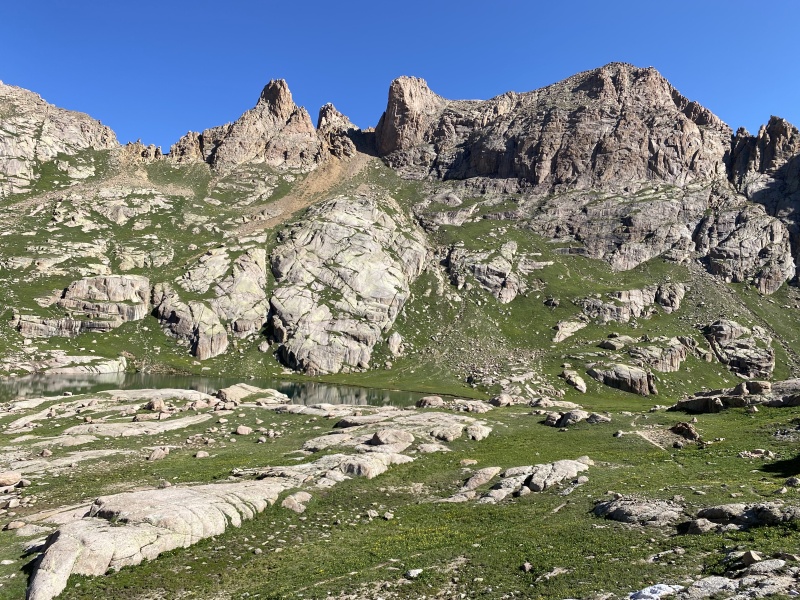
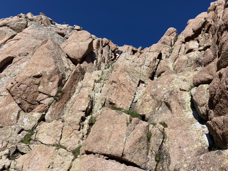
This ramp probably isn't that apparent to most people who look at Eleven. Heck, Eleven probably isn't that apparent to most people who look at Eleven. Why would it be when you're surrounded by four of Colorado's most spectacular fourteeners? Nobody cares about thirteeners. Never heard of 'em. Anyway, the ramp is key to the peak and we half hiked, half scrambled up rock-dotted-grass only a few feet wide into a short V-shaped slot that was running with water. The V-slot wasn't hard but it did require concentration. A fall over the nearby edge of the ramp would probably be fatal. The top of the V-slot was full of cantaloupe-sized loose rocks as well, so we went up one at a time and waited at the crux of the route, a bunch of chockstones jammed together into the top of the slot. 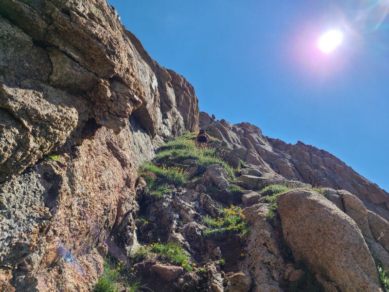
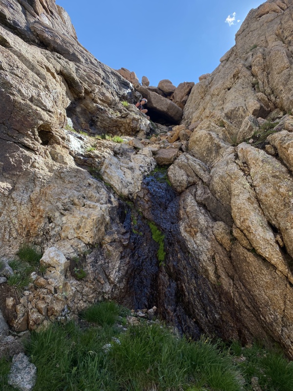
For the most part the crux was less hard and more awkward. Going at Class 3 we had some wide stemming moves at the bottom and then an odd, crab walking, sideways traverse on a large slabby boulder, with hands on the other rocks above. Honestly, while the rocks felt solidly jammed together I didn't trust them. It seemed like the type of thing where accidentally pulling even a small stone would cause the whole thing to collapse on top of you and turn you into a red slick on the ground. 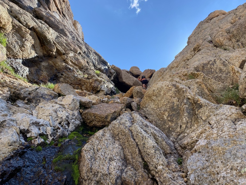
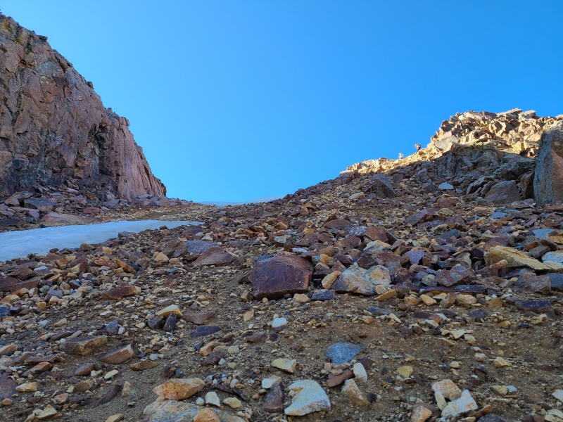
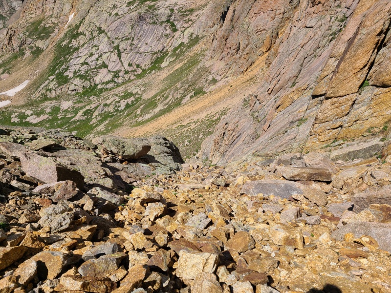
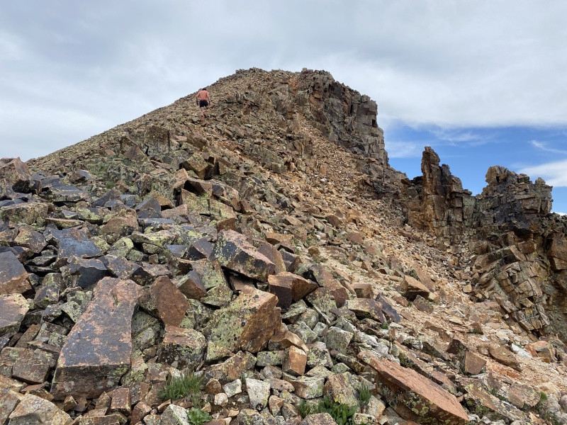
Having dispatched the crux we were confronted with everyone's favorite, a high angle junkshow of loose red talus. It's always red. Once again we stayed spaced apart so as to not knock rocks down on each other. This section was a few hundred vertical feet and pretty unpleasant, but we managed not to dislodge anything. As we came to the summit plateau the angle eased and rock quality improved. 
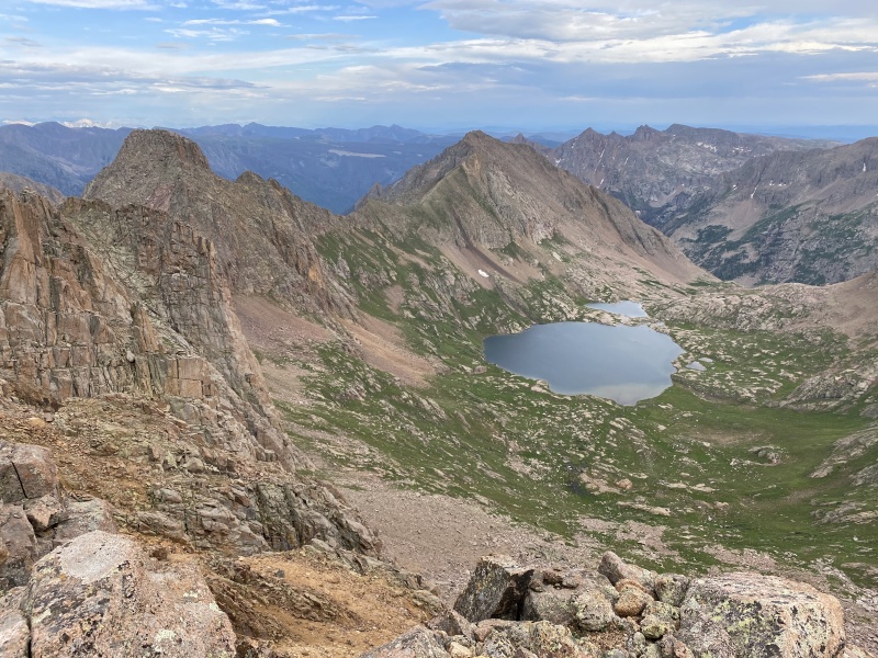
From the summit plateau to the actual summit was a few minutes of enjoyable Class 2+. Views from this centrally located summit were breathtaking. 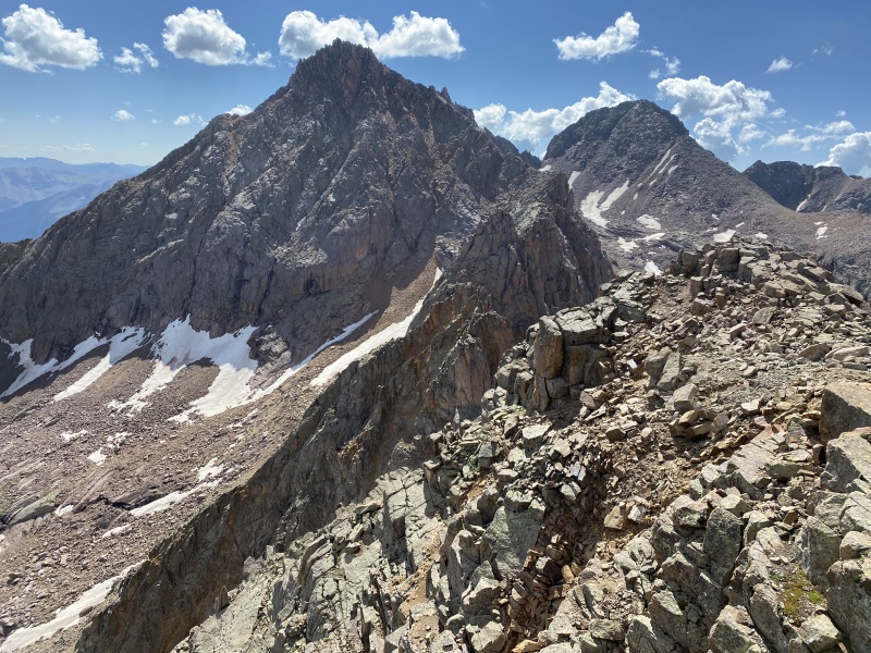
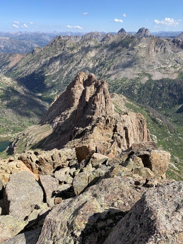
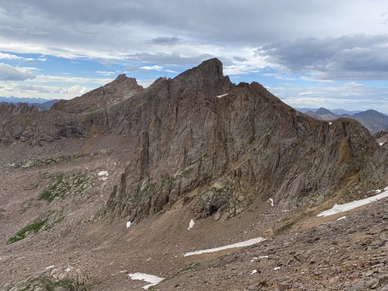
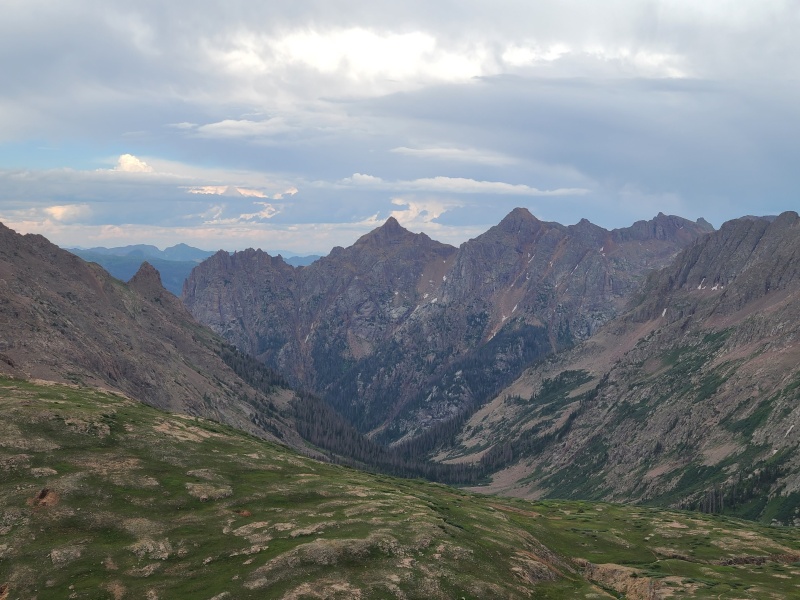
Though it wasn't the nicest peak of the trip Eleven had perhaps the best views. I do love me some Weminuche. We spent a few minutes taking photos and discussing our route over to Glacier Point - we might be able to stay high - before returning to the junky red gully and chockstones. Down climbing the chockstones the way we climbed up would be quite awkward so we all went down a different way, less stemming and somehow less awkward, but facing out. Obviously that wouldn't have worked on the way up. We carefully down climbed the wet section and then frolicked down the ramp back into the basin. 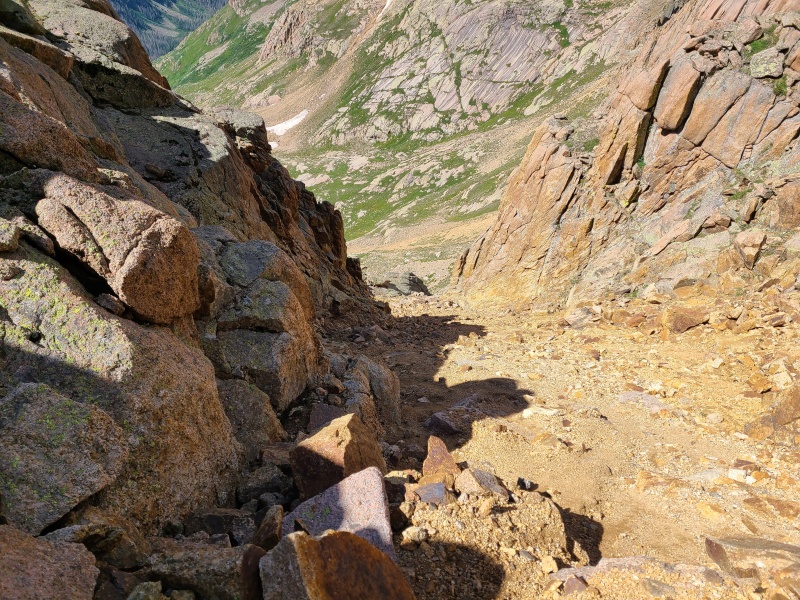

Once more we discussed staying high along a series of ramps and slabs en route to Glacier Point, but the route seemed contrived and unlikely to save time or effort so we abandoned it in favor of just going back to the trail and ascending that towards Eolus instead. We descended back to the lakes and attendant crowds. 
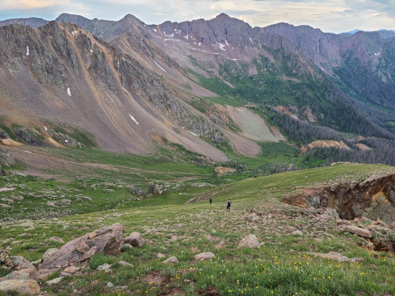
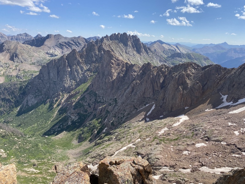
When we met up with the trail things sped up. We hiked past little groups and big groups, young and old, red, orange, yellow, green, blue, indigo, and violet towards Eolus before once again leaving the trail and the hordes. We had soft-ranked peaks to climb, OK? Overall Glacier Point wasn't much of a peak, just a large pile of decomposing gravel. A direct ascent would have been too steep so we swung around the peak and up its more moderate east ridge. 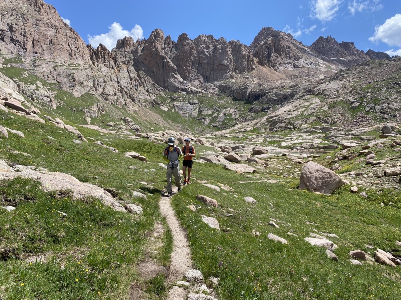
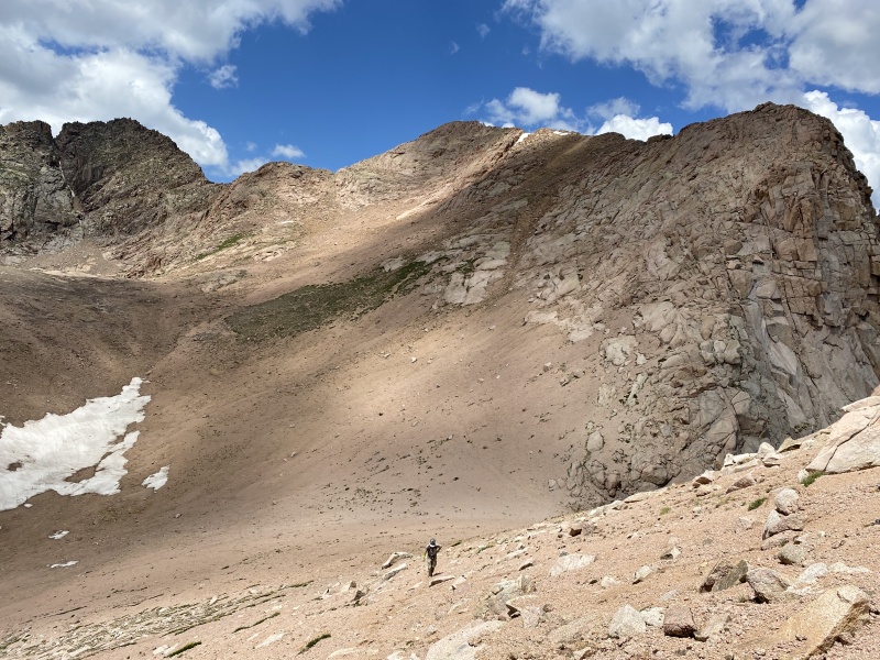
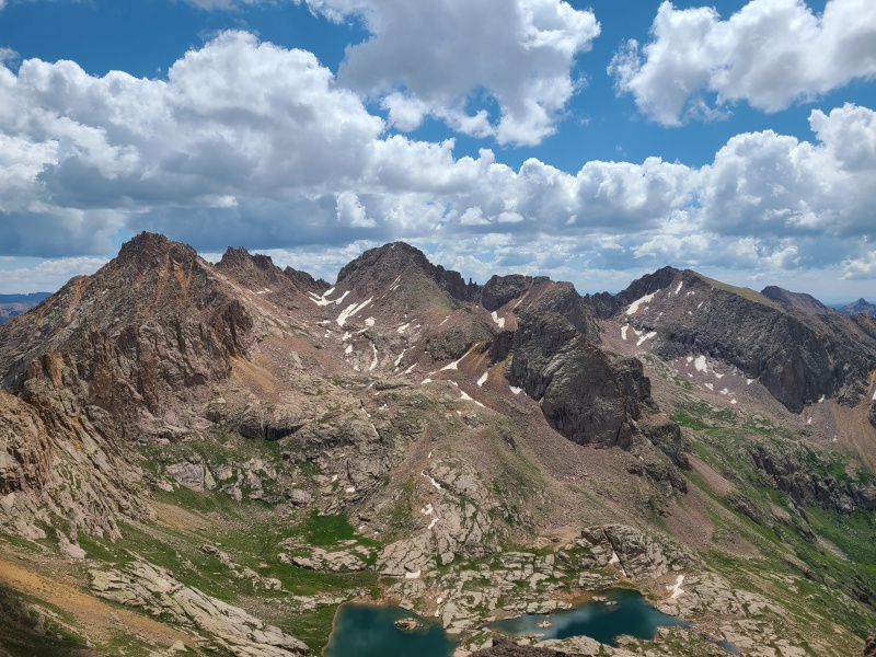
As expected the views were amazing and just different enough from those of Eleven to keep things fresh. Drinking in the Weminuche's energies replenished us for the rest of the day, and down we went. Here I split with Whiley and Luke, who went to climb Eolus and North Eolus, while I went back to camp. I'm a slower backpacker than them so I thought it prudent to break camp and get moving and they could meet me along the way or at Hazel Lake later that evening. 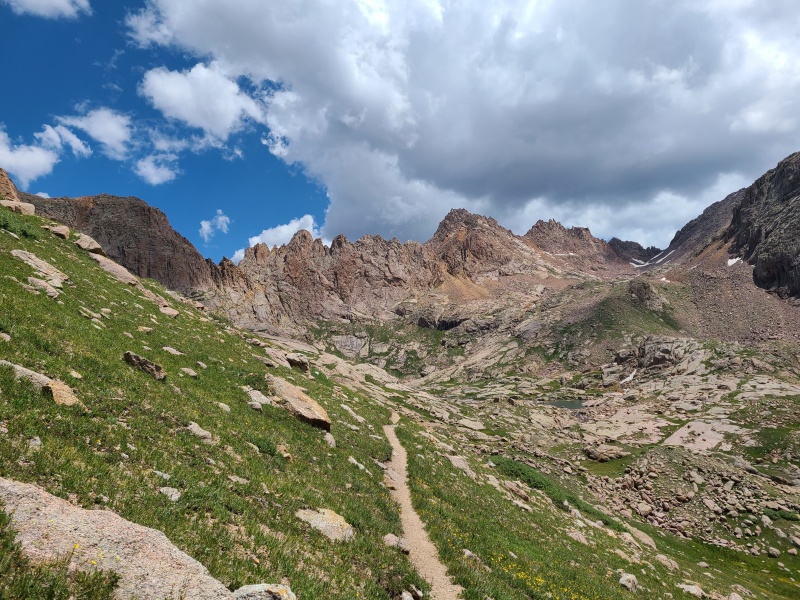
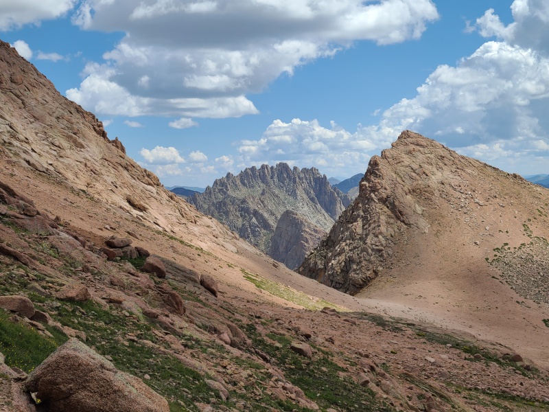
I reached camp quickly and tore down. I took my food from the bear bag and re-strung it for them, packed my sleeping gear and tent, and headed back up the trail a third time in less than 24 hours. At the junction towards Columbine Pass I went east and immediately had the rest of the trail to myself. I slowly hiked towards the pass, reached the area we left the trail the prior day for Jupiter, and continued on. It was nice having some time to myself in this great place, and on a good trail no less. 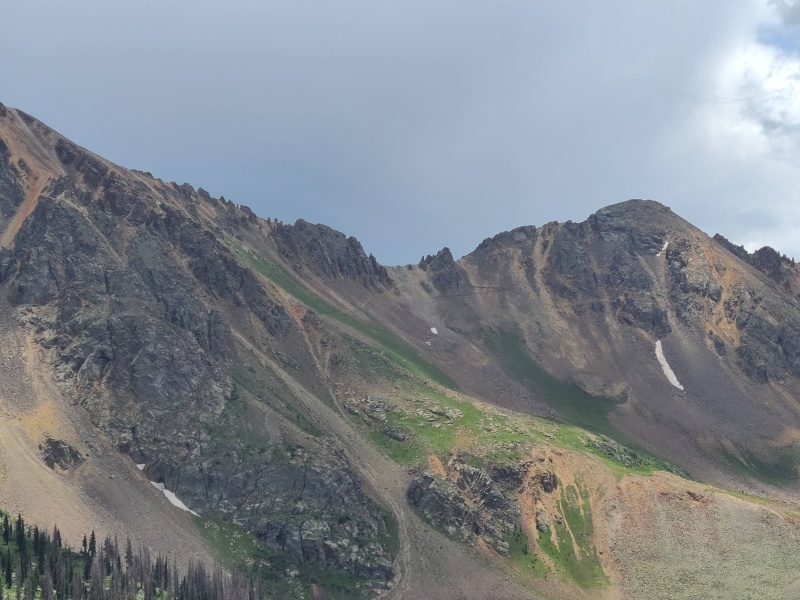
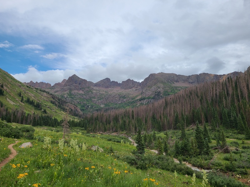
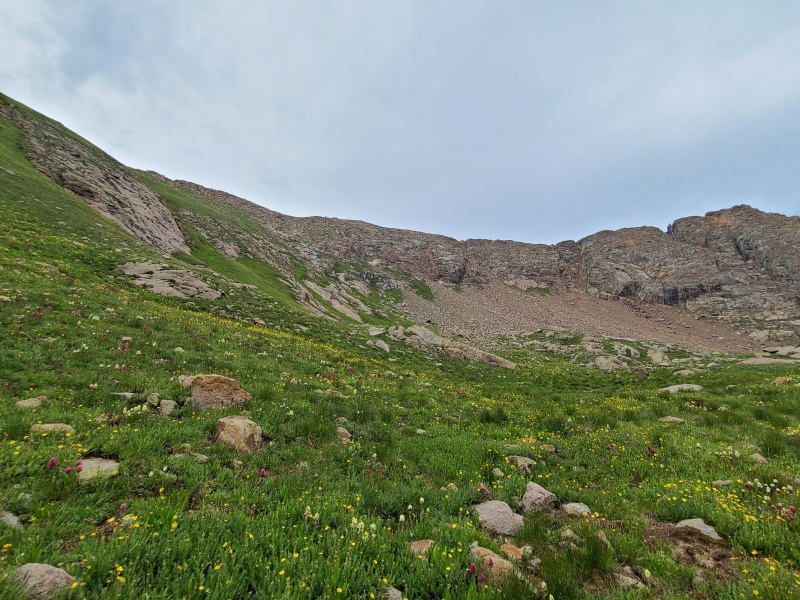
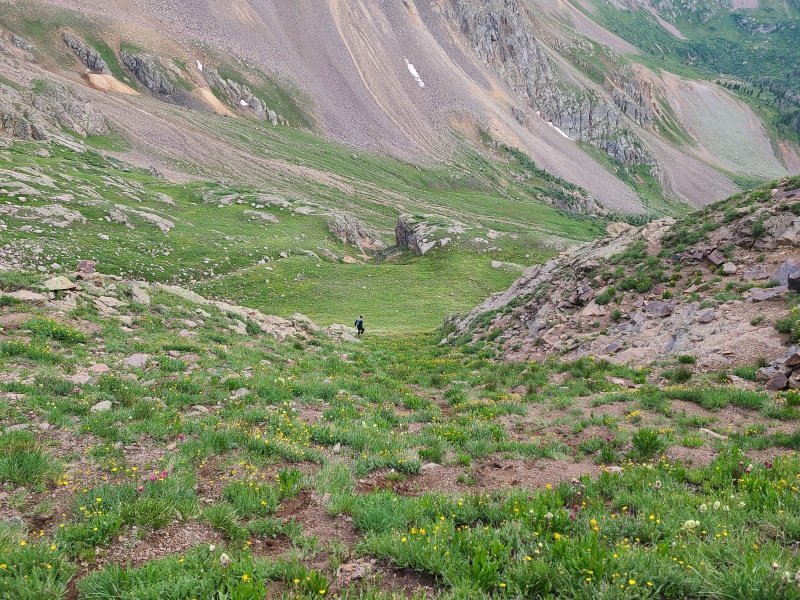
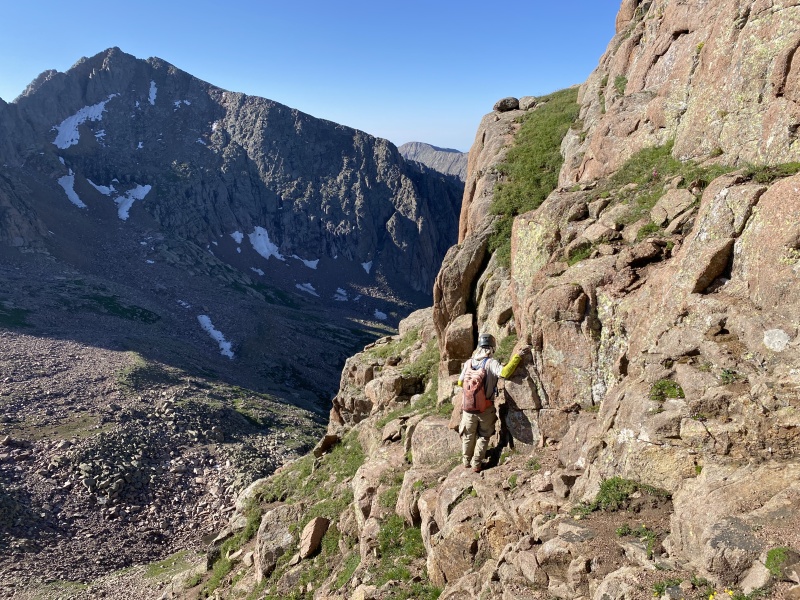
From the pass I had a couple of options: drop down to Columbine Lake and then reascend the short pass over to Hazel Lake; go off-trail and try to stay roughly level until reaching a nasty talus field en route to the pass; or stay level and then gain elevation before dropping to the pass, but on grass. I chose option three since it seemed like the least amount of effort, and by far the least annoying. 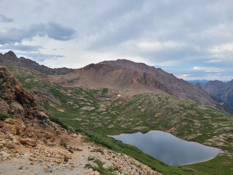
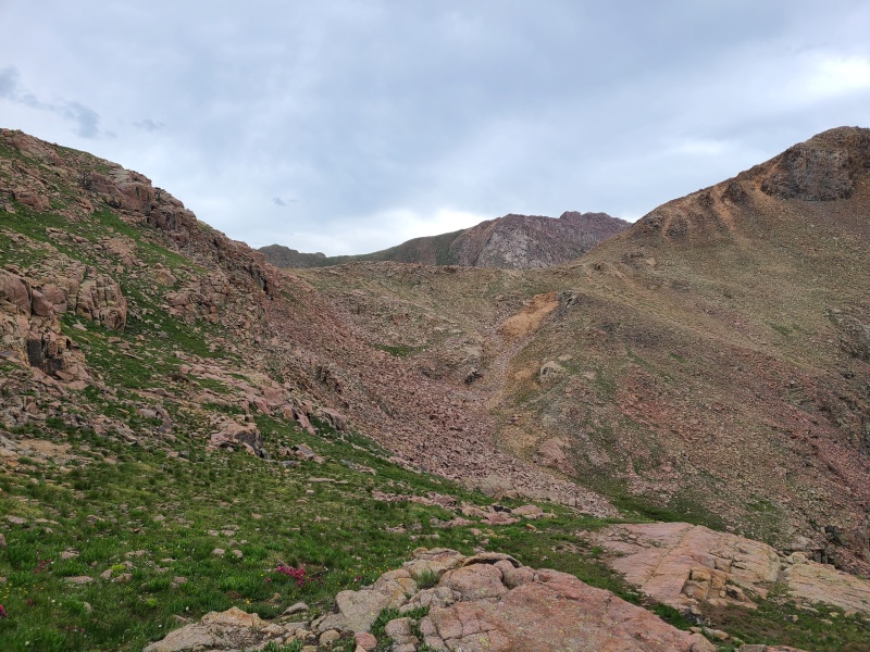
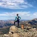
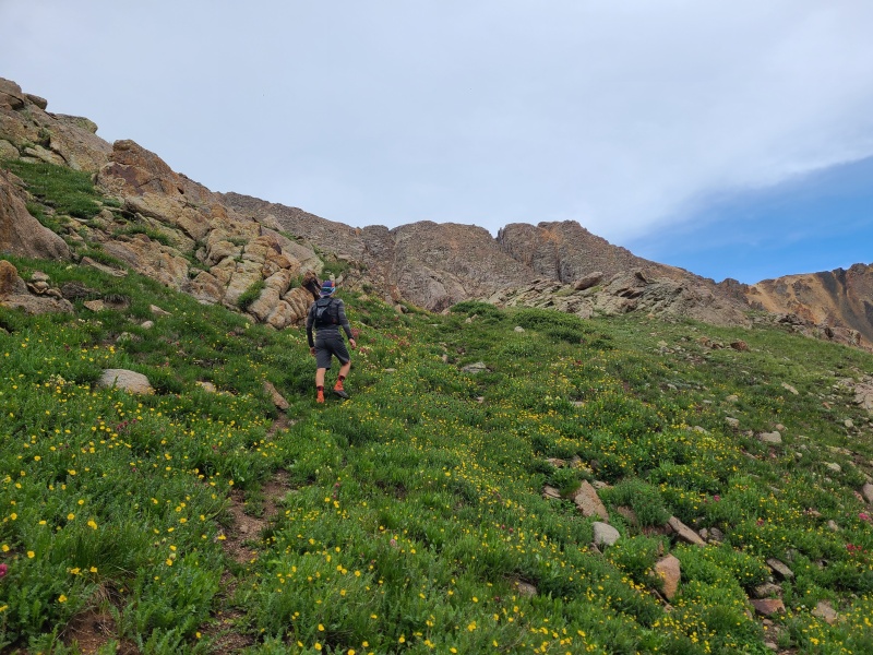
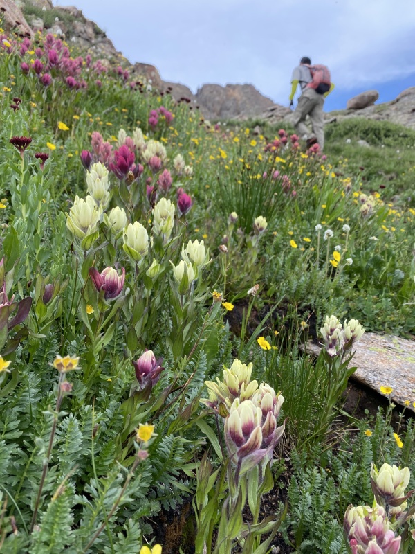
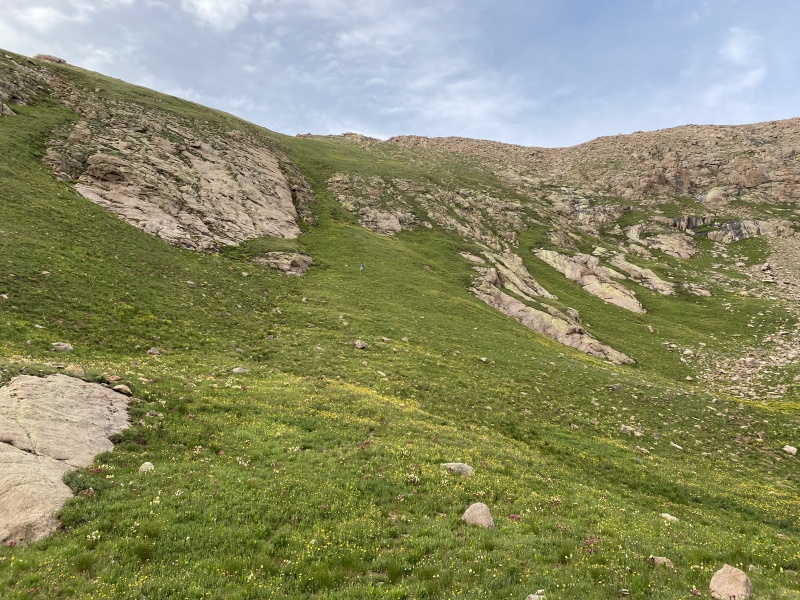
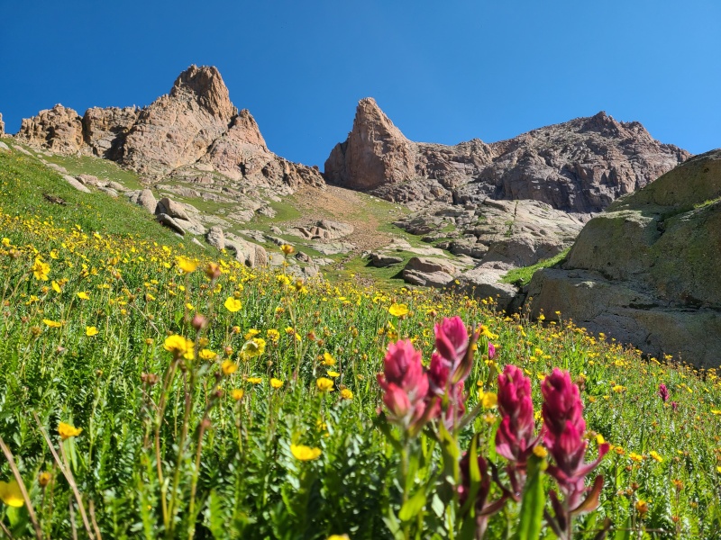
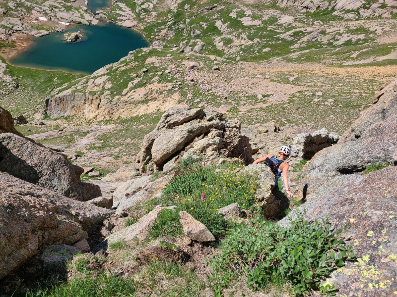
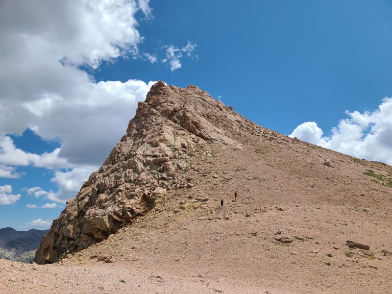
The hike up and down to the pass was simple and charming, a nice mix of pleasant easiness in front of me and Weminuche insanity all around me. At the pass I dropped my pack and hiked Hope Mountain's easy north ridge on talus. Hope was the easiest peak of the trip and a nice change of pace from the scrambles and steepness of the peaks before. 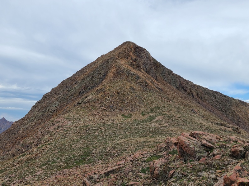
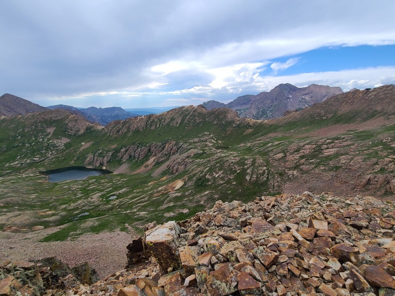
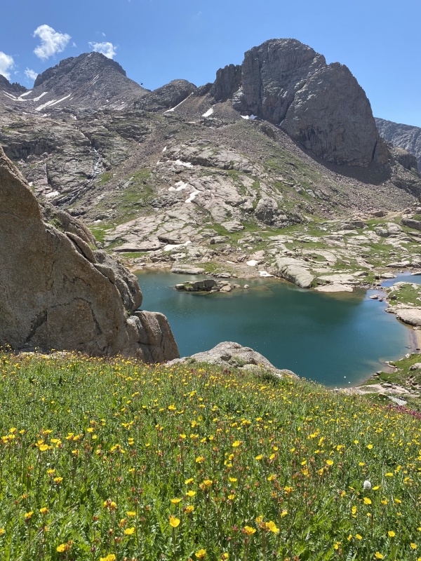
Whiley and Luke hadn't yet made an appearance (Whiley's photo was taken some time after I had already descended to Hazel Lake) so I returned to my pack and then took the trail down to Hazel Lake. The lake was as smooth as glass. I found a picturesque flat spot a couple hundred feet from the lake and setup my tent there while waiting for my compatriots, who showed up an hour or two later and set up their camp a ways from mine. Despite the grass there was plenty of uneven and rocky terrain. We filtered water and cooked dinner then turned in for the night. Violent storms arose after dark, storms which lashed our tents with rain and split the sky with lightning and deafening thunder. It was a storm that would prepare us for the next two days, for the Echo of Thunder... 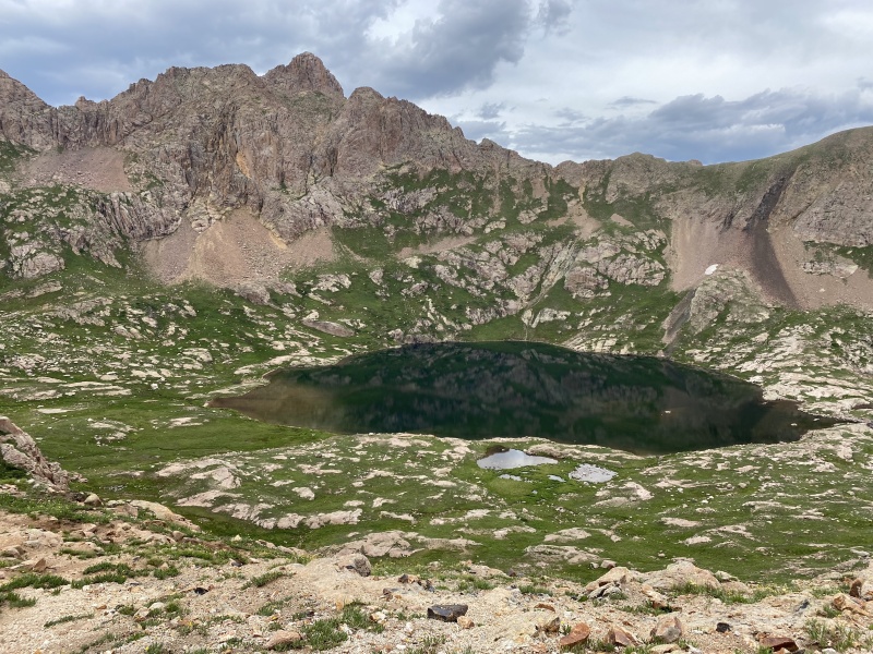
Day 2 StatisticsClimbers: Ben Feinstein (myself), Whiley H., Luke G-W.
Splits:
Version history:
Thumbnails for uploaded photos (click to open slideshow): ")
")
")
")
")
")
")
")
")
")
")
")
")
")
")
")
")
")
")
")
")
")
")
")
")
")
")
")
")
")
")
")
")
")
")
")
")
")
")
")
")
")
")
")
")
")
")
")
")
")
")
")
")
")
")
")
")
")
")
")
")
")
")
")
")
")
")
")
")
")
")
")
")
")
")
")
")
")
")
")
")
")
")
")
")
")
")
")
")
")
")
")
")
")
")
")
")
")
")
")
|
| Comments or Questions | ||||||||||||||||||||||||
|---|---|---|---|---|---|---|---|---|---|---|---|---|---|---|---|---|---|---|---|---|---|---|---|---|
|
Caution: The information contained in this report may not be accurate and should not be the only resource used in preparation for your climb. Failure to have the necessary experience, physical conditioning, supplies or equipment can result in injury or death. 14ers.com and the author(s) of this report provide no warranties, either express or implied, that the information provided is accurate or reliable. By using the information provided, you agree to indemnify and hold harmless 14ers.com and the report author(s) with respect to any claims and demands against them, including any attorney fees and expenses. Please read the 14ers.com Safety and Disclaimer pages for more information.
Please respect private property: 14ers.com supports the rights of private landowners to determine how and by whom their land will be used. In Colorado, it is your responsibility to determine if land is private and to obtain the appropriate permission before entering the property.