| Report Type | Full |
| Peak(s) |
McCauley Peak - 13,555 feet Echo Mountain - 13,303 feet Grizzly Peak - 13,700 feet Thunder Mountain - 13,108 feet |
| Date Posted | 04/04/2023 |
| Date Climbed | 07/19/2021 |
| Author | supranihilest |
| Additional Members | whileyh |
| The Echo of Thunder | |||||||||||||||||||||||||||||||||||||||||||||||||||||||
|---|---|---|---|---|---|---|---|---|---|---|---|---|---|---|---|---|---|---|---|---|---|---|---|---|---|---|---|---|---|---|---|---|---|---|---|---|---|---|---|---|---|---|---|---|---|---|---|---|---|---|---|---|---|---|---|
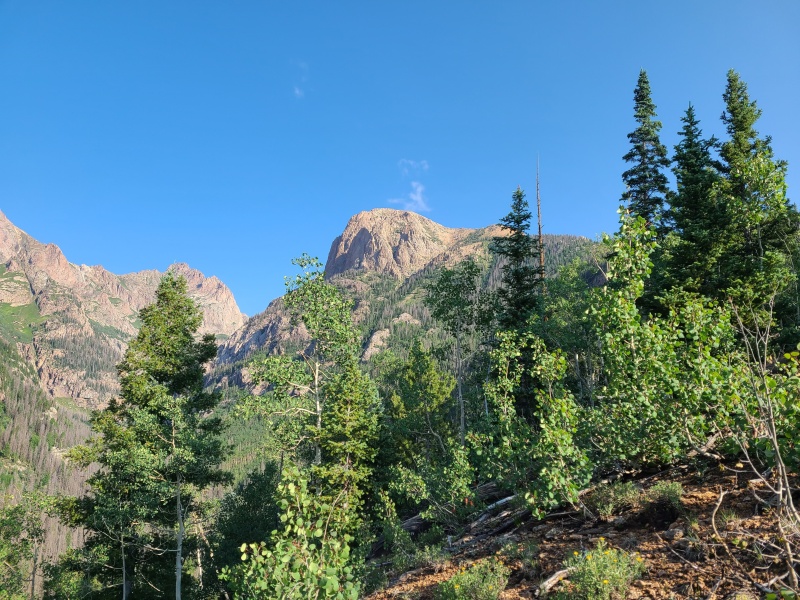
Table of ContentsMonday, July 19, 2021: Day 3 - McCauley Peak, Echo Mountain, Grizzly Peak C, and Backpack to Thunder Mountain A Monday, July 19, 2021: Day 3 - McCauley Peak, Echo Mountain, Grizzly Peak C, and Backpack to Thunder Mountain A In the two days prior we'd backpacked into Chicago Basin, climbed five thirteeners (and some fourteeners for Luke and Whiley), then backpacked to Hazel Lake below Bicentennial thirteener Grizzly Peak B and McCauley Peak. Overnight it poured and stormed so hard it threatened to rip us from the very earth we pitifully clung to. Lightning frequently rent the sky, and the ensuing thunder was so loud it shook our tents and woke us from slumber. Since we were camped above treeline we had little protection from the elements, only the high rocks around us and the thin nylon of the tents. The storm abated by morning and left us with clean spirits, fresh minds, and a beautiful sunrise over Grizzly Peak C. 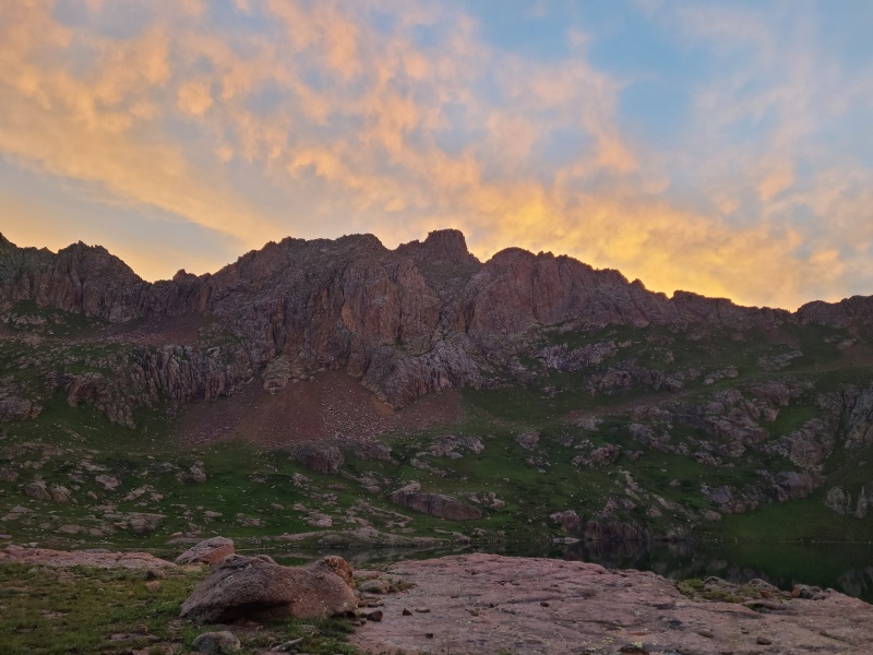
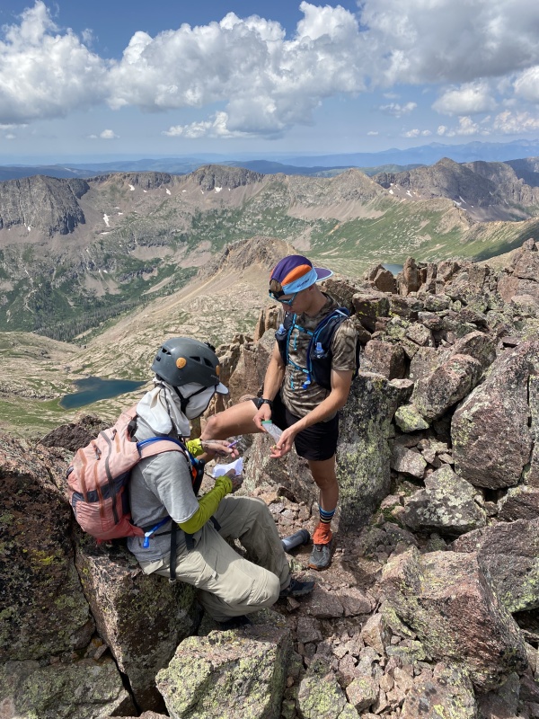
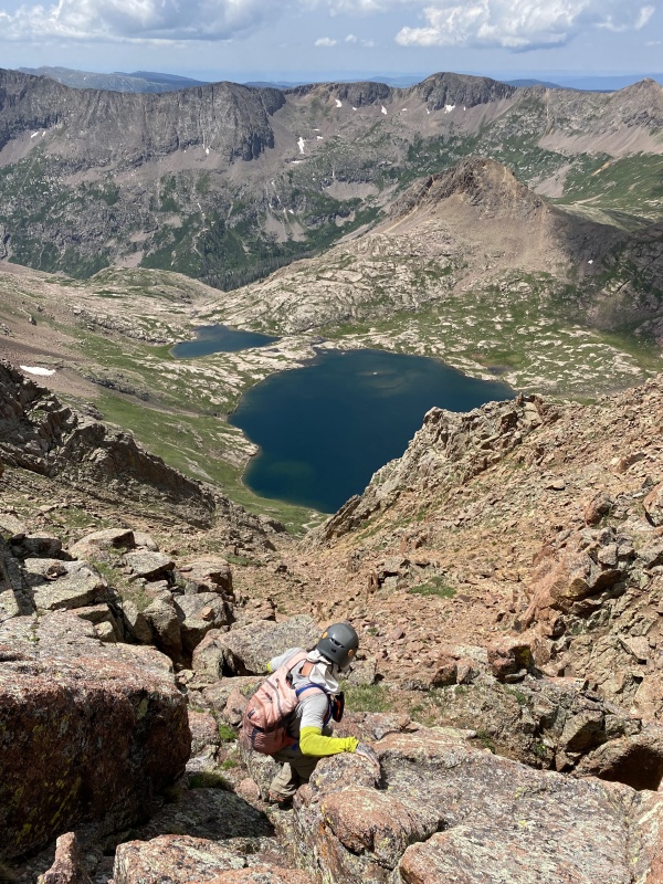
We lazed about in camp since everything was wet. We knew the peaks, all of which were scrambles, would also be wet. We also changed our order of peaks for that reason. We'd intended to do Grizzly C first but moved it to last of the three for the day, so that its north-facing scramble would have time to dry. More bad weather wasn't predicted so time wasn't really a concern. When we'd breakfasted and things had dried out a bit we began up and around Hazel Lake's west side before curving east towards an obvious grass ramp that led up McCauley Peak. 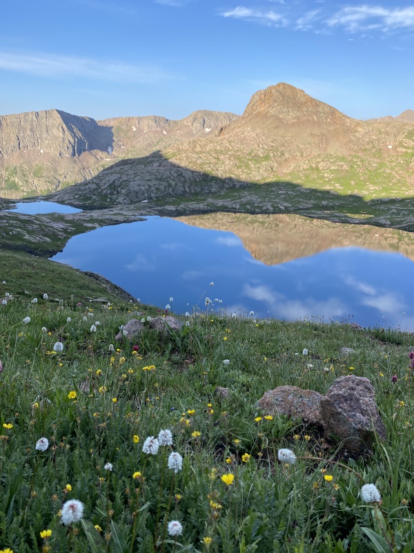
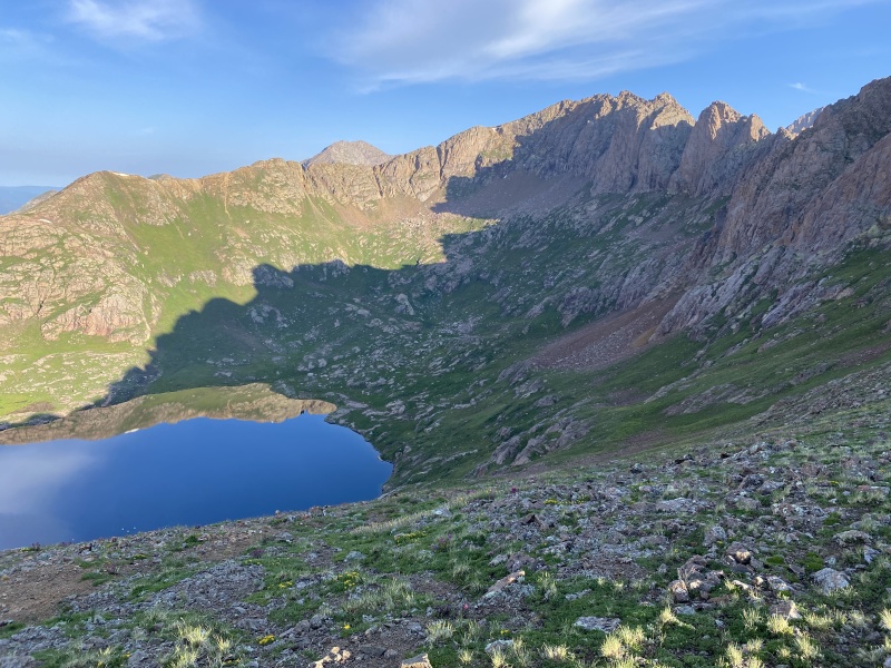
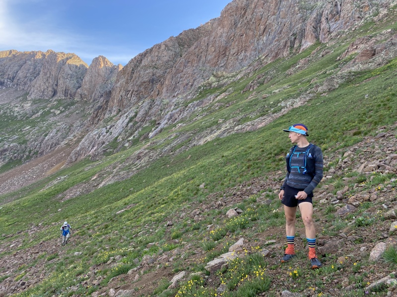

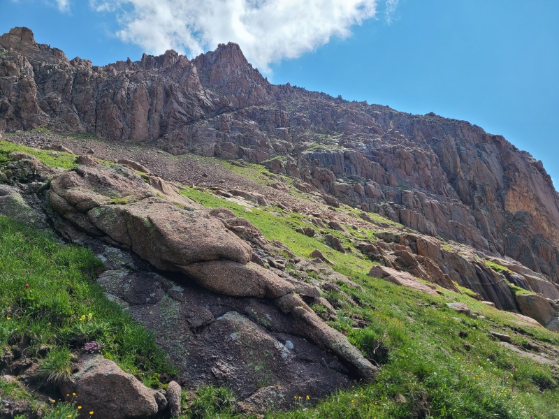
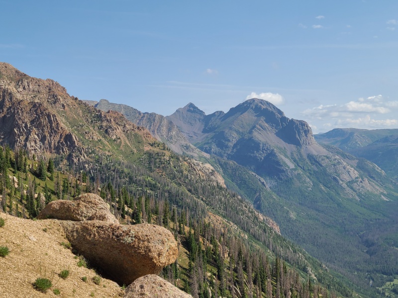
The ramp, which was a mix of grass and granite boulders and talus, came and went quickly. As expected the views grew and grew as we rose. Before long the Class 2 grass ramp became rocky, and the scrambling began. 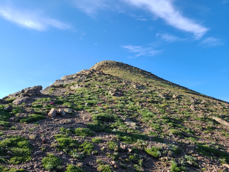
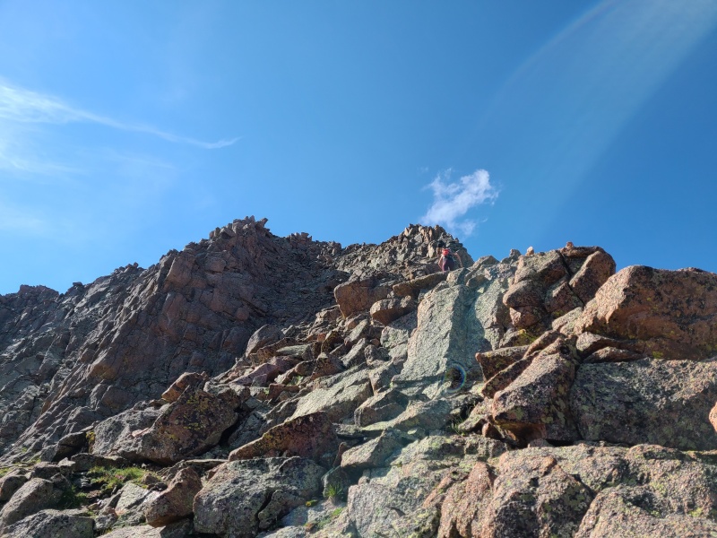
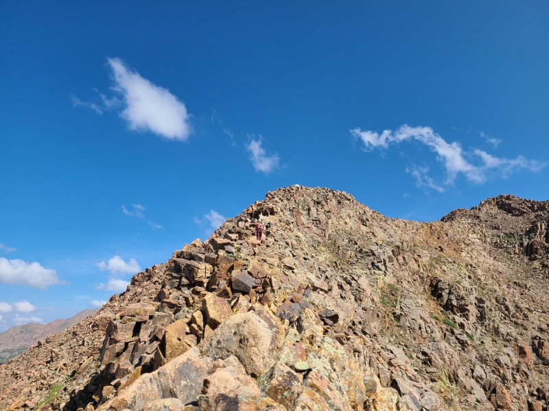
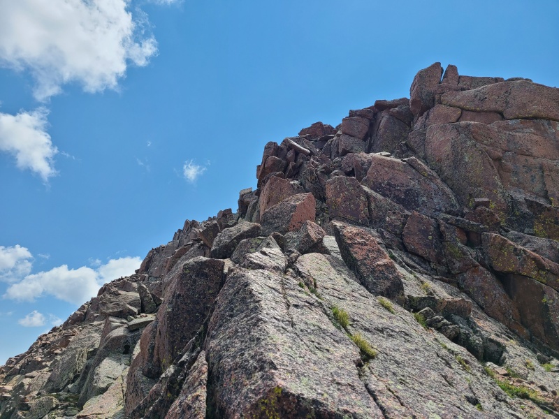
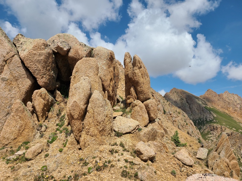
Mostly stacked boulders, the scrambling was fun, solid, and came in spurts. The ridge narrowed as we came closer to the summit block, slowly clambered over the heavily lichened granite. 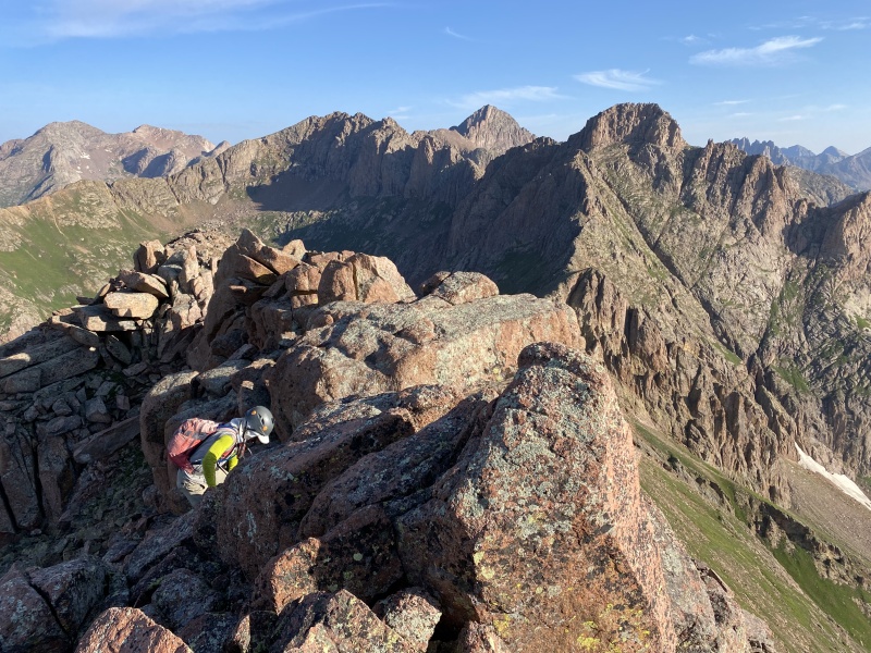
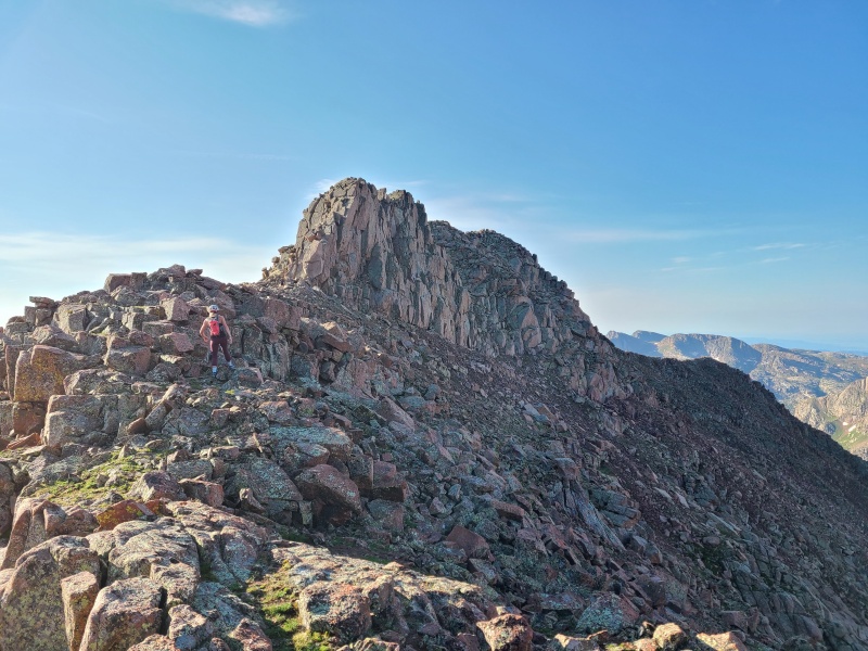
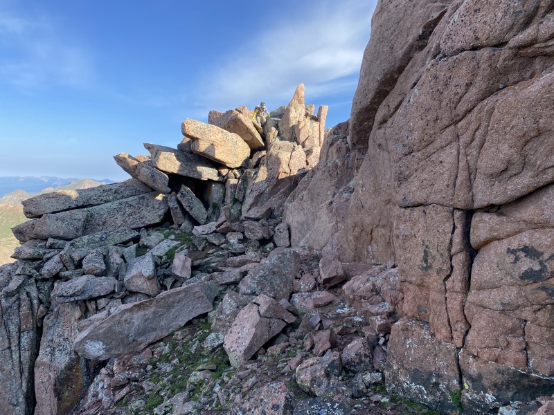
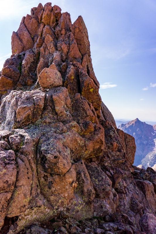
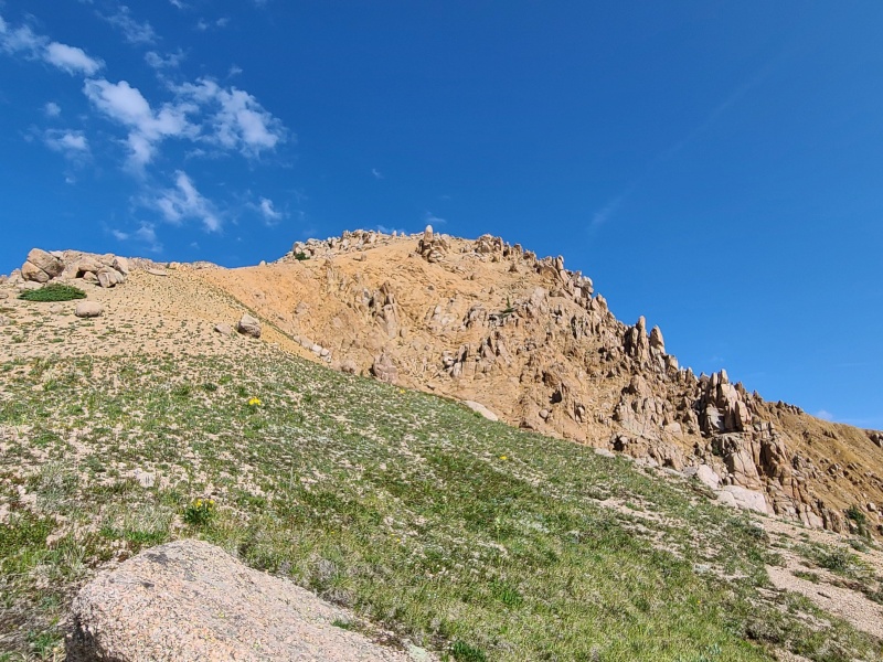
The summit block was small but didn't immediately present an easy way up it. We passed under its east side on dirt and a small cleft in the middle of the block opened up and provided easy Class 2+ ledges to the summit ridge and summit proper, which was a nice block of stacked granite, going at Class 2+ to Class 3. Some loose rock was found on the ledges but overall the summit scramble was relaxed and highly enjoyable. It ended far too soon! 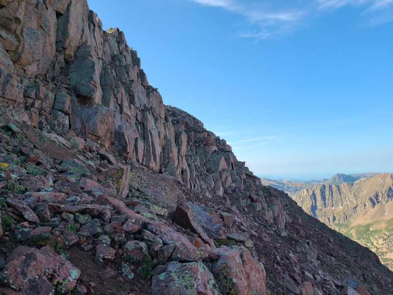
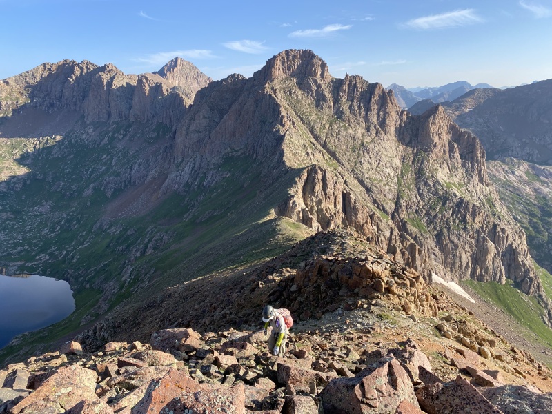
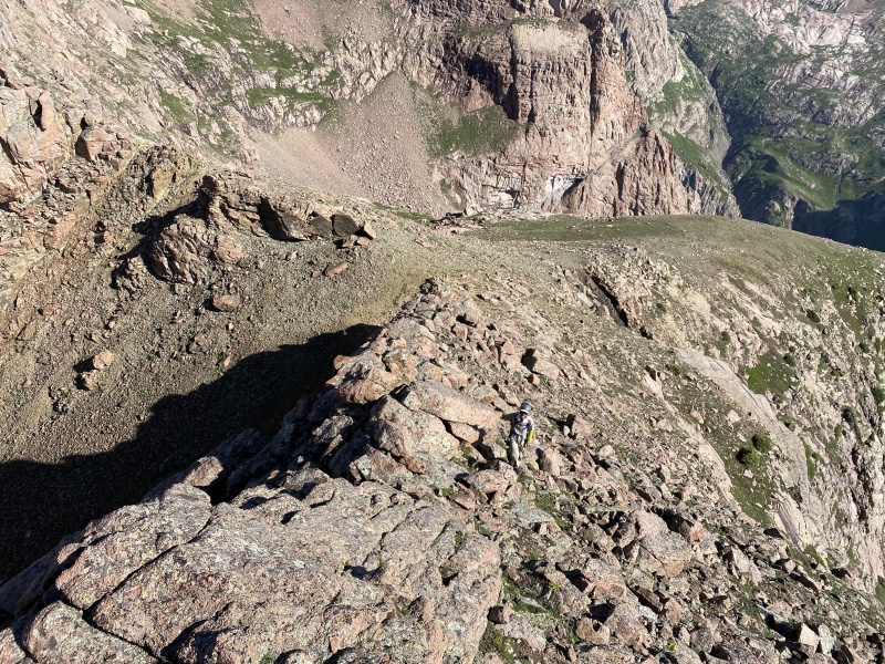
We didn't linger on McCauley, because the next peak of our day was the one we were most excited about - Echo Mountain. Echo is an unranked thirteener that we knew nothing about besides that we must climb it. Sure, McCauley and Grizzly C were ranked but they were known quantities. The fun thing about unranked peaks is we often have to figure them out for ourselves. We dropped off McCauley's summit block and started south along the ridge, traversing on steep dirt and boulders. Prior to reaching the ridge crest farther away we encountered Class 2 and some Class 2+. Everything was loose so we stayed spaced out. 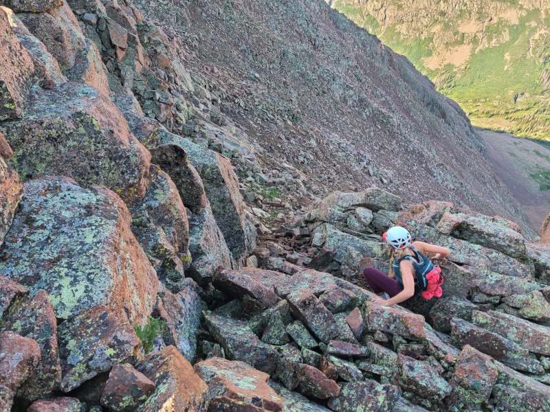
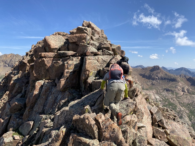
Upon reaching a small saddle just south of McCauley the ridge narrowed and the flanks dropped away. Exposure increased, as did the difficulty, to Class 3. In spots the ridge even had short knife edges. We took our time along the ridge, both because of the exposure as well as the sheer joy of it. 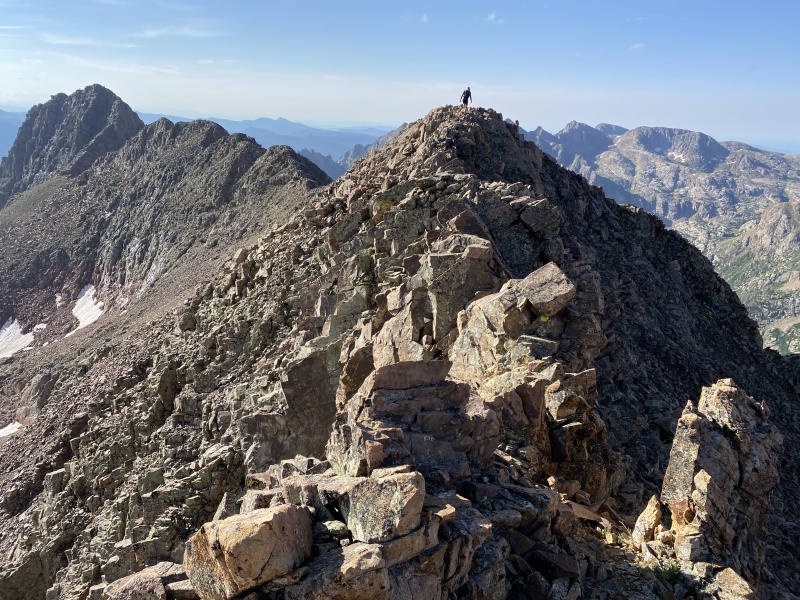
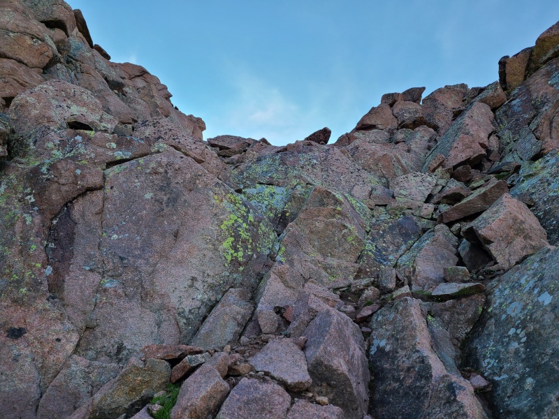
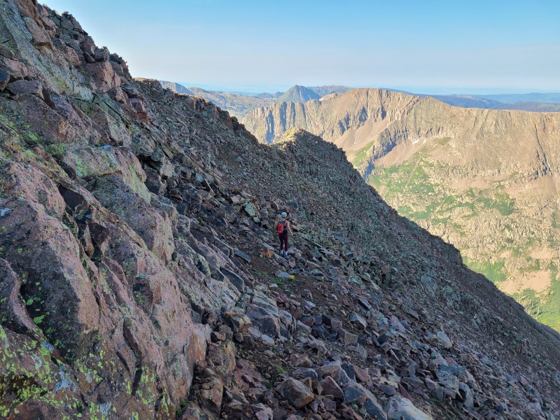
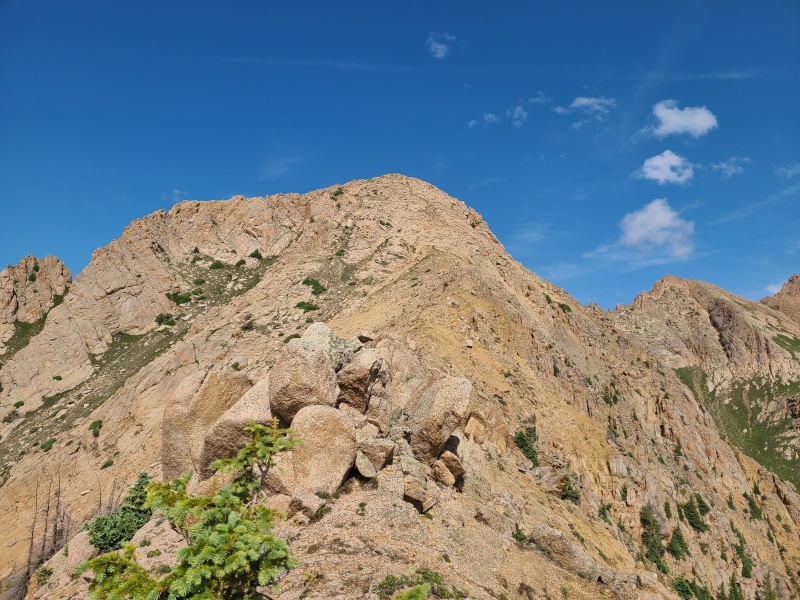
About half a mile down the ridge we came to another saddle. From here there were two choices: continue along the ridge and across several difficult looking notches, or drop into a small bowl to the east before reascending below Echo's north face. Luke chose the former, Whiley and I the latter. We split up and planned to meet for the summit scramble. For Whiley and I's route, there were no difficulties to speak of. The descent into the bowl was on moderately angled talus and grass, and ascending back to Echo was mostly grass with one short section of steep, loose talus. We reached the bottom of Echo and waited for Luke for several minutes. When he reunited with us he said the ridge went at mostly Class 3, with some difficult and exposed Class 4 thrown in. 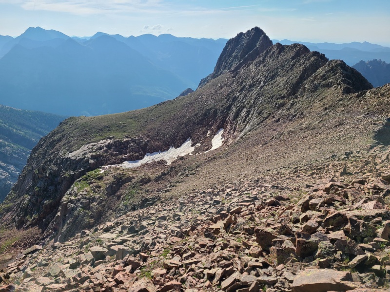

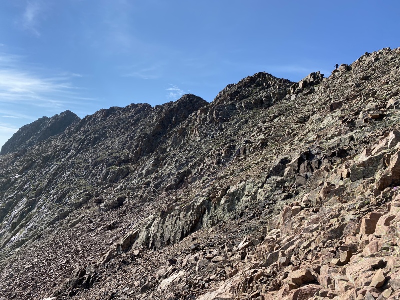

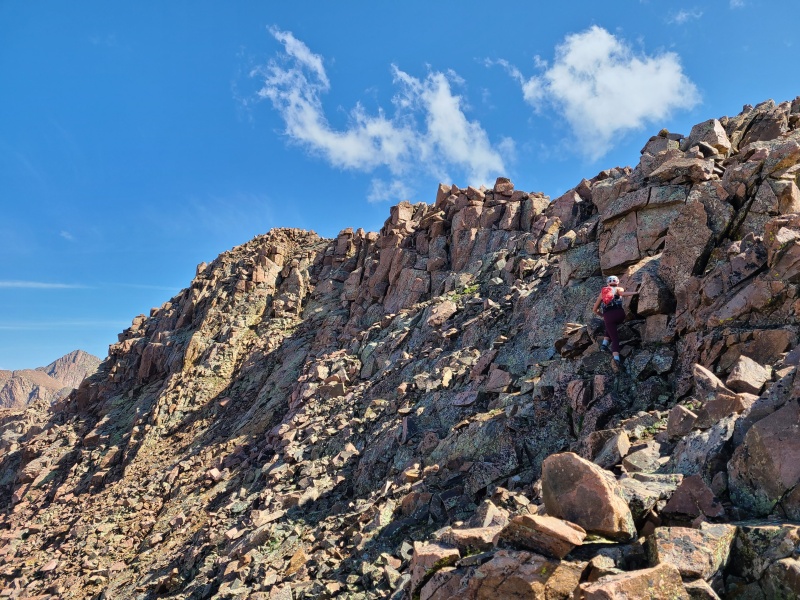
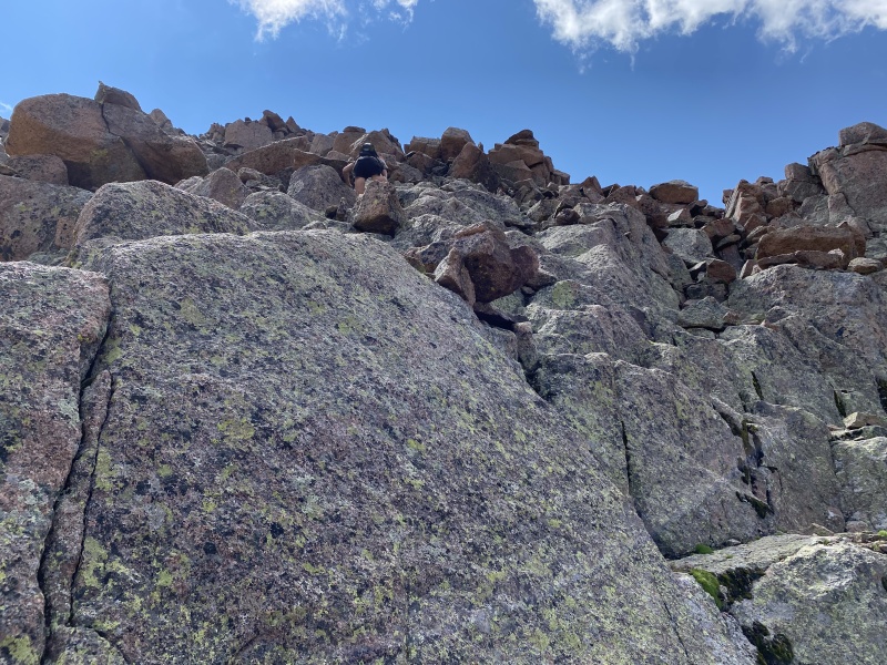
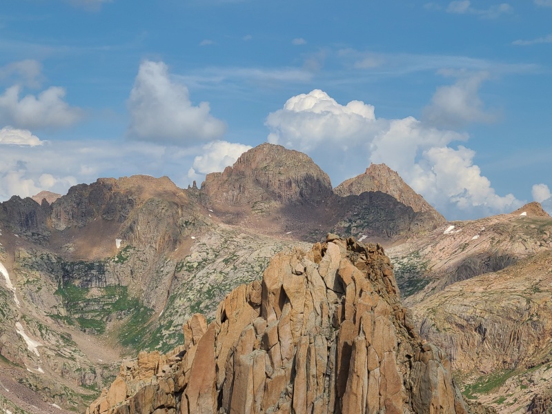
From a distance Echo had looked like it might be hard, since it leapt out of the end of the ridge nearly vertical. When we reached its north face we found this not to be true. While steep, the face was stepped out and much easier than it looked from afar, more of a concavity than a wall. We scrambled up the righthand ridge, which was Class 3 and some Class 4; difficulty could be reduced to mostly Class 2+ with bits and pieces of Class 3 by moving more to the center of the face. 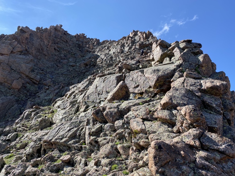
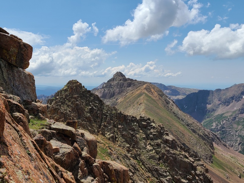
The scramble up Echo was yet another that was extremely enjoyable but too short. That's basically every scramble though, to be fair. If they could just continue for hours instead of minutes I'd be in heaven. We spent another few minutes on the summit, remarking at how fun the scramble was, and enjoying the view of the next day's peak - Thunder Mountain A - before scrambling back down, this time taking the easier center face. We took the easier lower traverse back to the ridge and scrambled back up and down McCauley, which was as much fun in reverse as it has been going to Echo. 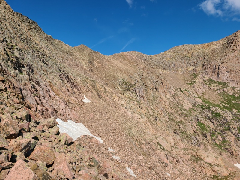
Once we were back on the grass north of McCauley, we again crossed Hazel Lake's north side, this time en route to a ramp up Grizzly C's south face, west of the summit, that would grant us passage through an otherwise technical cliff band spanning the entire south side of the peak. 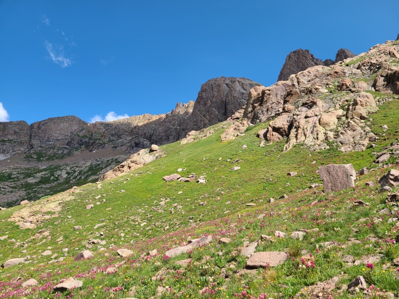
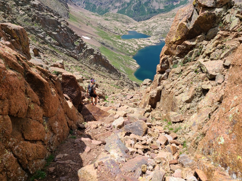
There are actually two ramps on Grizzly C's south face, approximately on top of each other. The higher, longer of the two ramps is the one that would get us closer with far fewer difficulties, since the lower ramp is blocked by the cliffs that make up the upper ramp. For the most part the ramp wasn't difficult in any way, but it was wet and the rock was rotten. I'd say it was Class 2+ but no harder. 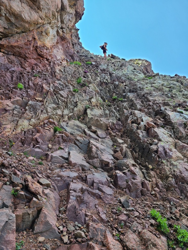
Immediately at the top of the ramp the face opened up into a broad bench. We had a much better view of Grizzly C's summit block here, which appeared similar to McCauley's, just several times larger. Any potential route from the south where we were looked technical, so we hiked across the bench on kitty litter and talus to a notch west of the summit block, which allowed us to cross onto the north face. 
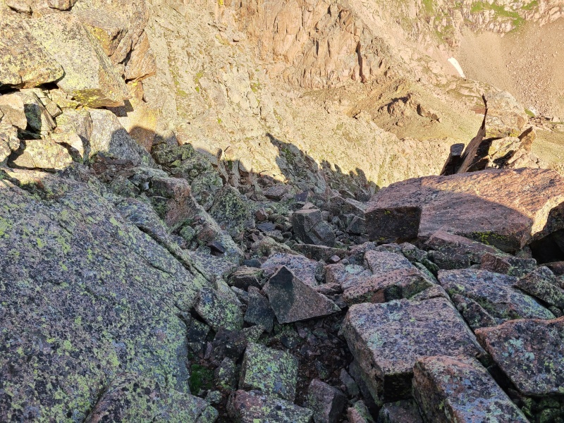
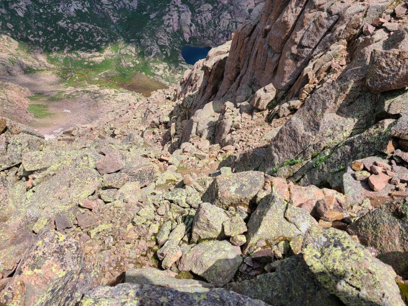
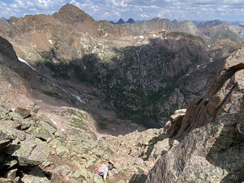
The notch was where the peak started getting fun. It was all scrambles from there to the top. The north face was also significantly more exposed, really just a massive, steep face of broken ledges and boulders that ran down into Grizzly Gulch. We wrapped briefly east and into another concavity, like on Echo, this time much larger. Cairns littered the area but weren't entirely necessary - should the scrambling have gotten more difficult than Class 3, we'd know we were off-route. Besides, zig-zagging up the numerous ledges on the face funneled us right to the summit, and was again easy and highly enjoyable. Oh how I love the Weminuche! 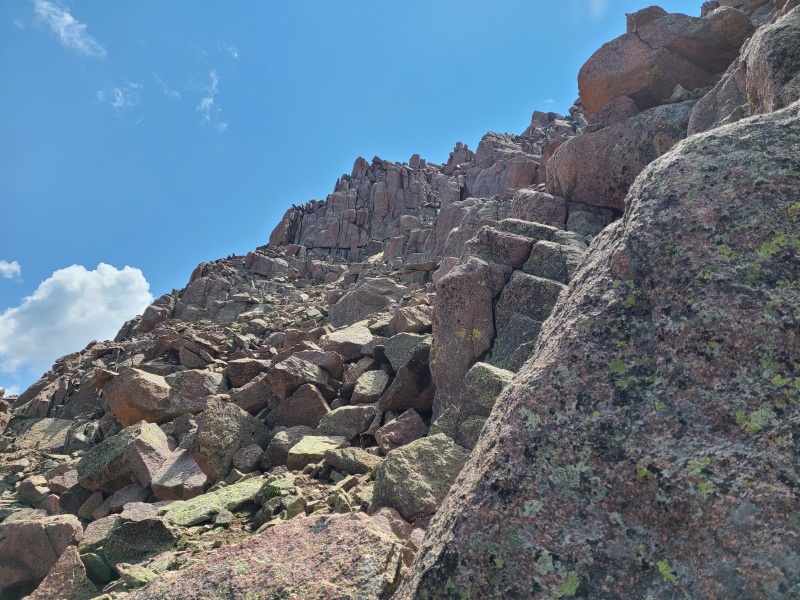
Grizzly C was another fine scramble on a day full of fine scrambles, and it wasn't even the end of the good times for the day! We still had a lengthy backpack to do and didn't know where to set up camp for the night, so we signed the register and immediately turned around and began down. We were careful not to bounce any rocks down on each other and soon found ourselves back at the notch between north and south faces. 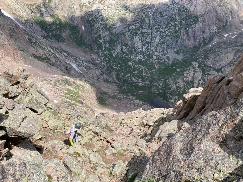
Crossing back to the north side we had to be mindful of finding the ramp we'd come up, since neither were visible from the gently sloping bench until we were basically on top of a cliff. Essentially the best way to get back was just stay right below the giant overhead cliffs. We couldn't go up them and following them down led us back to the ramp. Going lower would get us into harder territory. 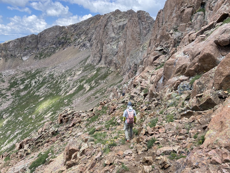
Going down the ramp was a bit tedious since the footing wasn't that trustworthy, but we were all down it quickly and headed back to camp to pack up. 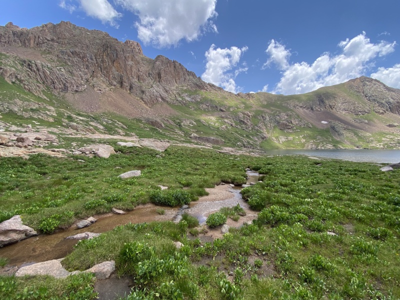
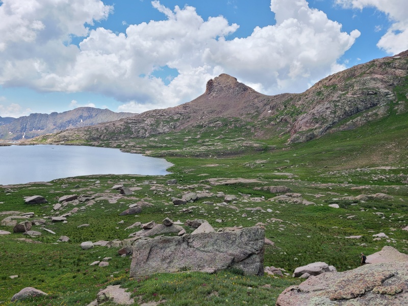
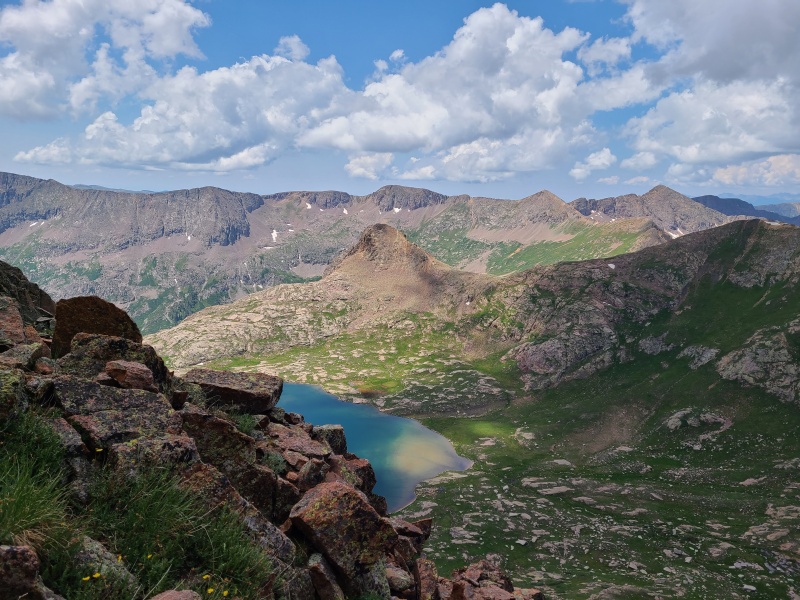
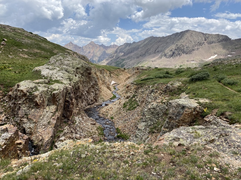
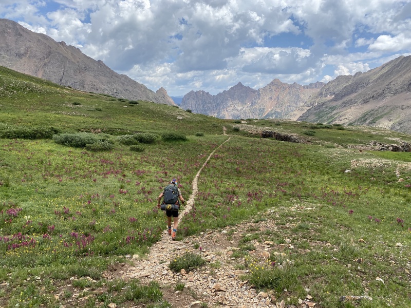
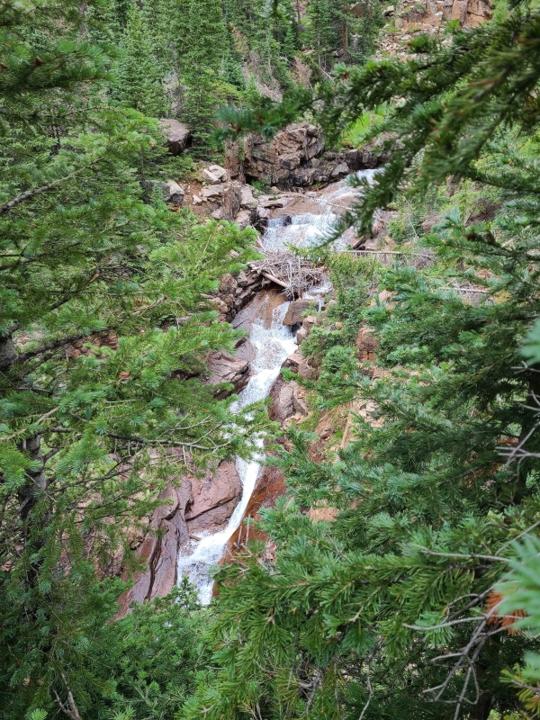
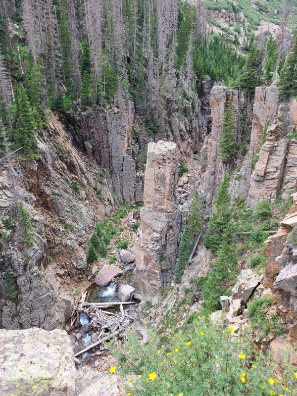
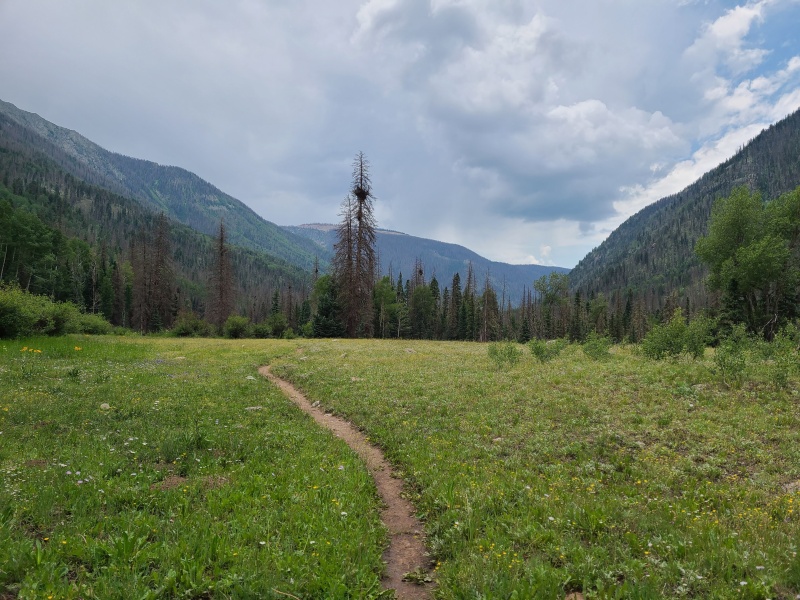
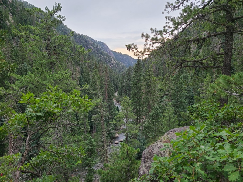
Since we were all together on this day, unlike the day before, we also stayed together for the hike down Johnson Creek. As mentioned, we had no idea where to camp to best climb Thunder A. Like Echo it was a peak we knew absolutely nothing about, and considering the maze of sheer cliffs we'd seen on the southwest face weren't really sure what the peak would hold for us. The south and southeast sides looked better on topo maps but in this area that's no guarantee of reasonability. There could just as easily be insanity hidden in the forests. After we packed up we humped our stuff over the pass between Hazel Lake and Columbine Lake, then started down the beautiful Johnson Creek trail (marked as the Needle Creek trail on maps, since it comes over Columbine Pass from Needle Creek, but I prefer calling it the Johnson Creek trail). This approach to Chicago Basin is a lot more distance, vert, and effort than the Needle Creek approach, which is unfortunate - I think it's vastly superior in the views department, which says a lot considering literally everywhere in the Weminuche is stunning. We made good progress down the trail past towering granite peaks and faces, waterfalls, and into the forest. 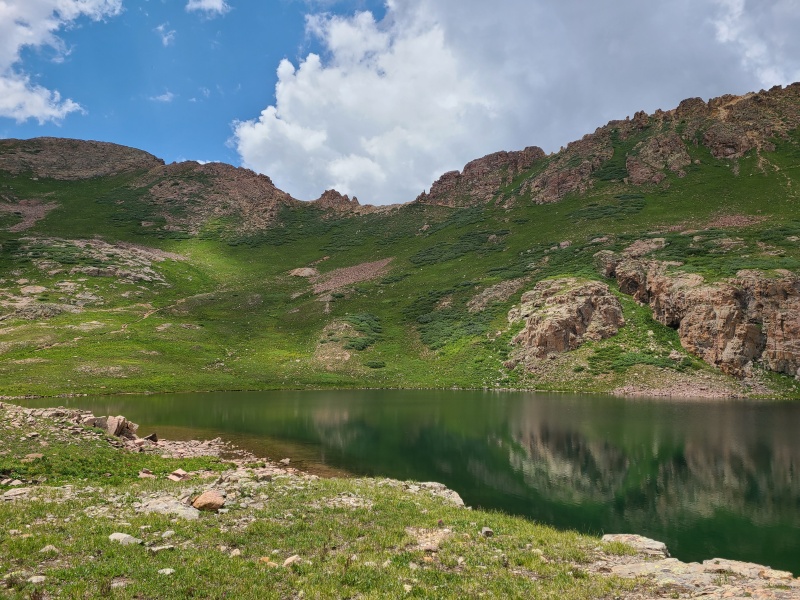
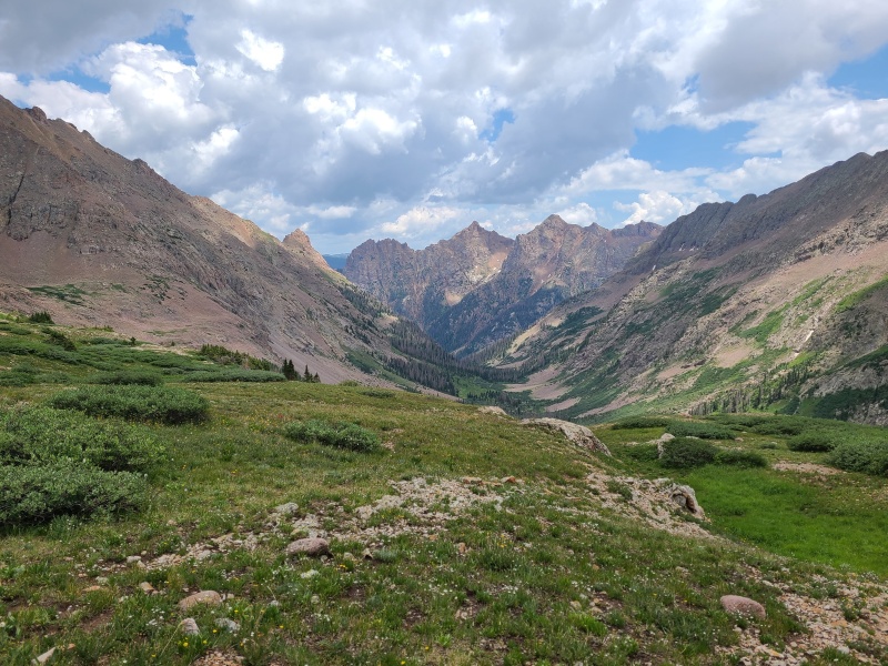

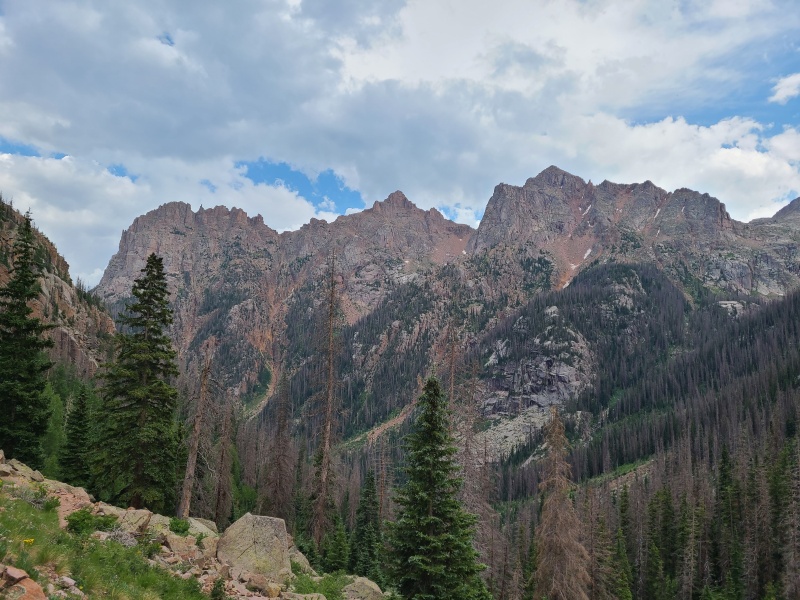
The trail switchbacked innumerable times as we descended through tons of the open slabs and cliffs of the area. For most of our hike there was also no obvious way up Thunder A. We couldn't even see up Grizzly Gulch until we were right underneath Thunder A's southeast ridge anyway, and everything else to that point was clearly impassable. However, once we crossed the unnamed creek draining Grizzly Gulch there was a noticeable shift in the terrain. Things became less steep and the obvious rocks and cliffs found elsewhere disappeared. We pitched our tents barely downstream from this creek crossing on the south side of the trail. Passersby could have touched our tents, that's how close we were to the trail, but it made sense to camp right there: there was running water nearby, there was space for our tents, and as best as we could tell we could head straight uphill up Thunder A's southeast ridge, which looked steep and bushwhacky but bereft of rocks. Whiley and Luke were still looking for more so they decided to scout Thunder A while I stayed at camp and filtered water. They actually managed to reach the summit and came back for dinner, with plans to repeat Thunder A the following day with me. We turned in and planned to rise early for more Thunder. Day 3 StatisticsClimbers: Ben Feinstein (myself), Whiley H., Luke G-W.
Splits:
Tuesday, July 20, 2021: Day 4 - Thunder Mountain A and Vallecito Creek Deproach 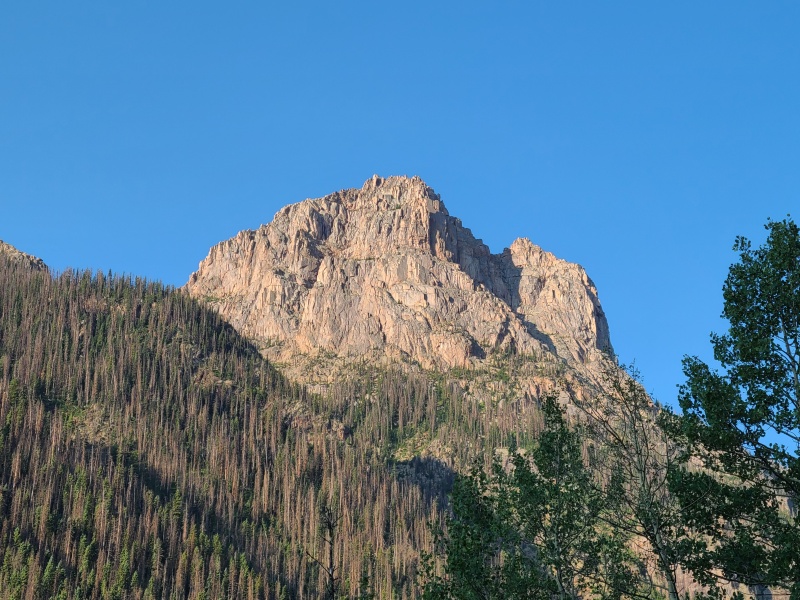
We were up and moving just after 8am. Since my two compatriots already knew the route up Thunder A this was going to be a quick and easy peak. Steep as hell, sure, but short. We walked all three steps from our tents to the toe of the ridge and entered the forest, bushwhacking our way up. 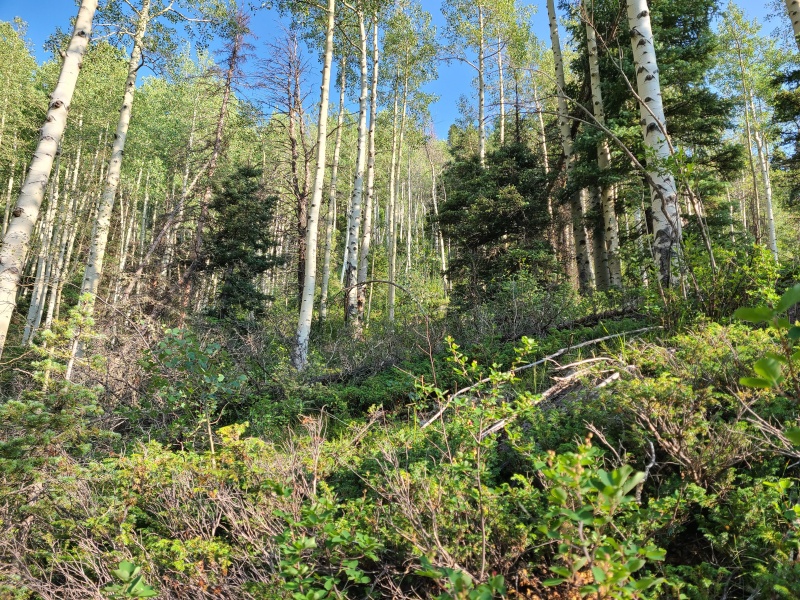
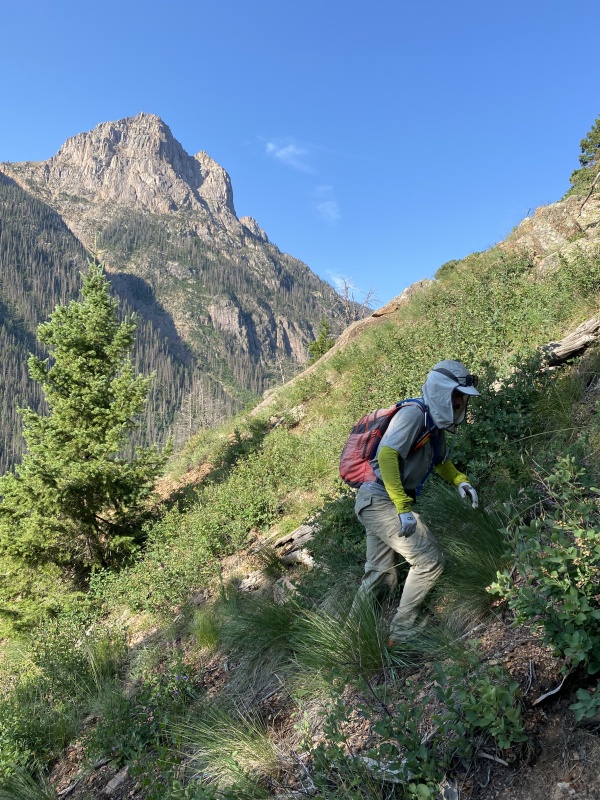
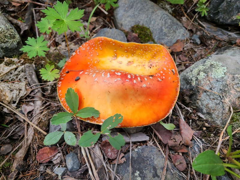
Aside from one short, flat spot in the middle of the forest the ridge was unrelenting to the point where it opened up above treeline. The trees near treeline were planted in a thick layer of orange Needles kitty litter, rock conditions that would continue most of the rest of the way up the peak. 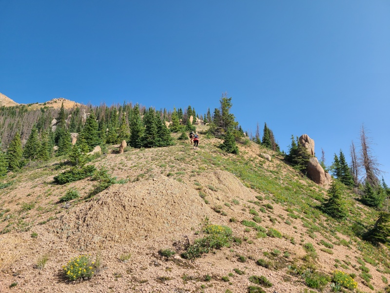

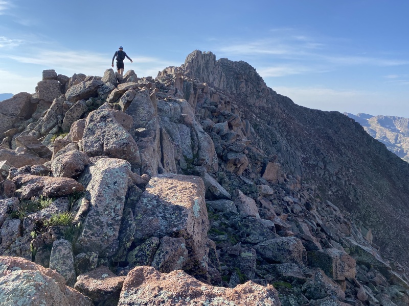
Eventually even the grass on the ridge gave way to pure kitty litter. We continued straight up. By now the route was obvious, just stay right on top of the rounded ridge crest. Going off onto the sides was pointless. 
As we ascended so too did the angle of the ridge, ever so slowly. Eventually we were simply on all fours "walking" up a sea of ball bearings. This section of the ridge wasn't technically difficult in any way, but it was super annoying because it was the two steps forward, one step backward, energy sucking type of rock and it seemed to go on forever. 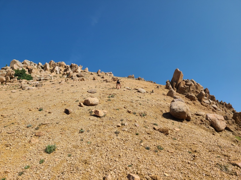
The ridge slowly bent towards the northwest and after much too much in the way of orange pebbles we came to some of the first semi-solid rock on the ridge. From here onward the difficulty of the ridge rose to Class 2+, mostly just a bunch of slabs consisting of barely held together granite bits. The scrambling wasn't that hard, nor that exposed, but every movement would send down a shower of pebbles and flakes, and a fall would undoubtedly be a short but painful cheese grater on the sharp granite. Still, it was a heck of a lot of fun because until yesterday we'd known nothing about this peak, and the absurdity of such a giant pile of whatever the hell this was was entertaining all on its own. 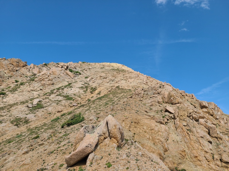
Right near the summit the rock quality improved slightly - less showering rock with all movement - and the terrain became a bit more complicated. This was the one place on the ridge where we deviated off the ridge crest, instead staying to climber's right to maximize the scrambling along the sea of slabs here. Going to the ridge crest would have just been a walk, which wouldn't have been as much fun. 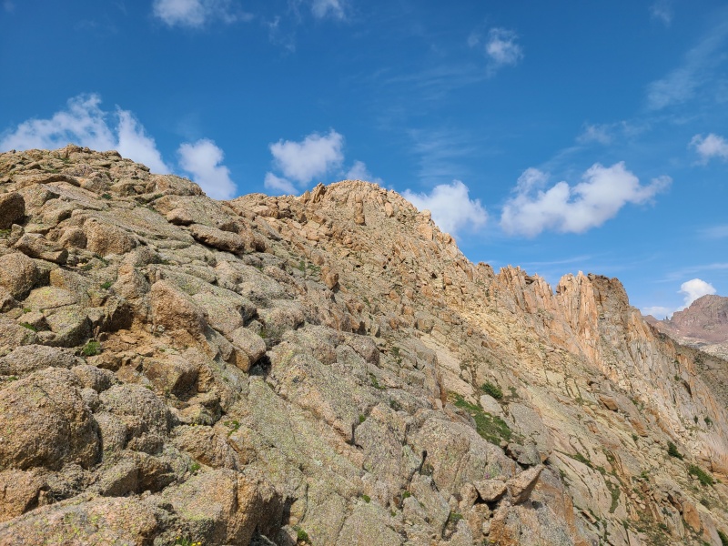
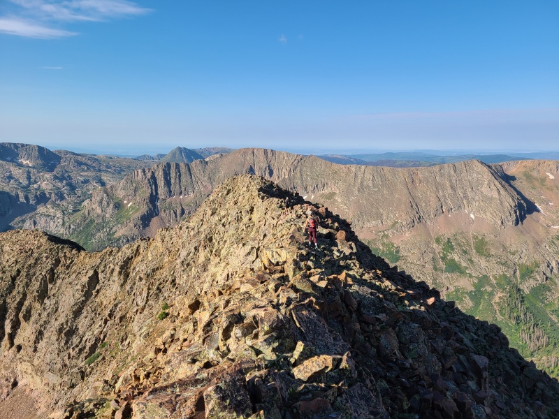
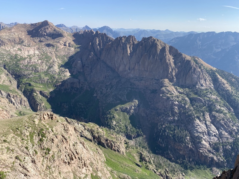
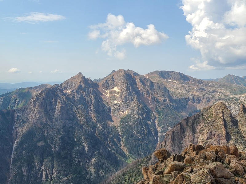
The very last moves to the summit were exhilarating. The views from Thunder A exploded in every direction. Undoubtedly this peak has some of the most phenomenal views in the Weminuche, and from a unique vantage that only a handful have ever experienced. (For the sake of comparison, when I published this report, Whiley and I were two of the seven ascents for Thunder A on 14ers.com.) From Endlich Mesa to Windom Peak to Rock Creek thirteeners to Vallecito Creek, the 360-degree panorama up there was jaw-dropping. 
We drank in our weekend and unfortunately had to head down long before we would have liked - clouds were beginning to build and this would be a bad place to be in a storm. The plus side of this peak being such a gigantic pile of scree, and so steep, is that we were able to bomb down the entire 3,600-plus foot descent in under an hour, and that wasn't even running. 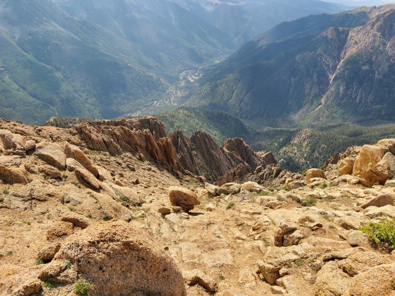

When we reached camp we didn't bother filtering more water, even though we were low. The clouds had become somewhat questionable for rain, and the cover had lowered temperatures. We quickly packed and began down the trail once again. It was less than one mile from our camp to Vallecito Creek, where the already good trail strengthened. 
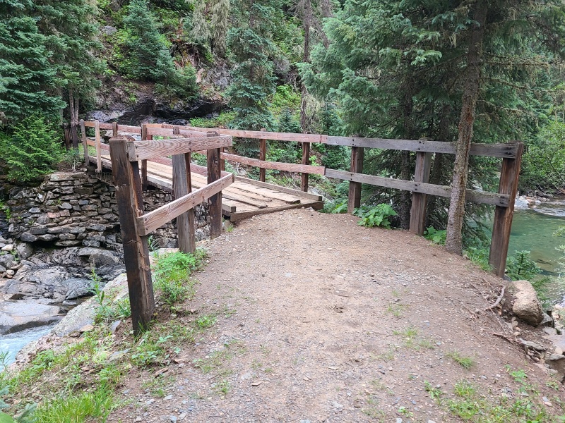
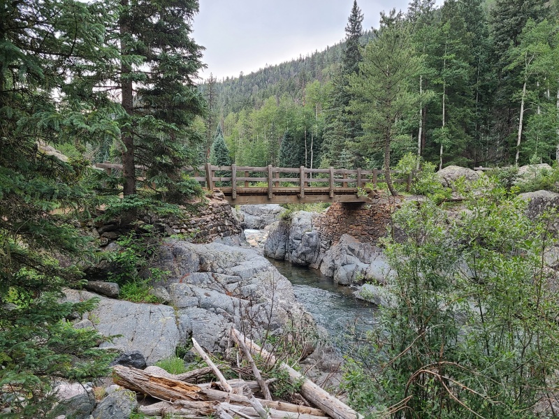
We now raced down the trail towards our waiting shuttle vehicles as it showered around us. We never got wet from the rain, but we did get wet at a creek crossing that was missing the bridge that formerly spanned it. Two further crossings still held bridges, which made it so much easier to navigate the creek. 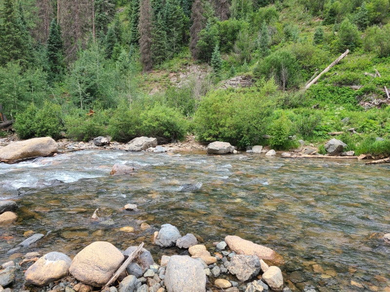

As we descended the drainage finally opened towards the reservoir. We walked through the campground at the trailhead, oblivious to the bustle of activity around us. We were in good spirits from yet another highly successful trip, and already dreaming of more. We changed out of our wet footwear, snacked, and drove back to Purgatory to pick up Luke's car. This trip was a bit strange for us, having spent so much time and effort bagging more unranked thirteeners than ranked, but we love them all, big and small, ranked and unranked, hikes and climbs, it matters not. Whiley and I especially like the mystery surrounding unranked peaks, so their abundance was just as welcome as their ranked cousins. Echo and Thunder were especially enjoyable and unique, and worth sharing with friends. I recommend them to all wanderers of the Weminuche. It's not every day one gets to hear the Echo of Thunder, but it's always an invigorating experience. Day 4 StatisticsClimbers: Ben Feinstein (myself), Whiley H., Luke G-W.
Splits:
Thumbnails for uploaded photos (click to open slideshow): ")
")
")
")
")
")
")
")
")
")
")
")
")
")
")
")
")
")
")
")
")
")
")
")
")
")
")
")
")
")
")
")
")
")
")
")
")
")
")
")
")
")
")
")
")
")
")
")
")
")
")
")
")
")
")
")
")
")
")
")
")
")
")
")
")
")
")
")
")
")
")
")
")
")
")
")
")
")
")
")
")
")
")
")
")
")
")
")
")
")
")
|
| Comments or Questions | |||||||||
|---|---|---|---|---|---|---|---|---|---|
|
Caution: The information contained in this report may not be accurate and should not be the only resource used in preparation for your climb. Failure to have the necessary experience, physical conditioning, supplies or equipment can result in injury or death. 14ers.com and the author(s) of this report provide no warranties, either express or implied, that the information provided is accurate or reliable. By using the information provided, you agree to indemnify and hold harmless 14ers.com and the report author(s) with respect to any claims and demands against them, including any attorney fees and expenses. Please read the 14ers.com Safety and Disclaimer pages for more information.
Please respect private property: 14ers.com supports the rights of private landowners to determine how and by whom their land will be used. In Colorado, it is your responsibility to determine if land is private and to obtain the appropriate permission before entering the property.


