| Report Type | Full |
| Peak(s) |
Sunlight Peak - 14,061 feet Windom Peak - 14,089 feet Mt. Eolus - 14,087 feet North Eolus - 14,042 feet |
| Date Posted | 08/01/2021 |
| Modified | 08/03/2021 |
| Date Climbed | 07/23/2021 |
| Author | JacerJack |
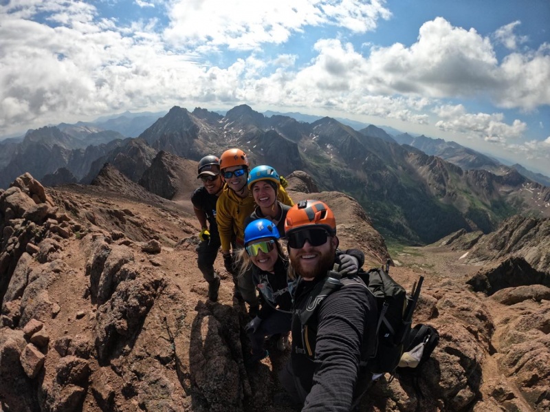
| The Chicago Basin Four |
|---|
|
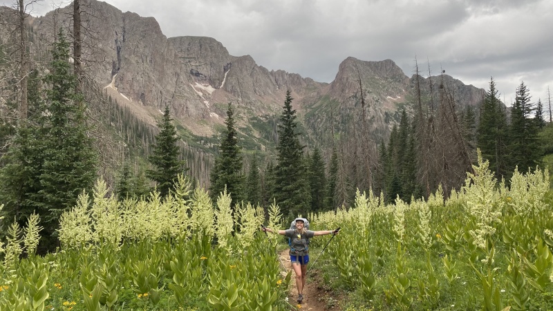
The Chicago Basin Four If you've done this trip before, you will likely not find any new information here (although I imagine it would be fun to relive the experience of this incredible basin through some fresh photos). In similar fashion to the great TR from 2017 by JQDivide, this report should help give some information to those who are wondering what to expect when tackling the Chicago Basin Four (Sunlight, Windom, Eolus, and North Eolus) via the Durango & Silverton Train. Our party consisted of me, my wife Taylor (aka tayjack), Chris (aka Stiffler_From_Denver), Shawn (aka Exiled Michigander - who finished several years ago on Eolus), Johan, and our two friends from Denver, Collin and Kendra. The plan was for Chris, Shawn, and Johan to add 20 miles by approaching a day earlier from Vallecito (check out Stiffler_From_Denver's TR on that approach here). Each group had a radio, and we were set to rendezvous at the top of the Basin, then we would climb together and they would take the train out with us (note that if you want to do it this way, you will still need to pay full price for round trip train tickets. As of July 2021, they do not offer one-way tickets from Needleton back to Durango). DAY 1: Train & Hike in Right off the bat, there are a couple things I wish I would have known prior to boarding the train in Durango:
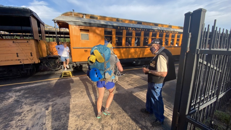

Despite starting our trip with a brisk jog with our heavy packs, we made the train (barely) and enjoyed an amazing 2.5 hour ride to the Needleton stop. The conductors and breakmen (and breakwomen, if that's a word?) wear old-timey garb that makes you feel like you've taken a step back in time. Choose the open air gondola if you have the option. It's a worthwhile experience and the enclosed cars were hot and cramped. 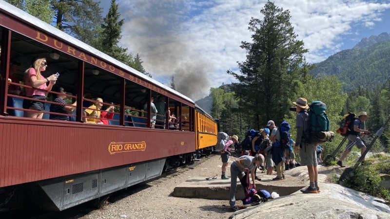
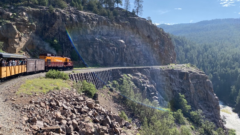
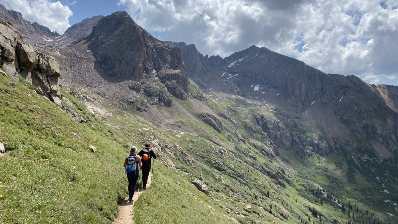
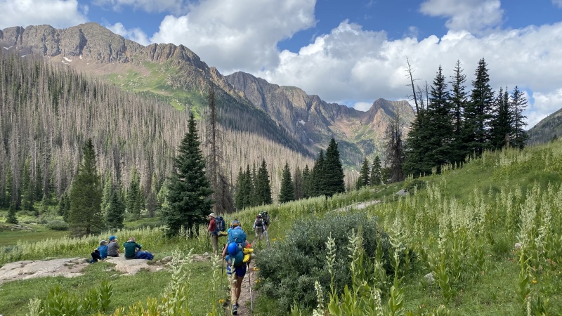
Once off the train at Needleton, we took about a half hour to tape our feet, eat a snack, and hike upstream a couple hundred yards to stash some beer for the return. It was a mad dash once hikers were off the train. There were about 40 of us in total, and it looked something like the Spanish running of the bulls as people jockeyed for position in hopes of securing a camp site in the Basin. We were the last group to start our hike up to the Basin, and perfectly content with it. The train dropped us off at 10:30 am and we started up toward the Basin right at 11. Plan on adding at least a half hour to the typical 3.5 hours to get to the Basin due to the massive amounts of recent deadfall about 3/4 of the way up. It's easy enough to pick your way through, but it was pretty slow going. About 2.5 hours in, we were deep into the deadfall, but we ended up making pretty good time to the Basin after about 4 hours (from Needleton) at a brisk pace with two brief stops. 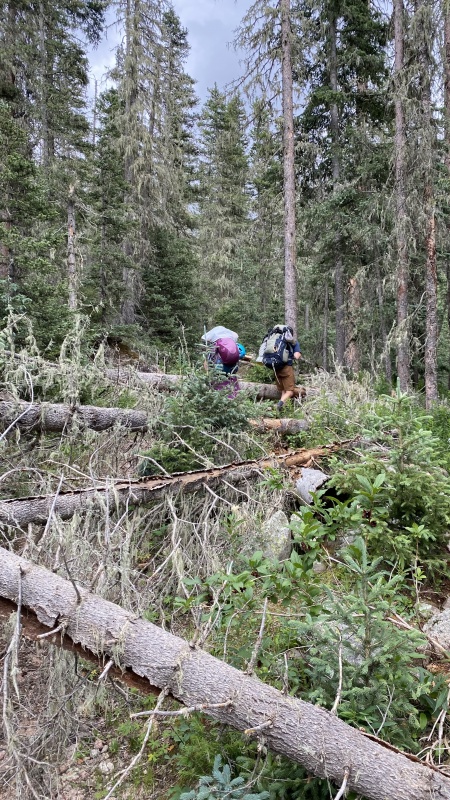
Chris and I had planned to be on our BCA radios at the top of each hour, starting at 2 pm (shamelessly stole the idea from the movie I am Legend). It worked like a charm and at 2:00 pm I heard a broken transmission and could recognize someone calling out my name. It was Chris, and he had made great time from Vallecito over Columbine pass and told me "get your ass up here, we have the best site in the whole Basin!" Sweet relief. He, Shawn, and Johan already had 20 miles on us, and they were relaxing in the highest allowable site in the Chicago Basin. After just over 7 miles from Needleton, we found ourselves in pole position for the next day. 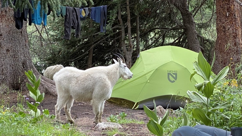
DAY 2: Sunlight & Windom The weather forecast for the period we were staying in the Basin was questionable at best... A strong monsoon surge with 100% chance of precipitation and flashflood warnings were among the many red flags we saw on the forecast. Two days before we left, our front range weatherman even called out "concentrated moisture over the San Juans." Yikes. 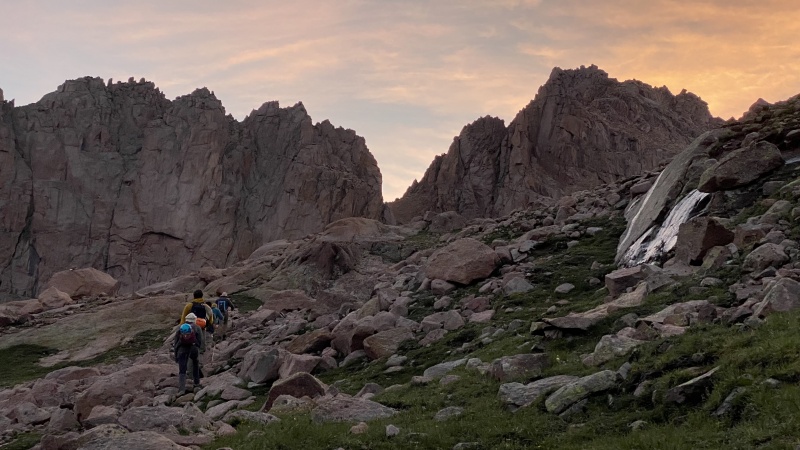

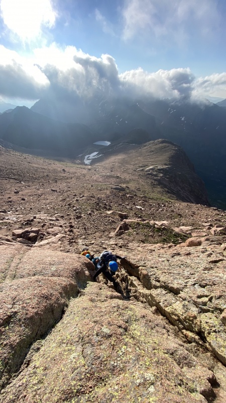
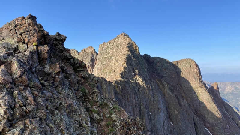
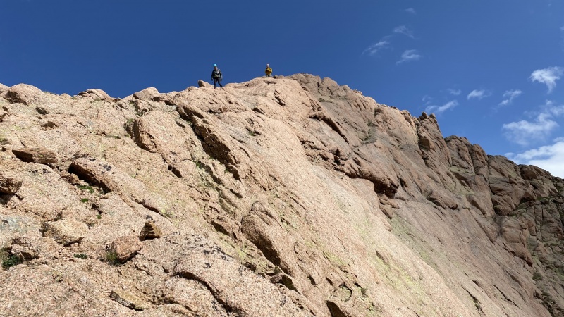
The first gulley up Sunlight is loose and rockfall is certainly a factor (especially after torrential rains the night prior). Helmets here are a good idea. Above the gulley, you are rewarded with some incredible climbing on excellent rock. It's solid class 3 with some easy class 4 "choose your own adventure" type moves, if you want. 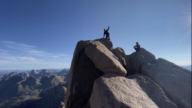
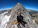
A note on the Sunlight Summit Block: From someone who is relatively middle of the road as far as exposure tolerance goes, I found the summit block to be a total rush. Its a relatively safe move on super solid rock, but the airiness on the true summit is unlike anything I've experienced on any of the other standard 14er routes (it's really hard to capture in a photo). However, I never felt in danger -- it was just fun (you don't want to overshoot the final move, though!). 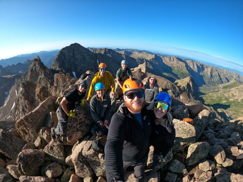
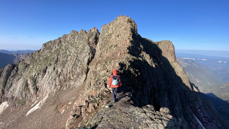
We descended and after about an hour, we were in the upper basin that separates Sunlight and Windom. There was no defined route here, but we used our intuition to stay high and follow a gash/ledge along some solid rock and met up with Windom's prominent West Ridge. There is some incredible geology along this route -- Taylor found a geode the size of a football, along with several smaller ones... all of which she left for others to enjoy; Please do the same if you are lucky enough to come across these :) 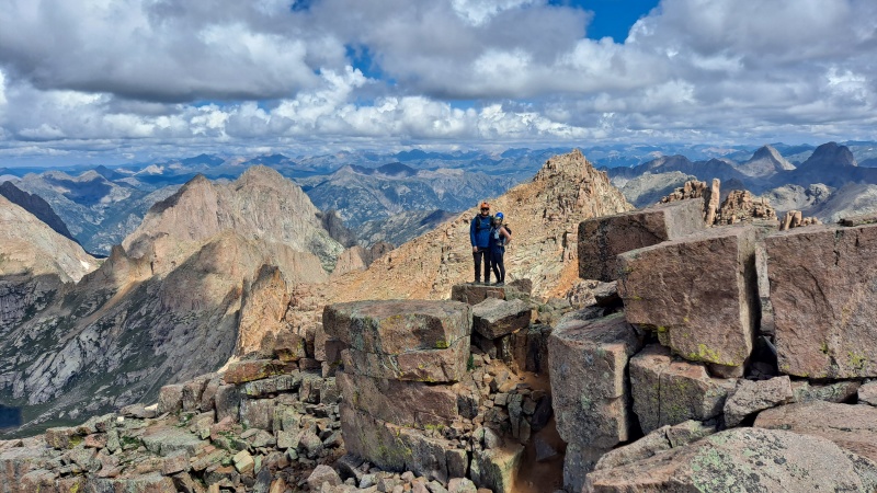
After about 2 hours from leaving Sunlight, we were standing on the summit of Windom at 10:15 am. Clouds were quickly building, so we took some photos and made haste getting down. Once we were back to Twin Lakes, on cue, the skies opened up with lightning and hail. We descended the last 1,500' to camp in what I call "the lightning jog." 
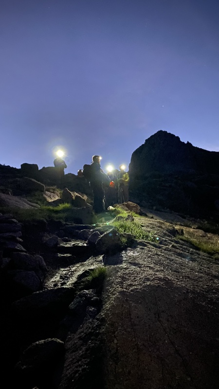
Day 3: Eolus and North Eolus After a few hours of restless sleep to the sound of heavy rain, I awoke to my alarm clock at 3 am and it was still raining buckets. It sounded like my tent was in the shower. If you spend much time outside in Colorado, you're probably well acquainted with the summer weather patterns, which includes an afternoon thunderstorm that rolls out by the time you go to bed... That was certainly not the case on this trip, and at 3:00 am on day 3, I found myself laying in my tent and absolutely disheartened by this fact. 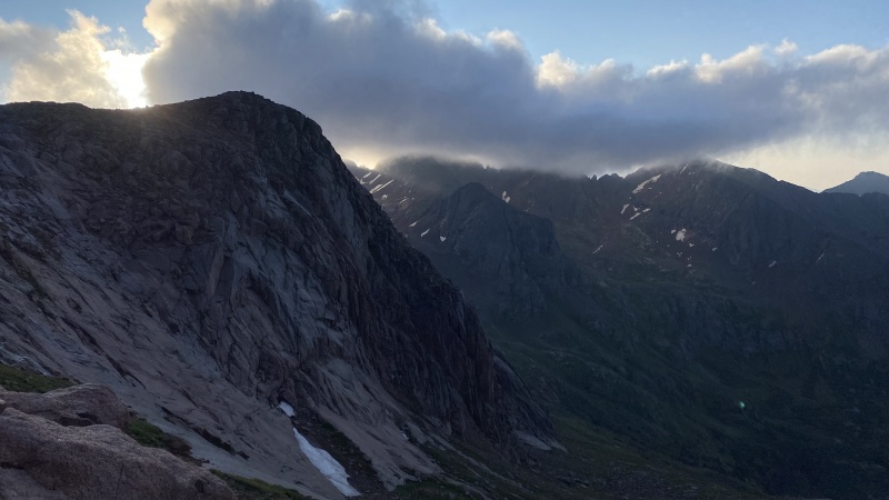
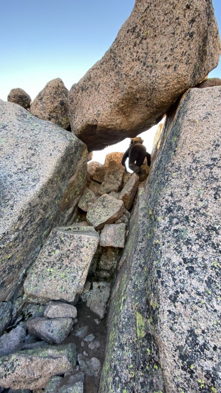
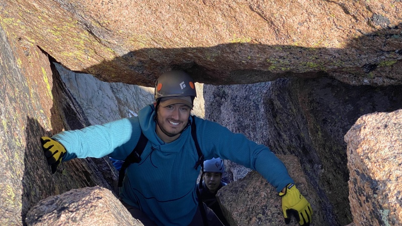
After filtering some water at Twin Lakes, we were up at the Eolus/N. Eolus saddle in a little over an hour from the lakes. There is a prominent crack leading directly up to the saddle -- the easiest way to gain the ridge is to skirt around the crack and climb the slabby rock to the right, but we wanted to add some flavor to the route and chose to climb the crack/chimney up to the saddle. 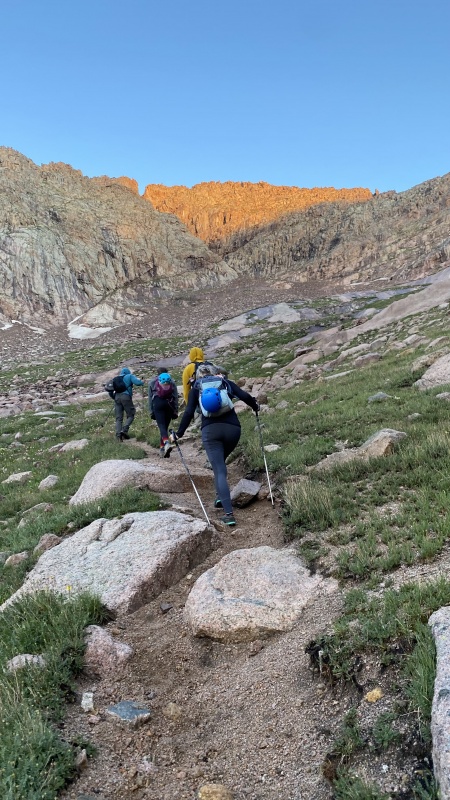
We were relieved to have a sky that was free of clouds (for now), but the evidence of yesterday's deluge was still lingering. All of the rocks were still damp and the dirt was saturated and therefore extremely greasy and slippery. The rocks on the North aspects of Eolus had a thin coating of ice on them, but the Southern face had melted in the sun. For this reason, the remainder of the route was a bit spicier than any of us were anticipating. All of the moves felt relatively secure, but with mud-caked boots on wet rock, it took much more deliberate and careful climbing. The rock ledges are stacked like terraces, which are separated by patches of downward sloping dirt and grass... Not a big deal when it's dry; pretty spooky when it's wet. We encountered several other groups who shared our feelings on the conditions of the route that day. 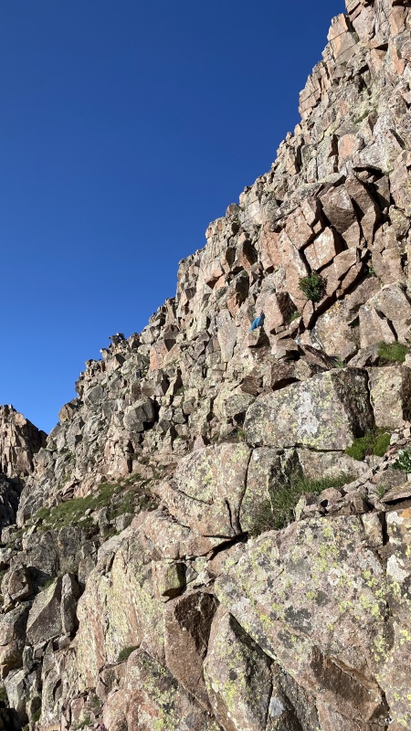
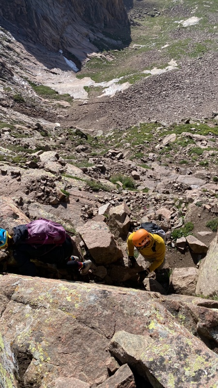
Apart from the less than ideal conditions due to the rain the day before, all of us really enjoyed the route. I would liken the upper part of Eolus to a shorter version of Pyramid and with better rock. It was fun to zig-zag up the ledges made from nature's Legos.
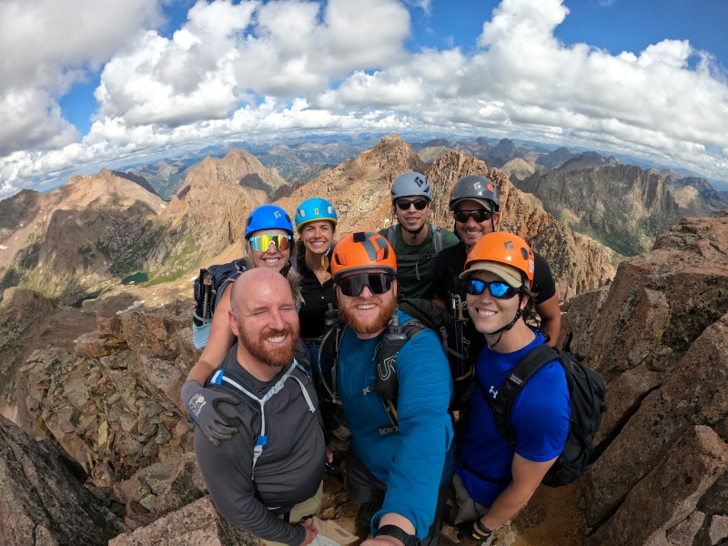
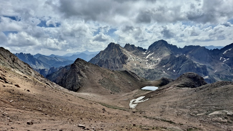
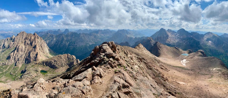
An hour of focused climbing past the saddle put us on the summit of Eolus by 8:30 am. This has to be one of my favorite views of any 14er summit... Not only can you look back to Sunlight and Windom to enjoy the fruits of your labor from the prior day, but the views of Jagged, Vestal, and the other rugged San Juan peaks are absolutely breathtaking. 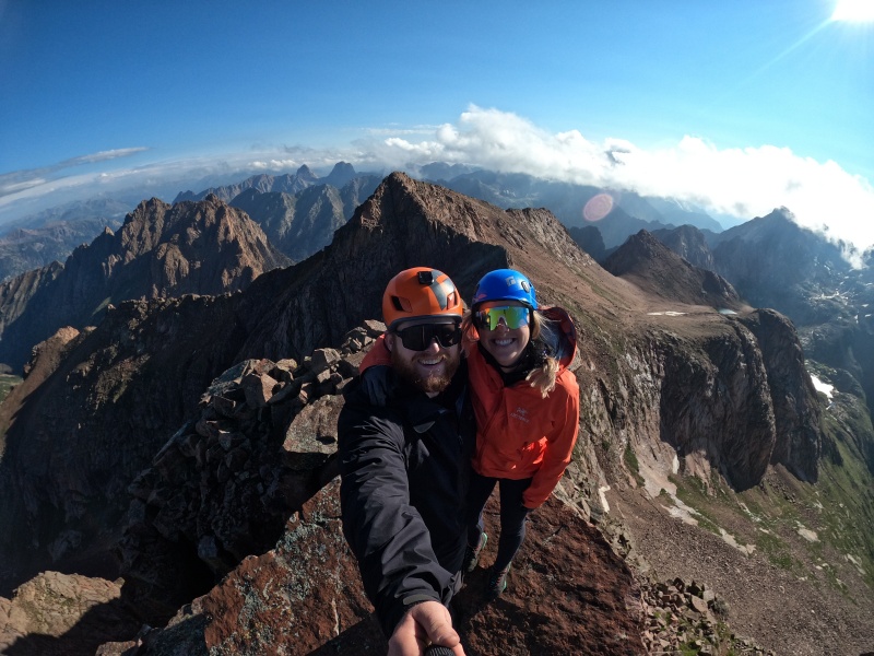
With good weather, we hung out on the summit for about 45 minutes while we waited for the light breeze to finish drying off the rock for our descent. 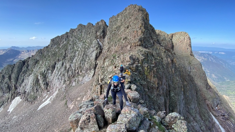
Once again, we returned to camp just in the nick of time. As soon as we sat down for lunch, the skies opened up and returned to their regularly scheduled programming for the rest of the day. With a sense of accomplishment and relief, we huddled together under our tarp and took turns sharing toasts with the small amount of whiskey and wine we had lugged up. I recall someone toasting "to our tarps"... I'll drink to that! DAY 4: Hike out & Margaritas on the train 
The Mystery of the Missing Beer and the Landslide that actually did happen... However, in the midst of trying to solve the mystery of our missing beer, we were informed that a large landslide had taken out a portion of the tracks and the train had not run for over a day! (one person said two days). The crews had been working until 2 am the morning of our pickup to get the train back up and running... Other groups planning on returning before were not so lucky (apparently several hiked out via Purgatory, and several other groups were rescued one by one on diesel hand carts). I would like to think our missing beer found a home with some thirsty and desperate hikers who were left stranded by the landslide. It made me feel better to imagine that our beer might not have gone in vain; instead, it may have brought bit of joy to an otherwise hopeless group of stranded hikers. I'll stick with that story in my mind. The RAT Test 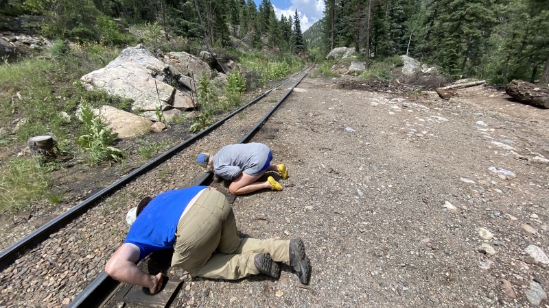
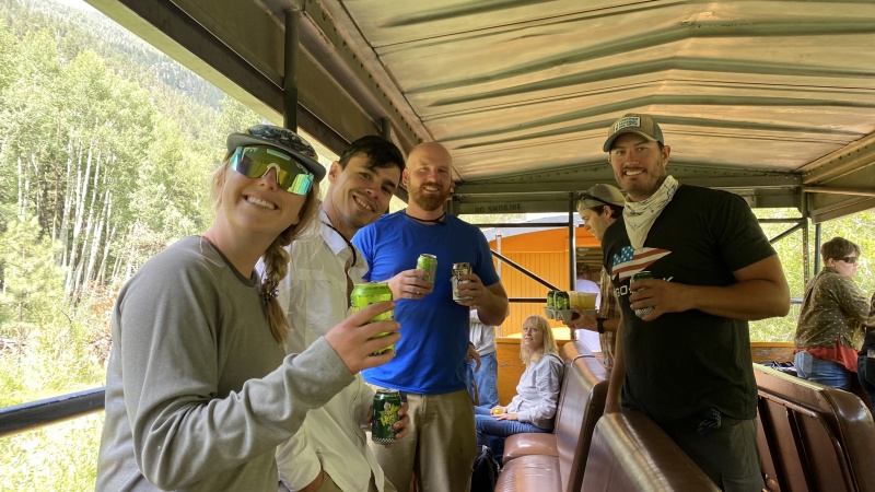
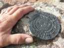
After taking our RAT Tests and coming to terms with the fact that our beer stash was gone for good, it was time to board the train back to Durango. Beers on the train are $5 each (tax included) so plan your cash accordingly. Garmin Stats (trip totals): Thumbnails for uploaded photos (click to open slideshow): ")
")
")
")
")
")
")
")
")
")
")
")
")
")
")
")
")
")
")
")
")
")
")
")
")
")
")
")
")
")
")
")
")
")
")
")
")
")
")
|
| Comments or Questions | |||||||||||||||
|---|---|---|---|---|---|---|---|---|---|---|---|---|---|---|---|
|
Caution: The information contained in this report may not be accurate and should not be the only resource used in preparation for your climb. Failure to have the necessary experience, physical conditioning, supplies or equipment can result in injury or death. 14ers.com and the author(s) of this report provide no warranties, either express or implied, that the information provided is accurate or reliable. By using the information provided, you agree to indemnify and hold harmless 14ers.com and the report author(s) with respect to any claims and demands against them, including any attorney fees and expenses. Please read the 14ers.com Safety and Disclaimer pages for more information.
Please respect private property: 14ers.com supports the rights of private landowners to determine how and by whom their land will be used. In Colorado, it is your responsibility to determine if land is private and to obtain the appropriate permission before entering the property.