
Log In 
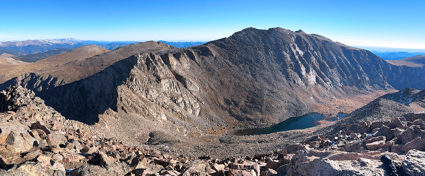
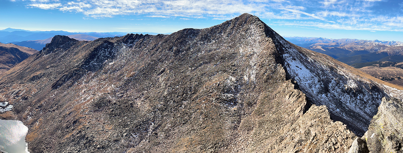
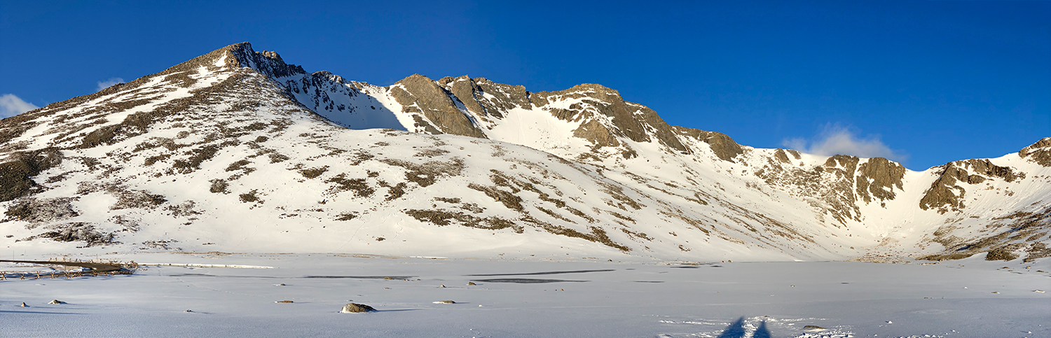
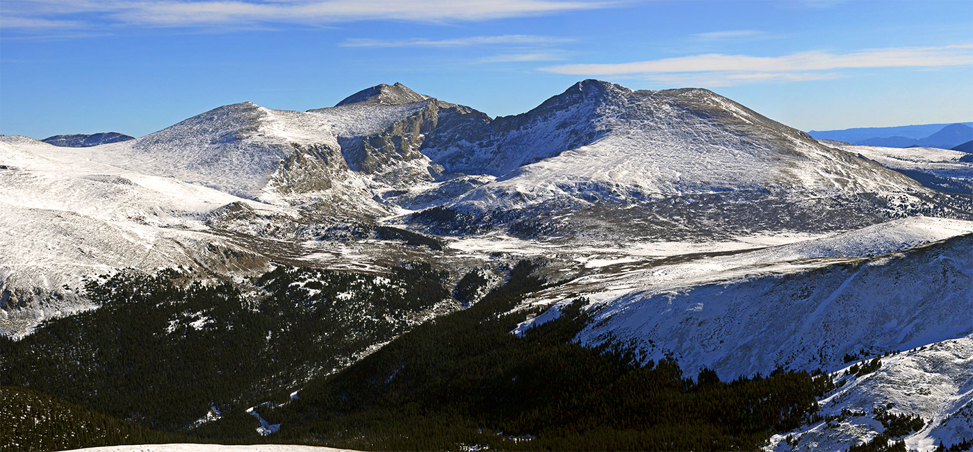
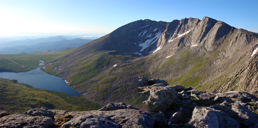
Mount Blue Sky is the highest peak in the Mount Evans Wilderness in the Front Range. In March 2022, Clear Creek County approved a proposal to rename Mount Evans to Mount Blue Sky and in September 2023, the new name was officially adopted.
Elevation 14,268' (LiDAR)
Prev Elevation 14,264'
CO 14er Rank 14 of 53
Range Front
Forests Arapaho / Pike
County Clear Creek
Towns Denver, Idaho Springs, Georgetown, Evergreen
Mt. Blue Sky

Other 14ers in Group

Peak Mount Bierstadt

Photos

360 Pano
360° Summit Pano
pic1
pic2
pic3
pic4
pic5
pic6
pic7
pic8
pic9 pic10 pic11
pic12
pic13 pic14
pic15

Climbing Routes

route
Mt. Bierstadt - West Slopes Standard Route
Difficulty: Class 2
Total Elevation Gain: 2,850'
Round-trip Distance: 7.25 mi
Exposure: Low
Rockfall Potential: Moderate
Route-Finding: Low
Commitment: Low
route
Mt. Blue Sky - West Ridge from Summit Lake Standard Route
Difficulty: Class 2
Total Elevation Gain: 2,000'
Round-trip Distance: 5.5 mi
Exposure: Moderate
Rockfall Potential: Moderate
Route-Finding: Moderate
Commitment: Moderate
route
Combo: Bierstadt, Sawtooth, Blue Sky Standard Route
Difficulty: Class 3
Total Elevation Gain: 3,900'
Round-trip Distance: 10.5 mi
Exposure: Considerable
Rockfall Potential: Considerable
Route-Finding: Considerable
Commitment: High
route
Mt. Blue Sky - West Ridge from Echo Lake
Difficulty: Class 2
Total Elevation Gain: 5,600'
Round-trip Distance: 17 mi
Exposure: Moderate
Rockfall Potential: Moderate
Route-Finding: Moderate
Commitment: Considerable
route
Mt. Bierstadt - East Ridge
Difficulty: Class 3
Total Elevation Gain: 3,000'
Round-trip Distance: 5 mi
Exposure: Considerable
Rockfall Potential: Considerable
Route-Finding: Considerable
Commitment: Considerable
route
Mt. Blue Sky - West Ridge from Guanella Pass
Difficulty: Class 2
Total Elevation Gain: 3,100'
Round-trip Distance: 9.25 mi
Exposure: Moderate
Rockfall Potential: Considerable
Route-Finding: Considerable
Commitment: Considerable
route
Combo: Tour de Abyss Loop
Difficulty: Class 3
Total Elevation Gain: 3,000'
Round-trip Distance: 5.75 mi
Exposure: Considerable
Rockfall Potential: Considerable
Route-Finding: Considerable
Commitment: High
route
Mt. Bierstadt - South Ridge
Difficulty: Class 2
Total Elevation Gain: 4,500'
Round-trip Distance: 14.25 mi
Exposure: Moderate
Rockfall Potential: Moderate
Route-Finding: Considerable
Commitment: Moderate
route  _
Mt. Blue Sky - North Face Moderate
Difficulty: Class 3  Moderate Snow
Total Elevation Gain: 1,500'
Round-trip Distance: 2 mi
Exposure: Considerable
Rockfall Potential: Considerable
Route-Finding: Low
Commitment: Moderate
route  _
Mt. Blue Sky - West Gully
Difficulty: Class 3  Steep Snow
Total Elevation Gain: 1,650'
Round-trip Distance: 5.25 mi
Exposure: High
Rockfall Potential: Considerable
Route-Finding: Moderate
Commitment: Moderate
route  _
Mt. Blue Sky - North Face Steep
Difficulty: Class 3  Steep Snow
Total Elevation Gain: 1,500'
Round-trip Distance: 2 mi
Exposure: High
Rockfall Potential: Considerable
Route-Finding: Moderate
Commitment: Moderate

Map

Human Verification Required

Trip Reports

  8 Recent Reports Peaks Climbed Added
  Tour de Abyss Bliss
By: DC703
Added: 7/17/2026
Mt. Blue Sky
Mt. Bierstadt
7/16/2026 7/17/2026 6  11
  A Windy Evans Egis
By: Beda681
Added: 6/28/2026
Rogers Peak
Mt. Warren
Mt. Blue Sky
"Epaulie"
Epaulet Mountain
Rosalie Peak
Mt. Bierstadt
Mt. Spalding
Gray Wolf Mountain
The Sawtooth
6/27/2026 6/28/2026 7  10
  Tour de Abyss: there has to be a better way
By: pthomps17
Added: 6/20/2026
Mt. Bierstadt
Mt. Blue Sky
6/19/2026 6/20/2026 2  9
  Bierstadt (No Willows!) Alt Route Cut-through Google Map Included GPX file available for download
By: JJEII
Added: 6/19/2026
Mt. Bierstadt
Mt. Blue Sky
6/18/2026 6/19/2026 3  4
  Blue Sky - West Ridge
By: kakrine10
Peak(s): Mt. Blue Sky
Added: 6/3/2026
Mt. Blue Sky 6/1/2026 6/3/2026 2  5
  Bierstadt - Sawtooth - Evans/Blue Sky - 5/22/26 - Spring Snow Conditions
By: nico792
Added: 5/23/2026
Mt. Blue Sky
Mt. Bierstadt
5/22/2026 5/23/2026 6  5
  Mt. Blue Sky - South Gully Google Map Included GPX file available for download
By: Ryan1979
Peak(s): Mt. Blue Sky
Added: 1/31/2026
Mt. Blue Sky 1/28/2026 1/31/2026 3  11
  Project Blue Skyline Google Map Included GPX file available for download
By: justiner
Peak(s): Mt. Blue Sky
Added: 1/11/2026
Mt. Blue Sky 4/25/2025 1/11/2026 9  2
View All 379 Trip Reports

Frequently Asked Questions about Mt. Blue Sky

I don't want to hike up Mount Blue Sky, can I drive to the summit?

Almost! Mount Blue Sky is home to the highest paved road in North America. You can drive the Mount Blue Sky Scenic Byway (Highway 5) up to the upper parking lot at 14,130 feet, leaving just a short, 100+ foot walk up an established trail to reach the true summit. However, vehicle access is seasonal (typically Memorial Day through early October) and requires booking a timed-entry reservation ahead of time through Recreation.gov.

How do I climb both Mount Blue Sky and Mount Bierstadt as a combination hike?

The Sawtooth Ridge is a notorious Class 3 scramble that connects Mount Blue Sky to neighboring Mount Bierstadt. Many endurance hikers park at Guanella Pass, climb Bierstadt first, and then cross the jagged, exposed ridge of the Sawtooth to bag Blue Sky on the same day. Crossing the Sawtooth requires using hands and feet on Class 3 terrain, making a climbing helmet and route-finding skills essential for a safe traversal. While not an overly difficult route, this traverse requires a lot of time and should only be done if you have some basic Class 3 scrambling skills. Don't be fooled by anyone who might tell you it's and easy hike. It's not. And you won't find a trail on the traverse across to The Sawtooth, just plenty of tedious work getting across this rocky ridge.

Are the mountain goats on Mount Blue Sky dangerous to hikers?

Because hundreds of vehicles drive to the top every day, the local populations of mountain goats and bighorn sheep have become dangerously habituated to humans. They will fearlessly approach vehicles, campsites, and hikers to lick salt from sweat-stained backpacks, car tires, and trekking poles. To prevent dangerous encounters or wildlife conflicts, you must keep a distance of at least 50 feet, never offer them food, and secure all personal gear. It's also important to know that dogs can chase wildlife. Dogs are allowed on Mount Bierstadt, but they are strictly required to be kept on a physical hand-held leash at all times. DO NOT even think about bringing your dog on the Sawtooth traverse route between Bierstadt and Blue Sky. :)

What is the name history of Mount Blue Sky and why was it renamed?

Originally named "Mount Rosalie" in 1863 by painter Albert Bierstadt, the mountain was officially renamed Mount Evans in 1895 to honor Colorado's second territorial governor, John Evans. However, because Governor Evans's executive orders directly led to the horrific Sand Creek Massacre of 1864—where U.S. cavalry slaughtered over 150 peaceful Cheyenne and Arapaho people—the federal government stripped his name from the peak in September 2023. The new name, Mount Blue Sky, was chosen by tribal leaders to honor the Arapaho (known as the "Blue Sky People") and the sacred Cheyenne Blue Sky renewal ceremony.

Additional Mt. Blue Sky History

Name History 3
Climbing History 0
Mining 0
Geology 1
More Information 0
  View All