This is the best ski route on Blue Sky's north face. Crampons are very helpful between 13,400' and the top of the snow below the summit ridge.
1 shows most of the route seen from the parking area near Summit Lake. In the photo you can see that you must ascend a bench that rises up in the east end of the Summit Lake bowl.
Walk out onto the Mt. Blue Sky road, turn right, and follow the road. After a short distance, the road crosses the east drainage of Summit Lake. Leave the road on the right side and walk across grass and rocks until you reach the base of the slope. Your immediate goal is to ascend the slope up to the small bowl below the north face. Climb 470' of elevation and 1/3 mile up to the top of this slope at 13,300'. You now have an unobstructed view of the north face. The summit is up to your left, but this route climbs the snow in the easiest portion of the north face.
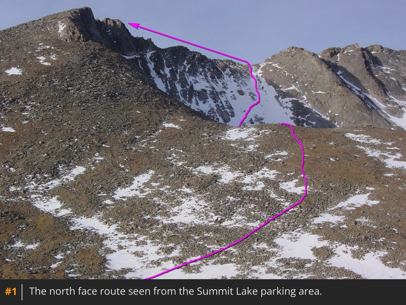
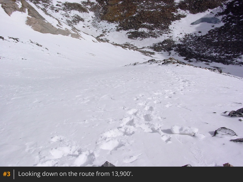
2 shows the view from here.
Take your time and pick your line up through the snow. I found it easiest (and safest) to start on the left side, and cross into the rocks near the center and then follow the rocks up through the center of the snow. Descend into the small bowl, pass the tiny lake, and begin your ascent up across boulders toward the left side of the snow field. From the tiny lake, you must climb approximately 780' of elevation to reach the summit ridge. Carefully climb up the snow as you aim for the top of the snow the ends below the lowest part of the ridge above. As you near 13,900', the snow field starts to narrow below the lowest portion of the ridge above -
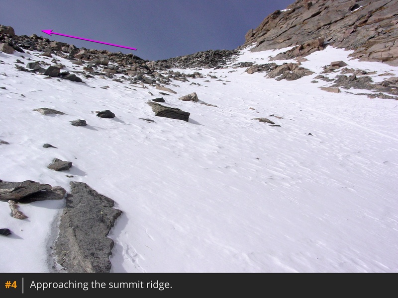
4. Climb straight up to reach the top of the snow between 13,900' and the ridge (above 14,100').
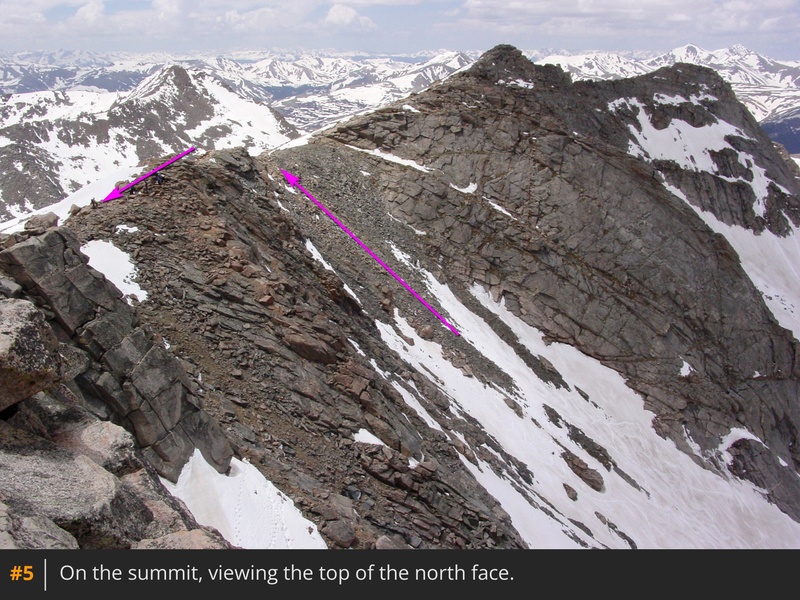
Turn left and hike 0.13 miles along the summit ridge to reach the summit.
5 looks back along the ridge. If you're hiking, descend back to Summit Lake via the West Ridge, over 13er Mt. Spalding.


 GPX Track File
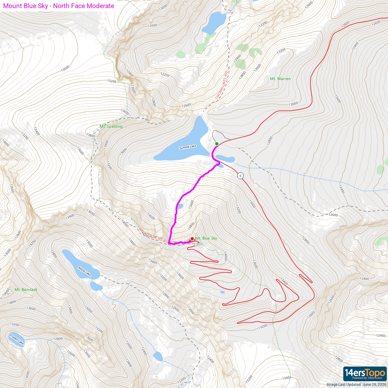


