Download Agreement, Release, and Acknowledgement of Risk:
You (the person requesting this file download) fully understand mountain climbing ("Activity") involves risks and dangers of serious bodily injury, including permanent disability, paralysis, and death ("Risks") and you fully accept and assume all such risks and all responsibility for losses, costs, and damages you incur as a result of your participation in this Activity.
You acknowledge that information in the file you have chosen to download may not be accurate and may contain errors. You agree to assume all risks when using this information and agree to release and discharge 14ers.com, 14ers Inc. and the author(s) of such information (collectively, the "Released Parties").
You hereby discharge the Released Parties from all damages, actions, claims and liabilities of any nature, specifically including, but not limited to, damages, actions, claims and liabilities arising from or related to the negligence of the Released Parties. You further agree to indemnify, hold harmless and defend 14ers.com, 14ers Inc. and each of the other Released Parties from and against any loss, damage, liability and expense, including costs and attorney fees, incurred by 14ers.com, 14ers Inc. or any of the other Released Parties as a result of you using information provided on the 14ers.com or 14ers Inc. websites.
You have read this agreement, fully understand its terms and intend it to be a complete and unconditional release of all liability to the greatest extent allowed by law and agree that if any portion of this agreement is held to be invalid the balance, notwithstanding, shall continue in full force and effect.
By clicking "OK" you agree to these terms. If you DO NOT agree, click "Cancel"...
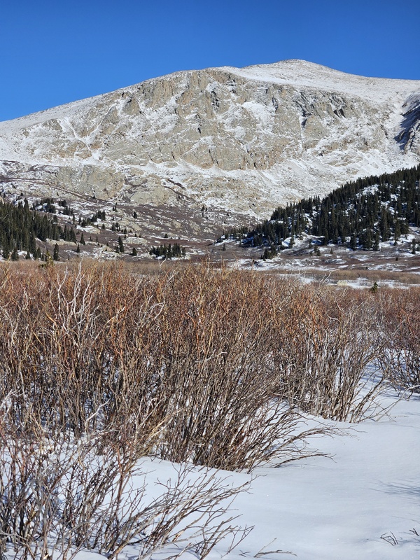
I started at 4:45am from the winter closure parking lot. The first mile is just hiking up the road and there are three switchbacks. On the third switchback you'll want to keep going straight/north. After you leave the road there is usually a trench for the next half mile because people use this as a shortcut to hike Mt Bierstadt. After this you'll pass to the left of a large pond which opens into a basin of flat terrain with patches of willows. I choose to navigate this by staying off the hills and mostly stuck to the flat ground. This might add mileage but you avoid lots of bushwacking through willows. Continue directionally toward the West Gully which is in picture 2.
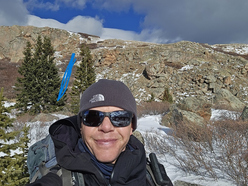
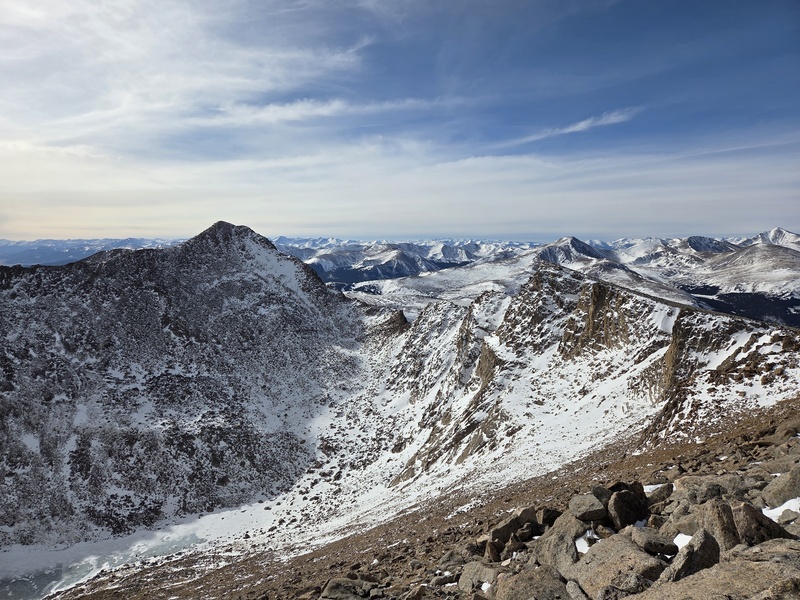
The south gully is on the upper left side of this picture. To reach this gully you want to aim toward the left side of the picture near the trees.
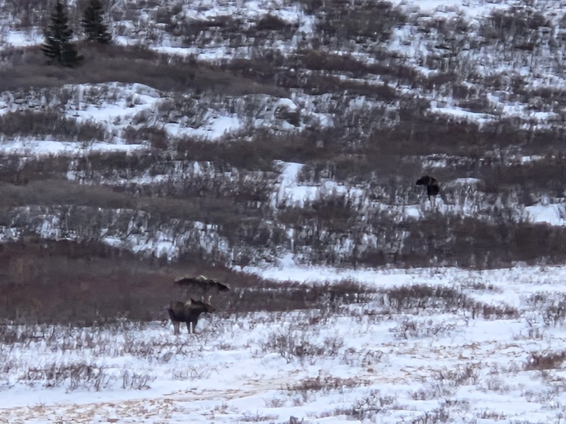
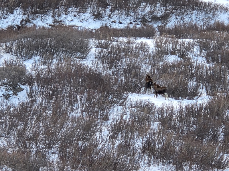
Once you get near the base of the South Gully the willows become very thick and there are several small ponds. Navigate through this using the south side of the basin. The best option is to avoid this area and go south up onto the hillside. Two reasons: 1. Less bushwacking 2. This is highly active moose area and if you get on the hillside you'll avoid running into a moose in the willows. The high ground also gives you increased visibility to any moose in the area. I saw six moose on this trip, including a cow and calf.
Caption HereCaption Here
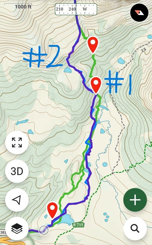
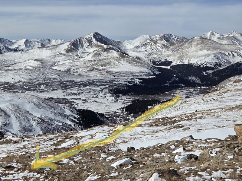
There is a camp at the waypoint marked #1 in the picture below. I found this to be a good spot to rest, eat, and hydrate. From the camp you'll want to avoid going directly up the gully from here. The snow collects and is deep, there are also a lot of willows. As you can see from the picture below I took the gully directly on a previous attempt and it was miserable/time consuming. I found the easiest way up and down is to aim for the pond from the camp. You'll have to bushwack a little while making your way up a hill from the camp through the trees and willows. You end gaining a hill and can see the terrain in front of you.
Caption Here
The next picture was taken near the middle of point #1 and #2. The cliffs ahead look intimidating but there is a safe passage through the willows where the line is drawn on the picture. Once at the top of the cliffs you can head west and meet up with the gully.
Caption Here
I stayed to the left/east part of the gully on easy ground. Further up the gully there are easy ways to cross. You shouldn't have to work hard to pass over the gully.
Caption Here
At this point you can see Gray Wolf Mtn on your left and the summit ridge to Spalding on your right. Find an easy gully crossing and pick an easy line up the hillside to the ridge to Spalding. From the top of the ridge, you could summit Spalding and continue over to Mt Blue Sky. I had already climbed Spalding and choose to continue west toward the West Ridge of Mt Blue Sky. Aim for the point in the picture below. Any of the Mt Blue Sky West Ridge route descriptions will work once you get to the point.
Aim for the point in the background.Now at the point in the previous picture
At this point you are only about .75 away from the summit. For me, this took about 1.5 hours due to route finding.
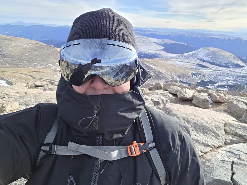
Looking back at Mt Bierstadt and the SawtoothSummit Picture
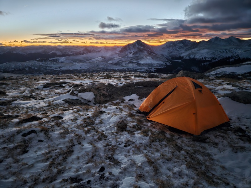
I made it back to my tent around 5:00pm. Nice sunset!
Full disclosure this trip took me three tries to reach the summit of Mt Blue Sky. I learned a lot along the way and wanted to share some tips to help my fellow hikers to be successful in less attempts.
Distance = 15 miles rt from Guanella Pass Campground /Winter Closure ; Elevation gain = 4,500 ft
The gpx is my successful attempt one way. I planned to camp on the Mt Spalding ridge so I was carrying a fully loaded backpacking pack that weighed 45lbs. I camped because I tried a day trip prior, hiked for 12 hours, and only made it to the Spalding ridge. I figured I could hike for about 6 hours to the Spalding ridge which is about 5 miles and set up a camp there. The elevation for my camp spot was about 13,000 feet.
Hope this helps! Happy Trails!!
My GPS Tracks on Google Maps (made from a .GPX file upload):
I took this route as well when I did Blue Sky in winter instead of going up the Sawtooth descent gully. This had a lot more manageable snow and less willow whacking. I wonder if in this case a normal snow year would have helped speed up travel through the willows, the snow was over the willows and most boulders then and I didn't posthole through too much
the_hare I think the bushwacking was offset by the easy terrain. Most of the route was 2in of snow or less and I made good time. It would have been slower for me if I had to snowshoe. I avoided a lot of willows with the experience I gained on the first two attempts. I see your point though, I could have taken more direct lines in deeper snow.
I think I'm just a slow hiker, lol. I've lost a step as I get older. I started hiking in my early thirties and ten years later, my miles are just slower. Maybe I could train a bit harder too.
Caution: The information contained in this report may not be accurate and should not be the only resource used in preparation for your climb. Failure to have the necessary experience, physical conditioning, supplies or equipment can result in injury or death. 14ers.com and the author(s) of this report provide no warranties, either express or implied, that the information provided is accurate or reliable. By using the information provided, you agree to indemnify and hold harmless 14ers.com and the report author(s) with respect to any claims and demands against them, including any attorney fees and expenses. Please read the 14ers.com Safety and Disclaimer pages for more information.
Please respect private property: 14ers.com supports the rights of private landowners to determine how and by whom their land will be used. In Colorado, it is your responsibility to determine if land is private and to obtain the appropriate permission before entering the property.
")
")
")
")
")
")
")
")
")
 Summit Picture")
")


