Taken from west of Guanella Pass,
1 shows the route. Locate the well-defined Mt. Bierstadt trail and begin descending east toward Scott Gomer Creek. Weave through willows for nearly a mile to reach the creek, near 11,500' -
2. After crossing the creek, pass a large boulder on the left and reach a small clearing
at 11,500'. In the clearing, locate a faint trail and follow it away from the Bierstadt trail and into the willows -
3 and
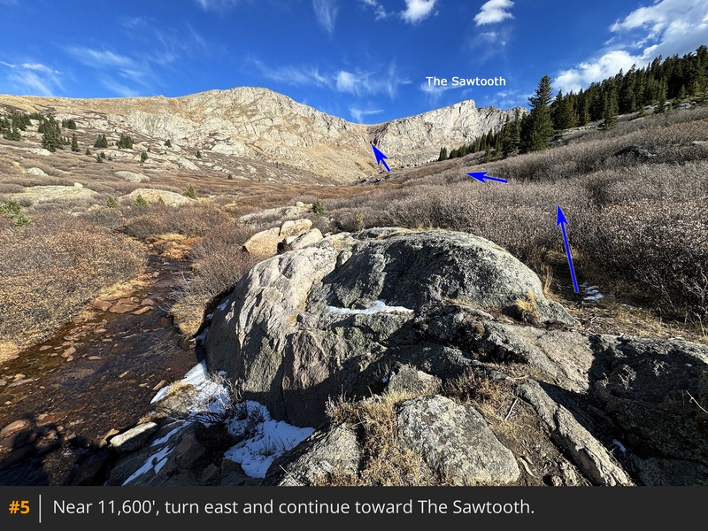
4. Try to stay on the trail as it heads east and northeast along the creek. This can be a bit difficult because the area is usually wet or even swamped. Near 11,600', the trail reaches the creek near a boulder -
5. Turn right and continue through the willows. At you approach the upper end of the creek you'll see a gully to the east -
6. It's nicknamed "Gomer's" gully and provides a fairly easy way to reach Mt. Blue Sky.
Near 11,700', cross a large clearing and follow the trail up through ledges on the right side of the gully -
7 and
8. Near 12,300', enter the gully
and continue up the left side -
9. Climb approximately 600 feet by staying mostly on the left or near the center -
10. Above 13,100', the top of the gully widens and the trail exits on its left side -
11. Continue higher as the pitch eases and your view opens up -
12. Next, you need to locate Blue Sky's west ridge. 13er Mt. Spalding is up to your left and The Sawtooth is up to your right but both are difficult to identify from this vantage. Continue higher until you can see the bump at the west end of the ridge (
13 and
14) and walk directly toward it.
At 13,700' and the start of the ridge
, drop right slightly, and follow a cairned route below the ridge crest -
15. The remaining mile to the summit consists mostly of boulders but you'll find plenty of cairns and trail segments. As you approach the summit area, the terrain gets a bit easier -
16. Just below the summit, intersect the tourist trail that comes up from the summit parking area and walk to the top -
17,
18 and
19. Return via the same route, descend the gully and walk out along the same side of the creek -
20 and
21.


 GPX Track File


