This long, scenic route is a good substitute to the well-traveled, standard route from Guanella Pass. However, the upper route does not have a trail and requires some bushwhacking.
From the center of the Abyss TH parking lot, start up the well-defined Abyss Lake (#602) trail -
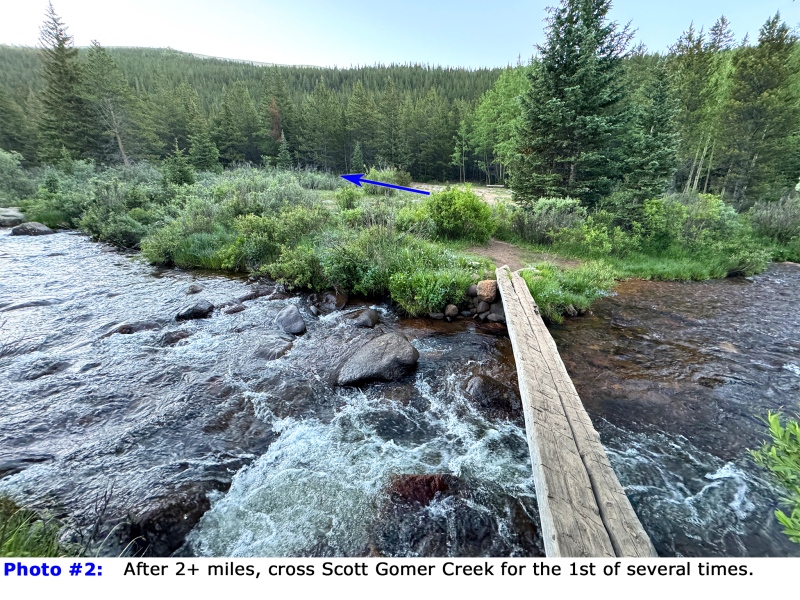
1. Enter the Mount Evans Wilderness begin your long walk to the northeast. After 2.25 miles, cross Scott Gomer Creek on a good log bridge -
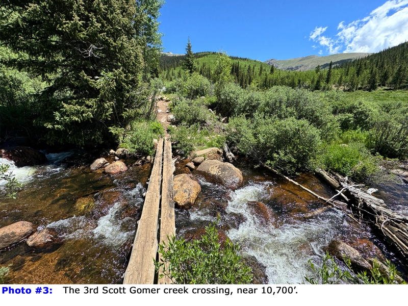
2. Cross it again at ~3.25 miles, and yet again before 4 miles in -
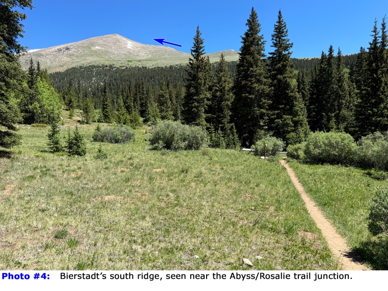
3. A short distance later, the view opens up and you can see Bierstadt's south ridge -
4. Pass the Abyss/Rosalie (#603) trail junction at 10,875', continue east, and pass and 2nd Abyss/Rosalie junction -
5 and
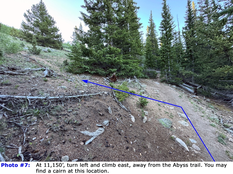
6. Switchback up a hill and when you reach 11,150', with a clearing up to your left, stop -
7. To reach the south ridge, you need to leave the Abyss trail, and this is the best location for the turn
.
You may or may not find a cairn in this location and there's no trail above this point. Turn left, leave the Abyss trail and ascend the right side of a steep clearing -
8. As you climb higher, stay right until you reach the edge of the east ridge -
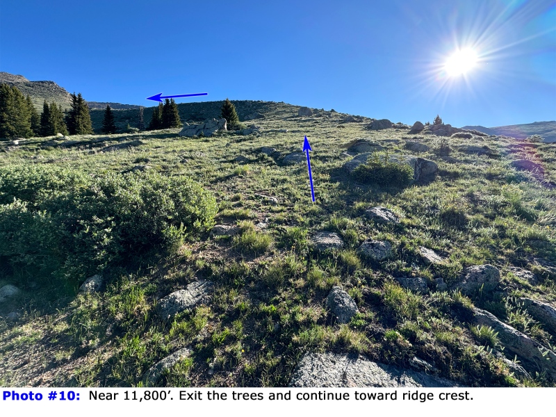
9. Continue northeast along the edge of the ridge to avoid the large amount of deadfall off to your left. Near 11,800', exit the trees and hike toward the ridge crest as it continues north -
10. As you gain the ridge, much of the upper route comes into view -
11 and
12.
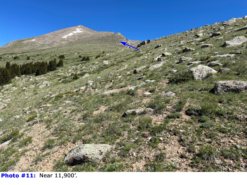
Now above 12,000', continue along the ridge and make your own line up the next ridge point -
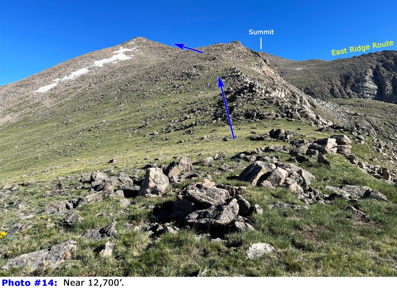
13. Near 12,700', the route becomes a bit more clear when you get a peak at the summit -
14. Ascend another point -
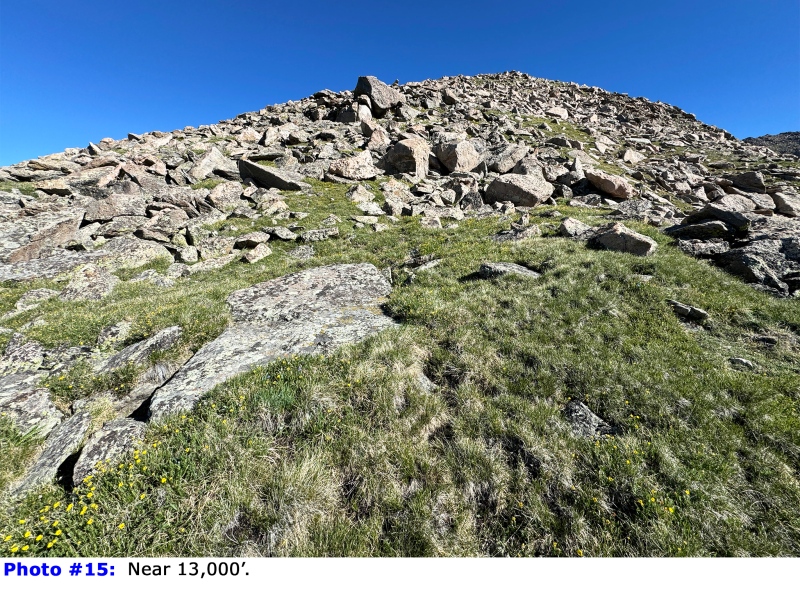
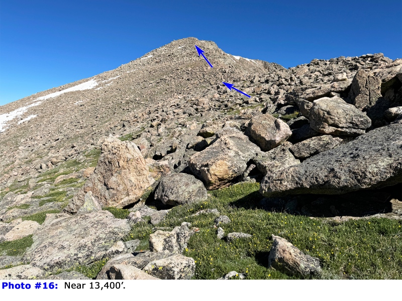
15. Near 13,400', you can finally see the top of the south ridge -
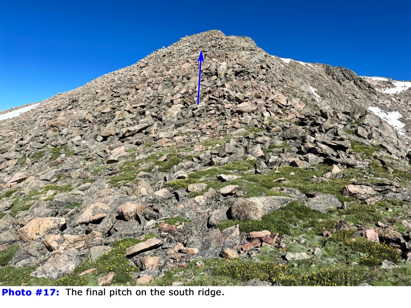
16 and
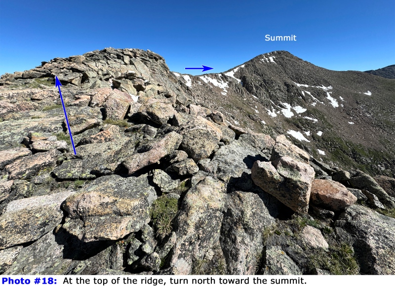
17. Ascend more talus to reach the top of the ridge, where you can see the summit -
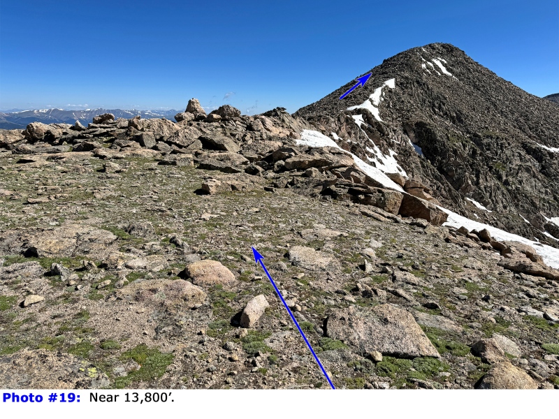
18. Don't forget to walk to the edge of this area for a fantastic view over Frozen Lake. Continue along the ridge to reach flatter terrain, near 13,800' -
19. Walk northeast to join the upper portion of the standard, west slopes route, just below the final summit pitch -
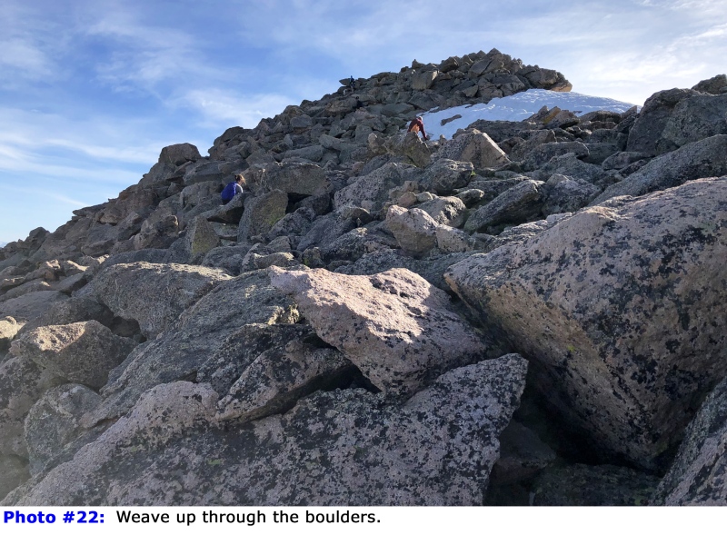
20. Without a trail, work your way up through the boulders, staying on or just left of the ridge crest -
21. When the pitch eases, walk a bit further to reach the summit -
22 and
23.

 GPX Track File


