HOLD ON! This is a long and challenging route requiring Class 3 climbing skills and should not be attempted by novice hikers or those new to the high peaks.
Begin by hiking to the summit of Mt. Bierstadt via the
Mt. Bierstadt - West Slopes Route.
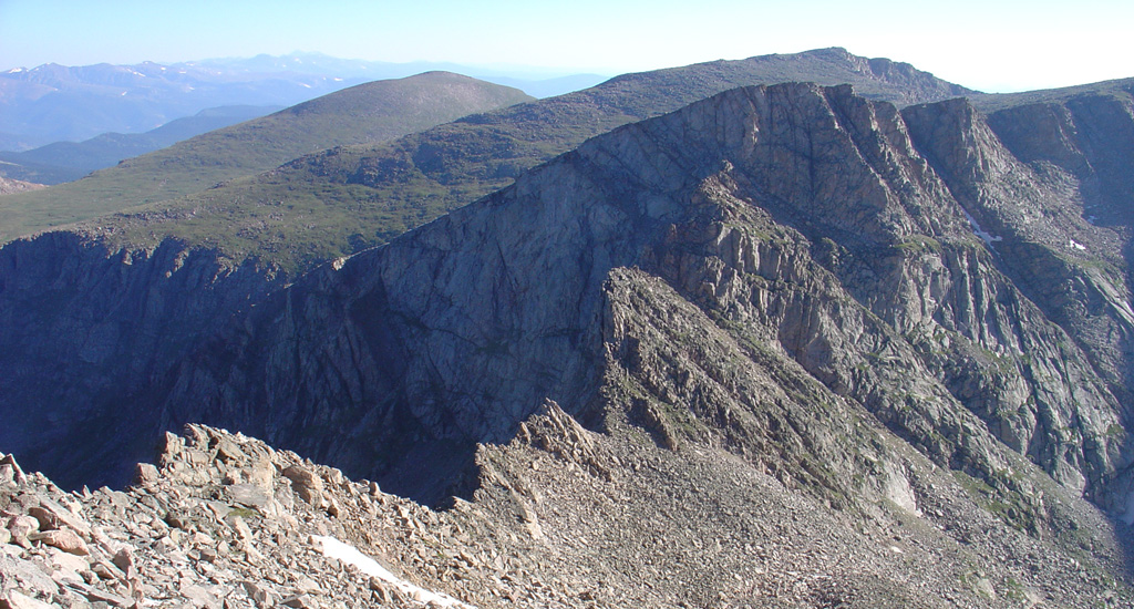
1 provides a view of Bierstadt and portions of the Sawtooth ridge from Mt. Blue Sky. From Bierstadt's summit, look north to spot the Sawtooth and the rugged connecting ridge -
2. Leave Bierstadt's summit and descend north toward the Sawtooth, staying to the right of the ridge crest -
3. Study the remaining route carefully as you descend -
4. Near the low point of the ridge, pass a couple of ridge points on the right and spot a large gendarme ahead -
5. Reach a notch and walk up to the gendarme. Choose your line: either climb directly over it or navigate around it to the right. Both options will require Class 3 moves -
6,
7, and
8.
After passing the gendarme, you'll encounter a gully followed by another rock outcropping -
9. Turn left and ascend to a notch
in the ridge -
10. Pass through the notch, turn right, and follow a ledge along the west side of the Sawtooth -
11. The ledge begins narrow but soon becomes more defined and easier to follow. To cross the final ledges, turn right, climb slightly, and traverse below rock slabs before ascending a dirt ramp -
12,
13, and
14. Pass a large boulder that recently broke off from above and exit the ledges near 13,600' -
15. After reaching easier terrain, turn right and hike up through a talus field to reach the top of the Sawtooth
-
16.
From the Sawtooth, look east to view Mt. Blue Sky's west ridge -
17. Descend east before walking up toward a hump on the ridge -
18. At a notch, drop slightly to the right and follow a cairned route below the ridge crest -
19. The final mile to Mt. Blue Sky's summit involves mostly boulder-hopping, but cairns and trail segments make navigation fairly straightforward. Continue along the ridge until the summit becomes visible -
20. Upon reaching the summit area, intersect the summit tourist trail and follow it to the top -
21 and
22.
The descent:
There's no need to recross to Bierstadt to return to Guanella Pass. Retrace your route back to the west end of the west ridge, where you'll see the Sawtooth to your left -
23. Instead of heading toward the Sawtooth, walk northwest into an open area between the Sawtooth (left) and Mt. Spalding (right). Continue descending through this open area until you reach the top of a gully
that drops into Scott Gomer Creek -
24. The terrain narrows and guides you into the gully. It steepens quickly, but a rugged trail runs through much of it -
25. Watch for loose rock and scree as you descend.
Near 12,300', exit the gully to the left and locate a trail descending through ledges to a clearing by the creek -
26 and
27. Cross the clearing and follow the trail into the willows. Route-finding in this section can be challenging. There's a narrow trail all the way back to the Mt. Bierstadt trail, but it is easy to lose. Stay on the left side of the creek and head west through the willows -
28. Be aware that this area remains wet through mid-summer and might require bushwhacking. Hike roughly 1 mile along the left side of the creek to reconnect with the Mt. Bierstadt Trail. From there, follow the trail back to the Guanella Pass trailhead -
29.
