From Echo Lake, drive over 11 miles up the Mt. Blue Sky road (Colorado 5) to a corner at 13,300' with a small parking area. Park here OR drive all the up and park at the summit parking lot. If you plan on parking at the summit, you will need a parking reservation in advance - see the Summit Lake Trailhead page for more info.
1 is an overview of the route. Begin by walking down toward the saddle between Mt. Blue Sky and Epaulet Mountain -
2. If you started your hike at the 13,300-foot corner on the road, don't follow the small path from there to the closest gully. You must descend to the saddle. On the west side of the saddle, near 13,100', locate the top of a gully which drops west toward Mt. Bierstadt -
3. Turn right into the gully and descend west toward the basin below -
4. Carefully make your way through the rock as you drop 800' (
5 and
6) to reach the base of the gully near 12,300'. Continue west across the basin, over the Abyss trail, and eventually cross the small stream running out of the basin. Reach the base of the east ridge just west of the stream crossing -
7. You're next goal is to climb 800' (Class 2) up the slope to reach the crest of the ridge. Pick your line and climb to the ridge crest -
8 and
9.
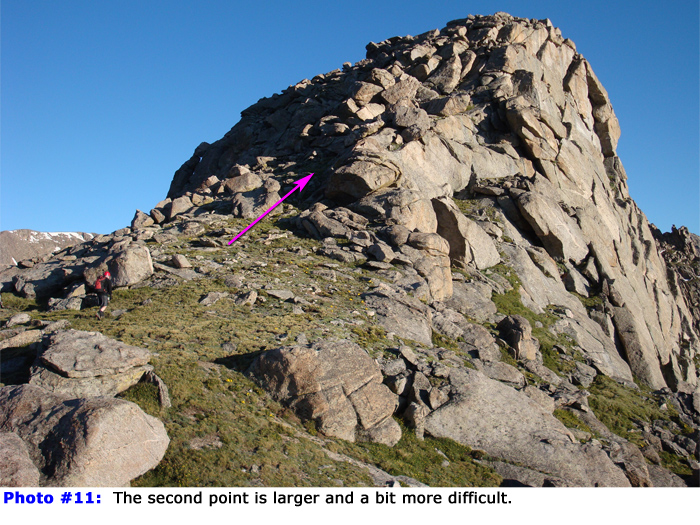
Turn right and begin by scrambling over the first, small point on the ridge -
10. The second point comes into view and it's a bit larger -
11. Scramble over this point to see Point 13,641', the crux of the ridge -
12. Point 13,641' holds great rock and plenty of climbing opportunities. In
13, you'll see a section highlighted in red - this is Class 5 and blocks easy passage. The way around this is to follow a grassy ledge on the right side before climbing steep rock to regain the ridge -
14. Hike over to this area and drop onto the ledge -
15. Bypassing the cliffs to your left, follow the ledge for a bit and begin climbing back toward the ridge -
16. This pitch is steep but take your time and you'll be able to keep it to Class 3. Once back on the ridge, scramble to the top of Point 13,641' -
17 and
18.
Bierstadt's summit is in view but don't be fooled, plenty of distance and scrambling remains. Leave the top of Point 13,641' -
19. The downclimb from the point is steep and exposed, especially along the ridge crest and to the right. Search left of the ridge crest for easier terrain so you can bypass the more-difficult ridge sections. Near the base, scramble past some large rocks to reach easier terrain -
20. Pass some remaining points along the ridge (
21) to reach the final pitch -
22. Climb approximately 200 feet over large blocks to reach the summit of Bierstadt -
23
For the descent, you have several options: 1) Return via the same route, 2) Traverse to Mt. Blue Sky via the
Sawtooth Route, or 3) Descend to Abyss Lake and re-ascend the gully to return to the Mt. Blue Sky road. The remainder of this text describes option #3 since it is not described elsewhere... From the summit, drop north along the start of the The Sawtooth route -
24. After a short distance, angle right, away from the Sawtooth ridge and begin working your way through boulders and small ledges, aiming for Abyss Lake -
25. During your descent, you may encounter a few easy, Class 3 sections. Continue (
26,
27 and
28) to reach Abyss Lake, below 12,700' -
29. Walk along the side of the lake to reach the flats on the south end and continue east to the gully you used to access this area -
30. Re-climb the gully, turn left and walk back to the road.

 GPX Track File
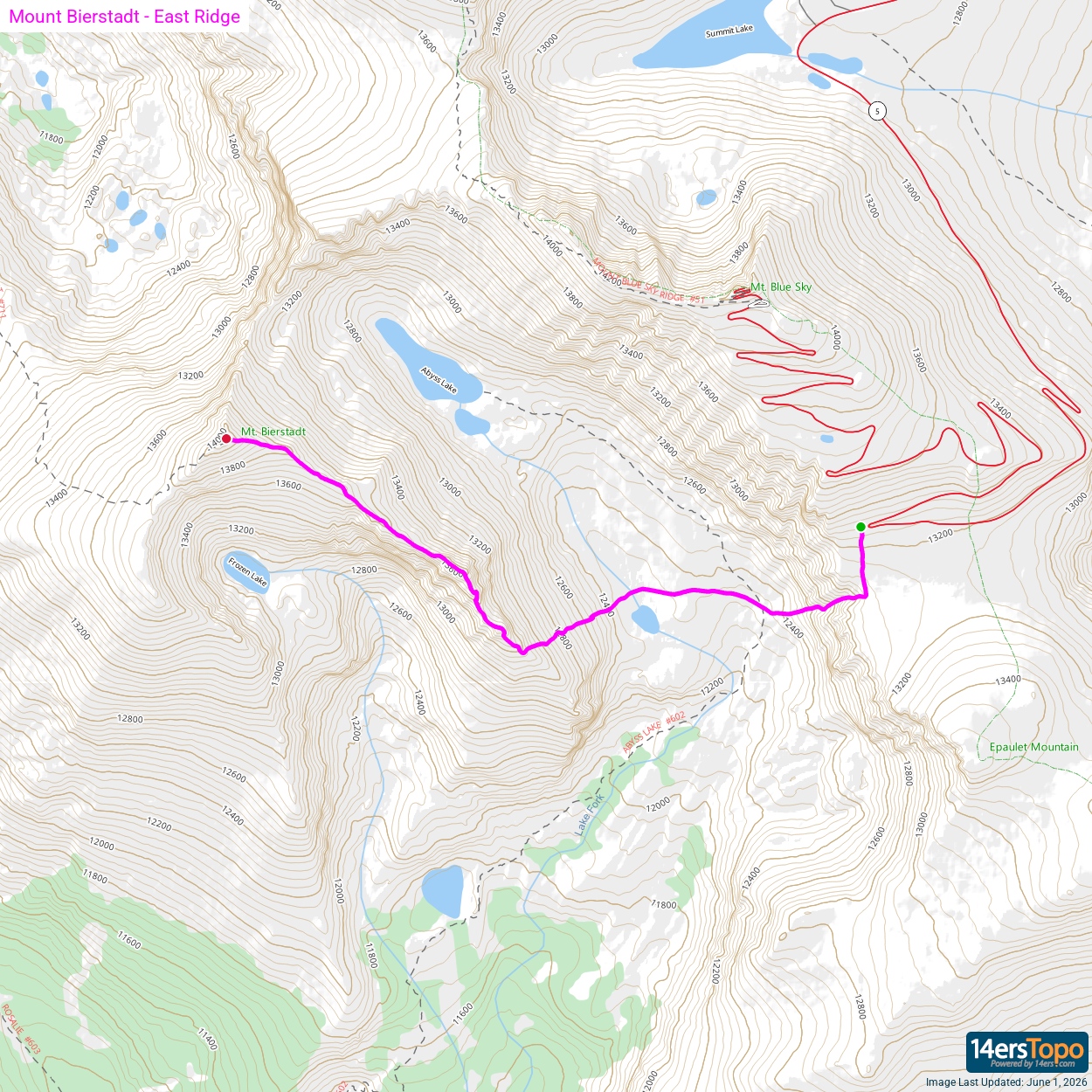


