Log In 
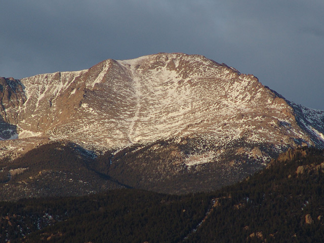
Pikes Peak, affectionately known as "America's Mountain," rises dramatically above the Great Plains near Colorado Springs, its striking silhouette inspired Katharine Lee Bates to write "America the Beautiful" after her visit to the summit in 1893. Named after explorer Zebulon Pike—who famously attempted but failed to climb it during his 1806 expedition—the peak holds a rich legacy of early exploration, Indigenous history, and 19th-century mining. Today, it stands as a unique blend of rugged alpine wilderness and high-altitude tourism, with a fully paved toll highway, the historic Pikes Peak Cog Railway, and the Summit Visitor Center at the top.

For hikers and mountaineers, Pikes Peak offers massive vertical challenges across distinct ecosystems, though its routes are generally non-technical. The legendary standard route via the East Slopes follows the Barr Trail, a grueling 24-mile round-trip journey from Manitou Springs that punishes hikers with nearly 7,500 feet of elevation gain. For those seeking a shorter but scenic mountain experience, the Northwest Slopes (Crags Trail) approach from near Divide provides a more manageable 14-mile round-trip with roughly 4,300 feet of climbing.
Elevation 14,109' (LiDAR)
Prev Elevation 14,110'
CO 14er Rank 30 of 53
Range Front
Forest Pike
County El Paso
Towns Manitou Springs, Colorado Springs
Pikes Peak

Photos

360 Pano
360° Summit Pano
pic1
pic2 pic3 pic4 pic5 pic6 pic7 pic8 pic9 pic10 pic11 pic12 pic13 pic14 pic15 pic16 pic17 pic18 pic19 pic20 pic21 pic22 pic23 pic24 pic25 pic26 pic27 pic28 pic29 pic30 pic31 pic32 pic33 pic34 pic35 pic36 pic37 pic38 pic39 pic40 pic41 pic42 pic43 pic44 pic45 pic46 pic47 pic48 pic49 pic50 pic51 pic52 pic53 pic54

Climbing Routes

route
Pikes Peak - East Slopes Standard Route
Difficulty: Class 1
Total Elevation Gain: 7,600'
Round-trip Distance: 24 mi
Exposure: Low
Rockfall Potential: Low
Route-Finding: Low
Commitment: Moderate
route
Pikes Peak - Northwest Slopes
Difficulty: Class 2
Total Elevation Gain: 4,300'
Round-trip Distance: 14 mi
Exposure: Low
Rockfall Potential: Moderate
Route-Finding: Low
Commitment: Moderate

Map

Human Verification Required

Trip Reports

  8 Recent Reports Peaks Climbed Added
  Northwest Slopes
By: toddfromlegal
Peak(s): Pikes Peak
Added: 7/28/2026
Pikes Peak 7/25/2026 7/28/2026  
  Pikes - #250 on the 250th!
By: warg
Peak(s): Pikes Peak
Added: 7/2/2026
Pikes Peak 7/2/2026 7/2/2026 12  8
  Pikes Peak Northwest Slopes
By: DrewJHartmann
Peak(s): Pikes Peak
Added: 5/29/2026
Pikes Peak 5/28/2026 5/29/2026 7  15
  Snowy Syntheses: South-Central Sawatch & Pikes in Winter
By: the_hare
Added: 3/2/2026
Pikes Peak
Mt. Princeton
Mt. Antero
Mt. Columbia
3/10/2024 3/2/2026 7  44
  Barr Trail Early Winter Snow
By: bmoore
Peak(s): Pikes Peak
Added: 11/26/2025
Pikes Peak 11/22/2025 11/26/2025 6  6
  Crags - 1st Time
By: nickdanielson
Peak(s): Pikes Peak
Added: 8/23/2025
Pikes Peak 8/23/2025 8/23/2025 4  5
  Barr Trail Trial Run
By: nickdanielson
Peak(s): Pikes Peak
Added: 8/9/2025
Pikes Peak 8/9/2025 8/9/2025 1  5
Quest to 100 / Part 2: Bagging the Big Boys Before the Summer Swarms / #20 to #33 Google Map Included GPX file available for download
By: notidealbutfine
Added: 6/2/2025
Mt. Yale
La Plata Peak
Pikes Peak
Fletcher Mountain
Mt. Elbert
"Lackawanna"
Torreys Peak
Mt. Blue Sky
Mt. Democrat
Mt. Sherman
4/25/2025 6/2/2025 5  44
View All 342 Trip Reports

Frequently Asked Questions about Pikes Peak

How difficult is it to hike Pikes Peak via the Barr Trail?

The standard Barr Trail route is rated as Class 1, meaning it is a well-established, non-technical dirt path that requires no rock scrambling or climbing skills. However, it is one of the most physically grueling standard routes of any Colorado 14er due to its immense length of 13 miles one-way and staggering elevation gain. Hikers must endure a relentless uphill grind through distinct ecological zones, pacing themselves to avoid severe exhaustion or acute mountain sickness before reaching the summit.

How does the Crags route compare to the standard Barr Trail?

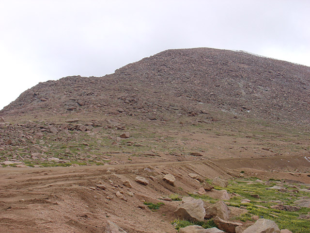
The Crags route is heavily preferred by hikers who want to summit Pikes Peak in a single day without the brutal mileage. At 14 miles round-trip compared to Barr’s 24–26 miles, it significantly limits your time on the trail. However, the trade-off is the pacing; while Barr Trail is a long, gradual ramp, the Crags route is a sustained, steep climb that forces you to earn your elevation much faster, shifting from a Class 1 walk to a Class 2 hike with boulder fields near the top.

Can I buy food, water, or use the restroom at the summit?

Yes, hikers have full access to the amenities inside the Pikes Peak Summit Visitor Center once they reach the top. The facility features modern restrooms, indoor seating, a gift shop, and a dining area famous for serving fresh, high-altitude cake donuts. While you can purchase hot food and bottled beverages to refuel, you should not rely on the summit complex for emergency shelter outside of its standard operating hours, as the building closes and locks when the highway and cog railway operations end for the day.

What makes the weather on Pikes Peak uniquely dangerous for hikers?

Pikes Peak stands as an isolated sentinel on the eastern edge of the Front Range, making it a primary target for violent, fast-moving weather patterns. Because it sits directly above the plains, afternoon lightning storms form rapidly and can catch hikers on the upper mountain. Standard safety protocol dictates that you must monitor the sky constantly and plan your itinerary to top out and begin your descent below the tree line well before noon to avoid deadly lightning strikes, high winds, and sudden summer snowstorms.

Additional Pikes Peak History