| Report Type | Full |
| Peak(s) |
Mt. Yale - 14,200 feet La Plata Peak - 14,344 feet Pikes Peak - 14,109 feet Fletcher Mountain - 13,943 feet Mt. Elbert - 14,438 feet "Lackawanna" - 13,826 feet Torreys Peak - 14,272 feet Mt. Blue Sky - 14,268 feet Mt. Democrat - 14,154 feet Mt. Sherman - 14,043 feet |
| Date Posted | 06/02/2025 |
| Date Climbed | 04/25/2025 |
| Author | notidealbutfine |
| Quest to 100 / Part 2: Bagging the Big Boys Before the Summer Swarms / #20 to #33 |
|---|
|
From my blog: https://notidealbutfine.wordpress.com/2025/06/02/quest-to-100-part-2-bagging-the-big-boys-before-the-summer-swarms-20-33/ 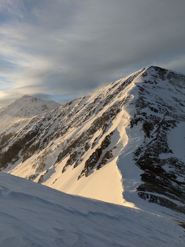
Late April to early June is an interesting and fun time to be in the Rockies. During this second leg of the quest, conditions are changing quickly and so is my strategy and style along with them. Not only is it warm enough to happily car camp every weekend, but many of the ridges and slopes higher above tree line are melting out quickly, making bagging multiple peaks in a linkup a lot easier than before. Additionally, many of the trailheads that are normally inaccessible during calendar winter are now opening up, making for a lot more options when it comes to finding windows in the weather and avalanche forecast. Unfortunately, the higher temperatures means less likelihood of a long, continuous ski descent as we move into couloir season. Regardless, I’m plenty happy I still got three fantastic summit ski descents during this leg of the trip and still looking to do more while there is still safe snow around the state. This past month, my strategy has been to climb as many of the popular peaks before the summer hiking crowds invade. This meant focusing primarily on the 14ers and busy mountains that are within reasonable driving distance from the Denver/Boulder/Colorado Springs area, such as the Front, Tenmile, Mosquito and Sawatch ranges. In addition to beating the crowds, another early season goal of mine has been to skirt as many day use and parking fees by hitting popular areas before they typically open for reservations on Memorial Day. This is nice on the wallet and also cuts down on big crowds, as most tourists don’t want to lump on additional miles to get to a summer trailhead just to hike in the snow. Lastly, I’ve incorporated more car camping at trailheads (or nearby) this spring, and it has really helped out not only with earlier starts, but also meeting my loose goal of bagging two to four mountains per weekend before peak season in July. Soak in the spring romping and enjoy! My CalTopo Map: https://caltopo.com/m/KS1MKP5 4/25/25 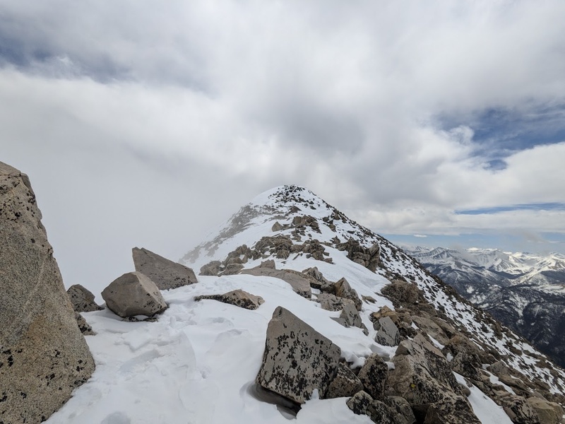
Today was meant to be reserved for climbing La Plata Peak, however I got a late start and decided to pivot to Mount Yale as it’s almost an hour closer to my house. I left the Denny Creek Trailhead around 7:00AM with my full ski kit hoping there would be a decent line somewhere on the southwest slopes. To my dismay, the snow was not remotely continuous until well above tree line. In retrospect, I should have taken note of these red flags and dropped my pack and ski gear much earlier, but with vigilant abandon, I continued on, hauling that heavy pack all the way to tree line and along the ridge to just about 13,500′ where the obvious ski line came to an abrupt halt. I finally dropped the pack, bagged the cloudy summit and made it back down for, what I would consider to be, the worst descent of the quest thus far. Even though the roughly one mile of continuous skiing I had done was actually really excellent, by the time the snow started getting patchy, my descent was extremely slow-going and tiring. Today was a perfect example of how sometimes snowshoes can be a better option than skis. Constantly transitioning from skis, to ski boots, to trail runners in the variable conditions was less than ideal and in addition to having left way too late, the snow below tree line was turning to utter, slushy garbage in the afternoon sun. By the time I was back to the car, I was soaked and exhausted, though illuminated with joy for the experience to finally be over. A couple big takeaways from today as a newb in the world of spring mountaineering:
4/28/25 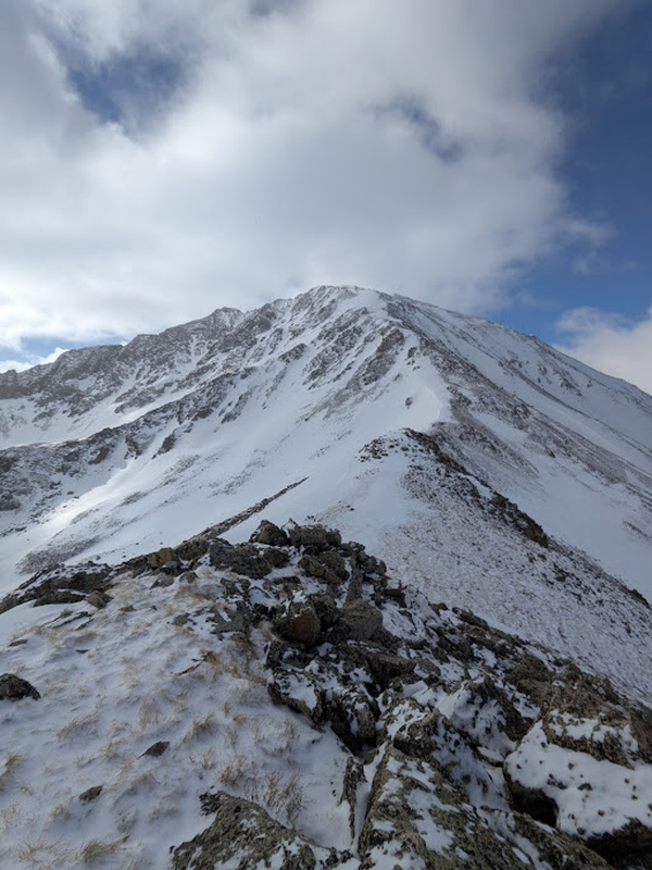
I car camped in my little Yaris the evening before the climb for a nice and cozy night. Having learned from my sufferfest on Yale a few days prior, I left the trailhead much earlier at 5:30AM and had a much more successful day. I also switched out my ski kit for snowshoes and was equipped with a significantly lighter loadout this time around which ended up being a perfect read of the route for today’s conditions. I followed the standard route up the creek then left the trail around 10,700′ and bushwhacked up the steep ridge to just about tree line. The winter route climbs the class 2+ headwall, which avoids crossing the steep, avalanche-prone slopes on the west face. The headwall proved to be steepish and fun, all thanks to having a light pack. From here, the route just stays on the ridge proper all the way to the summit, following some undulating ups and downs and beautiful exposure on both sides. This was by far the most fun part of the hike today, though the final mile felt arduous and slow-going. The summit views on La Plata are panoramic, truly breathe-taking and absolutely worth the effort. I’m happy to say, my descent was extremely uneventful and made it back to the car by 11:45AM. Looks like I learned my lesson from Yale! 5/2/25 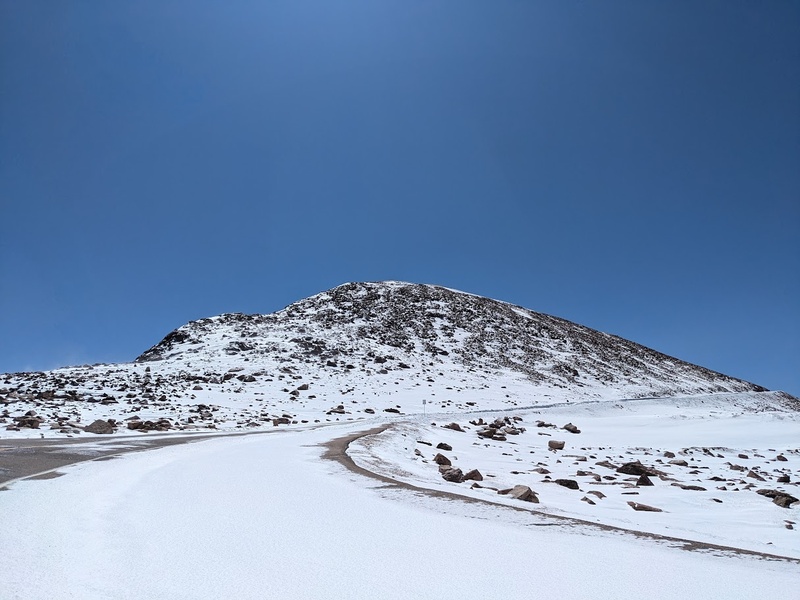
Logistically, putting together my climb on Pikes Peak was a little complex and tiring, but ended up working out incredibly smoothly all things considered. A decent storm had been hitting the Front range for the past three days prior to my climb, leaving Pikes with four to six fresh inches of powder. Friday was looking to be one of those windless, extremely clear, post-storm bluebird days that you dream of getting out and skiing. Unfortunately, I work late on Thursday evenings, but I couldn’t let this golden opportunity go to waste. Unable to camp Thursday evening, I left my home at 3:00AM Friday morning and was able to get moving on trail by about 6:00AM. Sleep deprived but stoked for amazing conditions, I ventured forth onto the northwest slopes. I started from the winter gate closure, located about 1.1 miles down from the Crags Trailhead. Below tree line, most of the trail was relatively dry, with intermittent patches of solid snow. Just above tree line, the trail climbs a long, but gentle snow slope that overlooks an amazing panoramic view to the west. Obnoxiously large South Platte granite boulders litter the terrain with their towering might. I managed to climb this slope in running shoes and spikes, but transitioned to skins once above the major uphill portion. Above this elevation, the powder was nice and deep, but was able to link up with the plowed road relatively quickly which made for very easy gliding on my skins. I skinned to just below the final climb below the summit, where I finished up the class 2 hike up the talus slope. Probably the biggest benefit to climbing Pikes in the spring was having the entire summit to myself! To be completely alone on a Saturday atop one of the west’s most popular peaks, was truly memorable. I soaked in the spectacular views of the plains to the east as the ghosts of hustle and bustle moved about the desolate visitor center and various summit attractions. I spent more time than I generally do on the summit before heading down for a pretty mediocre ski descent. Most of the trail above 13,000′ is relatively flat and didn’t ski well, but the slope heading to tree line made carrying that extra ski weight just fine. Today was a long one, but the juice was well worth the squeeze: I certainly couldn’t have asked for a more ideal Pikes Peak experience! 5/3/25 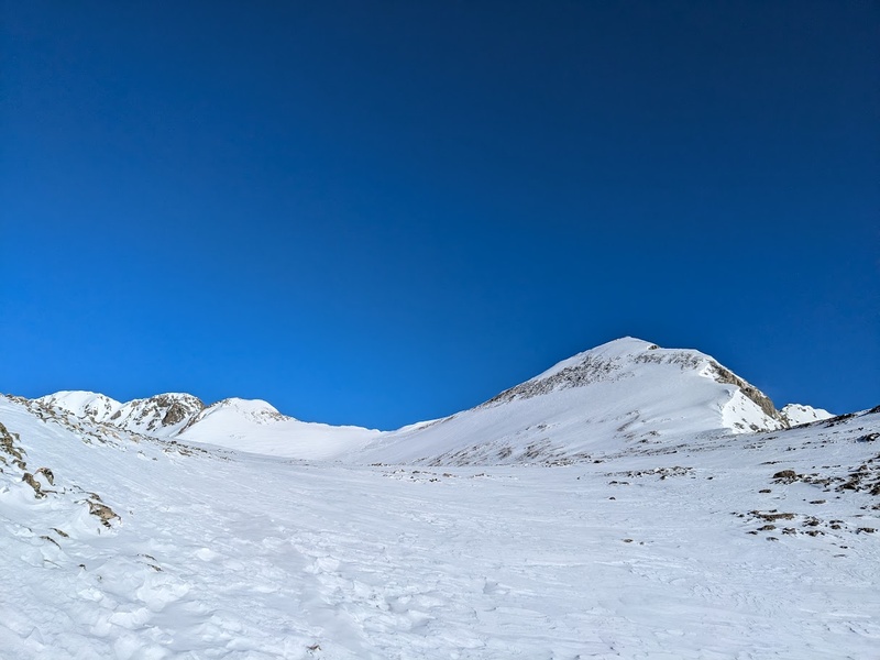
After finishing up Pikes around 3:00PM, I drove out to Fairplay to get some dinner, then up to the Quandary Trailhead to camp for the night, where I’d hike in for Fletcher Mountain the next morning. I’ve been wanting to bag Fletcher early in the season for one main reason: the Blue Lakes Trailhead would be closed this summer for construction forcing you to start at the Quandary Trailhead, which requires a parking reservation. The dirtbag in me immediately raised the alarm and began looking to find a loophole. The loophole is easy: just climb before June and you’re good to go. The Quandary Trailhead was absolutely bumping at 4:00AM on a Sunday. Tons of folks were out, mostly to ski the Cristo Couloir, bustling around the trailhead in the the dim illumination of red headlamps. I got started from the gate closure about .35 miles up from the Quandary Trailhead around 5:15AM and headed up the dry road to the dam. Just after the dam, the continuous snow began and gave me a positive indication that today would be an amazing, long descent back down. The trail up to the base of Fletcher climbs two steep cliff bands before the final basin, both of which I tackled in trail runners and trekking poles. Upon arriving at the base of the southeast ridge, I opted to change into my ski boots, crampons and an ice axe as the terrain was looking a lot more committing and steep. I stayed far away from the massive cornice on the ridge proper and opted to climb the steeper section further in on the face. This was steeper than anticipated and the snow was super variable, anywhere from blown powder to breakable crust. Snow was continuous to the top and I managed to summit around 8:45AM. Amazing views of Atlantic Peak and Quandary’s west ridge dominate the nearby periphery. I dropped in from the summit at about 9:00AM and opted for the slightly more bare, but also more gentle southwest slope. The snow was too icy and variable for me to want to ski the steep line I had just climbed, so I cut across the slope at a lower elevation to meet back up with my up track. From there, I had the pleasure of partaking in a beautiful, long, chill ski around the cliff bands and back to the dam; one of the more memorable descents of the quest thus far, in fact, particularly because of the lovely quality of snow at the lower elevations. I’d highly recommend this quality mountain as an uncrowded alternative to skiing Quandary any day! 5/10/25 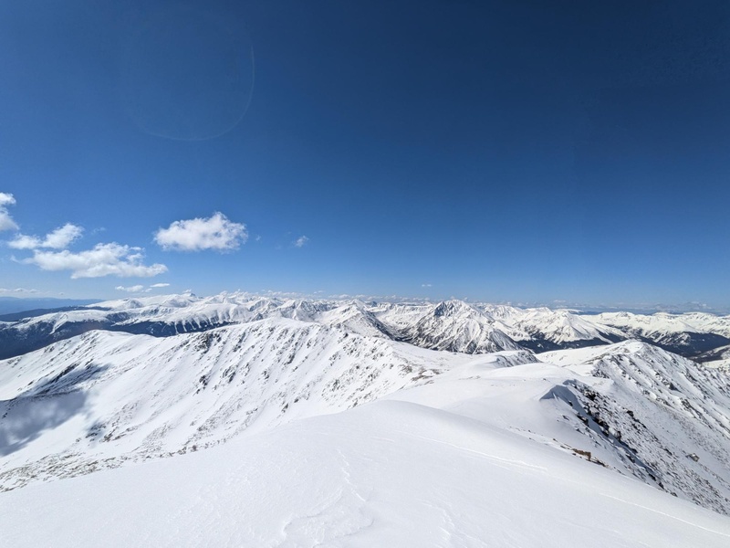
Snow had been accumulating around the state a few days prior to my climb on Elbert, but it appeared as though Friday through Sunday were looking good for clear weather days with small amounts new snow in the evenings. Originally, I had planned to climb Elbert’s northeast ridge, purely on the motivation that I could get to the parking lot easily with my vehicle (I don’t have a 4WD vehicle) and cut off miles, but with the new snow that had accumulated around Elbert recently, I opted for the east ridge purely based on the better skiing conditions. The night before my climb, I made it about .6 miles up the 4WD road in my Honda CRV with 8 inch clearance before opting to camp for the night. I’d say the road is certainly possible with a stock AWD vehicle, like a CRV or Subaru, but it had been raining quite a bit that evening and I wasn’t able to get enough traction on the wet mud to get up the crux. I left my camp at 5:15AM and hiked the remaining 1.2 miles on the dry 4WD road to the South Elbert trailhead. The trail meanders through the forest and crawls to tree line where the continuous snow began and the amazing views of Twin Lakes finally opened up. Luckily, it had gotten nice and cold the night before so I was able to keep my trail runners with micro spikes on all the way to the summit. Elbert’s east ridge is HUGE and open with lots of gain above tree line. The peaks in the Sawatch range are so broad and tall and I truly felt like I really noticed it today while climbing the extra few hundred feet to the top. I made it to the summit just before 10AM and was blessed with the beautiful opportunity of having the highest point in Colorado all to myself on a marvelous spring day. Not to mention, the snow was in prime conditions and I was stoked to ski this amazing peak from the summit! My descent down Elbert’s east ridge was long, enjoyable and extremely chill on beautiful, soft corn snow. By far one of the best ski descents I’ve ever experienced, most assuredly because of my affinity for skiing chill terrain in good conditions. Despite the longer approach from below the south trailhead, this route as a ski descent deserves every bit of the 4 star rating I have given it and would highly recommend it to anyone that is looking to ski the 14ers as a chill classic. 5/11/25 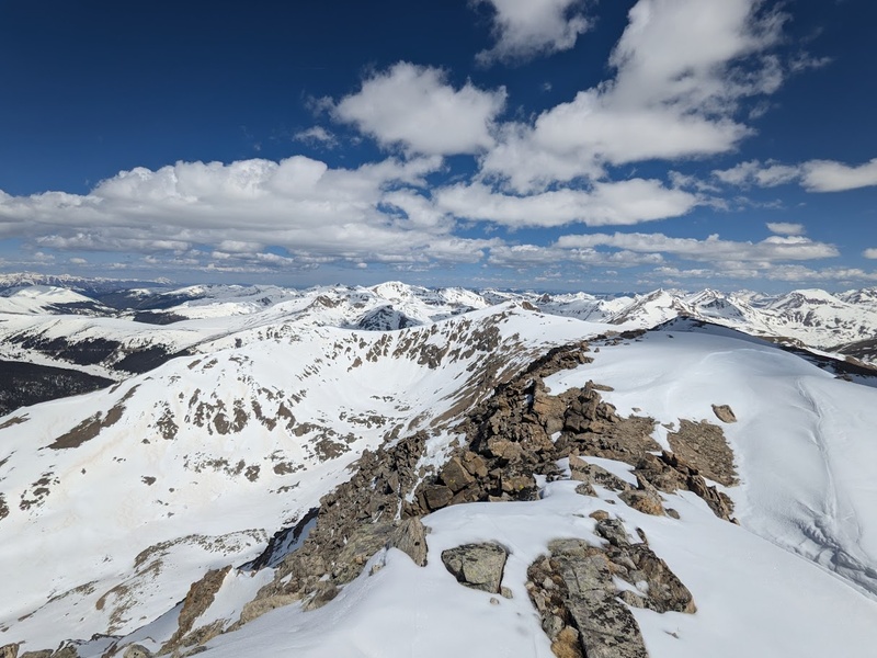
The evening after Elbert, I made my way down to Leadville to High Mountain Pies for a mezze luna sandwich, a serious nostalgia trip for me as I had this meal twice while on the Colorado Trail back in 2023. In my opinion, you can’t beat a bunch of vegetables and hummus after a long day on the mountain. After dinner, I parked just a few miles up the road from the La Plata trailhead where I’d meet fellow vegan and skiing/climbing partner William for Lackawanna Peak’s southwest gulley the following day. Originally, I had planned to climb Lackawanna’s northwest ridge after Independence Pass opened up on Memorial Day, but I discovered the southwest gulley route on 14ers.com and went for this route because of its short distance and good skiing. Because this trail and couloir is only about 2 miles to the top, we started later in hopes of good snow conditions upon reaching the summit. We embarked at 7:00AM, bushwhacked through the dry willows for about a quarter mile and entered into the couloir proper. From here we donned our crampons and ice axes and began making our way up the firm morning snow. Unfortunately, William was recovering from an ankle injury from last month and had to bail about half a mile up the couloir due to the pain. He’d wait at the car where there is full view of the couloir while I charged on. Though the mileage on this route is short, it has a lot of gain and the climb continued on for what felt like forever. Just below 40 degrees, this felt like a true snow climb in contrast to yesterday’s Elbert: kicking steps with crampons and daggering with an ice axe. I summited around 10:45AM and managed to ski a small strip of snow from the summit proper back down to the saddle where I looked upon the descent from above. The gulley is steep, but very wide at the top and narrow but more mellow at the bottom. The plan was to ski safe and make wide turns near the top, then control my speed and make smaller carves at the chokes. Everything went according to plan, though I’ll be the first to say, this was probably a little more full-on than I was planning to ski, especially solo. While the snow felt safe, this is steeper and narrower terrain than I generally ski in the backcountry. Knocking this one off the list really feels like a big accomplishment and a level up in my own personal skiing journey. Another two thumbs up from me on this one! 5/17/25 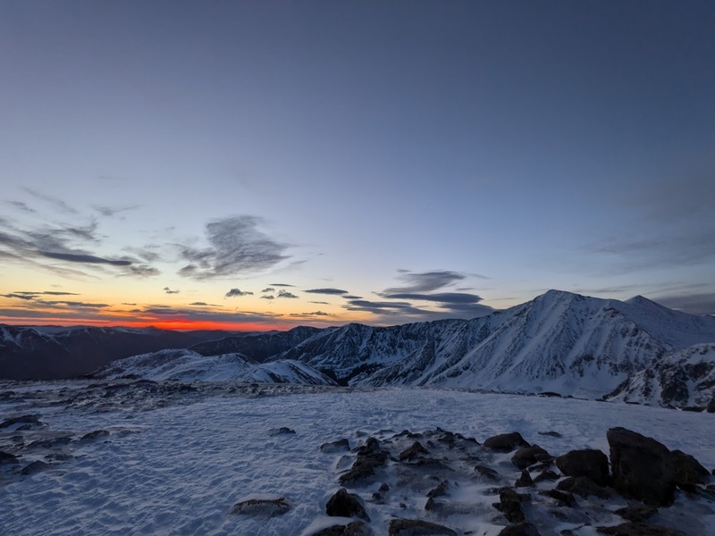
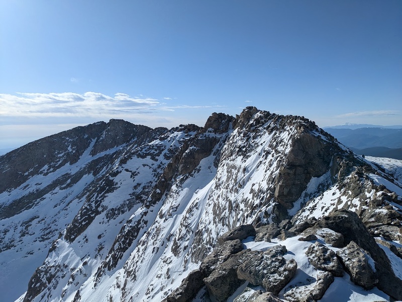
Plans had changed multiple times this week as the forecast was kind of up in the air for the past few days. Ultimately, I decided to get up to the Front range to knock out some really popular peaks before Memorial Day weekend. Saturday had 15 mph winds expected on Torreys so I opted to climb the west ridge from Loveland Pass. I drove out Friday evening only to find out that you basically cannot camp anywhere remotely near either ski area, on the pass or near the interstate (do your research, kids). I ended up stealth camping in some trees at an undisclosed location somewhere outside of Bakerville, which luckily wasn’t too far of a drive to my starting location. I got started from the top of Loveland Pass around 4:00AM, illuminated in the beautiful glow of the almost-full moon. While the lighting was fantastic, the winds were absolutely, bonechillingly, horrendous and I can by far say that it has been the coldest I have been all season with the exception of my failed first attempt on Mount Silverheels back in March. It appeared as though the forecast was going to be a little wrong today, but I had already summited East Loveland Pass Peak and Cupid, so I chose to suffer on in the frigid winds in hopes of bagging Torreys today. Once the sun came out, I warmed up significantly and got a great burn climbing the snow up Grizzly Peak, which is the last summit on the way over to Torreys. One more big climb up Torreys’ west ridge and I was standing atop looking across to Grays, the first 14er I has climbed when I was 15. Talk about nostalgia on the summit! I was happy to finally be on top, but due to the continuous up and down nature of this ridge, I still had a lot of elevation to gain before I would make it back to the car. Today’s trip broke my season’s record to date for most gain in a single day thus far at 5,725′ gain. I also broke both my micro spikes and a gaiter so some repairs were certainly in order that evening as well. The west ridge route has a wonderful alpine aesthetic and shouldn’t be missed: I love these kinds of routes that have you traversing for such a long time on a ridge above tree line and this one certainly did not disappoint. Not to mention, it appeared to be less crowded than the standard routes on Grays and Torreys, most likely because there isn’t great consistent skiing back to the car. Anywho, this was an amazing hike with near-perfect views, despite the wildly atrocious winds. 5/18/25 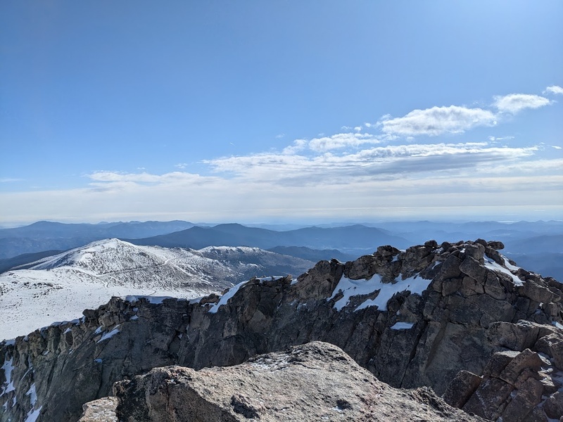
After finishing up Torreys, I headed down to Silverthorne to eat a large bowl of pho, repair my gear and pack for the following day on Mount Blue Sky’s west ridge. Afterwards, I drove to Georgetown and camped in my car just a few hundred feet below the winter gate closure on Guanella Pass. I wanted to bag this one before the gate opened next weekend as that’s when the crowds start flooding in. Despite a lot of tourists coming up the pass to my sleeping spot only to take a picture of the sign and turn back around, I slept surprisingly really well! I got started at 4:00AM and made my way up the 1.7 mile road walk really quickly. One huge advantage to hiking the 14ers on the Front range is that you can pretty much always count on there being a great snowshoe trench in place for you to follow all the way to the top and this was certainly true for today as well. The trail weaves through the willows before coming to a gulley just below Mount Spalding’s west slopes. There was a lot of wet avalanche evidence from earlier in the day, but the snow was stable and easily climbable early in the morning. From the top of the gulley, I hiked to the base of the west ridge, dropped my pack for the summit push and charged on. Some fun and easy scrambling brought me to the top of Blue Sky, yet again all alone up there in total solitude. Despite the 35 mph forecasted winds, today was pleasant and sunny and also got to bag the subsummit, West Evans, before wrapping up my descent. All things considered, this was a great way to get Blue Sky. 5/25/25 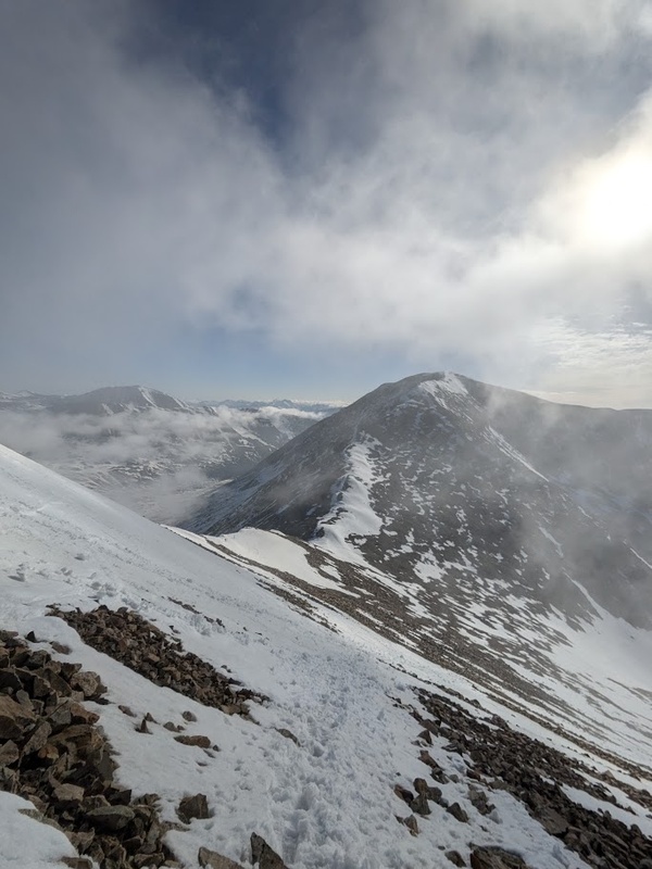
I had some plans to visit my family in Colorado Springs this weekend, so I decided on the DeCaLiBron loop on my way back home for a number of reasons: it worked with my weekend logistics nicely, it was a popular loop I wanted to get done before the main trailhead opened and it was an easy way to bag multiple peaks on my list in a single easy day. Even on a Saturday night during Memorial Day weekend, the car camping situation at the gate closure was very chill and easy to get a good night’s sleep. Somehow I apparently silenced my alarm the night before the climb. Upon naturally awakening, it was lighter than I was expecting and could hear the chirping of the morning birds, which were both bad signs that I had overslept. Sure enough it was 5:00AM, two hours past my alarm. I scrambled to get out quickly and hit the trail by 5:30AM. I also forgot my trekking poles at home so this morning had the entire vibe of just being a little bit off. I even had to turn around after hiking about a quarter mile because I forgot my phone in the car! Despite the rough start, the day went really smoothly and I enjoyed the DeCaLiBron loop way more than I thought I would have. Even though I got out later than I was planning, I still managed to be the first of the day on each of the summits and pretty much had the trail to myself in addition to bagging South Bross. Hiking this loop before the gate opens and the snow melts is a big part of the 4 star rating I’m giving this one. However, even if you were to hike here during peak season with the summer crowds, the DeCaLiBron loop is a classic. Not many routes let you stay above tree line bagging so many peaks in such a short distance and that kept it super interesting the entire time. This one greatly exceeded my expectations! 5/31/25 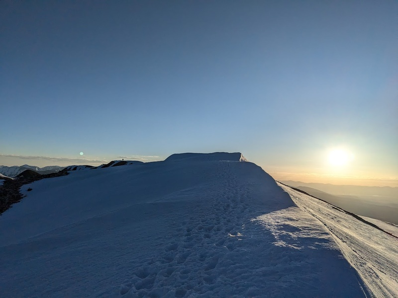
I’ve been loving the Mosquito and Tenmile ranges this spring a lot more than I anticipated, so I was excited to get on Sherman and Dyer for my second linkup of the season. I camped a few miles below the Fourmile Creek trailhead and even got to use a toilet the morning of my climb: what a luxury! I got started at 4:30AM this warm morning and moved my way quickly up the trail knowing the snow would soften rapidly today. Before the Sheridan-Sherman saddle, a steep snow slope with three or four small cornice triggered avalanches lie ahead. Luckily there was a great set of steps already kicked going up the easiest portion of the slope and this remained true for the entirety of the ridge leading to Sherman. I love climbing ridges and this one did not disappoint! I even had the pleasure of sharing the summit with a couple of mountain goats! From Sherman, I descended the east slopes towards Gemini Peak. Gemini isn’t ranked, but the summit is so close to the trail I thought I might as well get it on my way to Dyer. From Gemini, the ridge descends to a low point, thins out, then begins climbing again towards the summit of Dyer Mountain. Not having a bootpacked trail on this traverse (because apparently nobody does the 13ers?) definitely made it trickier, but nothing felt outside the realm just micro spikes and poles. I waited a few minutes on the summit of Dyer to take in the views and let the snow soften a bit before plunge stepping my way back down the ridge and back the way I came. On my way down Sherman, I decided to climb Sheridan as well because the weather so was incredibly nice out, I couldn’t resist extending my time in nature a little more this wonderful morning. TLDR:
6/1/25 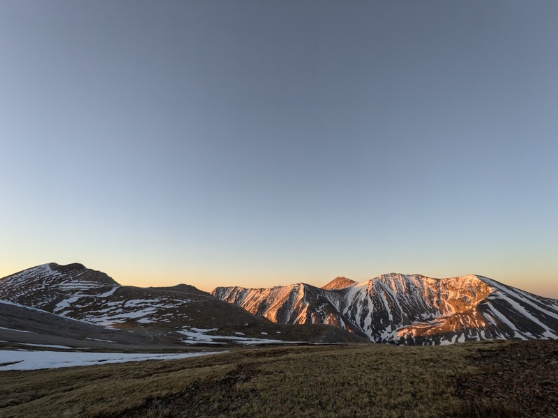
I camped in my car at the Grizzly Gulch trailhead located about 3 miles down the road from the Baldwin Gulch trailhead (because toilet) where the long trek up Antero begins. Since the last few times I had been out, I had not needed snowshoes or boots, I went with a light kit and chose trail runners, micro spikes and poles (I remembered them this time) in hopes of moving fast on the way up and running down the trail on my descent. I got started from the 2WD trailhead at 2:45AM and hiked in the dark for a couple hours by headlamp. Upon walking the first few miles of the trail, I’m VERY glad I didn’t attempt any of this road with my vehicle: it’s far too steep, narrow and rocky for a stock AWD vehicle. I’d leave this one for this jeeps, 4runners and trucks. Near tree line I ran into a lot of remaining snowdrifts on the road and a large snowfield just before the major portion of switchbacks. Even before sunrise, I was still post holing regardless of where I stepped on the snow, so I opted to traverse the snowfield and climb directly up the steep, grassy south-facing slope located climber’s right of the snowfield. This was steep and semi-arduous but effectively cut off a little over a mile of the trail and was absolutely a great call. I followed along the 4×4 road to the base of South Antero, which I mistakenly took for the main summit. In another rookie mistake, I dropped my pack here for a summit push, leaving behind my poles and micro spikes behind thinking that the path to the summit was completely dry. Once I crested the saddle after South Antero, I realized that the true summit lie ahead, which involved crossing a few runout snow slopes before the dry class 2 hike to the top. Not wanting to go back to my pack, I chose to go for it in just the running shoes: the crossing was short and the snow was still stable and good. The traverse and summit push ended up working out all fine in the end (the snowfield was highly consequential, but very easy) and I’m thankful that this amateur mistake has provided another learning moment for me: if you’re going to drop your pack for a summit push, make sure you know what you need. Since I misread my map, I mistakenly only brought the gear I thought I needed for what I mistook to be the summit only to be met with conditions I would have wanted those dang spikes and poles for. Most people wouldn’t give Antero 3 stars, but I found the experience to be a really pleasant hike before the 4×4 traffic begins. Not to mention, the road made for a fantastic trail run back to the car and this comes from a guy who is certainly not a runner! TLDR:
So what’s next? Well, due to my ignorance and piss-poor timing, I didn’t get my reservation for the Maroon Bells-Snowmass Wilderness until very recently, leaving me with very few options. I chose the latest few consecutive dates that were available (trust me, the pickens were indeed slim) and ended up with a few weekdays in late June. Typically a little early to climb the Bells and Pyramid, this would pretty much be the one shot to get it this season unless I happen to get lucky with a cancellation or want to put in a lot more effort. Until I set of for the elks in late June, I’ll be hanging around the Sawatch range, mostly banging out the remaining 14ers and combos that are relatively close to home. Spirits are high, I’m (mostly) injury free, and counting down the days until summer scrambling season begins. Stay safe and have fun out there! Thumbnails for uploaded photos (click to open slideshow): ")
")
")
")
")
")
")
")
")
")
")
")
")
")
")
")
")
")
")
")
")
")
")
")
")
")
")
")
")
")
")
")
")
")
")
")
")
")
")
")
")
")
")
")
|
| Comments or Questions |
|---|
|
|
Caution: The information contained in this report may not be accurate and should not be the only resource used in preparation for your climb. Failure to have the necessary experience, physical conditioning, supplies or equipment can result in injury or death. 14ers.com and the author(s) of this report provide no warranties, either express or implied, that the information provided is accurate or reliable. By using the information provided, you agree to indemnify and hold harmless 14ers.com and the report author(s) with respect to any claims and demands against them, including any attorney fees and expenses. Please read the 14ers.com Safety and Disclaimer pages for more information.
Please respect private property: 14ers.com supports the rights of private landowners to determine how and by whom their land will be used. In Colorado, it is your responsibility to determine if land is private and to obtain the appropriate permission before entering the property.

