Log In 
Elevation 14,043' (LiDAR)
Prev Elevation 14,036'
CO 14er Rank 43 of 53
Range Mosquito
Forest Pike
Counties Lake, Park
Towns Fairplay, Alma, Leadville
Mt. Sherman

Photos

360 Pano
360° Summit Pano
pic1
pic2
pic3
pic4
pic5
pic6 pic7 pic8 pic9 pic10 pic11 pic12 pic13
pic14
pic15 pic16 pic17 pic18 pic19 pic20 pic21 pic22 pic23 pic24 pic25 pic26 pic27 pic28 pic29 pic30 pic31 pic32 pic33
pic34
pic35 pic36 pic37 pic38 pic39 pic40 pic41 pic42 pic43

Climbing Routes

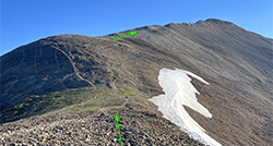
route
Mt. Sherman - Southwest Ridge Standard Route
Difficulty: Class 1
Total Elevation Gain: 2,100'
Round-trip Distance: 5.25 mi
Exposure: Moderate
Rockfall Potential: Moderate
Route-Finding: Low
Commitment: Low
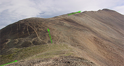
route
Mt. Sherman - West Slopes
Difficulty: Class 1
Total Elevation Gain: 2,150'
Round-trip Distance: 4.5 mi
Exposure: Moderate
Rockfall Potential: Moderate
Route-Finding: Low
Commitment: Low
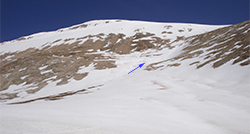
route  _
Mt. Sherman - South Slope
Difficulty: Class 2  Easy Snow
Total Elevation Gain: 3,100'
Round-trip Distance: 8.5 mi
Exposure: Low
Rockfall Potential: Moderate
Route-Finding: Moderate
Commitment: Moderate

Map

Human Verification Required

Trip Reports

  8 Recent Reports Peaks Climbed Added
  MT Sherman - One and done
By: SCALAR86
Peak(s): Mt. Sherman
Added: 8/2/2026
Mt. Sherman 8/1/2026 8/2/2026 2  7
  1st 14er
By: andyjb1232
Peak(s): Mt. Sherman
Added: 6/26/2026
Mt. Sherman 6/13/2026 6/26/2026 6  4
  Mt. Sherman 2025 and Again in 2026
By: tblack
Peak(s): Mt. Sherman
Added: 5/25/2026
Mt. Sherman 5/16/2026 5/25/2026 5  4
  Sherman - via four mile creek road
By: Jnassiri1
Peak(s): Mt. Sherman
Added: 4/3/2026
Mt. Sherman 3/28/2026 4/3/2026 1  6
  Sherman - West Approach
By: jackmcclear
Peak(s): Mt. Sherman
Added: 3/16/2026
Mt. Sherman 3/15/2026 3/16/2026 4  4
  Tenmile-Mosquito Traverse FKT Google Map Included GPX file available for download
By: SpeedWalker
Added: 9/27/2025
Peak 8
Peak 10
Pacific Peak
Fletcher Mountain
Clinton Peak
Mt. Democrat
Mt. Tweto
Mt. Evans
Mt. Sherman
Horseshoe Mountain
9/20/2025 9/27/2025 11  10
  Mt Sherman and Gemini Peak
By: Tarelda
Peak(s): Mt. Sherman
Added: 9/1/2025
Mt. Sherman 8/31/2025 9/1/2025 4  18
  Mt Sherman - Southwest Ridge Google Map Included GPX file available for download
By: azmike11
Peak(s): Mt. Sherman
Added: 8/22/2025
Mt. Sherman 8/18/2025 8/22/2025 5  16
View All 388 Trip Reports

Frequently Asked Questions about Mt. Sherman

Is Mount Sherman a good 14er for beginners?

Yes, Mount Sherman is widely considered one of the easiest, shortest, and most accessible introductory 14ers in Colorado. The standard route is a non-technical Class 1 trail hike that spans just over 5 miles round-trip with a relatively gentle 2,100 feet of elevation gain. It has a distinct path for most of the trek, making it the perfect entry-level peak for families, and out-of-state tourists looking to test their high-altitude lungs.

How rough is the standard road to the Mount Sherman trailhead and how high can I park?

The standard route approaches from the Fairplay side via Fourmile Creek Road. The road is passable for standard 2WD passenger vehicles for the first several miles. If you have AWD/4WD, you can drive higher and park at or just below the upper gate at 12,000 feet, which significantly cuts down on the vertical climbing distance required to reach the summit. Don't expect to get a low-clearance 2WD vehicle to within the last mile of the gate as the road becomes very rocky and rutted.

Is the alternative West Slopes route from Leadville less crowded?

Not really. While the lower approach through the Iowa Gulch drainage on the Leadville side sees significantly fewer hikers than the busy Fairplay side, the illusion of solitude vanishes quickly. Once you finish climbing the West Slopes and top out on the main upper saddle ridge, you will immediately join the standard, heavy crowds coming up from the Fourmile Creek trailhead for the final push to the summit.

Is Mount Sherman a safe option for winter and spring hiking?

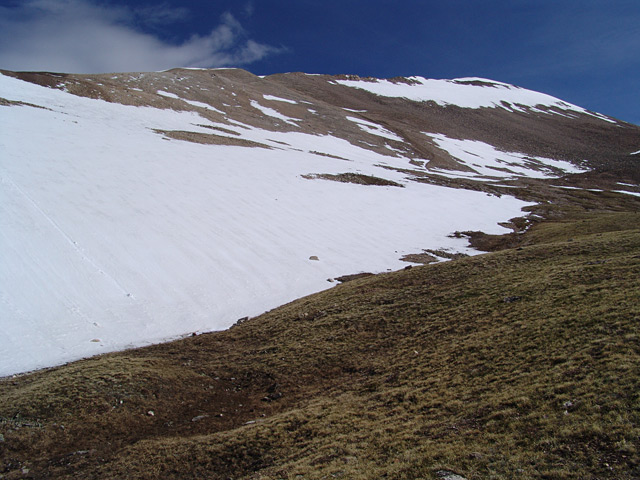
While it is a popular winter peak due to its shorter distance, the standard access road is not plowed all the way to the upper gate, which adds substantial walking mileage. Additionally, late spring snow covers the pitch between the Hilltop Mine area and the main saddle, turning a simple walk into an potentially dangerous slope that requires an ice axe and microspikes. When there is a lot of snow or a dangerous cornice blocking that saddle on the standard route, the South Slope snow route is a much safer option to avoid slide hazards.

Additional Mt. Sherman History

Name History 1
Climbing History 0
Mining 1
Geology 0
More Information 0
  View All