This route is recommended in winter or spring when snow coverage is adequate. Park at the winter closure (usually near 10,900', a mile below the Leavick mine) or drive higher when the road is open. Continue up the road to 11,700' where you have great view of Sherman and the general route -
1. In
2, locate a narrow drainage that hits the right side of the road. This is the bottom of the drainage that runs between Sherman and White Ridge, and much of it will be followed during the ascent. Bypass the rugged bottom of the drainage by walking about 100 yards further up the road to a corner where the road turns left. Why leave the road here? Well, bypassing the lower portion of the drainage puts you on easier terrain and avoids some areas that may contain dangerous snowpack. The bypassed portion has been shown in yellow on Topo Map #2.
At 12,000', leave the corner of the road and hike north up onto a small slope (
3) and across a small basin -
4. There are several ways to hike through this area, but your goal is to head north to intersect the drainage near 12,400'. After ascending a couple of the small slopes, the drainage appears -
5. Continue north by hiking directly up the drainage or on the left side. Near 12,500', Sherman comes back into view and the route up the drainage is fairly obvious -
6. The route turns slightly northwest as you approach the South Slope -
7. Taken from 13er Mt. Sheridan,
8 is a different view of the entire South Slope. Above 12,800', the terrain becomes a bit steeper as you climb north below the northwest end of the Mt. Sherman-White Ridge saddle -
9. Follow a wide, shallow gully that may or may not have continuous snow up to the saddle -
10,
11. Near the top of the gully (13,600'), angle slightly to the right to pass under some steeper terrain up to your left.
12 looks back on the route after reaching the top of the gully.
Taken from White Ridge,
13 shows the remaining route to the summit that is not visible from the route. Just continue north and then northwest up the remaining slope above 13,800' -
14.
15 looks southeast back toward White Ridge and the top of the route. Hit the summit ridge and walk over to the summit -
16, ^17.


 GPX Track File
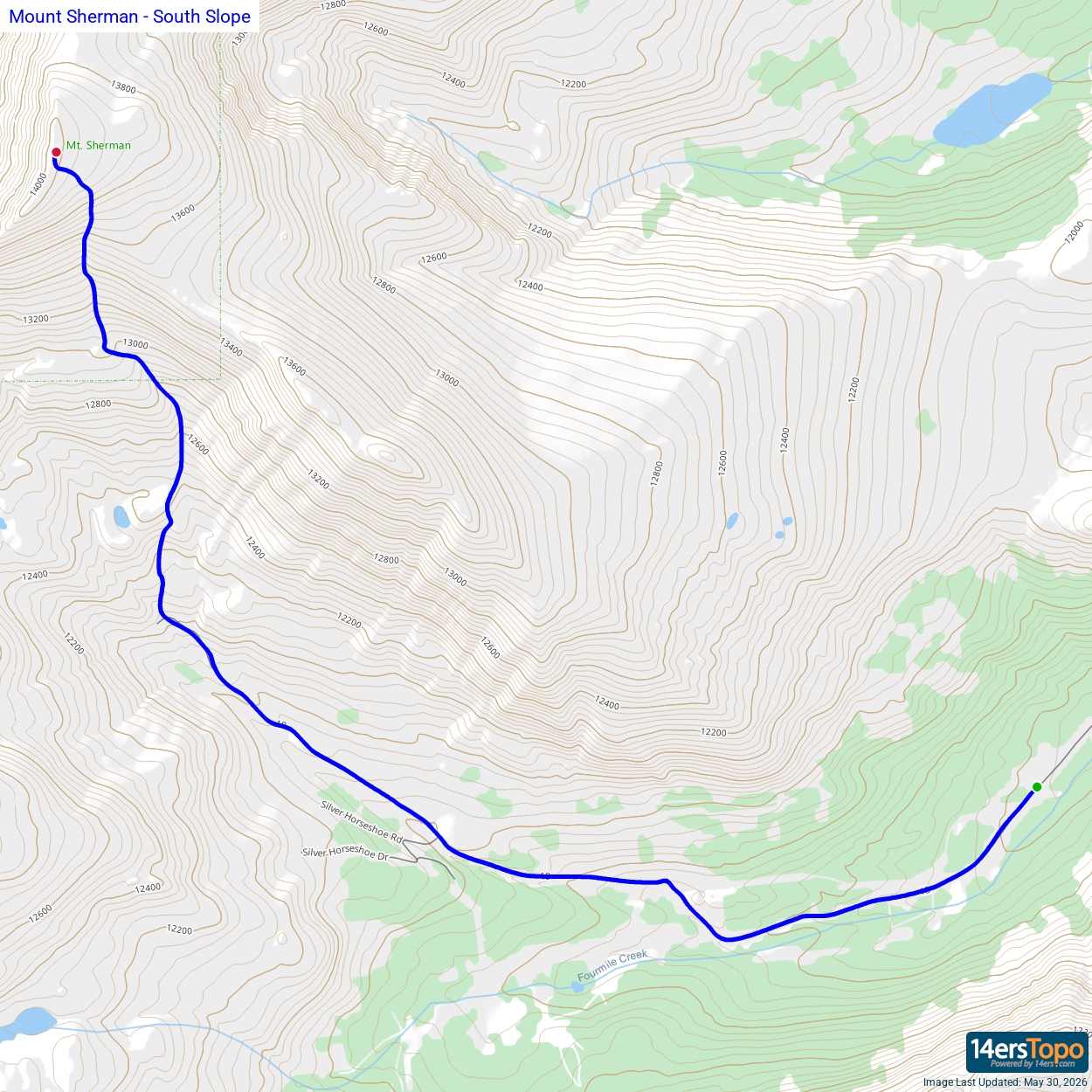


