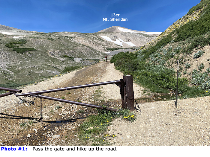
From your parking spot, hike up the road and pass the gate at 12,000' (
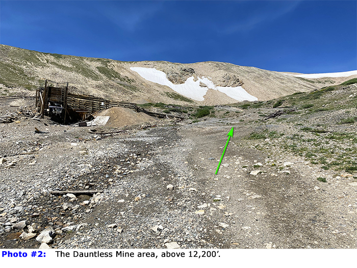
1). Continue to the Dauntless Mine at 12,300' (
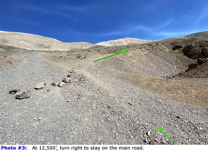
2). Near 12,500', turn right at a junction and stay on the main road (
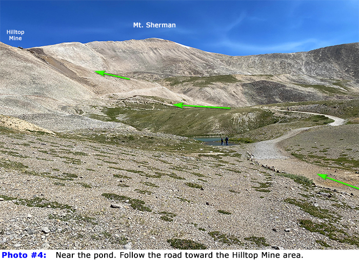
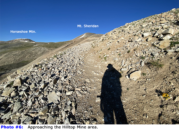
3). Follow the road as it heads east and then north, passing a pond and crossing a large flat area below the Hilltop Mine (
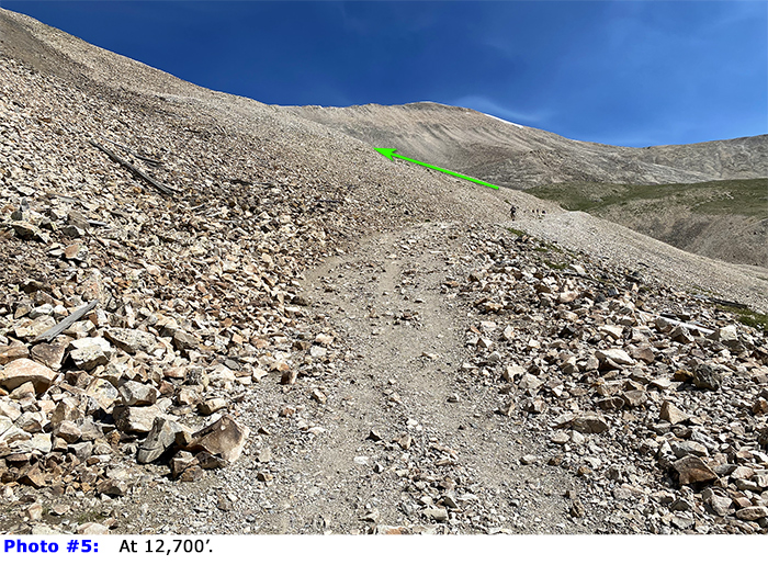
4). Continue along the road (
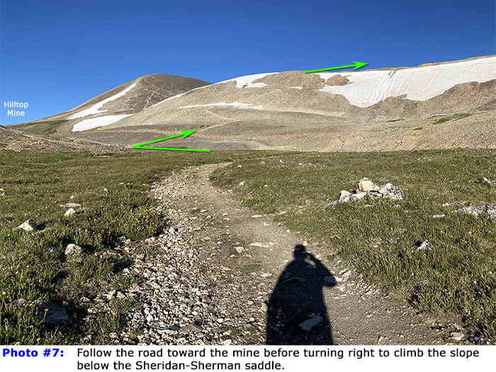
5) and, at 12,800', turn left as you approach the upper mine area
(
6). Once on a flat area near 12,900', the saddle between 13er Mt. Sheridan and Mt. Sherman will come into view ahead (
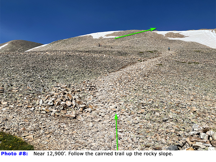
7). Stay on the road as it passes a gray-colored gravel pile. Shortly after, look for cairns and a trail that departs the mine area and leads toward the slope below the saddle (
8).
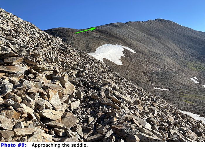
Follow the trail as it switchbacks up toward the left side of the saddle. In early summer, you may encounter patches of snow along this section—look for cairns and stay on the defined trail (
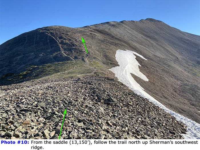
9). When you reach the 13,150-foot saddle
, turn right to view Sherman's southwest ridge (
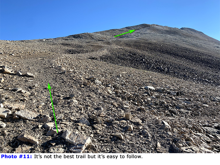
10). Walk over to the base of the ridge, where you'll find several trail options. Follow the most-defined, cairned trail as you begin your ascent of the ridge (
11). For the first few hundred feet, stay on the right side of the ridge (
12). Near 13,600', regain the ridge crest at a notch, and continue along the crest (
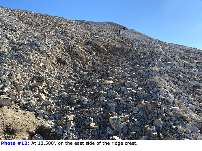
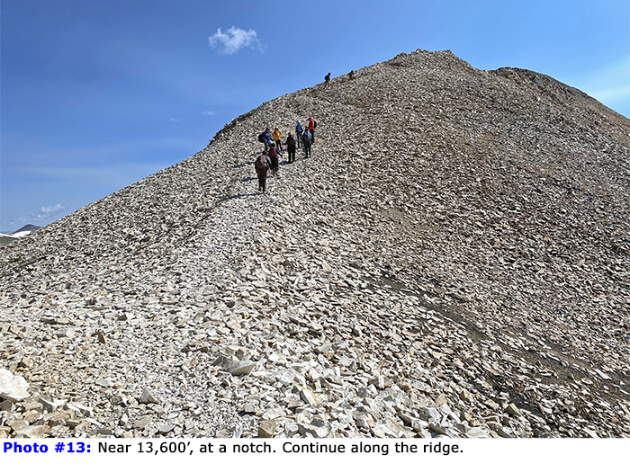
13).
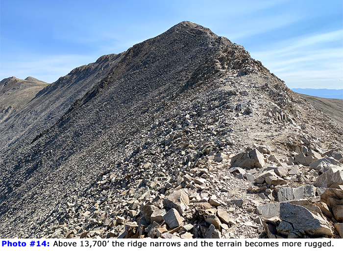
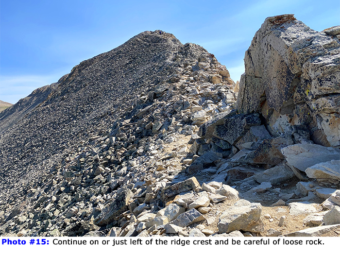
The remainder of the ridge hike becomes visible. Next, you'll encounter the most challenging part of the hike: a narrowing ridge with loose rock along the trail (
14,
15). Continue toward the final pitch along the ridge (
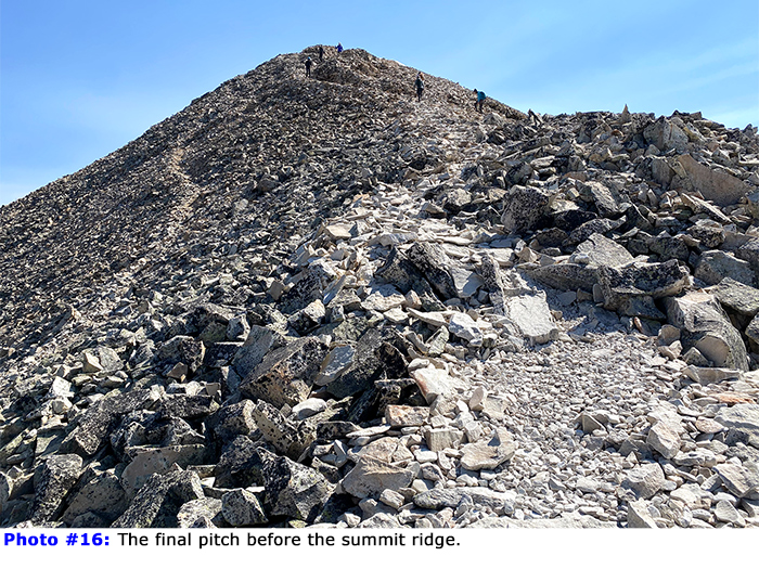
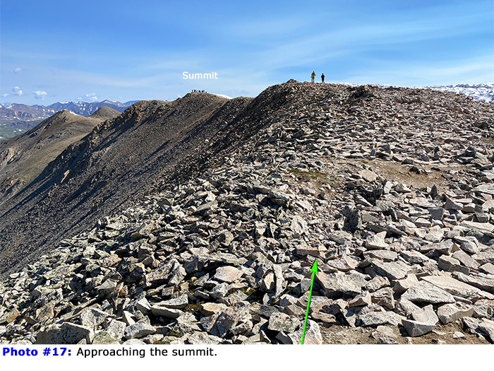
16) and ascend to reach the south end of Sherman's summit ridge (
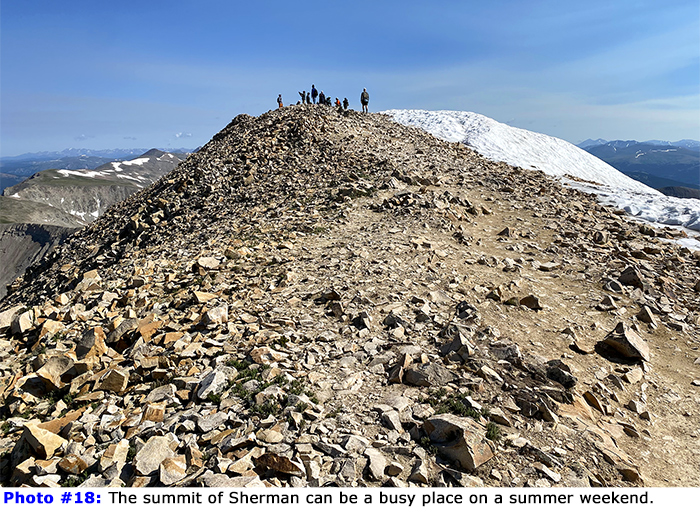
17). From there, it's a 0.2 mile walk to the summit (
18). During your descent, be sure to follow the same route and resist the temptation to take shortcuts back to the Hilltop Mine area (
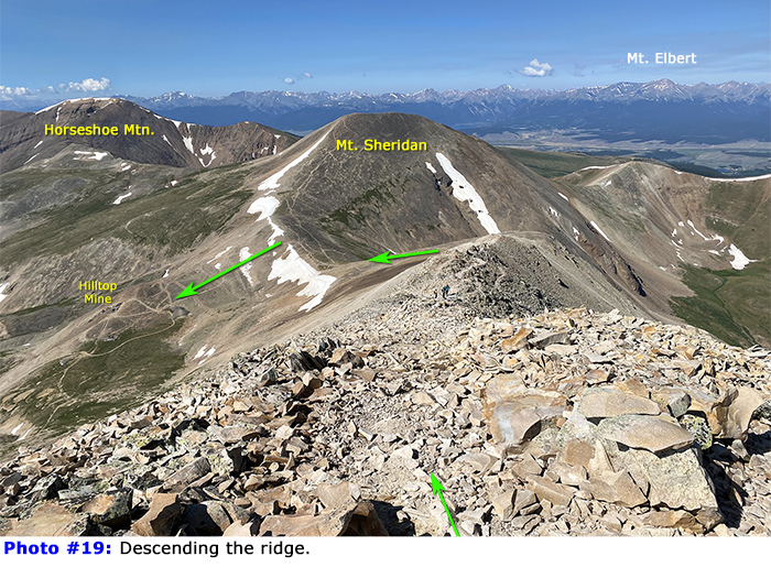
19).

 GPX Track File


