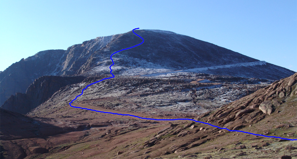
Leave the trailhead, cross Fourmile Creek on a wooden bridge, and begin ascending the trail (
1). After half a mile, pass a junction where a spur from the Crags Campground intersects with the Crags trail (
2). Walk another 30 yards to reach a second junction and turn right onto the Devil's Playground trail (
3). Cross a stream on a log bridge and follow the well-defined trail. At 10,400', cross another stream (
4). Continue heading east for approximately one mile until you reach a small clearing near 11,000' (
5). At 11,050 feet, the trail swings left and begins ascending a long, rugged section to reach a corner at 11,400' (
6). Stay right as the trail zigzags up the steep hillside (
7) and exits the trees near 11,900' (
8). Follow the trail eastward up a slope.
At the top of the slope, at 12,750 feet, the summit comes into view (
9). Continue heading east along the broad trail, passing through a strip of rocks (
10) to arrive at the Devil's Playground area (
11). Cross to the east side of the Pikes Peak road and follow the marked trail (
12,
13). You are still over 2 miles away from the summit. Continue southward around a point, descend slightly, and pass a corner of the road at 12,900' (
14). Near 13,150 feet, reach an overlook on the left side of 13er point "Little Pikes Peak," where the remaining route becomes visible (
15). Continue to another road corner (
16) and ascend to a flat area below the final pitch (
17).
Above 13,600' lies the crux of the route: approximately 350 feet of easy Class 2 rock-hopping (
18). The route is well-cairned, and the rock is mostly stable. Take your time and zigzag higher (
19). At the top of the ridge, walk past another corner of the road and proceed to the summit (
20,
21).
