| Report Type | Full |
| Peak(s) |
Pikes Peak - 14,109 feet Mt. Princeton - 14,200 feet Mt. Antero - 14,271 feet Mt. Columbia - 14,075 feet |
| Date Posted | 03/02/2026 |
| Date Climbed | 03/10/2024 |
| Author | the_hare |
| Snowy Syntheses: South-Central Sawatch & Pikes in Winter |
|---|
|
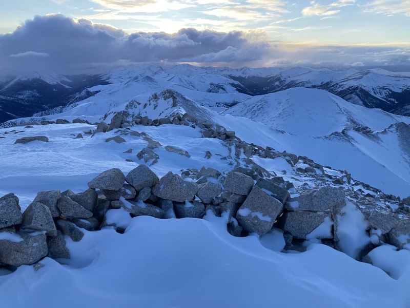
Snowy Syntheses: South-Central Sawatch & Pikes in Winter Pikes Peak via Crags Mount Princeton via Tigger Peak E ridge direct from comm. towers Mount Antero via subsummit Pt. 13780 W/NW rib Mount Columbia SE ridge I wanted to share a few trips from my progressing winter 14er journey that were a bit more involved length, gain, and/or route-finding-wise. In a previous report I covered 10 easy-moderate winter 14er hikes with some introductory motivations, gear talk, preparation methods and hiking techniques. I won't go into so much detail beta-wise for these peaks since there are already multiple well-documented reports for each noting appropriate winter routes and cautions. I just appreciate the opportunity to write about encounters with the mountains and share my process of developing insight from them. Pikes (1/5/23) I forgot how long of distance this route was until I looked it up for this report. It's at least paired with a bit less elevation gain, actual trails, and not much interface with deep snow or rock clambering. In trying to find the trailhead I accidentally got sidetracked and ended up driving up into the Mennonite campground. If you're doing tight switchbacks steeply uphill among small buildings, that is not the right way. The winter closure TH was off to the right instead a little past the campground. 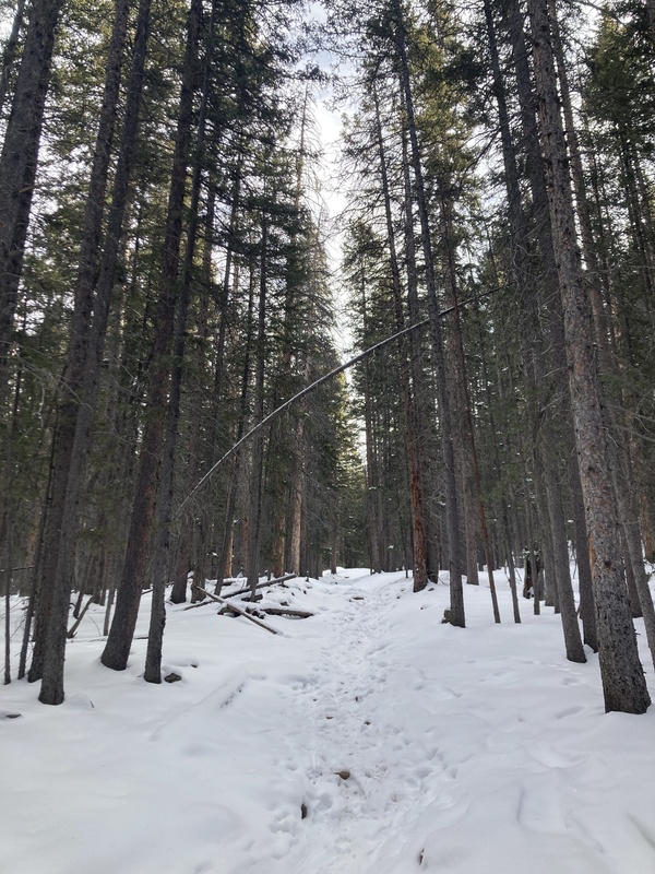
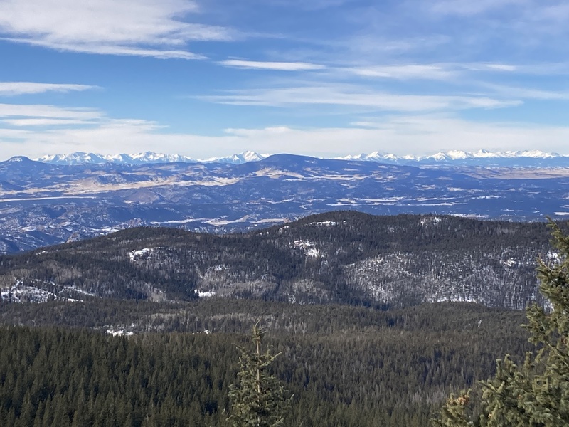
The trail through the forest was well-tracked since a recent snow, but I still carried my snowshoes to deal with any potential drifting further up. Some switchbacks just below treeline offer incredible views of large swathes of the Sangre de Cristo, Sawatch, Mosquito, & Front ranges. This was a stunning vista worth hiking up to alone and contrasted with the more mundane views of the dusty plains and foothills from the East slopes route. Just as you can see Pikes as a lone bump on the eastern horizon from peaks miles and miles away, so can these same mountains be viewed in panorama from this isolated and towering massif. 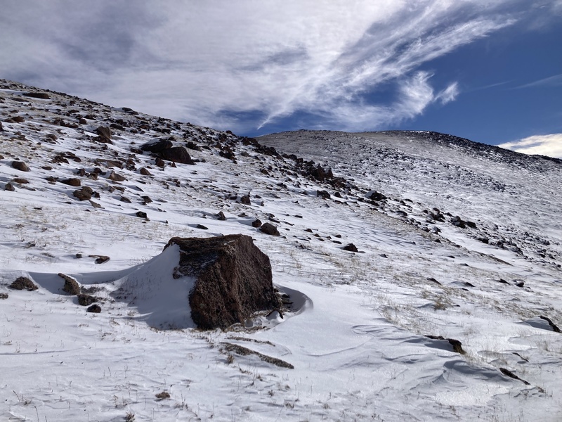
I had planned on doing this peak earlier in the season to avoid previously reported problems with deep whoomphing snow and even avalanches below & near treeline. The snow in these areas on this day wasn't anywhere near that loaded, but it was enough to make me glad to have brought my snowshoes. Soon enough I could ditch them for the grassy windblown upper slopes of Devils Playground Peak. The hillcrest revealed a stunning view of DPP's pink granite colonnades and in the distance Pikes with Little Pikes before it like a family portrait. Walking through a window in DPP's monolithic ribs was a cool and unique trail feature. 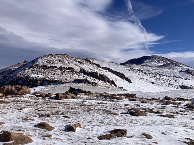
The wind was ripping across the massif as I headed towards Little Pikes along the trail that paralleled the road. I figure that since it's fairly flat up there with few large obstacles the wind is really given a chance to race. Per other reports the NE/backside of Little Pikes can get a bit loaded and sketchy, but postholing through the covered trail wasn't too bothersome this time. Soon I was making my way up the final stretch of boulder-hopping up to the peak proper. On the summit webcam during the previous days' storm I noticed some rime ice formations on railings and rocks. I hoped to catch these today but was only left with sun-whittled scraps laying about. 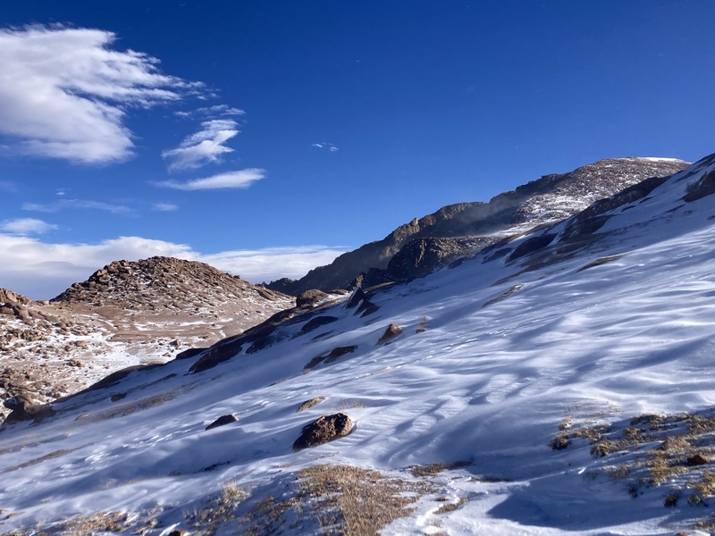
Unfortunately I made it to the summit house just after it closed for the day. I found respite from the wind in an alcove on the far side of the building to drink and snack up before heading back down. I didn't really want to deal with downclimbing the upper boulders or re-cross Little Pikes's backside snow, so I favored just walking back down the road to Devil's Playground. I already saw the ranger's truck ride down for the day smashing through snowdrifts as it went, and there weren't any other visitors' cars in the lots so I figured it wouldn't bother anyone. 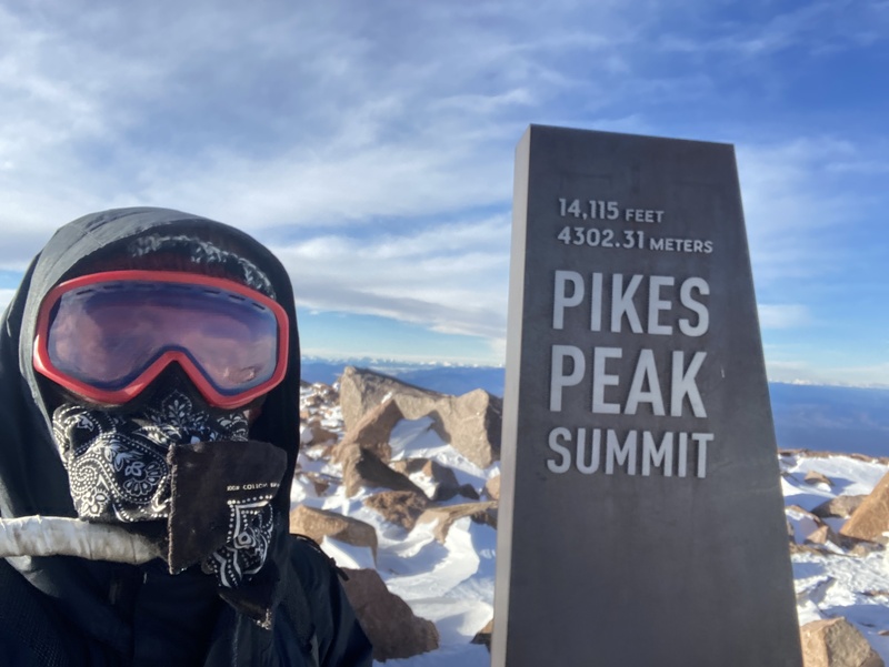
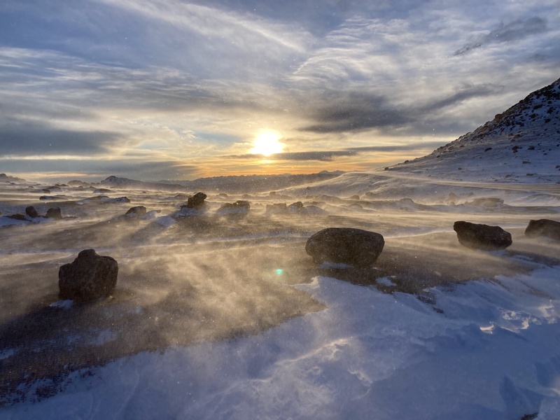
Translucent wind gusts still stampeded across the summit plateau. Bundled up and securely situated on the paved road far from any tumbling drop-offs, the squalls filled me with a rush of excitement. I leapt into the air yielding myself to the flurries as they spun and carried me across the road, becoming one with the many millions of snowflakes careening across the tundra. I responded to the roaring gales with whoops and yells of my own. I bathed amongst the warm hues of these fiery, vaporous rapids as the setting sun lit the suspended crystals ablaze. 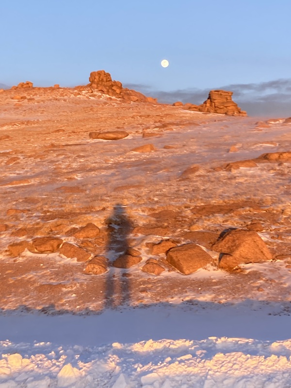
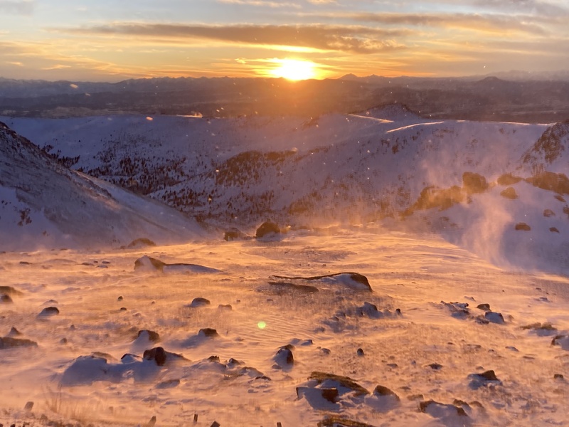
I made it back to Devil's Playground right around when blue hour relinquished its last light and decided to bump up to the peak before returning downslope. I got out my Inreach near the summit to send an OK message, and incredibly the device shut down from the cold--this has never happened to me before. The wind calmed as I descended beneath the hillcrest of the summit plateau. I located my snowshoes towards the bottom of the open slope and sent down the rest of the trail under radiant moonlight. Unfortunately, soon after this outing I experienced an odd pseudo-concussion at the bouldering gym that left me with severe symptoms for months and effectively ended my winter season. I made a couple of attempts still, one on Princeton and another scouting trip to Longs Cables route, but the general malaise and light sensitivity dampered much outdoor activity. I still deal with some symptoms from this occasionally even 3 years later, but the injury ended up forcing me into different hobbies and activities that have come to enrich my life. Princeton (attempts 2/3/23, 2/5/24, 2/29/24, summit 3/6/24) It is hard for me to call a nemesis that which looks like a god. I don't think I'll ever tire of Princeton's view from the east coming down 285. Its twin 13er subpeaks reach around like the mirrored arms of a throne while its behemoth body reclines down to the valley floor in a manner fit for a monarch. Bailing early after any attempt also meant I had time to hit up House Rock Cafe in downtown BV, the (formerly) best restaurant in the state IMO (RIP). 
Still, completing this mountain in winter took me 4 tries. I did attempt once after my head injury in 2023 following a well-trenched track and stopped just below the subpeak Tigger. I just couldn't get the conditioning in following the injury to continue climbing the whole thing. The next year I went for it once more. As other reports note, the switchbacking road past the towers crosses a clear avalanche gully multiple times. The road cut itself may get loaded and difficult to deal with as well. Ascending the not-too-steep ridge direct through the trees avoids snow problems like this below treeline... or so I had hoped. I was the first to set the trench on my second attempt and stayed as close to the crest of the ridge as I could. I sunk into the sloppy snow following the recent high snow-water-equivalent storm. Suddenly I heard collapsing atop an open drifted section. While there surely wasn't enough of a slope angle to avalanche, the snow was obviously destabilizing likely as aided by a warm day under a noon sun. I retreated to a patch of bare ground and tried linking up shallower areas on ahead until I was blocked by a significantly drifted area with no dirt in sight. 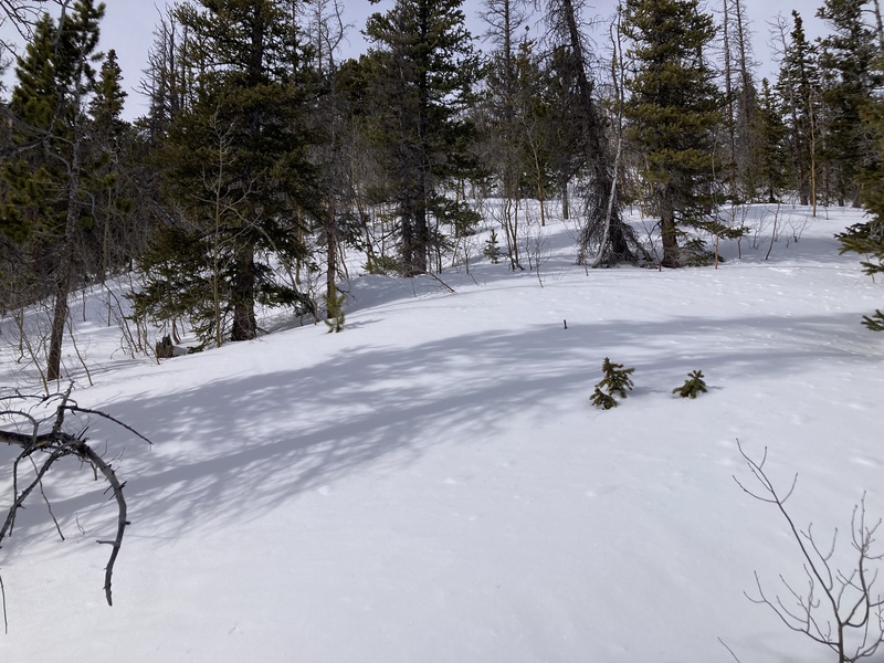
I just had one more switchback to cut up the ridge until I reached the likely windblown tundra above treeline. Still, I had to cross back over these drifts on the way back down that would get even more decompensated over the course of the afternoon if I kept going up. I decided I didn't want to deal with any more potential collapsing or any unfortunate results, especially being by myself. I'm sure that checking if House Rock Cafe was indeed open while still on the ridge played into my decision to bail. On the way down I stayed south of ridge proper and found much shallower snow. Clearly solar radiation had shrunk and solidified the drifts providing much easier crossing. This insight figured greatly into planning for my next attempt. 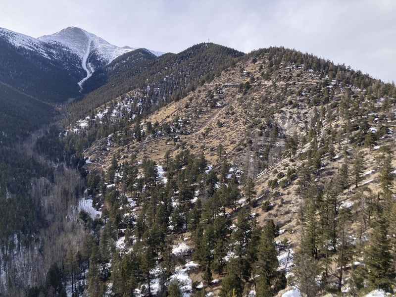
For my third try I decided to bypass the snow obstacles on Tigger's lower E ridge by flanking them completely. I enjoy charting out nonstandard routes up 13ers & 14ers as I often discover neat features, artifacts, or sights that would go unobserved on a beaten trail. On the Copernicus weekly satellite featured as a PeakBagger app map layer, I noticed that the south ridge of Tigger peak just past the Chalk Cliffs was relatively snow-free, had nearby accessible parking, and any private property could easily be circumvented. It was only 4600ft of gain up to Tigger over 2 horizontal miles, but no matter, I appreciated quad-heavy trail angles anyways. Suffice to say this was exceedingly ambitious and I didn't even reach the elevation of my previous attempt. Much of the push up to the ridge itself was loose dirt with grass clumps and I had to class-3 scramble up some cliffs with snowshoes in hand. The ridge proper wasn't too bad at first, but I eventually got choked off by a thick stand of stubby aspens in deep snow. I admitted I wouldn't be summiting this way within my time constraints for the day. I scurried back down the steep embankment and left more erosion than I anticipated with my footsteps and tumbles both in the upper pine forest and lower scrub. I discovered that the south-facing aspect which melted off the snow I wanted to avoid had the trade-off of unconsolidated dirt and loose debris. 
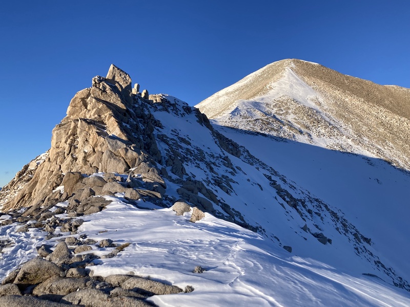
After this I decided to try again via the standard winter route. With my learnings about southern-aspect route quality from the past two trips now reaching a synthesis, I successfully bypassed the previous drifts on the lower ridge over more stable snow just south of the ridge proper. Above treeline I dropped my snowshoes and prepared for the ascent up Tigger peak. Other winter reports on Princeton will also well note this, but a series of partially hidden gullies on Tigger's north face pose avalanche hazards in the winter and besides this make for a real slog to cross. Climbing Tigger's windblown NE ridge and continuing along the connecting ridge to Princeton clears these chutes like a rocky highway over potent frothing rivers. 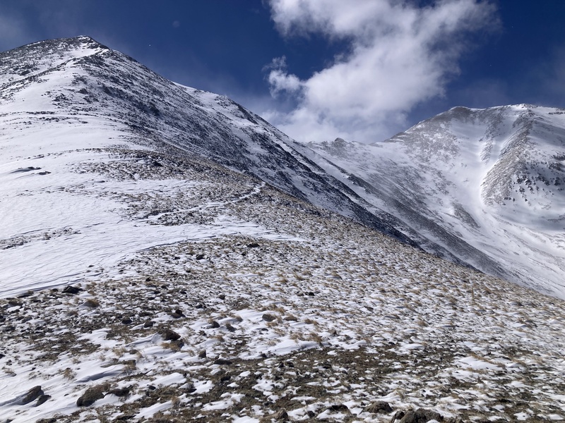
Heading up Tigger was a pretty par-for-the-winter-course steep talus hill climb. I stuck to the rocks when available to avoid deeper punchy snow or traversed firm wind-hardened snow slabs on the way up. Clouds of various shapes, sizes and densities breezed past overhead. It always seems like a grab-bag for what kinds of coverage you'll get with "some clouds" or "partly cloudy" forecasts. These certainly made the atmosphere more dynamic and set up an awesome contrast. As little me went up one way on the ridge, these iridescent leviathans cruised the other way down-valley. I felt the spray of their frozen scales as they brushed past, their appendages twirling and breaking and writhing and dissipating like celestial cephalopods. 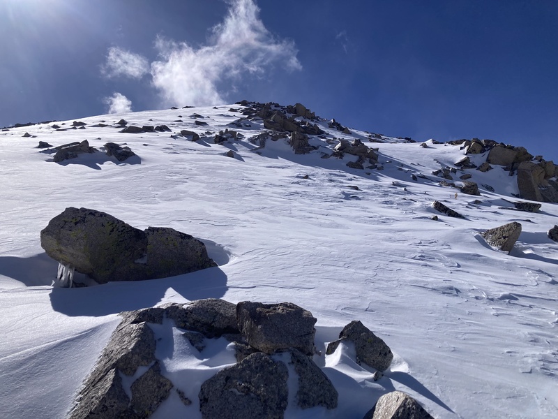
I stuck to the ridge proper before coming to a horn-looking feature. It seemed like skirting around on rocks poking through the snow across its north face might save some energy, but this likely was not the case as I ended up wading through deep powder deposits before reaching the ridge again. On the last undulation up to Princeton I hoped the setting sun would illuminate the clouds and frozen precip spectacularly, but this was not to be as a larger cell to the west blocked the light. 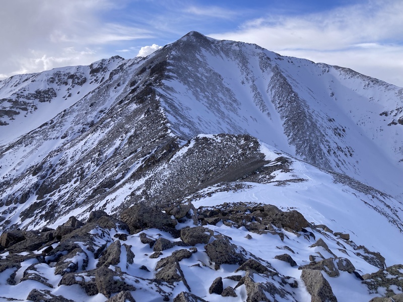
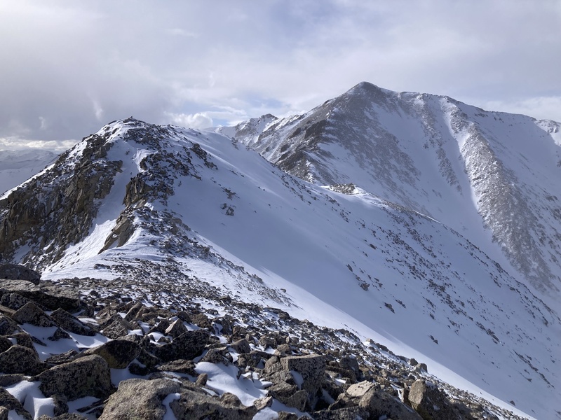
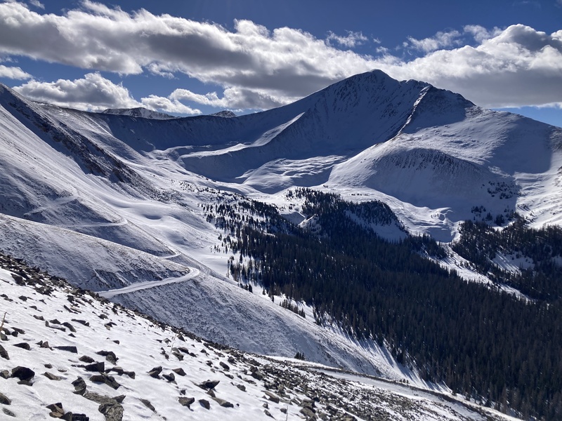
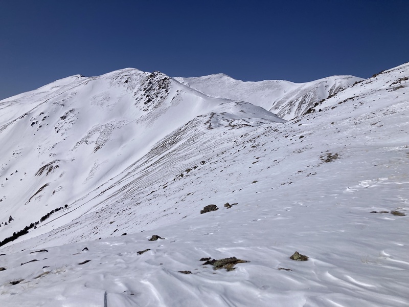
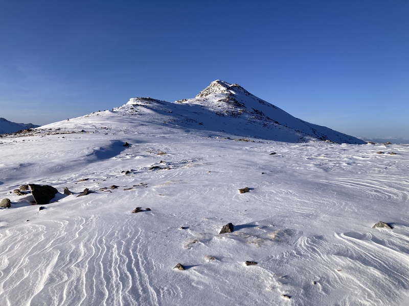
I summited before sunset and took a quick look around in the dimming daylight before trotting back down the ridge. When it's colder and windy like this I usually tie a bandana over my nose and mouth to keep my face warm without impeding breathing. This evening, however, it was cold and maybe humid enough from the passing clouds for both of my bandanas to freeze stiff and make impermeable to breath. It was about headlamp time when I made it back up to Tigger. I vaulted down the talus and back to my snowshoes without incident. To save time coming down the lower road, I blasted down the slope cutting the first large switchback closer to the lower TH from 9700 to 9300ft. This area is mostly outside the camp and remains on public land. This was the most attempts by far I've had on a single peak, but in looking back I safely received a number of lessons that I can now take with me to any mountain in the future. I cannot be upset about spending more time on a massif that that is so magnificently appealing--or for any unplanned visits to House Rock Cafe, for that matter! Antero (1/29/24) I honed in on the central/southern Sawatch during winter 2024 in part because these peaks could be done by their respective winter routes at any point in the season with little avalanche concern. Antero, like Princeton, also features a winter track avoiding slide paths over the summer road by way of a ridge up to a 13er subsummit. The gain on this rib is stiff--nearly 2000ft over 0.75mi--but such is the price for not having to worry about any loaded gullies (for the most part...), and at least it's direct. The snow and talus conditions on this ridge made it one of the hardest efforts I've put in so far towards a winter summit. Antero doesn't have the same visual presentation as Princeton from the Arkansas River valley, but I do appreciate how the ridges on its uppermost north face remind me of Alpamayo, the most incredible looking mountain in the world. The Baldwin Gulch basins on approach also display captivating views, especially Cronin Peak's swooping concave face. 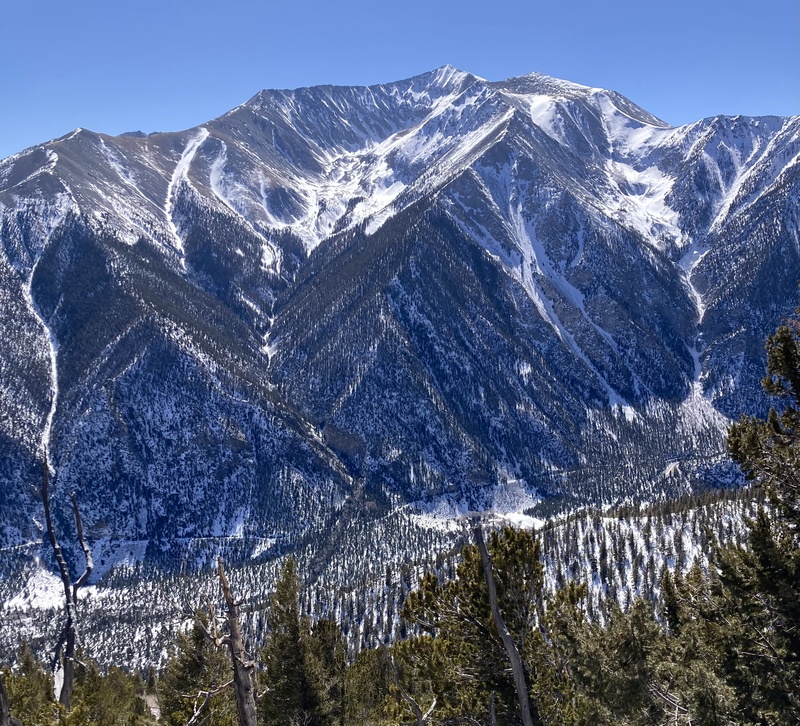
I almost threw my whole trip less than 5 minutes after starting off. Ice floes from cascading streams early on barricade most attempts at driving up the road but can easily be crossed on foot with spikes. I punched right through one of these to running water underneath and submerged most of my boot. Thankfully the waterproofing held and I could continue on with dry feet. A couple larger parties had summited recently and left a bomber bootpack and trench up the snowed-in road. Not much to say about the road on up--a couple of small open slopes to keep an eye on while crossing underneath especially following the recent snow dump, an uneventful boulder-skotch across Baldwin creek. Eventually I came to a pulloff at 11,720ft which marks an accessible start to the W rib of Pt 13780. The 2000-foot endeavor up to the subsummit consumed the next 2.5hrs of moving time. 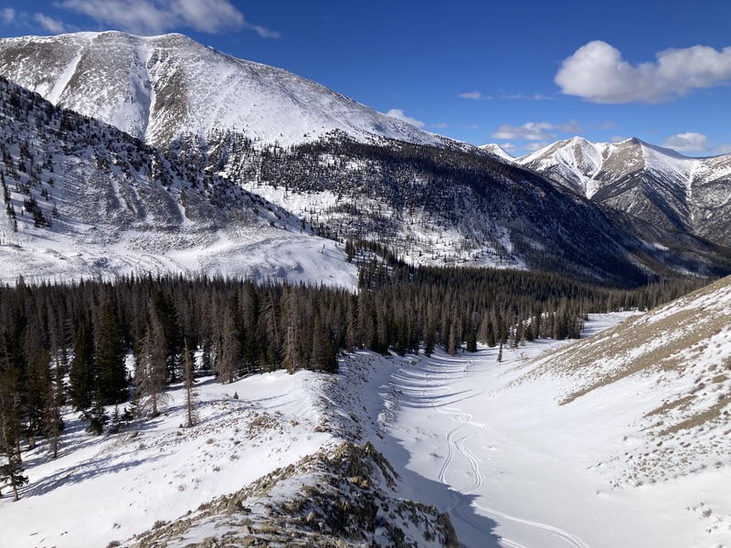
The initial half of the ridge up to a bench at 12700ft is more mellow in grade and had plenty of wind-scoured tundra grass mixed with crumbled scree. After a short rest at this flat break, I powered up the main effort of the day. The upper rib held plenty of surprisingly secure talus blocks exposed in the surrounding snowfield. The grade was steepest here, though, and it took great care while high-stepping to avoid losing balance or plunging a leg into a slushy trapdoor. 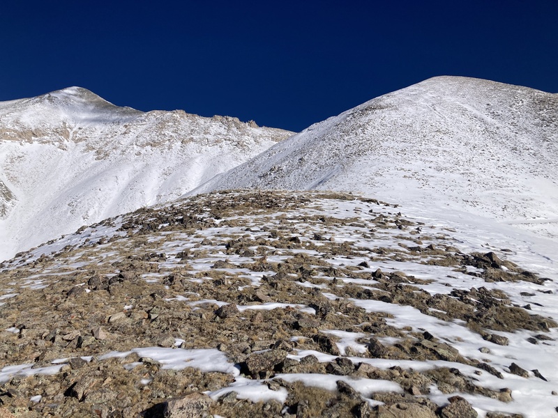
At one point around 13,000ft a flash of peripheral movement caught my eye. A tiny creature with a mousey tail a little bit larger than a peanut shell bounded across the snow before it vanished behind a rock. I had an idea of what this animal might be at the time, and after some research back home I concluded that this was likely a dwarf shrew. These minute predators dart about the alpine constantly foraging for insects, including throughout the winter pursuing subnivean prey. Small animals often have to eat much more than larger ones to keep up their metabolism; shrews are the epitome of this. They are champion hunters and persistent predators. I haven't found any records of trappings higher than 11,000 or 12,000ft--in fact, any observations of dwarf shrews at all are sparse. It felt like a special moment to glimpse this specimen at such a height. While pudgy pikas, lumbering marmots, and graceful ungulates often take center-stage among alpine fauna, there is great wonder to be found in things small and unassuming just above the snow. 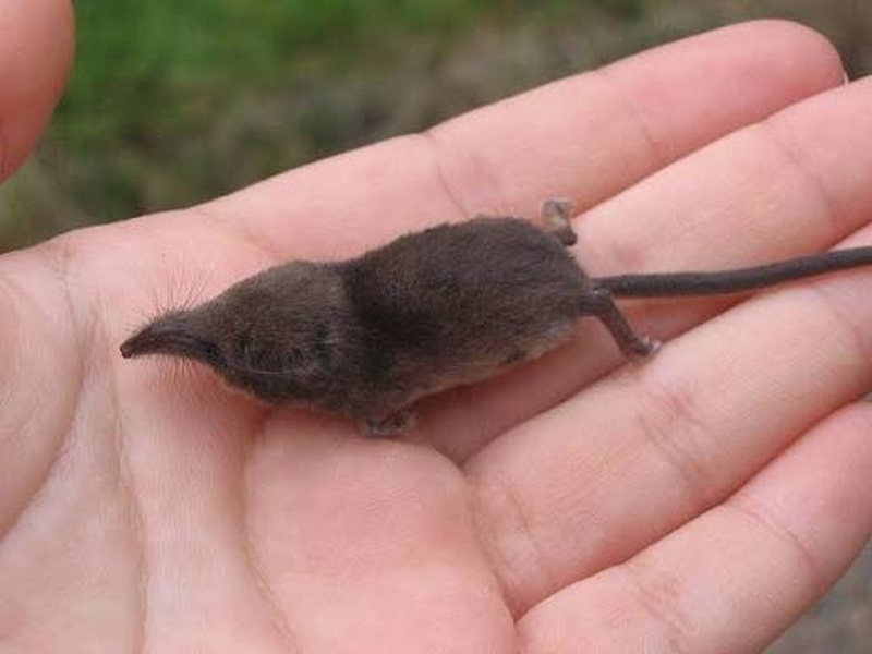

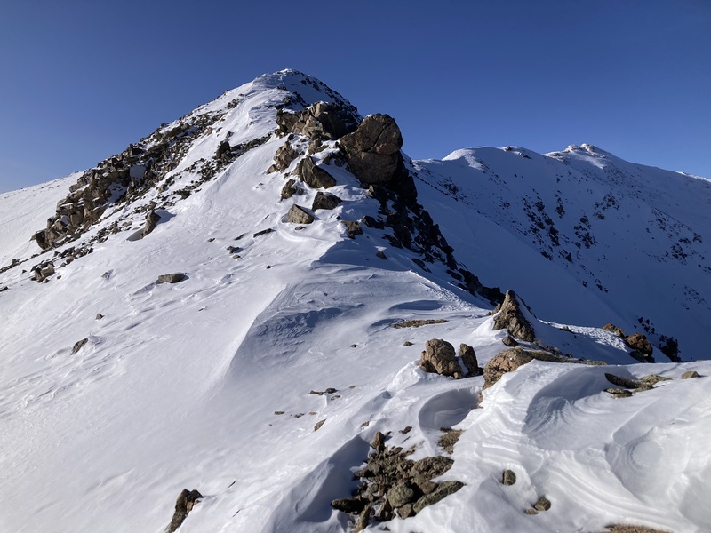
Finally the rib rounded off to Pt 13,780 providing a perch to scout the last 0.5mi and 500ft of gain to Antero's summit. I really appreciate the blocky hogsback on the saddle between here and Antero. The trusty rock and mild scrambling comes as a bit of a reward after lunging up so much talus of unknown stability. I rejoined the column of tracks through the snow from earlier parties and plodded straight up the last ridge to the peak just as the sun winked out beneath the horizon. 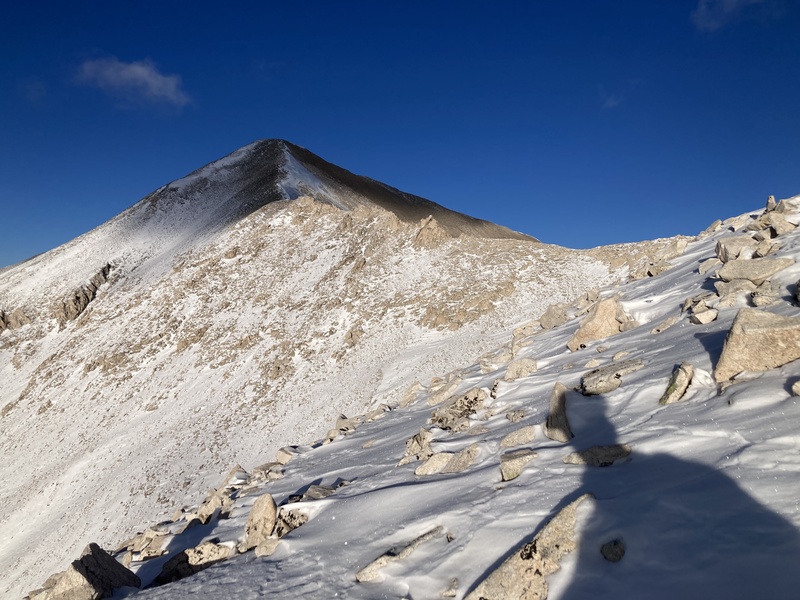
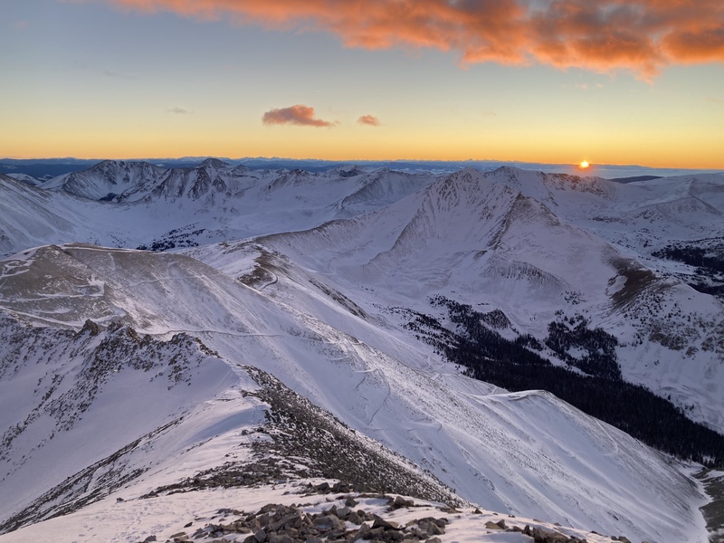
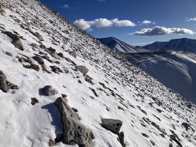
I really did not want to descend the 1000 feet of the upper rib of Pt 13780. Stepping up on rocks exerts one kind of force, but stepping down adds extra momentum that could send things tumbling underfoot, including me. I couldn't imagine treading down carefully this way would be much quicker than ascending, either. As the red-orange sky faded to a cerulean-indigo, I would have rather gotten down off the brisk higher elevations sooner than later. Luckily Antero abounds with excavator access roads dynamited into its flanks. In the twilight I spotted one that drew from near the start of the hogsback and contoured down and around the rib, cutting the rocky ridge descent to over halfway down. The road was clearly drifted but surely bootable on its exposed outer edge. 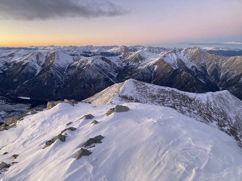
The road went but ended up a bit hairier than anticipated. From afar I could detect one potential problem area where a gully appeared to drift over the road. Before reaching this point the shallow sugar snow path edge went as about as smoothly as I had hoped. The drifted-over section, however, turned out to be a wind-affected bulwark. The snow was something like wet sandstone, stiff and concretized with a thin and slick surface of facets. I swung my headlamp up the wind-loaded gully above and judged that if anything released from up there it would dump into the powdery lee side of the drift, right where it would have been easiest to cross. I figured I would need to scale around on the flank of the embankment to avoid this overhead hazard. I scratched and clawed with my microspikes and pole tips for purchase, noting that the drift extended down as a solid chute for hundreds of feet down the gulch below. After only a handful of movements I was clear to heave myself up over the rim of the rampart and plopped safely into the deep powder on the other side. Now out of harm's way, I wrapped around to the ridge proper and continued down from the earlier flat bench to easy terrain. 
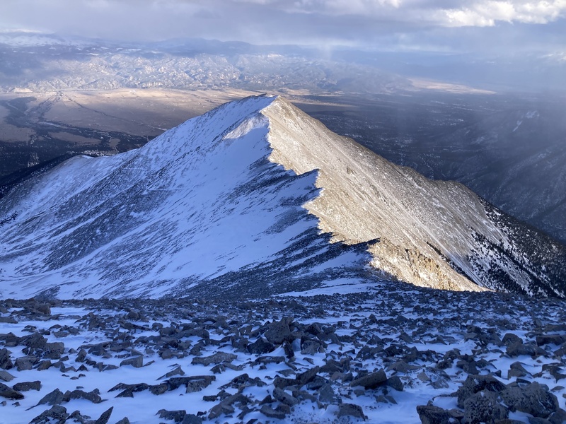
I recuperated my snowshoes at the base of the ridge and returned along the trench under the night sky. The road back was even more uneventful than the morning's trek up, and soon enough the cabins of the hamlet of Alpine flickered through the trees like landing strip lights welcoming me back to the trailhead. As it turns out, despite avoiding a wet boot first thing in the morning and managing not to posthole through the same creek on the return, thanks to my non-waterproof gaiters and inevitable stray snow my boots still ended up soaked by the end of the day. My feet stayed warm enough with movement, but I am now sure to carry a spare pair of socks and impermeable gaiters. While I'm not unhappy I took the W rib bypass road on the descent, the slick conditions on the gully drift were very heads-up even if they only lasted for a few moves. This would have been a pretty good application for an ice axe belay plunged into the drift. I have some heftier microspike Hillsound Trail Crampons that would have also helped mitigate the slippery purchase on the embankment. Perhaps the gully above was nothing to worry about after all, too, and I engaged with more danger scurrying around the drift to avoid it. My spikes and pole tips held in the end, but the consequential chute definitely upped the value of keeping extra tools in my kit even when I don't expect to need them. It seems that distilling learnings from harrowing experiences like this can help retain their thrill while diluting the original dread. That's of course not to say I had a bad day on Antero at all. The ridge push was a tough challenge successfully accomplished and I got to see a rare resident animal. Witnessing from up high the great bulb of the Sun bury itself behind the horizon and blooming the whole sky with color is never an experience soon forgotten either. Columbia (attempt 3/1/22, summit 3/10/24) Columbia was another peak that took me multiple attempts due to iffy snow conditions. My successful ascent topped my personal record for longest time spent on a single summit push and back: 15 hours. This summit completed a nice trio of these more moderate winter 14ers across the central-southern Sawatch for the 23/24 winter season. A typical winter route for Columbia, given that the 4WD road normally snows in and becomes impassable, ascends the Colorado Trail and then branches off upon the lower SE ridge all the way up and around to the summit. A pull-off area on CR365 just past the intersection with residential Creek Run road serves as a humble winter trailhead. 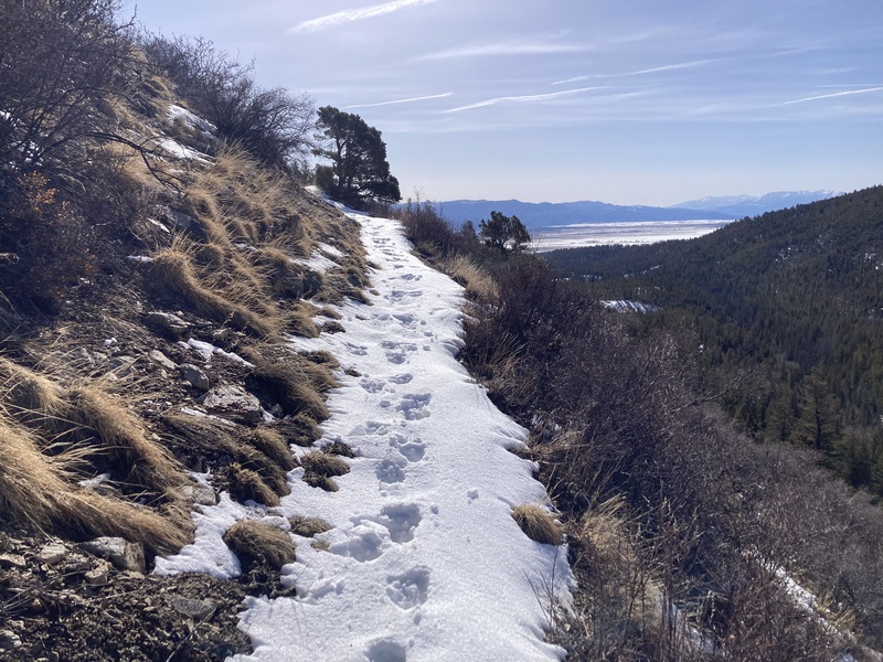
The Colorado Trail snakes up a scrubby hill sporting a 35-45 degree slope, but it held virtually no snow likely thanks to its SW-facing orientation & this very angle absorbing more radiation. A parade of animals had already led the way up a decent amount of the route. A moose first marshalled up this upper hill and onto the SE ridge. Its hoofprints drafted a trench through deeper drifts which I was happy to poach. The tracks soon strayed from my intended path, however, which left the trailblazing up to me. On my first attempt a party had trenched through the forest close to the crest of the lower ridge, but on my next trip I decided to apply my earlier learnings to chart a more efficient way up. As on Princeton, the southern slope of the ridge didn't hold the deep snowdrifts that collected on the ridge proper. I linked up several dry sections in between supportive melt-freeze bands on this aspect. Eventually I had to return to the ridge proper again around 10,800ft due to more prevalent snow cover. A uniform lodgepole stand canopied thicker snow that quickly turned sloppy as the sunny morning wore on. A rocky point with a steep apron around 11,200ft blocked my ascent, so I traversed south around to a snow-laden rib to get back to ridgetop. 
This area bore sporadic spindly aspen clusters and some odd snow-loading formations. Despite being sun-exposed, angled, and south-facing, this open area held the deepest drifts I had encountered so far. Wide crevasse-like gaps split the bases of small rollovers. I hadn't seen or read about anything like this before--were these cracks signs of previous collapsing and movement? This rib wasn't at a dangerous avalanche angle, but the amount of snow and warming temps raised my hackles. Nothing shifted as I carefully tread up the drifts and among less-loaded pine havens. The dry rocks on the outcropping above provided a nice spot to take a breather and take in the stunning view of Mt. Yale to the south. 
That wasn't the end of the odd snow behavior, though. Just after this rocky point a flatter open snow section led up to another low-rising hill. On my first attempt, as I trudged up the E-facing snowy apron of this next bump, the top few inches of snow crust across most of the slope delaminated and slid slightly. After all lay still I gingerly darted towards some nearby trees in a flat sheltered area. I knew some snow had fallen in the area recently followed by a warm stretch which included the sweltering day I was on the mountain then. I figured the heat was not helping the last snow layer bond to the pack. This would not be the last snow I'd have to deal with for the day, of course, and other layers ahead might be deeper or in more consequential terrain. I decided to turn back there, and as if for confirmation another tiny bump on the flat area delaminated as I crossed it as well. I now worried even more about the odd drift-cracks on the snowy rib while descending and stayed as far away from them as I could. I made it back around to the slop forest without issue and continued my descent with a likely stop at Rock House Cafe on the way out as a concession. 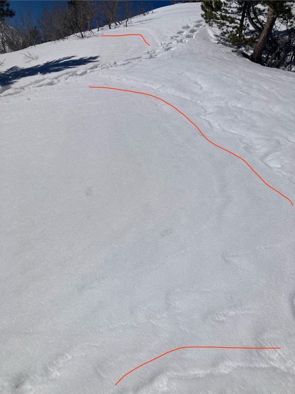

My second attempt delivered much more stable temps and snow conditions. I swung around to the patchier southern aspect of the low-rising hill that turned me back last time. A canid of some sort took over the trailblazing at this point through a grove of bony sun-bleached trunks and on up the ridge. The snow was much thinner here in this likely more wind-affected zone above treeline. 
The coyote or fox tracks gave way to a mess of ungulate prints after a ways. A teeming mass of movement on the ridge ahead caught my eye. The creek formed from the basin between Columbia's E & SE ridges is named Three Elk Creek. Another stream just north of this coming off the E ridge is christened Four Elk Creek. Perhaps these numbered elk are locals after all, because I saw some 15 elk ahead picking away at exposed tundra. They spotted me while I was still far away and ran off in a train one behind the other up drifted undulations and out of sight. 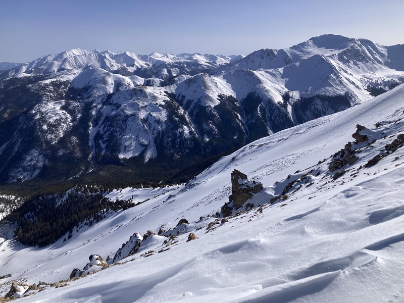
I trotted along after the herd towards the upper Columbia cirque. A snowy concave slope off the ridge reflected and focused the afternoon sun towards me like a solar oven which hurried me out of its focus before I started cooking. The first 13,200ft hump on the upper ridge afforded me sweeping views of the whole Three Elk basin and rest of the route. A mile and a half of shallow fluctuations along the ridge covering about 1000ft of gain remained before the summit. 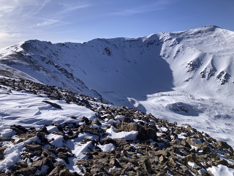
I sped along the gentle ascent as the light of day faded, quickly assessing rock and snow obstacles ahead and deciding to cross or bypass them. I think my experience gained thus far aided my confidence and ability in completing this ridge swiftly. The snow was often shallow or supportive enough to traverse without punching through, but not always, and some steeper protrusions spiced up the routefinding. Thankfully the notorious crosswinds up here were mild this day. Once the ridge started curving north, I contoured on the drier western-facing talus to avoid unsupportive snow on the ridgetop. 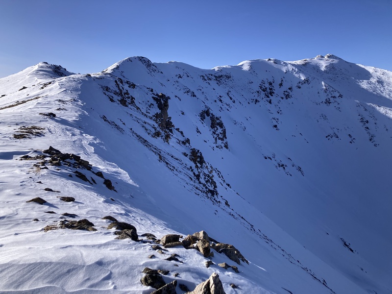
The final snow-gilded tundra walk led up to a raised summit block. Harvard and its connecting Rabbit Ridge greeted me on the other side of the summit in soft cloud-filtered evening glow. 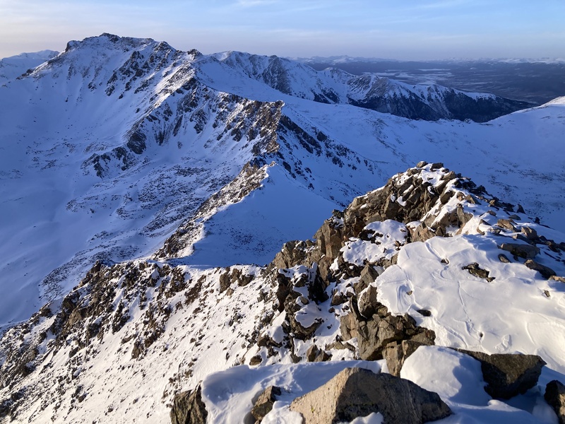
I didn't spend much time on the summit and rushed back to cover as much of the upper ridge as I could while it was still light. I noticed the elk from before had chosen to negotiate the talus slope on the south side of the ridge. I followed their lead to avoid bogging down in any surprise postholes on the ridge proper. It was headlamp time right about at the place where I had first spotted the elk, but thankfully at that point I had many sets of tracks, including my own, to guide me back to the trailhead. Daylight savings time towards the end of winter is a huge boon to late-starters like me, but I still had a lot of mileage left on the return come sunset. I hustled through the mild night air and finally got back to the car at the ripe hour of midnight. Like my issues with snow on one Princeton attempt, the loaded features on Columbia that gave me pause and sent me back weren't of significant size or angle. I take great care looking at slope angles and past reports to determine hazardous avalanche areas; winter routes are often established to avoid these traps. But I took the instability I did face as a portent of continually deteriorating conditions throughout the day. While the route overall likely would have been safe from life-and-limb snow hazards, it wouldn't be too fun continuing on poorly consolidated or bonded snow. Given the right weather and conditions most of these peaks could be completed all throughout winter and weren't dependent on more or less snow, so I had no pressure against turning back and trying again another time. I am grateful to these four giants for fostering my skills and judgment in the winter alpine. I've found that developing an awareness of mountain conditions simultaneously bestows a greater awareness of one's self as well. It's as if the auguring of my feet through blankets of alpine snow knits more tightly together my own self-constitution. Perseverance, courage, wonder, awe--these are but a few gifts from the winter peaks that I look forward to laying bare and bearing time and time again. Thumbnails for uploaded photos (click to open slideshow): ")
")
")
")
")
")
")
")
")
")
")
")
")
")
")
")
")
")
")
")
")
")
")
")
")
")
")
")
")
")
")
")
")
")
")
")
")
")
")
")
")
")
")
")
|
| Comments or Questions |
|---|
|
|
Caution: The information contained in this report may not be accurate and should not be the only resource used in preparation for your climb. Failure to have the necessary experience, physical conditioning, supplies or equipment can result in injury or death. 14ers.com and the author(s) of this report provide no warranties, either express or implied, that the information provided is accurate or reliable. By using the information provided, you agree to indemnify and hold harmless 14ers.com and the report author(s) with respect to any claims and demands against them, including any attorney fees and expenses. Please read the 14ers.com Safety and Disclaimer pages for more information.
Please respect private property: 14ers.com supports the rights of private landowners to determine how and by whom their land will be used. In Colorado, it is your responsibility to determine if land is private and to obtain the appropriate permission before entering the property.

