Log In 
Elevation 14,021' (LiDAR)
Prev Elevation 14,017'
CO 14er Rank 50 of 53
Range San Juan
Forest Uncompahgre
County San Miguel
Towns Ouray, Telluride, Rico
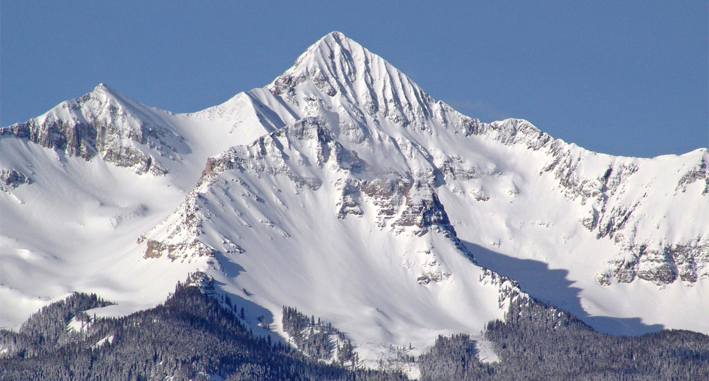
Wilson Peak

Photos

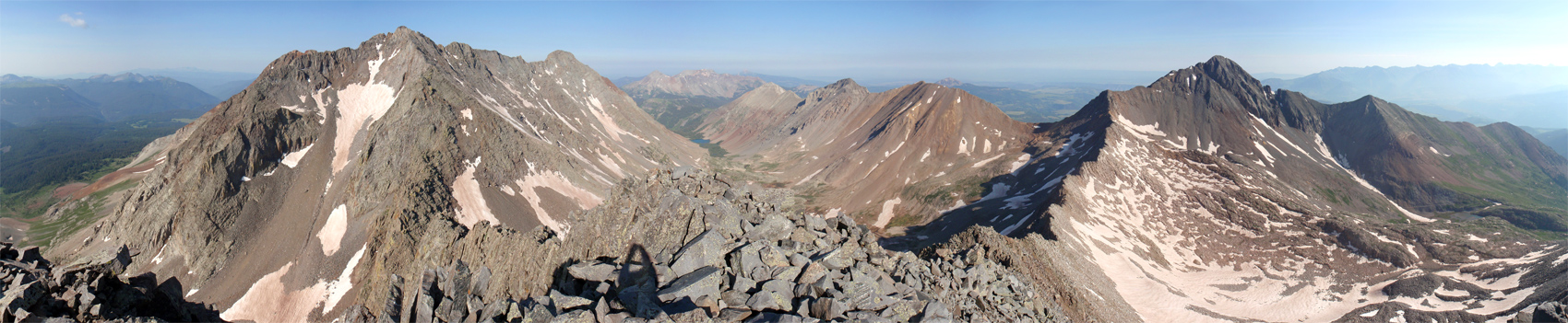
360 Pano
360° Summit Pano
pic1
pic2
pic3
pic4 pic5 pic6 pic7 pic8 pic9 pic10 pic11 pic12 pic13 pic14 pic15 pic16
pic17
pic18
pic19 pic20
pic21
pic22 pic23 pic24 pic25 pic26 pic27 pic28 pic29 pic30 pic31 pic32 pic33 pic34 pic35 pic36 pic37 pic38 pic39 pic40 pic41 pic42 pic43 pic44 pic45

Climbing Routes

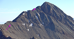
route
Navajo Lake Approach
Difficulty: Class 1
Total Elevation Gain: 2,000'
Round-trip Distance: 9.5 mi
Exposure: Low
Rockfall Potential: Low
Route-Finding: Low
Commitment: Low
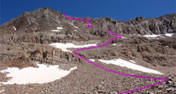
route
Rock of Ages Approach
Difficulty: Class 1
Total Elevation Gain: 2,800'
Round-trip Distance: 8.5 mi
Exposure: Moderate
Rockfall Potential: Low
Route-Finding: Low
Commitment: Low
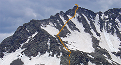
route
Kilpacker Approach
Difficulty: Class 1
Total Elevation Gain: 800'
Round-trip Distance: 6 mi
Exposure: Low
Rockfall Potential: Low
Route-Finding: Low
Commitment: Low
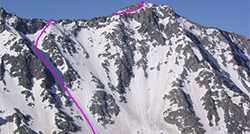
route
Woods Lake Approach
Difficulty: Class 1
Total Elevation Gain: 2,115'
Round-trip Distance: 9 mi
Exposure: Low
Rockfall Potential: Low
Route-Finding: Low
Commitment: Low
route
Wilson Peak - Southwest Ridge Standard Route
Difficulty: Class 3
Total Elevation Gain: 3,900'
Round-trip Distance: 10 mi
Exposure: High
Rockfall Potential: Considerable
Route-Finding: Considerable
Commitment: Considerable
route
El Diente Peak - South Slopes Standard Route
Difficulty: Class 3
Total Elevation Gain: 4,400'
Round-trip Distance: 12 mi
Exposure: Considerable
Rockfall Potential: Considerable
Route-Finding: High
Commitment: Considerable
route
Mt. Wilson - Southwest Slopes Standard Route
Difficulty: Class 3
Total Elevation Gain: 4,400'
Round-trip Distance: 12.5 mi
Exposure: High
Rockfall Potential: Considerable
Route-Finding: Considerable
Commitment: Considerable
route
Mt. Wilson - North Slopes
Difficulty: Class 4
Total Elevation Gain: 5,100'
Round-trip Distance: 16 mi
Exposure: High
Rockfall Potential: High
Route-Finding: High
Commitment: Considerable
route
El Diente Peak - North Slopes
Difficulty: Class 3
Total Elevation Gain: 5,000'
Round-trip Distance: 15 mi
Exposure: Considerable
Rockfall Potential: Considerable
Route-Finding: High
Commitment: Considerable
route
Combo: Mt. Wilson + El Diente Traverse
Difficulty: Class 4
Total Elevation Gain: 500'
Round-trip Distance: 1 mi
Exposure: High
Rockfall Potential: High
Route-Finding: High
Commitment: High
route  _
El Diente Peak - North Buttress
Difficulty: Class 4
Total Elevation Gain: 3,200'
Round-trip Distance: 5 mi
Exposure: High
Rockfall Potential: Considerable
Route-Finding: High
Commitment: High
route  _
Mt. Wilson - East Face
Difficulty: Class 3  Moderate Snow
Total Elevation Gain: 4,900'
Round-trip Distance: 12 mi
Exposure: High
Rockfall Potential: Considerable
Route-Finding: High
Commitment: High

Map

Human Verification Required

Trip Reports

  8 Recent Reports Peaks Climbed Added
  Wilson Peak NNE Ridge Google Map Included GPX file available for download
By: Boggy B
Added: 8/1/2026
Wilson Peak
Gladstone Peak
8/1/2026 8/1/2026 9  8
  of chafe and character-building Google Map Included GPX file available for download
By: EvanKBlack
Added: 7/30/2026
San Luis Peak
El Diente Peak
Mt. Wilson
Wilson Peak
Mt. Sneffels
Mt. Lindsey
7/22/2026 7/30/2026 9  24
  Coors Light Adventure
By: mountainboy28
Peak(s): Wilson Peak
Added: 5/10/2026
Wilson Peak 8/3/2025 5/10/2026 3  8
  SOLO Day Hiking the Winter 14ers
By: illusion7il
Added: 4/26/2026
Mt. Eolus
North Eolus
Sunlight Peak
Windom Peak
Capitol Peak
Pyramid Peak
Snowmass Mountain
Maroon Peak
North Maroon Peak
Mt. Wilson
El Diente Peak
Wilson Peak
Mt. of the Holy Cross
Little Bear Peak
Longs Peak
12/22/2025 4/26/2026 32 
  Four Nights at the Wilson Group
By: jcbmaverick
Added: 9/7/2025
Wilson Peak
Mt. Wilson
El Diente Peak
9/4/2025 9/7/2025 7  21
  Exploring The Bilky Way Galaxy Google Map Included GPX file available for download
By: masonzastrow
Peak(s): Wilson Peak
Added: 6/24/2025
Wilson Peak 6/24/2025 6/24/2025 3  22
  Wilson Peak - Stepping Up My Winter Game Google Map Included
By: Jgeeez
Peak(s): Wilson Peak
Added: 12/25/2024
Wilson Peak 12/21/2024 12/25/2024 28  18
  Sayonara, San Juans (or, a Screed against Scrambling)
By: HikesInGeologicTime
Peak(s): Wilson Peak
Added: 8/18/2023
Wilson Peak 8/5/2023 8/18/2023 7  23
View All 170 Trip Reports

Frequently Asked Questions about Wilson Peak

Is Wilson Peak a good first choice for an introductory Class 3 scramble?

No, Wilson Peak is a serious, technical mountain that should not be attempted as a first Class 3 climb. While the lower approach trails are smooth and straightforward, the final summit ridge line features complex route-finding, loose rock zones, and sections of vertical exposure that demand previous scrambling experience on more forgiving, solid peaks.

Is Wilson Peak the mountain featured on the famous Coors Light beer can?

Yes, Wilson Peak is the iconic, jagged mountain silhouette immortalized on the labels and cans of Coors Light beer. While many people mistake it for Maroon Bells or Mount Sneffels, this rugged peak sits prominently in the San Miguel Mountains just outside Telluride, offering hikers the unique opportunity to climb an instantly recognizable piece of American pop-culture history.

Can I climb Wilson Peak, Mount Wilson, and El Diente Peak all in one day?

Bagging all three summits in a single day creates a massive, grueling endurance day. If you choose to attempt it, the most efficient method is to start at the Navajo Lake or Rock of Ages trailhead and ascend El Diente Peak's North Slopes route first, then traverse across the ridge crest to Mount Wilson, and hit Wilson Peak on your way back out. To do this safely, you should aim for early summer so you can climb the unstable North Slopes of El Diente when the couloir is filled with consolidated snow, avoiding severe summer rockfall hazards.

Which trailhead offers the best access for climbing Wilson Peak, and do I need a 4WD vehicle?

The standard and most popular access route is from the Rock of Ages trailhead. This approach is highly favored by hikers because the road is well-maintained and passable for most 4WD/AWD vehicles. Do not attempt to drive a low-clearance 2WD car to this trailhead.

Additional Wilson Peak History

Name History 1
Climbing History 0
Mining 0
Geology 1
More Information 0
  View All