You can start the traverse
1 from either Kilpacker or Navajo Basin. This route description assumes you are climbing El Diente first and traversing to Mt. Wilson. Here are the routes involved for each basin:
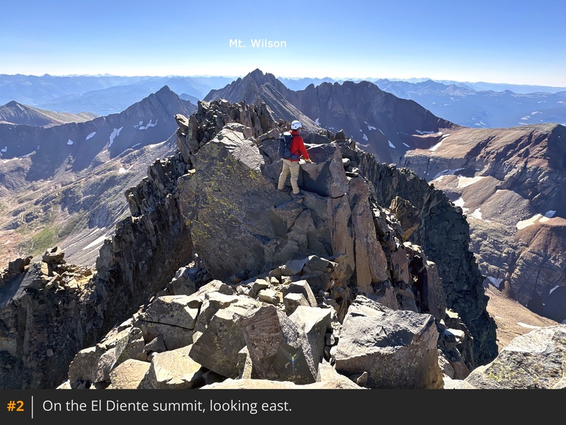
From the summit of El Diente
2, descend
3 to the notch and retrace your ascent route (assuming you climbed either the north or south slopes route) along the north side of the ridge
4. Locate the top of the small gully that drops down the south side and descend it
5. Angle left out of the gully and begin the traverse back under the Organ Pipes
6 7. After the Pipes, continue traversing on loose, gray rock and begin to ascend back to the ridge as you turn a corner
8. Beyond the corner, you'll reach the area where El Diente's North Slopes route meets the ridge crest
9.
Just below the ridge crest, stay on the south side and continue toward "Pin Point," a cluster of gendarmes blocking the ridge
10. To keep the difficulty at Class 3, do not climb directly over "Pin Point." Instead, stay slightly below the ridge crest, crossing stacked rock to reach the base of the gendarmes. Look for cairns marking the way across the steep rock
11. Alternatively, you can descend farther below the ridge and bypass the gendarmes entirely, but this option will cost you an additional 100 feet of elevation. Traverse onto more stable, larger rocks, moving around the gendarmes as you make progress
12 13 14. After bypassing the gendarmes, ascend loose terrain to regain the ridge crest
15 16.
Next, follow the ridge ahead, which is relatively straightforward
17. Scramble above 14,000', as you approach the top of "West Wilson"
18. Continue across toward a bump of more challenging rock on the east end of "West Wilson"
19. From this point, the final ridge obstacle is obvious
20. But first, you must downclimb from "West Wilson"
21. Navigate through rocky terrain to reach the lowest point of the saddle, pausing to preview the steep climb that awaits on the other side
22 23.
Now for the crux of the traverse: a narrow, steep section of rock with exposure on both sides. Drop slightly to the right (south side) of the ridge and look for the most manageable way to start climbing
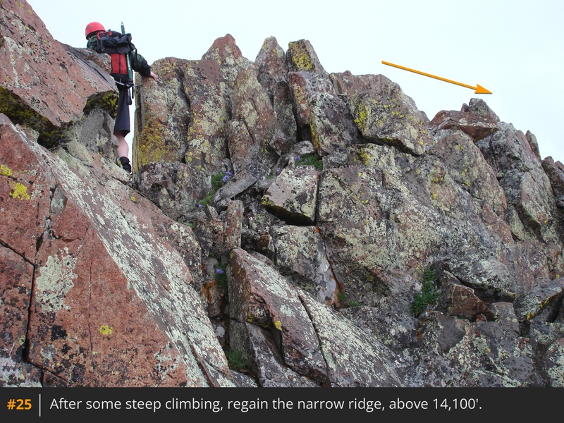
24. Look for ways to shift left toward the ridge crest as you ascend. As the climbing becomes difficult or exposed, take your time and don't go too far right. Near 14,100', regain the ridge crest near the west edge of this steep section
25 26. Carefully scramble eastward across the narrow ridge and gain a view of the remaining route
27. Descend the east end of this section
28, sticking to or just left of the ridge crest, as you approach the final saddle on the connecting ridge
29.
From the saddle, turn right and pass rock walls into a Class 2 gully leading up to Mt. Wilson's summit ridge
30. Ascend the gully to reach a 14,150-foot notch, where the route joins Mt. Wilson's North Slopes route
31. Turn right to climb out of the notch, following the narrow summit ridge
32. The final crux obstacle along the ridge is a grouping of rocks barring clear access to the summit
33. Moving left provides the easiest bypass, while the right requires exposed Class 4 climbing moves. After overcoming this crux section, gain Mt. Wilson's summit
34 35.
If you started the traverse from Kilpacker Basin, return via Mt. Wilson's Southwest Slopes route. If you need to return to Navajo Basin, descend Mt. Wilson's North Slopes route.







 GPX
GPX KML
KML