Follow the
Kilpacker Approach to reach 12,600' and the junction for El Diente Peak's south slopes route -
1. The rocky Kilpacker "trail" essentially ends here, and this junction
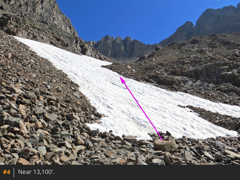
is usually marked by a couple of small cairns, so don't expect anything too obvious. For Mt. Wilson's southwest slopes route, look for cairns and head east along the north side of the basin -
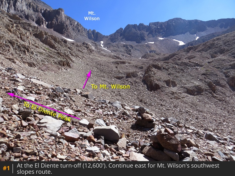
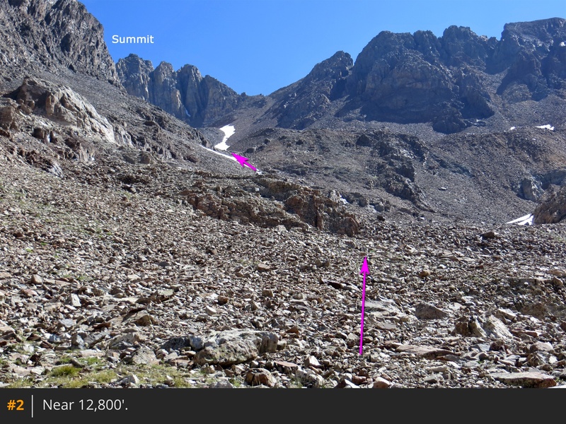
2. As the basin comes to an end, angle northeast into a drainage that leads toward Mt. Wilson -
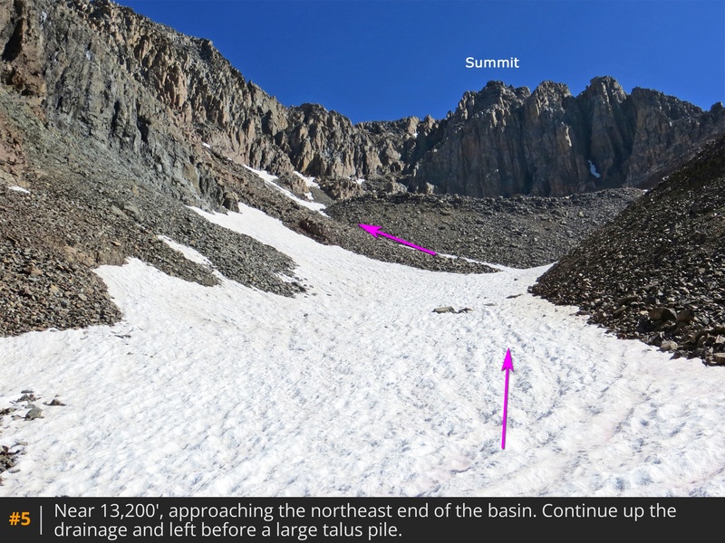
3. Continue up the drainage (
4) until reaching 13,200', where you'll get a clearer view of the remaining route -
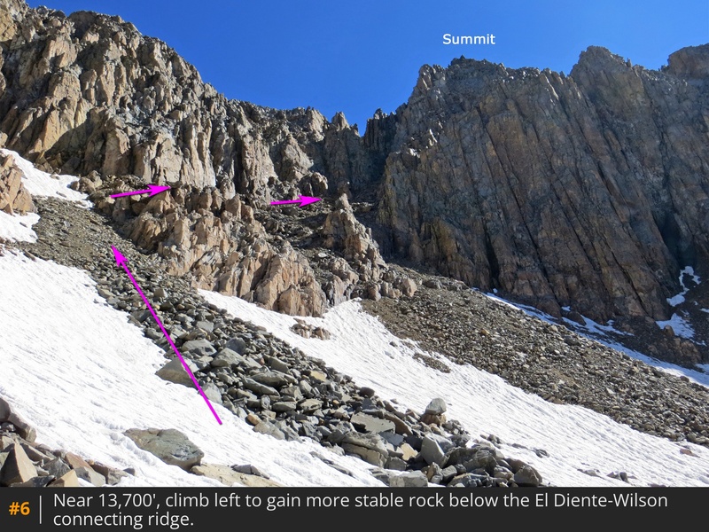
5. Make your way toward a large talus pile and turn left before continuing to 13,700' -
6. The remaining route is straight ahead, but to avoid unpleasant terrain, climb to the left onto rocks just below the connecting ridge between El Diente and Mt. Wilson -
7.
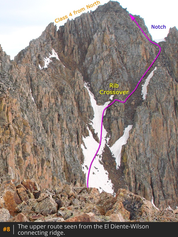
Photo
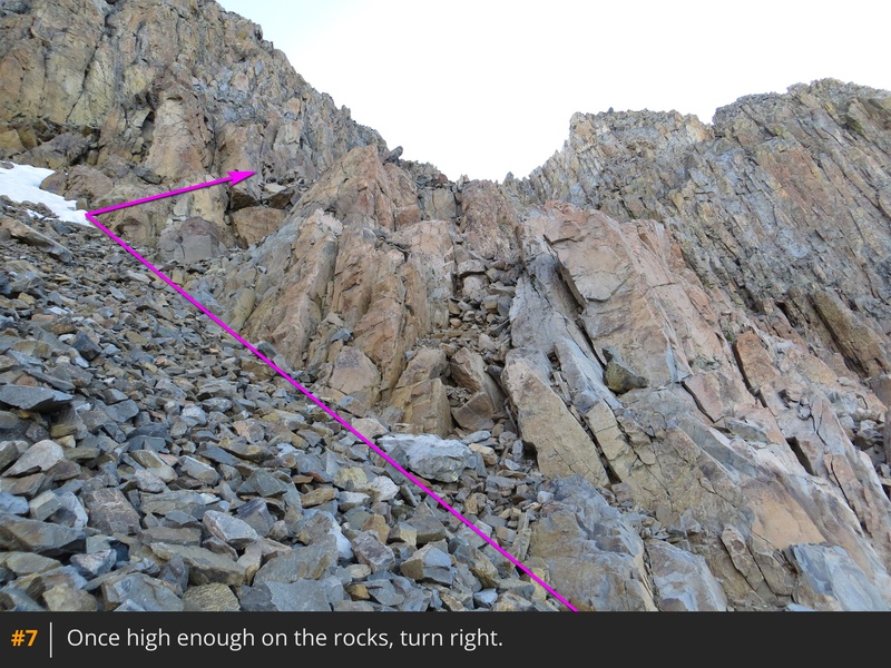
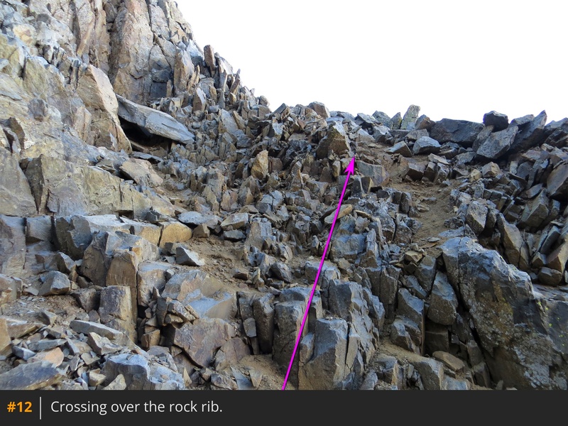
8, taken from the El Diente-Mt. Wilson traverse, shows the remaining route. In summary, you'll ascend partway up a gully, cross over a rock rib, and then climb another gully to reach a notch before progressing to the summit. After ascending the rocks shown in
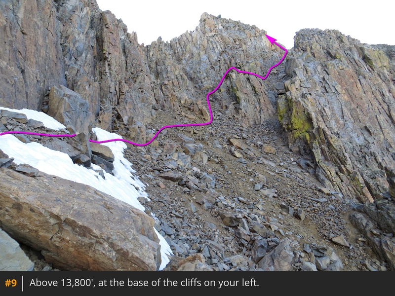
7, turn right to view the next section of the climb -
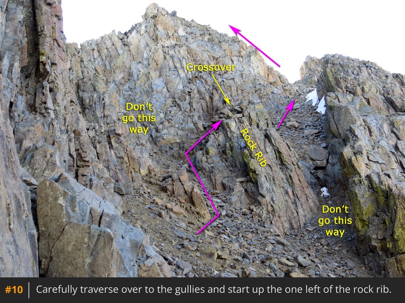
9. Around 13,800', traverse beneath the cliffs on loose rock and enter the gully -
10. Climb this section briefly and locate the rib crossover point visible in
11.
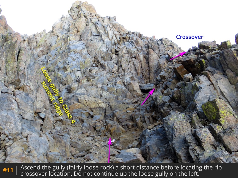
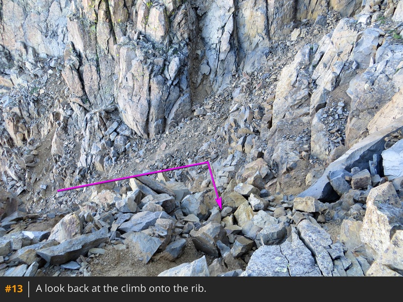
Turn right, execute a few Class 3 moves to gain the rib (
12,
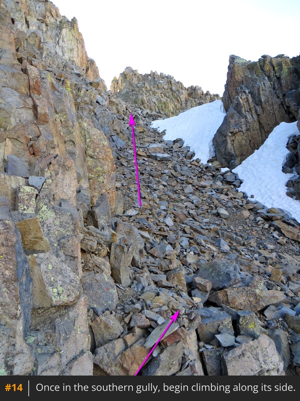
13), and step over to see the southern gully. Drop down slightly into this gully and begin climbing along the side -
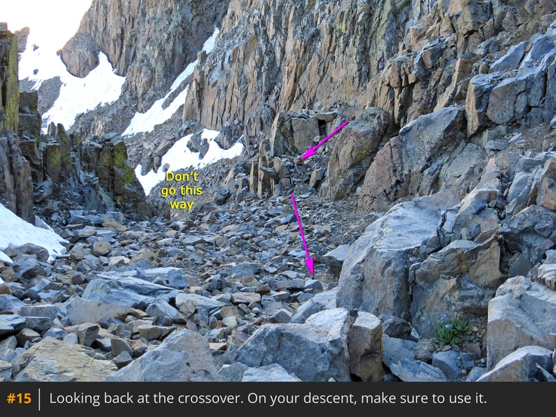
14. Look back to take note of the crossover point to ensure you can identify it on your descent -
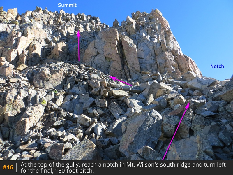
15. Continue up the gully to reach a notch
in Mt. Wilson's south ridge, near 14,200'. Turn left and climb the final 150-foot pitch -
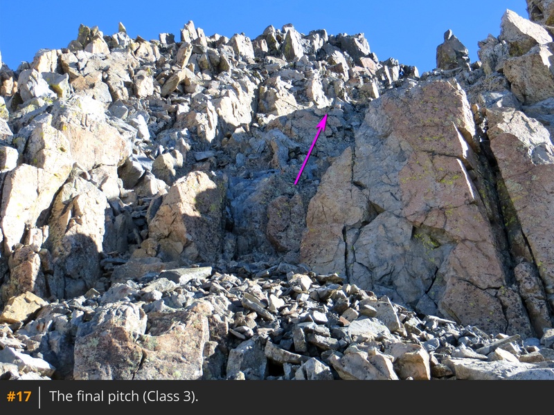
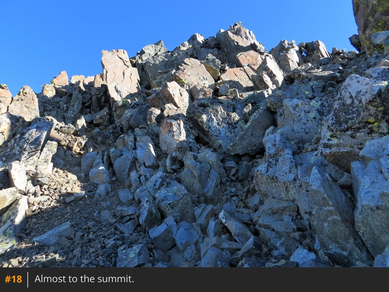
16,
17,
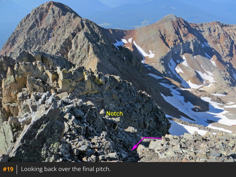
18. This is the most challenging part of the route, but the difficulty can be kept to Class 3. Gain the summit and enjoy the views -
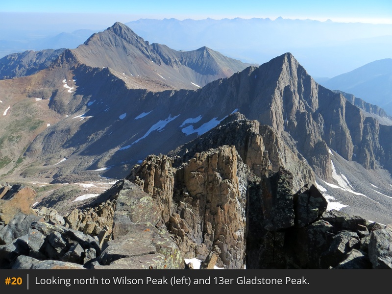
19,
20.


 GPX Track File
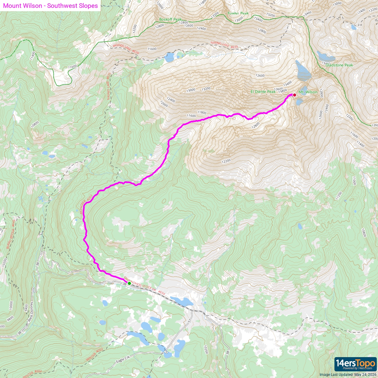


