| Report Type | Full |
| Peak(s) |
Wilson Peak - 14,021 feet Mt. Wilson - 14,256 feet El Diente Peak - 14,175 feet |
| Date Posted | 09/07/2025 |
| Modified | 09/08/2025 |
| Date Climbed | 09/04/2025 |
| Author | jcbmaverick |
| Four Nights at the Wilson Group |
|---|
|
I wanted to get some more Class 3 experience this year so I aimed for the Wilson Group, as each standard route is Class 3. There were a ton of different options for approaches and campsites, and I had some great advice from others in the forum, but I ended up deciding on the plan that minimized the distance and gain I would need to hike. So, the itinerary became this: two nights at Navajo Lake to tackle Wilson Peak, and two nights at Kilpacker Basin to take on Mt. Wilson and El Diente (No Traverse). This would be my longest self-contained backpacking trip as well, and I found that four nights worth of food is about the limit of my bear canister space. Sunday August 31st I drove 14 hours in from Omaha and arrived at Navajo Lake Trailhead around 8PM local time. There were a couple narrow spots on the way up Dunton Rd where I had to basically get into the ditch to let a couple big pickup trucks pass me. Otherwise, the road was pretty nice and my Subaru Ascent had no problem. When I arrived at the trailhead, I put on the X-Mode to make sure the car was level. There were only about 4 cars there and they all seemed to be empty. I signed the register, knowing that this could be useful for SAR if I went missing, and made sure to write NO TRAVERSE in the comments. I felt that this way they wouldn't try to look under the ED-W ridge if I went missing and also kept me accountable to sticking to the plan. I am wanting to complete all 58 14ers in my lifetime but in a way that minimizes risk as I am from the Midwest and not a seasoned mountaineer. "Stick to the plan" became a regular mantra for me on this trip. I went to my car to sleep, and was surprised to find that nobody else entered the lot that night. Monday September 1st Happy Labor Day! I woke up with the sun, smashed on some mini donuts and Java Monster, and got my stuff put together. My pack had to weigh at least 50 lbs with all the gear and food and 2 liters water I brought for the hike up to Navajo Lake. It was only about 4 miles though, so I pushed through it, and made it to the lake around 11AM. I found a terrific campsite just across the creek, that had a lot of space for a kitchen station and a place to hang my gravity filtration system. 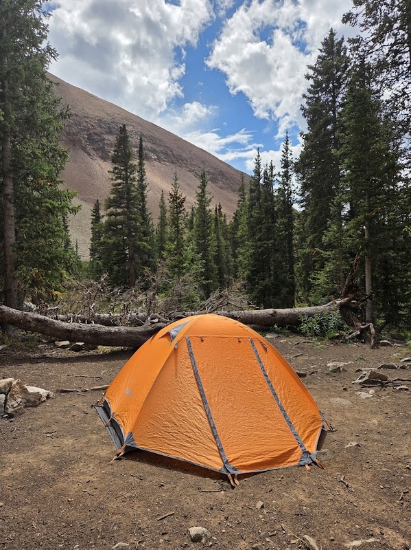
After getting camp set up I decided to do a bit of exploring. First, I went back down the trail a bit to where I saw a cave I wanted to check out. It was a pretty cool little cave, not sure if it was manmade or not. After that, I decided to walk past the lake a bit upslope and scout the trail for Wilson Peak. There are apparently campsites above the lake too in the trees but I didn't know that, not that I would've wanted to carry my pack even further. After checking it out a bit I went back to the lake and decided to take a dip. It wasn't terribly cold but I didn't stay long... just got in up to my neck and then got out to dry. Lounging on the shore in the sun was peak relaxation. 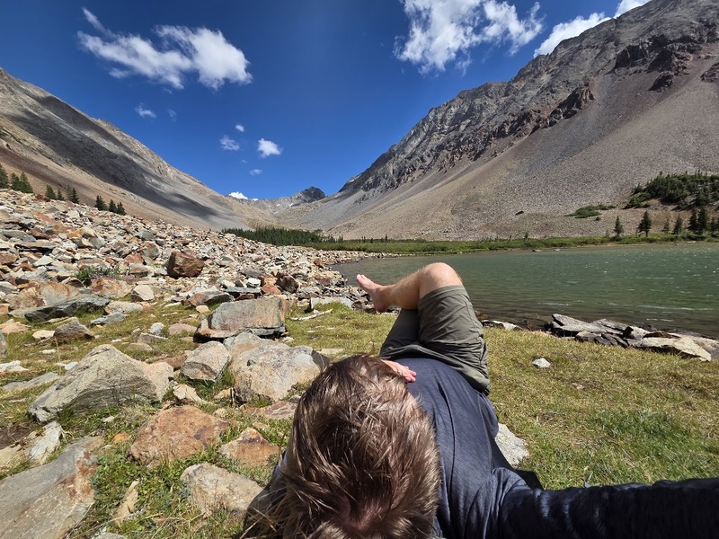
A couple of other groups arrived that night, one of which I was surprised was burning a campfire as Navajo Basin had multiple signs on the way in saying "No Campfires" not to mention that the area was in Stage 2 fire ban. They even had an electric chainsaw... these guys came prepared. I cooked dinner and then went into the tent for a bit listening to an audiobook. I also made sure my day pack was full on water, snacks, and stuff I need for summitting. I fell asleep around 9PM but it was a bit uncomfortable. I've never had great luck sleeping at altitude, and even with my low-profile camping cot it was tough. I had my alarm set for 6AM. Tuesday September 2nd Summit dayyy. I woke up at 4AM to pee and, per usual, I couldn't get back to sleep so I decided to just get on with it. I cooked up oatmeal and instant coffee, did my morning poo in a WAG bag, and started up the trail about 5AM. I didn't see anybody behind me the whole way up, and the trail was well-marked in the upper basin with these elaborate massive cairns that are deserving of awards. 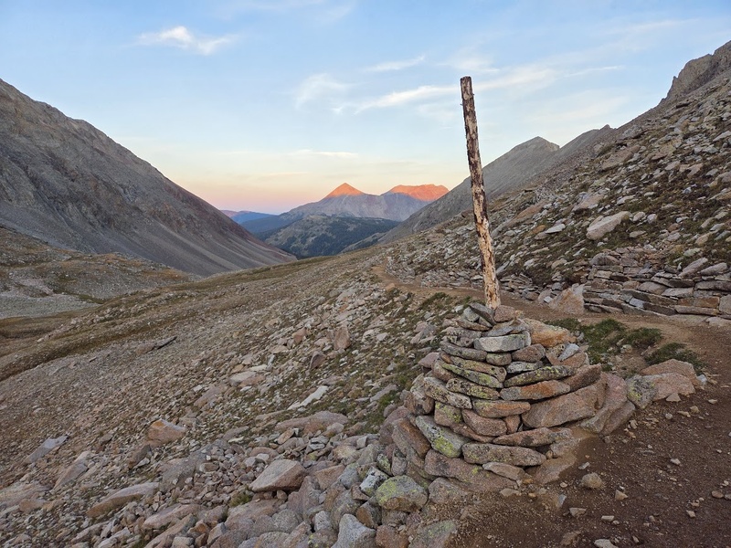
The sky was pretty well-lit by the time I started up the Rock of Ages saddle but the sun was still behind the ridge. The climb up the slopes to the saddle definitely elevated my heart rate but it was not too bad. The abandoned mine near the saddle was an interesting sight to see and it really grasped my attention for a bit and just had so many questions... how long has this stuff been here? how did they get it here? what were they mining for? did they make a lot of money? why was it abandoned? are they ever coming back for it? I may never learn the answers but it was a cool piece of history to see how far man will go to make a living. 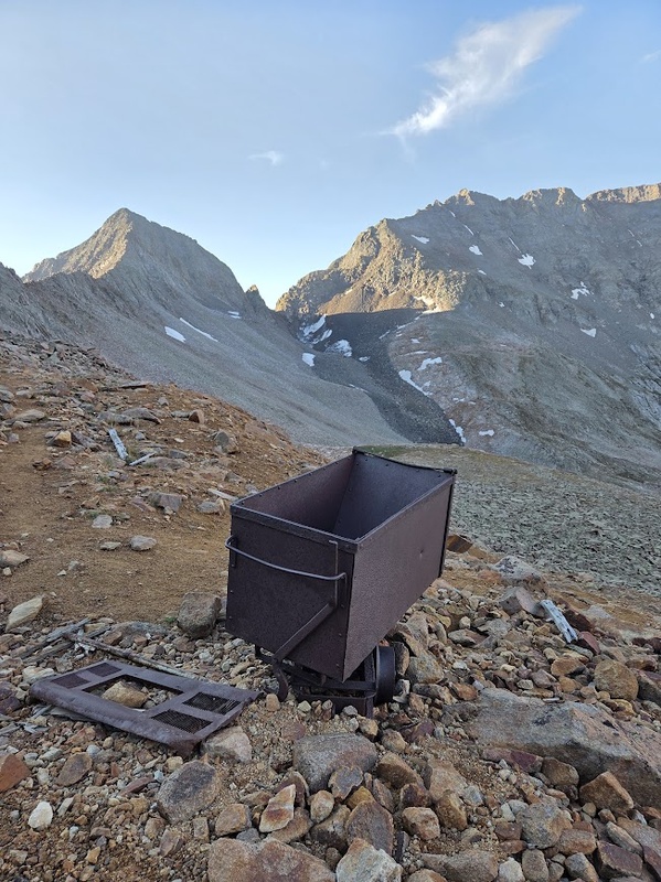
As I reached the Rock of Ages saddle, I heard a plane getting closer and closer. I realized it was going to fly right over me so I tried to grab my phone and get a shot. It did end up flying over my head, but I was too slow on the phone to get the shot. I was shocked and amazed at how close it was flying to the mountains. It ended up turning into the Navajo Basin, and I later found out from my camp neighbor that the plane dropped trout fry into the lake. Cool! At the saddle, I put on my helmet and put my poles away. I had a quick snack and went on my way, following the route in the 14ers app. I consulted the route frequently as I traveled through the technical terrain. The crux wall by the gash looked scary, and there were two people coming down when I got to it so I got to see just how massive it was in comparison. "Human for reference". However, it was a pretty solid climb and I got to the Wilson Peak summit (#19) around 930AM. I called the wife, checked the latest weather forecast, and logged into Pokemon Go to see if summit was a pokestop (It is not). There was a wooden sign up there that I borrowed for my summit pic. 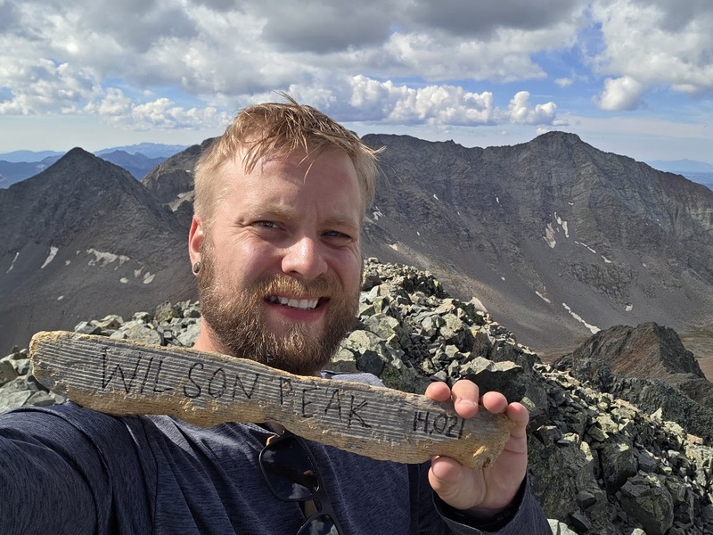
I made it back to camp pretty uneventfully although there was one thing I won't forget. As I was heading down Rock of Ages saddle I encountered someone who was still heading up. It was about 12PM probably at that point, and there was some clouds building in the area and rain falling in the distance. He asked me what I thought about the clouds and I told him the forecast didn't call for any rain today and I haven't heard any thunder so.... he was like OK cool I'm going for it. He ended up summiting and then PASSING me by the lake before I made it to camp. I marveled at how fast he was and found out that he was on his way back to Kilpacker Basin... he climbed over Mt. Wilson to get to Wilson Peak and was on his way back to Kilpacker. That it is a HUGE day. On the way back down, I debated in my head whether to just keep camp at Navajo Lake and try to summit Wilson-El Diente from there by going around to Kilpacker Basin on the same day. It would be adding 8 miles to my hiking but I wouldn't have to move camp. Yet again, I affirmed myself to "stick to the plan". Also another thing... I ran into someone on the way up Wilson Peak, as she was on her way down. Jen is her name, and Wilson was her finisher. Congratulations! I told her my plan to do El Diente-Wilson in one day via standard route only and she suggested I do Wilson first so that I'm not coming up on people doing the traverse. I ended up taking her advice and was glad I did for multiple reasons. Read why further. Wednesday September 3rd Today was all about moving camp from Navajo Lake to Kilpacker. Being as I was in no rush, I was able to cook my oatmeal in daylight and broke camp by 9AM. I headed back down the trail to get to the connector trail between Navajo and Kilpacker. For a lot of the way, I was debating whether I should just go back to the car and move it to Kilpacker Basin TH but that would about 3 miles to my hike with full gear. Plus, it kind of felt like cheating on my four nights self-supported backpacking trip. "Stick to the plan" I ended up going with and turned off at the junction. 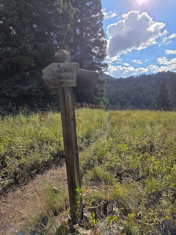
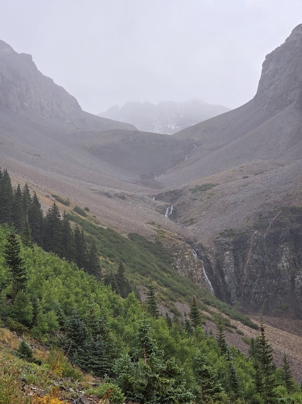
The connector trail was a little overgrown in the meadow but in the forest it was pretty easy to follow. The creek crossing was a bit of a bear to find a good path across but I made it over with dry shoes and took a break there as I knew the rest of the way was uphill. I remember going through an aspen grove after that with some huge trees, one of which had a date of 1963 carved in it. While I don't condone carving into the Aspen bark, it was interesting to note that the tree was over 60 years old. There were some other old aspens there, I don't think I've ever noticed old ones like that, and I saw that the bark on the lower trunk can get mottled and hard with age. When I connected to the main Kilpacker Basin trail it was obvious, as there was a sign for El Diente Route there at the junction. As I hiked up I had to step over some fresh horse poop, which got me thinking. Why is it OK for horses to poop right on the trail but not for dogs? And why do humans have to bury their poo? I wasn't seriously looking for answers but it's the sort of things that I pondered out there during my time in the wilderness. I ended up setting camp closer to the creek crossing at Kilpacker Basin, as I did not want to hike any further up through the meadows and there did not seem to be easy water access from the typical Kilpacker Basin campsites. I set down my pack and went further ahead with just my daypack just to make sure there weren't some better sites up ahead. That's where I got the first peek of the Kilpacker Basin and the scenic waterfalls. 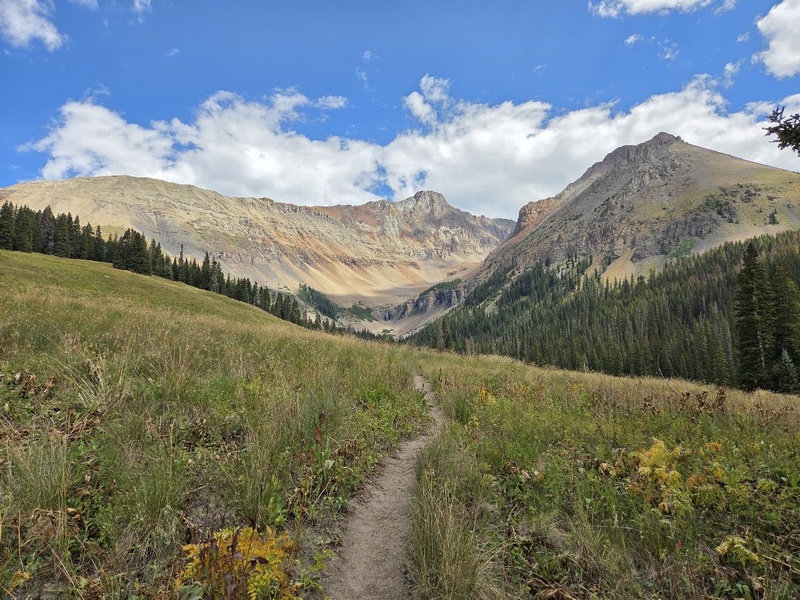
I didn't find any that were showstopper sites, and you can't really see the waterfalls from the camping area, so I went back to my spot and set up camp. I ate lunch, relaxed a bit, took a dip in the creek and sunbathed. The whole time I was thinking how cool it would be to get up close to the waterfall. So around 3PM I decided to go exploring and just try to folllow the creek up to the falls, as I knew there wasn't really a defined trail to get there. On the way, I actually found a secret waterfall in the woods, it had to be about 20 feet high and I know I wasn't the first one there because there were a couple fire rings in the area. I continued ahead and after hopping across some talus, I got to the upper falls. 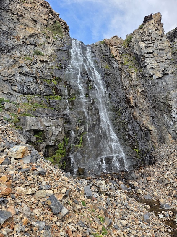
The upper falls seemed to be about 30 feet high. I got down to my undies and took a quick shower in it, feeling like a real wildman. I spent about half an hour there before I decided it was time to head back to camp for dinner. I didn't go back the same way I came, instead I saw a faint outline of a trail that went straight up out of the talus field by the creek to meet the Kilpacker Basin trail. I got back to camp around 6PM and cooked up some grub. I laid down around 8PM, set my alarm for 4AM, and went to bed. Thursday Sept 4th Without fail, I woke up before my alarm to pee and couldn't go back to sleep. This time it was 230AM. Now normally 4AM is the earliest I'm willing to wake up for a summit but since I was already awake... I went on with it. And I'm sooooo glad I did. You'll see why later. I hit the trail around 330AM after breakfast and the sky was dazzling with stars. I saw three shooting stars that morning. I trudged along the scree up the basin, and around 430AM I noticed two headlamps behind me probably about a mile in the distance. Awesome, I'm not alone out here. At the 12,600' junction, I went ahead towards Mt. Wilson. As expected, the two headlamps behind me turned towards El Diente. The approach to Mt. Wilson is long through the scree and talus, the trail is not well-defined, but it was nice getting most of the suck out of the way in the dark. The sky was light by the time I got to the upper drainage basin. I donned my helmet and cinched my beanie in the elastic bands on the outside of my pack. I found the technical portion of the route for Mt. Wilson was easy to follow and not too demanding. I approached the Mt. Wilson summit (#20) around 830AM. Elated, I shouted a big ol WOO at the top. I saw two humans on the top of El Diente from there, but they did not WOO back. Oh well, I don't take it personal. I ate a summit snack, snapped a couple pics and decided to get on with it as I still have to climb ED and the weather was showing storms arriving around 2PM. 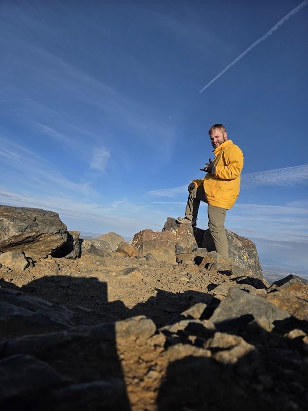
When I got to the 12,600 feet junction, I realized I lost my beanie. It must've gotten snagged on the way down from Wilson. This was disappointing, as I wore that beanie when sleeping to help keep me warm. The climb up El Diente was steep and loose. There are like three gullies to scramble up that I found very intense cardiologically. I consulted the 14ers app frequently to make sure I didn't get off route. I reached the El Diente summit (#21) about 1115AM. There are actually two little summit piles, but there is one that is just ever so slightly taller and it has an old busted out PVC pipe that used to store something like a registration paper. No summit marker though seen on any of the three peaks in the Wilson Group so either I missed it or that's just the way it is. The summit of ED is small but it makes for some great dramatic summit shots when standing on it. While I was finishing up my shots, I heard thunder in the distance and decided it was time to boogie. The time was about 1130AM. 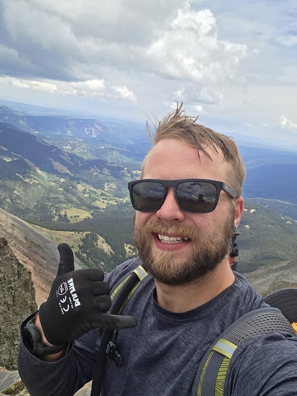
On the way down, the thunder got closer and I started to panic. I was butt sliding and scree-surfing down the slopes and about 12PM it started to graupel. I still hadn't made it out of the gray gully. I saw two people walking down the valley from Mt. Wilson and I realized they might've found my beanie, but I didn't think I would be able to catch up to them. So I hurried downslope to get closer and then, gave a big shout down below "HEY! DID YOU FIND A GRAY BEANIE?!" They stopped and hesitated and one of the shouted back "YEAH!" so excitedly I yelled back "AWESOME! PLEASE LEAVE IT AT THE JUNCTION! THANK YOU!" and they went on ahead. The weather continued to deteriorate. I did end up finding the beanie on a cairn just past the junction, which was a huge relief. However, I found out that I tore two holes in my pants and almost lost my car keys. That's what I get for butt-scooting. I was still above treeline and at this point there was thunder overhead and the graupel had turned into a steady rain. I was terrified. I donned my rain gear and tried to keep moving. At certain points when the thunder sounded very very close, I tried to hunker down next to boulders hoping it would pass but the storm stuck around for a bit. 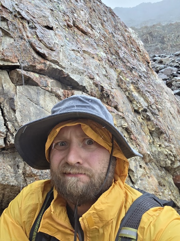
I got back to camp around 2PM and I was soaked. I got into my dry camp clothes and hunkered down. It continued rain and thunder. I texted my wife via T-Mobile T-Satellite (highly recommend) and asked her if there is a better weather window to get back to camp that night or the next day as planned. She said tomorrow morning was the best bet so I decided to stay warm and dry in the tent and take a nap. It was raining on and off until about 6PM and I decided to get out and get cooking. I also tried to dry out some clothes, but there just wasn't enough time. So I ended up gathering some dry twigs from under the trees and started a fire. I know Stage 2 fire ban but the ground around the fire ring was drenched and it was kind of an emergency to dry my clothes for the hike back to the car. Please don't yell at me. It started raining again around 8PM so I put out the fire and went to bed. I ended up getting 9.5 hrs of sleep that night... the most I've gotten the whole trip. The next morning everything still felt a little cold and damp but at least it wasn't actively raining. I skipped breakfast, broke camp, and started heading down around 8AM. The plan today was to hike down the Kilpacker Basin trail, past the connector trail I took to get there, to another connector trail closer to the road that would take me to the Navajo Lake TH. However, the ground was still wet and muddy, and I decided it would be better to hike down to Kilpacker Basin TH, ditch my pack, then take the road to the Navajo Lake TH and drive back for my pack. Along the way, I met a local woman walking her dogs on the trails named Linda. She was nice and we got to talking, she pointed out the skunk cabbage falling over and told me about a herd of sheep at the Kilpacker Basin TH. It was the wildest thing, as the sheep scurried off the trail in front of us. Hundreds of them. 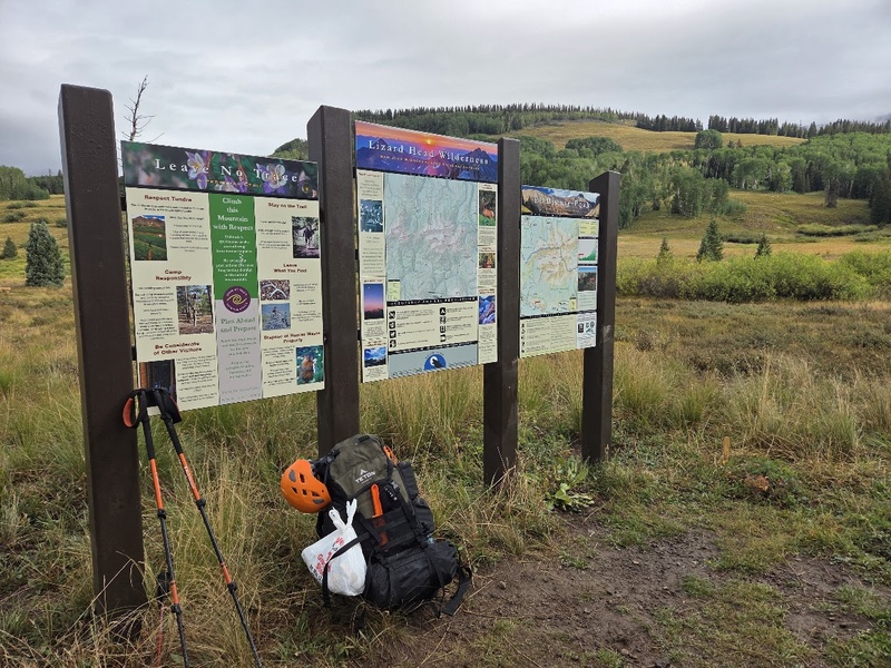
I dropped my pack and Linda agreed to watch over it until I got back. She was camped there at the trailhead with her husband, so it was no biggie. The amount of relief I felt when seeing my car, and then it started right up... oh, I wish we could bottle it. I switched into clothes I left in the car and headed for my pack. Afterwards, I ended up going to Telluride to get a hot meal and do a little souvenir shopping. What a magical town! I parked at Carhenge free parking and walked to Stronghouse Brewpub. What a cool restaurant and the food was delicious... I'm a bit of a Reuben connoisseur and their Reuben was top 3 for sure. 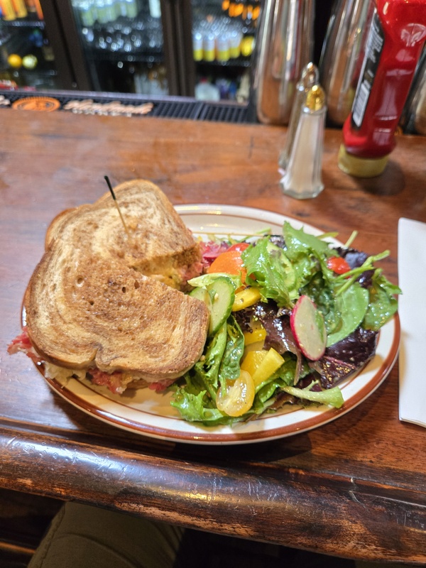
I also got to try a wet hops IPA, which is seasonal as wet hops are freshly picked. It was more floral and less bitter than most IPAs I've had, I was impressed. From there, I rode the free gondola to Mountain Village, got some presents to bring back home for the wife and kids, and rode the gondola back down. However, I heard from others that I should stop at San Sophia station to go to the scenic overlook. Glad I did. 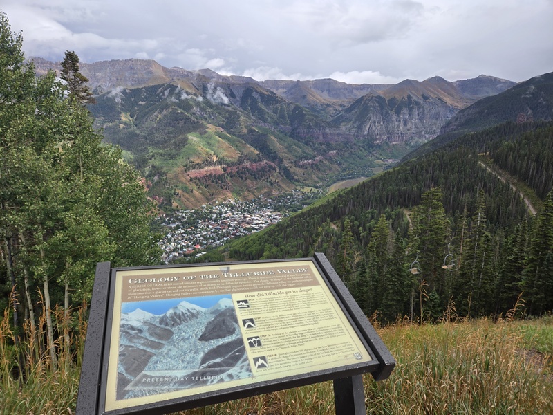
That night, I had a hotel room in Delta... with a 2-person whirlpool tub IN THE ROOM. I couldn't wait to get a good soak in after hiking around 33 miles with over 12K feet of gain over four days. All in all, the trip was successful. Looking back on it, if I would've started at the expected time on Thursday the storms would've been hitting me as I was coming down Wilson and there was no way I would've tried for El Diente in that weather. So although it was terrifying and miserable on the way down, I was still able to accomplish my goal without injury or loss. Heck yeah. Thumbnails for uploaded photos (click to open slideshow):  Entering the Wilderness area from Navajo Lake TH")
 Fresh-faced and bushy tailed on first day")
 Chillin by the lake")
 Sundowning on Navajo Lake")
 Looking back at Navajo Lake during the climb")
 An interesting scene near Rock of Ages Saddle")
 Made the summit! Wilson Peak")
 Campsite at Navajo Lake")
 The turn-off from Navajo Lake trail to Kilpacker Basin trail")
 A view of Kilpacker Basin")
 The lower falls")
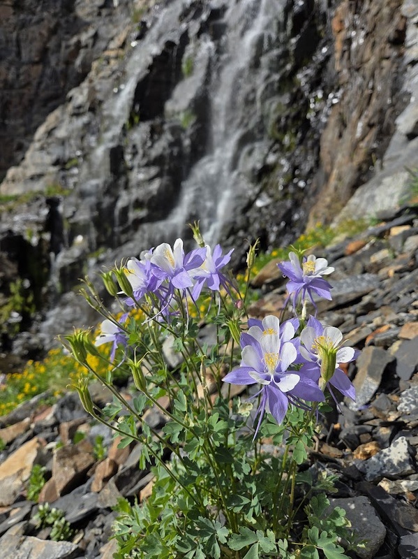
 Columbine in bloom... after Labor Day! I was shocked.")
 Upper falls")
 Mt. Wilson Summit pic")
 El Diente Summit pic")
 Caught in the storm on the way back to camp")
 Looking back at upper Kilpacker Basin socked in with storms")
 Ditched my pack at Kilpacker Basin TH")
 Massive cairn in Upper Navajo Basin")
 The overlook from San Sophia Station")
 The Brewben at Stronghouse Brewpub")
|
| Comments or Questions | |||
|---|---|---|---|
|
Caution: The information contained in this report may not be accurate and should not be the only resource used in preparation for your climb. Failure to have the necessary experience, physical conditioning, supplies or equipment can result in injury or death. 14ers.com and the author(s) of this report provide no warranties, either express or implied, that the information provided is accurate or reliable. By using the information provided, you agree to indemnify and hold harmless 14ers.com and the report author(s) with respect to any claims and demands against them, including any attorney fees and expenses. Please read the 14ers.com Safety and Disclaimer pages for more information.
Please respect private property: 14ers.com supports the rights of private landowners to determine how and by whom their land will be used. In Colorado, it is your responsibility to determine if land is private and to obtain the appropriate permission before entering the property.


