Log In 
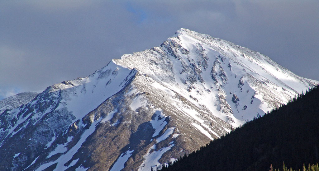
Torreys Peak and neighboring Grays Peak sit on the Continental Divide, 40 miles west of Denver. Grays is the highest point on the Divide and Torreys is a close 2nd. This pair of peaks can be seen towering over Lake Dillon, in Summit County. If you drive the paved road to the top of 14er Mt. Evans, Grays and Torreys can be seen to the west/northwest. Grays and Torreys were named in 1872 during a ceremony on the summit of Grays Peak, conducted by botanist Charles C. Parry, in honor of two of America's most famous botanists, Asa Gray and John Torrey. Torreys Peak is one of the easiest 14er climbs in Colorado and is usually climbed together with Grays Peak. If you climb these peaks, try to do so on a weekday so you'll be able to find a parking spot at the Grays Peak Trailhead.
Elevation 14,272' (LiDAR)
Prev Elevation 14,267'
CO 14er Rank 12 of 53
Range Front
Forest Arapaho
Counties Clear Creek, Summit
Towns Bakerville, Montezuma, Keystone
Torreys Peak

Other 14ers in Group

Peak Grays Peak

Photos

360 Pano
360° Summit Pano
pic1
pic2
pic3
pic4
pic5
pic6
pic7
pic8
pic9
pic10 pic11 pic12 pic13 pic14 pic15
pic16
pic17 pic18 pic19 pic20 pic21 pic22

Climbing Routes

route
Grays Peak - North Slopes Standard Route
Difficulty: Class 1
Total Elevation Gain: 3,000'
Round-trip Distance: 7.5 mi
Exposure: Low
Rockfall Potential: Low
Route-Finding: Low
Commitment: Low
route
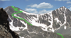
Torreys Peak - South Slopes Standard Route
Difficulty: Class 1
Total Elevation Gain: 3,000'
Round-trip Distance: 7.75 mi
Exposure: Low
Rockfall Potential: Low
Route-Finding: Low
Commitment: Low
route
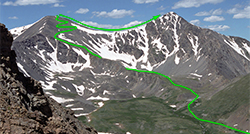
Combo: Grays and Torreys Standard Route
Difficulty: Class 1
Total Elevation Gain: 3,600'
Round-trip Distance: 8.25 mi
Exposure: Low
Rockfall Potential: Low
Route-Finding: Low
Commitment: Moderate
route
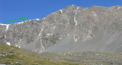
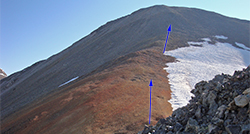
Grays Peak - South Ridge
Difficulty: Class 2
Total Elevation Gain: 3,250'
Round-trip Distance: 6.5 mi
Exposure: Moderate
Rockfall Potential: Moderate
Route-Finding: Moderate
Commitment: Moderate
route
Grays Peak - Southwest Ridge
Difficulty: Class 2
Total Elevation Gain: 3,800'
Round-trip Distance: 10.25 mi
Exposure: Moderate
Rockfall Potential: Moderate
Route-Finding: Moderate
Commitment: Moderate
route
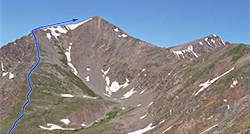
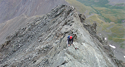
Torreys Peak - Kelso Ridge
Difficulty: Class 3
Total Elevation Gain: 3,100'
Round-trip Distance: 6.75 mi
Exposure: High
Rockfall Potential: Considerable
Route-Finding: Considerable
Commitment: Considerable
route  _
Torreys Peak - West Ridge
Difficulty: Class 2
Total Elevation Gain: 5,500'
Round-trip Distance: 10 mi
Exposure: Moderate
Rockfall Potential: Moderate
Route-Finding: Moderate
Commitment: Considerable
route  _
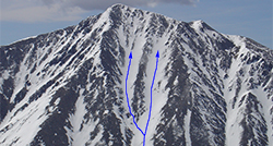
Torreys Peak - NW Face/Tuning Fork
Difficulty: Difficult Class 2  Moderate Snow
Total Elevation Gain: 4,500'
Round-trip Distance: 10.5 mi
Exposure: Moderate
Rockfall Potential: Considerable
Route-Finding: Considerable
Commitment: Considerable
route  _
Grays Peak - Lost Rat Couloir
Difficulty: Class 3  Steep Snow
Total Elevation Gain: 3,000'
Round-trip Distance: 6.5 mi
Exposure: Considerable
Rockfall Potential: Considerable
Route-Finding: Moderate
Commitment: Considerable
route  _
Torreys Peak - Dead Dog Couloir
Difficulty: Class 3  Steep Snow
Total Elevation Gain: 3,000'
Round-trip Distance: 6 mi
Exposure: Considerable
Rockfall Potential: Considerable
Route-Finding: Moderate
Commitment: Considerable
route  _
Torreys Peak - Emperor Couloir
Difficulty: Class 3  Steep Snow
Total Elevation Gain: 4,500'
Round-trip Distance: 9.5 mi
Exposure: Considerable
Rockfall Potential: Considerable
Route-Finding: Considerable
Commitment: Considerable

Map

Human Verification Required

Trip Reports

  8 Recent Reports Peaks Climbed Added
  Tour of Grays Basin Ridges Google Map Included GPX file available for download
By: hobbes7714
Added: 7/22/2026
McClellan Mountain
Mt. Edwards
Grays Peak
Torreys Peak
Grizzly Peak
7/21/2026 7/22/2026 5  15
  Hoosier Pass to Loveland Pass Google Map Included GPX file available for download
By: justiner
Added: 7/13/2026
Grays Peak
Torreys Peak
Mt. Edwards
6/8/2025 7/13/2026 12  5
  Loveland Fourbanger (Cupid, Grizzly, Torreys, Grays)
By: DrewJHartmann
Added: 5/15/2026
Torreys Peak
Grays Peak
Grizzly Peak
"Cupid"
5/13/2026 5/15/2026 4  18
  Kona The Mountain Dog
By: sfreytag
Added: 1/8/2026
Grays Peak
Torreys Peak
Kelso Mountain
Wildhorse Peak
Missouri Mountain
Uncompahgre Peak
Redcloud Peak
Mt. of the Holy Cross
Mt. Princeton
Mt. Columbia
Mt. Oxford
Mt. Massive
Mt. Cameron
Mt. Democrat
Mt. Yale
6/29/2019 1/8/2026 26  31
  Grays and Torreys - Combo Route
By: Ryno
Added: 9/30/2025
Grays Peak
Torreys Peak
7/20/2025 9/30/2025 4  4
  Grays & Torreys from the Grays South Ridge Google Map Included GPX file available for download
By: knova
Added: 9/3/2025
Grays Peak
Torreys Peak
8/31/2025 9/3/2025 1  3
  Grays and Torreys
By: Paul M
Added: 8/11/2025
Grays Peak
Torreys Peak
8/8/2025 8/11/2025 5  34
  Hiking 8 peaks to get back to my bike to get back to my car Google Map Included GPX file available for download
By: Alpine_Iris
Peak(s): Kelso Mountain, Mt. Edwards, Grays Peak, Torreys Peak, Grizzly Peak, "Cupid", 12,582 - 12,582 feet, AS P560 BM - 12,752 feet
Added: 7/4/2025
Kelso Mountain
Mt. Edwards
Grays Peak
Torreys Peak
Grizzly Peak
"Cupid"
12,582 - 12,582 feet
AS P560 BM - 12,752 feet
6/26/2025 7/4/2025 15  33
View All 536 Trip Reports

Frequently Asked Questions about Torreys Peak

Are Grays Peak and Torreys Peak suitable for beginner 14er hikers?

Yes, Grays Peak is widely considered one of the absolute best introductory 14ers in Colorado for beginners. The standard trail up Grays is a non-technical Class 1 walk-up that features a well-defined trail all the way to the 14,278-foot summit. Nearby Torreys Peak is slightly more rugged but is a straightforward Class 2 hike via the connecting saddle trail, making the pair a great stepping stone for novice hikers looking to test their high-altitude stamina.

Can a standard car make it up the road to the Grays Peak Trailhead?

While standard 2WD passenger cars occasionally attempt it, driving all the way to the main Stevens Gulch Trailhead almost always requires a high-clearance 4WD or AWD vehicle. The 3-mile dirt access road off Interstate 70 features deep ruts, exposed rocks, and large potholes that can easily scrape or damage low-clearance vehicles. If you drive a standard car, your best option is to park at the lower Bakerville parking lot off the highway exit and hike or carpool up the rough dirt road to the start of the trail.

When is the absolute best time to hike Grays and Torreys?

The ideal time to hike these peaks is early morning on weekdays during the summer months (late June through early September). Because they are located less than an hour from Denver right off I-70, the trailhead parking lot fills to maximum capacity before 5:00 AM on summer weekends, creating massive crowds and heavy trail congestion. Choosing a Tuesday, Wednesday, or Thursday morning allows you to enjoy the trail with far more solitude and less parking stress.

Is there an established trail all the way to both summits?

Yes. You will find a well-defined, continuous trail to the top of both mountains. The route from the trailhead to the summit of Grays Peak is fully established. If you choose to add Torreys Peak, a highly apparent, heavily traveled trail drops down from Grays into the connecting saddle and leads you directly up onto the summit ridge of Torreys with no off-trail navigation required.

Additional Torreys Peak History

Name History 0
Climbing History 0
Mining 0
Geology 0
More Information 0
  View All