| Report Type | Full |
| Peak(s) |
Mt. Elbert - 14,438 feet Mt. Massive - 14,427 feet Mt. Harvard - 14,424 feet Blanca Peak - 14,350 feet La Plata Peak - 14,344 feet Maroon Peak - 14,163 feet North Maroon Peak - 14,022 feet Mt. Eolus - 14,087 feet Crestone Peak - 14,299 feet Snowmass Mountain - 14,105 feet |
| Date Posted | 04/27/2024 |
| Date Climbed | 03/12/2024 |
| Author | Will_E |
| Winter 14ers- The 6 year Trench |
|---|
|
Winter 14'ers-The 6 year Trench When I started the 14'ers in June of 2018 I wasn't sure I'd be able to get through the list even in summer. I had no plans to try any of them in winter, I figured if I just went out and tried to get one or two every weekend I could possibly do them all in a few years. I didn't attempt any of the harder (class 3 and up) 14'ers until I had a solid 20+ class 1 and 2 peaks. When fall came around in 2018 and I lost the ability to do these peaks in shorts and a tank top, I just figured I'd keep trying to get to the top of as many peaks as I could for as long as I could until the end of the year, then would pick things up again next summer. As the year ended I just kept going, and fell in love with the views and the challenge of getting to the top of big peaks in the cold. This is my story, peak by peak, of getting through the Colorado 14'ers in calendar winter. Winter 18/19: 9 peaks My first official winter 14'er was Grays Peak, December 22, 2018. I didn't know anything about the official start of winter, this just happened to be the first full winter day. Weather was sucky, it was cold and windy, I had no views. I mostly just needed to get out and be on a mountain, I had to put my nearly 19 year old cat down the day before and thought getting out on a mountain would help me feel better. His name was Captain Kirk, he was awesome. Apple stats:15.38 miles, 4985' elevation gain, 8 hours, 54 minutes. I don't generally take breaks when hiking other than at summit, I pause the workout at summit, so my trip times don't include time hanging out at summit. 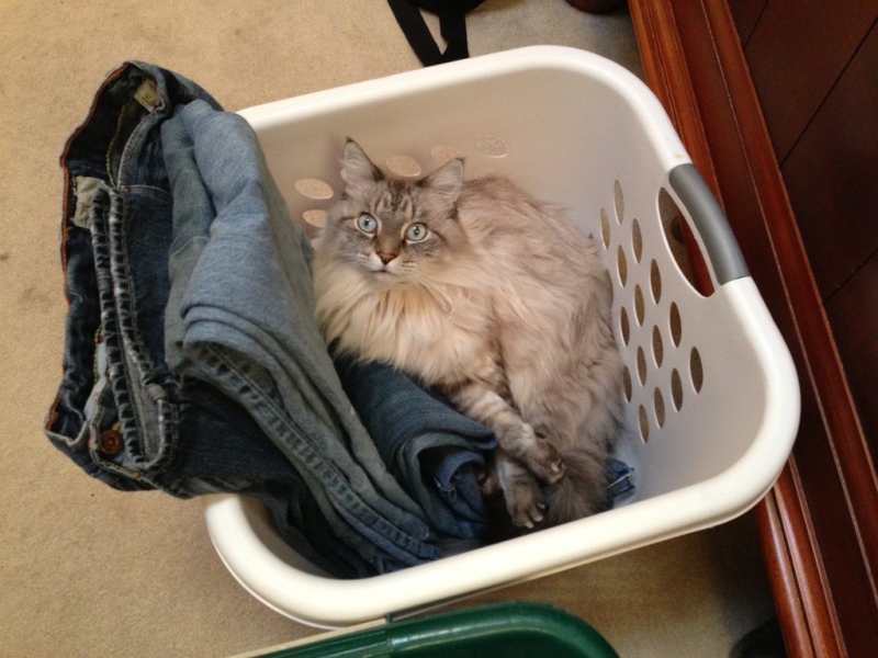
Mt. Belford, 12/29/18: Super cold day, among the coldest days I've had. I started fairly late, around 9 or 10am, I didn't expect it to take me long (it didn't). Car showed outside temperature to be -12° when I hit the trail, and it was windy too. So miserable up high I skipped doing Oxford. Apple stats: 9.23 miles, 4,952' elevation gain, 5:10 trip time. Huron Peak 1/5/19: Snow in winter 18/19 started off fairly slow, overall it was a heavy snow year, but the crazy snow didn't really start up until February, and was even more nuts in March. I didn't realize at the time how unusual it was to be able to drive a 2wd sedan all the way to Winfield. I was with a friend and might have been showing off a bit with my driving skills going a short distance past Winfield and nearly getting us stuck. There was a trench that day, and we thought it unnecessary to take our snowshoes. When we reached the long flat section just past treeline we realized the err in our plan, but pushed through, mostly sort of crawling on our knees. Perfect weather day, very little wind. Apple stats: 12.1 miles, 3234' gain, 7:29 round trip. Mt. Bierstadt 1/10/19: I don't remember much about this day, looks like I had good views. :Shrug: Apple stats: 11.08 miles, 3,592' gain, 4:52 round trip. 
Mt. Elbert 1/17/19: One of my rules I set for myself initially in winter was to not do anything in winter that I hadn't done in summer so I'd have some familiarity with the route, as I've long proclaimed myself world's worst route finder. I broke my rule on this trip, I had done Elbert in summer of 2018 via the Black Cloud trail, this day in January I did the typical east ridge winter route. I got a little bit lost breaking trail near the end of treeline, once out of the trees it's easy to see the route. Cold windy day. Apple stats: 14.58 miles, 6,686' elevation gain 8:39 round trip. Elevation gain is optimistic, apple calculates elevation gain off barometric pressure, on days with crazy weather it sometimes overestimates. Probably more like 5,000' for this trip. 
Mt. Massive 1/26/19: Another cold windy day, and I again broke my rule about doing unfamiliar routes in winter. Got lost around treeline again, I was breaking trail and just lost my sense of direction, I don't think I had discovered the concept of using GPX files for navigation yet. Somehow made it to the top, similar weather to Elbert a few days prior. I didn't know about the N Massive thing, and even if I had I probably wouldn't have gone for it given the weather. Apple says 17.06 miles, 8,508' gain, 10:19 trip time. Gain was probably more like 5k, distance seems a few miles high too. Missouri Mtn. attempt, 2/16/19: At this point the mountains had gotten a lot of snow, and I really didn't know what I was doing regarding avalanche conditions, I don't think I was even checking the forecast. I didn't even get out of the trees, which was probably for the best. I reached the area just past the creek crossing and the snow was so deep and powdery I was moving so slow there was no way I was going to get anywhere close to summit. Humboldt Peak attempt, 2/23/29: Broke my rule again, I hadn't even done Humboldt in summer conditions, but it looked like a safe, easy route, and I had started using GPX files to help with navigation. There was a ton of snow starting at the 2wd TH, I was breaking trail the entire distance to treeline. It was cold and windy above treeline, I was starting to lose feeling in my fingers around 13,500 and turned back. Before I got back to treeline my phone died. I had a battery to charge it, but there was some little piece of debris in the charge port that I couldn't get out. Ended up lost going down further north than where I went up, fortunately I ended up recognizing when I reached the Rainbow Trail and managed to find my way back. Long miserable day with no summit to show for it. I went back for Humboldt at the end of March, but alas it was no longer winter. Pikes Peak, 3/2/19: I didn't expect to be able to summit Pikes Peak this day, there was a snowstorm forecasted to arrive in the afternoon. I made good time to the A Frame, the Barr trail was well tracked to there, I had only used snowshoes for a mile or so. At the A frame I was above the clouds and there was no sign of the storm yet, so I went for it. Storm arrived about a mile before I reached summit, there was no way I going to turn back being that close. No views at summit, but the seeing the clouds below me before the storm arrived was spectacular. Apple stats: 24.33 miles, 7468' elevation gain, 10:44 trip time. 
Mt. Antero, 3/9/19: This was the weekend after the "bomb cyclone" hit the state, if that's not the coolest name for a snowstorm, I don't know what is. I was breaking trail in deep, thick snow the entire way to treeline, and it was a fairly warm day. 13.65 Miles, 6,018' gain, 9:25 trip time. 
San Luis Peak, 3/16/19: I had planned to do Uncompahgre this trip, as I was familiar with it, I was staying in Gunnison for the weekend. Lake City was having a bit of a snow apocalypse, it wasn't even possible to get to the bottom of Nellie Creek Rd. I scrambled to find something else to climb in the area, and discovered that San Luis Peak was around 2 hours away from Gunnison. I didn't know anything about the peak or route, or how far I'd even be able to get to the trailhead. When I reached the end of what was plowed Google said I was 2.5 miles from the trailhead, so I was thinking it would be a 14-15 mile day, perfectly doable, even with a nearly 9am start. I was breaking trail in deep snow from the car door, 5 miles later I was finally at the start of the trail. It was around 5pm when I reached summit, got back to the car after 11pm. When I got back to the hotel a few hours later my eyes were burning, I had been out in a perfect cloudless, windless day with no eye protection, and learned a hard lesson about photokeratitis. Apple stats: 20.95 miles, 5,698' gain, 13:59 trip time. 
Winter 19/20: 19 Peaks LaPlata Peak, 12/30/19: I don't know why LaPlata is so hard in winter, but it is. It isn't super long, it isn't terribly technical, yet for some reason I felt like it shouldn't take as long as it did. The day was cold, it was below zero to start. I remember meeting a skier in the parking lot putting his gear on as I was leaving, we chatted for a few minutes before I told him I need to get moving before I started freezing. Breaking trail up the winter route was tough. Temp at summit was 0°, but there wasn't much wind. Apple stats: 14.37 miles, 5,009' gain, 10:16 trip time. No idea how Apple got 14 miles, should be closer to 10. 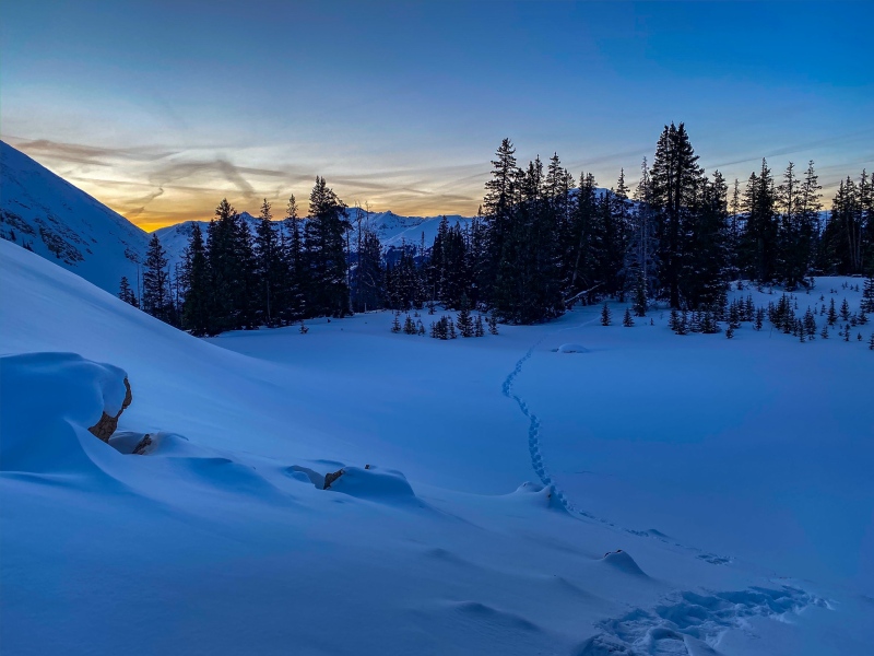
Torreys Peak, 1/1/20: Crappy weather day, it was cold, windy and snowy. I went up the standard route. 12° at summit, Apple says 15.33 miles, 6,081' elevation gain, 8:08 trip time. 
Quandary Peak, 1/4/20: A few of the easier peaks I had been sort of "saving" for when weather wasn't good. This day had a sucky forecast, I think wind forecast was 35-40 mph, my general rule is to not go out if the forecast is showing stronger than 35 mph. Quick day, I wore snowshoes the entire day because I broke one of my micro spikes at the trailhead. 19° at summit, and windy. Apple says 7.21 miles, 3467' gain, 3:41 trip time. Decalibron 1/11/20: I didn't really like these peaks in summer, too short, I don't find the views to be that great, and the hiking is kinda boring. I was waiting to do winter Decalibron on a sucky conditions day, my thinking is that if I'm gonna do these boring peaks again, might as well do them on a sucky weather day and do enjoyable peaks when the weather is nice. The sucky conditions were as advertised, it was below 10° all day long, coldest temp I saw was 3°, and the wind across Cameron was pure misery. I did the clockwise route, when I reached Bross I was only showing 8 miles for the day, I went back to Cameron and down to get some additional distance. Apple says 14.39 miles, 5,904' gain, 8:24 trip time. Blanca/Ellingwood, 1/18/20: I knew Blanca was going to be a big day, wasn't even sure if I'd be able to get Ellingwood too. I started earlier than normal, around 6:30, at 8,000', like usual for Lake Como Rd. My rationale for starting on the late side is that 1) I enjoy a good night's sleep 2) if I'm gonna be hiking in the dark, doing it at the end of the day will at least give me some tracks to follow. After making it up to the top of Blanca I decided to just go down to the low point on the ridge to Ellingwood, didn't think I had time to get Ellingwood. When I reached the low point, I looked at the sun's position, it looked deceptively high. I didn't look at my watch because I didn't want to have a reason not to go for it. The ridge to Ellingwood was tougher than I anticipated, I'm glad I pushed on, the views from Ellingwood were spectacular. Got back to the car around 8:30pm. Apple says 20.04 miles, 7,541' gain, 12:51 trip time. Summit temp on Blanca was 14°. 
Mt. Princeton, 1/25/20: Weather conditions were generally pretty agreeable on Saturdays this entire winter. I was working in Hastings, NE most of this winter and alternating between short weekends and long weekends. On short weekends I had to work a full day on Friday, and drive back on Sunday afternoon, so tried to do closer peaks on these weekends (I was living in Aurora back then). Little traffic on 285 in winter made it easier to get some of these Sawatch peaks. I like Princeton, it has decent distance and great views. Apple says 15.19 miles, 5,439' gain, 8:32 trip time. Summit temp was 15°. 
Mt. Harvard, 2/2/20: I did the standard route to Harvard rather than Frenchman's Creek. I was expecting to be all alone up there like usual, turns out I was following my heroes Devin and Arthur, they branched off towards a 13'er south of Harvard while I went straight to Harvard, we didn't meet. Another nice weather Saturday. Apple stats: 20.24 miles, 5,521' gain, 10:15 trip time. Summit temp was a balmy 21°. 
Kit Carson, 2/15/20: I knew very little about couloirs at this point in my journey, and had no idea that the direction a couloir faces affects its stability, or lack thereof. When I set out to do Kit Carson this day I was undecided whether I was going to try the N ridge or Outward Bound couloir. Avalanche conditions were yellow that day, which I equated to a yellow traffic signal. Snow felt fine in the couloir, but I won't pretend I was an expert in such matters. I carried my snowshoes all the way to summit thinking I might return via the Avenue/Challenger, but decided to return via the couloir. It was another great weather Saturday. Apple stats: 19.82 miles, 7,130' elevation gain, 12:50 trip time. Summit temp was 18°. 
Mt. Lindsey, 2/22/20: Lindsey wasn't on my radar for this winter, I knew it was one of the crazy long distance days. I rarely poach trenches, but when Brad McQueen, WildernessJane and 2 others (sorry, don't know the other 2 people to give credit) did this the week before and provided info on how great the road conditions were and put in a nice trench, I decided to go for it the following weekend. Another nice weather Saturday, it was windy in the morning, calm at summit. Apple says 18.02 miles, 5,553' gain, trip time was 10:47. 
Sunshine/Redcloud, 2/28/20: Another great forecast, this winter was really being generous with low wind days, I was planning Redcloud/Sunshine on Friday, and Uncompahgre or Wetterhorn on Saturday. When I parked at the Mill Creek Campground to do the south ridge to Sunshine, I was surprised to see 2 vehicles there. When I reached the top of Sunshine I saw two guys on the bypass around Sunshine, I later learned that they were my heroes ToyotaSupraNihilist and CaptainSuburbia. We missed crossing paths by like 20 minutes. Nice day, but I was more looking forward to Wet/Unc the next day. Apple stats: 10.59 miles, 5,538' gain, 7:00 trip time. Summit temp was 25°. 
Wetterhorn Peak, 2/29/20: When I pulled up to the closed gate at the end of County Rd. 20 Saturday morning I still hadn't decided whether I was going for Unc or Wet. They both start from the same place in winter, Wet is a little bit longer distance. I decided to go for Wetterhorn, it was another great weather day with warm temps and little wind. The road walk was cold but quick, it's mostly in the shade until turning off for Wetterhorn. I was surprised to have a trench all the way through treeline, I later learned that my hero Preston Dennis was up there the day before. Beautiful day and weekend. Apple stats: 20.8 miles, 5,045' gain, 9:30 trip time. Summit temp was 10°. 
Crestone Peak and Crestone Needle, March 7, 2020: This was my first really big winter endeavor. I had done Crestone Needle on December 21, started before the solstice, finished after, I knew at the time (and didn't care) that it didn't count, it took me 15.5 hours. I figured if I was going to go all the way back in there from S. Colony Lakes, I might as well try and get them both. I didn't even know at the time that there was another route from the other side. Anticipating that I was looking at an 18-20 hour day, and my general dislike of waking up early, I decided to try something new: an overnight start. I figured it was going to take me 8 hours to reach red gully, which is where I wanted to be around sunrise. I pulled into the parking area around 9pm, tried to take a nap, I just can't force myself to sleep when I'm not tired. I also had a bit of anxiety as I wasn't sure exactly how my body would react to being asked to stay up for 2 days straight to climb a couple big mountains. I started around 10:30 pm, the day went quicker than expected. Custer County SAR had packed down the road up to the kiosk, saving me a few miles of breaking trail. I reached a cold and windy Broken Hand Pass around 4 am, was halfway up red gully at sunrise. I never had intention of doing the Crestones traverse, at that point I hadn't done it in summer conditions. After getting back down red gully and reascending Broken Hand Pass I wasn't feeling too terribly tired and was able to go get the Needle too. It was a fantastic long hard day, and gave me a huge confidence boost that I could handle the distance, vert, and the overnight hiking on no sleep. Trip stats: 25.01 miles, 9,462' vert, trip time 17:28. 
Uncompahgre Peak, March 15, 2020: The start of Covid. This was the first time Covid felt real, I had mostly just heard about it in the news, didn't seem like anybody realized how this would change our lives. I drove to Gunnison the day before, when I pulled into the Holiday Inn Express parking lot there were 4 or 5 cars there. It's a huge hotel, and I might as well have had the entire floor to myself. Nothing had actually shut down at that point, but people stopped traveling. I had yet another great weather day, it was a fantastic way to finish off a great winter. Apple stats:16.55 miles, 5,045' gain, 9:30 trip time. Summit temp was 26°. 
Winter 2020/2021: 18 peaks Winter started off with sadness, I had to put down my nearly 16 year old cat, her name was Colonel. I found her when I was volunteering at a creek cleanup project in Rifle, CO when she was just a few weeks old, she was a really sweet kitty. It was 2 years to the day from when her older brother left, and just like before, I needed to be on a mountain. Weather wasn't great for Humboldt Peak, but I didn't care. There were a few groups that had been up recently, a trench was in place. It was cold, windy and miserable, but relatively quick. Apple stats: 14.52 miles, 6,757' gain, 7:31 trip time. Elevation gain seems a little exaggerated. Summit temp was 18°. 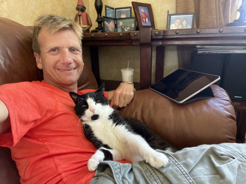
Mt. Shavano/Tabeguache Peak, 12/29/20: Lots of new snow the day before, I had never been to the Angel of Shavano campground where most people start in winter. Instead I decided to see how far I could get to the standard trailhead. I made it about 3 miles from the standard route trailhead, I was breaking trail from the start. The snow at the top of treeline was deep and steep, weather was better than forecasted, wind wasn't bad. On the way back from Tabeguache I went around Shavano rather than over it, was a huge mistake, some of the worst trap door snow I've ever encountered, and the sun had just gone down. Long hard day, I got back to the toaster around 9pm. Apple says 19.81 miles, 6,675' gain, 12:11 round trip. Summit temp was 11°. 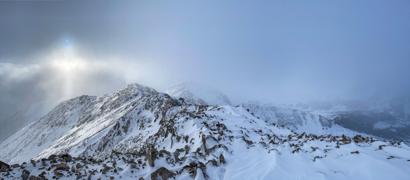
Mt. of the Holy Cross, 1/2/21: I knew what an incredible ordeal this was going to be, crazy distance, some off route bushwhacking to avoid avy slopes, and a long night of breaking trail. I started at the gate at 11:30pm, it was 7° out. I was at the top of the road in a little under 4 hours, where a sled was parked. A short distance from there I could see a tent off in the distance where the sled puller was sleeping, what are the odds? I decided against waking him up (it was around 3am) and continued breaking trail in some of the toughest trenching conditions I've encountered. I still question how I was able to actually reach summit that day, it was likely the toughest winter peak, physically. Took me a hair under 12 hours to reach summit, a little over 7 hours to get back to the car. Never crossed paths with the other guy, but we chatted on the condition report I posted here. Long, hard, incredibly rewarding day. Apple says 31.79 miles, 8,525' gain, took me 19:10 round trip. Summit temp was 17°. 
Castle and Conundrum Peak, 1/13/21: These aren't particularly difficult peaks, but have some avy danger along the way. In January 2021, lots of people were out getting these peaks, I had a trench most of the way. Not a particularly difficult day compared to most days when I was breaking trail. Apple says 19.05 miles, 6,531' gain, roundtrip was 9:32. Temp at summit was 24°. 
Belford and Oxford, 1/15/21: Belford was my first winter repeat, necessary since I skipped Oxford the first time. Windy up high as usual on Belox, but not nearly as cold as previous, I showed 14° at summit. This time my distance was much longer, I parked at the snowplow turnaround, which adds around 3 miles each way. Apple stats: 21.83 miles, 9,661' gain, trip time 9:41. Elevation gain was probably 6k or so. 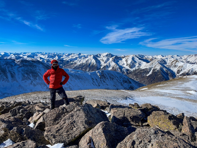
Wilson Peak, 1/18/21: Wilson Peak was my first summit of the "dirty dozen", which are referred to as the most dangerous of the winter 14'ers. While Wilson peak was a relatively easy day physically, it absolutely is worthy of inclusion in the dirty dozen. I found the short scramble from false summit to summit to be very sketchy, despite not being terribly long. I still think of it as one of the most difficult sections on a winter 14'er. It was a perfect weather day with very little wind. Summit temp was 21°, Apple says 16.18 miles, 5,650' gain, round trip was 10:03. 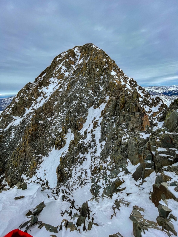
Mt. Sneffels, 1/20/21: My heroes SupraNihilist and CaptainSuburbia had been up the standard route a few days prior and turned around just below summit, which was all the convincing I needed to try the SW ridge instead. Weather wasn't terribly cold or windy, but it was very cloudy/blustery, I had no views most of the day. Apple gave 16.21 miles, 5,356' gain, time was 10:13. 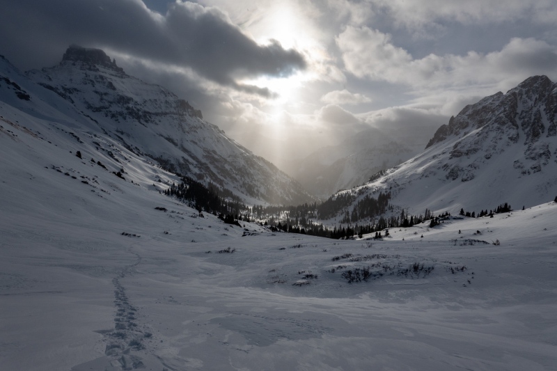
Longs Peak, 1/22/21: I did Longs via the Glacier Gorge route, which is sort of the back way to the trough through Mill lake and Black lake. It was a cold, snowy, windy day, and the trough took forever. Views up high were pretty sucky, but it was a relatively easy day. 9° at summit, distance was 16.74 miles, gain was 6,180', which might be exaggerated a bit. Round trip was 10:40. 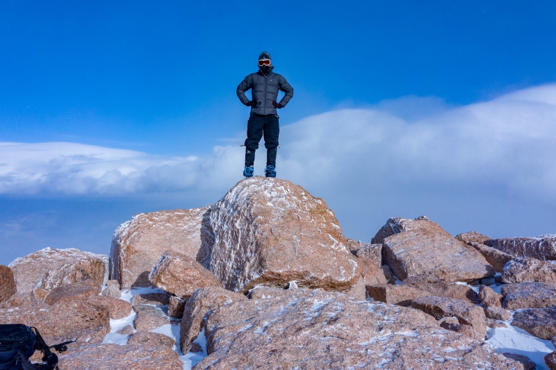
Mt. Yale, 1/25/21: Seems like it's always windy on Yale. Not terribly difficult, but nice views for the effort. When I got back to the trail split for Yale/Hartenstein Lake it was relatively early in the afternoon so I went to the lake, which was some really tough trenching. Summit temp was 9°, Apple gave 15.51 miles and 5,433' gain, time was 9:16. 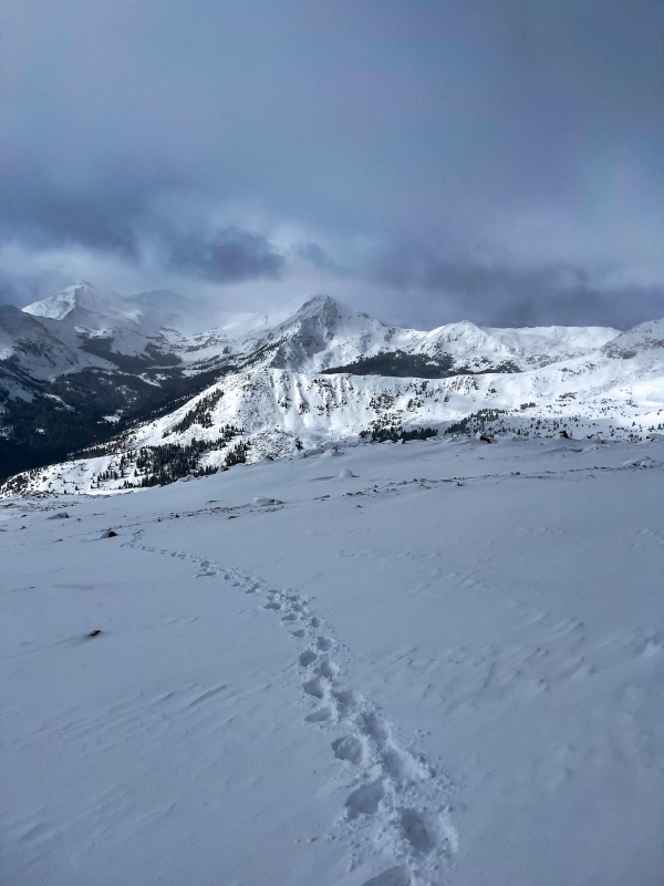
Missouri Mtn, 1/28/21: I parked at the snowplow turnaround, when I reached Missouri Gulch Trailhead there was a bike chained up. I had started kinda late (as usual), just past the creek crossing I met up with my hero Blazintoes, I was in awe. We trenched together for a mile or so before I split off for Missouri and she went and got Emerald. My day was long, but not as long as hers. I think Missouri is the best 14'er in the Sawatch. 16° at summit, distance was 18.76 miles, apple was giving extra credit on gain, it showed 8,128', was probably a 5,500' day, took me 10:36 round trip. 
Mt. Sherman, 1/30/21: I did my first winter Sherman with my former church Pastor, he'd been doing a 14'er every year in the summer and wanted to try a winter peak. He lives in southern New Mexico at around 3k' elevation, he was in pretty good shape, I suggested we do one on the easier side. We picked a date, and weather sucked, then picked another day he had time to come up for a weekend. Weather forecast wasn't great, wind forecast was 35 mph, which is my limit for making an attempt. Forecast was spot on, wind might have been a touch stronger than 35 mph, temp at summit was 10°. It was a cold, miserable day, fortunately we made good time. Apple says 11.72 miles and 5,032' of gain, which is likely exaggerated a bit. Took us 6 hours flat. He hasn't asked to do another winter 14'er;) 
Mt. Columbia, 2/12/21: Avalanche conditions were orange or red, can't remember exactly. I had been keeping Columbia in my pocket for a weekend like this when avy was high because it was a safe route. Denver was having an arctic chill, it was warmer on Columbia's summit that day than in Denver. The wind was some of the strongest I've fought with on a mountain, on the way down I was pushed over a few times. This was my 3rd summit of Columbia, and had no views all 3 times. Summit temp was 14°. Apple gave 16.96 miles and 10,933' of gain, I'd guess reality was probably 5,000'. Took me 9:55. 
Challenger Point, 2/13/21: Back to back days in winter are hard. I started working in Arkansas the first of February so only got to come home every other weekend and I was determined to make the best of the short time. After Columbia I drove to Salida to stay the night before Challenger. Forecast on Challenger wasn't great either, wind up high was miserable, and again had no views. Long hard day. 19.28 miles, 7,021' of gain, took me 12:03. Summit temp was 12°. 
Culebra Peak, 3/6/21: Culebra in winter is a tough long day, and Culebra seems like it's always windy. I camped at the gate the night before, which was pretty cold, but that left me first in line up the mountain. A younger guy (I think his name was Kyle) caught up to me, then CaptainSuburbia caught up, and we stuck together for a bit. Kyle ended up turning back around treeline, Captain Suburbia caught up again once more, then we met up again at Culebra's summit. I hadn't really planned on doing Red until the Captain convinced me to, we met up again on Red's summit, he was maybe 20 minutes behind me on both summits, he's pretty quick. Apple showed 16.85 miles and 6,604' of gain, my time was 8:29. Warm and windy, I showed 28° at summit. Little Bear Peak, 3/7/21: Another back to back day, this was tough, Little Bear and Culebra are both pretty sizable days, the weather forecast was primo for 3/7, I wasn't going to miss the opportunity regardless of how tired I was. I stayed the night in Alamosa, got a relatively early (for me) start at around 5am. I took snowshoes with initially, but a few miles in realized there was little to no chance I'd need them and stashed them. The bushwhack to Little Bear is really a pain, especially around Tobin Creek. It's also a really long route, but nothing terribly difficult until reaching S. Little Bear, I found the traverse to be pretty spicy, it was the only part with meaningful snow. Very little wind that day, and I showed 36° at summit, the warmest winter summit I've had. On the way down I lost my balance on one of the talus sections and banged my knee really hard, was tough getting back from there. Apple says 18.74 miles and 7618' of elevation gain, mileage is probably more like 15 miles, elevation gain is probably pretty close. Took me 12:13. 
Winter 2021/2022: 13 peaks I call this winter "The Miracle Winter", because we had such great conditions most of the winter. There was a brief window at the start of winter, then 2 weeks of storms in the mountains. After the storms passed we had a crazy amount of green avy days in the San Juans and Elks, which was exactly what I needed. I never expected to be able to get as many tough peaks as I did this winter. Pyramid Peak, 12/22/21: I made it to the top of Pyramid twice in December 2021, the first time was on December 4th, the main purpose of the early December trip was to see what winter camping was like. It sucks, but I knew I'd need to do it for winter Chicago Basin. I didn't think there had been much additional snow since my December 4 trip, so decided to go back on the first day of winter, but this time as a day trip. There was quite a bit more snow on 12/22, I was still able to get to the top via the standard route. It was a tough day, mostly from the leap of faith to summit. When I reached the top there were tracks in the snow, I learned the next day that my heroes John Balciar and Beard McQueen had gone up the other side, beat me to the top by an hour or so. Apple stats: 22.47 miles, 6,716' gain, 14:29 trip time. 
Snowmass Peak, 1/15/22: I was working in Arkansas again in January 2022, flew home for the weekend on Thursday, decided to go for Snowmass on Friday night into Saturday. Weather forecast was okay, more importantly the Elks were green on the avalanche forecast, a rarity. It was a long hard day, but I didn't find it as difficult as some of the other crazy long days like N. Maroon or Holy Cross, probably due to how nice the snow was, the trenching wasn't as difficult. I went all the way to the north ridge of Snowmass to get up, that's where I could see the most dry rocks. The ridge was a mix of trap door snow and relatively stable rocks, not difficult, but very tedious. Cold and windy at the summit, but at least I had clear skies. Summit temp was 15°. Apple says 26.11 miles, 8,150' gain, roundtrip was 18:56. 
Chicago Basin, 1/23-1/25: Chicago basin was high on my want list for this winter, the difficulty of getting everything to line up between weather, avy conditions and time off work feels like the biggest challenge. Beard McQueen and I had talked about teaming up for this, but I couldn't make the dates that he and my other heroes Angry and Blazintoes ended up going. Conditions were great most of January, there hadn't been much new snow since their trip in early January and avy conditions were still green for the week I had off work. Their trench likely saved me a day or 2, I was able to get in on Sunday, get all 4 peaks on Monday, then get back out on Tuesday. It was a hard 3 days, and I barely slept the 2 nights camped in the basin. Seeing Chicago Basin in winter was a dream come true. Day 1: 18.11 miles, 3,632' gain, 8:47. Day 2: 14.24 miles, 6,810' gain, 11:39. Day 3: 17.5 miles, 1,563' gain, 9:05. Coldest temps I saw were around 10°. 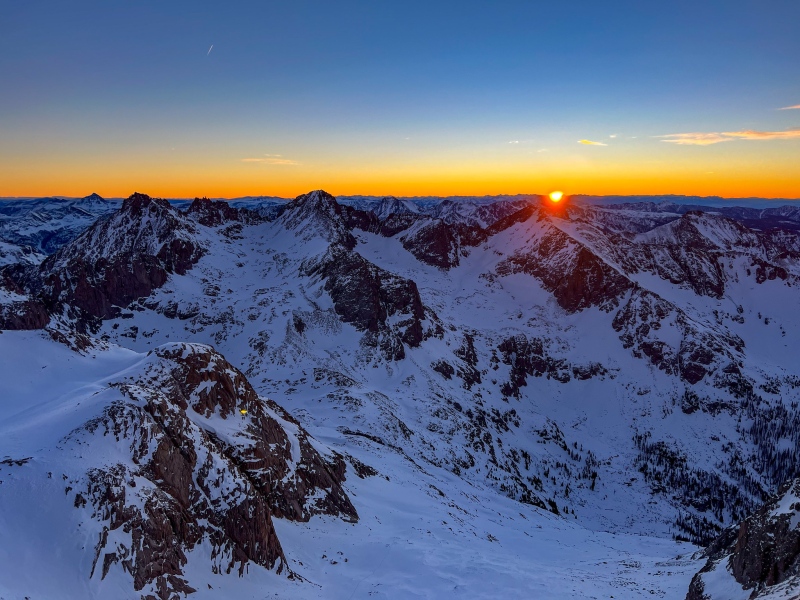
Mt. Wilson 1/29/22: Avy conditions were still green in the San Juans, I drove to Montrose to stay the night before. Cold start to the day, it was -1° when I left the car, ended up being a perfect weather day with very little wind. I went up the east face from Cross Creek, ran into Tom (Osprey) on my way down. Good snow made this a relatively easy day, I spent an hour at summit it was so nice up there. Apple stats:13.91 miles, 4,989' gain, 7:58 round trip. 
El Diente Peak, 2/13/22: We again had green avalanche conditions in the San Juans to try and get El Diente. My Hero SupraNihilist had attempted El Diente a few weeks prior and gotten within a stone's throw of summit. I didn't realize until he told me of his attempt that the road to Kilpacker was tracked by snowmobiles in winter, which makes it a doable route, despite being pretty significant distance overall. I did this as a long overnight hike, started at 11pm the night before the Super Bowl. Cold and windy at summit, I showed 19° when I reached summit at 9am. Worst part of the day was some nasty sidehilling on the Kilpacker trail getting back, I'll never forget how hard it was in the softened snow. 27.32 miles, 6,384' gain, 16:46 roundtrip. 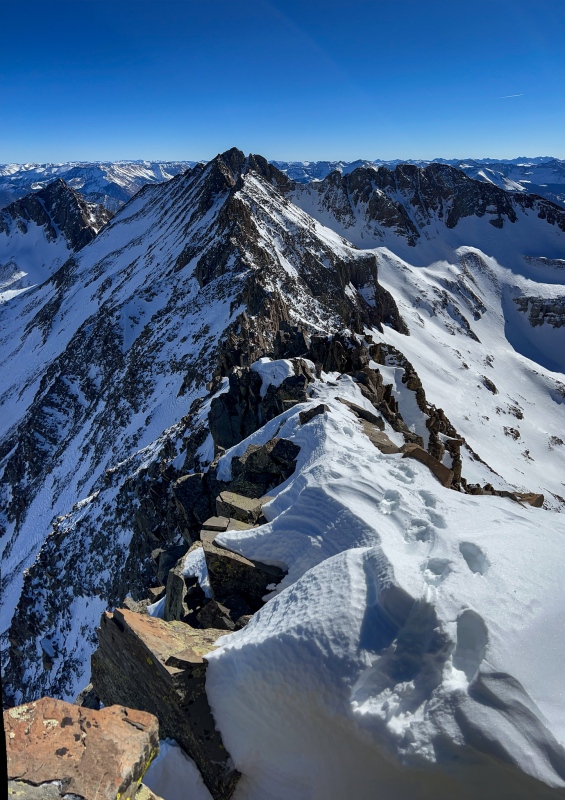
Massive/N. Massive, 2/26/22: Massive was one of my earliest winter peaks, I didn't know about the N. Massive thing until later. It was a super cold day, 3° to start, with some wind too. I like the route from Massive to N. Massive, lots of up and down and some fun terrain. Apple gave 19.83 miles, 7,297' of gain (probably a little high), trip time was 12:29. Summit temp was 10°. 
Mt. Evans (Blue Sky), 2/27/22: I had done Mt. Evans in late March 2019, didn't realize until later it was a few days after winter had officially ended. I went up the gully next to the Sawtooth, it was a perfect light wind day. Apple says 13.07 miles, 3,688' gain, 8:02 trip time. Summit temp was 32°. 
Handies Peak, 3/15/22: I had the last week of winter off work, and had in the back of my head that I might be able to finish this winter if conditions were good, unfortunately it wasn't meant to be. Handies was a relatively easy day, I went up the normal winter route that most people use via Handies south ridge. Apple gave 12.9 miles, 4,691' of gain, took me 8:21. Summit temp was 26°. 
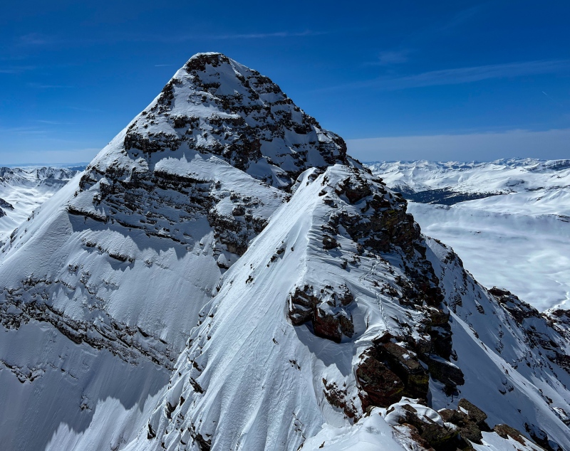
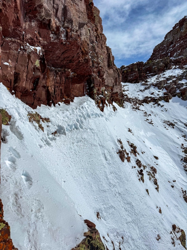
South Maroon Peak, 3/18/22: I knew there was pretty decent risk going for S. Maroon on the last day of winter, avalanche conditions were yellow. I told my 2 friends that keep an eye on me when I'm out doing crazy stuff that I anticipated getting to the Bell Cord Couloir and turning around. I started up the road a little after 11pm, when I reached the bottom of the Bell Cord the snow felt stable. I'm no avalanche expert, maybe it was risky, nonetheless I decided to go for it. The couloir took forever to get up, near the top the snow was deep and powdery. From the top of the couloir to summit wasn't difficult, and the views were incredible in all directions. I love that mountain. After reaching summit, I returned to the top of the couloir and attempted to go get North Maroon. I got up the first 2 towers without much issue, but when I reached the 3rd tower I was having a hard time finding a hold near the top to get up, made harder by having tired arms, snowshoes and rappel gear weighing me down. I decided to retreat. I'd been fortunate enough to get one more peak than I expected, probably shouldn't push my luck. Got back to the Bell Cord and made it down without much issue. Long hard day, I didn't get back to the car until almost 8:30pm. Apple Watch died before I got back to the car, it showed 22.79 miles and 8,758' of gain in 20 hours and 3 minutes. Garmin Inreach showed 23.9 miles with a trip time of 22:30. I was completely exhausted, my shoulders were so sore, I could feel my right shoulder ache every time I shifted gears in my manual transmission Honda on the long drive home. 
Winter 2022/2023: 1 14'er (repeat), 17 13'ers. Solid attempts on my 2 remaining winter 14'ers, but didn't make it to the top of either of them. Capitol Peak attempt, 12/26/22: I finished the (non-winter) 14'ers in September 2019 on Capitol Peak. I always knew it'd be last, because I was terrified of it. It really took me some time to work up to difficult moves, dangerous terrain and daunting exposure. I made it to K2 on this attempt, but just couldn't talk myself into going any further. 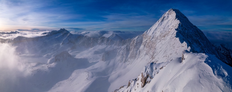
Mt. Sherman, 1/7/23: At this point in my winter 14'ers journey, there had been only 2 peaks I didn't do on my own: Sherman and Huron. I wanted to get Horseshoe anyway, so looped Horseshoe, Sheridan and Sherman together, which is still not that much distance. It was a cold day, all 3 summits were below 10°. Apple gave 14.69 miles, 5,157' gain, trip time was 7:01. North Maroon attempt, 3/19/23: I spent the 2 weeks prior to this day working in Orlando, I was pretty annoyed about not having a good window to try and get my last 2 peaks this winter. This day was my last shot at trying to get a winter peak this year, and conditions sucked. I left the Snowmass Creek trailhead around 9:15, it was hella cold all night, below 5°, and the trail breaking was tough from new snow a few days prior. I made it to just below Gunsight Couloir where the snow just didn't feel good to go up. Apple stats: 27.75 miles, 8,894' gain (likely exaggerated by 4,000' or so) in 18 hours and 4 minutes. It was a long hard disappointing day, but at least I didn't die. Winter 2023/2024: 8 14'ers, 21 13'ers Capitol Peak, 12/22/23: Leading up to the start of winter I had the same plan as previous winter, try and get Capitol early, and N. Maroon late. I went up a few days prior to 12/22 and put in a trench to Moon Lake. My hero Beard McQueen was looking at Snowmass to kick off winter, so I gave him a heads up on snow conditions in the Elks. Initially there was a 2 day window to start winter before storms were forecasted to arrive, but the window shrank to a single day so Brad changed plans, and was also fortunate to have Balciar join in. John and Brad started a little before me around midnight, I caught up and passed them a little after the creek crossing. When I reached K2 I hung out for a bit before down climbing to the ridge/knife edge, at this point I was still alone, feeling reasonably confident. After making my way about halfway across the ridge from K2 to Capitol, I looked at the remaining route and decided it was dumb to not wait for Balciar and follow his lead, I'm not sure anyone knows Capitol better than Balciar, especially in winter. We made it to summit without issue, Brad turned back at K2. It was a great weather day, 16° and light wind at summit. I was fortunate to have Brad change plans and Balciar join, wish Brad had made summit. Apple stats: 22.49 miles, 17,038' of gain (crazy how exaggerated the elevation gain was, probably around 7k in reality), trip time was 17:59. 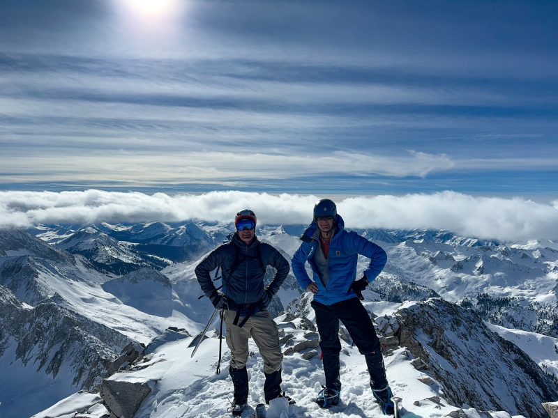
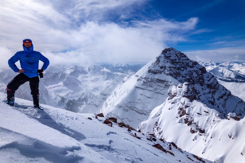
Huron Peak, 1/5/24: I wanted to repeat Huron as it was a winter peak that I hadn't done alone. Conditions were good on Huron, RyGuy and a few others went up on the first day of winter and put in a great trench that had been maintained by others since. It was a cold day, I showed 1° at summit, but not much wind. Some were able to drive all the way to Winfield, I decided not to push my luck, I parked at Missouri Gulch. Apple stats: 19.55 miles, 4,592' gain, trip time was 9:05. Belford-Oxford, 1/27/24: Hard to believe that Belford is my sole 3X winter repeat, I went up with my hero ToyotaSupraNihilist. It was a cold day, I showed 7° at Belford summit. Wind wasn't bad until the traverse to Oxford, per usual. Apple stats: 12.5 miles, 6,086' gain, 8:25 round trip. Bull Hill-Mt. Elbert, 1/31/24: Aside from my primary objective this winter, my secondary goal was to get as many bicentennials as I could, there are several I needed not far from home (in 2022 I moved to Salida). 1/31 was my last day before work would be sending me to Sioux Falls, and the day had a great forecast. I went up the south ridge to Bull Hill, made good time and weather was nearly perfect so I tacked on Elbert. 11.56 miles, 5,622' gain in 7:18. Summit temp was 25°. Mt. Antero, 2/24/24, with Logan and Jonathan: As much as I love being alone on a mountain, I don't dislike hiking with others occasionally. Nice relatively easy day, wind wasn't horrible. Ran into Michael Campbell, Bob Augenthaler and Thomas Brown near summit. Nice day. 11.64 miles, 5,019' gain in 7:18. North Maroon Peak, 3/12/24: I took the last week of winter off work hoping for a window to try and get North Maroon. New snow a few days prior kept the Elks at orange avalanche rating first part of the week. On Sunday 3/10 the forecast for Tuesday was released and the Elks went yellow. Another storm was forecasted to bring new snow Tuesday night giving me just a small window to give it a shot. I left the Snowmass Creek trailhead at 9:30 Monday night, took me nearly 13 hours to get to North Maroon's summit. I cried. I still find it hard to believe that I was able to do this, and a little sad that this huge journey is over. It was an amazing, long, challenging day accomplishing this goal. Apple stats: 29.49 miles, 15,853' gain (realistically was probably around 7,000'), trip time was 20:06. 
Getting to the summit of Colorado's highest peaks in winter is one of the greatest life goals I've ever had the good fortune to achieve. Thanks for reading. Thumbnails for uploaded photos (click to open slideshow): ")
")
")
")
")
")
")
")
")
")
")
")
")
")
")
")
")
")
")
")
")
")
")
")
")
")
")
")
")
")
")
")
")
")
")
")
")
")
")
")
")
")
")
")
")
")
")
")
")
")
|
| Comments or Questions | |||||||||||||||||||||||||||
|---|---|---|---|---|---|---|---|---|---|---|---|---|---|---|---|---|---|---|---|---|---|---|---|---|---|---|---|
|
Caution: The information contained in this report may not be accurate and should not be the only resource used in preparation for your climb. Failure to have the necessary experience, physical conditioning, supplies or equipment can result in injury or death. 14ers.com and the author(s) of this report provide no warranties, either express or implied, that the information provided is accurate or reliable. By using the information provided, you agree to indemnify and hold harmless 14ers.com and the report author(s) with respect to any claims and demands against them, including any attorney fees and expenses. Please read the 14ers.com Safety and Disclaimer pages for more information.
Please respect private property: 14ers.com supports the rights of private landowners to determine how and by whom their land will be used. In Colorado, it is your responsibility to determine if land is private and to obtain the appropriate permission before entering the property.