Log In 
Elevation 13,033' (LiDAR)
Prev Elevation 13,026'
CO Rank 616
CO 13er Rank 563 of 582
Range Sawatch
Unnamed 13033

13ers Within 5 Miles

Unnamed 13033 (0.00 mi) Unnamed 13148 (1.38 mi) Unnamed 13006 (1.55 mi) Unnamed 13228 (1.60 mi) Unnamed 13220 (1.67 mi) Unnamed 13291 (1.78 mi) Unnamed 13014 (1.95 mi) "Wayah Peak" (2.10 mi) Unnamed 13139 (2.58 mi) Unnamed 13221 (2.62 mi) Geissler Mountain East (2.63 mi) Deer Mountain (2.76 mi) Williams Mountain (2.78 mi) Mt. Oklahoma (2.83 mi) Unnamed 13556 (2.83 mi) Geissler Mountain West (3.05 mi) Unnamed 13204 (3.15 mi) Twining Peak (3.50 mi) Unnamed 13738 (3.58 mi) "K 49" (3.85 mi) Williams Mountain South (4.14 mi) Mt. Champion (4.16 mi) Unnamed 13541 (4.16 mi)

Photos

Unnamed 13033 and Nearby 13ers

pic1
UN 13001 ("Lost Man Peak") seen from Geissler Mtn ...
2012-08-26
pic2
UN 13003 seen from UN 13001
2012-08-26
pic3
UN 13026 seen from UN 13001
2012-08-26
pic4
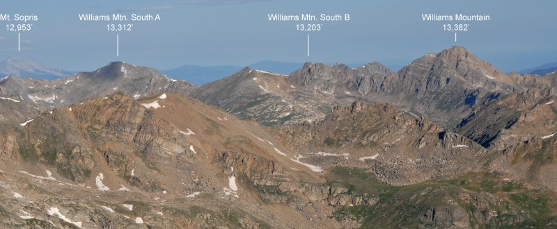
Williams South A seen from Williams Mtn
2012-08-04
pic5
Williams North seen from Williams Mtn
2012-08-04
pic6
Williams South B seen from the east ridge of Willi...
2012-08-04
pic7
Geissler Mountain West seen from Twining Peak-PT 1...
2012-06-25
By: geojed
pic8
North face of PT 13545 as viewed from basin to the...
2012-06-25
By: geojed
pic9
PT 13300 A from the ridge to the south
2012-06-17
pic10
PT 13202 from the valley to the south
2012-06-17
pic11
PT 13145 B taken from descent of PT 13230 B
2012-06-17
pic12
Unnamed 13,212 from Mt. Oklahoma
2011-08-07
pic13
Wayah Peak (left) and Unnamed 13,312 from Mt. Okla...
2011-08-07
pic14
Unnamed 13,230 (left half in shadow) from Mt. Okla...
2011-08-07
pic15
Mt. Champion from Mt. Oklahoma, looking south
2011-08-06
pic16
Williams Mountain from Geissler
2011-07-20
By: pw
pic17
East Geissler from the Lost Man trail
2011-07-17
By: pw
pic18
Twining Peak‘s northeast side seen from Geis...
2010-06-11
By: gToe
pic19
Unnamed 13736 seen from Mt. Massive.
2010-01-12
pic20
"K 49" seen from Mt. Massive.
2010-01-12
pic21
Deer Mountain seen from Mt. Massive.
2010-01-12
pic22
PT 13500 viewed from Twining Peak
2010-01-12
pic23
Mt. Oklahoma from Mt. Massive
2010-01-10
pic24
13001 left and its more impressive N ridge from ri...
2023-09-23
pic25
North face
2023-05-29
pic26
as seen from the saddle
2021-07-21
pic27
from Lost Man lake approach
2021-07-21
pic28
Twining Peak from West Geissler
2016-10-17
pic29
Geissler Mountain East viewed from the Lost Man Lo...
2016-10-16
pic30
Geissler Mountain East viewed from the summit of U...
2016-10-16
pic31
Geissler Mountain West viewed from the Lost Man Lo...
2016-10-16
pic32
PT 13,001 viewed from Lost Man Saddle.
2016-10-16
pic33
Unnamed 13,736 seen from Deer Mountain
2016-07-21
pic34
K49 seen from Deer Mountain, with 14er Mt. Elbert ...
2016-07-21
pic35
On the north ridge of K 49
2014-08-02
pic36
Oklahoma seen from "K 49"
2014-08-01
pic37
Deer Mtn. from "K49"
2014-07-28
pic38
Williams Mountain South A from just beyond ridge c...
2013-09-25
pic39
Williams Mountain South B - South Ridge
2013-09-25
pic40
Williams Mountain South B -North Ridge
2013-09-25
pic41
Williams Mountain - South Ridge
2013-09-25
pic42
Williams Mountain - South Ridge - Upper Summit ar...
2013-09-25
pic43
Williams Mountain - South Ridge - Upper Summit pi...
2013-09-25
pic44
Williams Mountain - North Ridge
2013-09-25
pic45
Williams Mountain North - South Ridge - From Will...
2013-09-25
pic46
Williams Mountain North - South Ridge - From sadd...
2013-09-25
pic47
Unnamed 13,736 and Deer Mountain (right), from Mt....
2013-07-20
pic48
Mt. Champion from Unnamed 13,736
2013-07-20
pic49
Twining Peak from Mt. Champion
2013-07-20
pic50
Williams Mountain summits from Unnamed 13,736
2013-07-20
pic51
Williams Mtn. (left) and Williams Mtn. North (cent...
2013-07-20
pic52
Unnamed 13,500‘ and Twining Peak from the we...
2012-10-02
pic53
Unnamed 13,736‘ (left, behind) and Mt. Champ...
2012-10-02
pic54
Twining Peak from Lackawanna
2012-10-02
pic55
Mt. Oklahoma from Lackawanna
2012-10-02
pic56
Deer Mountain from Lackawanna
2012-10-02
pic57
Unnamed 13,202 (left of center) from Lackawanna, l...
2012-10-02
pic58
Unnamed 13,545 from Lackawanna
2012-10-02
pic59
Deer Mtn from Frasco Benchmark
2012-07-11
pic60
Mt. Champion from Frasco Benchmark
2012-07-11
pic61
Unnamed 13,736 from Frasco Benchmark
2012-07-11
pic62
Twining Peak from Frasco Benchmark
2012-07-11
pic63
Mt. Oklahoma from French Mtn
2012-07-11
pic64
North face of PT 13,545 (Center) viewed from PT 13...
2012-06-25
By: geojed
pic65
Geissler Mountain West (L) and Geissler Mountain E...
2012-06-25
By: geojed
pic66
North Ridge of PT 13212
2012-06-17
pic67
PT 13230 B taken from PT 13145 B
2012-06-17
pic68
PT 13284 aka "Wayah Pk" taken from PT 13212 to the...
2012-06-17
pic69
Wayah Peak and other unnamed 13ers from Mt. Oklaho...
2011-08-07
pic70
Approaching Mt. Oklahoma from North Halfmoon Creek
2011-08-06
pic71
A close-up of Oklahoma
2011-08-06
pic72
Deer Mtn from the northeast
2011-08-06
pic73
Deer Mtn from the northeast (at sunrise)
2011-08-06
pic74
K 49 from Mt. Oklahoma
2011-08-06
pic75
Deer Mtn from Mt. Oklahoma
2011-08-06
pic76
UN 13,736 from Mt. Oklahoma
2011-08-06
pic77
Twining Peak from Mt. Oklahoma, looking southwest.
2011-08-06
pic78
Mt. Oklahoma....July climb....
2010-07-16
By: Teeboy
pic79
Twining Peak from Independence Pass.
2009-01-01
pic80
Mt. Oklahoma seen from Mt. Massive.
2009-01-01
pic81
"K 49" (left) and Deer Mountain (far right) seen f...
2009-01-01
pic82
From left to right: Mt. Champion, Unnamed Peak 13...
2009-01-01

Climbing Routes

Sorry, no route descriptions have been added for Unnamed 13033.
Map

Human Verification Required

Trip Reports

  Peaks Climbed Added
  From Fork Fryingpan Trail
By: WildWanderer
Peak(s): Unnamed 13033
Added: 10/5/2025
Unnamed 13033 10/3/2025 10/5/2025 2  32
  If Its Black Fight Back Google Map Included GPX file available for download
By: josephnephi
Peak(s): Unnamed 12,675, Unnamed 13014, Unnamed 12,794, Unnamed 13033, Unnamed 13220
Added: 8/9/2025
Unnamed 12,675
Unnamed 13014
Unnamed 12,794
Unnamed 13033
Unnamed 13220
7/2/2025 8/9/2025 40  10
  A Tale of Two Ridges: the Wayah Group Google Map Included GPX file available for download
By: Chipmunk
Added: 1/14/2025
"Wayah Peak"
Unnamed 13033
Unnamed 13014
Unnamed 13221
Unnamed 13220
Unnamed 13291
Unnamed 13228
Unnamed 13148
9/8/2024 1/14/2025 18  35
  out of the Fryingpan and into the Fryingpan River Google Map Included GPX file available for download
By: piper14er
Peak(s): Unnamed 13033, Unnamed 13014, 12,801 - 12801
Added: 7/2/2014
Unnamed 13033
Unnamed 13014
12,801 - 12801
6/28/2014 7/2/2014 11  29
  Out of the Fryingpan and into the Fire -OR- Hit in the face by a Fryingpan Google Map Included
By: bergsteigen
Added: 8/19/2013
"Wayah Peak"
Unnamed 13014
Unnamed 13220
Unnamed 13291
Unnamed 13221
Unnamed 13033
Unnamed 13148
Unnamed 13228
Pt 12653 A - 12563
Pt 12801
8/17/2013 8/19/2013 28  30
  Misc Sawatch 13ers
By: Furthermore
Added: 8/17/2011
"West Tellurium"
"Tellurium Peak"
"Tabor Peak"
Unnamed 13033
Unnamed 13014
8/4/2011 8/17/2011 1  21
  Where the Peaks have no names
By: mennoguy
Added: 8/11/2011
"Wayah Peak"
Unnamed 13291
Unnamed 13221
Unnamed 13220
Unnamed 13033
8/8/2011 8/11/2011 4  23