| Report Type | Full |
| Peak(s) |
"Wayah Peak" - 13,277 feet Unnamed 13033 - 13,033 feet Unnamed 13014 - 13,014 feet Unnamed 13221 - 13,221 feet Unnamed 13220 - 13,220 feet Unnamed 13291 - 13,291 feet Unnamed 13228 - 13,228 feet Unnamed 13148 - 13,148 feet |
| Date Posted | 01/14/2025 |
| Modified | 05/29/2025 |
| Date Climbed | 09/08/2024 |
| Author | Chipmunk |
| Additional Members | climbingcue |
| A Tale of Two Ridges: the Wayah Group |
|---|
|
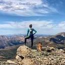
It was the best of climbs, it was the worst of climbs. Table of Contents: The Worst of Climbs: 13,220, 13,033, and 13,014 The Best of Climbs: 13,221, Wayah, 13,228, 13,148, and 13,291 Introduction: The Wayah group includes eight 13ers, only one of which someone bothered to give an unofficial name to. The word “wa’ya” means wolf in Cherokee, though what connection, if any, it has to this particular stretch of Colorado mountains remains unclear. One trip report I read claimed the name Wayah came not from the Canis lupus, but one of their domesticated descendants: someone's pet dog. Regardless of its etymology, the ridge is gaining popularity as a long traverse from the Hunter-Fryingpan Wilderness that collects all eight peaks, plus two 12ers, in one grueling swoop. For many, breaking the group into manageable chunks makes more sense. My partner Bill (climbingcue) had already done 13,220 and 13,291 and wasn't particularly interested in repeating them. Even if he had been, the stable weather required to complete the full traverse hadn't materialized. Bill and I concocted a different approach where I would start from Independence Pass and he would start from the Hunter-Fryingpan Wilderness. We would meet on 13,033 and hike back to Bill's 4Runner together before driving to the next trailhead. The next morning we would hike 13,221 and Wayah together. Bill could then return to his car while I continued along the ridge alone over the unranked peaks and 13,291 before returning to my vehicle on Independence Pass. I gave Bill the supplies I would need, which consisted of a change of clothes, sleeping bag, stove, and food. All that remained was for him to decide how he would get to the South Fork Pass Trailhead. Directions: There are several ways to approach this remote wilderness area: 1. Frying Pan Road (CR 4). This paved road originates in Basalt. To reach South Fork Pass TH (39.239797, -106.593) travel 27 miles on Frying Pan Road and turn right on road #504 at the Norrie Colony sign. About 3 miles up the road, take the left fork. In another mile, take the left fork again and follow it to the end of the road and the trailhead. To reach Fryingpan Lakes TH, travel 32 miles on Frying Pan Road. When the pavement ends, take a right onto road #505 and follow it until it dead ends at the trailhead. Both 504 and 505 are 2WD dirt. 2. Eagle-Thomasville Road. This dirt road winds its way from Sylvan Lake near Eagle up to the top of Crooked Creek Pass and down the other side to the small town of Thomasville near mile 25 of Frying Pan Road. The road is narrow, windy, and has some tight, steep switchbacks. The road is maintained for passenger cars but has a sign warning that it becomes impassable when wet. Taking this route will save you time and distance over Frying Pan Road. To be routed correctly by Google Maps, add stops at Sylvan Lake State Park and Ajax Sleepaway between Eagle and the trailhead. It also helps to download offline maps ahead of time. 3. Hagerman Pass. This is the shortest, but arguably worst, of the three approaches. Hagerman Pass is an 11.6-mile-long high clearance 4WD road that connects Leadville (near Turquoise Lake) to the east end of Frying Pan Road. Its AllTrails page has useful reports on current conditions, and popular opinion holds that it is rough and rocky. This was the route Bill chose despite my attempts to dissuade him, and he needed to use his rear locker to get over one obstacle. 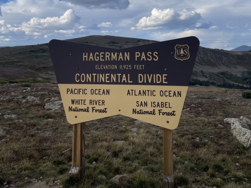
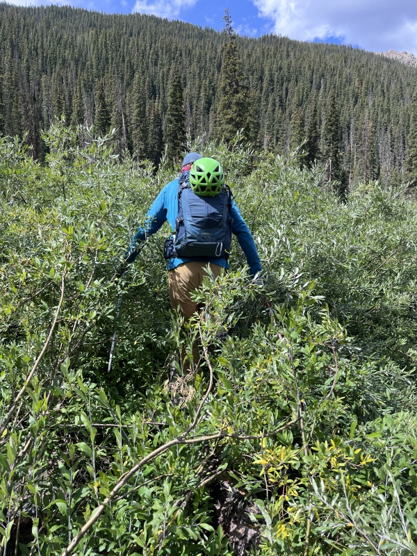
The Worst of Climbs: 13,220, 13,033, and 13,014 I started up the North Fork Lake Creek Trail at 6:00 AM, 30 minutes before Bill would depart from his own trailhead. The trail was easy to follow for the first two miles, at which point it turned and crossed the creek. Many people seem to miss this turn, as evidenced by a strong social trail that continued straight. Since the social trail led the direction that I wanted to go anyway, I followed it to its eventual end in a sea of willows. I followed the path of least resistance through the hated shrubbery, aiming for a game trail bisecting 13,220's south face that was visible from outer space (seriously, you can see this thing on satellite imagery). 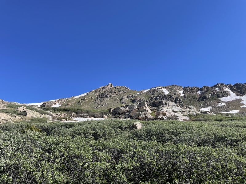
I finally reached the long-coveted game trail and immediately abandoned it in favor of climbing steeply up a grass slope straight toward 13,220, popping up just to the east of the summit. Fifth class rock guarded the high point, and I completed my one and only scrambling move of the day to gain a grassy ledge that wrapped left around the summit block to easier terrain. Following the game trail up would have kept things entirely class 2. A few minutes later, I was standing on top of my first peak of the day, looking at the long ridge ahead. 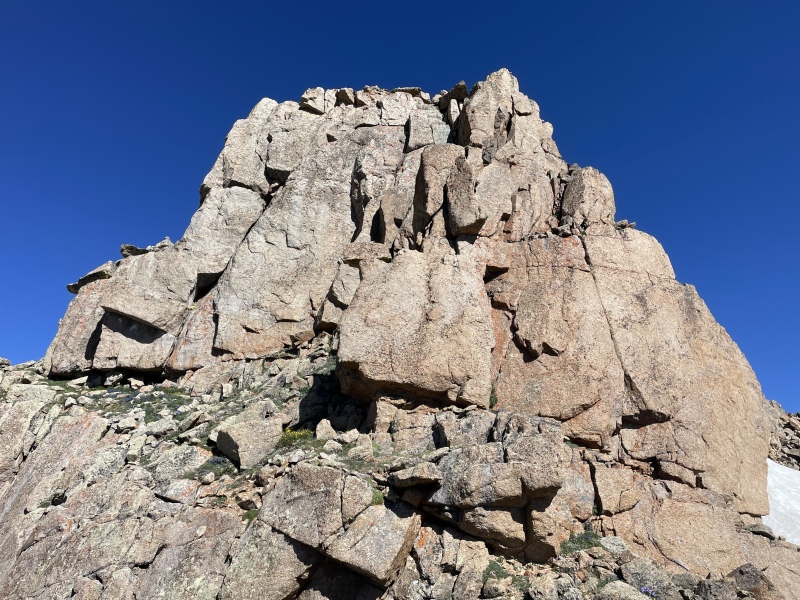
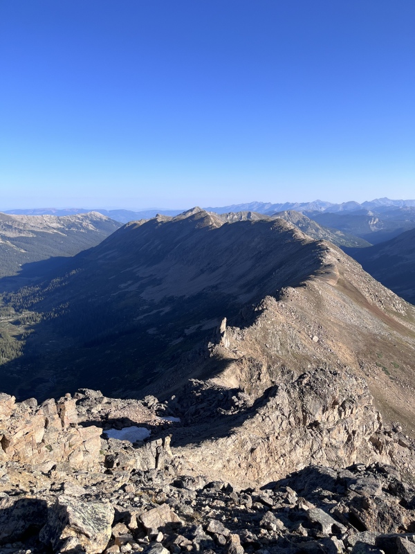
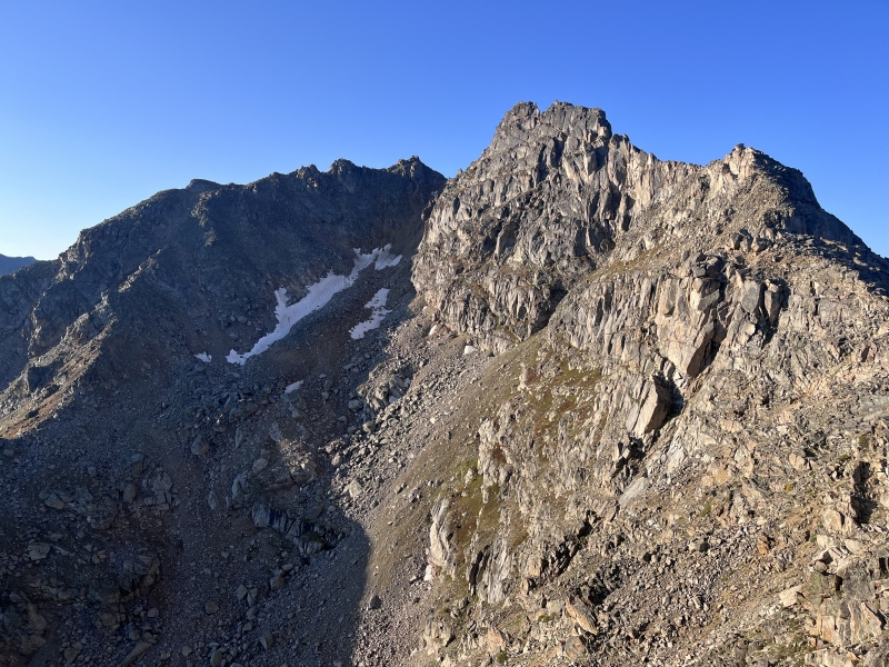
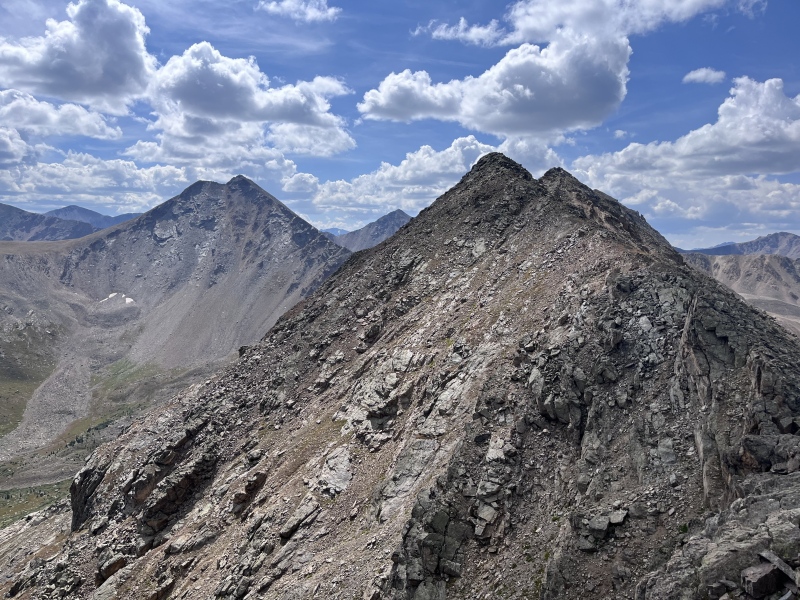
The ridge from 13,220 to 13,033 looked gnarled and complicated from above but went at class 2 on tundra and talus. There were some interesting rock formations along the way. 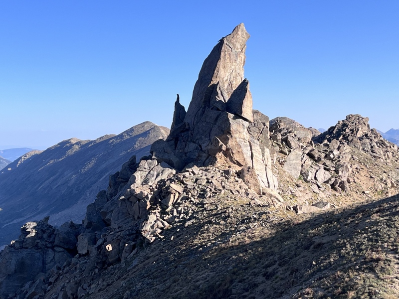

I was pretty sure I could see Bill already on top of the peak ahead. Dang it! I was hoping to arrive first and take a break. Sure enough, the ant-like figure in the distance materialized into a full-sized Bill as I arrived at the summit 1 hour and 15 minutes after leaving the last peak. Bill had followed the South Fork Pass Trail for 3.7 miles before finding a reasonable location to cross the river on boulders just north of Deadman Lake. From there, he climbed a steep grass slope to reach the ridge and summit of 13,033, where he had been waiting for 30 minutes despite my head start. We continued together, pausing briefly in what appeared to be the Sawatch Range’s contribution to Easter Island. 
Up next was 12,794. It would have been easy enough to tag it, but it had the double demerit of being a 12er and an unranked one at that, recently demoted below the 300' prominence threshold by LiDAR. We snubbed it and moved on to 13,014's unremarkable summit. 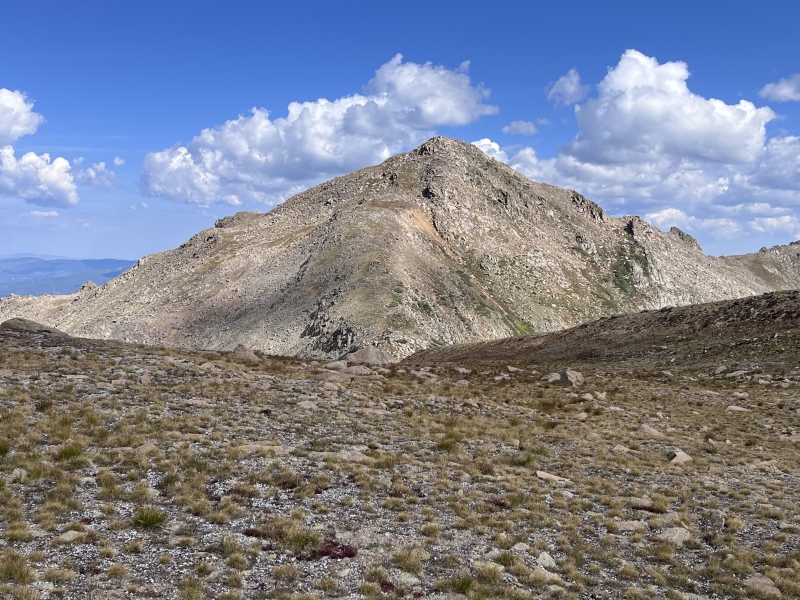
Our primary information on descending from 13,014 came from piper14er's trip report. He reported taking a less-than-ideal line to the valley below that ultimately led to him and his dog taking an unintentional swim in the river. Wishing to avoid a dousing of our own, we used the helpful beta provided in the comments section of that trip report and continued northwest along the ridge until we found a reasonable avalanche chute to follow down. We avoided the willows growing in the center of the chute by hugging the edge along the trees to skier's left. A brief but intense bushwhack brought us across the river and back to the trail, which we followed to Bill's 4Runner. Two hunters who had watched him climb to the ridge alone that morning came over to chat with us, confused that he had returned with me in tow or perhaps just envious of his skills as a backcountry pickup artist. 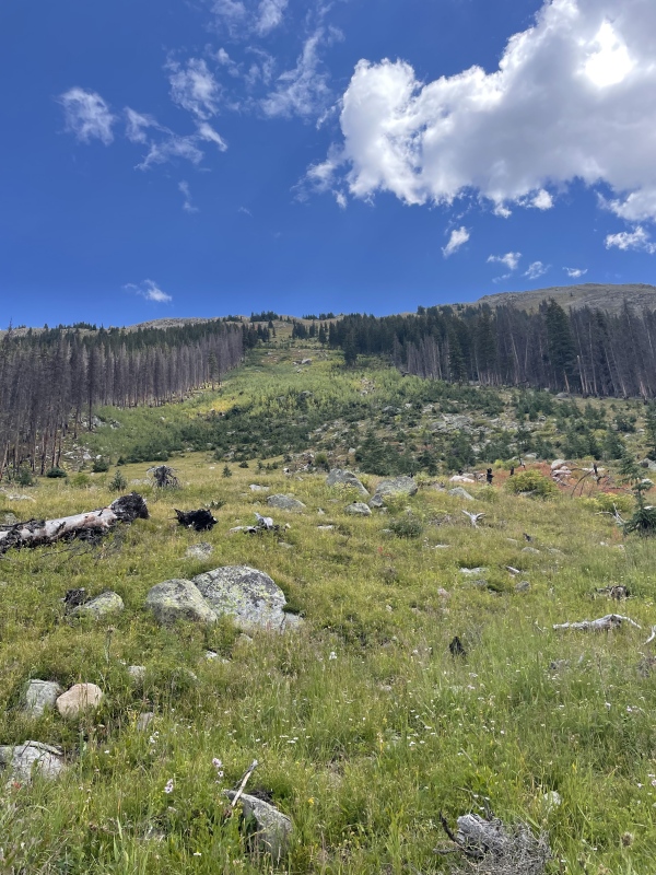

Was this ridge truly the worst of climbs? Not really. It wasn’t awful - just a bit underwhelming. But something had to be the worst, and it sure wasn’t the ridge we tackled the next day. Bill's Stats: Distance: 11 miles Vertical Gain: 4,200 feet Time Elapsed: 6 hours, 37 minutes My Stats: Distance: 11 miles Vertical Gain: 4,000 feet The Best of Climbs: 13,221, Wayah, 13,228, 13,148, and 13,291 After driving to the Fryingpan Lakes Trailhead and making dinner, we still had daylight left and did some exploring. Two trails originate at this trailhead: the Lily Pad Lakes Trail (goes straight from the trailhead) and the Fryingpan Lakes Trail (veers right and crosses a wooden bridge). We walked down the Fryingpan Lakes Trail, identified a promising spot to leave the trail the next morning, and retreated to the vehicle to get some rest. Our scouting trip proved useful since a pre-dawn start meant we were navigating by headlamp. We followed the trail for a short distance to our chosen turnoff and entered the forest to begin the bushwhack up 13,221's north ridge. As far as bushwhacks go, this one was steep but never terribly difficult. We gained 1,800 feet over the next 1.2 miles to treeline. Another half mile and 800 feet brought us to the ridge and face-to-face with our first summit of the day. 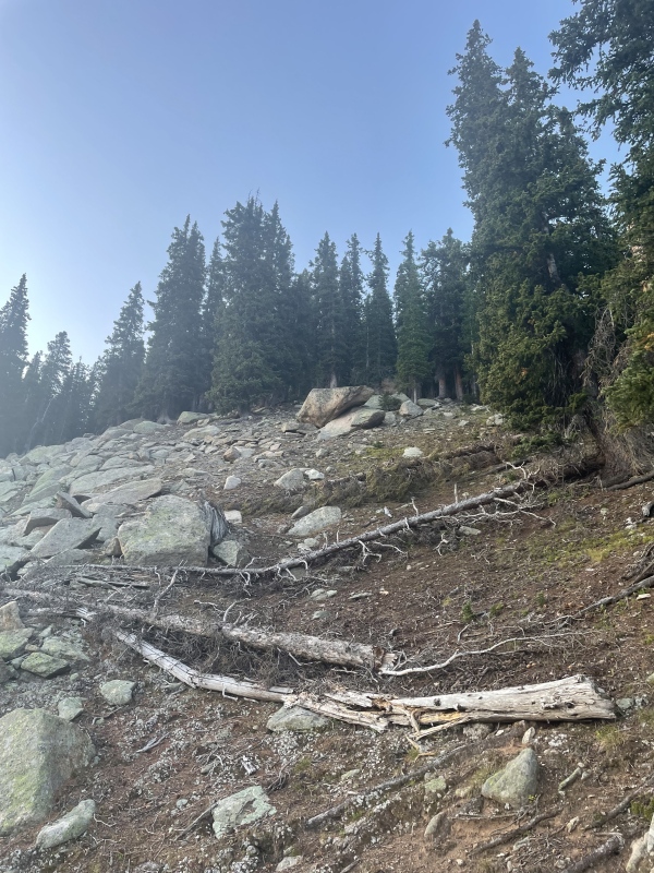
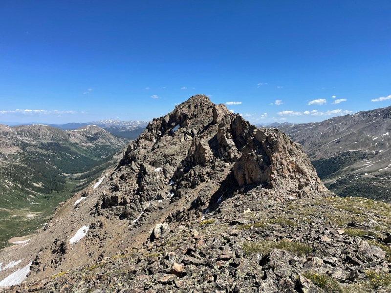
Soon we reached the first tower, where the scrambling began. 
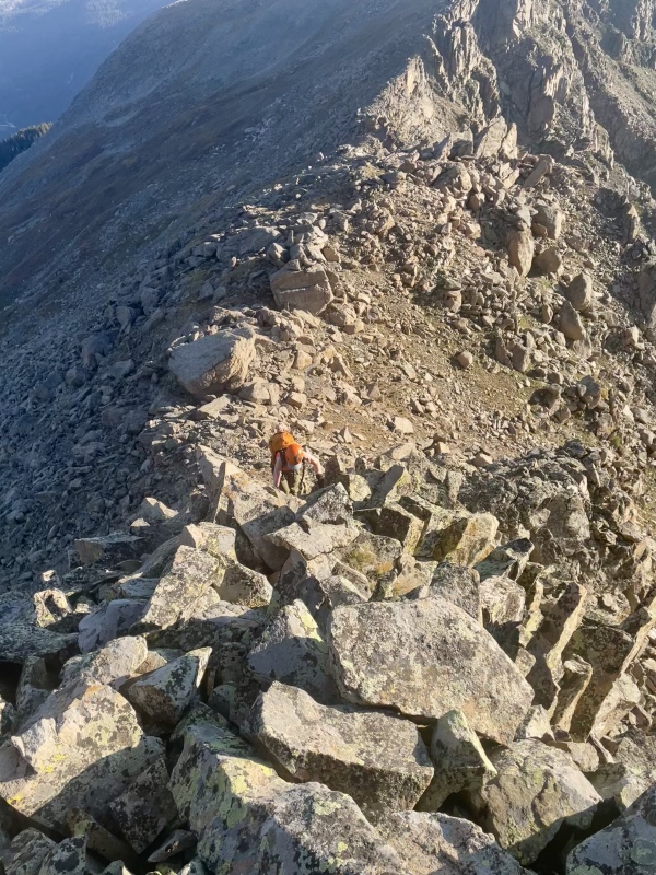
The difficulty of the second tower ramped up to class 5 and forced us off the ridge to the west. We scrambled around and up to the base of the summit block, where Bill found a protected chimney to take him directly to the top and I opted for the standard south side finish. We had expected little out of a low unnamed Sawatch 13er and were both pleasantly surprised by how much we enjoyed this peak. 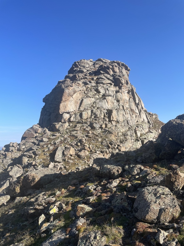
We climbed back down the south side of the summit block and continued toward Wayah, staying on the ridge to wring out as much class 3/4 scrambling as possible. Easier bypasses existed by dropping off first to the west, and then to the east side of the ridge if desired. At the saddle, the difficulty eased, and we cruised up class 2 terrain to the summit of Wayah. 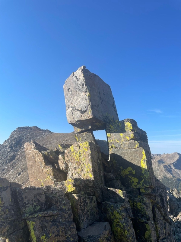

Here we parted ways. Having heard horror stories about the "evil alpine willows" and shoe-stealing mud lurking in the depths of the Marten Creek drainage to the west, Bill elected to try an unknown descent to the east. He backtracked north toward the Wayah-13,221 saddle before beginning down the drainage. Things started out well enough on a mix of steep grass and talus slopes. 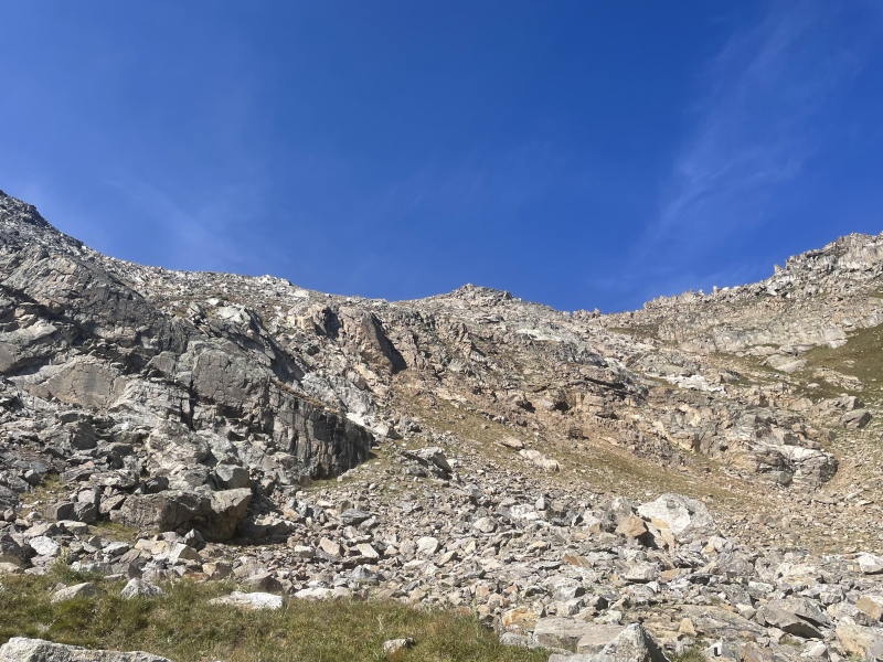
About one third of the way down, a cliff band interrupted the drainage. Rather than bypassing to the south (recommended), Bill downclimbed a small waterfall (not recommended). 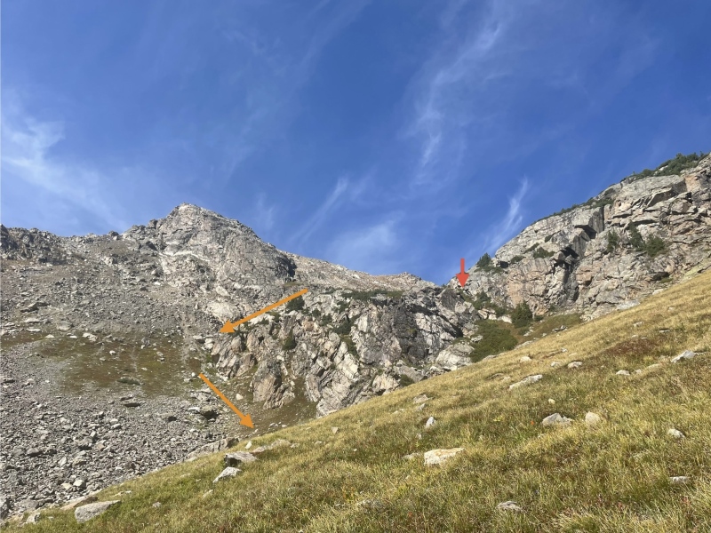
Below this difficulty, steep talus resumed. The willows growing in the lower part of the drainage were avoidable in the trees to the north. Unfortunately, the same was not true of the willows after crossing the Fryingpan River, and Bill endured a short, swampy, miserable romp through them before locating the Fryingpan Lakes Trail. He arrived back at his 4Runner at noon, around the same time I was puzzling my way up 13,291. But let's rewind... 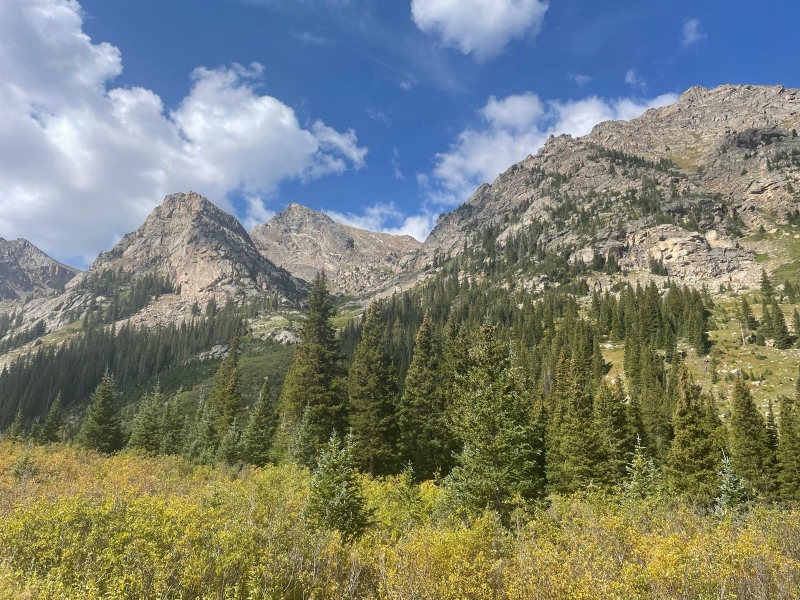
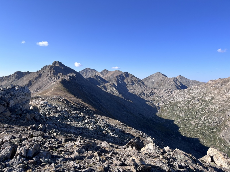
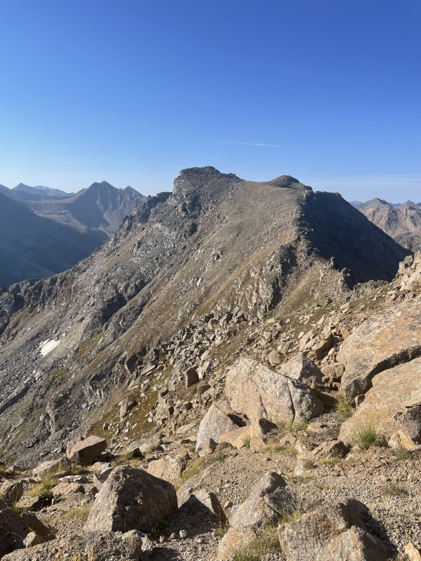
From Wayah, I pointed my feet south toward unranked 13,228, covering the uncomplicated terrain in 40 minutes. 13,228 had an interesting summit area with a trough formed by two parallel ridges. I tagged a few points on the left (east) of the two ridges, unsure of which was the highest. It turned out to be the southernmost, and from this vantage point I scoped out the terrain ahead. The next section between the two unranked peaks was the part I was most apprehensive about, since it purportedly contained a cliff and some tricky route finding. 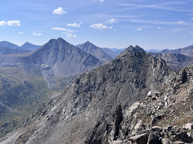
The cliff turned out to be a non-issue. I dropped 100 feet to the west on talus and located a friendly cairn that guided me around the cliff to a grassy ramp. 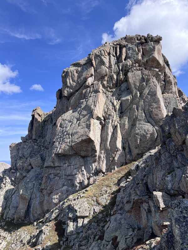

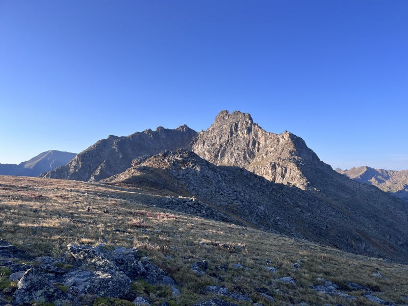
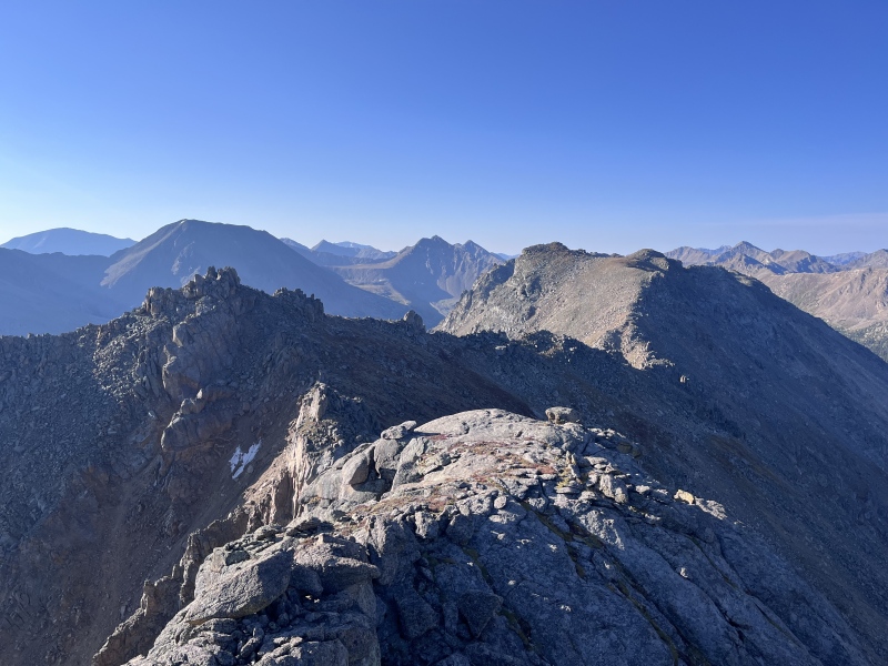
A bit more scrambling brought me to the saddle with 13,148. I bypassed a tower to the west, gained the summit, and paused to look back at the terrain I'd already navigated. Ahead, two false summits and 1.5 miles of ridgeline still separated me from 13,291, the last and highest peak of the day. Clouds were beginning to build, so I didn't linger. Though the ridge was mostly class 2, I encountered some class 3 terrain near the false summits. 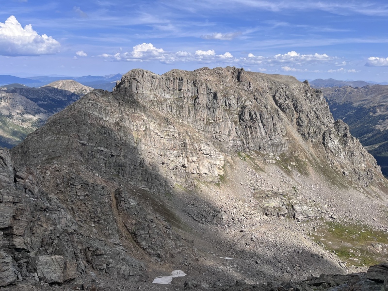
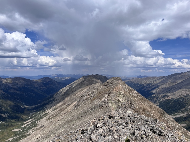
Topping out on 13,291 felt like stepping onto a finish line made of rocks and sky. But the day wasn't over yet. I descended the east side of the peak on class 3 terrain and located a well-placed cairn that marked a notch in the ridge. Crossing to the west side, I bypassed a jagged tower at its base. Finally, I was on easier ground. 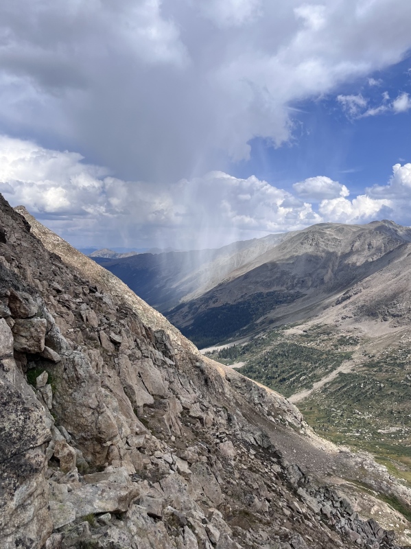
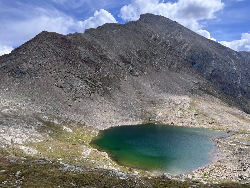
The unnamed lake at the 13,291-Deer saddle was a fitting endcap to a row of (mostly) unnamed peaks. From its shore, only four miles of the North Fork Lake Creek Trail separated me from the parking lot - equivalent to the span between the first and last peak of the day. With no route finding, scrambling, or talus to slow me down, I bombed down the trail in one third of the time it had taken me to cover the same distance on the ridge. Rain pattered against my windshield as I drove down Independence Pass to a far, far better rest than I have ever known. No, not death such as awaited Sydney Carton at the end of A Tale of Two Cities, but sleep in a real bed instead of the back of a 4Runner. 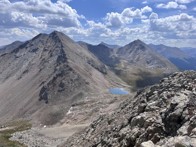
Bill's Stats: Distance: 7.65 miles Vertical Gain: 3,850 feet Time Elapsed: 6 hours, 9 minutes My Stats: Distance: 11 miles Vertical Gain: 5,300 feet Time Elapsed: 8 hours, 30 minutes Thumbnails for uploaded photos (click to open slideshow): ")
")
")
")
")
")
")
")
")
")
")
")
")
")
")
")
")
")
")
")
")
")
")
")
")
")
")
")
")
")
")
")
")
")
")
|
| Comments or Questions | ||||||||||||
|---|---|---|---|---|---|---|---|---|---|---|---|---|
|
Caution: The information contained in this report may not be accurate and should not be the only resource used in preparation for your climb. Failure to have the necessary experience, physical conditioning, supplies or equipment can result in injury or death. 14ers.com and the author(s) of this report provide no warranties, either express or implied, that the information provided is accurate or reliable. By using the information provided, you agree to indemnify and hold harmless 14ers.com and the report author(s) with respect to any claims and demands against them, including any attorney fees and expenses. Please read the 14ers.com Safety and Disclaimer pages for more information.
Please respect private property: 14ers.com supports the rights of private landowners to determine how and by whom their land will be used. In Colorado, it is your responsibility to determine if land is private and to obtain the appropriate permission before entering the property.