Download Agreement, Release, and Acknowledgement of Risk:
You (the person requesting this file download) fully understand mountain climbing ("Activity") involves risks and dangers of serious bodily injury, including permanent disability, paralysis, and death ("Risks") and you fully accept and assume all such risks and all responsibility for losses, costs, and damages you incur as a result of your participation in this Activity.
You acknowledge that information in the file you have chosen to download may not be accurate and may contain errors. You agree to assume all risks when using this information and agree to release and discharge 14ers.com, 14ers Inc. and the author(s) of such information (collectively, the "Released Parties").
You hereby discharge the Released Parties from all damages, actions, claims and liabilities of any nature, specifically including, but not limited to, damages, actions, claims and liabilities arising from or related to the negligence of the Released Parties. You further agree to indemnify, hold harmless and defend 14ers.com, 14ers Inc. and each of the other Released Parties from and against any loss, damage, liability and expense, including costs and attorney fees, incurred by 14ers.com, 14ers Inc. or any of the other Released Parties as a result of you using information provided on the 14ers.com or 14ers Inc. websites.
You have read this agreement, fully understand its terms and intend it to be a complete and unconditional release of all liability to the greatest extent allowed by law and agree that if any portion of this agreement is held to be invalid the balance, notwithstanding, shall continue in full force and effect.
By clicking "OK" you agree to these terms. If you DO NOT agree, click "Cancel"...
out of the Frying Pan and into the Fryingpan River...
Yep the river was raging, frothing, foaming, a torrent of whitewater cascading down from Deadman Lake... and so the story goes.
The South Fork trailhead can be reached by driving west out of Leadville over Hagerman Pass, a rough road at times with a big water crossing; or from Basalt off of Highway 82 driving east on the Frying Pan Road. Mile Marker 28 is your destination to reach FS 504. The road goes south and is marked by a sign that says "Norrie Colony". You follow FS 504 as it zigzags its way along taking two left turns, both signed, 10.5 miles to the end of the road and a parking area just before the gaging station. The South Fork trail is marked and is easily visible. The hardest part of the venture is getting there as this trailhead is near nothing much. Oh you could take the Eagle-Thomasville Road out of Eagle by I don't know anything about the road other than there is a sign in Thomasville that states if the road is wet it isn't a good road??
There was one snowslide that was across the forest service road but you can drive around the snow and debris.
The next hardest part of the trek, on June 28, 2014 is getting across the South Fork Fryingpan River to get to the peaks and then back across. I can't say this report picks the best way but it is one way and later in the summer it may be okay.
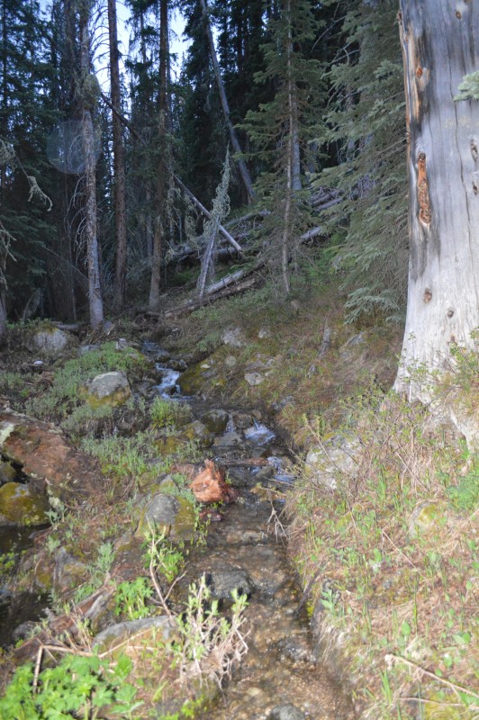
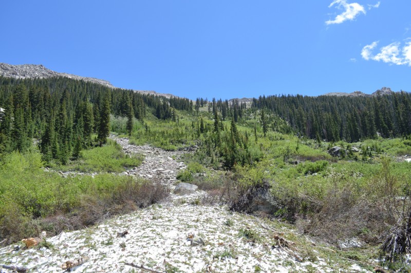
The trail in early morning, plenty of water, stiflingly warm and humid, no mosquitos.
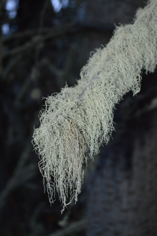
Lichen, tree moss, the first part of the trail was one of dankness, where trees are rotted by the environs, strewn here and there, fallen across the trail.
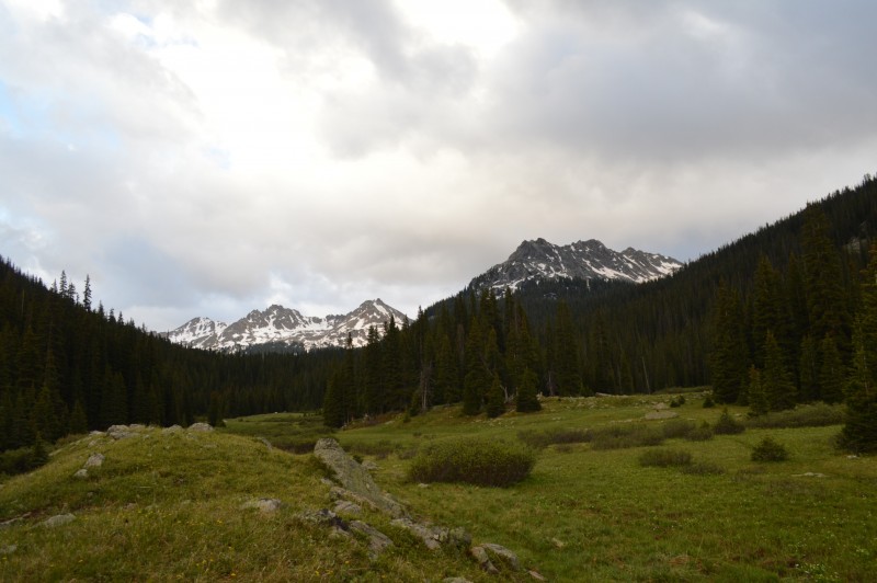
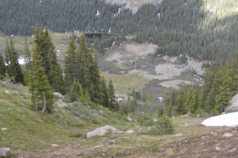
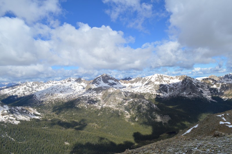
The trail opens up as it crosses a meadow and a look at the peaks to the south and west.
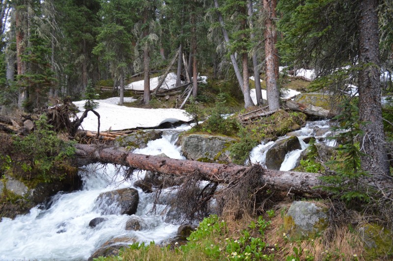
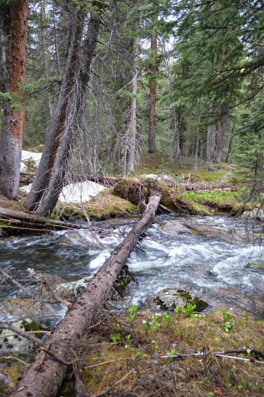
There were many swollen creeks and rivulets that required extra time and effort to cross. There were some with downed trees that could be used to pass over the fast moving waters.
We crossed the river. We availed ourselves of a nice tree bridge as we crossed the Fryingpan. It may have been better to go slightly higher up the trail, closer to Deadman Lake. We looked down from our perch on the steep slopes along this slide area and the lake. There looked to be a few places where the river narrowed and on the flats by the lake it was not cascading along.
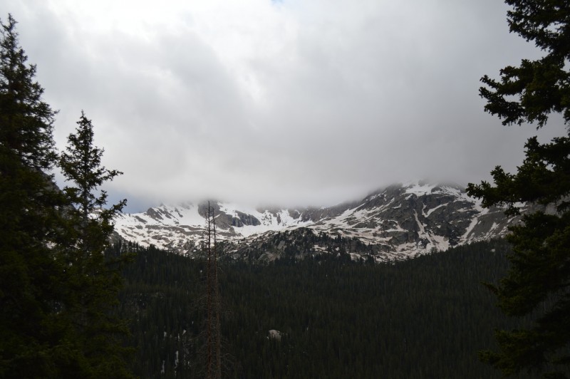
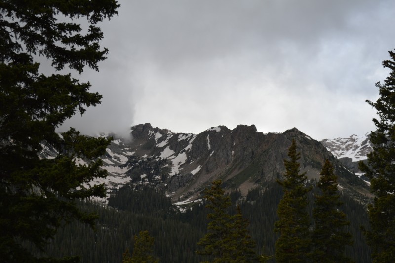
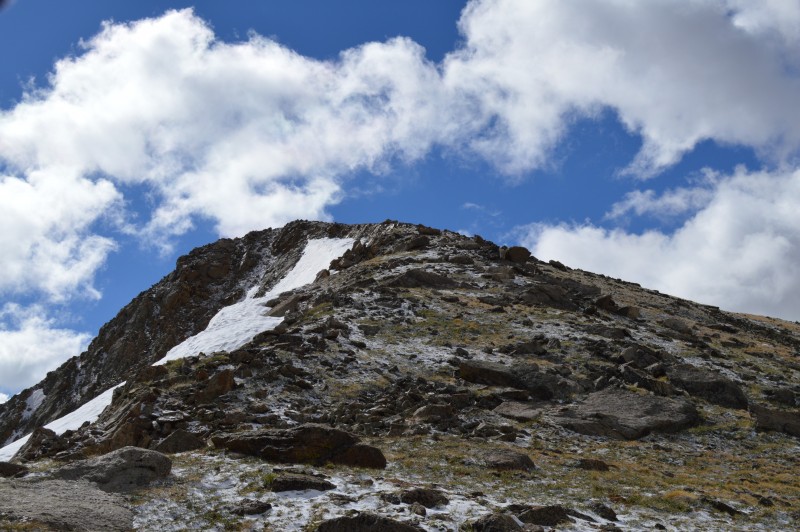
The early morning showed signs of approaching weather or seemed to anyway.
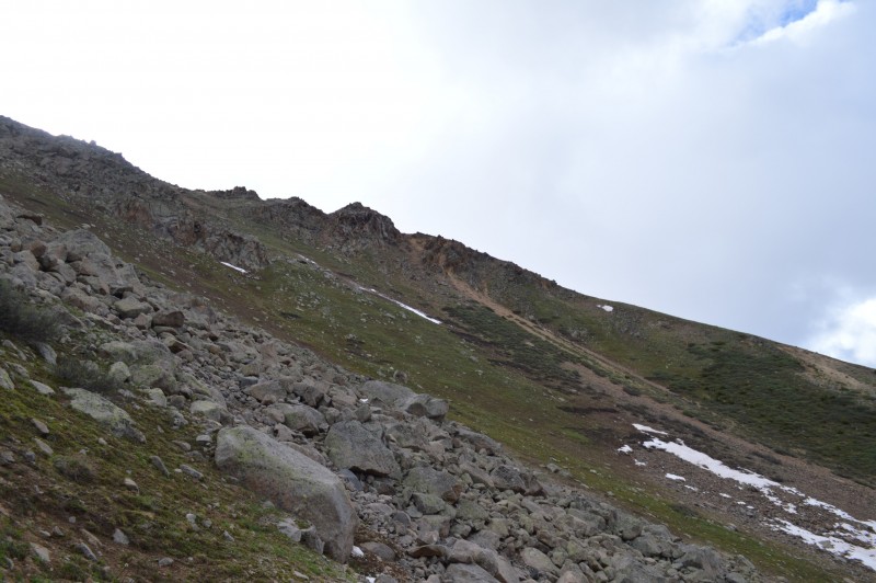
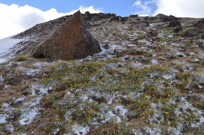
The slope below the ridge.
The angle of the slope with Geissler to the south, or some such peak.
The slope.
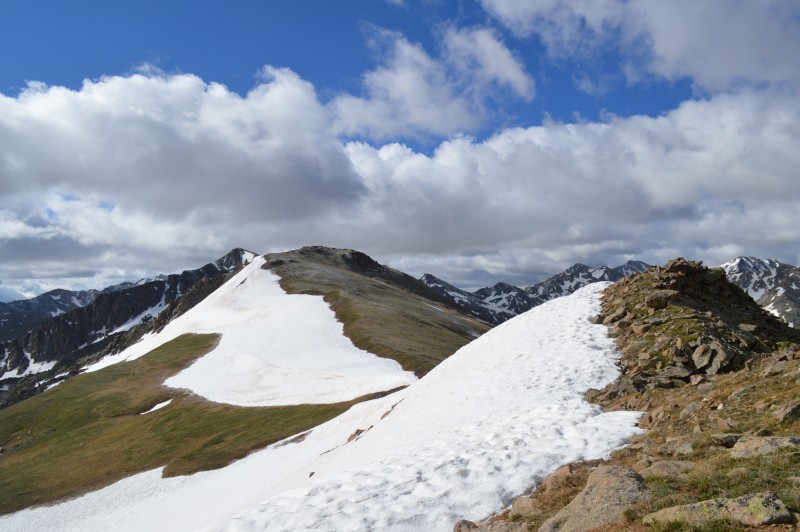
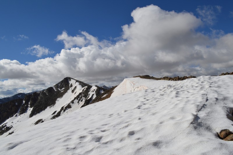
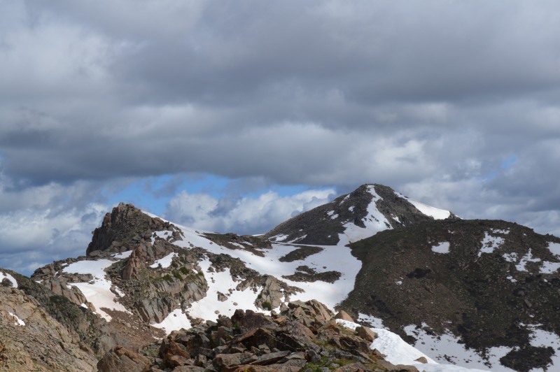
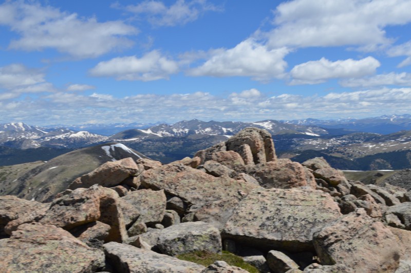
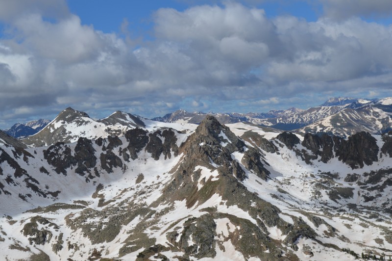
We gained the ridge, maybe a little farther north than may have been optimal, but it worked fine anyway. Unnamed 13,026 is the farther peak south.
A quick look north at 12,801 and Unnamed 13,003 before going south the three-quarters of a mile to Unnamed 13,026.
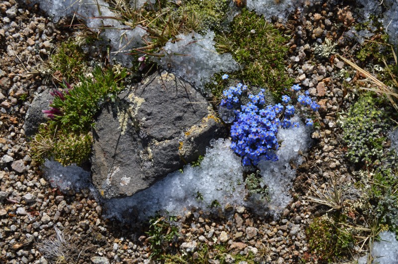
Flowers and hail. It had rained, hailed and thundered sometime around two to four a.m. while I was trying to sleep, here is the results of that hail higher up.
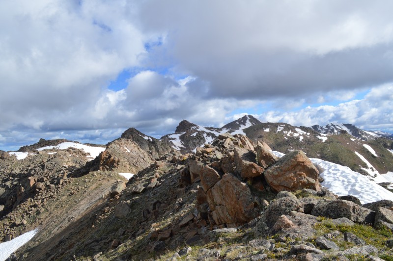
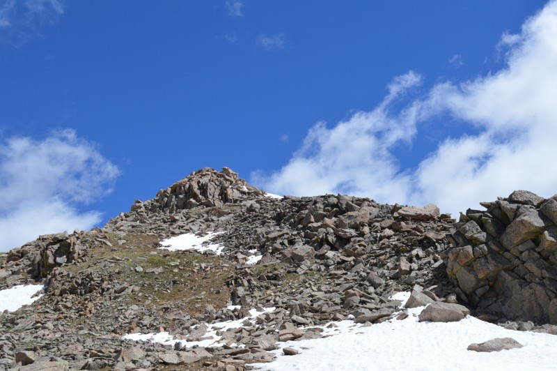
The first obstacle along the way, Unnamed 13,026 is beyond.
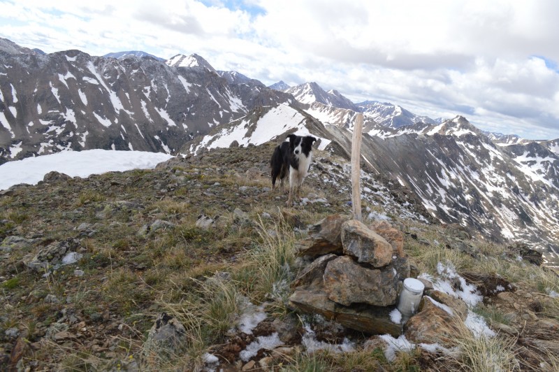
Unnamed 13,026.
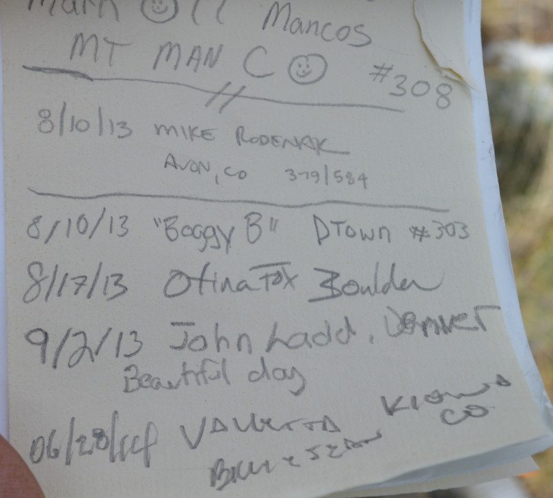
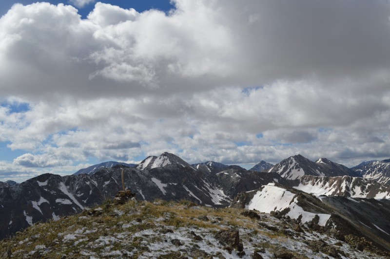
The summit.
Billie Jean and I were once again the first summiteers of the year, which we have been on all but one peak that has a register, except for one, where Alyson made it there before us.
A look north from whence we came.
The way north from where we started on the ridge south was a mix of grass and rocks. The way is Class 2, either on the ridge or just below it to the west. 12,801 is reached from its east side where there is no problem standing atop the high point.
A good look at 12,801 from the south.
We continued north towards Unnamed 13,003. The ridge is grass and some rock. This is a look at the south slope of Unnamed 13,003.
The summit of Unnamed 13,003. A large rock marks its high point.
We descended directly down from the peak, following a ribbon of grass through the talus, a short section of rock and then grassy slopes down to the lower section of this avalanche slide. There was snow and the debris from many a broken tree and branch.
The lower portion of the slide area was covered with small growth pines. We were able to find a decent path through to the bottom snow, through some willows and back to the South Fork Fryingpan River.
Where to cross...
There was a log jam of sorts where the river split in two. The first crossing went without a hitch, but we still had to cross the other half of the river. There was another, smaller jam on the left split and even though not ideal there was only a 5 foot jump from a large log to the other side. I made my way onto the log and then counted three, then jumped. It was okay except I stumbled and had to pick myself up, no problem. When I turned around to ask Billie Jean not to laugh at my clumsy landing I did not see her.
Uh Oh not good because it wasn't going to be easy to get back over to the side of the river I just jumped over from. I looked and saw that she had apparently lost her footing on the log and fell into the foaming waters. She was trying her best to claw her way out, luckily the log jam was keeping her from being washed away. She got out once then fell back in, so nothing for it but to jump in (not a great thing to have to do), holding onto willow branches as best I could.
My first thought was my wife will kill me if I don't bring Billie Jean home.
I reached for her several times as she strained against the rushing waters and just managed to grab a few inches of hair. I pulled her up on the log, got a better hold and with my just 6 months ago surgically repaired shoulder, flung her over and across the water to the west bank. She landed on the bank and was good to go.
I, on the other hand had lost my footing in the river, water up to my thighs, still clinging to the branches though. It took me three good tries and additional branches to pull myself out.
I don't need to do that again.
My boots and socks, pants were soaked but on the plus side it had cooled me off (the sun had come out an hour earlier full force). I took a few minutes to wring out the socks, empty my boots and let Billie shake out all the excess water a soggy dog can have and then it was off down the trail the last 1 1/2 miles or so in squishy boots.
The hike was about 11 to 12 miles roundtrip, 4400 feet and took about 9 hours. You can subtract about an hour and a half from that should you take this trek when the creeks are not so swollen with snow melt and you don't have to rescue dogs or fall in.
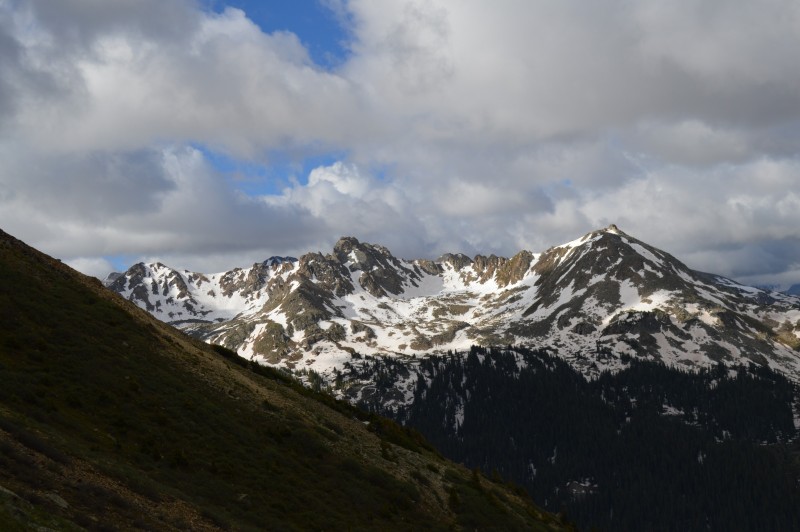
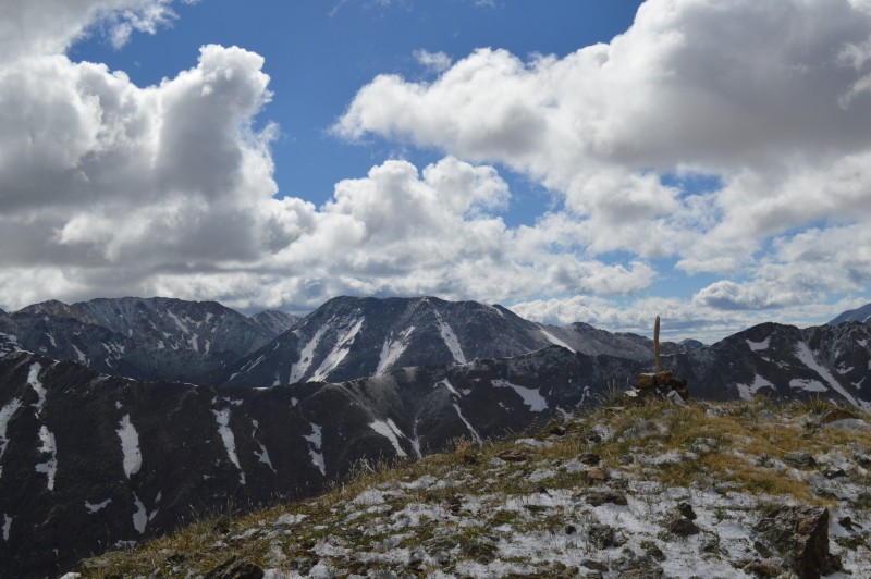
Vistas.
My GPS Tracks on Google Maps (made from a .GPX file upload):
Climbing in the spring with obstacles like: Image #1 (looks like a photo from my long awaited book entitled "the river, the trail") and Images #4 & #5 (the traditional "slippery log" crossing ... a move that The Man has refined and I merely wish to avoid at all costs, and if not, at least survive without submerging which has happened on more than one occasion). Regarding Image #21: It's a boy. :shock: Back to the exciting conclusion of your tale of success and woe ... glad you both made it across the raging torrent without injury or loss of limb or pants or shoes or dog. Your wife would not have been the only one that "would have killed you if you hadn't brought Billie Jean home" ... :wink:. Thanks for posting. Happy trails! :D
Glad you and your dog were able to cross the rivers with only getting soaked! Sounds scary... Makes the mud bog bushwhack I did last summer from one drainage east sound almost pleasant!
When I did those I went farther south up the trail and crossed closer to Deadman Lake in the rocks on the right 3rd of your image #6. Worked very well in August at least, the stream is narrower and easy to rock hop there. The way down I crossed farther north than you, much closer to the TH. I had also added 12653 and came back to the South Fork Fryingpan basin via the saddle between 13003 and a point marked as 12375 sort of angling NW towards the wilderness boundary. Glad you and Billie Jean were able to safely get back! I guess my crossings don't help you, but maybe future readers?
Fun peaks, this is a great part of the Sawatch that certainly leaves the ”talus heap” image of the range a distant memory. I have always enjoyed my outings in the Hunter-Fryingpan Wilderness, second only to Holy Cross Wilderness in my opinion of ”best of the Sawatch”!
Presto I knew you would have taken the wife's side... It is hard to find good hiking partners so I would not have let her go.
Berqsteiqen if I could marathon the peaks like you I could have avoided the soaking but I have to carve out a few here and there.
CT thanks for the info, I am sure someone can use it. It would have been better to cross by the lake. It was nice and grassy compared to some of last summer and fall Sawatch rockfest.
I had a similar experience getting to/from the Hagerman Tunnel from Hagerman Pass a week or two ago. I brought my big dog and my roommate's 30ish lb dog for the hike I expected to be pretty simple. The way up was annoying and difficult because of some smallish fast moving streams that weren't safe for the little guy to go through on his own so I tried to find an alternate path back to avoid them and ended up having to deal with bigger faster ones. My dog fell in one that was much deeper than it seemed but luckily it was one of the slower ones and he could get out.
When we got back out to the road around dusk there was a family of sightseers looking at stuff right outside their jeep. We were all soaked, dirty and tired so I felt like we looked like we'd just come out of a month of living in the wilderness. :D
thank you for one of your past trip reports that we recently used for info. Guess I'll just do it here. I'm sure we'll put this one to good use too. The Hunter-Fryingpan is high on the wish list. Glad you and Billie Jean made it out okay. Sounds like a real adventure. Thanks.
Caution: The information contained in this report may not be accurate and should not be the only resource used in preparation for your climb. Failure to have the necessary experience, physical conditioning, supplies or equipment can result in injury or death. 14ers.com and the author(s) of this report provide no warranties, either express or implied, that the information provided is accurate or reliable. By using the information provided, you agree to indemnify and hold harmless 14ers.com and the report author(s) with respect to any claims and demands against them, including any attorney fees and expenses. Please read the 14ers.com Safety and Disclaimer pages for more information.
Please respect private property: 14ers.com supports the rights of private landowners to determine how and by whom their land will be used. In Colorado, it is your responsibility to determine if land is private and to obtain the appropriate permission before entering the property.