| Report Type | Full |
| Peak(s) |
Precarious Peak - 13,378 feet |
| Date Posted | 08/19/2024 |
| Modified | 08/22/2024 |
| Date Climbed | 08/17/2024 |
| Author | JQDivide |
| Additional Members | Maverick6981, FoodieHiker, MKwhite45 |
| Perfectly Named |
|---|
|
Precarious: This peak is perfectly named. 
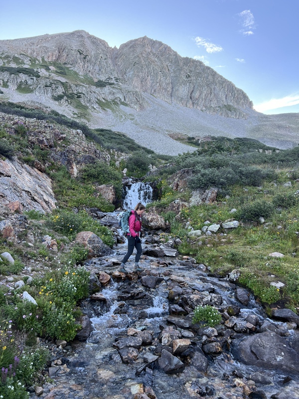
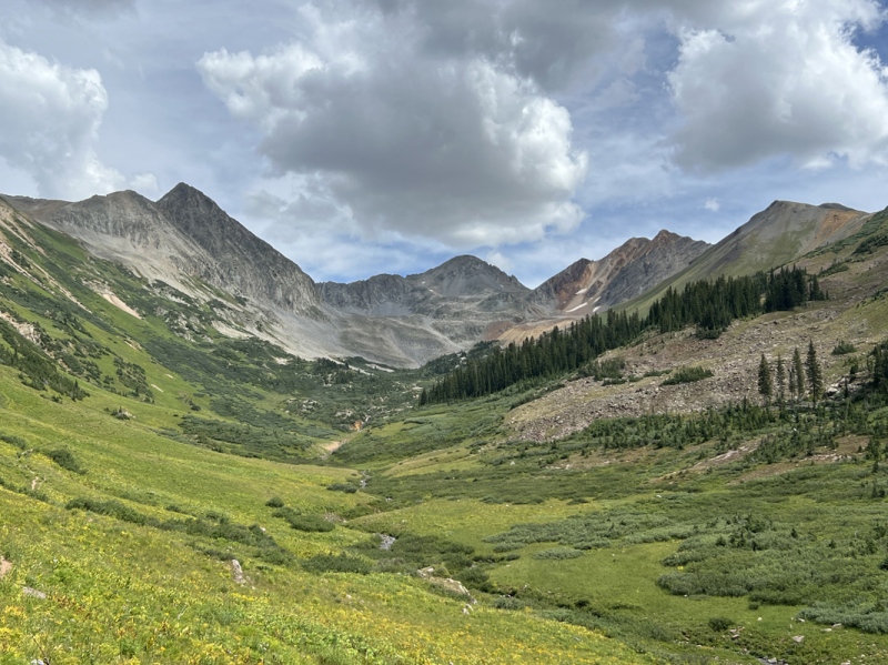
Every rock and boulder are precariously settled on the one below it, and on the ones below that. Another good name would have been Tedious. When we started our Crested Butte peak list, this one made us a bit nervous. We had read the TRs which talked about the rock fall. But it was when we saw “the gully” from across Rustlers Gulch from the top of Dorothy Peak did we get the real sense of nervousness. During this June trip we could see the rock fall happening in the gully. The potential was real. We had actually planned on get this peak last year, but time and weather hindered that. We grabbed its other neighbors earlier this summer and got a good luck at what we were getting into. And as Staci said: she told us what she was with her name, so we knew what to expect. We really haven’t been planning our peak choices for the summer and fall. Just kind of picking peaks before each weekend. This time, Megan asked us about going camping and hiking in CB. Chad was even going to go. Yep, there was a Chad sighting on a trail. After we checked the weather and our list, we decided to give Precarious a go. We camped at one of the newly redone campsites on Gothic Road. These are no longer designated dispersed, but numbered sites which you must pay for. The sites now have tent pads and metal fire rings. We hung out Friday, laughed a lot. We were loud enough someone came over about 10:30 p.m. and asked us to be quiet. We had to get up early anyway, so we decided to go to bed. The Approach. Rustlers Gulch is a great hike. Beautiful valley. Chad and Megan weren’t going to do the peak, but were interested in hiking up Rustlers Gulch. We were up and on our way before 5 a.m. and parked below the gate. I started the track right at the gate, which was about 5:10 a.m. From there the four of us walked up the trail in the dark. Between the first two creeks, Staci stopped. “Eyes.” We all looked at the glowing eyes ahead of us just off the trail to our right. I thought they were a bit high. She thought they were a bit wide apart. This was no deer, but a moose. Then I saw the other reflecting eyes down behind the cow moose, the momma moose. We quickly back off. We could only go so far to the left because of the willows and creek. But we started making noise and moved quickly to get passed her. I think this is the third time we have seen this mom and calf this summer. 
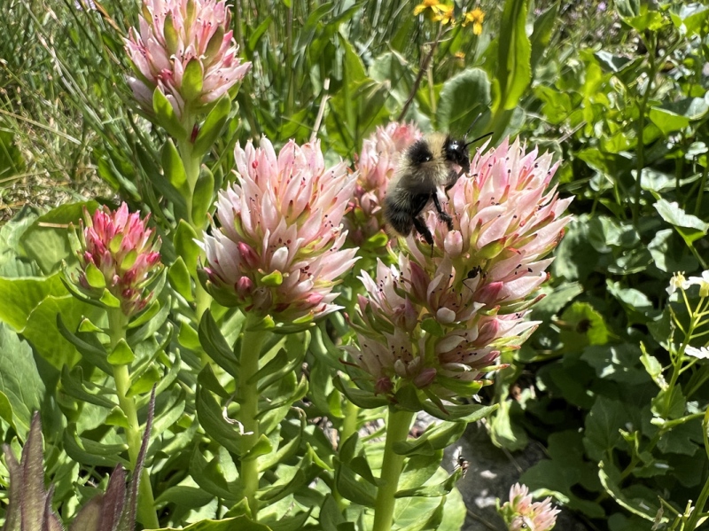
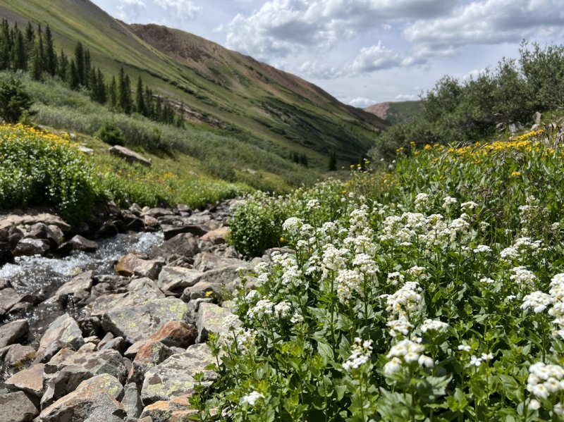
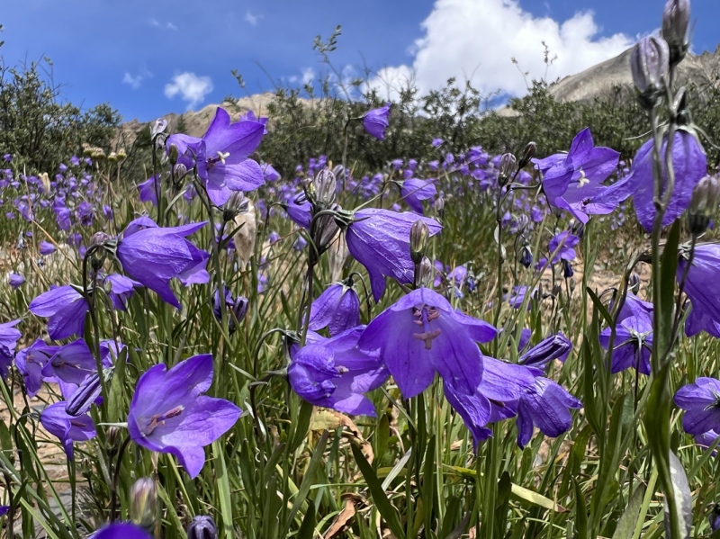
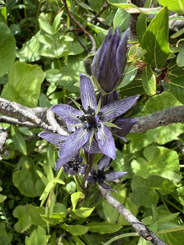
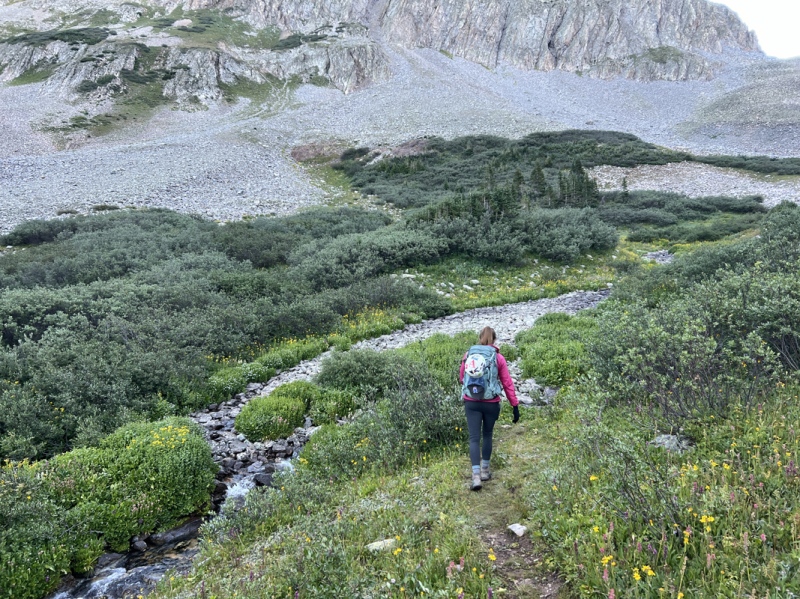
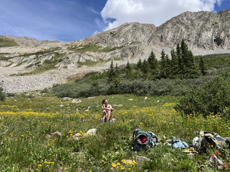
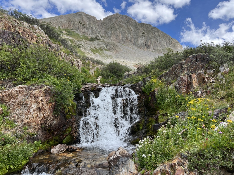
Across the log on the second creek. Up the trail and across the makeshift limb bridge over the third creek and soon the sky was getting light. As the sun came up, still hidden behind the peaks, we could start seeing the flowers that were still in bloom along the trail. This was our fourth time up here this summer. The flowers were past prime, but there were still enough to make this a good wildflower hike even now. Chad and Megan only went in about 3 miles, which probably made for a total of 7-8 miles round trip for them. (They rode with us and would walk back to camp.) We said our goodbyes around 6:40 a.m. and they went to CB for breakfast at McGill’s. We made the upper creek area around 7:20 a.m. I stashed some drinks in the creek for our return. Then we found a place to stop for breakfast near 11,600. Staci made some ham and cheese biscuits for us. We ate and looked up at the gully. 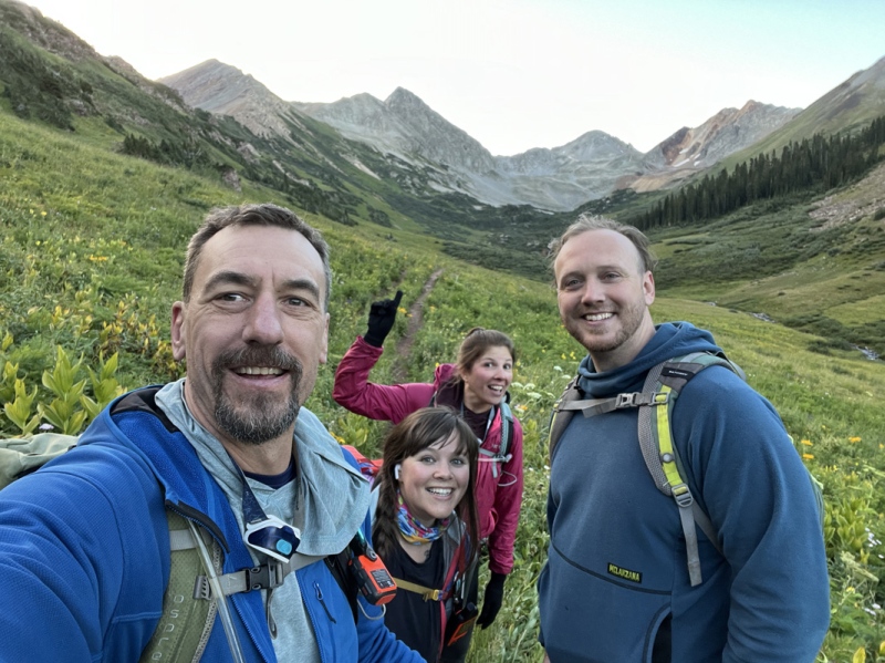
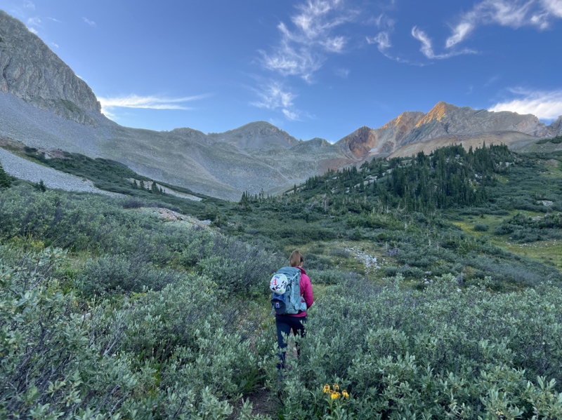
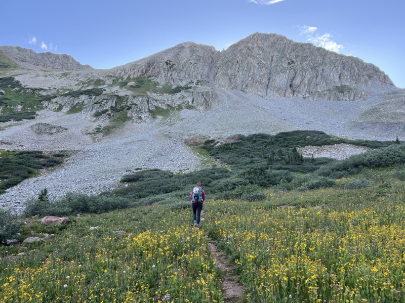
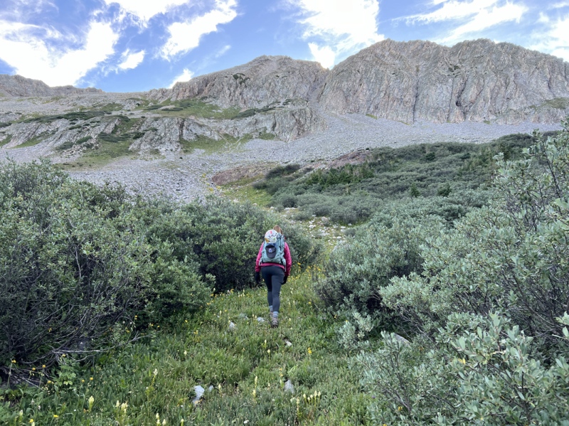
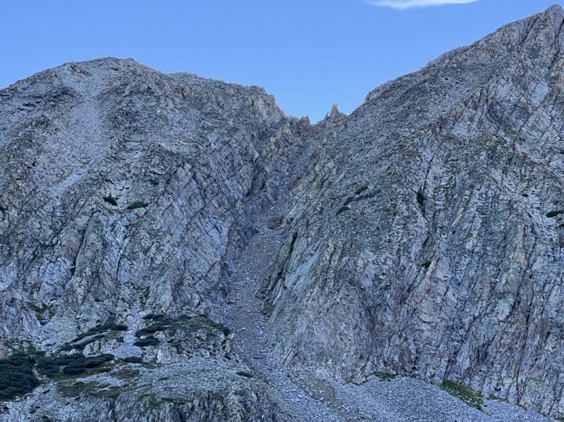
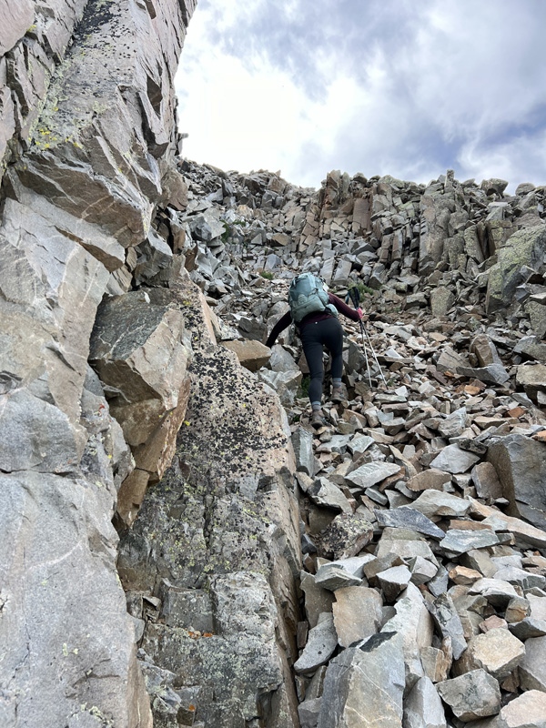
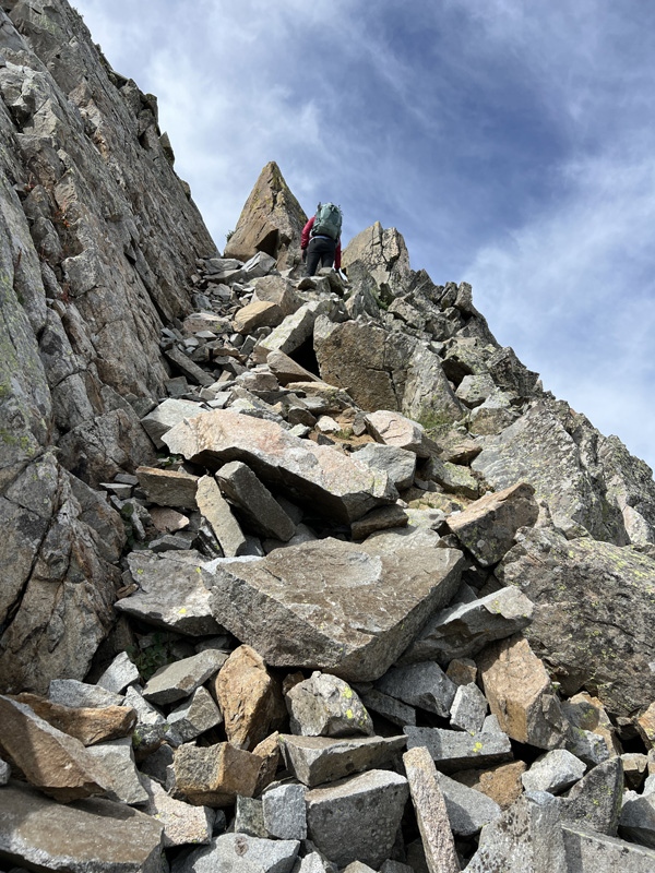
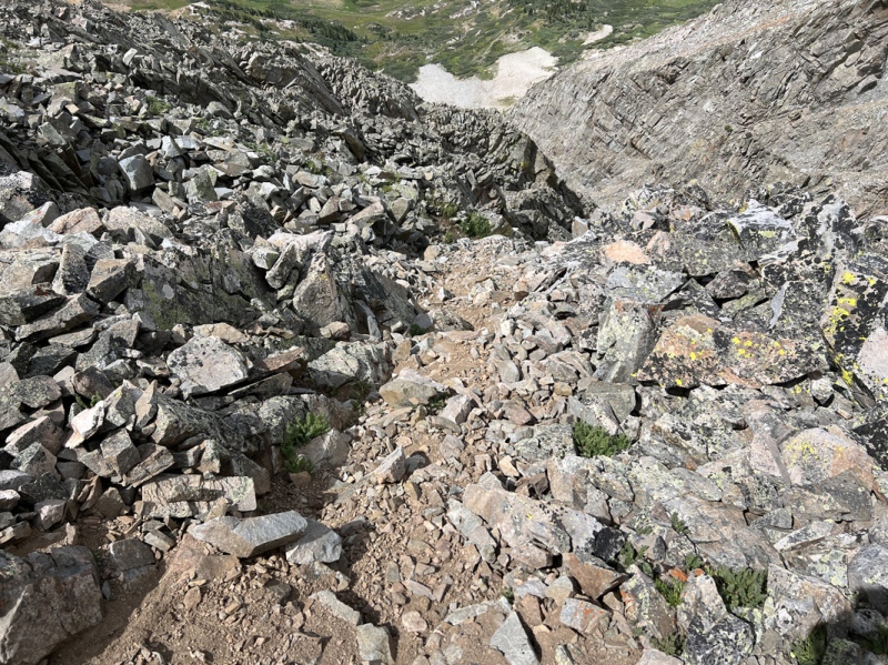
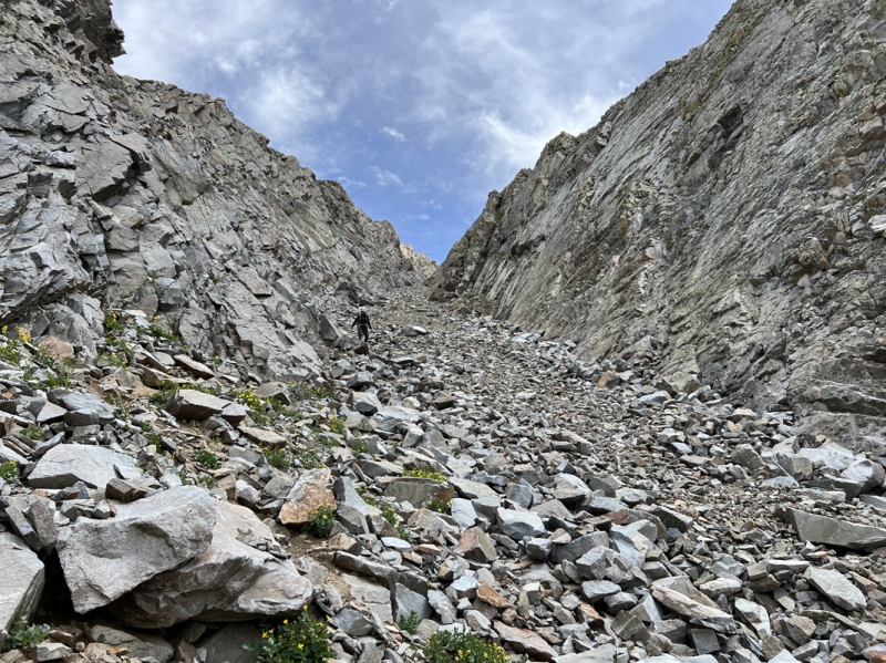
Lower Gully Game on. The boulders began near 11,700. Mostly they stayed in place. Near 12,000 feet, the left side wall of the gully began. If you moved right, the slope was mostly dirt. But wasn’t great footing. Pick your poison. At 12,200 the true gully begins. We put on helmets before entering. (8:30 a.m.) 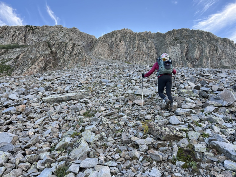
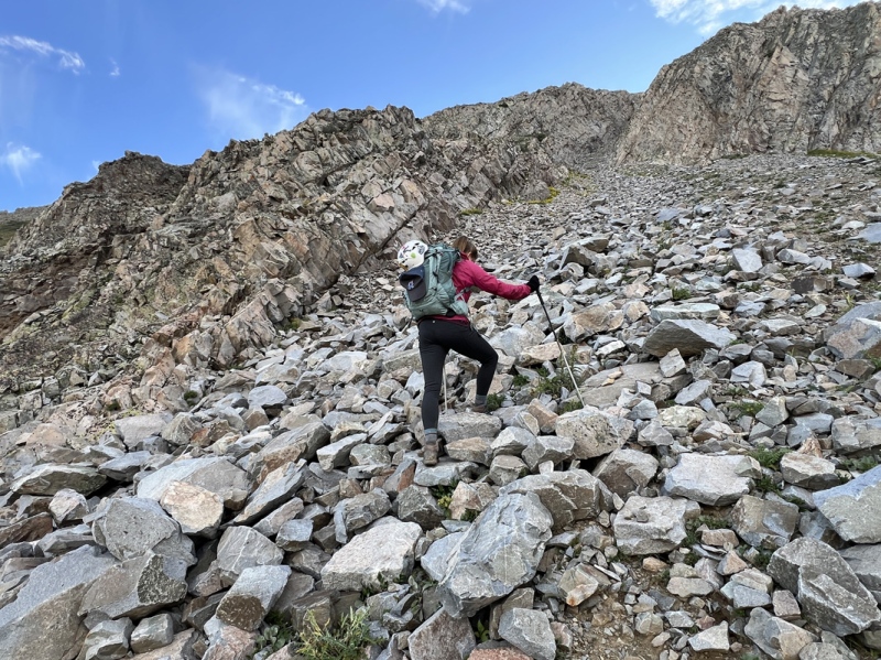
I have never been in anything so unique. I started thinking about other gullies. The gully that starts the Tour De Abyss. C3 on the Zapata route to Ellingwood. The Trough on Longs. Gully on Maroon. None of them are so defined. I felt like Luke Skywalker going into the trench on the Death Star. This was no ordinary gully, this was a canyon with vertical walls and a slanted floor made of boulders. It was pretty cool. But also a chore. Staci has been carrying microspikes in her pack all year, for years. Her first time to use them in summer was on the dirt gully up Pyramid. I even started keeping them in my pack. But this gully had very limited dirt to use them. There was no point in putting them on. It didn’t take long to figure out, everything moves. That was the mantra for the day. “Everything moves.” We said it over and over. Loose is the wrong term for this peak. Precarious fits. Each rock is resting, temporarily, on another. The rocks didn’t really slide. They wobbled, they rolled, they moved. We decided to give each other 20 to 30 feet of space between us. Mostly because the rocks didn’t tumble down the gully, they only mostly moved a few feet. So if they rolled on one of us, they would hit the feet or shins of the person behind. Extra space was needed. Granted this didn’t happen on every step. It wasn’t constant. But it was unpredictable. This took a while because one of us would move, then the other. What we should have done is each of us should have taken one side of the gully and moved up together. This one at a time business took much longer than it should have. But, we were well rested with all the breaks. We mostly stayed to the left side. No particular reason for this side. By staying close to the wall, we could use the solid parts of the wall to lean on, to take weight off our feet, which helped keep the rocks in place. 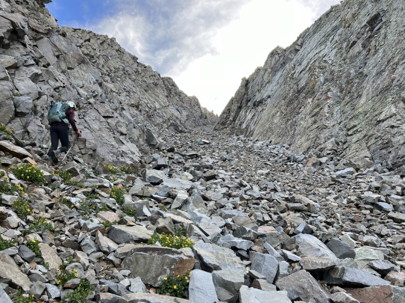
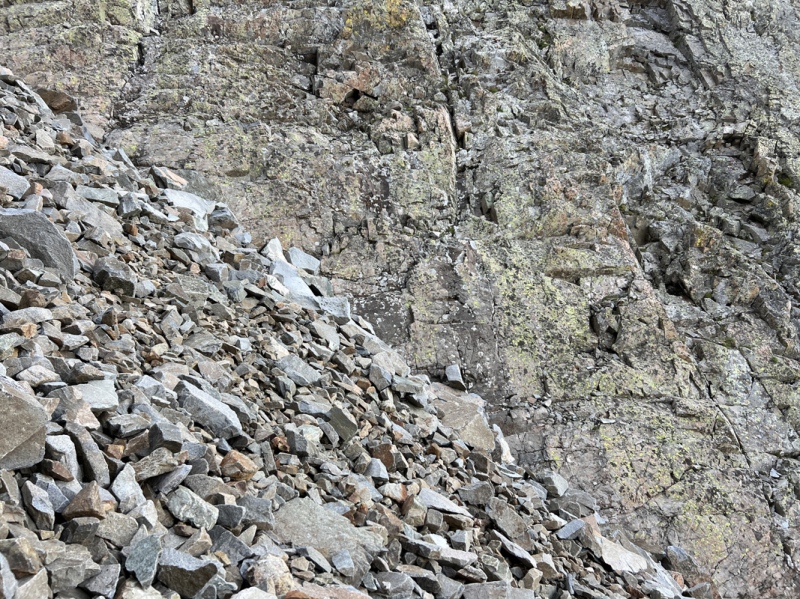
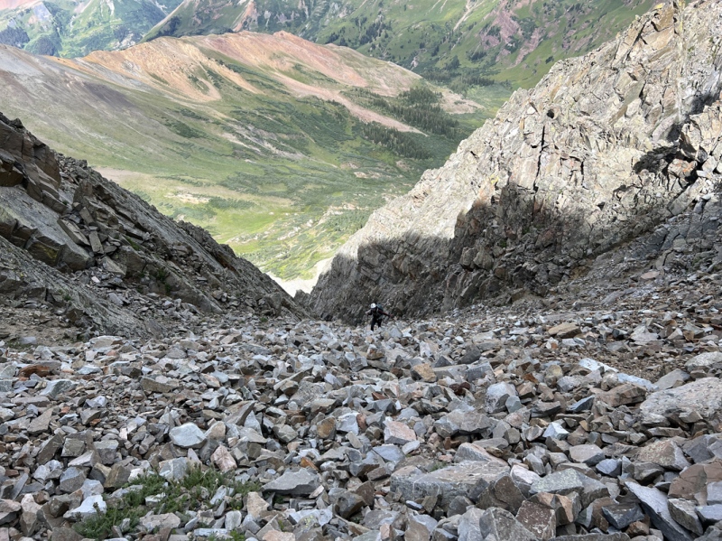
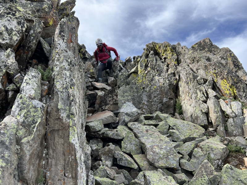
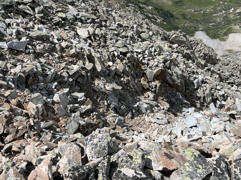
A rolling rock gathers no moss. This didn’t really hit home to until on the peak’s ridge when we could see an obvious difference. But I’ll bring it up now. None of the rocks and boulders in the gully had any lichens growing on them. These rocks move. I’d bet none of these rocks were in the same position last year. We were halfway up the gully and Staci stopped and asked if I could hear something. Nope. She said it was a vibration noise. My first thought was she was hearing some sort of movement in the rocks, or the wall, and it was about to fall on us. Freaked me out. But, it was only a bee, maybe a sweat bee. The rhythm of its wings in between the rocks made for a different kind of sound than normal. I realized then I was a bit high strung to instantly think the walls were coming down. Charleston Heston closing the gap in the Red Sea. Up we went, slowly. Stepping on teetering rocks and boulders. Some rolling away. And at times, it wasn’t just the top rock, but the three or four, or 10 below it. Again, not every step. But enough to think it could happen on any step. “Everything moves.” Upper Gully I had a gpx track from List of John of this peak. I assume it was John Kirk’s track. I hadn’t looked at it in a while. We were nearing the top of the gully. There is a pointy rock at the top. You can actually see this pointy rock in some of the photos taken from a distance. The gully splits in two, going to each side. I had assumed, we go to the top of the gully, go to the right at the pointy rock, near 13,000, then go to the “back side” (north face) of the peak to reach the summit. I was totally wrong about this. Near the top, I looked at the track. The track had already gone right, up one of many smaller gullies that had started appearing in the rock walls. I showed this to Staci. We starting looking at the small gullies trying to decided which way to go up. (9:50 a.m.) Since we were near the top, there was really only one option, without going back down, so we took it. Turns out this was an OK option. I say OK, because it got us out of the main gully and onto the west shoulder of the peak. But it was loose. Jenga rocks and dirt. Just enough solid rocks to provide some steps and hand holds. This little gully probably loses rocks whenever it rains, or the wind blows. 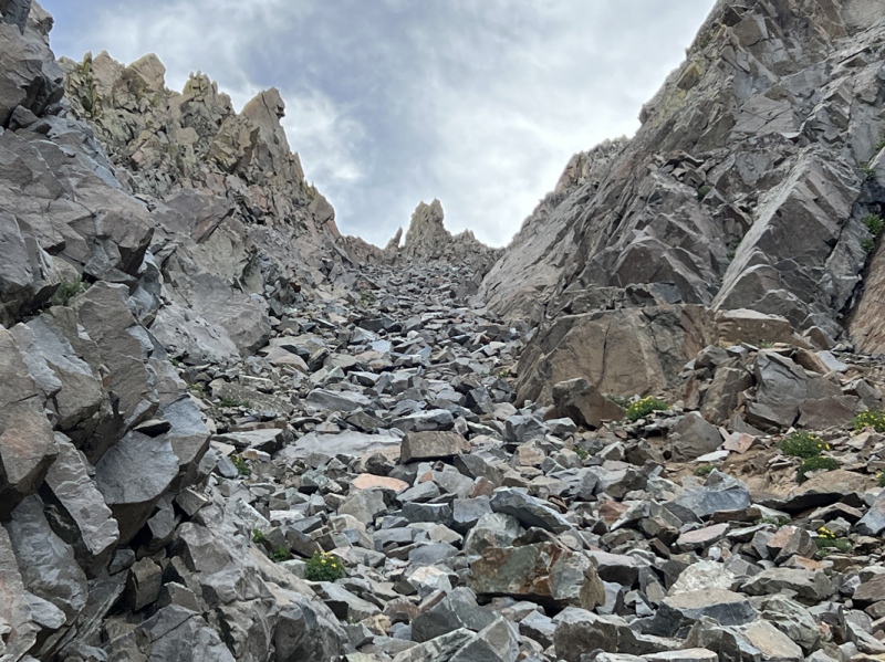
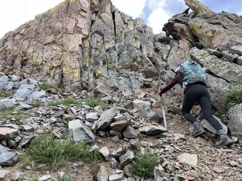
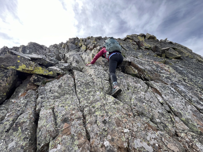
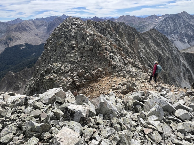
The West Shoulder Up above this little gully, the boulders were mostly solid, but “everything moves.” Though, all these rocks had lichen. They only moved a little. And here, we saw our first cairn. It was actually to the left and below us. I took a quick peek, it seemed that cairn led to another smaller little gully, that connected to the little gully we came up. We’d check that out later. We saw two more cairns above us. Then none. But I checked the track and moved in that direction, up and left. Saw a third cairn on the edge near 13,100. (10:15 a.m.) This brought us to the “back side” of Precarious. Looking at the Kirk’s track, it seems he went ridge proper but turned back at a notch on the summit ridge. This notch forms gullies on both sides of the peak, one we would cross soon. He came back here and began traversing along the north side of the peak. 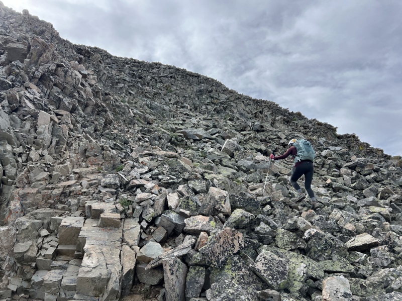
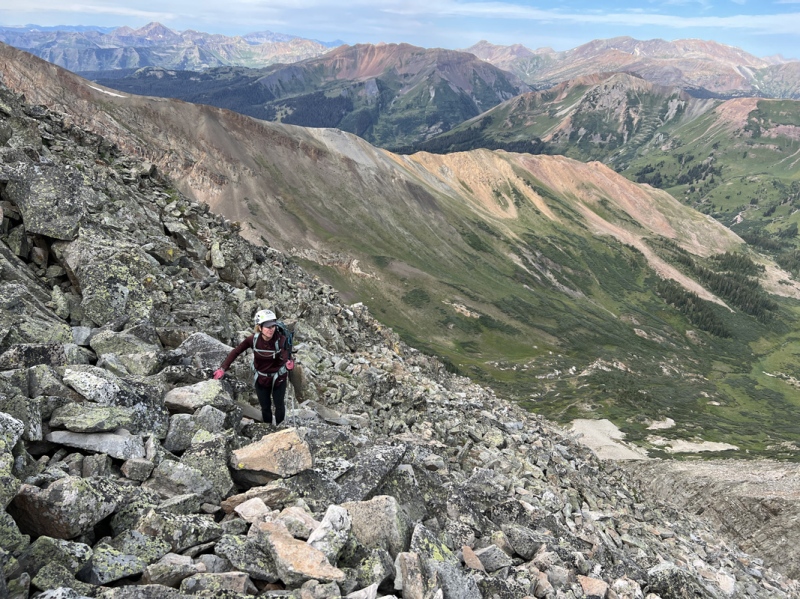
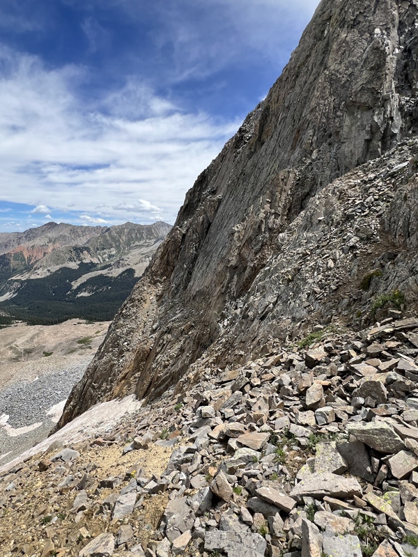
The North Face The north face of Precarious has a good bit of Class 3 terrain. The little gully was C3 as well. But the main gully was C2 rock hopping. We scrambled onto the north face. Followed a couple cairns and soon we were at a gully crossing. The gully with the summit ridge notch. C3 to get in and out of the gully. So, here is my take on the entire north face. Easy but legit C3. Only issue, this entire slope is a no fall zone. You fall, you are falling and rolling downhill. Not a lot of exposure, but enough to make you careful with each step. I don’t do well with exposure. And remember, “everything moves.” I was a Nervous Nelly. Over the years it has become obvious to me and some of the folks I hike with. Everyone else can step on a rock, and nothing happens. I step on that same rock, and it moves on me. I don’t know if it is because of how I move. My weight. My size 15 boots. But I move rocks others could dance on. The amount of rock movement on this entire route played around in my head. The pitch of the slope. The loose rocks on the face. I had to stop and take several deep breaths. 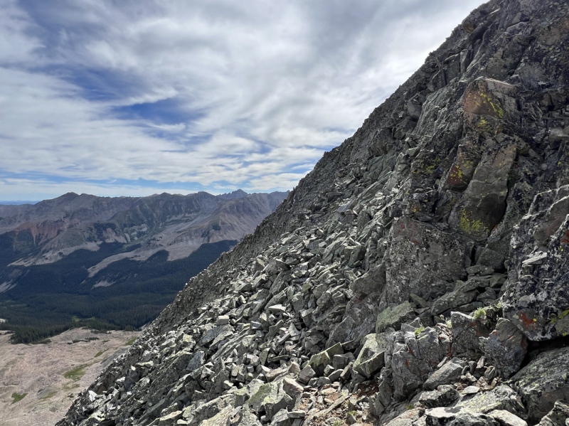
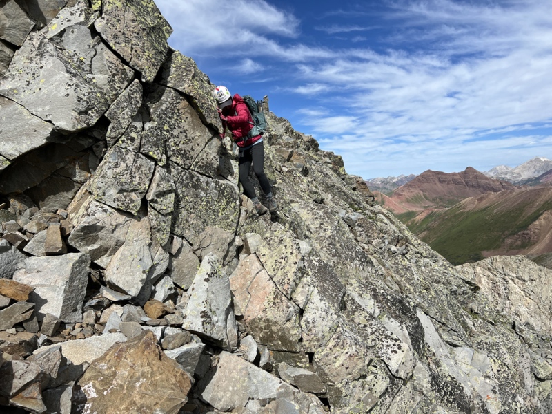
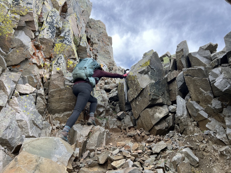
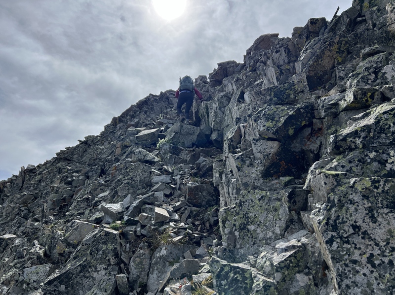
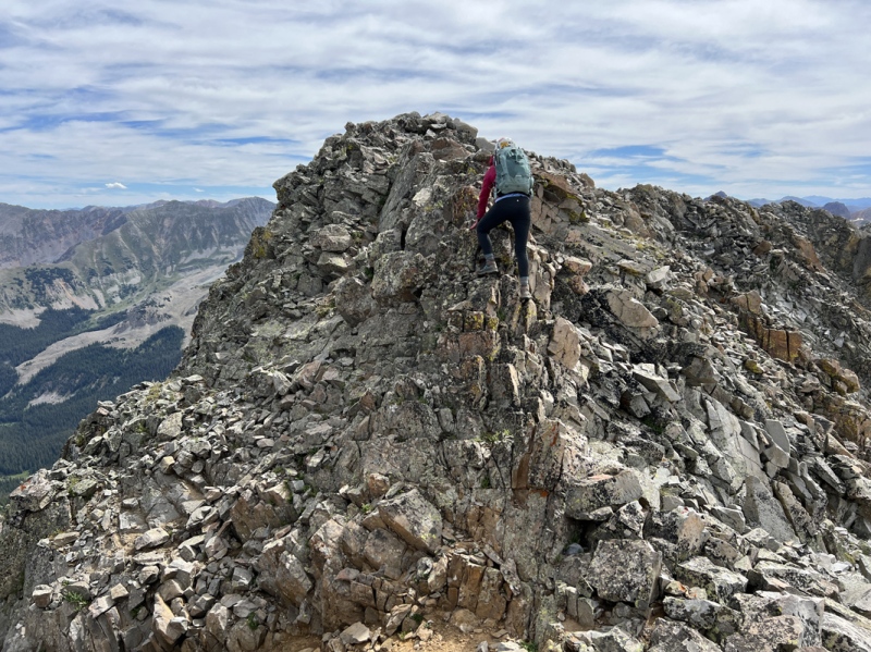
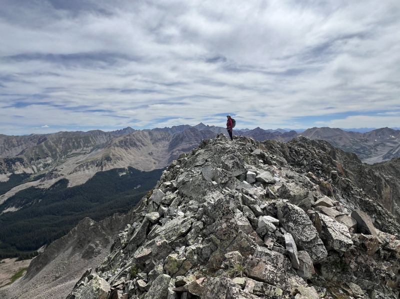
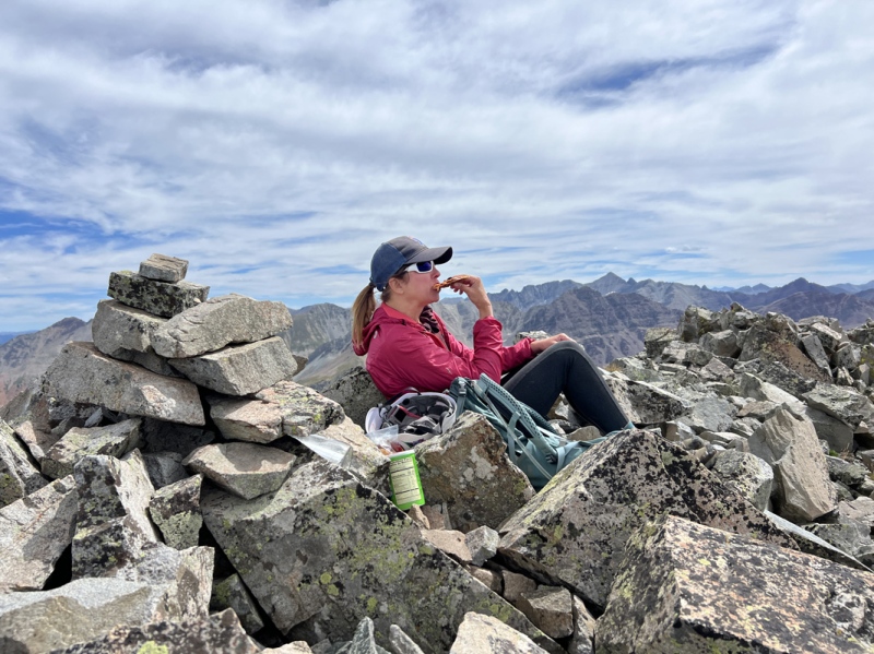
Beyond the gully, the route moves up and left. Found a few cairns. Then we came to a ramp that went up and right. The ramp was littered with rocks. The track went this way. The ramp ended between a wall and pointy boulder with a deadly drop beyond. C3 up the wall to another ramp that went to the summit ridge. This ramp had more loose rocks and questionable footing. Once on the ridge, there was a small drop, with a bit of C3 to get back up to the summit. We were on the summit at 11 a.m. We fist bumped and sat down for some pizza from Crave in BV. I took photos of the peaks surrounding us. Many of which we had climbed and hiked. Staci asked how I was doing, noticing I was quiet. Yep, I was a little worried about getting off. I hate down climbing. And I kept thinking, “everything moves.” I was way too into my head. 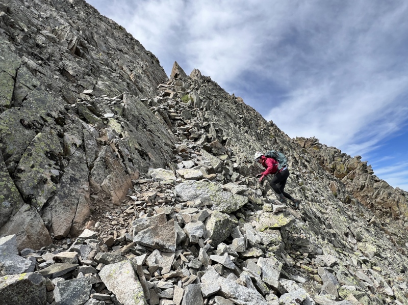
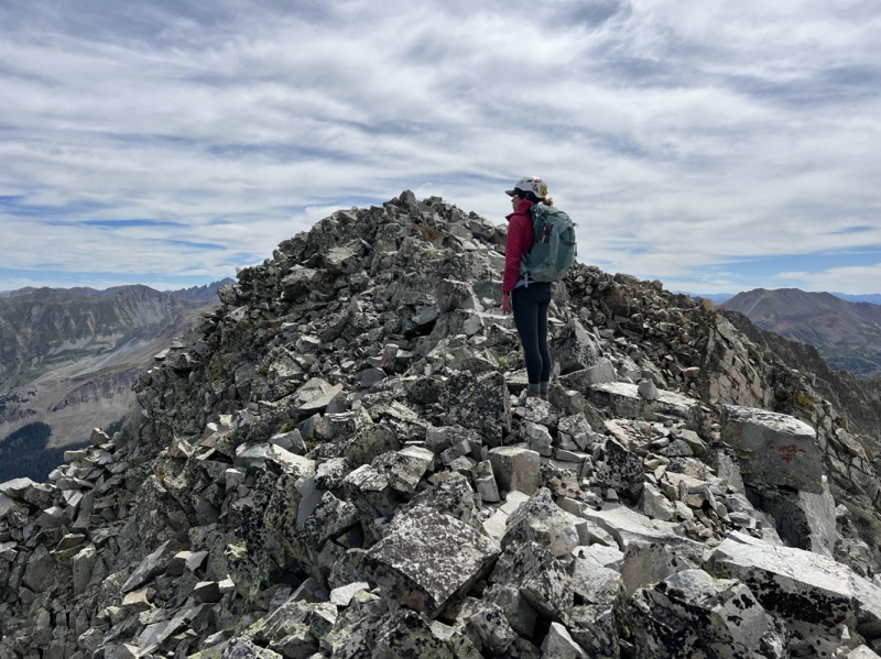
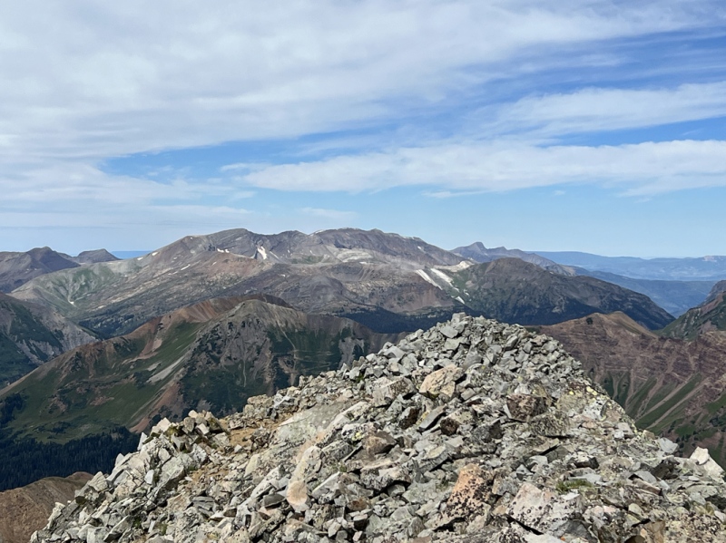
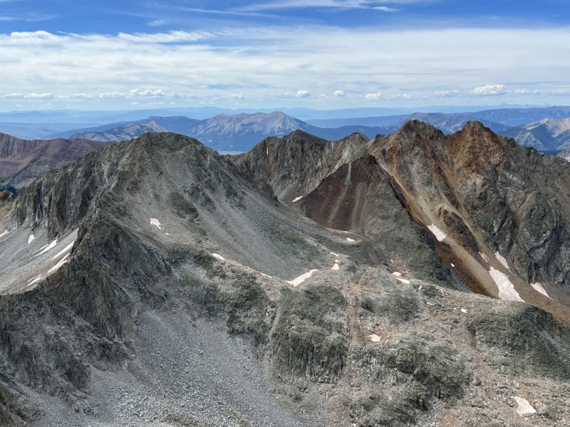
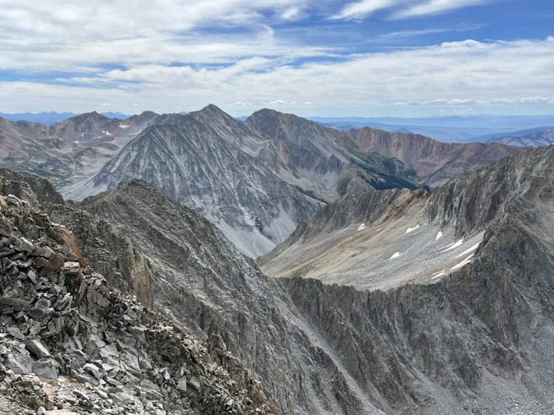
Summit Views 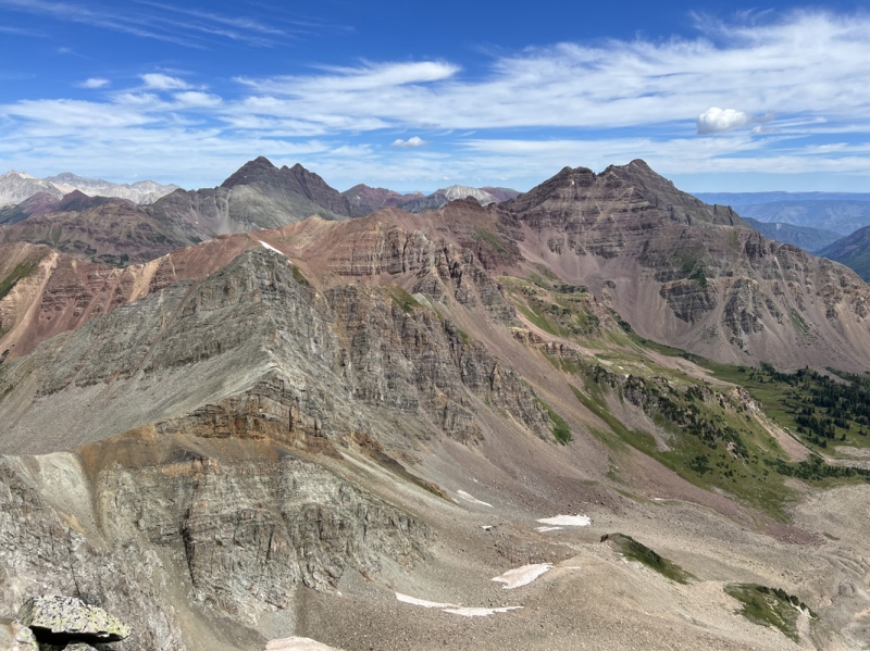
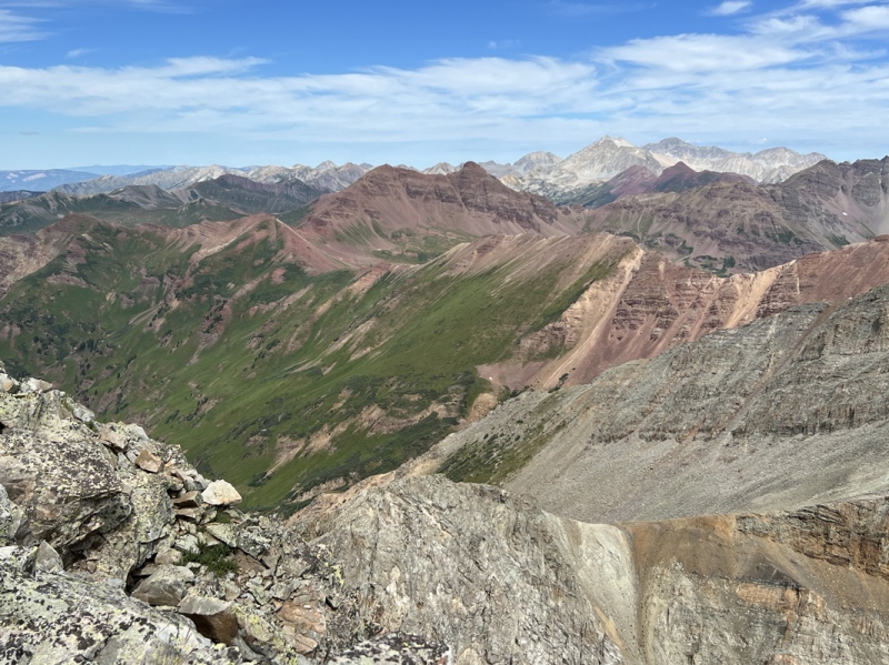
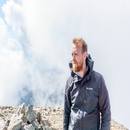
North Face of Precarious 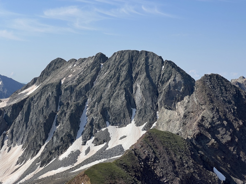
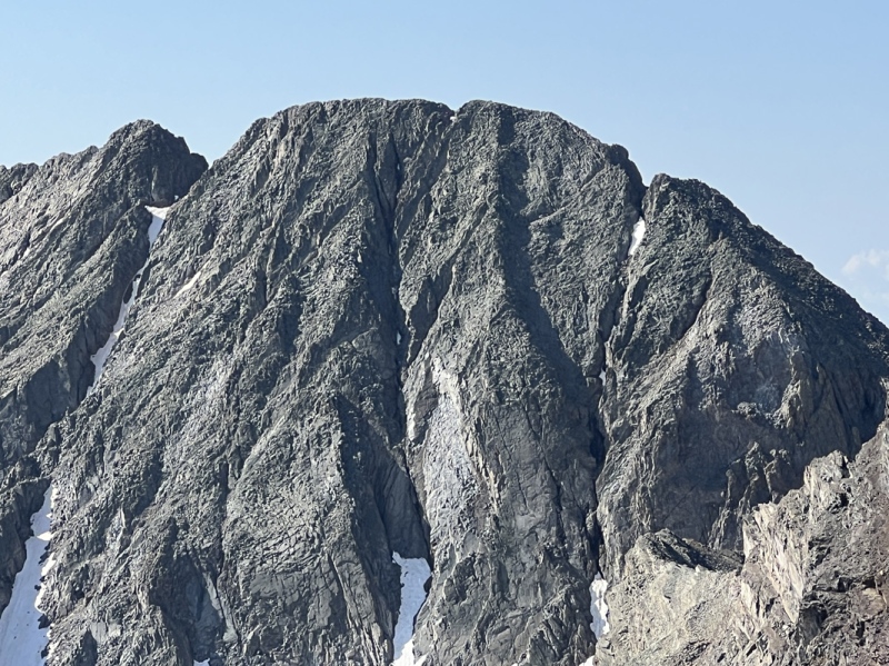
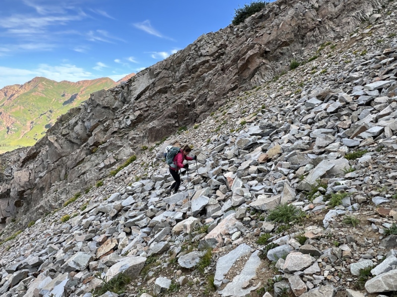
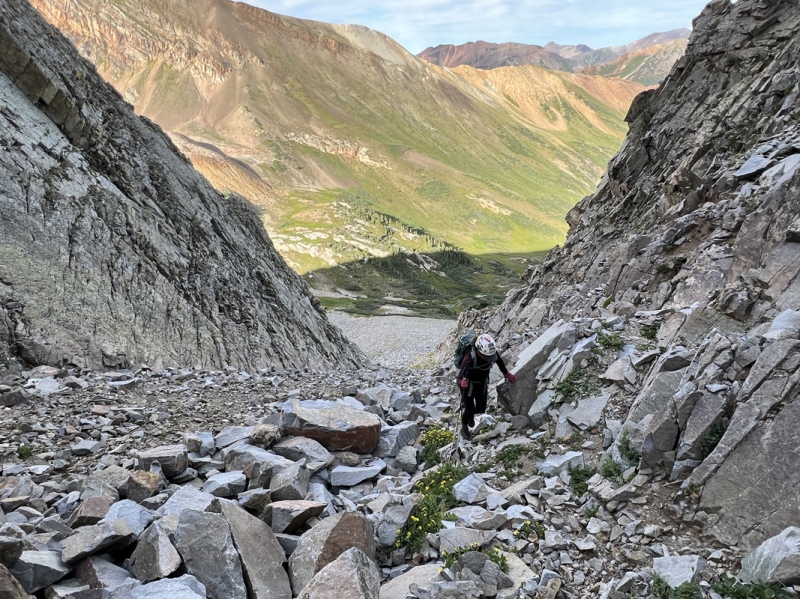
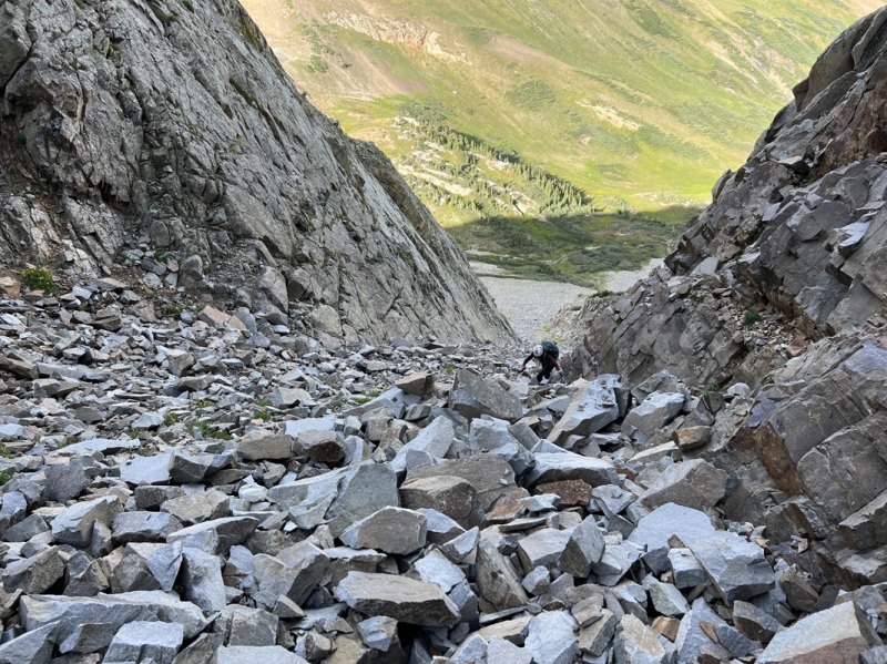
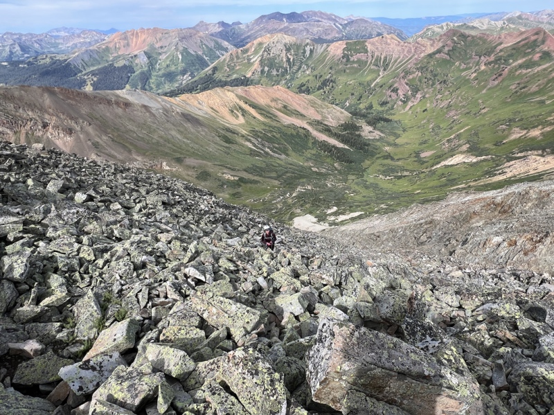
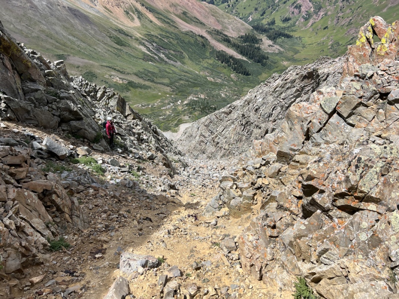
Summit is top center of the photo. That upper center notch, depression in the ridge, see photo "ridge drop" for details. Heading Down We started down about 11:35 a.m. I didn’t take many photos on the way down. Too focused on my footing. On the upper ramp, Staci stepped on a rock that rolled out from under her. Shit. She was fine. But that was in my head now. I grabbed onto the wall next to me, trying to keep my feet light. She handled the C3 downclimb to the next ramp. I took a moment and kind of butt scooted, and found a couple of boot holds and then used the boulder across to give me leverage. Long legs help sometimes. Down the rocky ramp. And then the rock slope. It was easier going up this slope than down because of some of the loose rocks and some kitty litter. Across the gully and back to the west shoulder. (12:15 a.m.) These rocks, well, they moved a bit. Most teetering here and there. We followed the cairns down to the smaller of the two little gullies. That was all kitty litter and we couldn’t see the bottom. So, back up to the little gully we had used earlier. But we actually went around it and down some boulders, skipping the top half of the gully, the really loose part. We were back in the main gully by 12:30 p.m. I walked up to the top of the gully to look around to the north face. I don’t think that goes at all. Well, not with my limited climbing skills. Down the main gully we went slowly, but faster than we came up. We stayed on the sides. Leaned into the walls to prop us up, lighten our footing, because “everything moves.” A few slips and rolled rocks here and there. We were out 45 minutes later, 1:15 p.m. (Checking later, we both had several light bruises and few scratches on our legs from all the rock movement.) It was a relief to exit that vertical canyon. But we still had 500 feet of rocky, bouldery slope. And our focus changed. We saw two people sitting by the creek, right where I stashed our canned palomas. Were they drinking our creek-chilled booze? 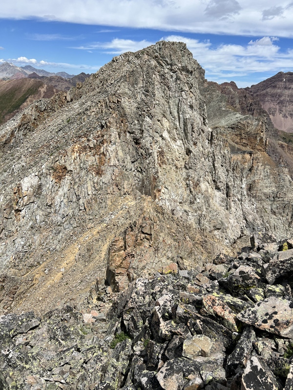
The Creek We were down to the creek by 1:40 p.m., a lot faster than we expected. Our chilled cans were safely hidden. And they were refreshing. A nice celebratory treat. Precarious was checked off the list. We were one peak closer to finishing our list, hopefully this fall. We hung out by the creek. Ate snacks. I even took off my boots and socks and soaked my feet in the cool water. The wildflowers up high were still nice. Took some photos on the way out. Even though we had been on this trail four times in the last three months, I’d like to come back in the fall to see the changes. On the way out, clouds were dark to the southwest. As we got closer to the TH, we started to hear thunder beyond Gothic. Staci saw some lightning in the distance. But we were back to the gate and in our Suburban before the rain started. Back at camp, Chad and Megan were in the canopy protected from the rain. We joined them. And soon we had cold drinks and were talking about our day. We listened to the rain and thunder bouncing off the mountains. After the rain stopped, Megan and Staci made dinner, fajitas and fixings. We spent the rest of the evening chatting and laughing. And we created a wonderful new company, with products coming your way: Dickle and Fuggs. The next morning, we had coffee and Staci made French toast with fresh fruit topping. It was a beautiful lazy morning. Though, Staci and I were both feeling the effects of leaning on the gully walls to get up and down. We both had sore muscles in our shoulders and backs, like we’d done a bunch of pushups. Precarious or Tedious, whatever you call it, it was a unique peak and hiking experience for sure. Glad we did it. Glad it’s done. But I doubt I’d ever go back.
For other Trips Reports on Rustlers Gulch 13ers: Precarious was #56 on our CB list.
GAIA Track: Thumbnails for uploaded photos (click to open slideshow): ")
")
")
")
")
")
")
")
")
")
")
")
")
")
")
")
")
")
")
")
")
")
")
")
")
")
")
")
")
")
")
")
")
")
")
")
")
")
")
")
")
")
")
")
")
")
")
")
")
")
|
| Comments or Questions | |||||||||
|---|---|---|---|---|---|---|---|---|---|
|
Caution: The information contained in this report may not be accurate and should not be the only resource used in preparation for your climb. Failure to have the necessary experience, physical conditioning, supplies or equipment can result in injury or death. 14ers.com and the author(s) of this report provide no warranties, either express or implied, that the information provided is accurate or reliable. By using the information provided, you agree to indemnify and hold harmless 14ers.com and the report author(s) with respect to any claims and demands against them, including any attorney fees and expenses. Please read the 14ers.com Safety and Disclaimer pages for more information.
Please respect private property: 14ers.com supports the rights of private landowners to determine how and by whom their land will be used. In Colorado, it is your responsibility to determine if land is private and to obtain the appropriate permission before entering the property.