Download Agreement, Release, and Acknowledgement of Risk:
You (the person requesting this file download) fully understand mountain climbing ("Activity") involves risks and dangers of serious bodily injury, including permanent disability, paralysis, and death ("Risks") and you fully accept and assume all such risks and all responsibility for losses, costs, and damages you incur as a result of your participation in this Activity.
You acknowledge that information in the file you have chosen to download may not be accurate and may contain errors. You agree to assume all risks when using this information and agree to release and discharge 14ers.com, 14ers Inc. and the author(s) of such information (collectively, the "Released Parties").
You hereby discharge the Released Parties from all damages, actions, claims and liabilities of any nature, specifically including, but not limited to, damages, actions, claims and liabilities arising from or related to the negligence of the Released Parties. You further agree to indemnify, hold harmless and defend 14ers.com, 14ers Inc. and each of the other Released Parties from and against any loss, damage, liability and expense, including costs and attorney fees, incurred by 14ers.com, 14ers Inc. or any of the other Released Parties as a result of you using information provided on the 14ers.com or 14ers Inc. websites.
You have read this agreement, fully understand its terms and intend it to be a complete and unconditional release of all liability to the greatest extent allowed by law and agree that if any portion of this agreement is held to be invalid the balance, notwithstanding, shall continue in full force and effect.
By clicking "OK" you agree to these terms. If you DO NOT agree, click "Cancel"...
These are peaks 50 & 51 on our Crested Butte peak list we are working on. If you want to see some TRs for a bunch of random CB area 12ers, check out our blog.
We tried hiking these two 13ers near the end of June. But we turned back on the ridge due to snow.
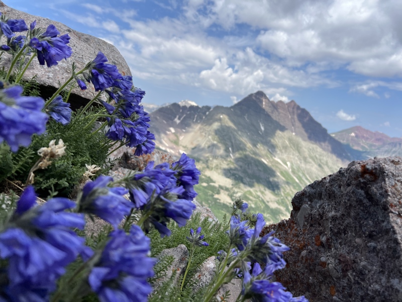
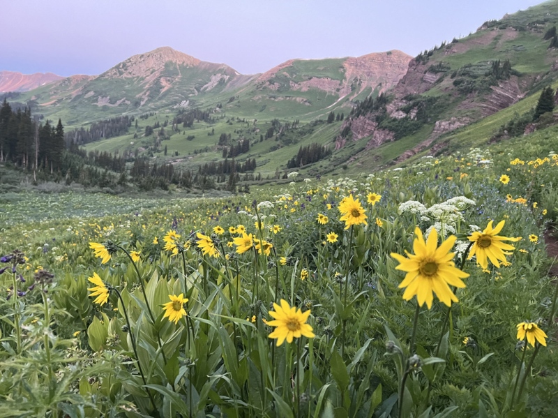
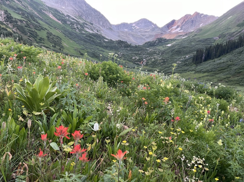
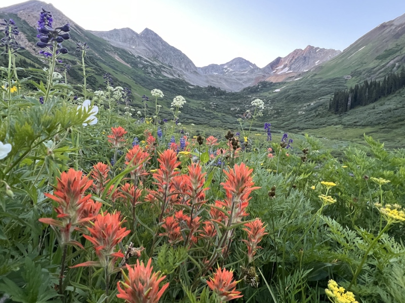
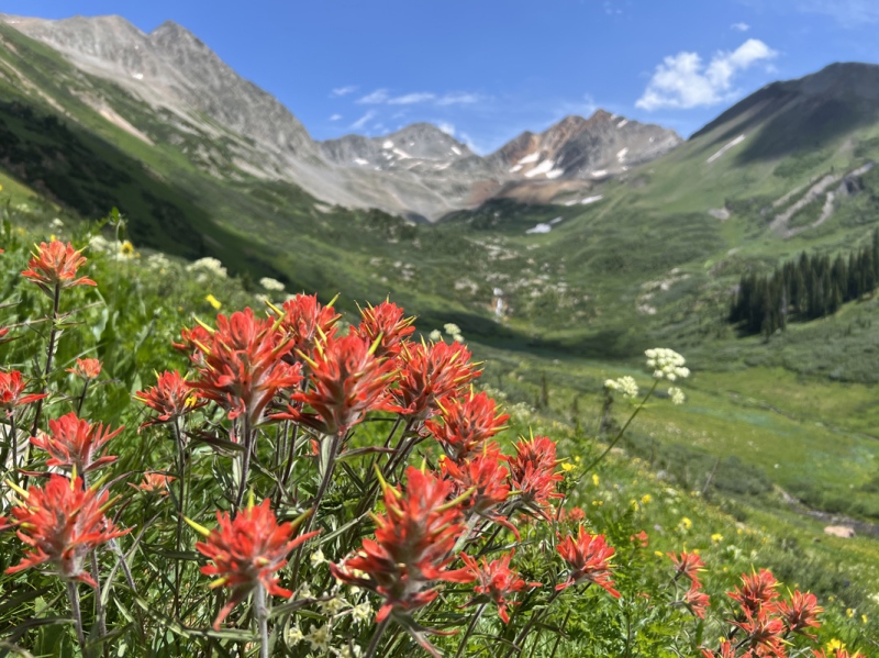
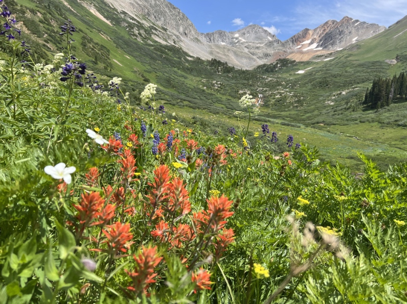
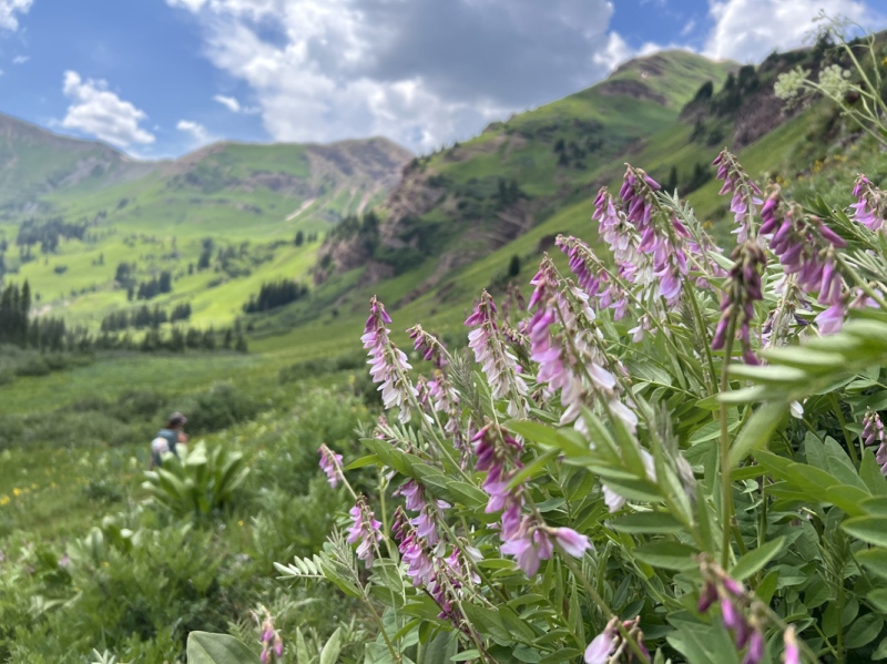
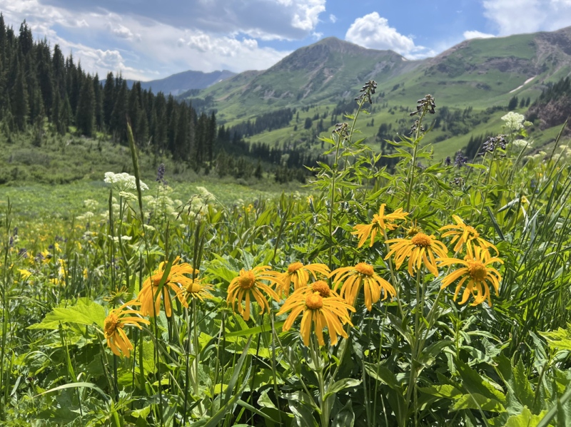
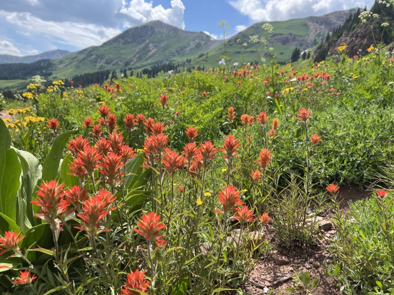
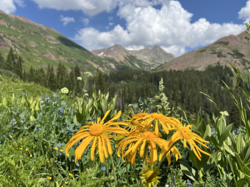
This second try was great, mostly because of the flowers in Rustlers Gulch. They were amazing! Photos just don’t do the views and experience justice. Acres and acres of flowers from the creek all the way up to 12,600 feet and beyond. Extraordinary!
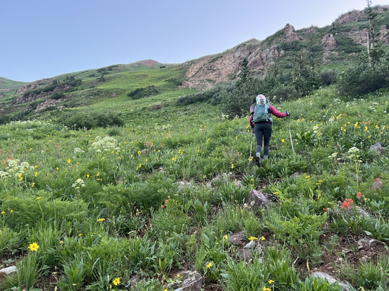
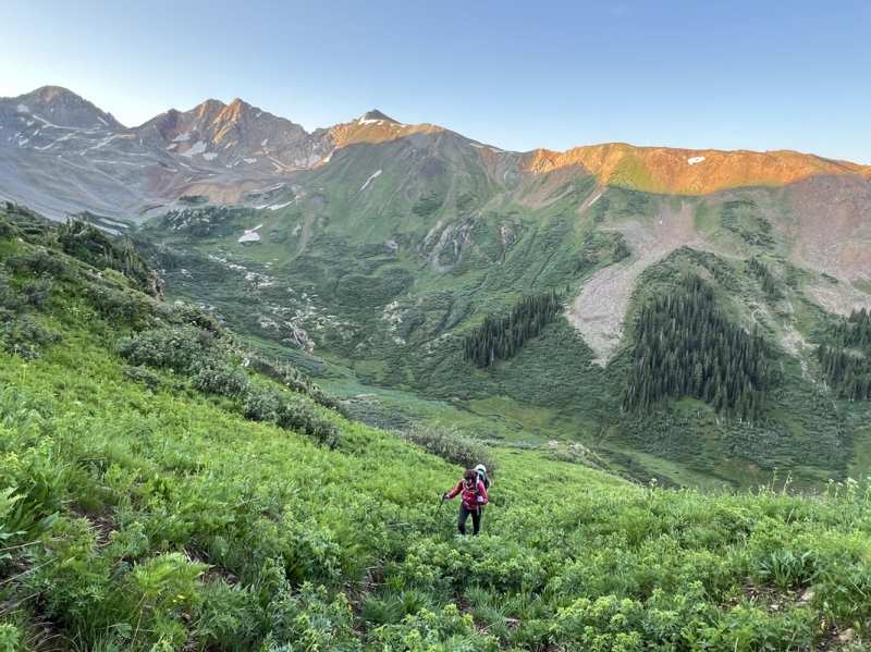
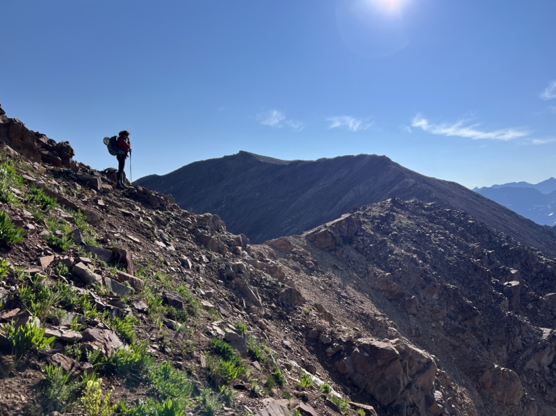
Start of the slope
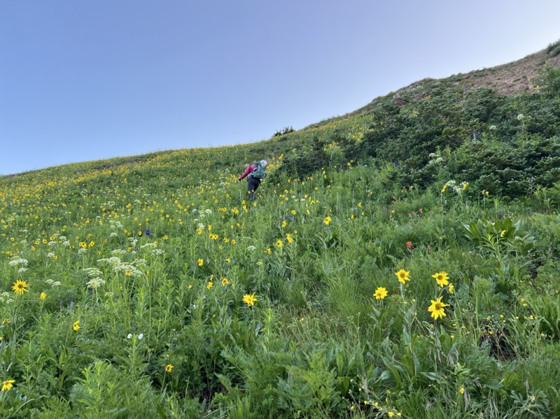
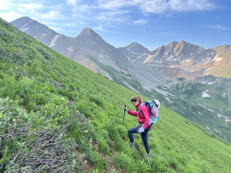
Flowers on the slope
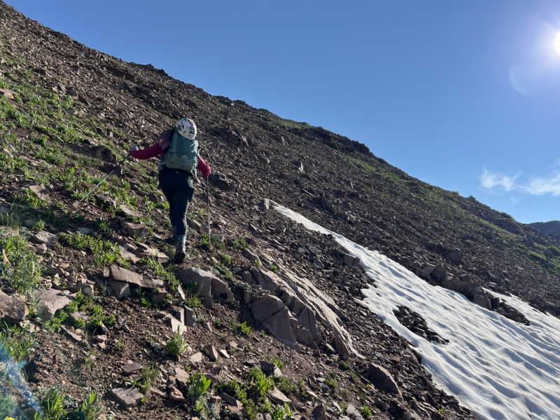
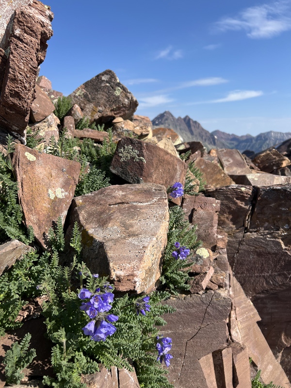
Rocky bits
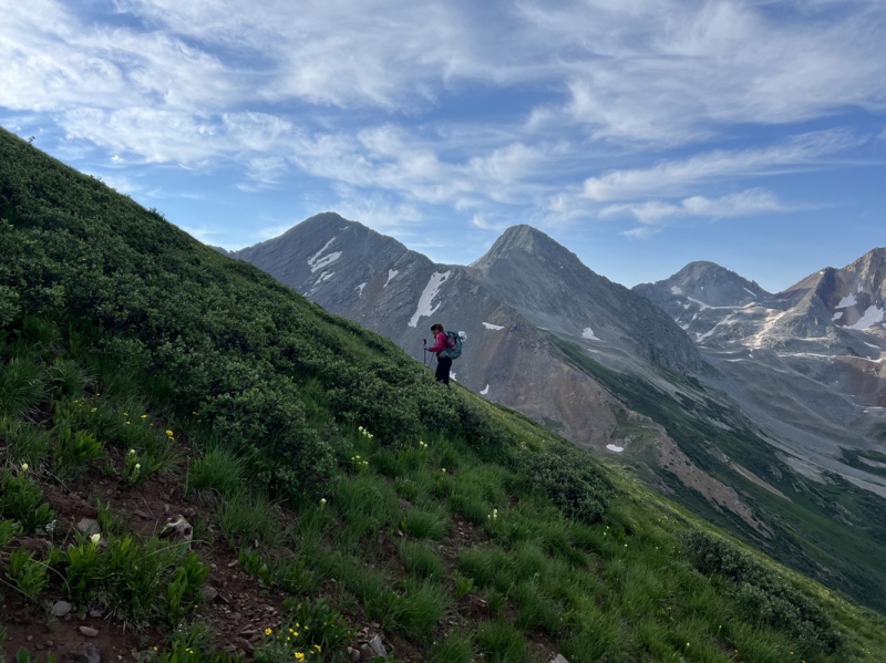
Slope
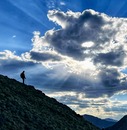
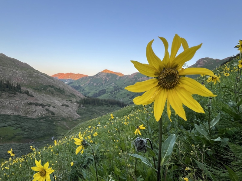
Sun starting to show
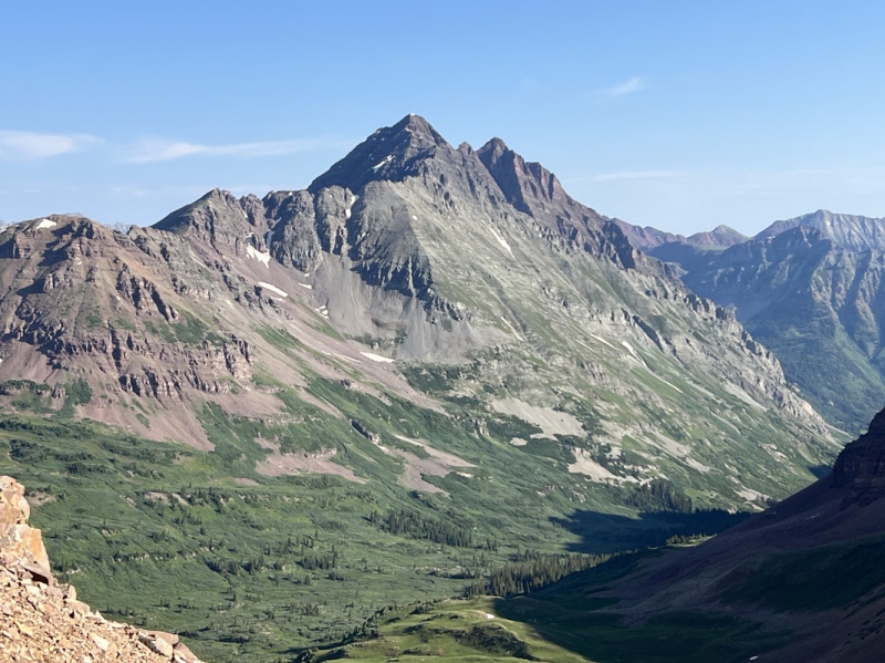
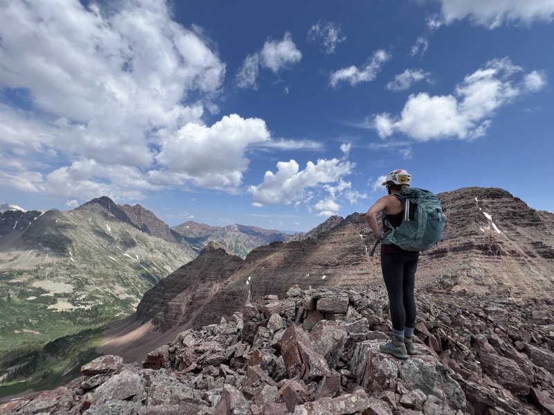
Nice view of the other 13ers in the basin, they are on our short list.
Steep
Nearing the top of the slope
We started early because we knew it was going to a long day, mostly because we are slow. We parked about .3 mile from the gate on the Rustlers Gulch Road. We were walking by 4:15 a.m.
The first creek had rocks, the second creek had a log, if you followed a side trail. But we got wet on the third creek. But rumor has it, if we would have gone farther on the side trail, we could have crossed dry. We stowed our sandals under a tree so we didn’t have to carry them.
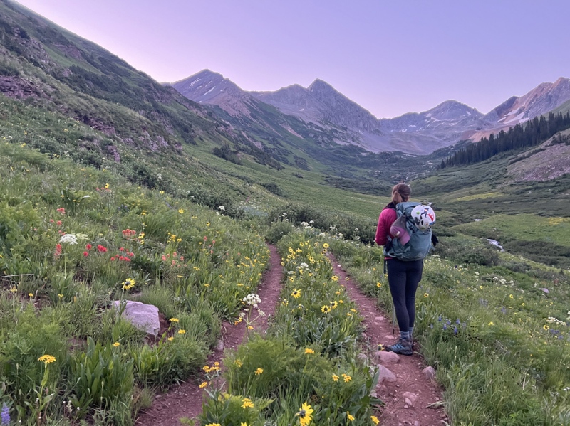
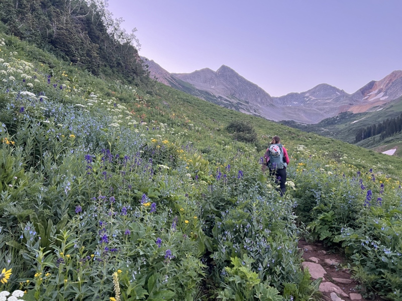
Once the light started showing we could see the abundance of flowers. We had to stop and just ‘be’ for a few moments. The walk in was fabulous.
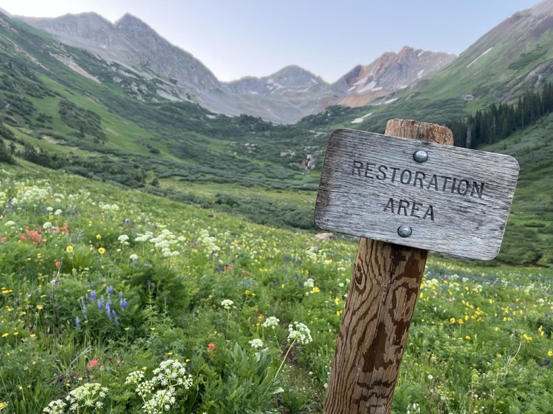
We followed the trail from the gate for just under 3 miles (near 11,100) and turned left, uphill. We hiked up the grassy slope into wildflowers. They just didn’t stop. We maneuvered around a rock cliff and went up again. The flowers faded. But once we hit 12,500, a different variety of flowers filled the slope. Wow.
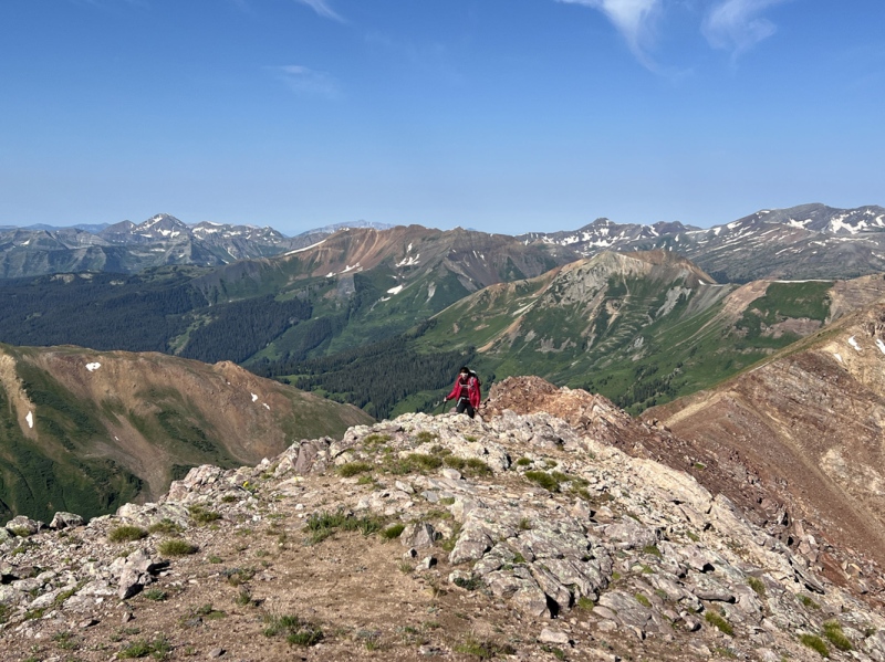
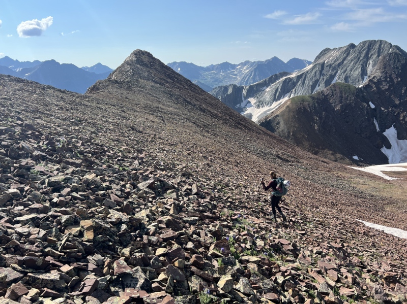
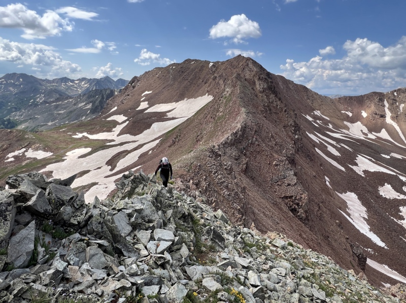
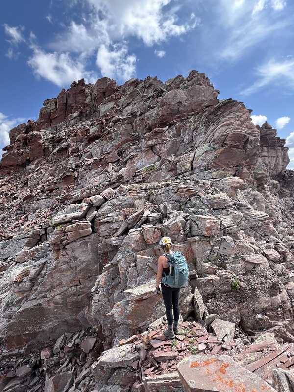
We were heading up the ridge toward a small saddle that had a gully on each side. That’s the spot we were we turned around last time. We reached that mark about 8:30 a.m. The top of the ridge in this area is near 12,900.
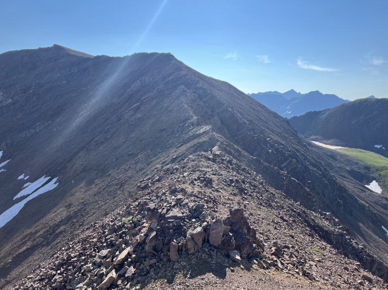
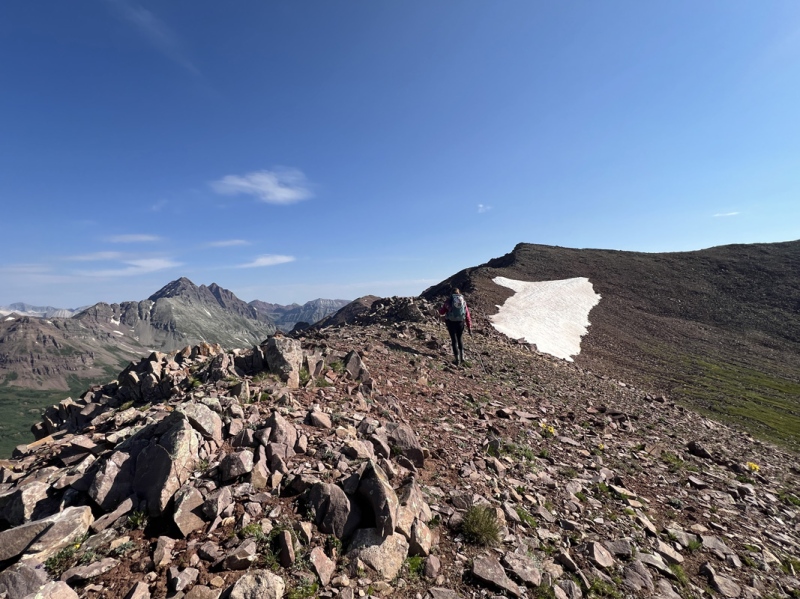
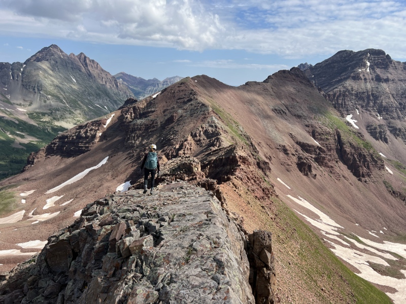
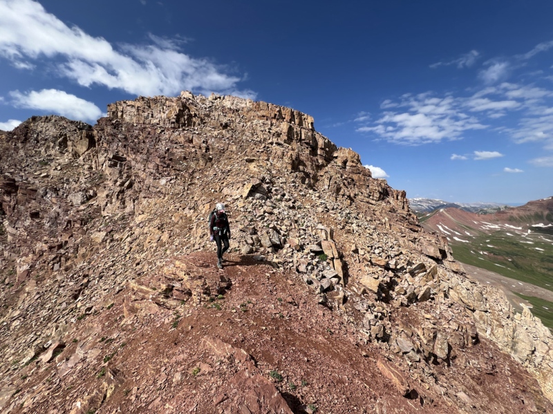
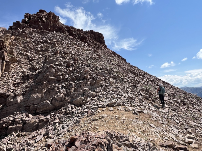
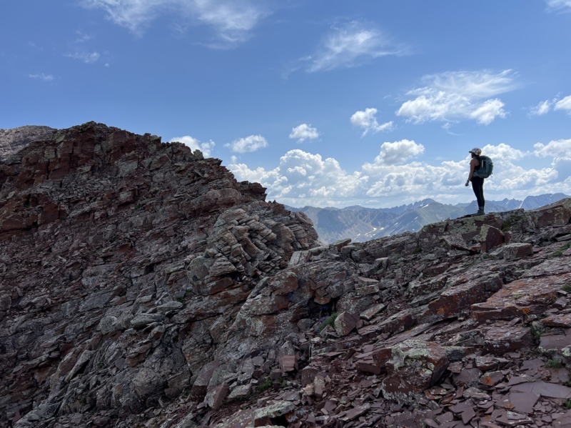
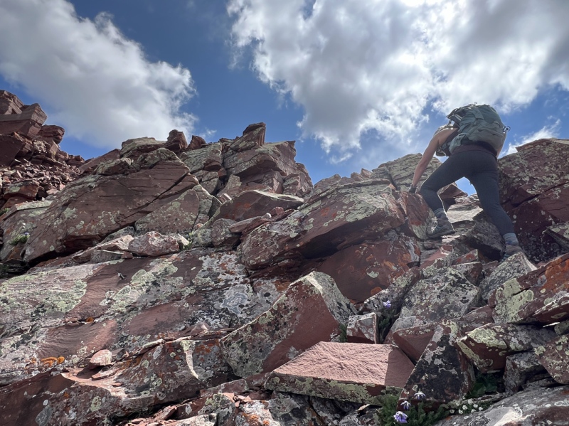
From there it is a Class 2 rocky and loose ridge hike to reach Un 13,114 That took about 50 minutes. There is a “high point” on the ridge that connects to Un 13,223, you can skip that.
On the ridge
Nice view of Maroon
On the ridge
Ridge
Ridge
Ridge
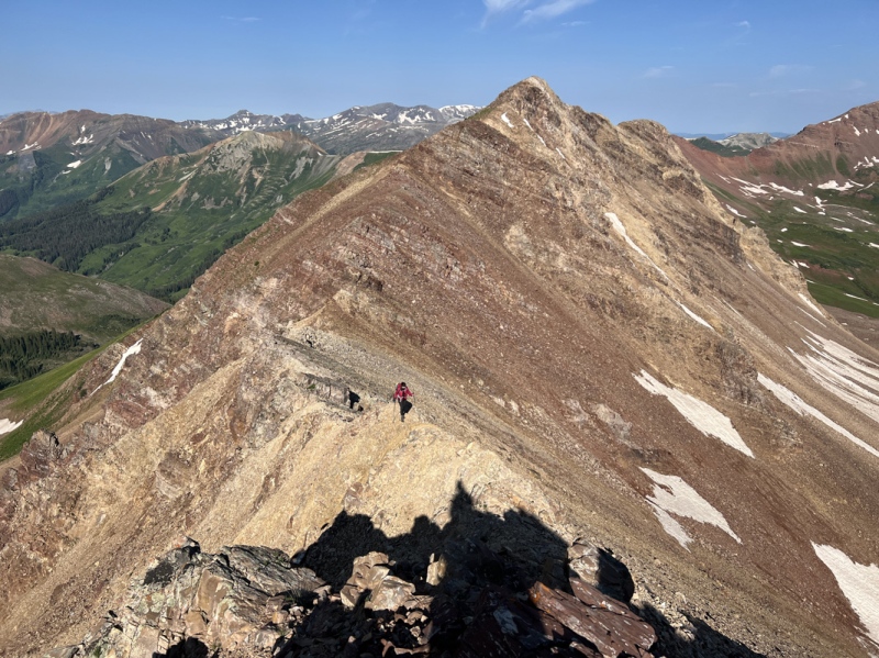
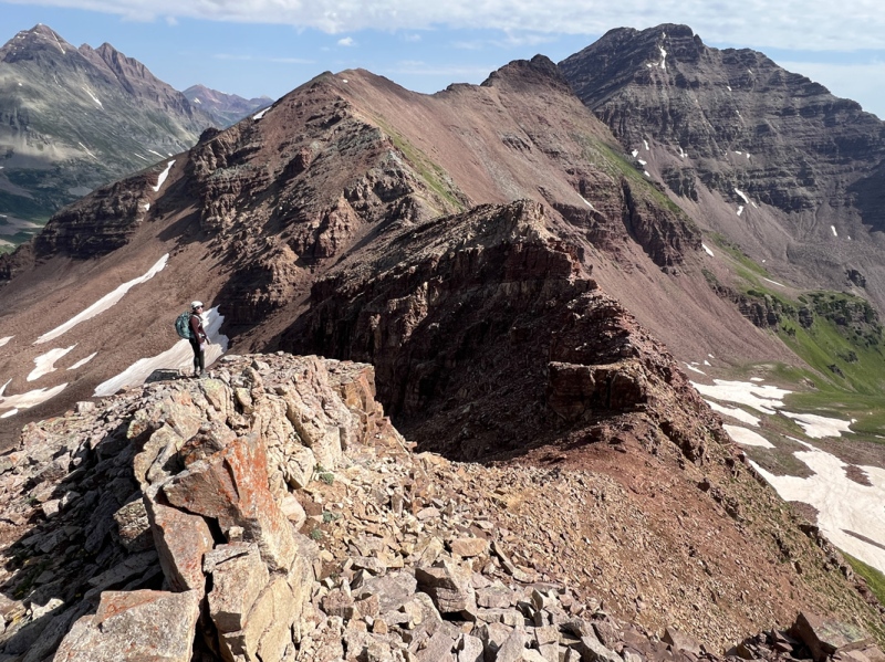
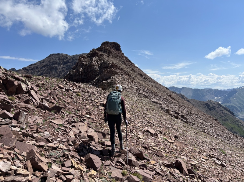
Nearing the high point, but we turned right to hit the first summit
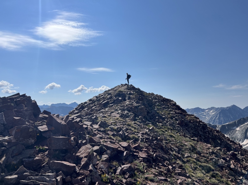
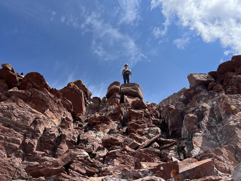
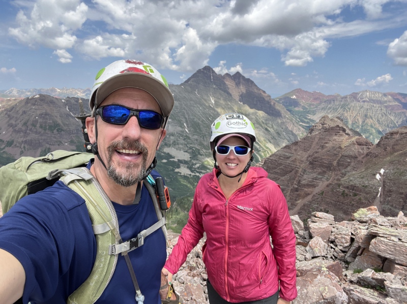
13,114
Summit
On the top
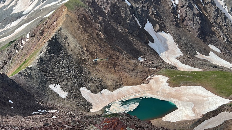
As we were approaching 13,114, we heard and saw a helicopter circling the Maroon Bells. Our first thought was SAR mission. We watched it for a bit. Then hit the summit. And the helicopter went away, then came back, then went away. Next thing we knew it was going by both Belleviews… then, right underneath us. It came up Rustlers Gulch. We are guessing a wealthy person wanted a mountain and wildflower tour.
We didn’t stay long on 13,114 because we knew there was a chance of weather.
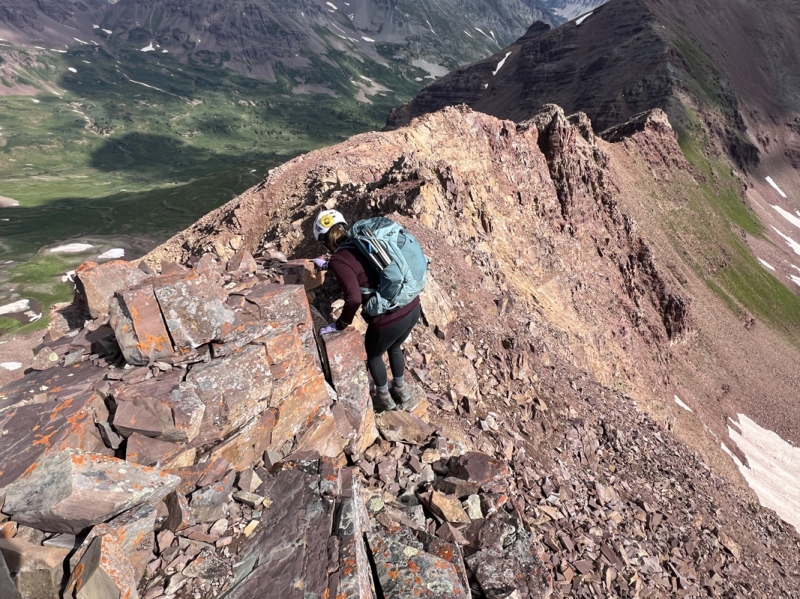
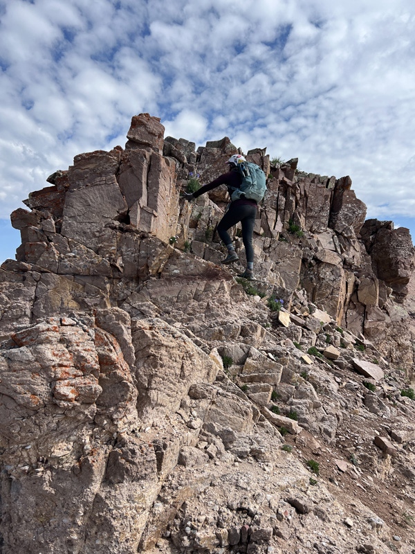
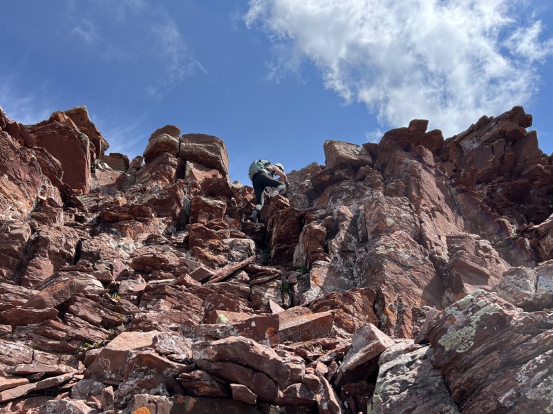
We went to the high point that connected the ridges. I’m guessing it was a Class 4 downclimb, high exposure. Staci went right down.
A member of our party, he shall remain nameless, decided he just didn’t fit on that small ledge and found the easy walk around.
Helicopter flew right below us while we were on top
High point move
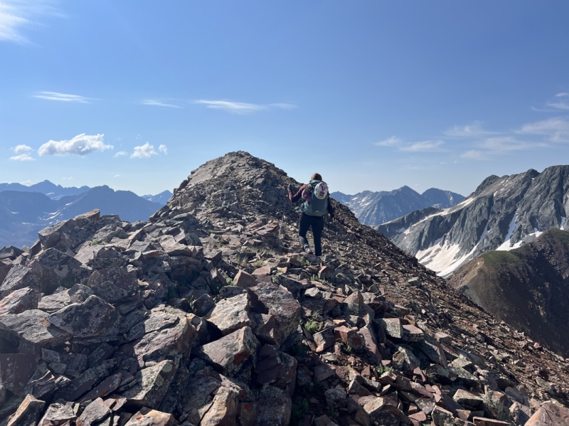
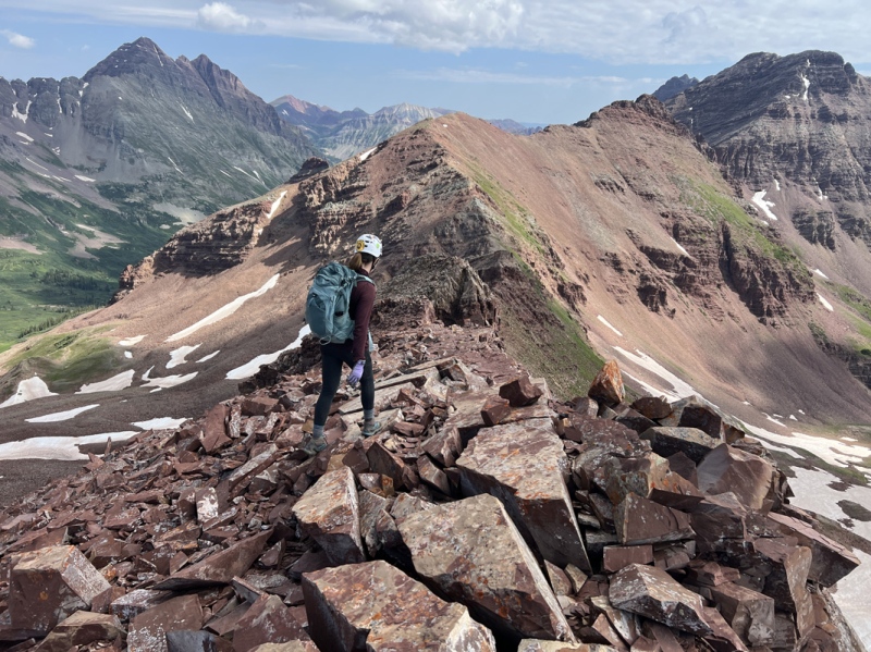
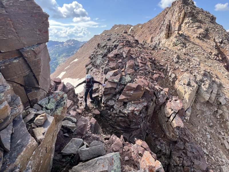
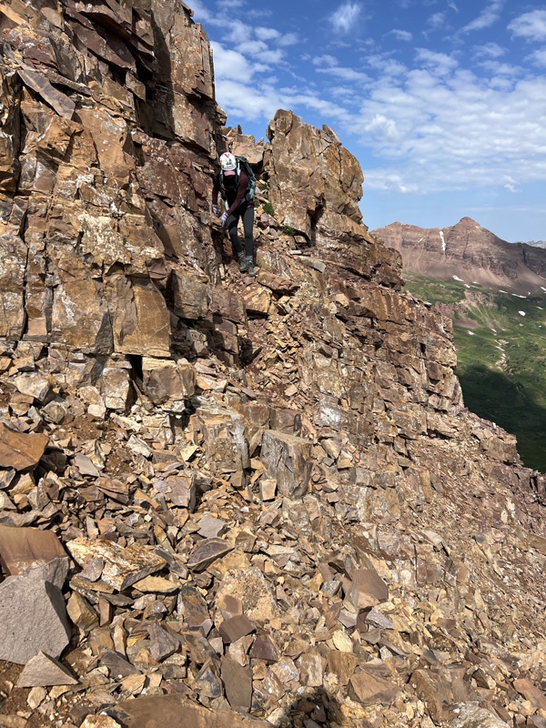
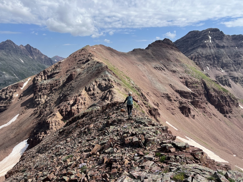
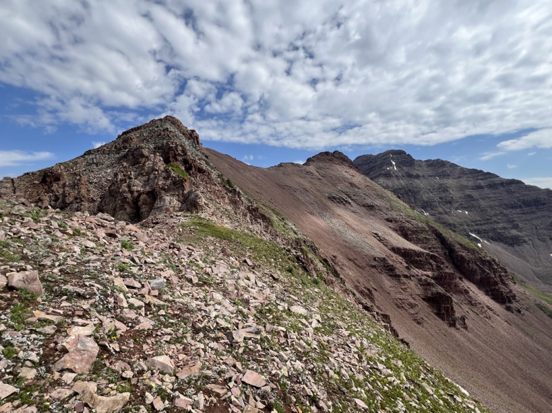
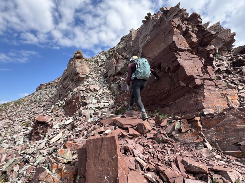
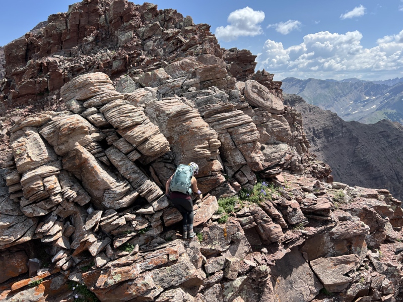
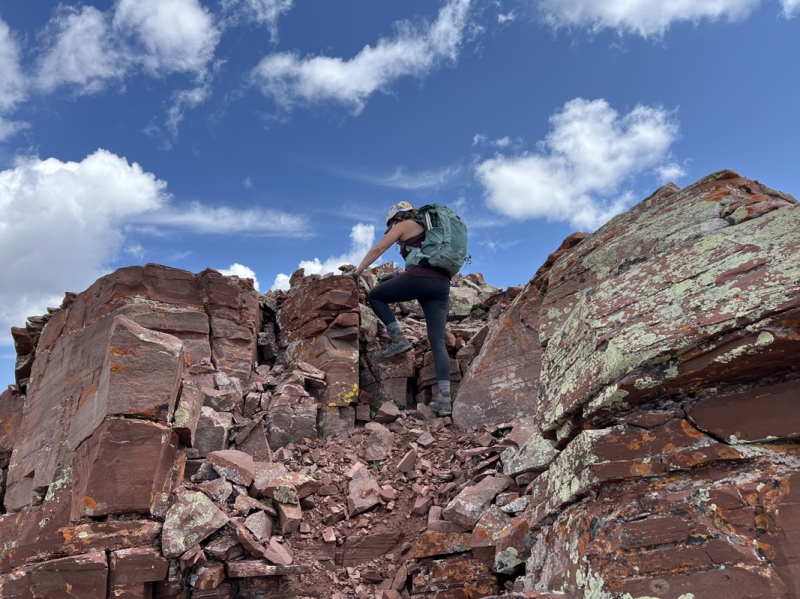
From there the ridge to 13,223 was a loose rocky Elk traverse. A few slabby areas. Several ups and downs. Lots of loose rocks. Stay ridge proper, unless you see a very obvious path to the left or right. There were a few Class 3 sections, all were easy. Just check your handholds.
As we got near the second summit, there was another up and down… we skipped it and side-hilled to the saddle. The summit bump has some of the more fun Class 3 sections from here to the top.
Took us 1 hour and 30 minutes from the high point junction to the summit of 13,223. We spent some time looking at the view of the Elks, ate some pizza and took some photos. It took us about 1:20 to get back across the ridge. Had a few rain drops along the way, but nothing weatherwise materialized.
On the traverse
Lots of sections like this
We went down and around here... wicked loose... we should have stayed ridge proper
This is what we should haves scrambled down, we went up it on the way back
Easy C3
Obvious walkway
Cutting across to the saddle before the summit
Below the summit area
Fun C3
A little down, have to get around that bulge of a rock in the middle
The bulge, Staci went right, hard, I went left, easy,
One more bit of C3
Almost there
Nice views of the Elks from the summit
Back to the ridge above Rustlers Gulch and down to the main trail took about another hour. Several people on the trail coming and going, all looking at the flowers.
We took our time walking back. The flowers were just spectacular. I have never seen so many. One of the best wildflower days I've ever had.
All in all, it was a long day, 12 hrs, 15 minutes. 10.8 miles, and 3,700 gain (according to GAIA, which seems to never count the ups and downs, so probably more in the 4,100-4,200 range).
My GPS Tracks on Google Maps (made from a .GPX file upload):
I was on Teocalli on Saturday and saw it too! We assumed the same thing after watching its leisurely journey through different basins. Gorgeous flower pics, hope you two are doing well!
I was just in the Rustlers gulch myself a few days ago for Precarious, and the flowers were amazing!
Caution: The information contained in this report may not be accurate and should not be the only resource used in preparation for your climb. Failure to have the necessary experience, physical conditioning, supplies or equipment can result in injury or death. 14ers.com and the author(s) of this report provide no warranties, either express or implied, that the information provided is accurate or reliable. By using the information provided, you agree to indemnify and hold harmless 14ers.com and the report author(s) with respect to any claims and demands against them, including any attorney fees and expenses. Please read the 14ers.com Safety and Disclaimer pages for more information.
Please respect private property: 14ers.com supports the rights of private landowners to determine how and by whom their land will be used. In Colorado, it is your responsibility to determine if land is private and to obtain the appropriate permission before entering the property.


")
")
")
")
")
")
")
")
")
")
")
")
")
")
")
")
")
")
")
")
")
")
")
")
")
")
")
")
")
")
")
")
")
")
")
")
")
")
")
")
")
")
")
")
")
")
")
")
")
")