| Report Type | Full |
| Peak(s) |
Mt. Belford - 14,202 feet Humboldt Peak - 14,068 feet Mt. Blue Sky - 14,268 feet Mt. Yale - 14,200 feet Sunshine Peak - 14,004 feet Torreys Peak - 14,272 feet Grays Peak - 14,275 feet La Plata Peak - 14,344 feet Mt. Elbert - 14,438 feet Mt. Massive - 14,427 feet |
| Date Posted | 01/14/2024 |
| Modified | 01/15/2024 |
| Date Climbed | 12/21/2022 |
| Author | the_hare |
| Freedom of the Chills: 10 Winter 14ers of 21/22 |
|---|
|
Freedom of the Chills: 10 Moderate Winter 14ers of 2021/22 I wanted to write about my winter-long 14er marathon a couple seasons ago to process my experience & share some pictures. I won't include too much detail as far as route descriptions go, especially for routes that just follow the summer trail or already have many well-written winter trip reports. I made peak conditions reports at the time for most of these trips with more specific info and pictures as well. Origin Story My first 14er, or even my first mountain I hiked in Colorado above 9000ft since I moved here, was Bierstadt in February 2021. I was pretty comfortable with winter conditions hikes at this point and had been wanting to do a 14er for a while. I'd been up above 14,000ft before on visits to Blue Sky when I was younger, but hiking up to that height seemed far beyond what I could imagine accomplishing myself. I'm from Louisiana, after all--a place where it rarely snows, the highest point barely registers as a hill, and where it doesn't even have much natural rock! After some avalanche risk research and nabbing some used snowshoes, I made an attempt at Bierstadt. I was forced to descend not long after gaining the slopes above treeline due to my not picking a more accurate weather forecast method. The weather looked clear in Georgetown to the north and Grant to the south, but a snow squall squeezed its way between them and drove me back down to the trailhead. My overall mindset shifted drastically after a romp in RMNP with some friends on a cold, turbulent day in February. We plodded from Bear Lake up to the Loch through bristling winds and snow-laden canyons. The gusts were severe at our destination as they hurtled over the Divide and surged across the lake's frozen surface. The crampons on my snowshoes kept me upright as I wandered across the ice into the blustery snowscape. I had a fantastic time despite the ~15-degree temperatures, deep snow, and high winds. I felt like I could do anything after that! 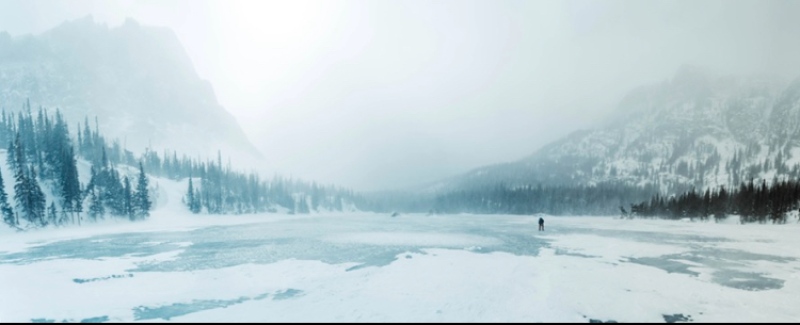
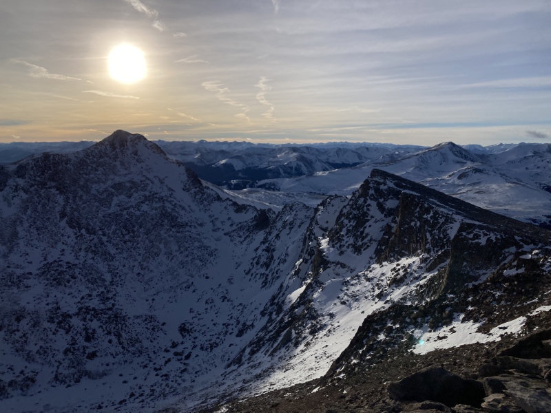
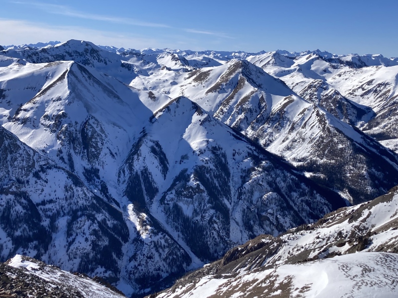
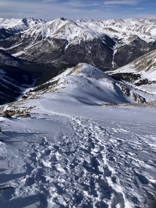
I successfully summited Bierstadt a few days later, although I finished feeling worse than my initial attempt since I forgot to keep my calories up as I climbed. I went for Quandary after that and then Decalibron which both went much more smoothly. I caught "the bug," I guess, as the challenge, starkness, and beauty of winter captivated me to plan more for next year. I also appreciated the benefits of cold-weather climbing compared to the summer months: no afternoon thunderstorms, less anxiety over parking spots, less crowds, and flatter bootpack approach trails to name a few! Additionally, I looked forward to how the austere winter environment might afford me an opportunity to grow in familiarity with my own senses and body. Especially in modern America there are so many establishments that not only divorce us from a connection to nature but with our own physical selves. The body is a thing to be ground down in labor instead of nurtured, sucked in and shamed instead of welcomed, numbed and intoxicated instead of heard, conquered instead of let be and learned from. Instead of gritting my teeth under a repressive "mind over matter" mantra, I kept open an intuitive ear and asked along the way to my objective: "What do I need? What is my body trying to tell me right now?" By paying attention to my bodily needs amidst the rigors of the winter wilderness, I hoped to foster a deeper connection to myself that I could carry back to everyday life. So, in the off-season I compiled a list of what I call "moderate" winter 14ers that had distances between 8-14mi, 3000-6000ft gain, accessible trailheads, & most importantly routes with virtually no avalanche danger or little risk with good conditions. I came up with Blue Sky via Guanella Pass, Grays & Torreys via Loveland Pass, Pikes via Crags, Massive E ridge, Elbert E ridge, La Plata NW ridge variation, Belford & Oxford, Columbia SE ridge, Yale E ridge, Princeton via Tigger Peak, Antero W rib, Shavano & Tabaguache via Esprit Point, Humboldt E ridge, and Sunshine & Redcloud from Mills Campground. Thanks to a flexible 3-day 12hr shift workweek I was able to knock out most of these during the winter of 2022 and came back with an extraordinary experience and some great pictures! Belford 12/21, NW Ridge This season started off abnormally dry--it looked more like early November than the first day of solstice. I took advantage of this to go for peaks that would have been harder to access otherwise. I shot for Belford/Oxford since the road up to Missouri Gulch was still easily passable. I felt queasy and slow-going up the initial switchbacks, likely altitude-related due to my sleeping at the trailhead the night before. It looked like a party had left footprints up the trail the previous day which was helpful for navigating the swath of old avalanche debris in the gulch. I did my homework on avalanches beforehand by learning the basics about 30-45 degree slopes and problem aspects in winter. There wasn't enough snow above my path on the east slopes of Missouri's north ridge to be of concern and Belford's NW ridge looked nearly snow-free when it came into view. Unfortunately, I had a hard time getting excited about the trail for that reason alone--the switchbacks scribbled up the ridge felt endless, especially with the continuing effects of the altitude. It was a good opportunity to practice different rest step techniques at least, and of course I couldn't help but appreciate the snow-gilded rock glacier floes of upper Missouri Gulch. 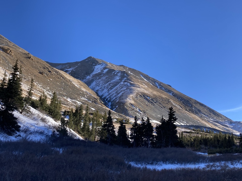
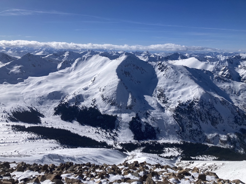
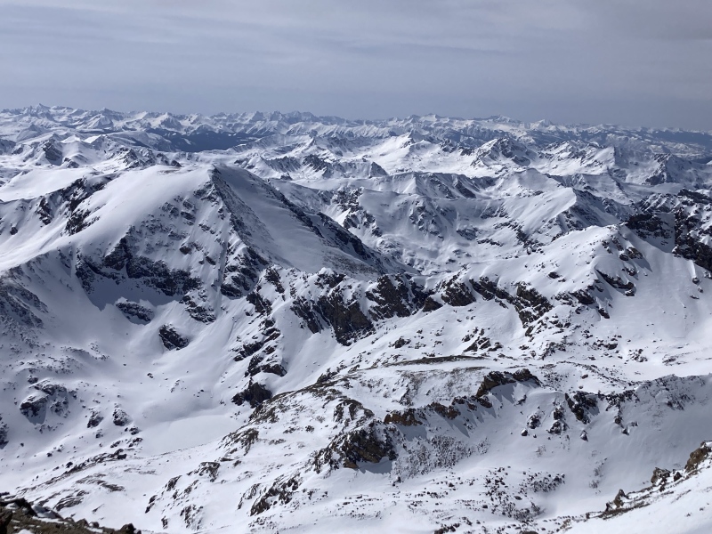
Finally I clambered upon Belford's stout hilltop-castle-like summit block. The sea of white-capped peaks spilling out to the horizon reminded me of choppy, wind-whipped lakes from back home. I judged my energy and the remaining daylight and felt like continuing to Oxford wasn't for me today--perhaps if I had prepared for the altitude a bit more before the season I would have had enough in the tank to complete the traverse and back. I was still beyond satisfied for today, particularly for coordinating with my body through my altitude-induced malaise to reach the summit. 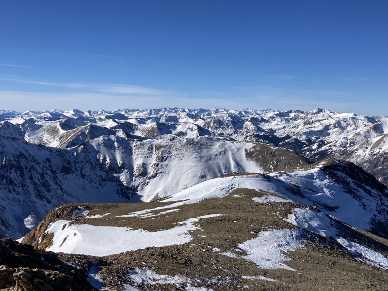
I appreciate the community and history around winter 14ers, especially the example and persona of the late Steve Gladbach. I only realized after I returned that I cheated "the game" that he first laid out--I didn't think about how the solstice starts at a certain time, not just a date, and set off a couple hours too early. Oh well--I'll have to head back over Belford anyways to complete Oxford & Missouri from Pecks Peak in the future. Humboldt 12/28 attempt, 1/7 summit; E ridge If I remember the Mountain Forecast weather report for Humboldt correctly, it was something like average winter temps at the summit (14-16deg) with a little higher winds (35mph) and "some clouds" (anything from a few bigger cottonballs to nearly overcast). Not bad overall, or at least good enough for me to drive all the way down to Westcliffe and check things out for my first foray into the Sangres. The morning light at the trailhead revealed enormous clouds churning over the mountains. I reasoned that I was fine with being a bit socked-in after driving several hours to be here. After a short-lived attempt at driving a little further up the 4WD road, I set off into the brooding mass of vapor. 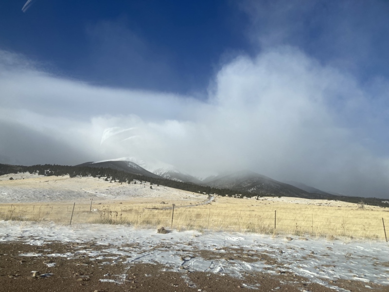
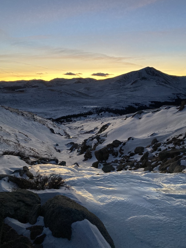
I didn't end up taking many great pictures due to my muted and overcast surroundings. Snowshoes proved useful for quick travelling up the snowy upper road and Rainbow Trail. I couldn't see any evidence of recent tracks cutting up the east ridge, so I broke trail through the drifts and downed trees onto the ridge's forested toe. I paused at 10,600ft elevation where the slope ahead steepened. It had been hard work to get here--I had only been trenching for 2/3 of a mile off trail up a gentle incline and it was just going to get harder for the next 1000 vertical feet. I knew I wouldn't be able to make the summit by a reasonable turnaround time at this pace, not that it was a great day for views in the first place. I figured I could come back soon and make good use of my trenching on a better weather day. The outing was completely made worth it back at the parking lot. As the sun that I hadn't seen since morning dipped below the horizon, a near-horizontal golden ray of light burst out from the Sangres like skyscraper spotlights. That beam grew wider and multiplied across the skyline, shifting in color from a blonde yellow to a fiery orange and rosy pink. I'd seen split sunsets before where clouds or mountains partially block the setting sun but never anything like this. The thin column of the Sangre de Cristo Range must be especially given to these celestial phenomena. 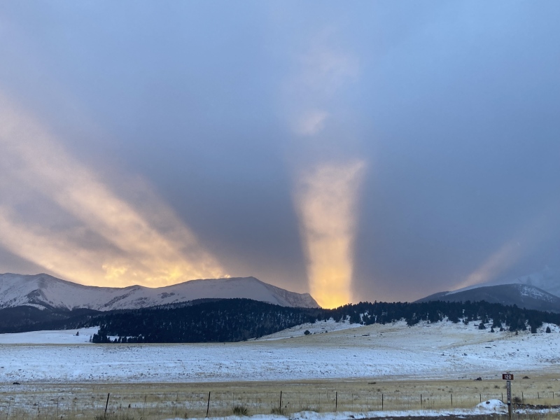
Fast forward a week and a half and I find myself back at the S Colony Lakes trailhead under clear weather this time. I retraced my steps up to the lower E ridge and came upon a wind-paved sidewalk in the snow. Turns out my trench got filled in since last time and this one was put in by user stickmann & friend; however, they also became exhausted from the effort and turned back soon after I stopped on my previous trip. With more energy this time thanks to their work, I zigzagged up the broad yet steep ridge above 10,600ft. I tried aiming for firmer, more supportive areas of snow but couldn't really find a pattern overall, so my trenching probably appeared pretty scattered. 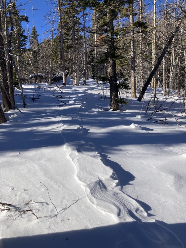
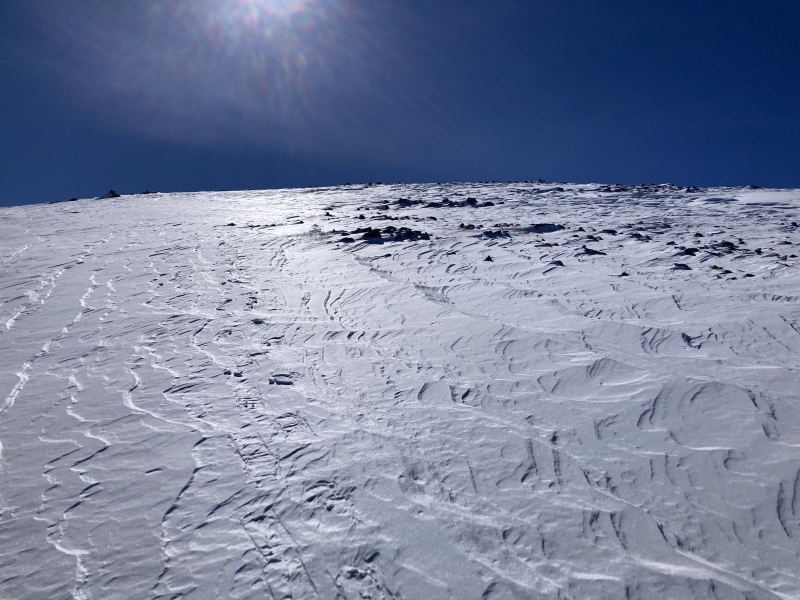
Finally I broke out above the slope into a gnarled pine grove. The wind had been blowing fiercely through here as evidenced by the snowdrifts sculpted into lofty waves. At this point in my alpine hiking career I knew that the shape of the mountain and route aspect affected what winds I would feel. On Humboldt this day above treeline it seemed that the prevailing westerly winds wrapped around the rather aerodynamically-shaped mountain and rushed directly towards me. In order to move forward I too had to become more aerodynamic by walking sideways up the bare tundra slope; the wind was so strong that I couldn't keep my balance if I faced it head-on! 
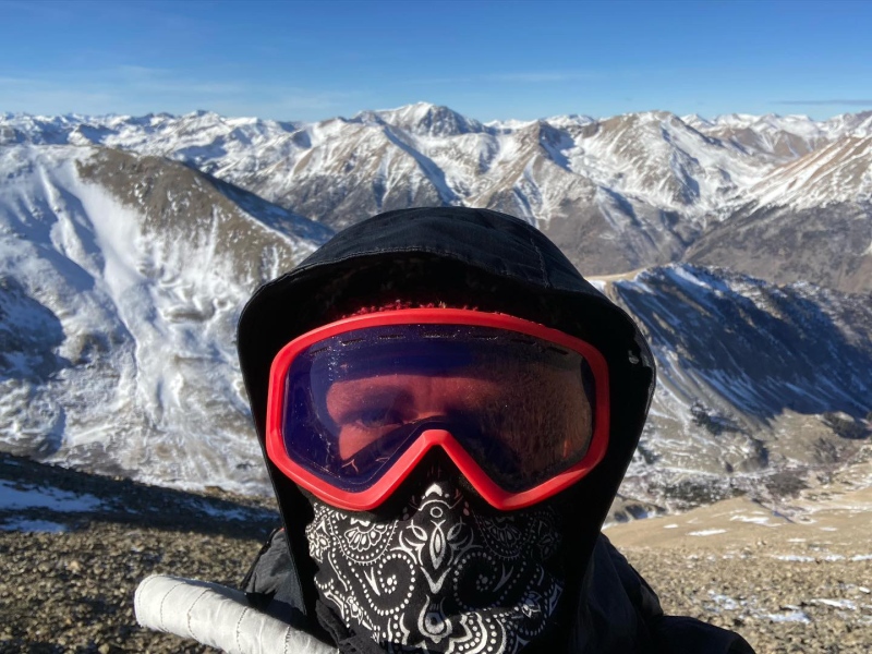
Noting the low-hanging sun, I paused at the 13,400ft false summit and almost called it for the day. However, this break afforded me the clarity to see how close the summit really was. I realized too that the mountain was finally blocking the blustery chaos instead of channeling it towards me, so I changed my mind and continued on. Boulders along the ridge saluted with delicate rime ice fingers, and an army of tiny frosty figurines greeted me when I finally clambered upon the summit. The full blast of winter's gales had returned up here, making the wind shelter very useful in between pictures of the Crestones. Ultimately the wind made the summit a short-lived stay and forced me back down the leeward upper ridge. 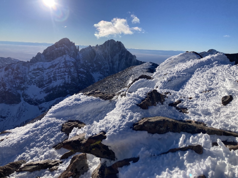
The rime ice alone on Humboldt rewarded me for my perseverance--really an incredible and very ephemeral sight that I haven't seen to such a degree on another peak so far. More satisfying than that, however, was knowing that my trenching building upon previous climbers helped many other parties summit the E ridge as well throughout the following weeks! Blue Sky 1/12, Scott Gomer Creek drainage to W ridge A few days later I set out for a 14er closer to home: Mt. Blue Sky/ then Evans. I knew the drill of marching up the closed yet snowpacked Guanella Pass road to the summer Bierstadt trailhead, having done this twice before the previous winter. I gawked at the amazingly long gait of moose prints in the snow and crossed my fingers hoping I wouldn't have to deal with their makers in the willow marsh ahead. 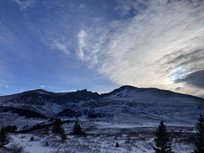
Originally I was eyeing the Sawtooth descent gully as an access point to Blue Sky's W ridge. Near the creek crossing I broke off the trail and gingerly snowshoed over the snow-encrusted willows. To my surprise in the middle of the flats I encountered a fresh trench heading up the drainage--maybe someone else had already blazed the trail to Blue Sky! After following the trench a ways, I realized it wasn't heading towards the Sawtooth descent gully after all and went more north instead. Considering the deepening snow over my intended path near the creek, I decided keep following the trench and try approaching the W ridge from Spalding's lower NW slopes. I scrambled over some large boulders at 12,000ft and traversed eastward over a gently sloping field towards Scott Gomer Creek which flowed between Gray Wolf & Spalding. The frozen creek was a remarkable milky glacial blue and still slippery even in microspikes. I continued up the windblown lower NW slopes of Spalding to 13,000ft where the drainage above the Sawtooth descent gully opened expansively. A small herd of bighorn sheep raced across the tundra below. I felt comfortable from here on after having crossed the Sawtooth ridge the previous summer. 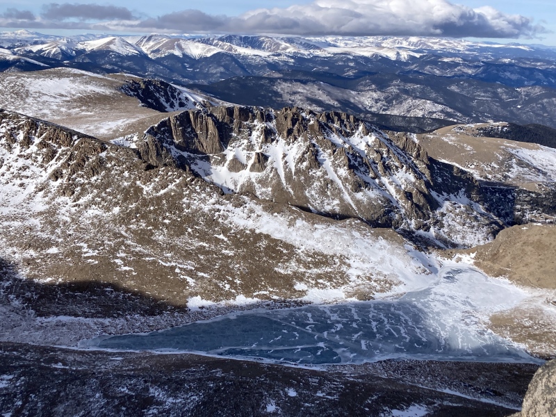
The trail through the boulderfield along Blue Sky's W ridge proved pretty difficult for me to track all the way through (even the second time around), but I enjoyed the scrambling across the large and stable rocks nonetheless. I noticed some small canid prints in the snow when I did stumble upon the trail and remembered seeing the same tracks in the flats west of Scott Gomer Creek. This marked the first of many traces of the winter 14er foxes/coyotes across the peaks I completed this season--on more peaks than not I saw these same tracks oddly following trails and ridges even up to 13,000 & 14,000ft! 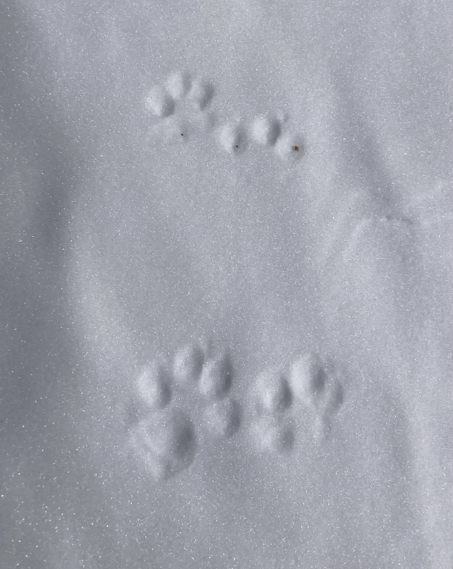
I only spent a few minutes taking in my surroundings at the summit since I'd been up here by car plenty of times, but this time I had no car and a descent in the dark ahead of me. After returning to Scott Gomer Creek, I beheld a dramatic sight: the sun parted behind the mountains for the evening and the whole sky blushed. A thin lace of cirrus veiled the deepening indigo sky, previously pale and easily overlooked, but now totally enrapturing as it developed in pink, orange, and yellow. I couldn't help the tears stream down my cheeks as I looked up at the firmament. Was I really the only one for miles who could see this beautiful expanse so unhampered like this? The thought compelled me to stay and bear witness to the fiery sky until it faded to a somber violet and finally a charred gray. 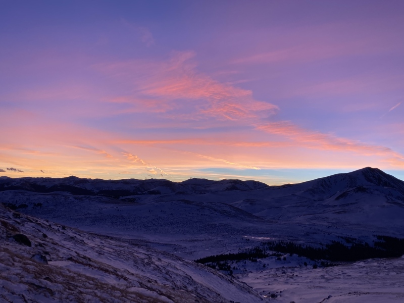
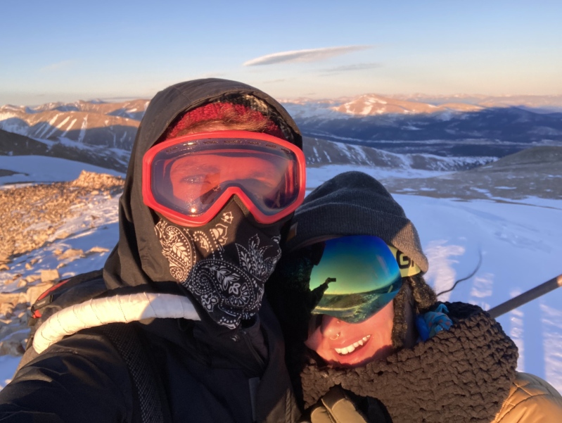
The snowshoe back was thankfully uneventful after not seeing any pairs of glowing orbs suspended 8 feet in the air. In the comments of my conditions report I found out that user cloudkicker and party had put in the trench I made great use of on the way to Gray Wolf Mtn from a shortcut off Guanella Pass road--thank you again! In the weeks following I noticed that several other parties attempted the way I originally intended up the Sawtooth descent gully but were turned back by hidden impassable drifts among the boulders. That made my summit feel a bit lucky, I guess--by chance I stumbled upon a trench to a completely different peak and rerouted to an area that had much more manageable conditions than the normal winter route. I hope the way I took over Scott Gomer Creek and up the SW slopes of Spalding gets more consideration in the future. The only really tedious part would have been the trail breaking among the tall willows further up the basin, but even then the trenching is shorter than continuing all the way up to the Sawtooth descent gully. Bonus: Sherman 1/20, SE ridge from White Ridge S slopes In hopes of convincing my girlfriend that what I've been up to this winter wasn't all that crazy, I decided to bring her along on one of the easier winter summits. It was my coldest outing all season with a forecast summit high temp of 7 degrees and incessant winds swirling about Sherman's historic basin. I regretted the route I charted up White Ridge's dry but talus-ridden S slope to its saddle with Sherman--the rocks were loose and large enough to be more of a hazard than walking the road up to the usual S Slopes winter route seemed. I was beaming with pride when we reached the summit after struggling up this slope through the wind. Unfortunately this mountain didn't seem the most picturesque to me as other peaks--the nearby 13er Horseshoe Mtn has a spectacular and unique appearance even from as far away as Hwy 285, but otherwise the historic ruins held my interest more than the natural features of the basin. Perhaps I'd have a different perspective if I hadn't chosen such a tedious route. Personally I didn't find this to be much of a "next level" or "moderate" winter 14er due to the lower mileage, straightforward road walk, and mellow mountain features, but exposure to the elements definitely made this an interesting one still! 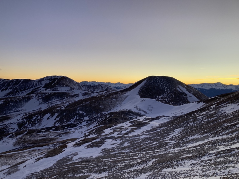
Yale 1/24, E ridge I didn't expect it at first, but this ended up being my favorite route all winter. User -wren- posted that he broke trail through the woods to up above treeline but ran out of time to summit due to the long, difficult effort. I heeded his call for someone to take advantage of his travail before the next storm and headed for the (ironically safer avy-wise) Avalanche trailhead. The views of the Princeton massif & variegated Sheep Mtn to the south were breathtaking as I ascended above timberline and traversed the lower E ridge. I kept looking north in awe as Harvard's bulk sleepily stirred and rose above Columbia. Being on a ridge afforded me a striking near-panoramic view of the mountains' winter majesty. 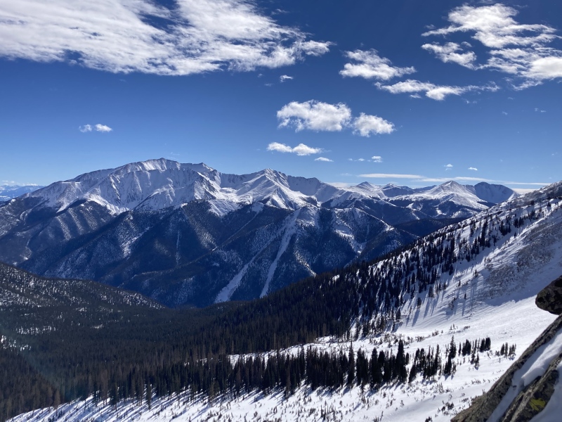
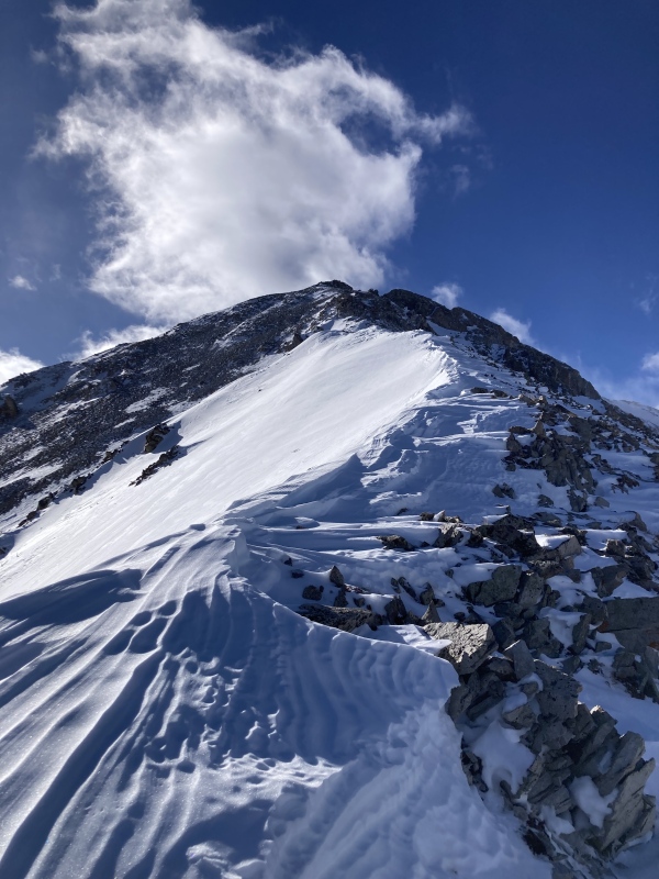
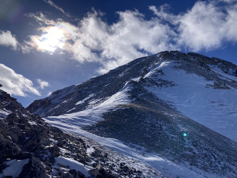
What I found really engaging was the mixed climbing up the ridge. This was my first time trying out my mountaineering boots and crampons and they served me well ascending the styrofoam-textured wind-furrowed snow. Once again I saw the same coyote/fox footprints making their way up the ridge and even over the false summit! I plunged through the heavy drifts flanking the final bumps in the ridge and carefully navigated their boulders to reach the summit. Thick, feathery clouds had been migrating overhead throughout the climb until they completely filled the sky at the peak. Finally I could glimpse the other side of the mountain where the waning sunlight pierced the vaporous behemoths above, staining the basins beyond a soft, shimmering yellow. 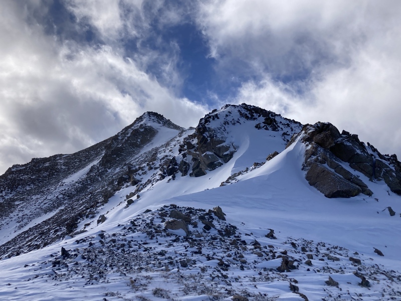
During my descent the sun peeked beneath the clouds and illuminated the falling snow, turning the sliver of air above the peaks an incandescent orange. The phenomenon only lasted a few minutes before everything returned to gray and I was left to navigate the rest of the ridge in the dark. 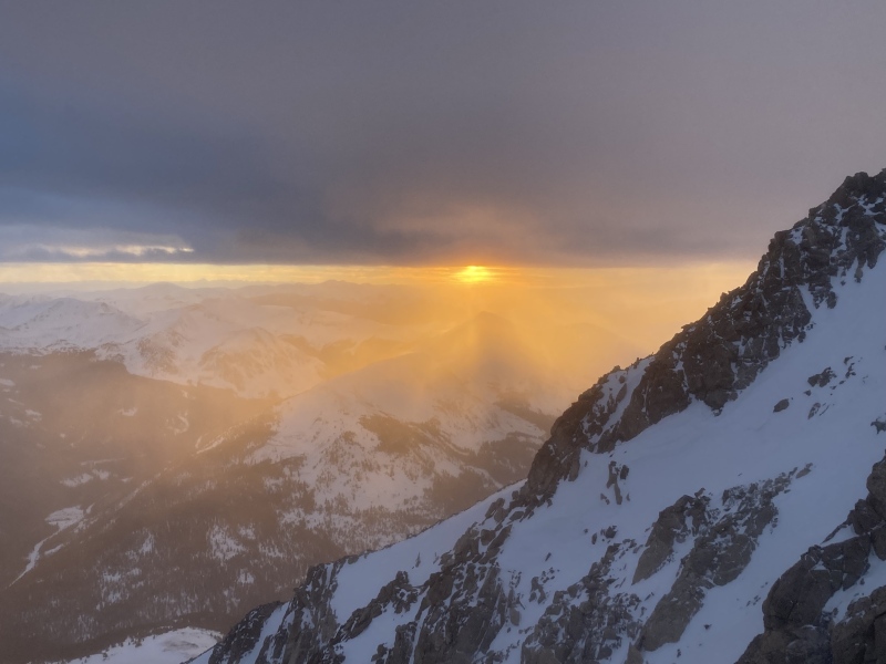
Even though this snowy sunset was truly mesmerizing, it wasn't the most enjoyable part of the outing. I really appreciated the challenge of negotiating the mix of windcrust snow, rock, and loose dirt on the ridge with my alpine tools. The views on all sides rewarded me throughout the day and I gained confidence in using my mountaineering skills. I look forward to focusing on more of these kinds of mixed ridge climbs where using a variety of techniques is necessary for a successful summit. Sunshine 1/31, Mill Creek Campground During the days before this trip to Sunshine I went ice climbing with some friends in Ouray. Knowing that Sunshine & Redcloud were relatively easy 14ers to access from the Mill Creek Campground, I made a detour to Lake City on the way home. It had been relatively warm over the weekend with the same forecast for today. The lower trail below treeline was balmy and muddy and I quickly ditched my snow pants. The gain up the timbered slope was stiff--2500ft in a little over a mile. I ended up liking this quad-heavy trail and the fast elevation gain that came with it. 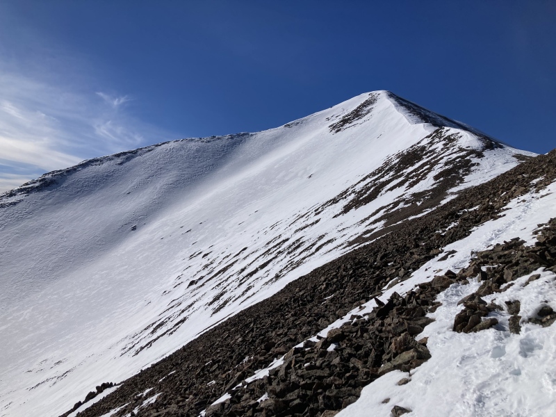
There's not much to say by way of views on the approach, but the summit vista was the most unique all season. The colorful, precipitous San Juan slopes buttressing rugged snow-laden peaks were an all-encompassing cathedral. I spent a great deal of time on the summit taking it all in, mostly because I wasn't able to brave the winds on the summit ridge to continue on to Redcloud with just leggings and shorts. Next time I'll definitely take my snow pants with me instead of stashing them! I was pretty wiped from the weekend and ready to head home anyway, so I couldn't be too disappointed after all. 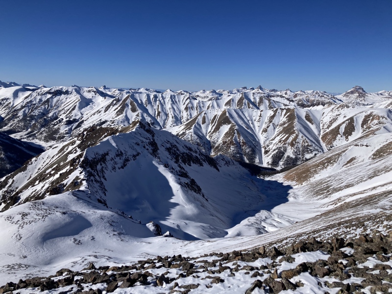
The choice I made at the summit to not continue on helped me formulate a matrix for decision making in the mountains that I still find useful even outside the alpine. I call it the Rule of Two: if I can readily see two (or more) reasons to change plans or take one option versus another, then I go ahead and make the call. That day I (1) didn't have the proper clothing to deal with the wind, (2) wasn't at 100% after a full weekend & (3) still had a long ways to drive home, so I turned back. Of course some events are more sobering and qualify as a reason to bail all on their own, but having a simple and explicit framework has helped me expedite decisions in a pressing environment like the wintry wilderness. Grays & Torreys 2/7, via Loveland Pass 6000ft of gain, woof! This would easily be another 12-hour day along with Blue Sky and Yale. By starting so far above treeline I appreciated not having to worry about trenching and being able to see much of the route at any point along the ridge. I was sure to stay far from the impressive cornice to the east as I traversed the rolling points from Cupid to Grizzly. Grizzly's slender summit ridge was the most puckery I felt so far this season--to the left was a sheer drop and to right was a steep, unsupportive snow crust with only a foot and a half or so in between. With that ridge out of the way until the return, I lunged down Grizzly's E slope only to reascend that loss up Torreys W slope. This trudge was the most time-consuming part of the route as steeper 1000ft rockhops usually go. I had hoped to make it more interesting by ascending the thin snow chute on the slope, but this wasn't consolidated enough to be feasible. 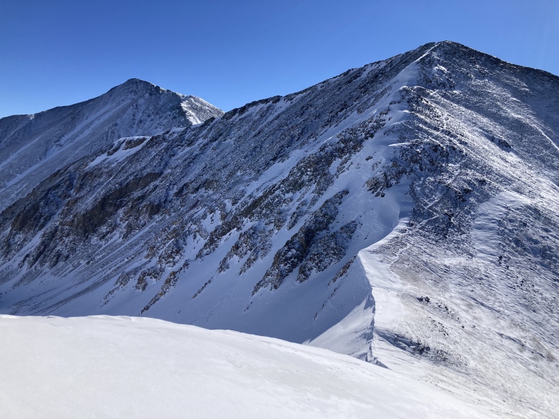
The wind had been mild so far, but its gusts picked up significantly once I topped out on Torreys' upper ridge. Spindrift cyclones teetered across the slopes until they toppled into Stevens Gulch below. The breeze provided a helpful tailwind as I hiked the rest of the way to Torreys' summit. The saddle between Torreys and Grays seemed to funnel the wind so much that it forced me to lean into the gusts to avoid getting blown over. I was surprised to see other recreators at this point heading across Grays' upper slopes to ski down the gulch. 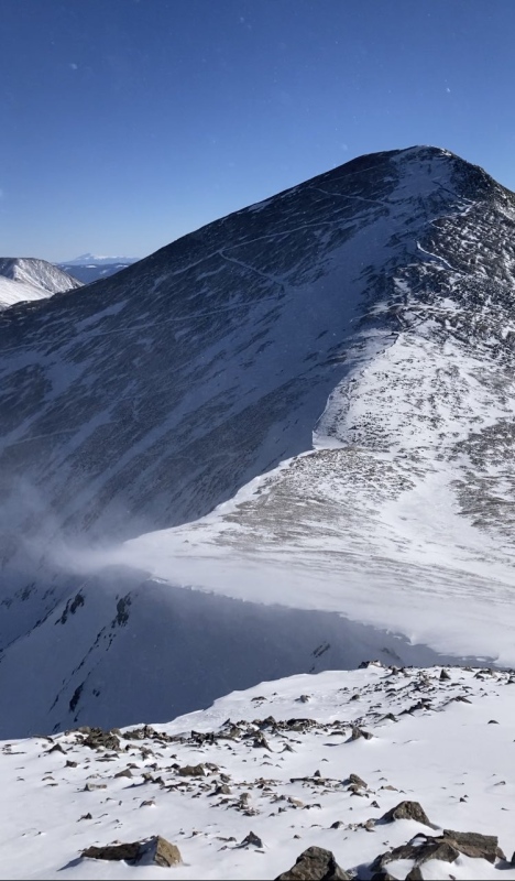
Amidst the screaming gales I briefly interacted with one young guy who came up to the saddle and asked me about one of the couloirs on Torreys--don't remember if it was about its conditions or location but he wasn't sure which one he might go for. My stomach plummeted as he headed off and proceeded to ski directly on the edge of the cornice on the saddle on his way to Torreys. I felt pretty powerless as I watched him go knowing about the avalanche accidents in the area, including cornice collapses. The jet engine winds would have drowned out any pleading yells towards him. If anything were to happen, I didn't have the right gear to reach him safely and quickly, or any probing equipment, or even my friend's inReach that I usually borrowed. I carry my own inReach now, but reflecting on this situation is making me consider packing a bit extra even if disaster strikes a fellow outdoorsperson even when I'm not anticipating company on the trail. I ran into an older man on the way up Grays who sounded like the young man's father as he watchfully eyed his son now atop Torreys. He seemed more experienced both at backcountry skiing and dealing with his son's foolhardiness--thankfully, nothing happened that I heard from CAIC at least. 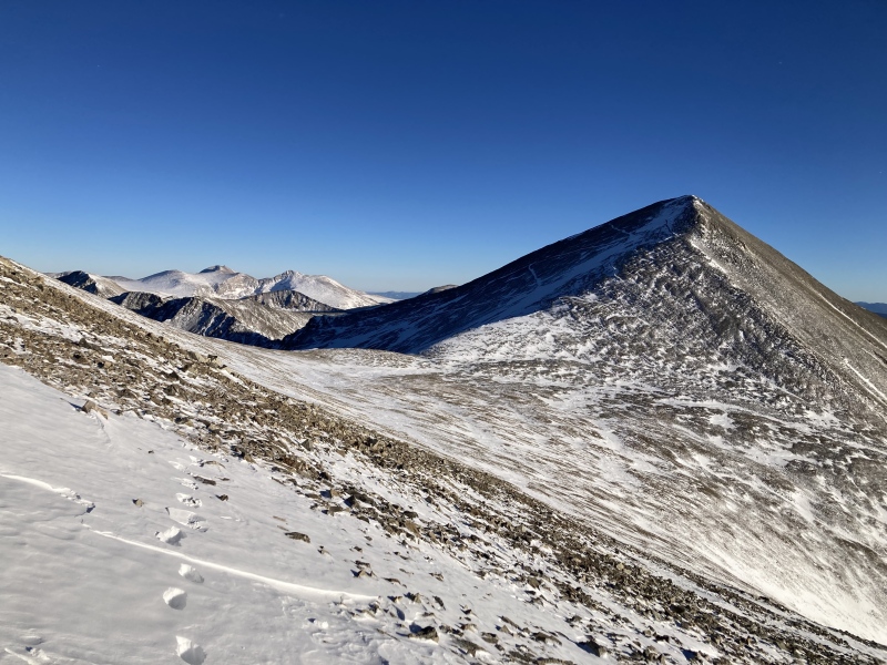
I continued for the short distance up Grays and booked it back down, aiming to at least make it back over Grizzly before dark. The upper strip of snow on Torreys' lower W slope was consolidated enough for me to get some glissading in for a fast and fun descent. The sun sank beneath the mountains as I re-ascended Grizzly, casting Torreys in a stark red-orange aura. I fought with my phone battery in the chilly shadow of the mountain and managed to get some great shots! 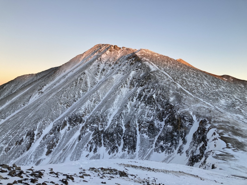
I did end up making it back over Grizzly amidst the fading, multihued light of a cloudless sunset. Traversing the narrow ridge didn't seem as harrowing now as it did earlier in the day. Soon it was time to pull out the headlamp and resummit the various bumps along the ridge crest back to the trailhead. The anticipation of being so close to my car gave me a boost of energy enough to jog along the flatter sections of the trail. I remember stopping on the last knoll to take a few minutes to soak up the wide-open view of the teeming night sky, hoping to catch a shooting star or two. 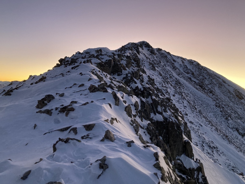
La Plata 2/14, NW Ridge winter variation At this point in the season the bootpack trail was a superhighway particularly thanks to larger parties like user JtheChemE's winter finisher. On the other side of the aspen grove I ran into a kind and friendly user balthazorerin who incredibly was just coming down from a sunrise summit. Can't imagine how cold that was at dawn! It was refreshing to chat with a fellow winter enthusiast on the trail--besides the couple guys on G/T last time she was the only other person I had met on trail all season. This was a fun, really enjoyable route. The forest on the approach was lush and mossy, reminiscent of Spanish-moss bearded cypress that I'm more familiar with down south. The headwall up to the ridge wasn't too big of a deal and the rest of the ridge up to the summit was straightforward and safe. Really nice intermediate route between more beginner winter 14er peaks and the longer moderate ones given the bomber trench. 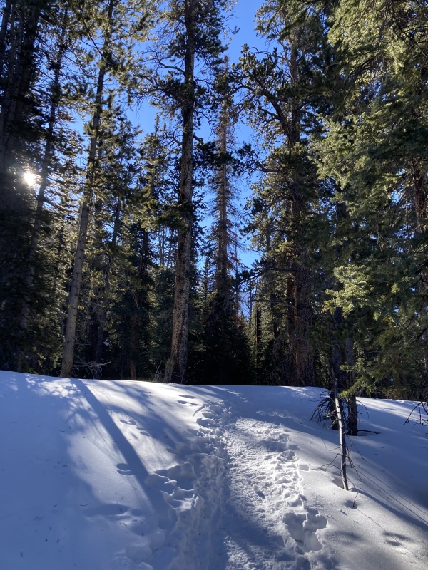
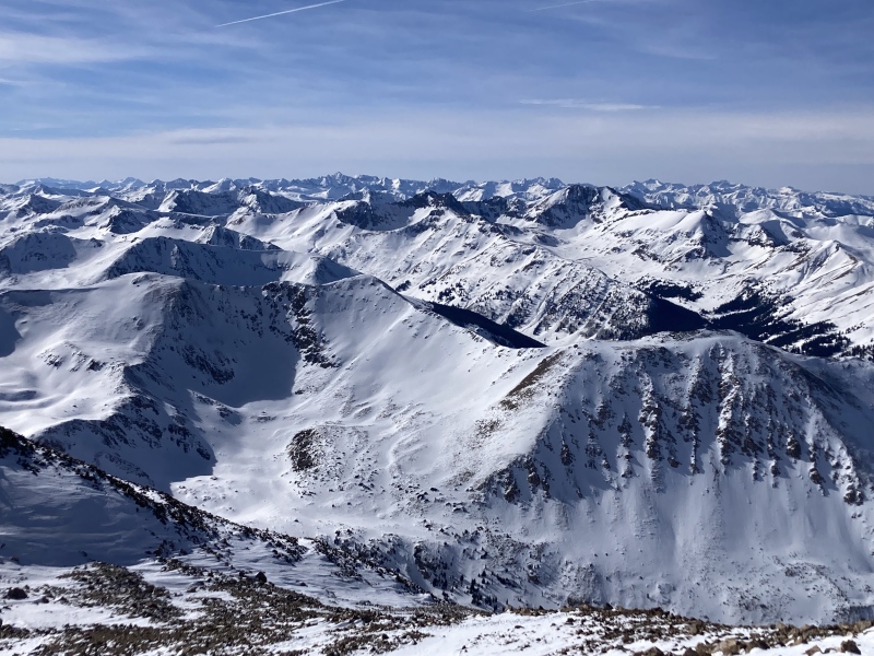
Elbert 3/14, E ridge After a longer stretch of not being at high elevation, I decided to go for a tamer winter trek. I had already done Elbert in snowy conditions the previous May, so I was already familiar with the route and the old "shortcut" up to 11,500ft. I took the well-tracked standard route up and was glad I hauled my snowshoes all the way past the flats at 11,500ft where the trail became blown over with deep snow. The snow conditions were a lot better back in May than this time of year--today there was a thin wind crust for most of the ridge above treeline that I often broke through in my snowshoes. However, the weather at the summit was oddly more pleasant than May: warm, sunny, no wind! I stayed up there for quite a while--I find the 13ers right on the other side of Elbert/Massive to be remarkably picturesque and a great reward for plodding up the rather featureless ridge. 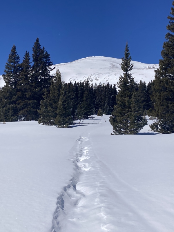
I took the old shortcut from the flats back down to the lower trail by the ponds. The sun had long set by now but the full moon gave plenty of light, enough to cast shadows of the aspens across the snow. Overall this was one of the more straightforward and less technical winter hikes for me this season, but the summit weather and views were one of the best. 
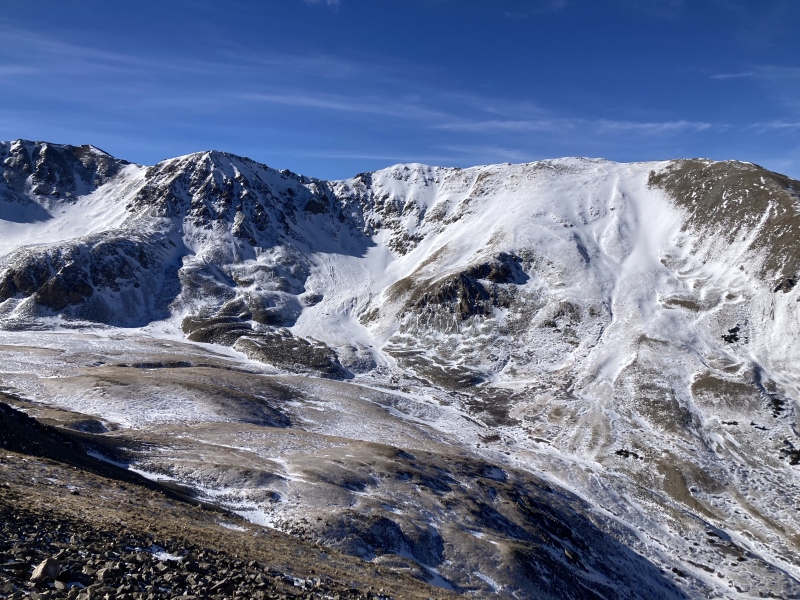
Massive 3/19, E ridge Last call! With this being the last full day before the equinox, the curtain was closing on my winter adventure. I decided Massive would be a good complement to Elbert--generally the same aspect and geological shape but more challenging and featured. I got a bit mixed up at the start by parking at the wrong lot and hiking around the ponds by the hatchery but soon connected with the correct and thankfully packed-down trail. Towering lodgepoles crowned with lush needles hemmed in the path. Past the CDT/Colorado Trail intersection I needed to don my snowshoes to follow the trench that some other parties had worked on earlier this morning. It had been gnawing at me intermittently so far, but at a certain point I started feeling overwhelmingly lonely and ground to a halt. I had been going all-out on this project for nearly the past three months and hadn't spent a lot of time seeing friends. Now I felt completely bogged down and wished I could be anywhere else but the middle of the woods by myself. 
Of course these were high Covid times then and I was still riding out the massive changes in social patterns the pandemic brought about. I desperately missed the ease of connection I had in the before-times, and the expansive flora and company of craggy giants during my winter travels wasn't enough to replace that. I remembered my girlfriend was hanging out with one of her friends that day and I almost turned around right then in frantic hopes of joining them. I found it ironic that I was feeling this on the one day I knew I would see several other people on the trail. Reaching out to my girlfriend about how I was feeling and spending some time in a patch of sunshine helped clear my humors enough for me to make a decision. After some internal wrestling, I accepted that I couldn't change much about my situation since I was several hours hike and drive away from anyone I knew, so I might as well keep going. Arriving above the forest and beholding Massive's expansive skyline further encouraged me towards the day's original objective. The lodgepole stand past the hatchery did seem uniquely thick and looming compared to other forests; perhaps its opaque maze-like density had placed more pressure on my psyche that day. I did end up bumping into several parties past treeline which broke up the barrenness of the tundra; at this point in commitment up the mountain any pangs of loneliness I felt weren't nearly as agonizing as before. 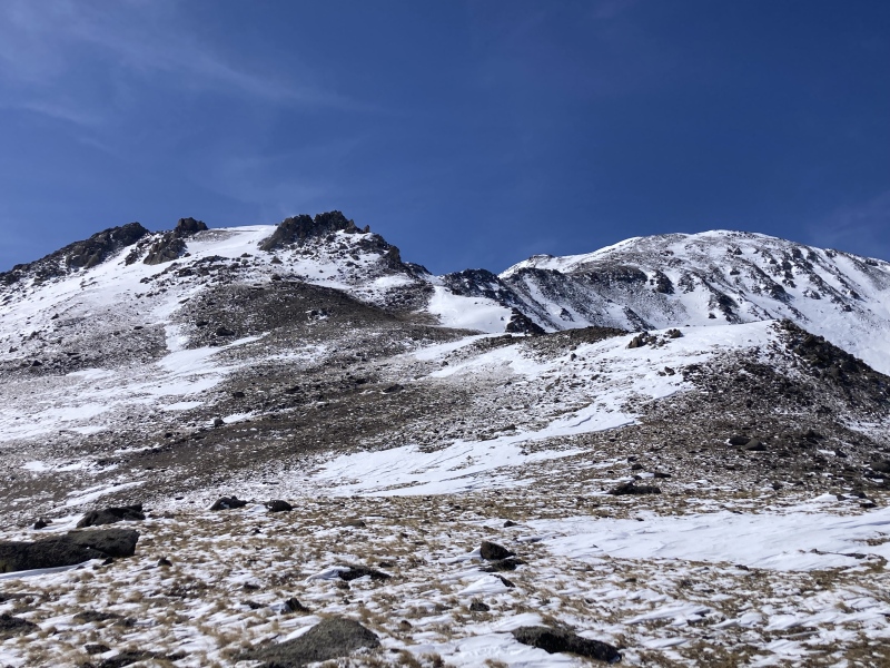
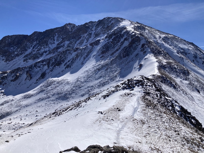
I followed the bootpack through some rocky knolls on the lower ridge and stashed my snowshoes. Deep snow looked sparse enough to avoid for the rest of the way to the summit. I strolled across the gentle lower slopes and aimed for a V-notch in an outcropping ahead to access the upper ridge. Like the ruins of castle towers, large boulders guarded the base of the parapet notch providing some fun scrambling. I continued upon the undulating ridge to the summit, kicking steps in packed snow and lightly scrambling to overcome its several knobs. One final trudge up a loose dirt trail lay between me and my last summit, and soon I was looking west over the rippling tumult of rocky ranges. 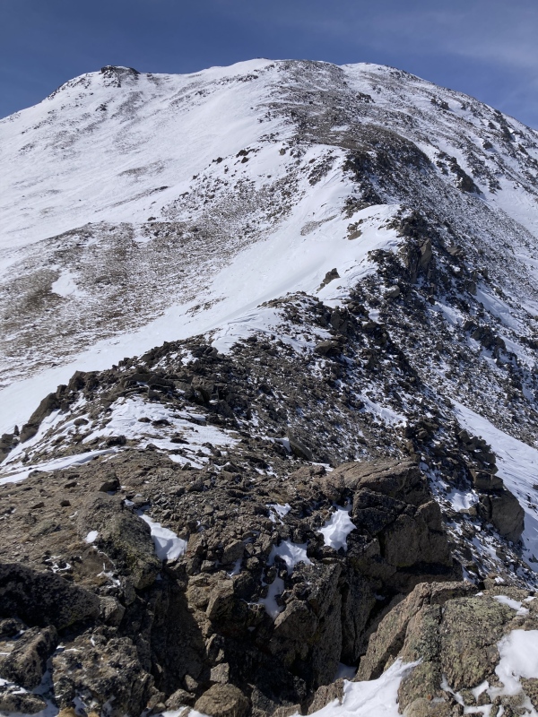
The sky was a bit hazy which made the views easier on the eyes. I was originally planning to summit North Massive this trip as well but didn't think I had the time or juice for it. North Massive's spinal-looking east ridge is an awesome feature and would be worthy of its own climb anyway. I bypassed the bumps on the upper ridge on the way down by descending to the upper basin to the south and coming back through the V-notch. I was glad that I gave up on North Massive when I got back to the rock domes at the base of the ridge because I ended up wasting a good chunk of time getting lost among the nearly identical mounds. I swore I stashed my snowshoes at one rock pile and confirmed my belief by seeing footprint-like disturbances in the shallow snow and dirt, but they didn't lead anywhere and may have just been made by a pair of pecking ptarmigans. Finally I backtracked and found the very apparent boottrack down to my actual snowshoe stash. The trek back through the darkening forest was long but not excruciating like earlier since I was now headed back towards civilization. 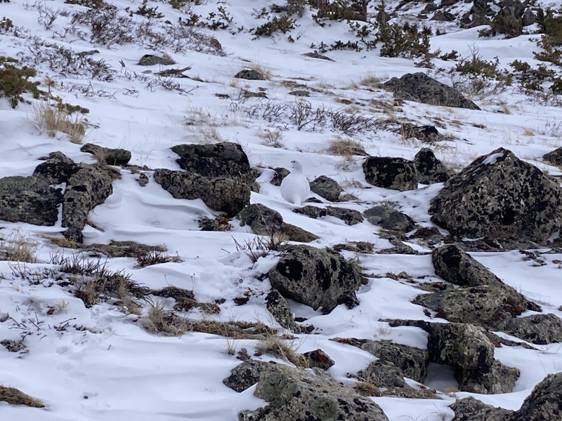
I found some resonance with the loneliness I felt after watching The Dawn Wall documentary about Tommy Caldwell & Kevin Jorgeson scaling an unclimbed face of El Cap in Yosemite. Kevin couldn't traverse one pitch of razor blade ledges and resigned himself to belaying Tommy up the rest of the wall. I understood how Tommy felt when he mantled up a large ledge that signaled the end of the hard climbing--at first he was elated for having come so far and certainly for being able to lay down on hard ground for the first time in days, but then his demeanor completely shifted: he felt lonely. The thought of being the only one achieving this historic climb felt forlorn and isolating instead of prestigious. Looking back down to Kevin, he resolved: "I'm going to do everything I can to help him make it up here." After a few more days, Kevin succeeded on the traverse and they topped out together. Of course, I didn't accomplish a feat like theirs and I think my number of summits this season was way more of a testament to my work schedule than athletic prowess. Still, I felt a parallel in Tommy's surprise loneliness: when I should have been feeling celebration at the end of an out-of-this-world few months, instead I felt isolation. Things changed after the equinox of course as I regained more of a hiking-social life balance, but the paralyzing pain I felt on this trip was something I would not like to repeat. Wrap-up Overall, however, even though I was the only one on the mountain on many of these hikes, I was not alone throughout the journey. "The game" of winter 14ers is only won with an individual checklist, but it's played by hikers helping others "make it up there." At times I helped set the trench or post information that lent a hand to a fellow climber's summit bid; more often I benefited from the prior efforts of winter adventurers and writers for my success. Friendly forum members shared encouragement and interest in my adventures. Particularly I appreciated the detailed trip reports from supranihilest, CaptainSuburbia, Will_E, bmcqueen, PeakSixTD, Dancesatmoonrise, daway8, SnowAlien, WildWanderer, RyGuy, JQDivide, and many others, not to mention Bill M for this site overall! I'm looking forward to standing atop more winter 14ers this season, but after some time away recuperating from a head injury last year I'm not as set as I was before on completing all of them. My adventure of 21-22 and reflecting on it while writing this report has helped me realize the kind of activities I love the most in the mountains. I'm more encouraged, too, to keep discovering the beauty of the alpine and what it reveals to me about myself. These experiments throughout the winter season honed my senses for very specific needs like protein and electrolytes and, overall, helped me further appreciate and listen to my body in general. Nothing could beat the arresting moments of the first sight of the day's objective, a sky-wide sunset, or the mountains beyond mountains view at the summit. It's as if, in fact, contrary to blunt realism about alpine travel, the mountains really do care: upon studying their features, toiling among their timbered toes, and tracing their faces up to their heavenly crowns they reward us with unspeakable secrets and deeper connections to ourselves and others. 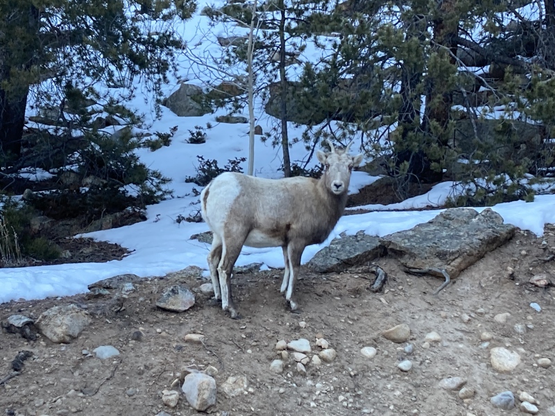
Post-script: Gear & Technique I didn't want to include this in the main body of this report since individual gear choices and climbing preferences seem to vary widely but I thought I'd stick some gear talk on at the end here for anyone who's interested or might stand to gain from it. I'm a big fan of used gear. If you're a fellow Denverite, Feral off Tennyson & 39th Ave has a great inexpensive collection of used gear--I've gotten everything from my backpacks to snowshoes to display gloves to aggressive ice tools here at significant discounts. Any time I'm in the area I pop in to see what's new, sometimes they have interesting "antique" pieces. There's a newer, smaller branch in Idaho Spgs as well. Early on I got some Snowline microspikes from Wilderness Exchange which I've loved but unfortunately have been discontinued. I always put on microspikes anytime I'm walking on snow--the benefit in increasing traction, steadiness, and speed even in miniscule amounts per step is always worth it over the course of the day in my opinion. If I needed another pair of microspikes I'd probably try the $20-30 Amazon ones before I got the exorbitantly priced Katahoolas. I'd usually get to the trailhead between 7:30-9:30am. That would usually put me at the highest part of the mountain towards the warmest part of the day and down below treeline after the sun went down. I would study previous trip reports and current conditions pretty closely to see if I needed to haul up snowshoes and poles. I mainly used Mountain Forecast to check weather--if it was a clear day with summit temps above 7 degrees and winds at 35mph or below I'd give it a go and it was never unbearable to me. Most days were pretty mild and enjoyable in the sun and out of the wind. I'm still workshopping with comparing NOAA's forecasts but I found MF to be pretty reliable given differences in wind patterns funneling through the mountains. I always carry gear and clothes that can cover every bit of skin to help block the wind. I find that windchill doesn't really affect me that way and winds are only a pain when they're so strong that they affect my movement or when I'd like more dexterity for taking pictures or getting snacks. One of my best-served pieces of gear is a black Columbia hardshell that both blocks the wind and also helps warm me up in the sun due to its darker color. For nutrition I always carry 3 snacks: mini beef jerky sausage links, sugar-dried mangoes, and trail mix. This combination of protein, glucose & carbs satisfies everything I feel I need on hikes. I bring a few packets of Propel electrolyte drink mix to pour in my mouth and swallow with water like a pill too in case I sense a sodium deficit. I don't understand why other brands of the same flavored salt need to be several times more expensive! I still use a water bladder in winter for ease of access as well. I made my own thermal cover for the tube and bladder out of a cheap roll of reflective bubble wrap--it's only failed once in the dense early morning forest on Massive. Alright, that's about all I find worth sharing. Thanks for reading and happy winter hiking! Thumbnails for uploaded photos (click to open slideshow): ")
")
")
")
")
")
")
")
")
")
")
")
")
")
")
")
")
")
")
")
")
")
")
")
")
")
")
")
")
")
")
")
")
")
")
")
")
")
")
")
")
")
")
")
")
")
|
| Comments or Questions | |||||||||
|---|---|---|---|---|---|---|---|---|---|
|
Caution: The information contained in this report may not be accurate and should not be the only resource used in preparation for your climb. Failure to have the necessary experience, physical conditioning, supplies or equipment can result in injury or death. 14ers.com and the author(s) of this report provide no warranties, either express or implied, that the information provided is accurate or reliable. By using the information provided, you agree to indemnify and hold harmless 14ers.com and the report author(s) with respect to any claims and demands against them, including any attorney fees and expenses. Please read the 14ers.com Safety and Disclaimer pages for more information.
Please respect private property: 14ers.com supports the rights of private landowners to determine how and by whom their land will be used. In Colorado, it is your responsibility to determine if land is private and to obtain the appropriate permission before entering the property.


