| Report Type | Full |
| Peak(s) |
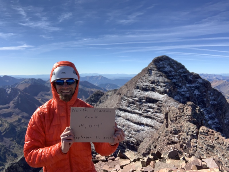
Mt. Sherman - 14,043 feet Castle Peak - 14,274 feet Conundrum Peak - 14,037 feet Pyramid Peak - 14,029 feet Snowmass Mountain - 14,105 feet North Maroon Peak - 14,022 feet Maroon Peak - 14,163 feet |
| Date Posted | 10/18/2021 |
| Modified | 10/26/2021 |
| Date Climbed | 09/22/2021 |
| Author | Milenk002 |
| Bells Traverse/Whole Elk Range Minus Capitol |
|---|
|
Bells Traverse/Whole Elk Range Minus Capitol
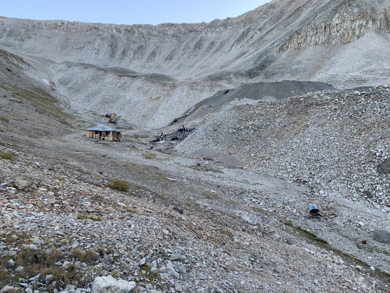
7 Summits, (8 actually,) in 9 Days Prelude: Worked all day at my job in Connecticut, finished packing around 10pm, alarm was at 4:30am for an 8:30am flight to Denver, didn't really sleep. Traveled, rented car, drove 3 hours to Leadville, bought groceries, the idea was to sleep in the car at Iowa Gulch Trailhead for Mt. Sherman, and climb it as a warmup for the harder Elks. Couldn't find the trailhead, got confused as to whether the trailhead began off road CR 2 or CR 2B. The trailhead is unmarked and difficult to find. In the waning light I ended up parking about a mile below where the trailhead starts off of CR 2B. The road between where I parked and the start of the Iowa Gulch Trailhead is a dirt 2WD ledge road with no good turnoff to park, hence I would have added mileage the next day. Temperature overnight was in the 30s at 11,400 feet, and coming from sea level, altitude sickness began to manifest itself as a pounding headache that robbed me of save perhaps 30 minutes of sleep. Day 1: Around 5am I said the the heck with it and began gearing up for the short, (I thought,) climb. Walked right by the start of the trailhead in the dark and headed left into a mined out amphitheater complete with abandoned buildings. Floundered around looking for a trail before checking my GPS and deciding to retrace my steps. On the way back I encountered two hikers heading up Dyer Peak, (an adjoining 13er,) one of them pointed me towards the Iowa Gulch Trail and I bushwhacked through some willows to where I could see the trail meandering through the talus just past some powerlines at 12,000'. From there it was an uneventful climb, but I had succeeded in doubling the distance by parking below the trailhead and getting lost. Exhausted from the climb, two sleepless nights, and suffering from a pounding, altitude induced headache, I grabbed a bite to eat in Leadville then headed over Independence Pass into Aspen. I wanted to climb the next day, but was dubious of my condition. Securing accommodation at Saint Moritz Ski Lodge, I promptly crashed at 7pm, and slept 10 hours of pure blacked out oblivion. 
Day 2: I arrived at Castle Creek Trailhead at about 6am, driving about 1/2 mile up the rough, high clearance 2WD road before deciding not to push my tires and luck any farther. The hike up the initial mining road was not difficult, but long, and I arrived at the start of the Class 2 headwall at 8am. Route finding in the talus of the headwall is a little tricky, but I worked to toward the lowest point just right of some snow in a shallow gully. I crested the headwall and spied a clearer trail farther up the amphitheater to the left. Rocks gave way to more dirt over the next few hundred feet, and it was smooth sailing to the ridge, where more urgent route finding begins. Generally the idea is to stay at or near the crest of the rock towers on the ridge since the angle and instability of the rubble slopes to the right are considerable. Left of the ridge are more exposed cliffs, I stayed in-between these and took my time. At one point the trail appears to move to the right under one of the rock towers, someone has made a line of rocks blocking the path as a trace indication of where not to go. I promptly stepped over this warning and quickly found myself negotiating an unstable rubble slope, it took a moment before I realized I was off-route and that there had been warning. I retraced my steps and continued proceeding at the spine of the ridge. The rest of the route up Castle Peak entails a short downclimb to a notch-gap before the final hundred feet or so of exhilarating scrambling, views are awesome. Took me 90 minutes from the start of the headwall to the summit, (that's with stopping to take pictures and videos,) but I tend to be a faster hiker/climber. 
The hike over to Conundrum Peak is straight-forward, with the initial downclimb, (and later returning upclimb,) off Castle being the toughest part, though it's more time-consuming than overly taxing. Took 45 minutes to reach the further true summit of Conundrum, it's closer than it initially seems, but broke out my trekking poles for parts of it since there's steep dirt sections, (returning as well.) Wonderful summit, well worth it. Yet my worst experience in the Elk's occurred about 2 hours after this. With no sunscreen or sunhat, (mistake,) I began retracing my way back to the mining road. September sky in Colorado can be cloudless and from 13,000 to 12,000 feet Old Apollo began hammering me like Apollo Creed. Tried to pull my shirt over my head, resorted to running, but it seemed like it took me an hour to reach treeline shade, cursing most of the way. Thoroughly cooked, I bought the widest brim sunhat I could find when I got back to Aspen. Whole hike, including relaxing at the summits, took 8 hours, 12.5 miles. My body felt surprisingly good afterwards, as my altitude sickness had disappeared and I resolved to attempt Pyramid Peak the next day, knowing that mileage-wise it was a shorter hike. Turned into bed around 7pm, and once again experienced blacked-out bliss. 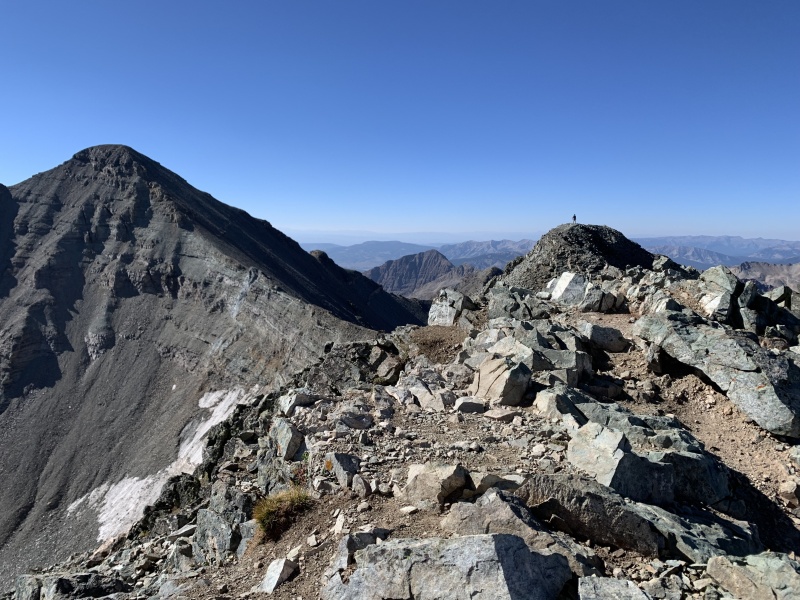
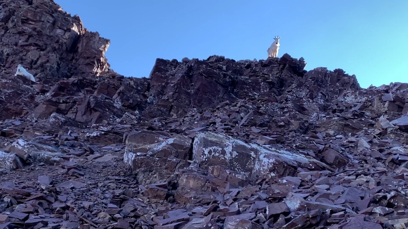
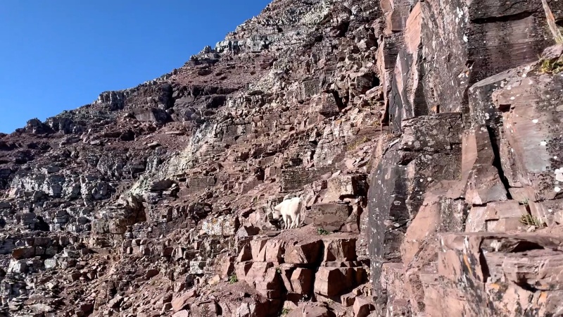
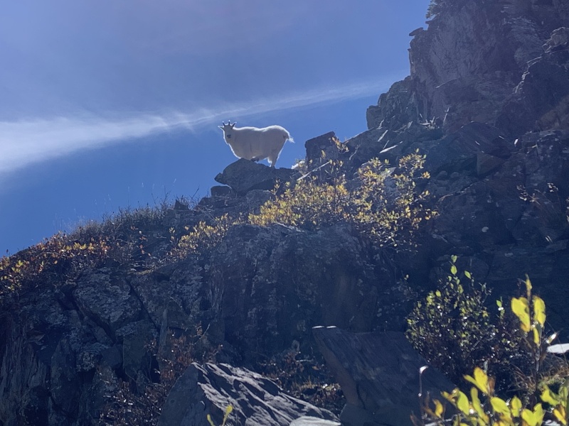
Day 3: Started up Pyramid Peak at about 6am, almost immediately didn't need my headlamp. I'd never attempted an official Class 4 route, but mistakenly, (and almost tragically,) made a ropeless, off-route descent off Crestone Needle several years ago, and thus was confident I'd faced worse. That being said, the trepidation I felt as I entered Pyramid's amphitheater and viewed the steep 1000' ascent up the headwall gave me pause and a shot of fear. Climbing alone, it's a very intimating place to find yourself. "Nothing to it but to do it," I said, and I started up the headwall using trekking poles for 80% of it. As I arrived at the saddle, I found a clan of mountain goats fearlessly regarding me. At one point I had to take a defensive/aggressive posture against one that ventured too close. Yet soon after this moment the goat began leading the way along a very specific, tricky route of hidden ledges along the backside of the ridge toward Pyramid's summit. The goat was following the standard route. Often it would disappear for a minute around a corner or above a shelf, and I would begin searching for the route in the exposed labyrinth of ledges. Then, as if by magic, the goat would reappear above me at the spot I had to get to next. It was actually amazing and felt like some kind of primal kinship between the guardian keeper of the mountain and myself, the pilgrimage visitor. In reality I believe the goats have learned to accept a granola bar handout at the summit if they accompany a grateful hiker to the peak. In spite of my guide, I found the route difficult, with a pitch up a crack of greenish rock being the most technical. Staying on-route is a challenge, and on the return trip I found myself crossing the most pronounced notch gap slightly too high and strained my rotator cuff trying to lower myself full extension to a lower ledge. Luckily I would only feel the injury slightly over the next couple days. 
Day 4: Rest day, I moved my accommodation to Glenwood Springs and visited Doc Holiday's grave. Being in good shape as a champion marathon runner I planned to hike Snowmass Mountain the next day car to car and packed my micro-spikes for the 22 mile round trip. Day 5: Slept well, arrived at the trailhead and began my journey up Snowmass Mountain at 2:59am. It was over 3 hours of hiking in the dark. About an hour in I saw a hovering, glinting light just off the trail and thought it was a supernatural UFO before realizing my headlamp was simply reflecting off the eyes of a mule deer. Around 5am I still hadn't reached the Snowmass Creek stream crossing , and started to worry I'd somehow taken a wrong turn in the dark. Normal cellphone reception is nonexistent in the Elks outside of the main towns and highways, so I turned on the GPS of my Garmin inReach satellite phone to assuage fears that I'd gone astray, all was in order. I reached the stream crossing soon after, and located the jumbled mess of the infamous Snowmass logjam. In the dark I missed the shortest route through, which is only about 20 yards long, and instead crossed a treacherous 50 yard stretch of wet, unstable, frost encrusted tangle of vampire impaling stakes. It does seem very dangerous, my trekking poles helped tremendously. I was able to shut off my headlamp soon after and reached Snowmass Lake at 7:15am. 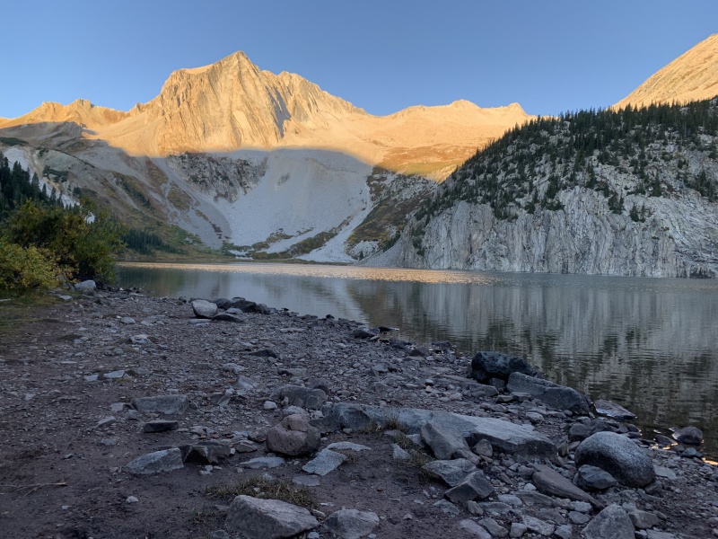
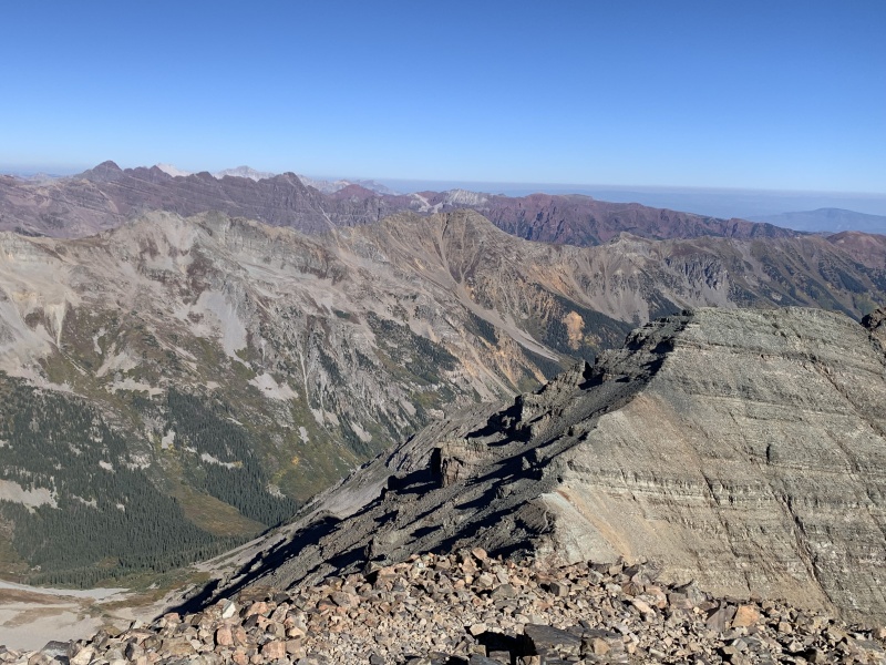
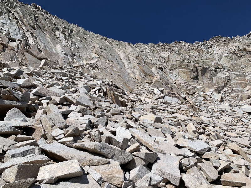
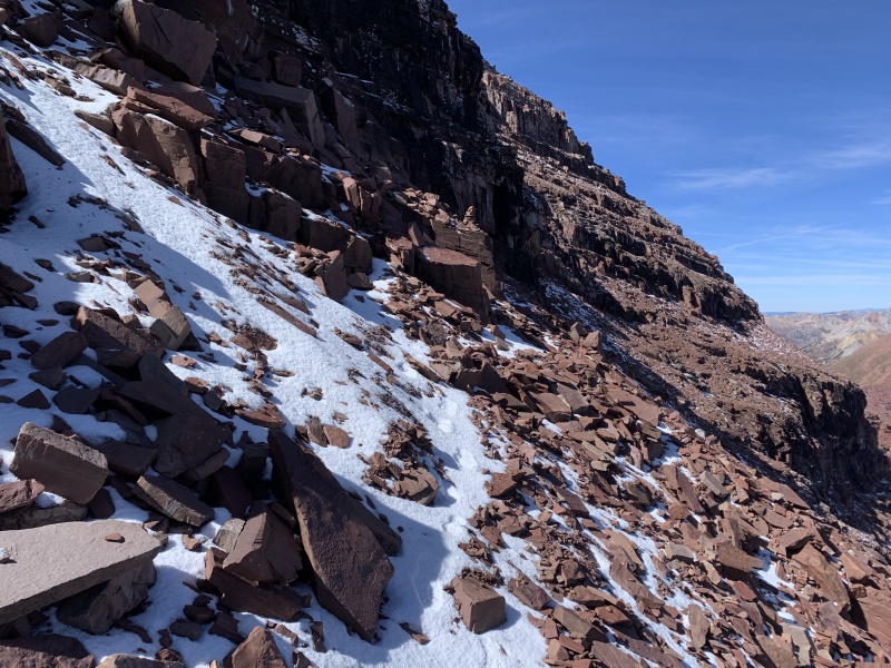
of the 3 bumps right of center The trail along the left side of Snowmass Lake strays up and down through the willows, and is difficult to follow, I just barreled forward through the thicket at some points, charting a trajectory that accesses the rubble slope at the far end of the lake. I found the initial 800 foot talus slope much easier than similar terrain I'd encountered on Pyramid Peak and Challenger Point. With my trekking poles I made a quick ascent to where Snowmass' permanent* snowfield should be. Arriving at the upper basin I found a good kilometer of easier hiking, but discovered the snowfield is not permanent, and summer temperatures transform the landscape to an ankle busting boulder field that in rivals anything I've encountered outside of Longs Peak's standard route. Global warming I guess, and I began rumbling forward towards the low point between Hagerman Peak Snowmass Mountain. Route finding was more prevalent than I'd anticipated, as well as the abundance of overhanging rock slabs. The length of the ridge from the saddle to the summit also surprised me. On Pyramid Peak the consequences of not following the route are obvious, on Snowmass the adventure is more open-ended, but not without risks. Steep terrain is never far away, and the jumble of white rock is never completely solid. I'd anticipated the endurance required to summit Snowmass as the main difficulty, but the technical aspects of the final phase of the hike were time consuming and just as challenging as the route's overall length. Reaching the summit was quite amazing and well worth it as usual, but the prospect of the return journey loomed large on the peripherals of my mind. 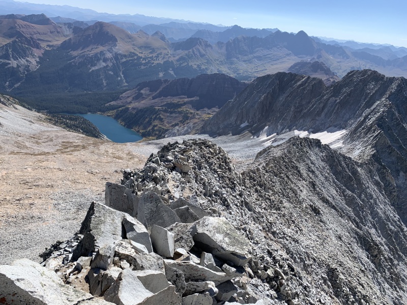
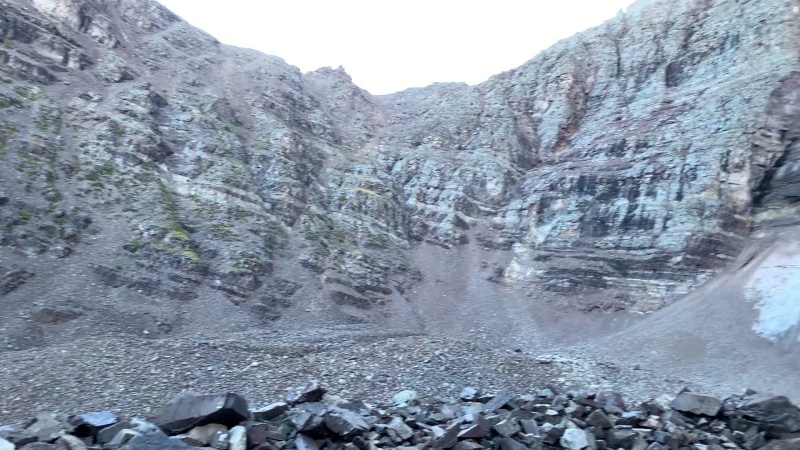
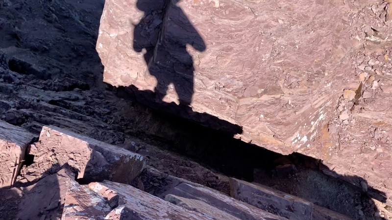
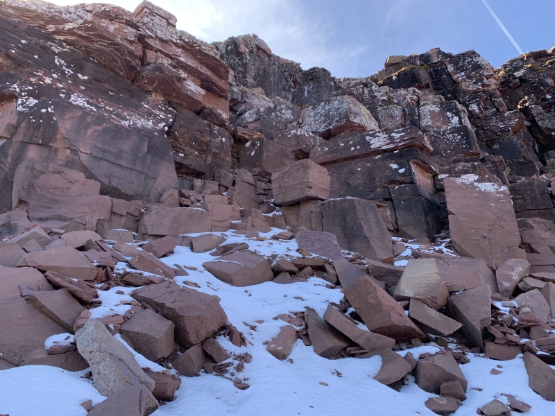
Patience and diligence are key in staying safe during the initial descent from the ridge. Still, the duration of the day wore on me, and I couldn't maintain proper focus, losing the route near the low point of the saddle. Peering down the basin I'd come up, I picked the most forgiving line and did something resembling a Class 4 downclimb through a crack system. When I reached safer ground, I discovered that I'd overshot the turn off the ridge by about 50 meters, but luckily my skill and confidence were enough to deal with some of Snowmass' off-route terrain. The rest of the hike proceeded as expected, and though long, was quite beautiful and interesting to me since I missed most of the approach in dark. Very memorable, the whole thing took 13 hours. Day 6: By this time it was September 19th, and the weather at the Elk summits changed. The forecast called for temperatures in the 20's, sustained winds of 25 to 35mph, and snow squalls. The wind chill would be in the single digits. Those are conditions I know not to take on, and I opted for a day trip to Dinosaur National Monument to sate my childhood curiosities about the place. It was dramatic but less than my childhood imagination of yesteryears could've conceived. There were unearthly landscapes, but precious few fully constructed dinosaur skeletons lying about. Still the place conjured visions of flesh and blood prehistoric dragons lurking long concealed in desolate, forgotten slot canyons. I'm glad I endeavored the 300 mile round trip from Glenwood Springs. Day 7: The weather remained unchanged, so I decided to check out Marble, Colorado, where they quarried all the stone for the Lincoln Memorial and other Washington monuments. Took about 50 minutes each way to drive the 20 mile, 2 lane road from Carbondale because DOT crews were closing lanes to avalanche proof the rock shelves next to the road. Marble is a one-horse town, but a gallery displaying some amazing marble sculptures was quite compelling. Day 8: The weather at the summits during the morning wasn't forecast to be much better, (31 degrees, 25mph wind,) but conditions would improve by afternoon to around 40 degrees with wind dying down to 15mph. This outlook still gave me pause, but I'd had enough sitting around and chose to attempt North Maroon Peak. This was the safest bet since the standard route up North Maroon faces east, and the sunrise would start melting any frost or snow immediately. Furthermore the wind was out of the west, and I'd be sheltered till well above 13,000 feet. I started at 6am without a headlamp, taking my time, knowing that each minute would make the alpine conditions more hospitable. After conquering Snowmass in a day, the prospect of North Maroon's nine mile route seemed like small potatoes. I'd read horror stories about the slog up North Maroon's gullies, but they really weren't that bad compared with Pyramid Peak's grassy ledge headwall, or Snowmass' boulder field. Yet once I emerged from the gullies, the situation suddenly became more dicey. The wind picked up and there was snow covering 2/3 of the surfaces where I wanted to put my feet and hands. The prospect of slipping became much more real. As I progressed up large blocks towards the crux of the route, I began to be afraid. I climbed up a steepish, technical crack, and thought it was 'the chimney,' that everyone talks about. I felt relieved that it hadn't been too difficult, before I realized that it was still in front of me. As I walked up to it, I harbored real doubts about successfully summiting: the chimney's foot and hand holds were smooth and snow covered, I'd seen ice here and there. For about 6 minutes I searched for the best holds before realizing I'd have to squarely commit to upward movement, without knowing where my next holds would be. I was able to toss my pack to a higher ledge, and move up the chimney unencumbered, trusting holds would be there. After this crux move, the route's conditions became further unsettling. More wind, more snow, more ice, fear for my safety and fear of failure did battle in my brain. Yet knowing the crux move was complete gave me solace, and the sun's incandescence promised to improve the route with each passing second. Step upon step the pitch eased as the summit block appeared 100 yards away, then 50, then 10. No one else attempted North Maroon on this day, but as I spied across to the other Maroon Bell, a solo climber meandered about its summit. My doppelgänger on North Maroon's twin was doubtless experiencing the same exhilaration elation I felt at their solo surmountation. 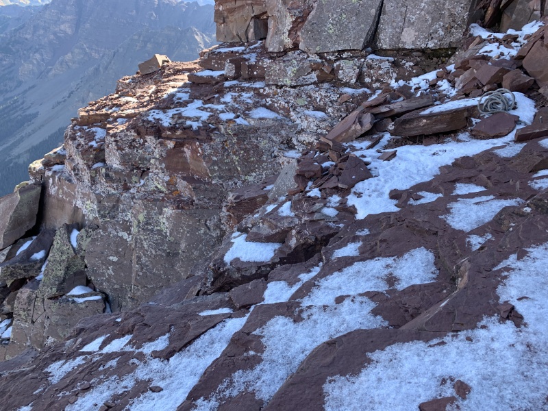
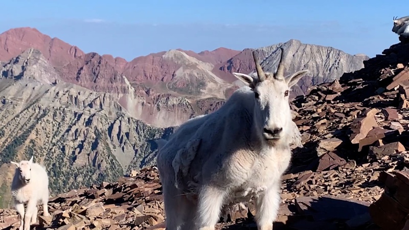
The problem with climbing up the mountain, is that you also have to climb down it. I knew if I could get back by the chimney, I'd be home free, but as I gazed down it and slowly started to offer my feet to the precarious holds, my intelligence got the better of me. "This is stupid," I thought, "this is how you break your leg." I withdrew from the danger and resolved to find another way round, I'd read rumors about an alternative route to the skier's left of the chimney and probed that way. I spotted cairns leading me to a rope and a still precarious downclimb off of large, snow covered blocks, but the danger was less than what the chimeny offered. I took my pack off, lowering it first before I followed. Moving back to the right for about 50 meters, I regained the standard route below the chimney. The rest of the hike was glorious and my mind glowed with euphoria as I beamed with a sense of accomplishment at the mountain goats that literally frolicked by me at one point, as well as at the busloads of causal hikers on the Maroon-Crater Lakes trail when I reached the creek basin. It was a day I'll always remember. 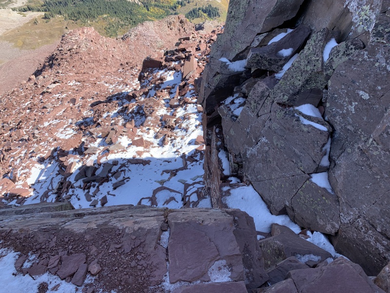

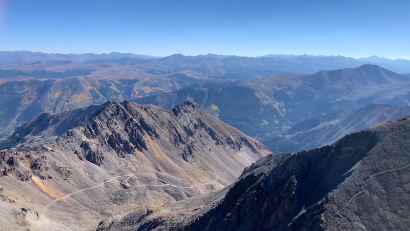
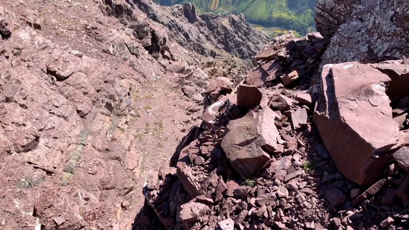
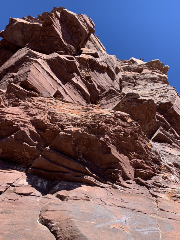
Day 9: One Maroon Bell down, one to go. I'd gone to sleep at about 8pm, and planned to hike Maroon Peak via the standard south ridge the next day. Weather would be excellent with calm conditions, temperatures in the 40s at the summits, and highs around 75 at the trailheads by midday. As I set out at 5:50am on the 12 mile roundtrip, I said out loud to myself, "Let's really attack this route," and began moving at a brisk tempo. I reached Crater Lake in 40 minutes, and started up the 2800 foot gain to Maroon's south ridge. Breathing steadily, as though I was out on a training run, I pressed forward with a zen mentality. It wasn't long before Crater Lake and the approach basin shrank far below me. The formerly clear trail began to dissipate in the upper half of the 2800 foot, increasingly rocky slope, but far above I identified the ridge contour line I was meant to aim for and gradually traversed toward it. Gaining the ridge at 8:20am, an awe-inspiring view of Maroon Peak's south face, still shrouded in shadow opened up before me. The challenge of navigating the steep, lengthy tangle of broken rock ledges now loomed before me. I'd memorized the route and knew the location of the major gully passages through the maze. I stepped forward with confidence. 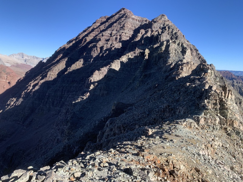
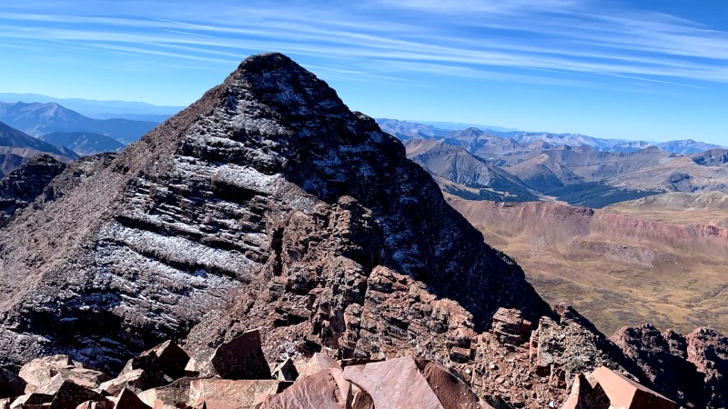
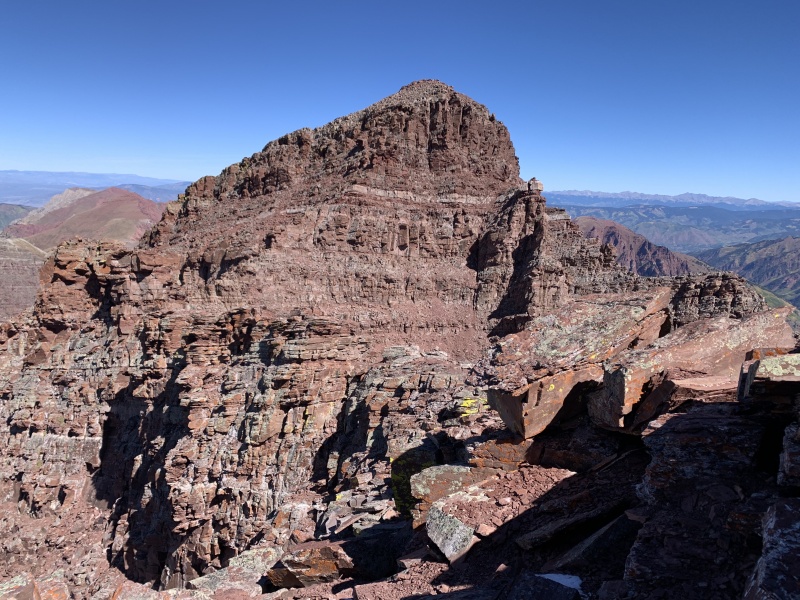
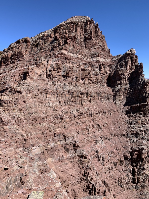
Despite its precarious reputation, Maroon's south face was well cairned, and the ledges comfortingly perpendicular. As I made my way through each obstacle, and steadily up each gully, a radical thought flashed across my mind, "This is too easy, you should do the traverse." I snapped back to the present task at hand, but the thought was there, and had been there all week, and likewise in those months leading up to my trip. My adventures the prior day on North Maroon Peak, the fear I felt, had chased out speculations of trying anything harder, but today was a new day. Around 10:20am I scrambled out of the mountain's shadow, into sunlight, and attained Maroon Peak's summit block. I was alone on the peak, yet within only a couple minutes I'd made a decision: The sky was blue horizon to horizon and the wind was calm. I'd studied the route, watching lengthy videos on it, and knew the descent trail down North Maroon from the previous day. I recognized I'd never have a better chance than now to experience this fabled route. If I was going to do this, now was the time, and although afraid to acknowledge it until now, I admitted to myself it's what I'd been planning all along. I set off across the Maroon Bells Traverse. I felt an unquiet trepidation vibrate through me as I stepped off and began downclimbing the ridge between the two Maroon Bells. The route was in shadow again, snow had accrued on my desired foothold ledges. Drops from block to block were almost as long as my body and required full extension disembarkment. The absorbing nature of the route prompted my excited energy to splay out through my blood vessels as an extreme, calm focus. I knew from watching route videos that I'd have to scale a rock tower with a fatal drop below me, it was a challenge I wanted to prove myself against. I told myself to keep going and that I could turn back if the crux looked too difficult. Maroon Peak and North Maroon Peak are only 1/4 mile apart as the crow flies, but it can take over 2 hours to pass between the two peaks since there is an elevation loss of 400 feet to the low point between the two summits, (the Bell Cord Couloir,) and a regain of 270 feet to North Maroon's summit. I reached the Bell Cord Couloir in just over 20 minutes and prepared to confront what's known as the 3 difficulties. The general way to find the entrance point to each of each difficulty is to stay left of the ridge crest. I located the first difficulty very soon after climbing a couple ledge systems out of the Bell Cord. To be honest, I found this 1st difficulty no more technical or exposed than some of the slightly off-route passages I'd navigated on Pyramid Peak, Snowmass Mountain or on Maroon Peak earlier that morning. I knew that the true test, however, was next. 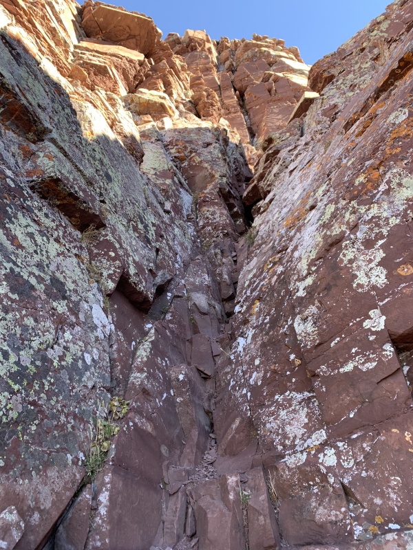

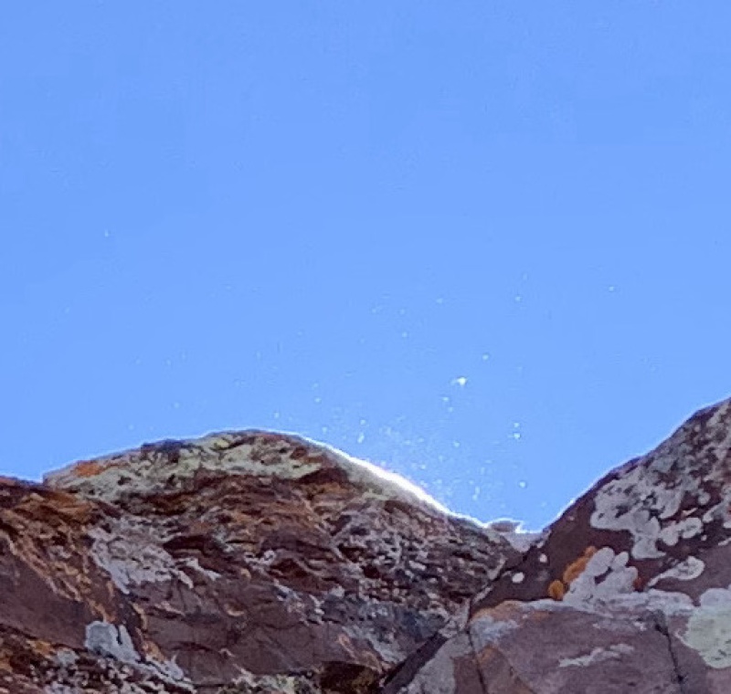
The 2nd difficulty is the most exposed, objectively dangerous point on the traverse, an airy 40 foot tower perched upon a much larger, fairly sheer drop. As I wandered left of the ridge, looking for its entrance point, I reorganized my mind, compartmentalizing the fear that could cause me to shake or freeze at a critical moment. I was helped in a flash by a powerful vision whereupon locating the threshold of the 2nd difficulty a slice of the sun peered over the traverse ridge raising a cadre of evaporating ice crystals, (or were they insects?) into a tranquil gyre of effervescent gleaming and glinting particles. It was a transcendent moment, a beckoning, its effect was calming. Serene now I ascended to the tower, verifying my line and placing my feet and hands on the initial holds. This would not be difficult, the holds were good and available, I don't need to look down and pulled up away from safety. I immediately bashed my head on an overhang, but not hard enough to pierce my focus or my helmet. In a matter of deliberate seconds I was pulling myself onto the top of the tower, and let out a war-whoop for the ages. A couple climbers on North Maroon turned and waved. Relief and euphoria spewed forth from my face and eyes as I smiled broadly as I ever remember, and my steps were as if on air. 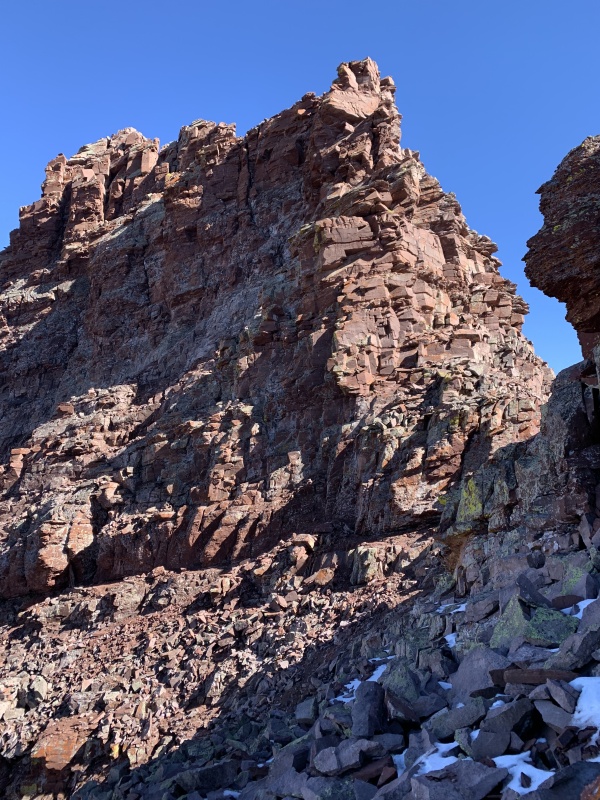
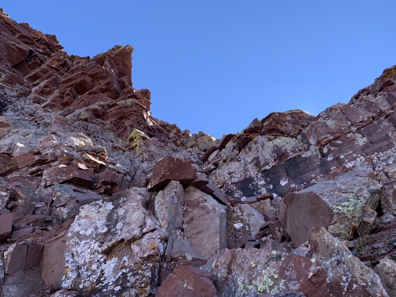
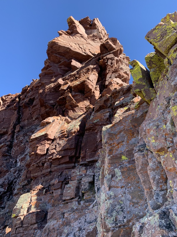
Beyond relief, I approached the 3rd difficulty, completely underestimating it. Rated at a 5.7 move, it was a squeeze through a chimney that was blocked with an overhang at the top. I opted to bearhug the sharp arete on the left side and lost contact with my feet. A shot of fear/adrenaline pierced through me and I bulldozed the trunk of my body over the rock crest to safety. It was not graceful, nor safe, but the risk hadn't been fatal with only 10 to 15 feet of exposure from the ground. From that point, it was a measured class 3 to class 4 scramble of deliberate route finding for 1/2 an hour to North Maroon's summit, the entire traverse had taken me 90 minutes to complete. A fellow climber atop North Maroon asked me how the traverse was, my first words were, "You have to be very steady in yourself." 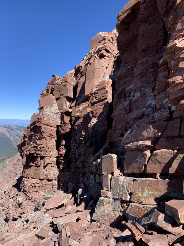

The descent back to the trailhead off North Maroon was extremely enjoyable for me and seemed to pass quickly. I'd be lying to say I wasn't euphoric, the weather was beautiful. I met a professional guide on the way down, and we talked mountains for a couple hours on the descending hike, sharing stories and information. I chattered on and on in my happiness, and before long I was in the parking lot taking my leave of the Maroon Bells. 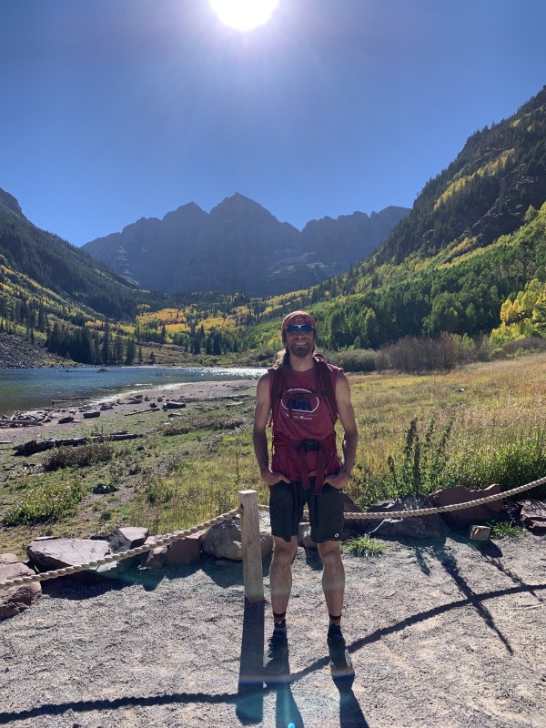
Epilogue: I had one more day to possibly climb, and prepared my pack for an early morning assault on Capitol Peak, arguably Colorado's hardest standard 14er. I figured after doing the Bells Traverse I could take on anything, however three factors assailed my plans. First I had to relocate my accommodation from Aspen to Glenwood Springs because there was no vacancy to be had that evening, this involved rushing around and not being settled in for the night until around 9pm. Second I was bodily exhausted and wondered how I would hold up on a likely 12+ hour hike. However the real problem was that I was too amped up from my day and couldn't quell my exhilaration enough to sleep. When my alarm sounded at 3am, I said forget it, trying to climb Capitol on no sleep would be committing the sin of underestimating the mountain. Still, around noon I drove to Capitol's trailhead and hiked a 5 mile loop to preview another adventure for another day. 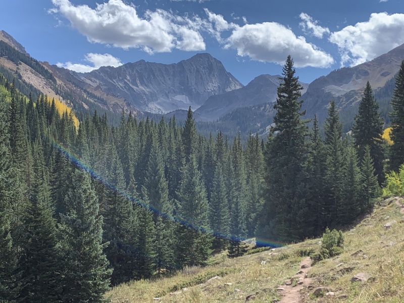
Thumbnails for uploaded photos (click to open slideshow): ")
")
")
")
")
")
")
")
")
")
")
")
")
")
")
")
")
")
")
")
")
")
")
")
")
")
")
")
")
")
")
")
")
")
")
")
")
")
")
")
")
")
")
")
|
| Comments or Questions | ||||||||||||
|---|---|---|---|---|---|---|---|---|---|---|---|---|
|
Caution: The information contained in this report may not be accurate and should not be the only resource used in preparation for your climb. Failure to have the necessary experience, physical conditioning, supplies or equipment can result in injury or death. 14ers.com and the author(s) of this report provide no warranties, either express or implied, that the information provided is accurate or reliable. By using the information provided, you agree to indemnify and hold harmless 14ers.com and the report author(s) with respect to any claims and demands against them, including any attorney fees and expenses. Please read the 14ers.com Safety and Disclaimer pages for more information.
Please respect private property: 14ers.com supports the rights of private landowners to determine how and by whom their land will be used. In Colorado, it is your responsibility to determine if land is private and to obtain the appropriate permission before entering the property.


