Download Agreement, Release, and Acknowledgement of Risk:
You (the person requesting this file download) fully understand mountain climbing ("Activity") involves risks and dangers of serious bodily injury, including permanent disability, paralysis, and death ("Risks") and you fully accept and assume all such risks and all responsibility for losses, costs, and damages you incur as a result of your participation in this Activity.
You acknowledge that information in the file you have chosen to download may not be accurate and may contain errors. You agree to assume all risks when using this information and agree to release and discharge 14ers.com, 14ers Inc. and the author(s) of such information (collectively, the "Released Parties").
You hereby discharge the Released Parties from all damages, actions, claims and liabilities of any nature, specifically including, but not limited to, damages, actions, claims and liabilities arising from or related to the negligence of the Released Parties. You further agree to indemnify, hold harmless and defend 14ers.com, 14ers Inc. and each of the other Released Parties from and against any loss, damage, liability and expense, including costs and attorney fees, incurred by 14ers.com, 14ers Inc. or any of the other Released Parties as a result of you using information provided on the 14ers.com or 14ers Inc. websites.
You have read this agreement, fully understand its terms and intend it to be a complete and unconditional release of all liability to the greatest extent allowed by law and agree that if any portion of this agreement is held to be invalid the balance, notwithstanding, shall continue in full force and effect.
By clicking "OK" you agree to these terms. If you DO NOT agree, click "Cancel"...
But, alas, I decided on the Twin Peaks near the town of Twin Lakes.
Trailhead: Willis Gulch Route: Willis Gulch trail then up a loose gully Length: 13 miles Vertical: 5000 feet Partners: Solo
Fair warning - I did NOT take the best route up - or down - Twin Peaks. If you want to see a better way to ascend/descend them, there are several TR's out there. Wild Wanderer has a good one here as does JQ Divide here. The route I took is more analogous to the route I took up Garfield that I documented here
But, I made it and actually had some nice views as the smoke was largely gone. And I got some good exercise. Good views and exercise are my primary reasons for hiking or climbing mountains. In fact, they are my ONLY reasons for doing what I do when I'm as old as I am and my friends wonder what the hell I do this for. Views and exercise. Period. Not into lists, no signs, no poser selfies to post on FB. Just exercise and views. Which is also why I repeat so many peaks. But I do admit that I kinda like writing up unusual peaks and weird ways (mostly bad ways) to go up and/or down.
Enough of that - to the pix.
Once again, less than an alpine start. Hit the trail at 8AM
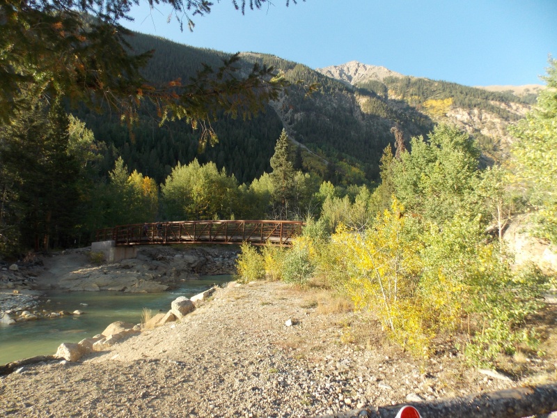
A nice bridge over Lake Creek right at the trailhead.
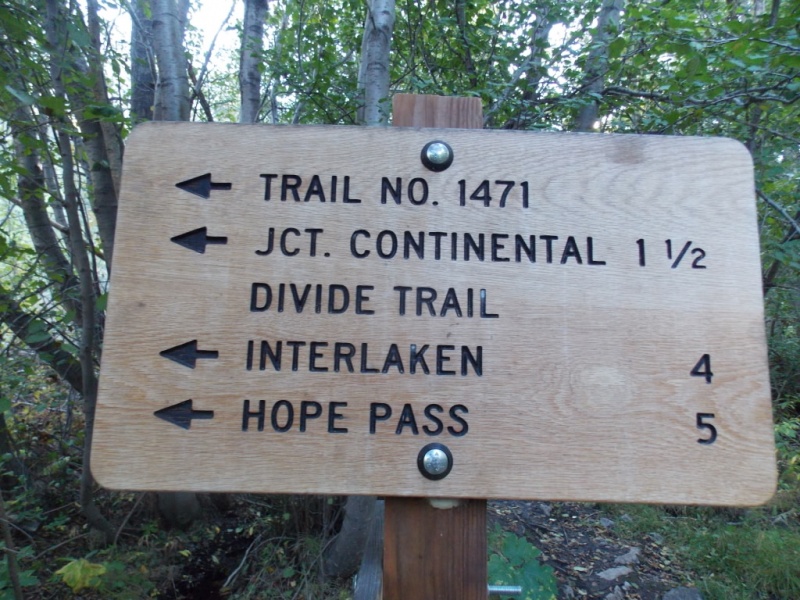
New signage most of the way that was not there when I did Rinker several years ago.
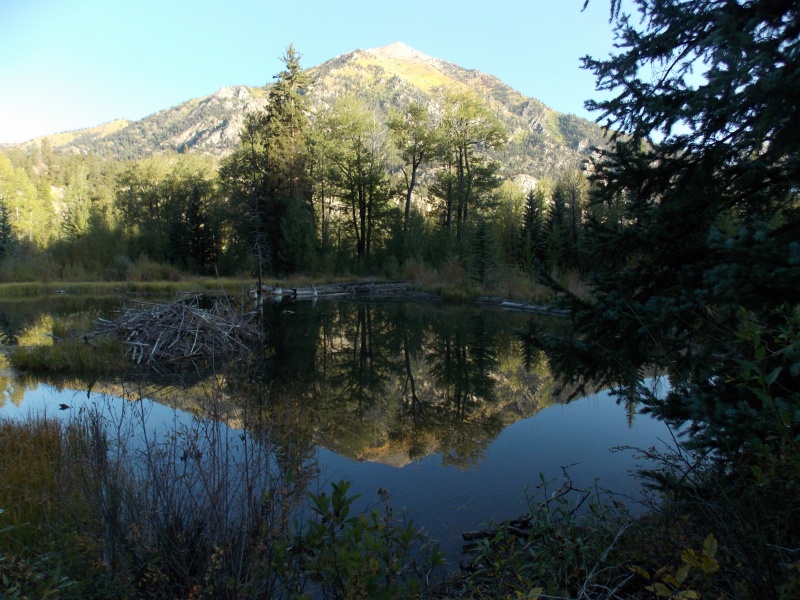
I couldn't resist taking this picture of what I think is Parry Peak, given the reflection that was in the small beaver pond.
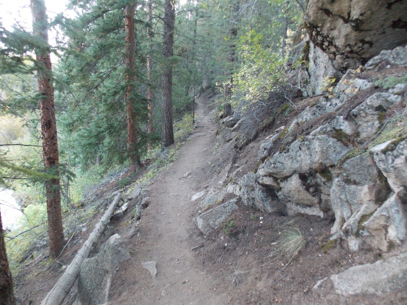
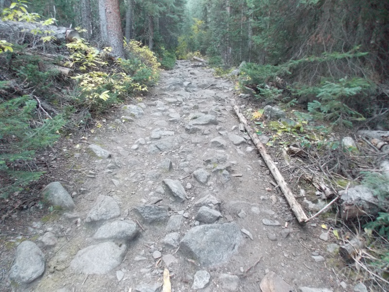
Nice well maintained trail most of the way.
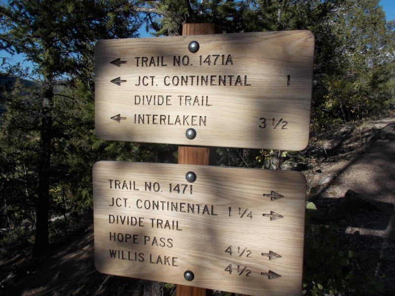
First trail junction (not too far along the trail). Stay to the right.
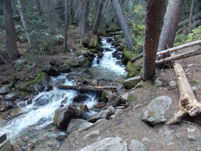
Taken from a bridge that crosses what I think is Willis Creek.
Looking back at the bridge. Continue on towards Hope Pass/Willis Lake.
Continue on the obvious trail.
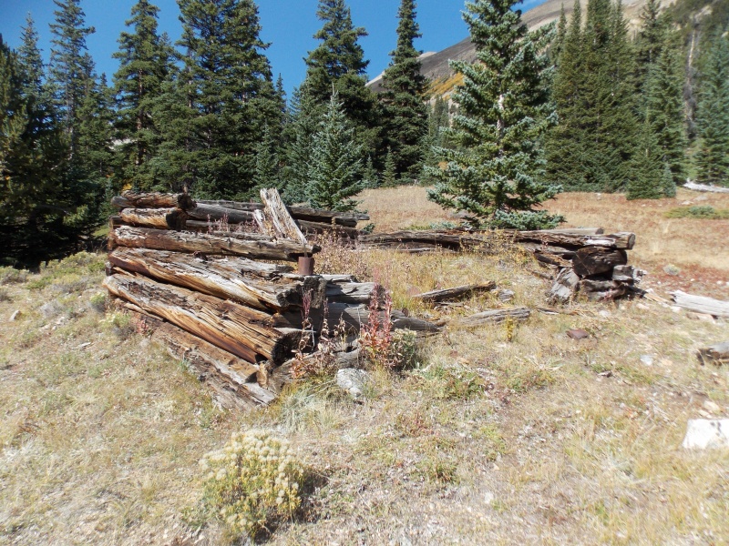
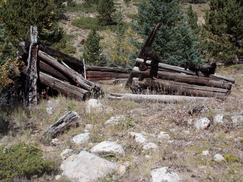
The next two pictures are of the remnants of a couple small structures - probably only 5' x 5'. Maybe old time miners had tiny houses?
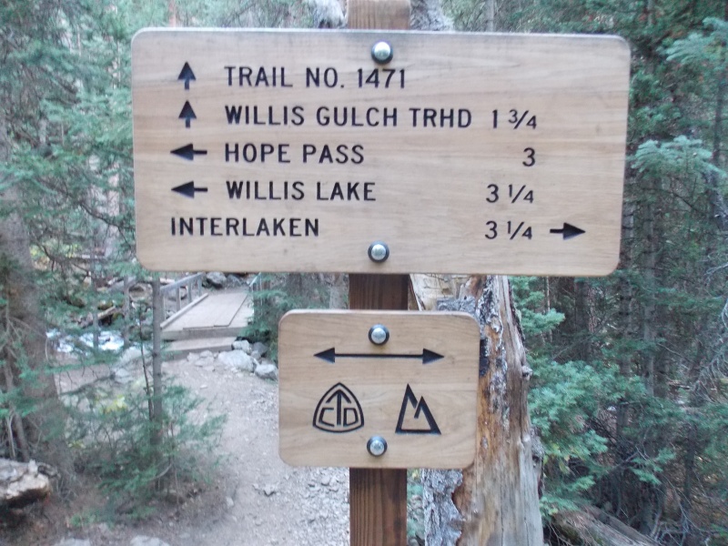
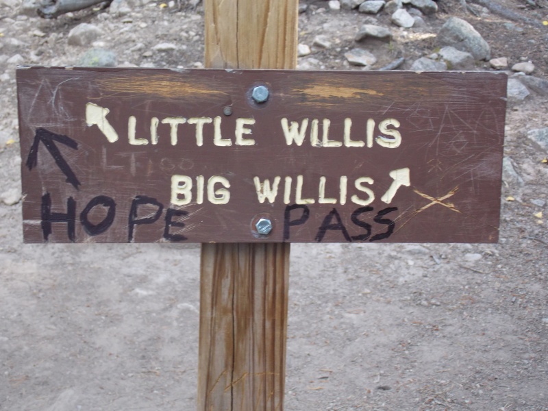
Last sign (and this one was here when I did Rinker). Go right here.
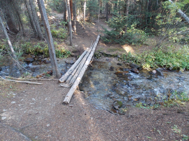
The only stream crossing left to deal with.
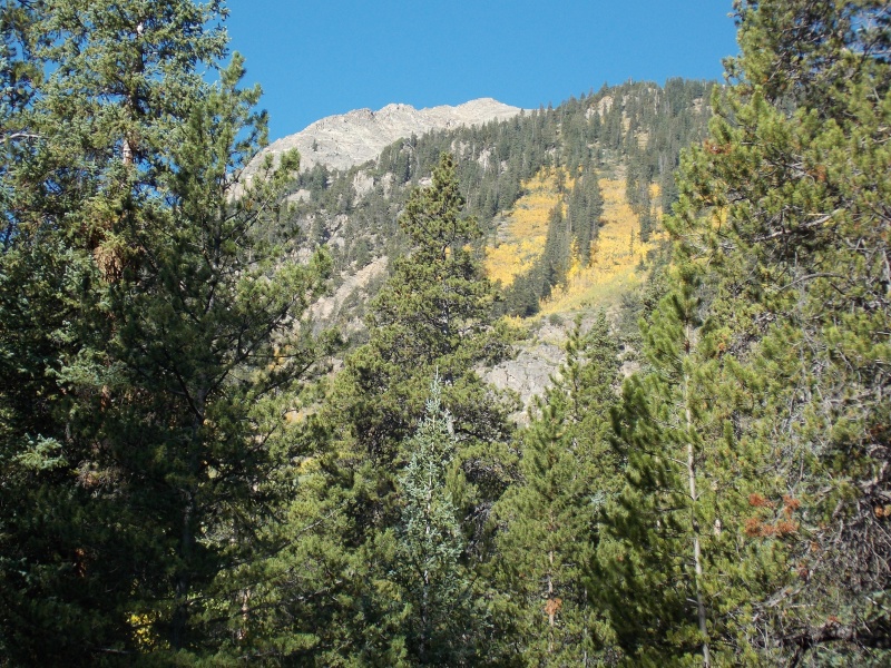
I think that might be one of the Twin Peaks?
The next two pictures show remnants of what I think were caused by the bad avalanche season a few years back. There were portions of the trail that were covered up and hikers had worked around it. When you are in this area, keep an eye out for casual trails leading to the right of this and later avalanche debris.
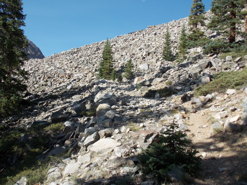
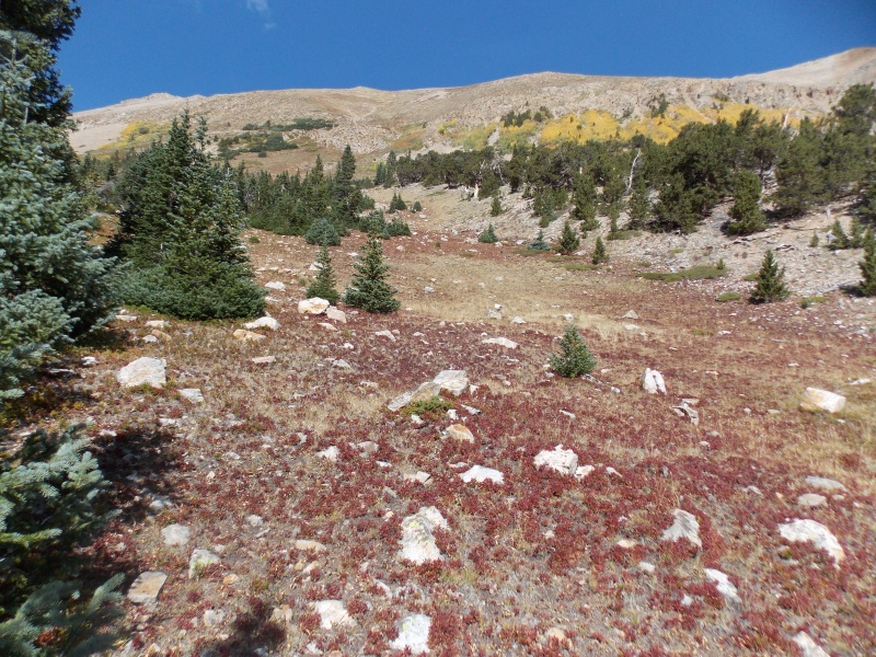
A rock glacier that must be crossed. Nice trail over it, however.
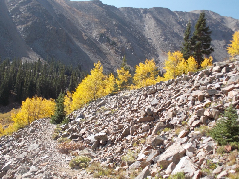
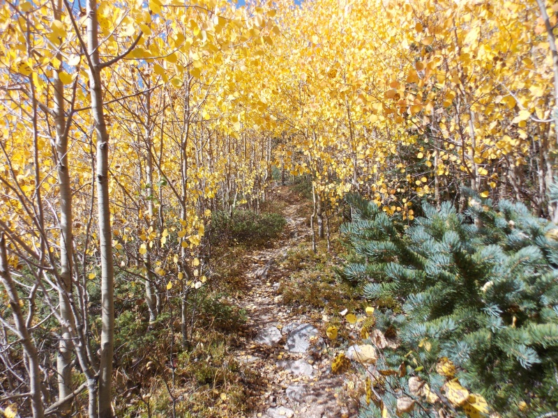
At the end of the rock glacier and autumn colors make an appearance.
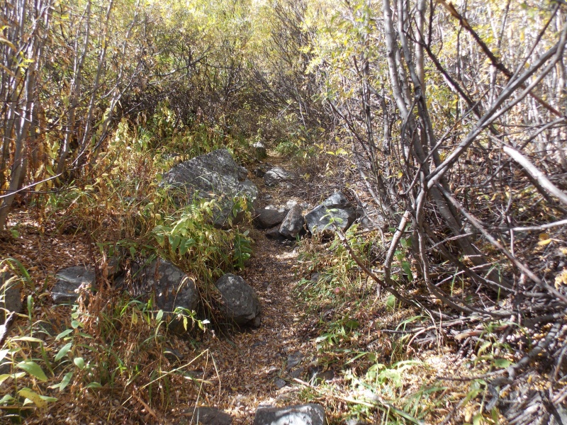
The trail goes through some VERY tall willows.
And then you will pass a larger miner's cabin.
Pretty fall colors.
And another miner's cabin.
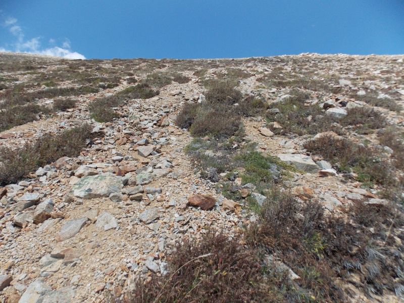
I had been looking for a way to gain the ridge between Rinker and Twin Peaks and this one looked doable so I left the trail here. Probably not a good choice...
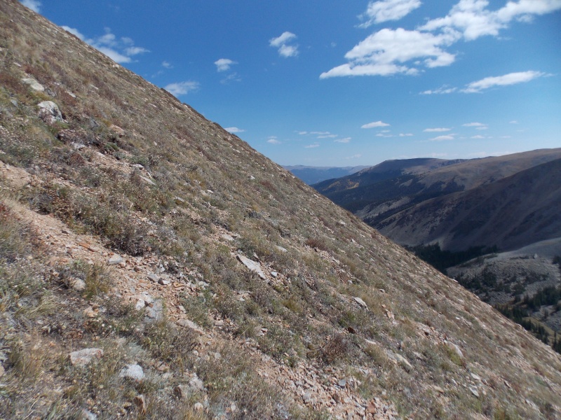
Looks mellow (more or less).
But it got steep quickly.
Taken from the same spot as the one above, it was loose. TERRIBLY loose.
For those of you who have done Pyramid - recall the steep loose slope that goes from the end of the amphitheater to 13,000 feet. IMHO, this portion was worse than that. I vowed I would find another way down. More on how that turned out later...
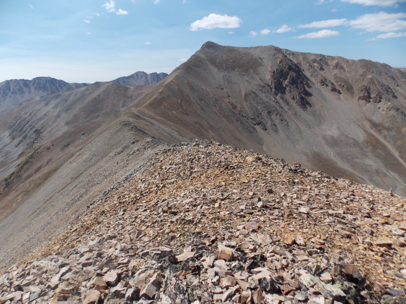
FINALLY on the ridge. Looking west towards Riker.
I didn't take any pictures looking east towards Twin Peaks and I should have. I think because it took me so long to make the ridge, all I thought about was getting to the top and finding an easier way down. What follows now are pictures I took from the summit.
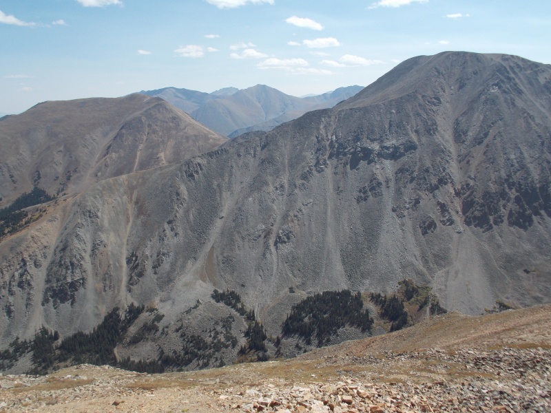
Hope peak on the right, Quail on the left.
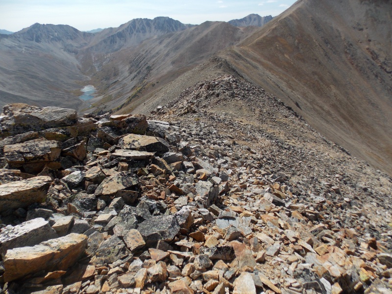
Heading back down the ridge.
I was hoping to take GeoJed's route off the ridge. It is described here.
But, as you will see from my Strava link here that didn't work out so well. I took the one on the left (southwest) up and the one on the right (northeast) down. If anything, my route down was worse than my route up. If that's even possible. Even with trekking poles, I slipped and fell backwards at least seven times. Having been in the Navy, I know how to swear better than most (sorry, Mom) and I used every word I learned on my slip and slide route down. No pics of that fiasco. In short, please do not follow my route up to the ridge or down unless you majored in masochism in college. The only saving grace for me was that going down was steep enough that when my feet slipped out from under me, I didn't have much of a backwards fall. Oh the simple pleasures of life, eh?
Anyway, I did make it down (obviously) and came out no worse for the wear.
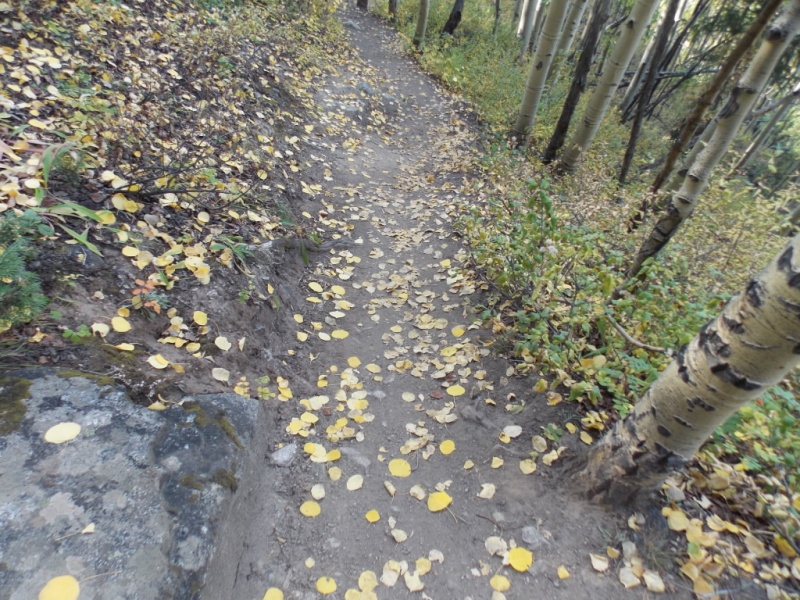
Gottta close this with a picture of aspen leaves on the trail. I always think of them as Mother Nature's gold coins.
Thanks for taking the time to read this - and as I always say at the end - Please be careful out there!
Thumbnails for uploaded photos (click to open slideshow):
29 degrees to serve beer at? Way too cold. That temp in Fahrenheit supresses all the flavor. In Celsius, that is almost hot tub warm. You made the right call by hiking.
I did your same route last year. From the fact you didn't complain about the willows along the trail, it must have been dry. Try doing them after a rain hah.
I thought the descent was steep too, but doable with treking poles.
But I thought it was a pretty area. That creek is nice when its flowing
The picture I have of the willows is just as I was entering them. They did get worse but not all that much after that. And yeah - wet thick willows are a real pain.
You probably had a better time coming down because you are certainly a better climber than I am. It just seemed like every time I thought it was easing up and I would relax a bit - boom - on my butt.
And yeah - it IS a pretty area. Nice trail, great views and not a lot of people. I think I will head up to Willis Lake one day soon.
There are spelling errors in that sign. It's not "Little" or "Big Willis" but Little or Big Willi's! That explains the structures: The sign directs the Willi's to their appropriate cabins! Little Willi's to the left, to their tiny little houses (like Hobbits), Big Willi's to the right to the big cabins. It all makes sense now...
If you have any more alpine mysteries, Jay, just send them my way...;-)
Yeah - I knew that I should have gone up the Rinker route as I had done that route several years ago. From my starting point off the trail, that just looked like an easy way up (not) and by the time I figured it out, I was already invested in it. Also, I had a printout of your route description but couldn't see the proper gully to come down as you indicate - probably because my assumption was that NE was that bump just a bit NE of the summit, not the one a ways away - as shown in Pic24. And from the printout I was carrying, I knew it was between the two but the one I looked at just didn't make sense. Guess I'll go back and do them again so I can get NE and take the easier way up and your gully down. It is a very pretty area and I won't mind going back.
Jay, you crack me up. I don't read all the TR's folks post here, but the title lured me in, good one! I need Rinker and the Twin Peaks too, wonder if I should just go to the restaurant instead :)
Rose - Anyone who knows me at all knows that I love humor - usually the self-effacing kind. I don't take myself all that seriously and nobody else should either! Glad you enjoyed it. And you will enjoy Willis Gulch. It is a very pretty area and I won't mind going back and catching the NE peak (cuz I missed the damn thing...) and Willis Lake looks like a nice area. As I recall, the views from the top of RInker are really nice - you get great views of Blaurock and Ervin in addition to much of the Sawatch.
Considered Rinker a few times but it's never made it to the 'short short list'. Looks like the fall colors would be nice in that entire area. Good to see you up high Jay.
Jay, I love all your reports and I have followed some of them on my hikes. I have been in Willis Lake before and it is very pretty, you pretty much continue on the trail and then up towards the basin. The avalanche area is now in so much better shape than two years ago when you had to hop and figure a way to cross all that madness. It was one of the first places where I saw the incredible force that Mother Nature has.
That area is beautiful. I am hoping next Summer to do Rinker and Twin Peaks so if you want, we can go back together with the right gullies. I have also been using microspikes on the way down on some hikes when it gets a little crazy and that has helped me for traction, so maybe, if you have some that would have helped as well, not sure. Take care and know you are an inspiration. Teresa
Thanks, Andrew. I think you and Jess would love that area. Very pretty and surprisingly, not all that many people on a weekday.
My sincere thanks, Teresa. While I enjoy writing TR's and it makes it very worthwhile when someone actually gets some benefit from them in some way and it should like you might have gotten some tidbits from some - Again, sincere thanks!
I would love to go with you when ever you would like to try it. Who knows - maybe we'll get a window in late fall. Or next year is good to0.
I have tried microspikes on steep loose stuff with mixed success. I thought they helped going up that sucky stuff on Pyramid but not of much help coming down. I had thought about trying them on Twin Peaks but every time I slipped, I thought it was the last time. I actually do a lot more TR's that what's on the site - Every week, I send pics and mini reports to friends and family. If you'd like to join that list just send me your email in a PM and I'll add you. I do the emails as "bcc" so nobody will see your email addy and if you ever want off the list, just give a yell. And no worries if you're not interested in getting them.
And - thanks for taking the time to compliment my reports and offer to be a patner for a peak. Could be fun!
Nice climb Jay! Just looking at that map, I would have just climbed up the ridgeline all the way. Why suffer a hard stiff climb when you can do a more gentle ascent? I mean, you can always switchback up any steep slope to cut down the angle, but a nice ridgeline was there for the taking! But that's just me, I always do the bushwhack when I can! lol
Good point, Beau. But I had read that the ridge was a real pain so I thought (wrongly...) that I could find a better way. Not so sure I succeeded on that one...
And yeah - in a very perverse way, I kinda enjoy bushwhacks.... Makes a good excuse for why I go so slow...
Caution: The information contained in this report may not be accurate and should not be the only resource used in preparation for your climb. Failure to have the necessary experience, physical conditioning, supplies or equipment can result in injury or death. 14ers.com and the author(s) of this report provide no warranties, either express or implied, that the information provided is accurate or reliable. By using the information provided, you agree to indemnify and hold harmless 14ers.com and the report author(s) with respect to any claims and demands against them, including any attorney fees and expenses. Please read the 14ers.com Safety and Disclaimer pages for more information.
Please respect private property: 14ers.com supports the rights of private landowners to determine how and by whom their land will be used. In Colorado, it is your responsibility to determine if land is private and to obtain the appropriate permission before entering the property.


")
")
")
")
")
")
")
")
")
")
")
")
")
")
")
")
")
")
")
")
")
")
")
")
")
")
")
")
")
")
")


