Download Agreement, Release, and Acknowledgement of Risk:
You (the person requesting this file download) fully understand mountain climbing ("Activity") involves risks and dangers of serious bodily injury, including permanent disability, paralysis, and death ("Risks") and you fully accept and assume all such risks and all responsibility for losses, costs, and damages you incur as a result of your participation in this Activity.
You acknowledge that information in the file you have chosen to download may not be accurate and may contain errors. You agree to assume all risks when using this information and agree to release and discharge 14ers.com, 14ers Inc. and the author(s) of such information (collectively, the "Released Parties").
You hereby discharge the Released Parties from all damages, actions, claims and liabilities of any nature, specifically including, but not limited to, damages, actions, claims and liabilities arising from or related to the negligence of the Released Parties. You further agree to indemnify, hold harmless and defend 14ers.com, 14ers Inc. and each of the other Released Parties from and against any loss, damage, liability and expense, including costs and attorney fees, incurred by 14ers.com, 14ers Inc. or any of the other Released Parties as a result of you using information provided on the 14ers.com or 14ers Inc. websites.
You have read this agreement, fully understand its terms and intend it to be a complete and unconditional release of all liability to the greatest extent allowed by law and agree that if any portion of this agreement is held to be invalid the balance, notwithstanding, shall continue in full force and effect.
By clicking "OK" you agree to these terms. If you DO NOT agree, click "Cancel"...
I know that most people do Garfield in combo with Grizzly. Most people are smart! Not me, I guess. I figured that I had done Grizzly twice - once via Bill's route and once via the Grizz couloir that I documented here. So, why not go up the down staircase and do Garfield the hard way. I had more than a little trepidation about the trek after reading Wild Wanderer's TR here and Glenmiz's excellent report here but I figured I'd give it a shot. And I will say that I was in total agreement with WW as I was going up - the scree was merciless. But I found that going down wasn't all that difficult - perhaps because it was easier than going up or perhaps dementia is settling in? <smile>
Anyway, here are the pictures on what was a beautiful, albeit windy day.
Avalanche debris on FS394
My FJ all alone at the TH
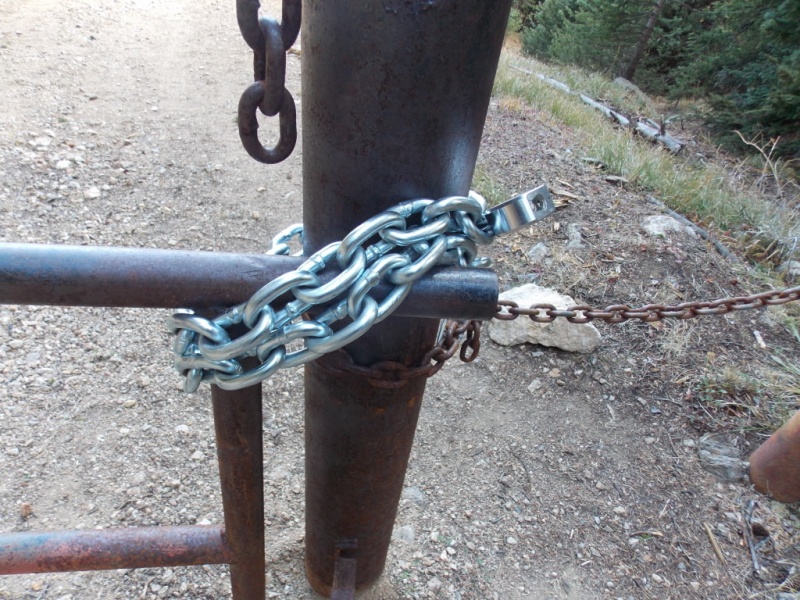
A new chain and lock on the gate?
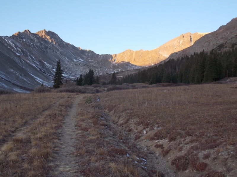
Sun hitting Grizz on the way in.
An old miner's shack? Or a miner's old shack?
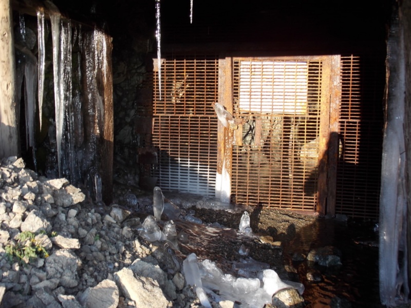
Ice stalactites and stalagmites at the mine entrance.
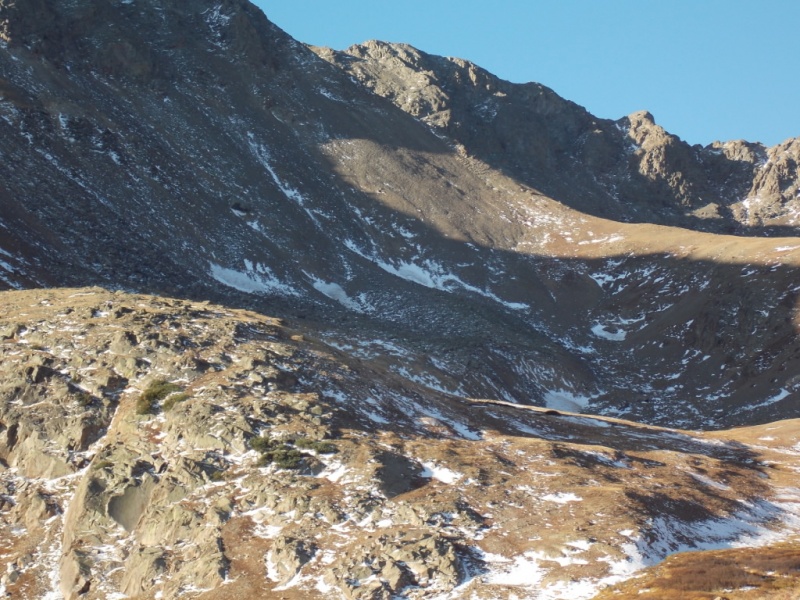
Zoom on Garfield
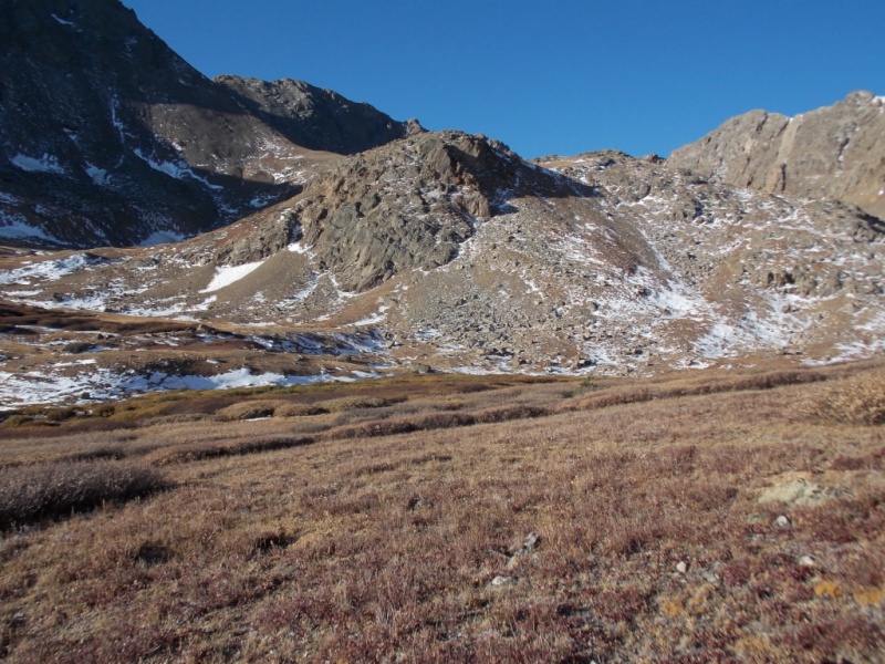
I had been trying to decide if I wanted to do the Grizz/Gar combo or just go for Garfield. The above picture sealed the deal for me as it looked doable.
I decided to go up just right of the large rock mass pictured below and see what it looked like from there
Head to the right of the rock mass.Head up the center of this picture.And this is what you see.
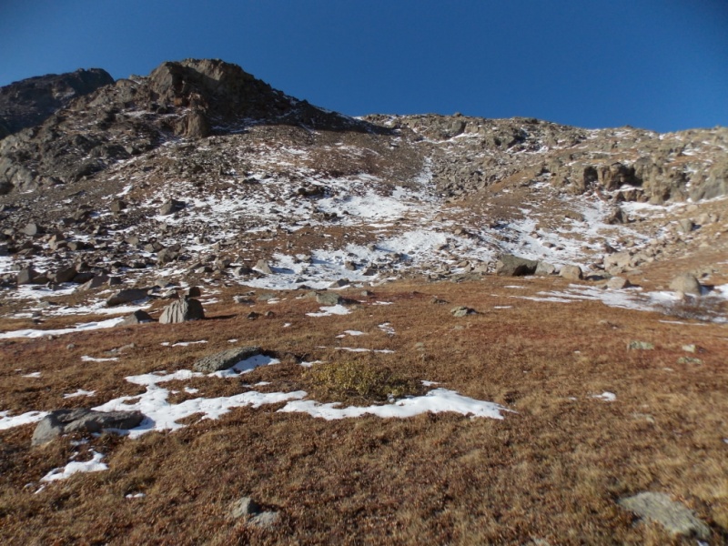
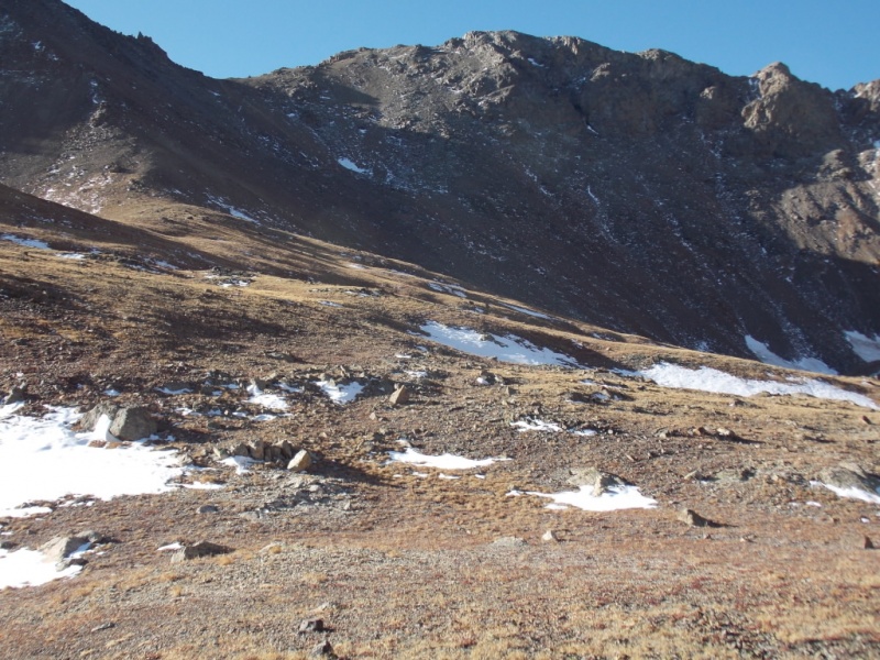
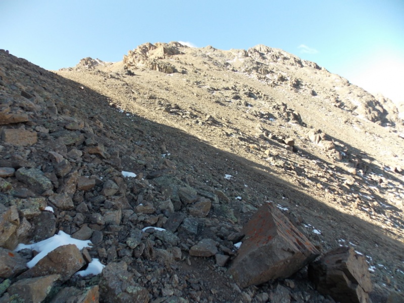
But, after you top out, you get a clear view of the route ahead
Aim for the saddle but stay to the left.A closer view
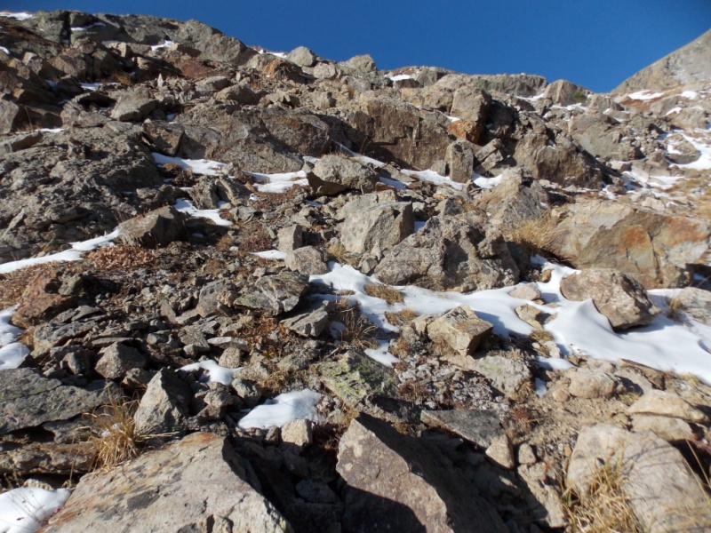
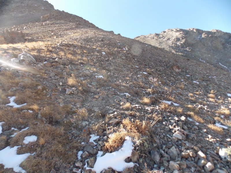
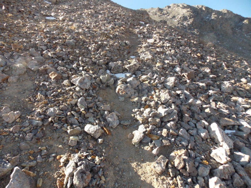
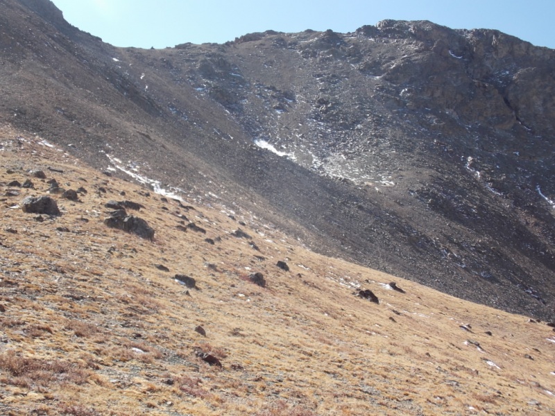
Then you are in the scree and talus. There are trail remnants (or paths carved out by sliding mountain goats) and some areas where you just kinda have to pick your way. I'm not sure I took the optimal route but it worked. And a note here that usually rocks with lichen on them are stable - not so here. Ask me how I know.
Scree...Looking back down from the same spot.
One of the trail segments
A note here - this was analogous to going up a down escalator. The ground/rocks seemed to move out from under every step I took and it was a bit of a struggle. I have noticed that as I have gotten older, my balance just isn't what it used to be. (Any other 70+ y/o hikers have that trouble or is it only me?) Anyway, I usually do better going up than going down (the balance thing). But this one was different. With everything moving it seemed like I was in a fun house after having a couple martinis. But coming down didn't seem all that bad. I also tried to stay high on the left hand side going up and I seemed to find a little more stable rock there. But nothing is stable until you get to the saddle.
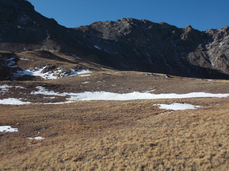
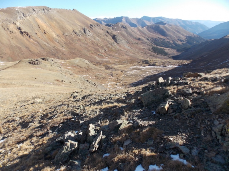
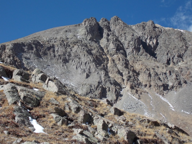
Almost to the saddle.
And finally, a view of the summit block.
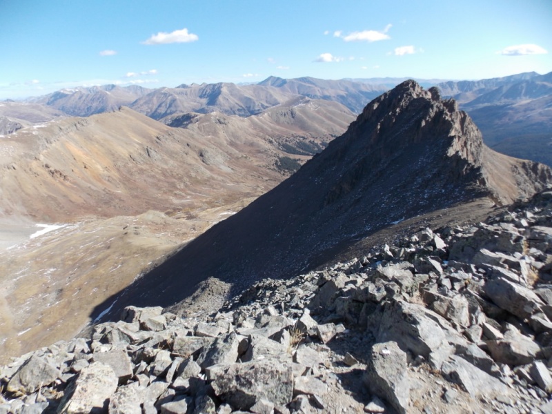
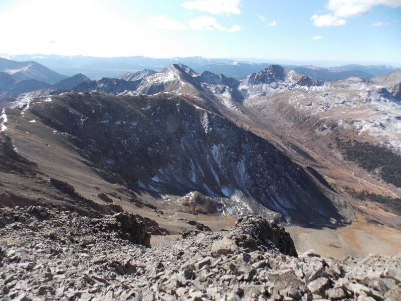
As always, the views from the summit were fantastic
Looking west
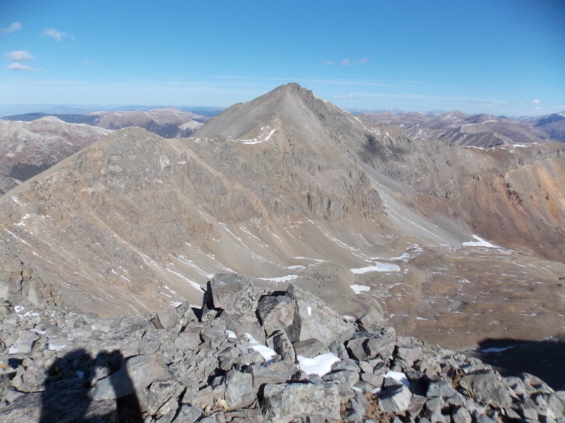
Looking north to Grrizzly
Looking east
Looking southeast
Looking south
The wind was pretty ferocious so I didn't stay long on the summit - just enough time to shoot the pics and vid and then head down. I didn't see the summit register but I really didn't look all that hard. Had I found it, I probably wouldn't have taken it out anyway cuz the wind would have moved it to another peak.
It was good to get off the summit and out of the wind and I took a few photos on the way down.
My route up (and down) is still in the shade.
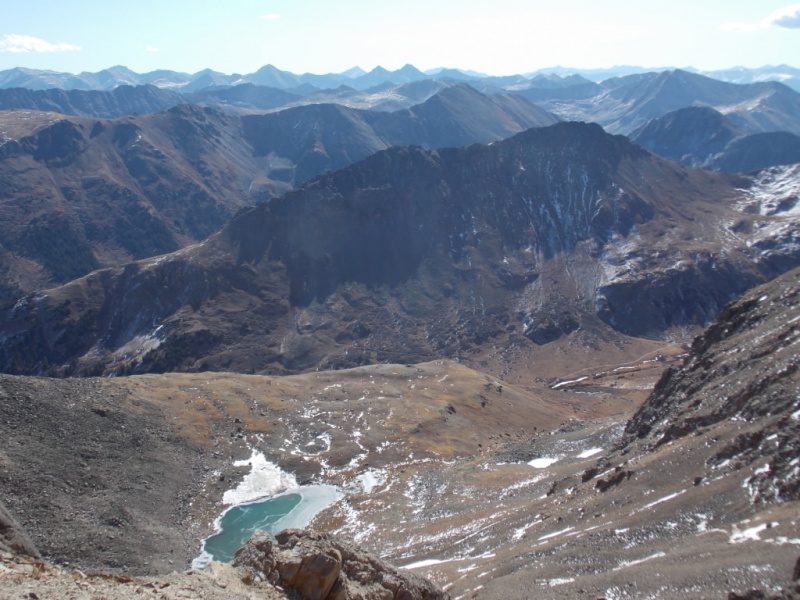
From near the saddle -Henschel Lake that I hadn't noticed on the way up.
Once I got out of the wind, I stopped just below the saddle for a quick bite to eat and took this vid. Note how the wind isn't a factor now.
And a final shot of Garfield.
On the way down, I couldn't help but look at Grizzly - what a beautiful mountain!
Grizz
Thanks for taking the time to read this and please be careful out there!
Thumbnails for uploaded photos (click to open slideshow):
A few martinis on the trail... It couldn't have made it any more difficult. Not sure if it would have helped, though. I'm also interested in the lichen story.
Too bad you didn't look at the trail register. That's, generally, not my thing but I did look at and sign this one. Pretty tough company!
Good to see you back in report mode Jay. Good luck and enjoy!
Odd - I thought most people knew this - at least we were taught that in Boy Scouts - admittedly in the late 1950's - that lichen likes to grow on stable surfaces and if a rock moves a lot, lichen doesn't take a liken to it.
Found this that more or less backs up the 60 year old Boy Scout thought that one should seek out lichen covered rocks when hiking.
[i]Most lichens grow on stable rock surfaces or the bark of old trees, but many others grow on soil and sand. In these latter cases, lichens are often an important part of soil stabilization; indeed, in some desert ecosystems, vascular (higher) plant seeds cannot become established except in places where lichen crusts stabilize the sand and help retain water.
Lichen - Wikipedia
en.wikipedia.org/wiki/Lichen[/i]
I have found the "stick to lichen covered rocks" to usually be valid. Exceptions always exist and the route up the north face of Garfield bore that out.
Anyway, Thanks to both of you for your comments. I appreciate the feedback very much.
I saw that lichen theory posted elsewhere on here earlier this summer and decided to test it out. Thus far, I haven't found the lichen rocks to be any more stable. I'm also not sure how lichen would be able to tell whether a 50 pound rock would shift if I put my weight on in. Perhaps by "stable", they mean the surface isn't likely to deteriorate due to the effects of weathering.
Thanks Jay!
I think the lichen get knocked off of loose rocks as they tumble, but that doesn't necessarily mean the rock is stable for human travel if it has lichen on it. Just that it hasn't rolled yet, or something like that ;)
I had no idea there would be so many and varied opinions about lichen! For me, it always seemed to hold that lichen covered rock was more stable but then I've not done the number of, nor the difficulty of the hikes and climbs that you folks have done. Perhaps we should start a poll.... Or a focus group... Or a government funded study... Or ??? (humor intended! - PLEASE don't take me seriously. Actually, nobody should EVER take me seriously!)
did Garfield the way you describe (with some snow too) and it was loose. Just glad you didn't go after that unranked bump in Pic 17! (I was quite relieved it wasn't ranked or anything). Keep on rockin Jay!
P.s. did in in early October too one year and there already was snow! More like a nuisance than anything.
Like most, I went down what you went up (and down). Real loose crap rock, must have really sucked going up. However, unlike looking for lichen, I look for rocks covered in moss. :lol: Get it! :)
@Natalia - Wow - with snow, too? Yikes! Yeah - that unranked one looks pretty gnarly for sure. And I will try to keep rockin' as loong as I can.
@Dan - LOL!
@Pete - Honestly not that cold - maybe in the high 30's/low 40's. The wind made it seem colder, tho. Sure was nice to gget out of it on the way down. Be well, my friend.
Garfield has one of the worst descents I can remember. Endless, steep, ankle deep scree. At least I had Grizzly Couloir to reduce the suck by half, I can't imagine going up that stuff.
@Matt - Thanks, man. Coming from you, that means a lot!
@Supra - The couloir is a hell of a lot more fun than Garfield for sure! Thanks for your comments - they are spot on.
Caution: The information contained in this report may not be accurate and should not be the only resource used in preparation for your climb. Failure to have the necessary experience, physical conditioning, supplies or equipment can result in injury or death. 14ers.com and the author(s) of this report provide no warranties, either express or implied, that the information provided is accurate or reliable. By using the information provided, you agree to indemnify and hold harmless 14ers.com and the report author(s) with respect to any claims and demands against them, including any attorney fees and expenses. Please read the 14ers.com Safety and Disclaimer pages for more information.
Please respect private property: 14ers.com supports the rights of private landowners to determine how and by whom their land will be used. In Colorado, it is your responsibility to determine if land is private and to obtain the appropriate permission before entering the property.


")
")
")
")
")
")
")
")
")
")
")
")
")
")
")
")
")
")
")
")
")
")
")
")
")
")
")


