| Report Type | Full |
| Peak(s) |
Rinker Peak - 13,789 feet Twin Peaks B Northeast - 13,270 feet Twin Peaks - 13,341 feet |
| Date Posted | 06/01/2020 |
| Date Climbed | 05/31/2020 |
| Author | WildWanderer |
| Ridge Route |
|---|
|
Rinker Peak – 13,783, Twin Peaks B – 13,333 & Twin Peaks Northeast – 13,270 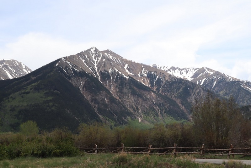 RT Length: 10.5 Miles Elevation Gain: 5471’ Wow, what a difference a couple of months make! I’d attempted Rinker Peak back in January but didn’t get very far. Today there was no snow on the ground at the Willis Gulch Trailhead and I was easily able to get a parking spot instead of parking on the side of the road. I gathered my gear and was on the trail by 3:30am. The trail begins at the south end of the parking area by crossing a bridge over Lake Creek and turning right. 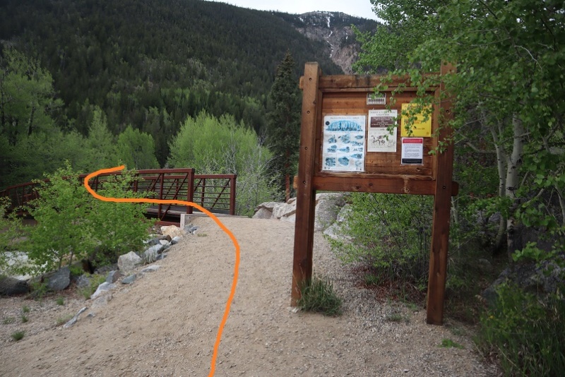 At this sign turn left and follow Trail No 1471 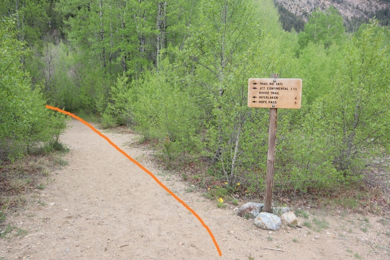 This will lead you through some Beaver Ponds on a nice trail. In the dark of the morning I heard a beaver sized splash about 4 feet away from me, stood in place for a second making noise, and for the next 15 minutes hit my trekking pole on every rock/tree I saw. I’m pretty sure it was a beaver, and the beaver didn’t care. 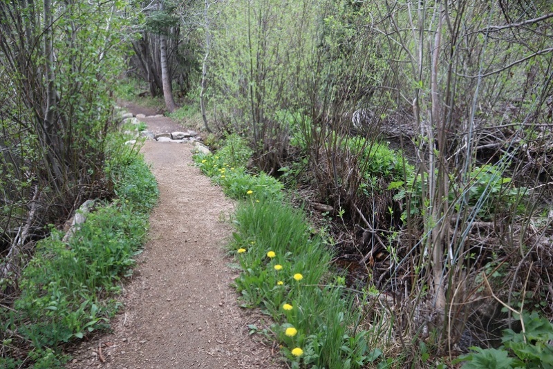 I followed the class 1 trail and stayed right at this junction to stay on Trail No 1471 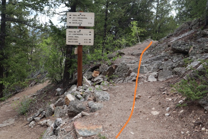 After hiking for 1.3 miles I turned right off the trail and bushwhacked my way up to the top of the slope. And I mean bushwhacked. 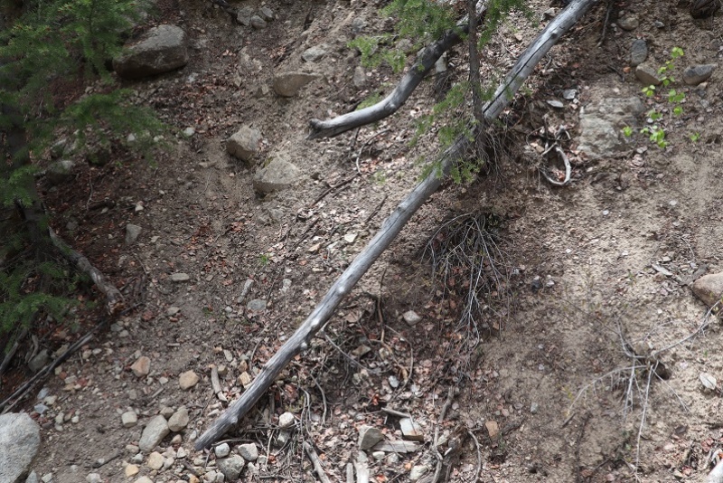 This was harder to do than it sounds, and I’m glad I did it at this time of year (before the bushes have too many leaves). There was a 20% chance of rain here last night and it looked like this section of the mountain got it: The branches and groundcover were wet and slippery and the slope angle just enough to keep me on my toes. There were tons of trails here, but they were all game trails and frequently and abruptly stopped. I just kept heading southwest, doing my best to find the path of least resistance, thinking to myself this ‘wet’ is the reason I could never do a thru hike, as I’d never dry out. Give me snow any day! (Also, I truly do want to do a thru hike…). It was quite an experience running into so many spiderwebs in the dark…  At 9275’ and after about half a mile of hiking off trail I came to the top of this part of the mountain, a kind of ‘ridge under the trees’. I wouldn’t call it a ridge per se, but from here if I would continue heading southwest I would have started losing elevation, so I turned left (south). 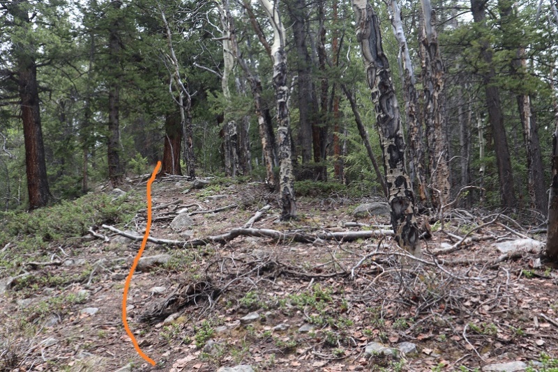 I followed this ridge south and then west as it rounded to treeline. There wasn’t a trail and I only saw 1 cairn all day (on the ridge) 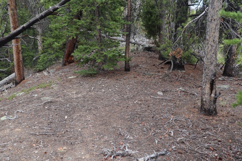 I came to an area with a lot of downed trees (which was fun to navigate at night, easy during the day) 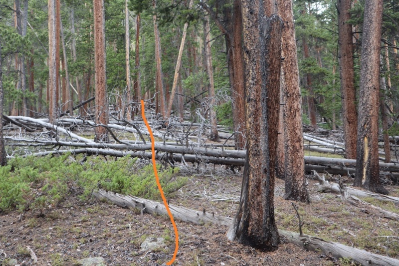 And headed straight up the mountain to treeline, passing through pine trees, dense aspens, and some loose rock piles 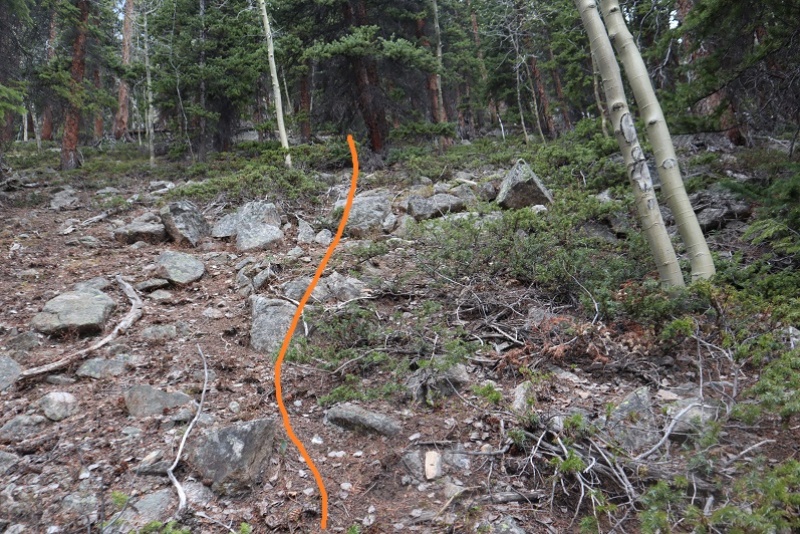 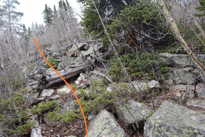 The rocks were large but many were loose. Be careful of your footing here: I don’t think any rocks will tumble down, but they will roll out from under you. 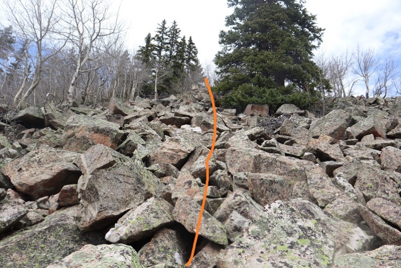 This brought me to treeline, where I found what looked like maybe an old structure (or windbreak) covered in snow so I couldn’t really tell. There were also rusted cans scattered all over and an old coffee pot. That means there had to be a better trail to get to this point than the one I’d taken, as it was obvious this area was once used more frequently. 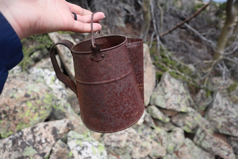 This was basically treeline, but there was just enough snow that I skirted it for a bit to make it to the ridge. 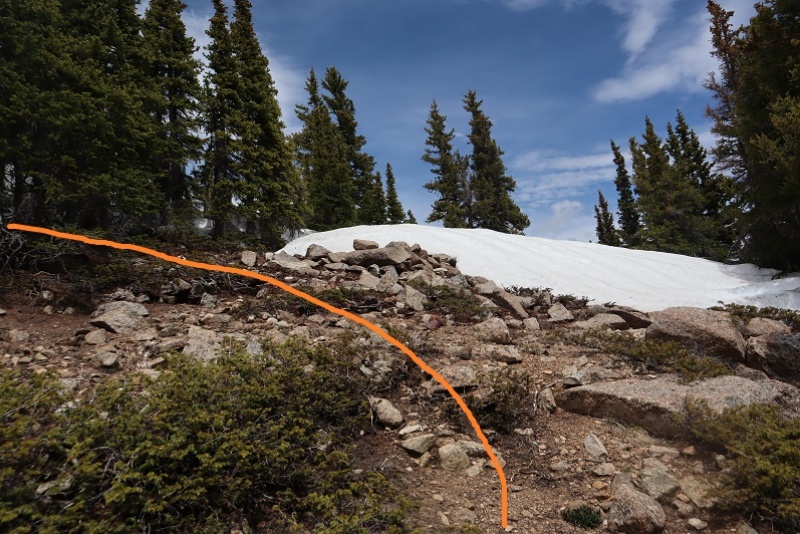 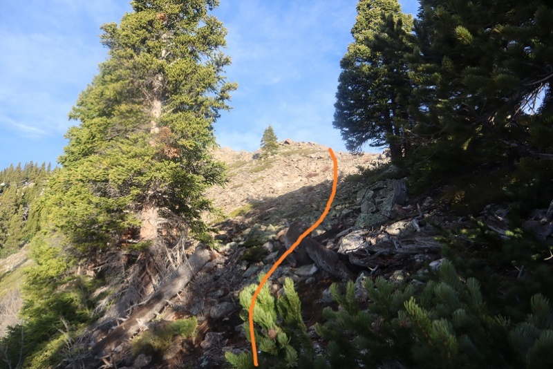 The ridge is straightforward. I thought the top would be Twin Peaks Northeast (it’s not). 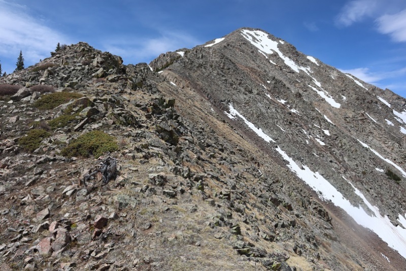 There are a couple of goat trails on the left side of the ridge, and one area where I had to dip down to the right to avoid a gully 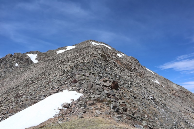 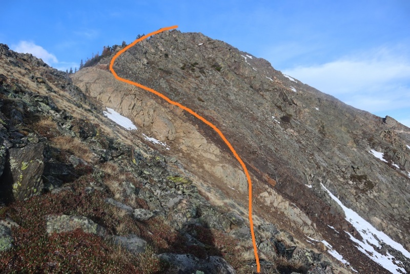 There’s a cairn at the top. I reached the ridge after 3.75 miles of hiking 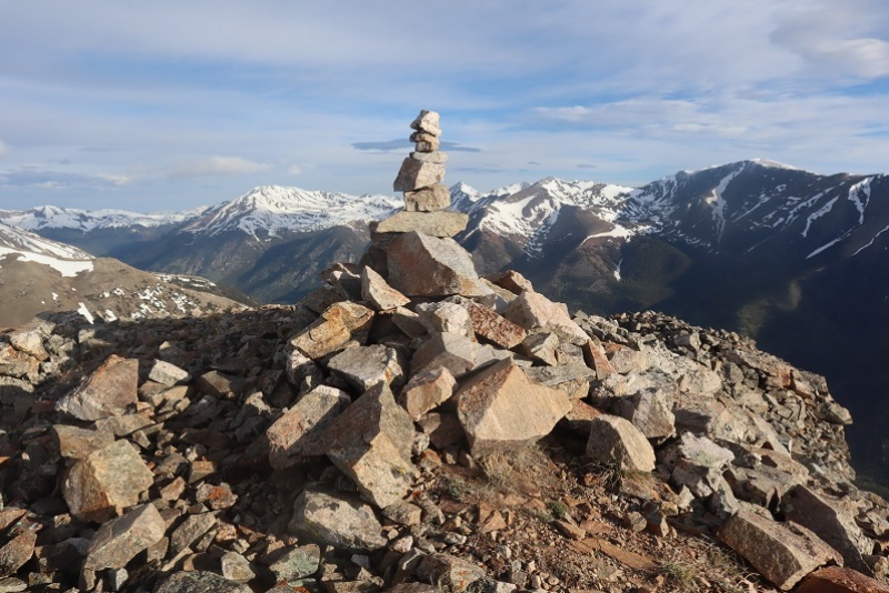 And from the top of the ridge you can see Twin Peaks Northeast 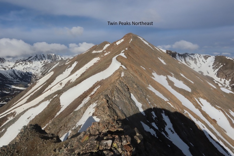 From here there are a lot of ups and downs to the rest of this hike. This is a class 2 ridge, and nothing too difficult presents itself. I went right here 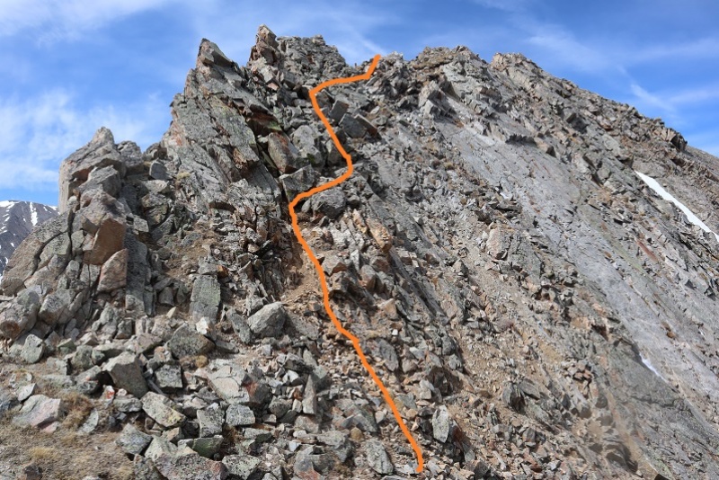 But mostly just followed the ridge. I made it to the top of Twin Peaks Northeast at 7:38am, after 4 miles of hiking. It was windy and thus cold, and here I put on my outer layer and balaclava and extra gloves. I got selfies here and at the next peak but I’ll spare you those and just let you see the videos, as these are unranked peaks. 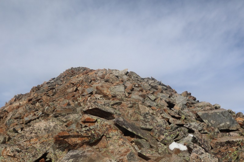 Twin Peaks Northeast: A storm was coming in, or at least it looked like clouds were rapidly forming, so I had to make a decision: Should I continue along the ridge or turn back? In the end I decided to continue to Twin Peaks and make the decision at that point. This is a long ridge, and requires commitment on the weathers part. I continued southwest along the ridge to Twin Peaks. The hardest part of this ridge was over and it was a simple trek (or it would have been simple without all that wind!!!). I made it to Twin Peaks B at 7:50am after 4.5 miles of hiking. Twin Peaks B:
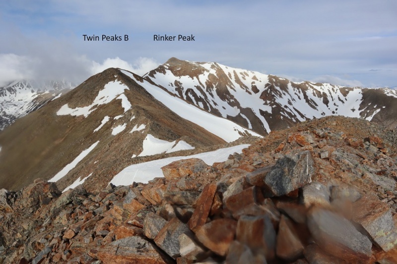 The weather seemed to be holding so I headed over to Rinker Peak. This was an easy class 2 ridge hike to the saddle 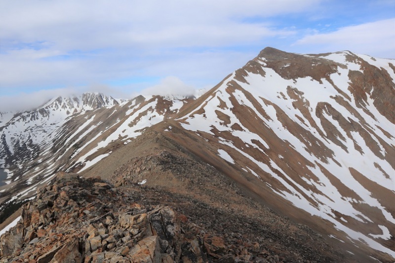 Here’s the route I took up to the summit of Rinker. Snow was (mostly) avoidable, and while I did some minor postholing, no traction was needed 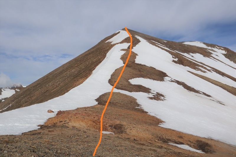 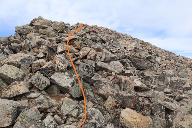 There was a tripod at the top, so if you brought up a tarp and rope you could have a nice shelter from the wind. I summited at 8:50am, glad I’d decided to continue this hike. It was 5.35 miles to this point and the weather was great.  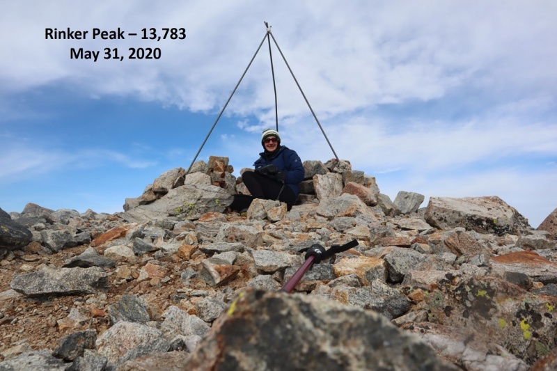 Rinker Peak:
Here’s looking at the route to this point 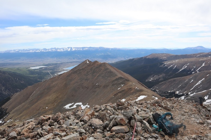 And the route back along the ridge (there are goat trails in areas to follow here) 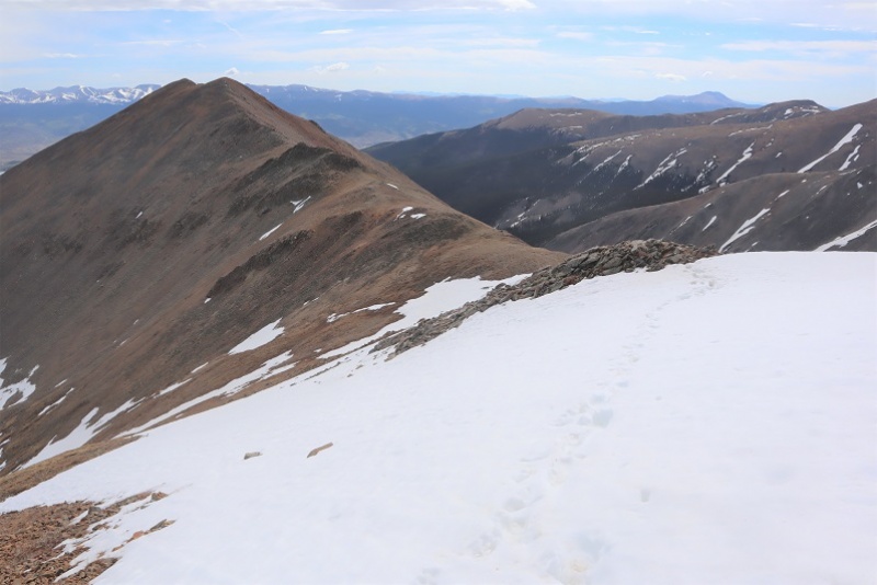 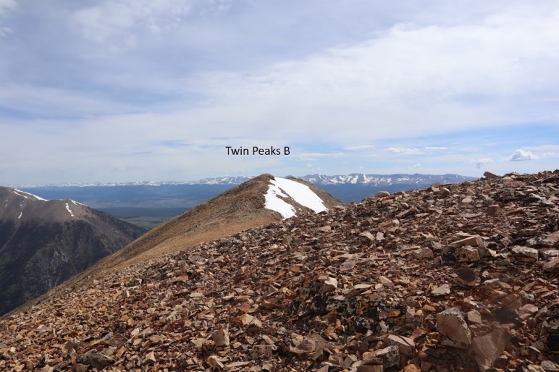 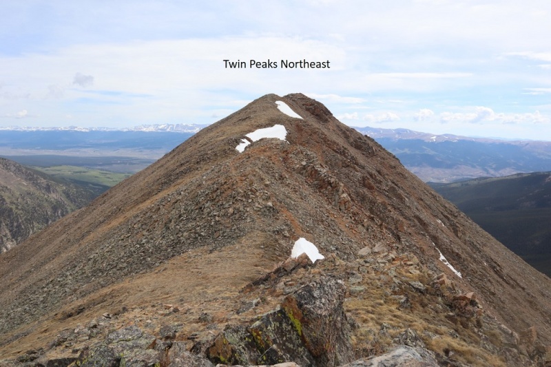 As on the way in, the only really tricky section (if you want to call it that) is between Twin Peaks Northeast and the point on the ridge to head back down 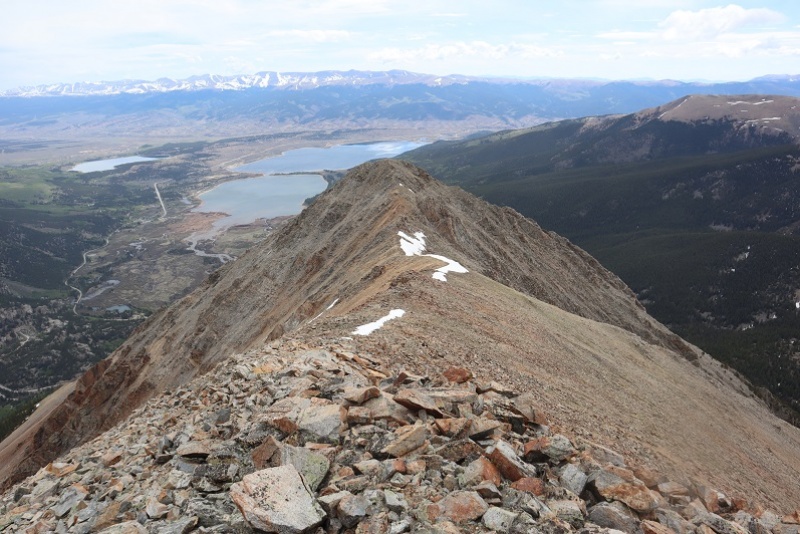 Go right around this rock 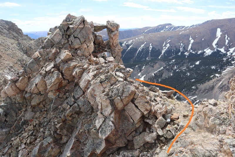 Left here (just before the saddle) 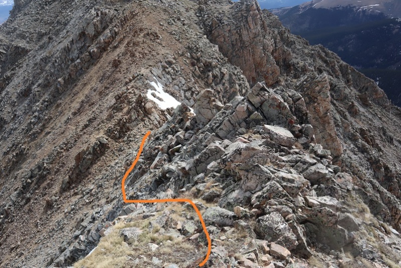 And this is the route to the top 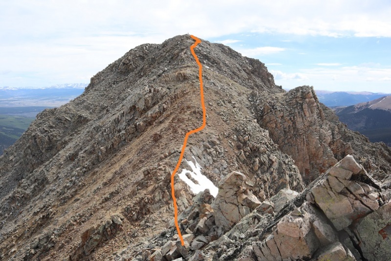 Be careful of loose rock here 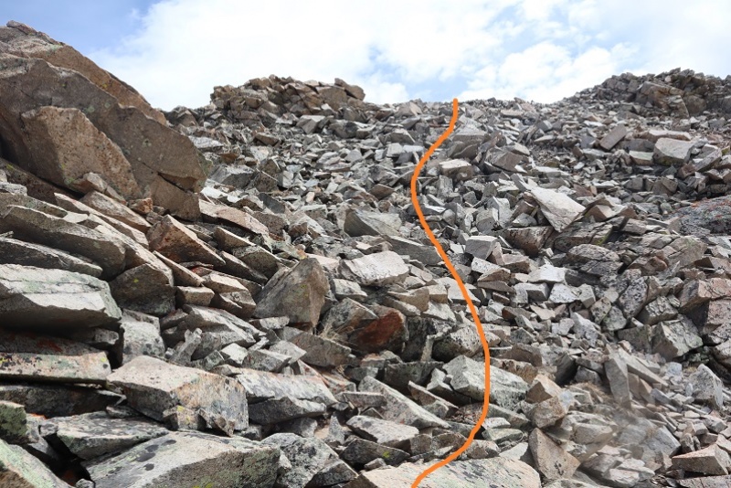 This will bring you back to the cairn  Just follow the ridge back to treeline 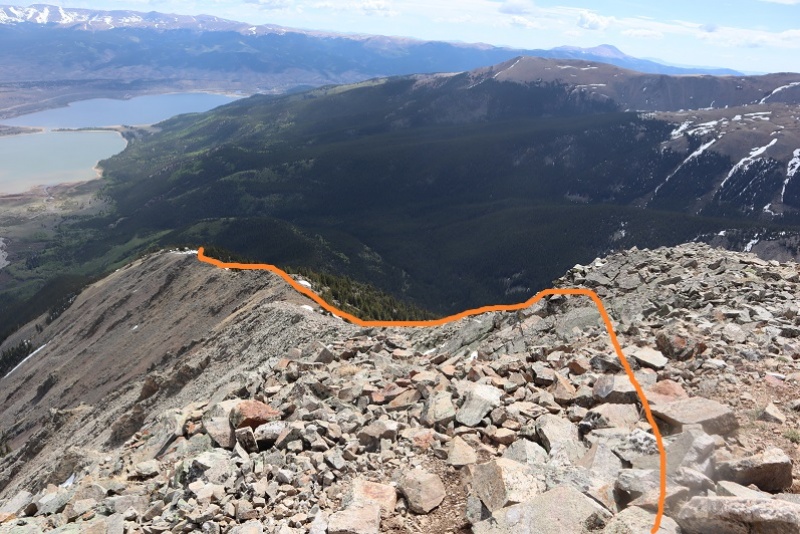 And back through the rocks, aspens, and pine trees 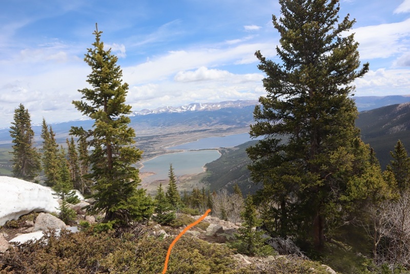 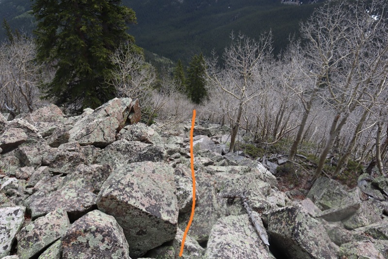 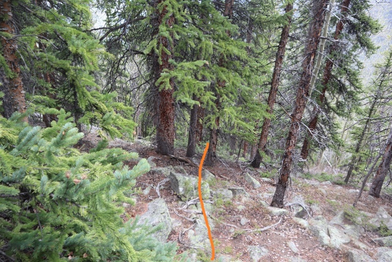 That will lead you to the ridge to follow below treeline 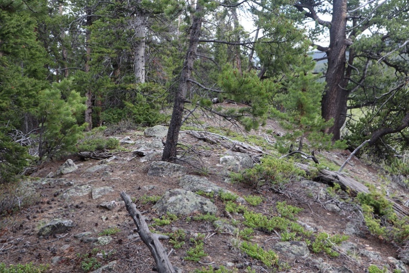 And eventually back to the trail 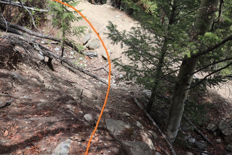 I passed the beaver pond in daylight (I didn’t see any beavers) 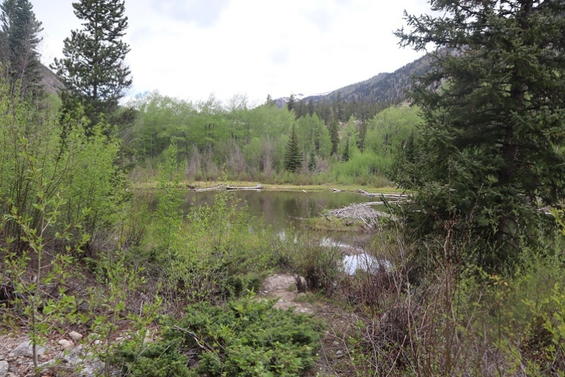 And crossed Lake Creek. It had more raging water than I’ve ever seen there before but to be fair, I’m usually in this area in winter and it’s mostly frozen. 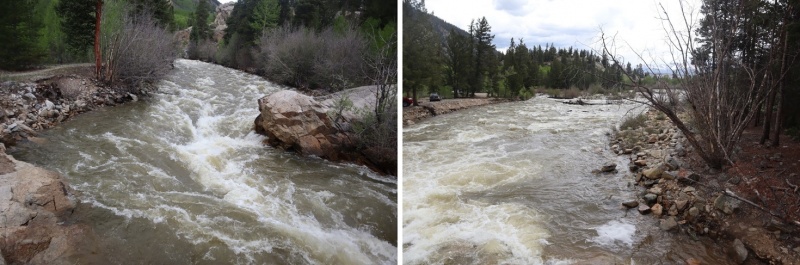 I made it back to my truck at 1:30pm, making this a 10.5 mile hike with 5471’ of elevation gain in 10 hours. I didn’t see another person all day, even when I was on the class 1 trail. It started raining as I left the parking lot. Here’s the route to the ridge as seen from Twin Lakes 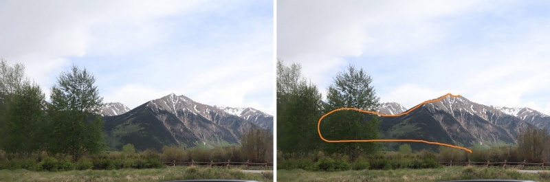 And my topo 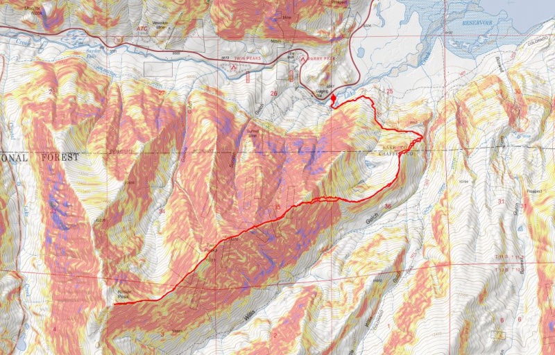 Thumbnails for uploaded photos (click to open slideshow): ")
")
")
")
")
")
")
")
")
")
")
")
")
")
")
")
")
")
")
")
")
")
")
")
")
")
")
")
")
")
")
")
")
")
")
")
")
")
")
")
")
")
")
")
")
")
")
")
")
|
| Comments or Questions |
|---|
|
|
Caution: The information contained in this report may not be accurate and should not be the only resource used in preparation for your climb. Failure to have the necessary experience, physical conditioning, supplies or equipment can result in injury or death. 14ers.com and the author(s) of this report provide no warranties, either express or implied, that the information provided is accurate or reliable. By using the information provided, you agree to indemnify and hold harmless 14ers.com and the report author(s) with respect to any claims and demands against them, including any attorney fees and expenses. Please read the 14ers.com Safety and Disclaimer pages for more information.
Please respect private property: 14ers.com supports the rights of private landowners to determine how and by whom their land will be used. In Colorado, it is your responsibility to determine if land is private and to obtain the appropriate permission before entering the property.

