Download Agreement, Release, and Acknowledgement of Risk:
You (the person requesting this file download) fully understand mountain climbing ("Activity") involves risks and dangers of serious bodily injury, including permanent disability, paralysis, and death ("Risks") and you fully accept and assume all such risks and all responsibility for losses, costs, and damages you incur as a result of your participation in this Activity.
You acknowledge that information in the file you have chosen to download may not be accurate and may contain errors. You agree to assume all risks when using this information and agree to release and discharge 14ers.com, 14ers Inc. and the author(s) of such information (collectively, the "Released Parties").
You hereby discharge the Released Parties from all damages, actions, claims and liabilities of any nature, specifically including, but not limited to, damages, actions, claims and liabilities arising from or related to the negligence of the Released Parties. You further agree to indemnify, hold harmless and defend 14ers.com, 14ers Inc. and each of the other Released Parties from and against any loss, damage, liability and expense, including costs and attorney fees, incurred by 14ers.com, 14ers Inc. or any of the other Released Parties as a result of you using information provided on the 14ers.com or 14ers Inc. websites.
You have read this agreement, fully understand its terms and intend it to be a complete and unconditional release of all liability to the greatest extent allowed by law and agree that if any portion of this agreement is held to be invalid the balance, notwithstanding, shall continue in full force and effect.
By clicking "OK" you agree to these terms. If you DO NOT agree, click "Cancel"...
After researching several other trip reports and not being satisfied with any the routes described I decided to use the data available to create a new, hopefully better route which others might find useful.
Milage: ~9mi RT (not counting my 1 mile accidental addition, which I deleted from the GPX tracks)
Gain: ~4,850ft according to GPS
Time: Just under 8hrs at a mostly relaxed pace (includes 30 minutes lost due to Robeson blunder). Averaged moving speed 1.5mph
Benefits of this route include:
Entirely avoids the ugly gullies others have described having to choose between
Avoids any backtracking (as many have done to tag Engelmann)
Avoids adding at 12k peak (Woods) at the end of the day (so you don't have to create a listofjohn account to track it...)
Actually manages to avoid any willow bashing despite dropping into a willow infested valley
I've almost gathered enough data with this hike to considering adding a route for this peak group (somewhat surprising no one has done that yet...) but I think there might be room for a slight bit of refining before trying to standardize this.
Included in this report will be:
Listing with links and brief overview statements of several other trip reports that were especially useful in studying this route
Description of how I veered off the (closed) 4WD road before the gullies that most other TR's describe
Mention of the ACTUAL TRAILS getting you up portions of Engelmann (not all the way)
A warning not to dismiss Robeson as some irrelevant little hump that you can bypass...
A description of how to descend the Parnassus-Woods saddle for a willow-free trek to a defined trail
In keeping with my usual style, I'll put large bolded section headers to allow beta seekers to more quickly scroll through and extract data of interest.
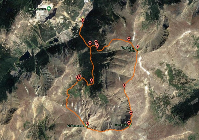
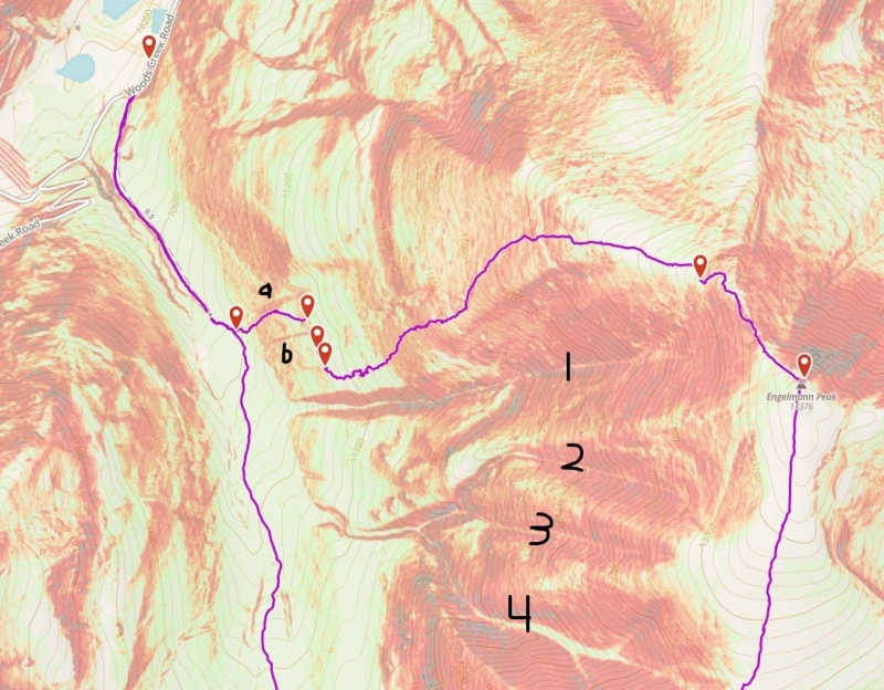
Snapshot of my GPX tracks with satellite view turned on.
Research Phase: Other Useful Trip Reports
Sometimes I do very little research on routes - just find the trailhead, see if it's class 2 or 3 or whatever and go. But for this one, in part due to the lack of a standard route, I did some extra reading.
There are plenty of other good trip reports out there but I'll highlight those which were especially useful in determining how to approach this loop.
Boggy B has the earliest TR (Dec 2010) with GPX tracks included (Ruby Creek Winter 13er Fun) and the earliest one showing all 4 peaks (plus Woods). This was with the loop being done backwards of what most people seem to do. The descent path down Engelmann helped inspired my ascent route.
awake has an Aug 2014 TR (Close by 13er Trio) which only covered 3 of the peaks but gave some good baseline beta including a snapshot of the route used up the 3rd gully.
rajz06 did a Sept 2015 TR (Bard Quintuplet) with all four 13ers plus Woods and included a GPX file showing an ascent up the 4th gully with lots of painful backtracking and an even more painful Woods direct descent.
goldenite did a Aug 2017 TR (Ruby Creek Quintuplet) with the helpful beta that there's now a small established trailhead with legal parking. Went up rib between gullies 2 and 3 (with the typical painful backtrack).
Most everyone seems to do Engelmann first and picks one of the ugly, loose gullies to fight up. Since I saw that Boggy B safely descended the West Slopes of Engelmann in December 2010 I figured it was safe to try an ascent of those same slopes. A couple of the reports referenced the fact that they thought it might be viable to descend the Parnassus-Woods saddle if desired. I did some satellite research that initially made me groan at the characteristic shading of willow territory but then made me optimistic there might be a way to avoid them...
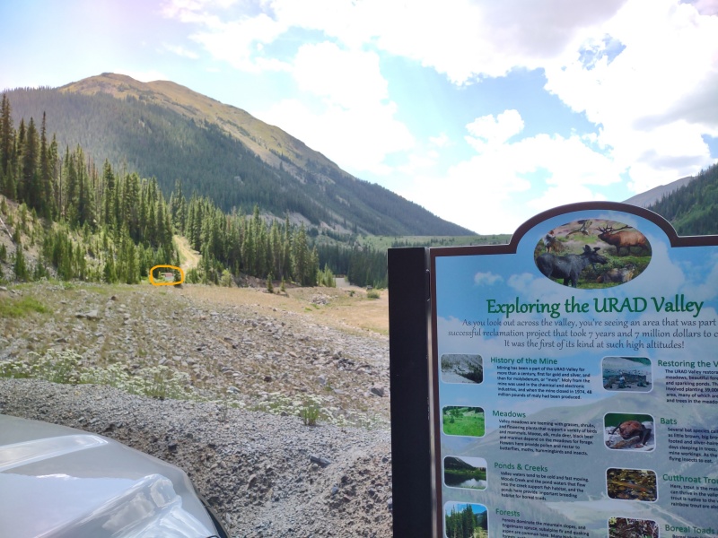
Ruby Gulch Trailhead
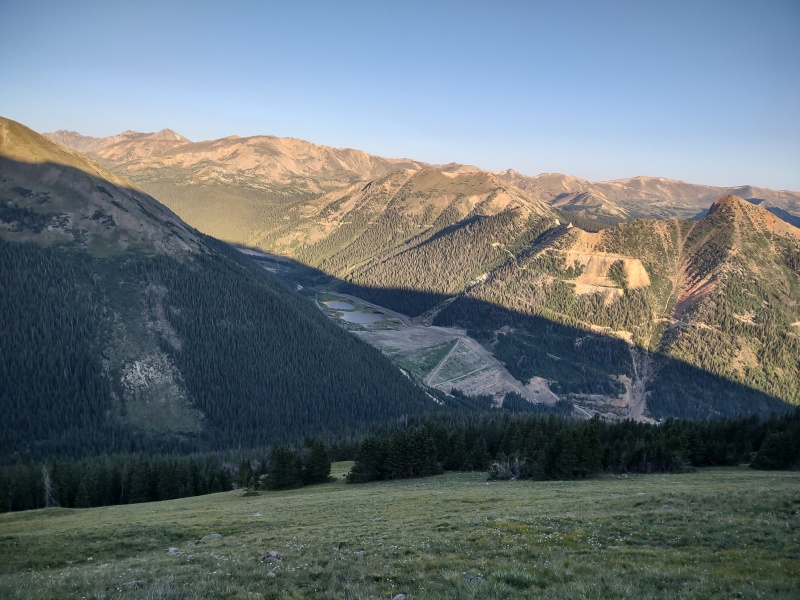
First off, most reports show the "DANGER: Extreme Avalanche Danger" sign at the start of the trail and how there's a sign a ways before that which says no parking for the next 3 miles. But as goldenite reported, there is now an established trailhead just slightly before the avalanche sign which has a large sign titled: "Exploring the URAD Valley."
Since they spent 7 million dollars on their reclamation project it seems clear they intend for people to come enjoy it...
That trailhead can comfortably hold half a dozen cars - perhaps a few more if people park carefully.
The avalanche sign marking the start of the trail circled in the distance.Standing just up the trail behind the avalanche sign looking at the small trailhead parking lot.
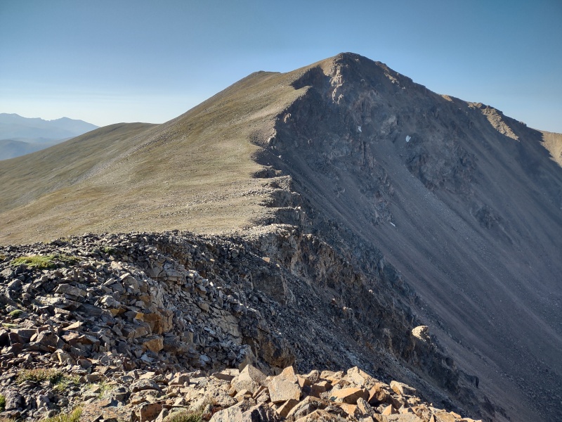
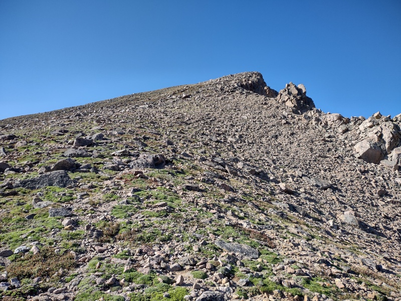
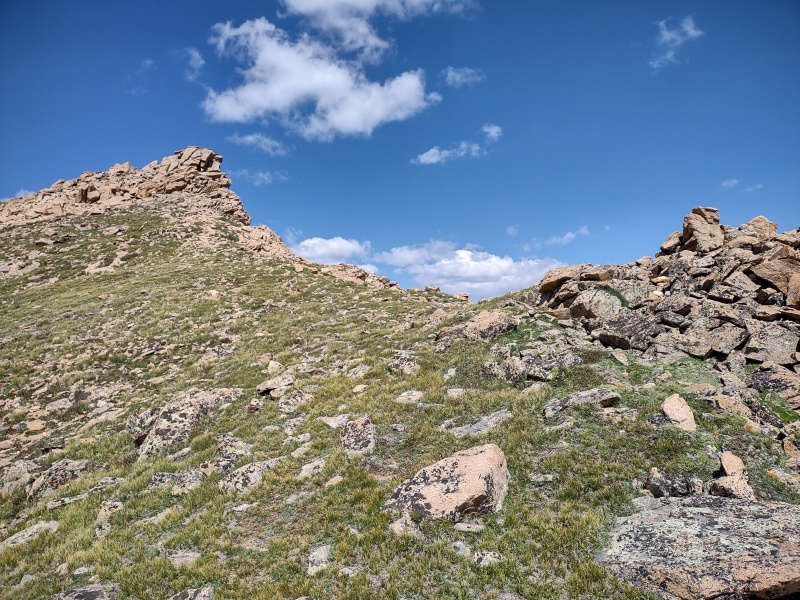
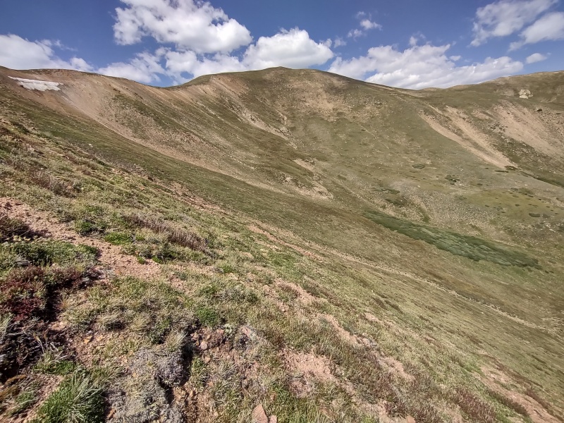
Engelmann West Slopes Ascent.
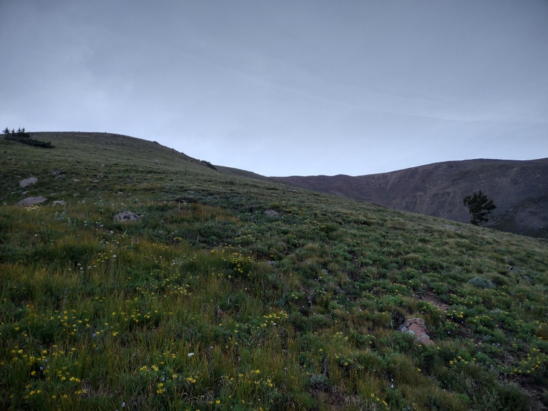
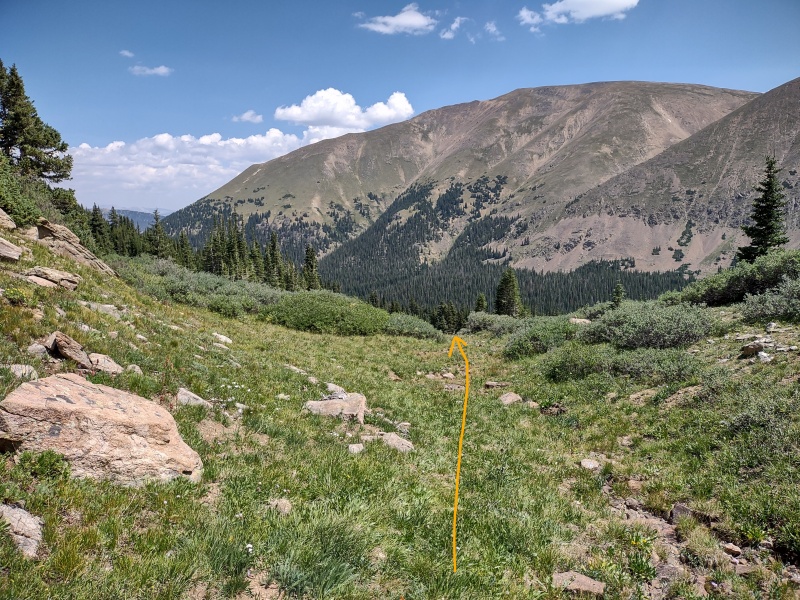
So, as stated earlier, I didn't want to mess with going up the gullies the other trip reports described. Instead I decided to take my chances with a bushwhack through the woods up the West Slopes of Engelmann. I thought it worked out pretty well.
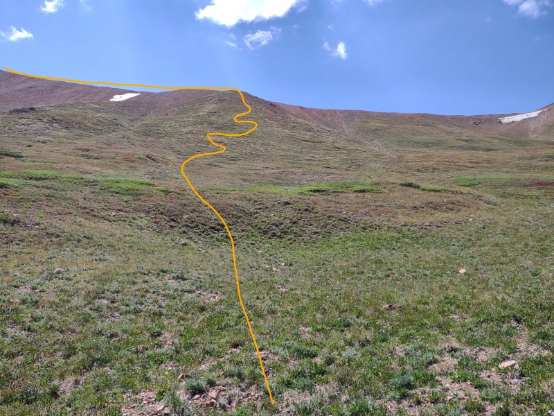
I noticed a couple little drainage gullies before you get to the 4 main gullies coming off of Engelmann. My original plan was to go up one of those little drainage gullies (labeled a and b in the snapshot below) but I actually ended up coming up between them and then hitting a faint trail that I followed horizontally along the slope until it started to descend so I curved upwards to try to meet the tracks Boggy B had uploaded.
My route went up between the 2 small drainages (a and b) before the 4 main gullies that other TRs have mentioned.
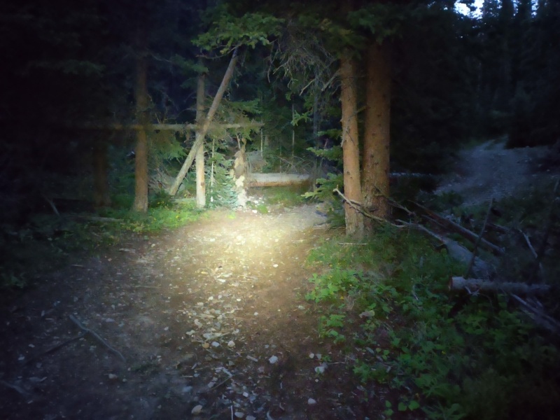
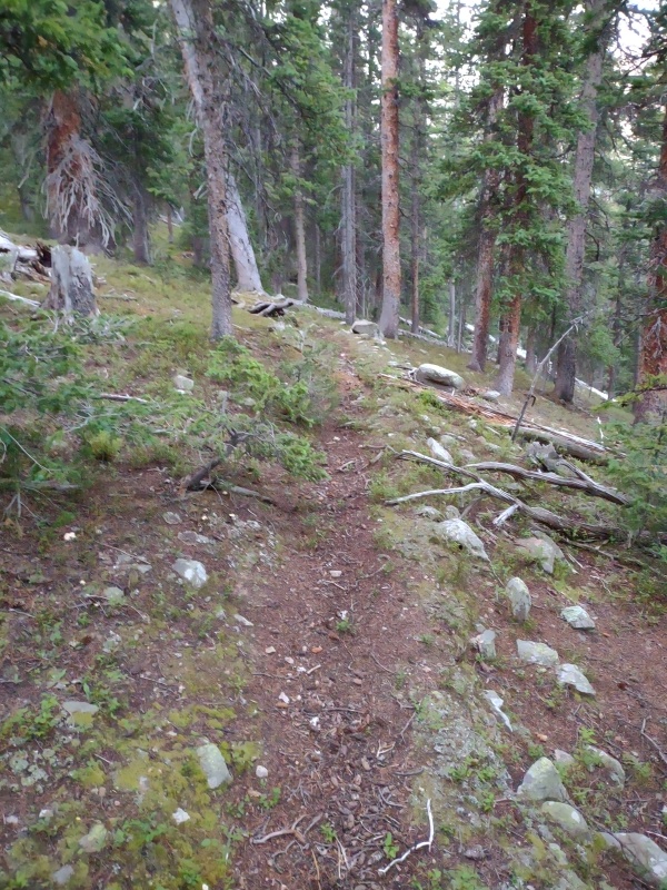
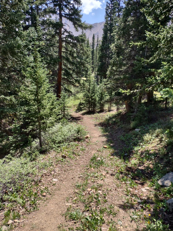
Other than the slope angle shading highlighting the a and b drainages, there wasn't really anything else to make this stand out as a location to turn to go uphill. There is a slight wiggle in the road where I turned off, as shown in the photo below. I looked for the best opening in the trees and went at it...
The trail wiggles off to the right but I cut left into a small break in the trees.
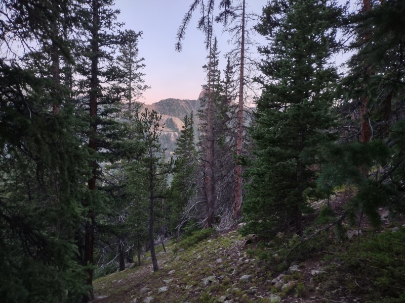
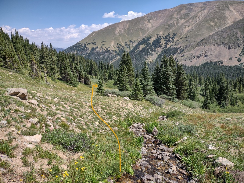
I was concerned about how much bushwhacking I might have to do to get up above treeline but it turned out, with a little winding and weaving to avoid downed trees, patches of thick foliage and such, I made it with very easily without really any actual "bushwhacking" per se.
I even found a faint little remnant of a trail (marked by the waypoints a couple photos up) before having to leave it as it began to descend when I needed to go up.
This is one area where perhaps a future hiker can refine this route up the West Slopes a little more...
It was steep and wooded but not too steep or too wooded.Had a faint horizontal trail to follow across the slope for a while.
It's worth noting that this does get pretty steep at parts but never quite reaches the classification of the so-called "class 3 grass." I much prefer steep but stable ground like this over loose junk in gullies.
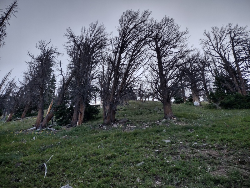
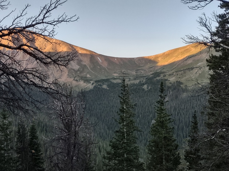
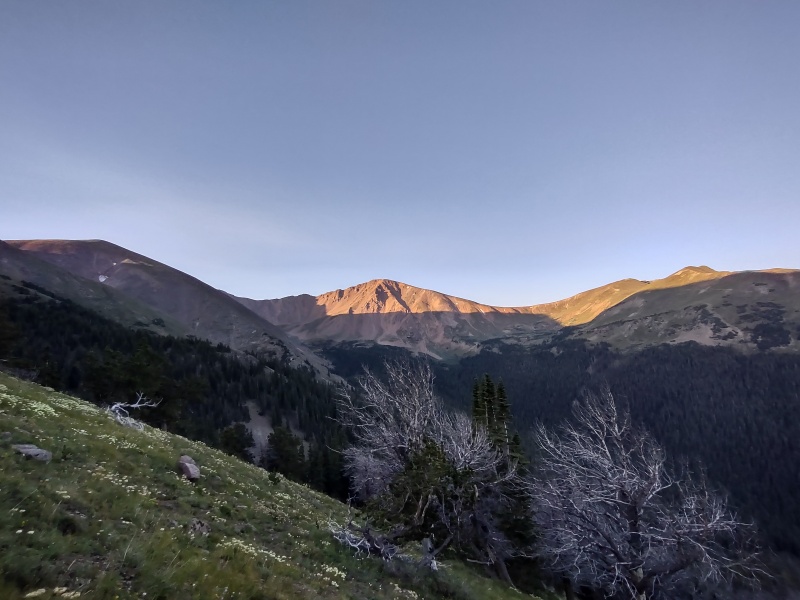
Nearing the top of one the steeper sections.An early look over at the Parnassus-Woods saddle - I descended between the 2 smaller dots of snow in the middle.An example of the steep but scenic trek up.There's a section past most of the trees where there's still plenty of grass.
One example of what inspired the extreme avalanche danger sign at the trailhead is the major avy path you can see coming off NE lopes of Woods Mountain (see photo below). Winter hikers take note!!!
Looking back towards the trailhead below Red Mountain (right side) and the avy path coming off Woods (left side).Gentle tundra going up the West Slopes of Englemann.
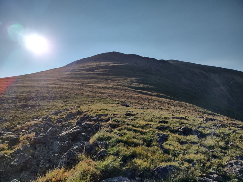
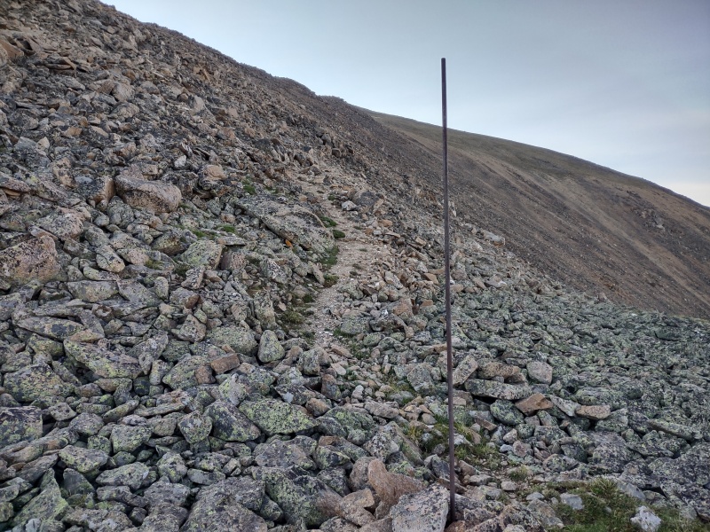
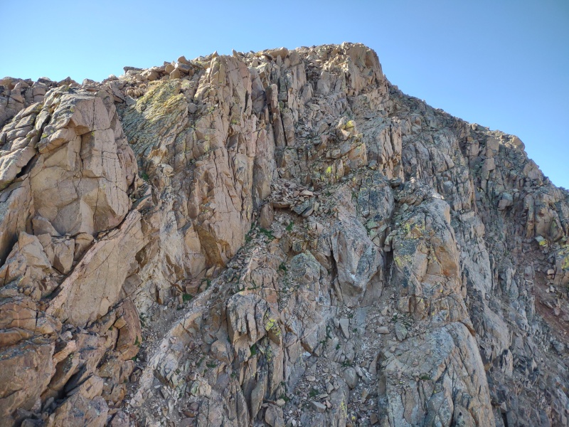
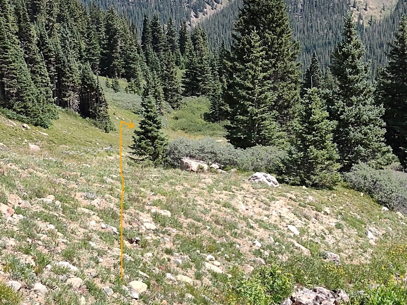
At around 12,900ft or so, as I was about to start scrambling up loose rock, a large wooden post caught my eye. When I went to investigate I was pleased to find a well established, cairned trail! I followed it most of the way up to the summit of Engelmann though it faded near the top.
This wood post caught my eye. Also note Torreys just to the left - don't mistake this for one of the peaks you're after!Start of the defined trail.Rocky route up Engelmann West Slopes.Coming up to the summit of Engelmann.Looking back on the route up Engelmann West Slopes.
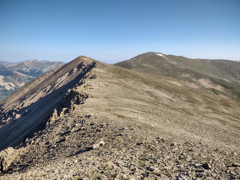
Onward to... Robeson??
Getting the other three 13ers from here is pretty much a straightforward ridge stroll but I'll add a couple quick cautions:
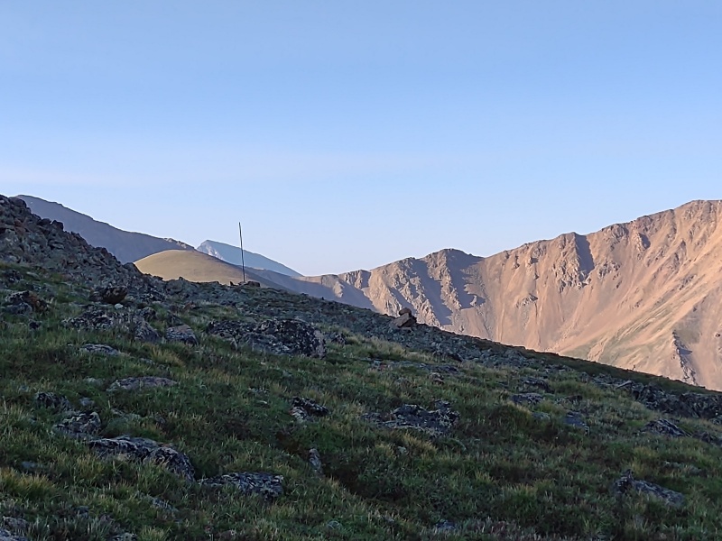
1) Take note that there's a ridge going off to the east from Engelmann - super obvious that it's not the right way to go but I could maybe see someone getting misled in inclement weather...
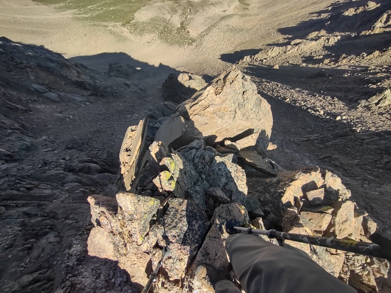
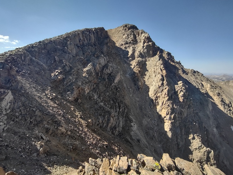
2) Don't make the mistake I did of dismissing Robeson as an irrelevant little hump on the ridge that you can bypass (even poor lowly Cameron is more impressive than this bump).
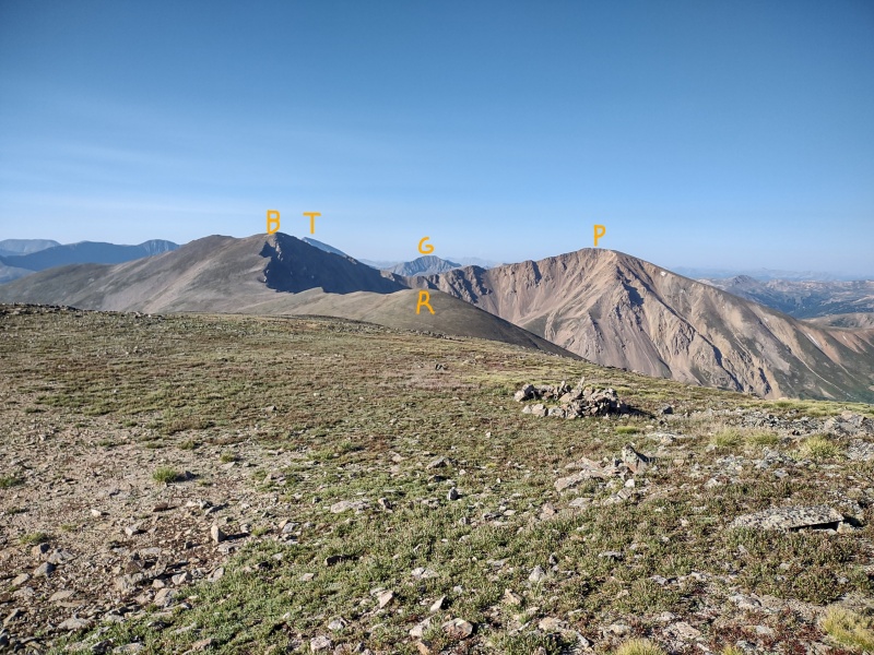
It was with great agony that I backtracked half a mile after realizing my blunder (I edited my GPX tracks to delete that blunder and show the route I should have taken). I think part of what threw me off was that a lot of the other trip reports either didn't hardly put in anything about walking between the peaks, or I just glanced over it so I didn't know what to look for. As a result, with Torreys hiding behind Bard (and from that angel looking much closer than it is) I was fooled into thinking that Robeson was the next prominent peak with Bard lurking behind it (a more careful look would have clued me in on my error).
Be sure to note where Robeson, Bard and Parnassus are and don't be fooled by Torreys and Grizzly in the background.
I was already at ~13,100ft up the side of Bard when I turned and looked back and noticed a hump that looked much more significant from this angel. My GAIA app doesn't mark the summits of any of these peaks and I had neglected to drop waypoints on them beforehand with the coordinates on this site. So I took my phone out of airplane mode, glad that I could get a signal to load to bring up the 13ers peaks on my 14ers.com app and to my horror I realized that I had strolled right past Robeson!
Anybody in the region that day likely heard my agonized groaning as I realized I now had to backtrack to avoid orphaning this puny little punk of a peak. But in my passion for revenge I flew back along the ridge, tagged the peak (including the little rock pile at the far end past the summit, just to be sure...) and was back to where I had left off in just over half an hour
Looking back in agony to realize I had skipped past Robeson and now had to backtrack.Almost up the annoying little Robeson.
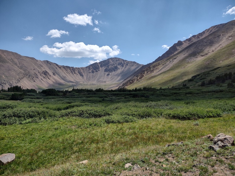
Robeson did at least offer some good views of the valley below to help me continue to plot my eventual descent.
Approximate descent route from Parnassus-Woods saddle up until I hit the main trail.
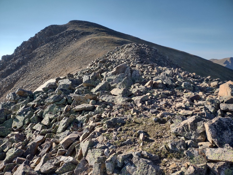
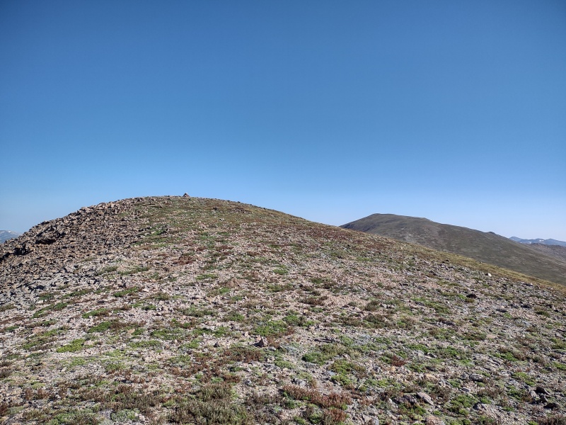
Onward towards Bard (again)
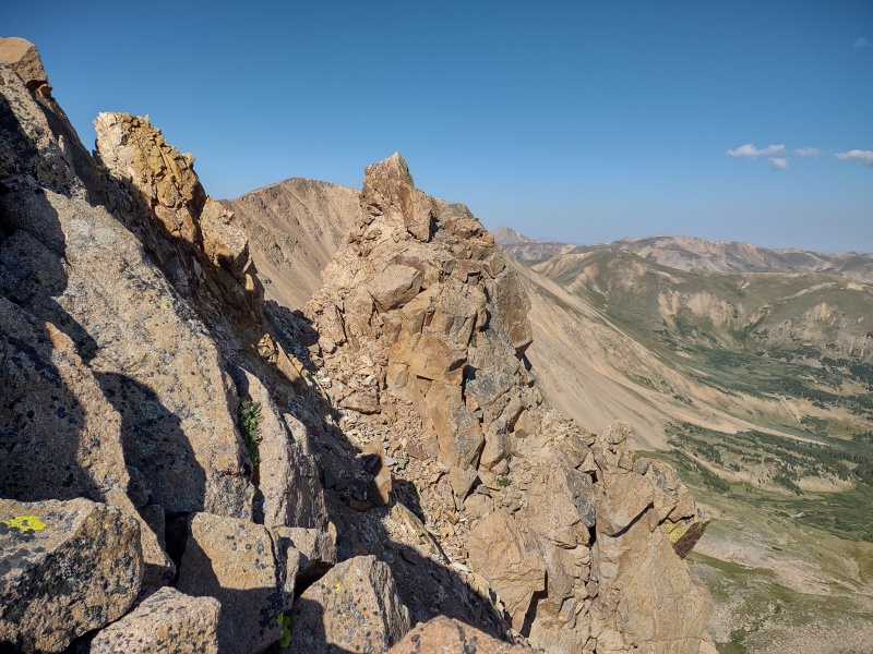
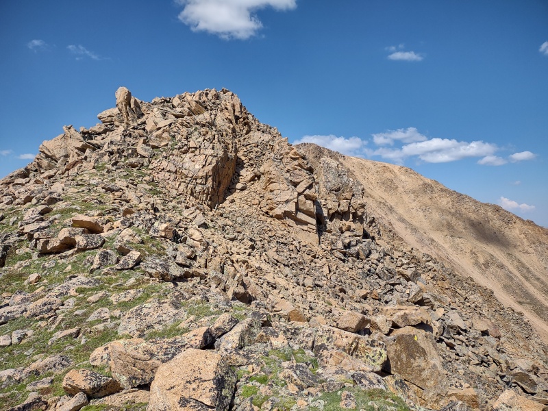
Going up Bard is pretty obvious - just stick to the ridge.
The view approaching Bard - winter note: there's some borderline avy terrain to the left - just stay on the ridge to stay out of trouble.The ridge up to Bard is chunky enough to reduce winter dangers while not adding too much hassle in summer.
Despite my inadvertent detour to go back for Robeson, I couldn't resist an additional tiny little detour for this dramatic little rock pile just off the trail that I dubbed "Bard Spire." It's sloppy, loose class 2.5 - 3 to get over to this little pile of rocks but it provides some pretty cool views!
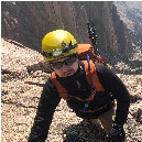
Bard Spire - my perhaps over-glorified name for this little feature. View of cliffs next to Bard Spire.Me on Bard Spire soaking in the exposure.View of Bard's dramatic NW face.
After that fun little detour (much more enjoyable than the backtrack to Robeson) I slogged on up to the summit of Bard.
Coming up on the summit of Bard.
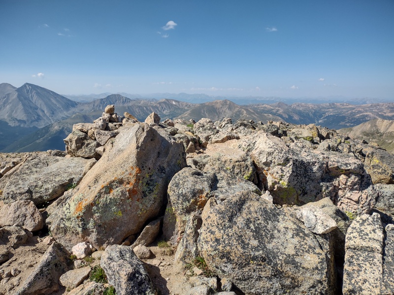
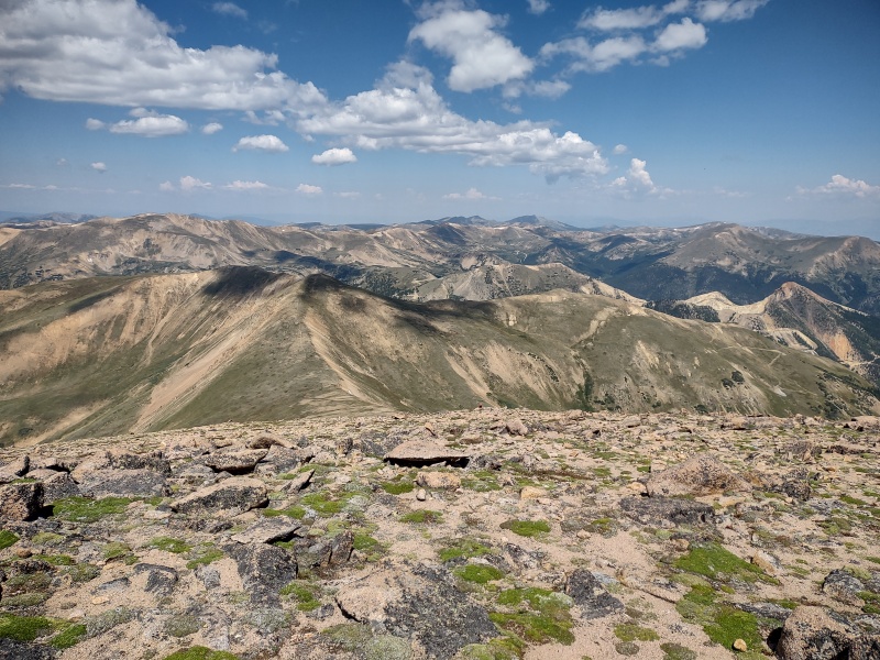
From the summit of Bard there are some cool views of some well known 14ers...
View of Grays and Torreys from Bard.View of the Sawtooth from Bard.
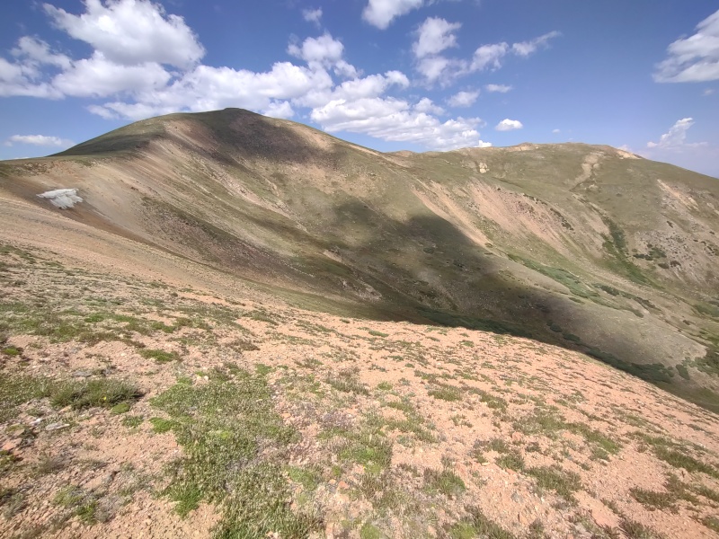
On to Parnassus
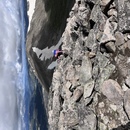
From Bard to Parnassus the route finally starts to get a little more personality moving into more of a class 2.5 type terrain or perhaps a little bit of class 3 depending on how you pick your line.
Nothing difficult or exposed or anything - just a little more visually interesting than a flat slope up a hill.
Some of the personality seen on the way to Parnassus.You can often choose to bypass or engage the more scrambly parts.
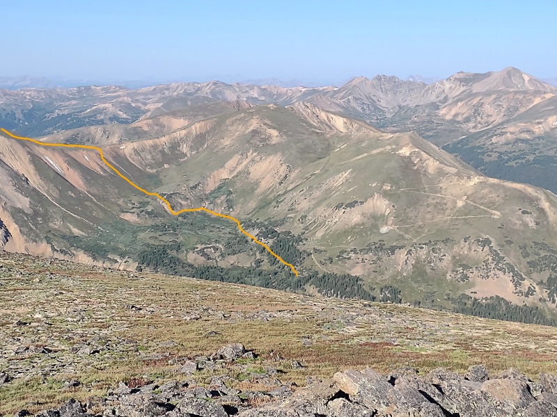
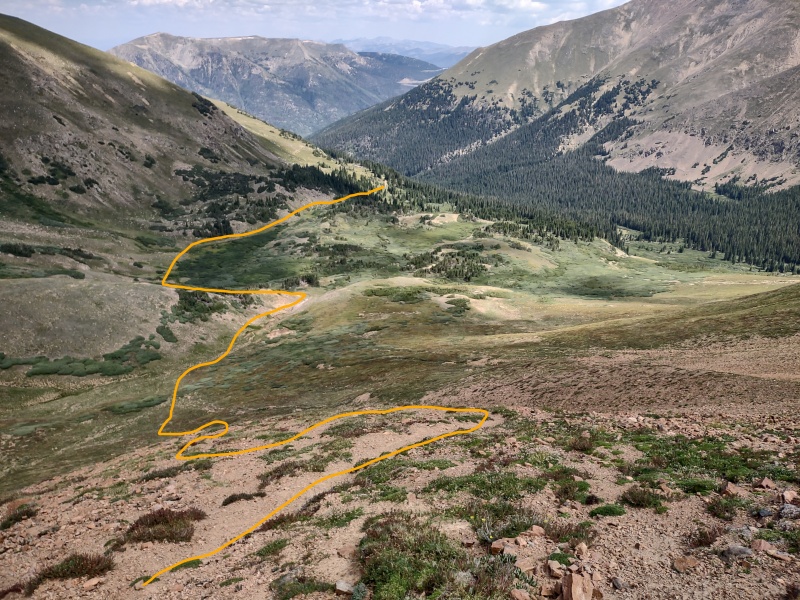
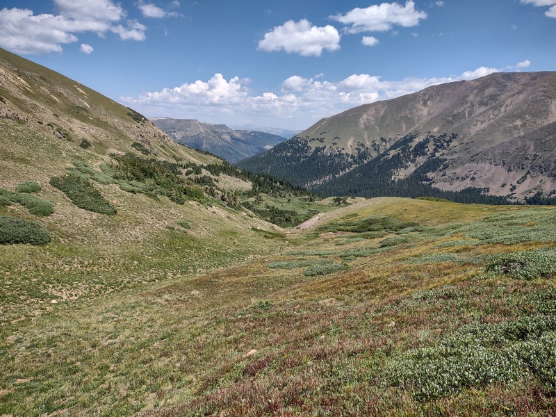
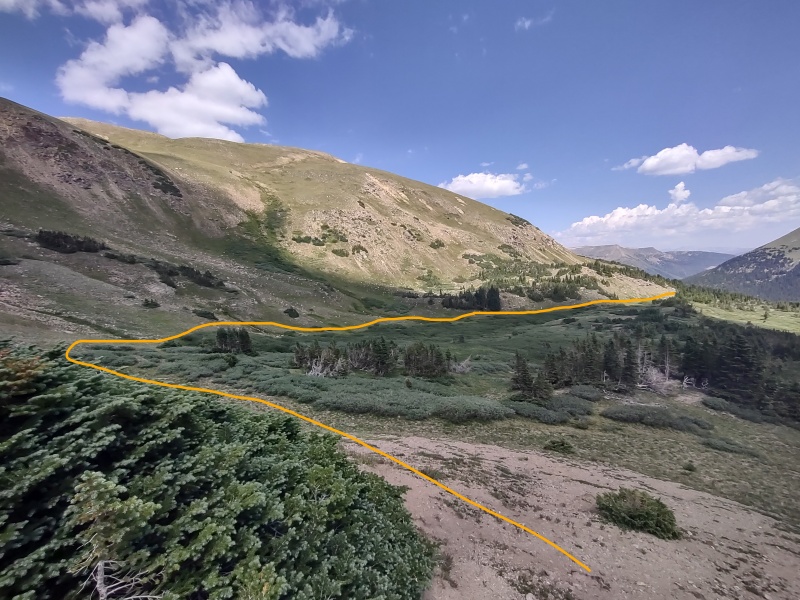
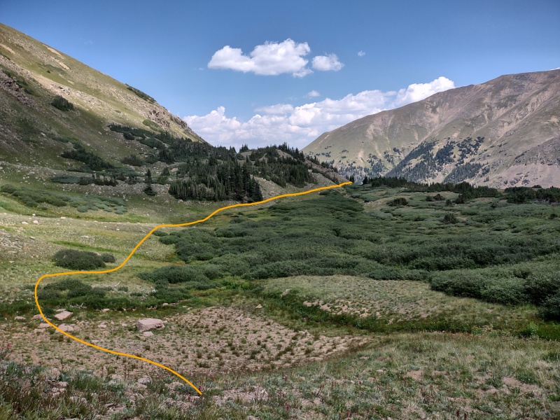
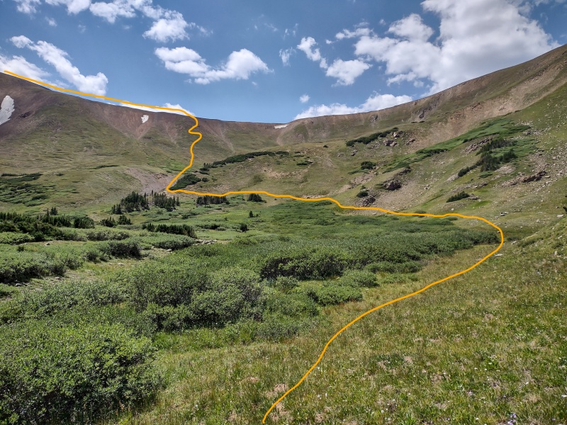
Parnassus-Woods Saddle Descent
So I'm not at all interested in doing or tracking anything below 13k and as a result I decided not to bother with the 12k Woods but instead drop off from the saddle below Parnassus and Woods.
The trick is doing so in a way that doesn't send you through the miry pits of Willow Hell. Thankfully those who follow the straight and narrow path can avoid that fate. Well, actually this particular path isn't really straight... but the following description/photos will guide you on your way.
Starting down to the Parnassus-Woods saddle. Dropping off the saddle a little before the low point - the snow blob is the far right one seen in photos 9 and 22.
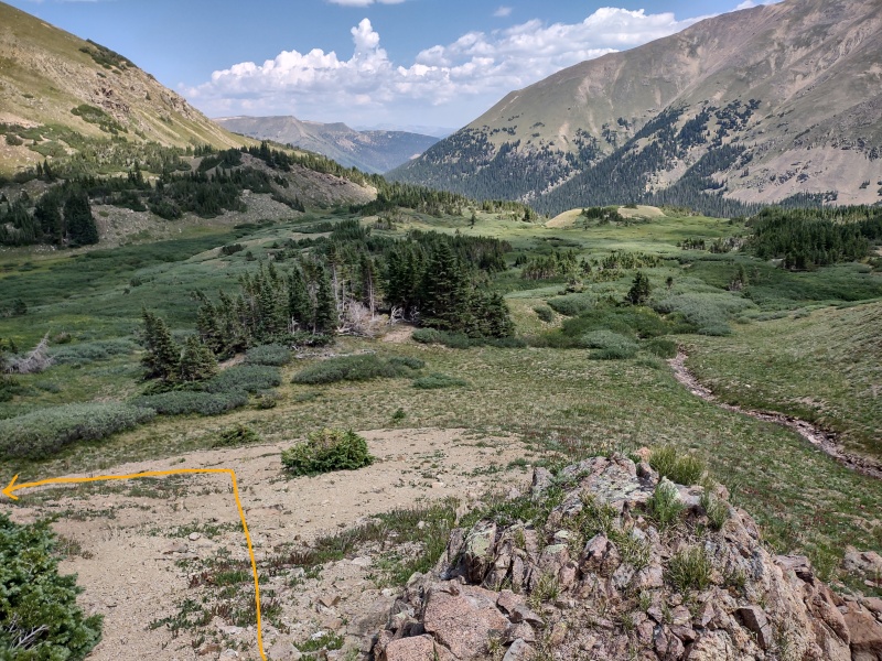
The trick is to drop off a little before the low point of the saddle - see the satellite view with GPX tracks (first photo in the report) as well as some other photos sprinkled along the way). The snow patches in some of the photos provide a useful reference point for comparison.
There are actual little trail fragments along portions of the hillside. I followed these for a bit but then there seemed to be a few variations so I followed the route I had eyeballed from studying the valley all throughout the hike.
There is one bare dirt gully that I aimed for then turned hard left to swing away from the willows then hard right to follow along the edge of the willows until eventually hitting the main trail.
Approximate path down through the bare dirt gully and around the willows.Looking to my left at other possible descent routes (note for reference that far right snow field, only it's on the left in this image). Aiming for the bare dirt gully.Looking back up the descent. Again note the 2 dots of snow seen in earlier images. This rock pile at the end of the bare dirt gully is where I took a hard left to bypass the willows.Hard left then hard right avoids the willows.Then follow along the hillside below the trees and above the willows.The willows make a nice foreground for Bard.Looking back over the route - avoiding the willows was easier than I expected.Shortly before reaching the trail it looked like the willows were about to win - but there was one small opening.
I was very glad to have skirted entirely around all the willows up to this point. As I passed along the hillside below the trees and above the willows I then started to worry that I was finally going to have to willow bash. I followed the one small opening in the willows, certain the sadistic little bushes were merely leading me into a trap.
As I passed through the opening and scanned around, my hopes of getting through without willow bashing began to diminish until I barely caught sight of a faint brown line - could it be???
I walked that way to investigate - yes, a trail!!!! Saved at last, without ever needing to do any willow bashing!!!
I was about to despair of getting through unscathed when a small faint brown line caught my eye...Zoomed in picture - the waiting deliverance is just barely visible!
After a little while the faint trail turned into a full on trail that then became the old 4WD road. Easy stroll from here on out. The only thing I didn't catch here was a good photo showing where to turn if you did this route in reverse (I'd recommend downloading my GPX tracks if you want to try that).
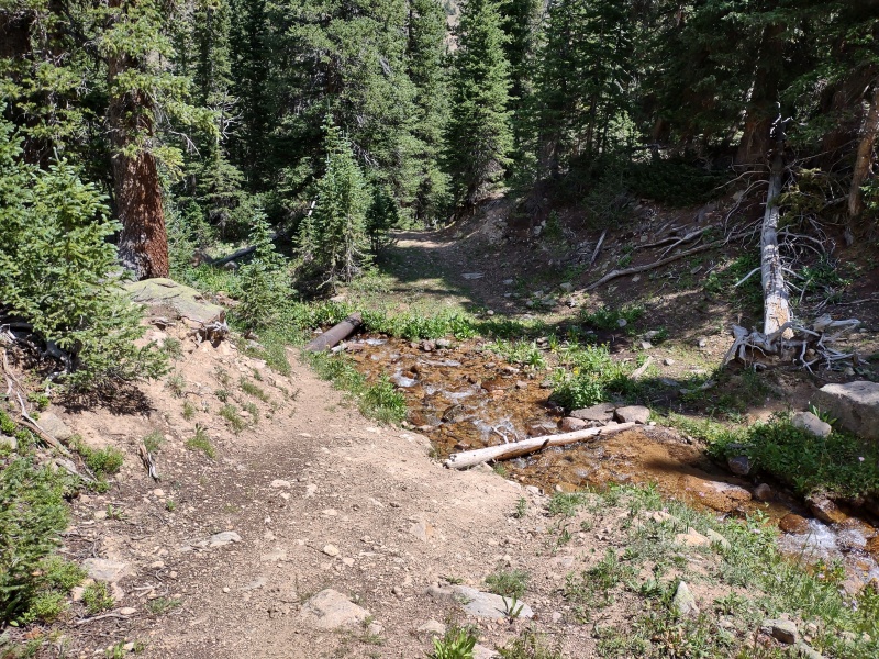
Take note that there are several stream crossings with old rusty drainpipes going over them. Some of them are very sturdy, others not so much - use them as a bridge at your own risk!
The faint trail soon become very big and bold. There were multiple stream crossings - a few with old rusty drain pipes going over them.
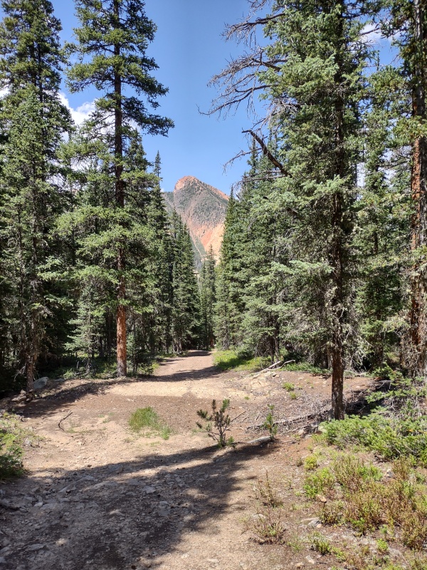
Once you see Red Mountain right in front of you, you know you're getting close to the trailhead.
Red Mountain comes into view as you near the trailhead.
My Times
5:29am start from Ruby Gulch Trailhead
7:41am on flatter tundra regions of Engelmann West Slopes
8:14am Engelmann summit
9:07am realized that I totally shot right past Robeson!!!
9:22am summited Robeson
9:41am back to where I had to turn around to go back and get Robeson
10:15am Bard summit
10:33am continue on
10:49am Bard-Parnassus saddle
11:24am Parnassus summit
12:02pm On valley floor weaving around willows and seeking the trail
12:40pm been on a solid trail for a while now
1:22pm back at Ruby Gulch trailhead
My GPS Tracks on Google Maps (made from a .GPX file upload):
"So I'm not at all interested in doing or tracking anything below 13k"
I was once the same way. As someone who has "seen the light," for lack of a better phrase, let me offer some perspective, if I may.
I once only cared about 14ers. That lasted a few years until I was done with them. Then what? Right, 13ers! Now I've done hundreds of 13ers. You might have undergone a similar 14er to 13er progression. When I started my 13er journey I didn't care about much else. My friend and climbing partner Whiley is a true peakbagger. She got me to expand my horizons, if you will, and do other peaks. Were most of them worth the time? No, not particularly. Heck, that includes a peak you skipped on this outing, Woods, which is honestly quite boring. I don't blame you for not doing Woods. But let's be honest, most of the 13ers are pretty boring too. That and there are gems hidden amongst all peaks. For example...
The view of Vestal Basin from Point 12,936. No other peak has a view of Vestal Basin that is this good.
Potosi Peak, Teakettle Mountain, Cirque Mountain, and Mount Sneffels from 12er "Reconnoiter Peak".
On the Palisade, barely even a 7er! A fine technical climb.
Insanity on Point 12,809 in the West Elk Wilderness.
Wilson massif, Dolores, and Middle from 11er Little Cone.
Southeast side of Endlich Mesa from 12er Sheridan Mountain.
I could go on... amazing scrambles, jaw dropping views, beautiful forests and flowers, cliffside dwellings, exploring your state and your country. The elevation and prominence that we judge peaks by are so arbitrary. How many ranked 13ers and 14ers have you done that are boring? Quandary and Bierstadt anybody? The point I'm trying to make is that the criteria by which we think of peaks being worth doing is arbitrary. As someone who's written extensive trip reports on obscure, unranked, 6,000-foot Flatirons dumped in a viewless forest I know you know the joy of doing the obscure, the bizarre, the pointless. Don't let "less than 13,000 feet = not interested" get in your way. Perhaps you thought at one point that "less than 14,000 feet = not interested". Perhaps not. But there are gems everywhere.
CaptainSuburbia, Carl, Steve - thanks for the nice feedback.
supranihilest - "As someone who's written extensive trip reports on obscure, unranked, 6,000-foot Flatirons dumped in a viewless forest I know you know the joy of doing the obscure, the bizarre, the pointless."
Bwahaha, well when you put it that way I guess there is a wee bit of inconsistency in my goals, though originally the Flatirons were only a training ground to prep me for higher altitude goals.
Yes, I did go through the 14k transition - at first moving from one list to another but, like many, the lure of the lists has been lessening.
Thanks for sharing the cool photos - I'm still not quite ready to be assimilated into listofjohn and the world of lower peaks but you've given me something to think about...
I don't track peaks under 13k either, but that doesn't mean I don't think they're not worth it.
I've done 12ers and 11ers and 10ers, etc., but I just don't track them.
I agree that some of these other lower peaks are just as rewarding as higher summits though.
Funkstein, that picture of Potosi, Teakettle and Co. is a great framed shot!
Daway, this is some documentation on some Frangers! As per usual from you..nice job.
Daway, I followed your route yesterday. It was good. I think you should definitely write it up as the route for the quartet.
Also, your photos were well-chosen. Most things that I wasn't sure about in the report were crystal clear when I got there.
A couple of things I'd suggest working into the report:
-- Steepness: The grassy descent ramp off of Parnassus is quite steep, and from the top, I wasn't confident that it wouldn't turn into "class 3 grass". It worked out, but maybe a warning there. I'd have been nervous if there had been snow, or if anyone was above me to roll rocks.
-- Water: Though you wouldn't want to drink the water in the forest streams of that mining area, there were still streams straight from snowpack on Aug 28th. The east face of Engleman gave a stream down to the Engleman-Robeson saddle which had filterable water. The escape ramps off Parnassus still had very clean water in the gully from those snow patches. That was helpful.
-- After the willows: I got lost after bypassing the willows. I'll admit I was very tired, but that might not be unusual for people since this is a substantial route. I saw the faint trail, but because it was so faint where I found it, I thought it was just fading out to the right, and so I went left. That had me starting to track up Woods, and then I dropped right and had a merry walk through the woods for 2 miles before I found the 4WD road by following Ruby Creek. I didn't realize the 4WD road went up so far into the valley - the COTrex app only showed it extended about 0.3 miles. Anyway... this is totally my fault after a long day, but maybe emphasizing that faint trail, the RIGHT turn, and the fact that it turns back left in a little while once you hit the 4WD road. Just how far up the valley does that 4WD road go, anyway?
-- Commitment: I think you did mention it... it struck me all the more on the route. The commitment is considerable after Engleman. I had perfect weather, so it was great. I would not want to be racing storms on this one.
-- The reverse route: Totally do-able. Since there are few landmarks in the forest below the west ridge of Engleman, I could see a person getting a little concerned about route-finding on the descent, but you're going to hit the 4WD road somewhere for sure. Maybe it's worth mentioning just how long and straight that road is, so you really can't fail to intersect it. I can't decide if the steep forest descent would be better than the steep Parnassus
@d_baker - maybe I'll do that approach as well in terms of doing but not tracking lower peaks...
@krishcane - cool! glad to know it (mostly) worked out for someone following along. I've been pondering whether or not to go ahead and write-up an official route description. Maybe I'll go ahead and go for it soon and incorporate your feedback into it. Thanks for the detailed feedback!
Its a fun loop, but I'm not sure I'd make this a route. That 2,000' slog up Engelmann is brutal and there isn't really a way to make it into a reasonable trail. The descent from the woods saddle is awful and the little climbers trail is way too steep. Otherwise its a fun little loop. I dont think it gets harder than 2+.
Thanks for posting your trip report. RandyMack and I tried your Engelmann route this morning and found it a huge improvement over one of the gullies that I'd done previously.
I recognized where the trail wiggles to the right as shown in your photo, checked my InReach to confirm the elevation was 10,760', and we headed east until we were out of the trees. The only modification we made was to add Woods Mtn. at the end of the loop.
Thanks for this excellent write up of a route I've been considering. It seemed like there had to be another way up Engelmann that didn't involve those gullies. As a fan of the "alpine start", my biggest concern is bushwhacking up Engelmann in the dark, so I'm hoping your .gpx file will help with that during my attempt!
Ascent: Directions up Engelmann worked well. Descent: I needed to follow the creek further on the way down to complete the willows. I ended up leaving the creek to stay above the willows (even saw a faint trail) and ended up with the bushwack described above by krishcane. Thanks for posting this information.
I tried to do only Engelmann last year and went too high on the road. Your picture of the road wiggling to the right at the double tree trunks was spot on. We dove into the woods and started up dodging downed timber. Soon enough we were at the dead trees around tree line and kept heading straight up the steep grass. Ran right into the pole with the trail behind. The trail went all the way until the last tundra romp to the summit. All good, but WOW what a heinous descent going down the same way.
Caution: The information contained in this report may not be accurate and should not be the only resource used in preparation for your climb. Failure to have the necessary experience, physical conditioning, supplies or equipment can result in injury or death. 14ers.com and the author(s) of this report provide no warranties, either express or implied, that the information provided is accurate or reliable. By using the information provided, you agree to indemnify and hold harmless 14ers.com and the report author(s) with respect to any claims and demands against them, including any attorney fees and expenses. Please read the 14ers.com Safety and Disclaimer pages for more information.
Please respect private property: 14ers.com supports the rights of private landowners to determine how and by whom their land will be used. In Colorado, it is your responsibility to determine if land is private and to obtain the appropriate permission before entering the property.


")
")
")
")
")
")
")
")
")
")
")
")
")
")
")
")
")
")
")
")
")
")
")
")
")
")
")
")
")
")
")
")
")
")
")
")
")
")
")
")
")
")
")
")
")
")
")
")
")
")