Download Agreement, Release, and Acknowledgement of Risk:
You (the person requesting this file download) fully understand mountain climbing ("Activity") involves risks and dangers of serious bodily injury, including permanent disability, paralysis, and death ("Risks") and you fully accept and assume all such risks and all responsibility for losses, costs, and damages you incur as a result of your participation in this Activity.
You acknowledge that information in the file you have chosen to download may not be accurate and may contain errors. You agree to assume all risks when using this information and agree to release and discharge 14ers.com, 14ers Inc. and the author(s) of such information (collectively, the "Released Parties").
You hereby discharge the Released Parties from all damages, actions, claims and liabilities of any nature, specifically including, but not limited to, damages, actions, claims and liabilities arising from or related to the negligence of the Released Parties. You further agree to indemnify, hold harmless and defend 14ers.com, 14ers Inc. and each of the other Released Parties from and against any loss, damage, liability and expense, including costs and attorney fees, incurred by 14ers.com, 14ers Inc. or any of the other Released Parties as a result of you using information provided on the 14ers.com or 14ers Inc. websites.
You have read this agreement, fully understand its terms and intend it to be a complete and unconditional release of all liability to the greatest extent allowed by law and agree that if any portion of this agreement is held to be invalid the balance, notwithstanding, shall continue in full force and effect.
By clicking "OK" you agree to these terms. If you DO NOT agree, click "Cancel"...
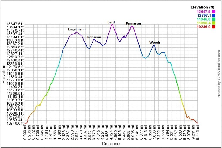
Starting Point: Woods Creek Rd, Elevation: ~10,200'
Peaks Climbed in order of ascent: Engelmann Peak (13,362'), Robeson Peak (13,140'), Bard Peak (13,641'), Mt. Parnassus (13,574'), Woods Mtn. (12,940')
Route: Loop
RT Distance: ~9.5 miles
Elevation Gain/Loss: ~5,300 feet (per Google Maps)
Group: Solo
Bard Mountain first piqued my interest after I read a TR by "awake". That provided excellent beta and, of course, I wanted to add as many adjacent peaks to the agenda so the list quickly gathered mass ending at four 13ers and a fifth peak just shy of that elevation distinction. Incidentally, these peaks can be climbed from Herman Gulch and there are some accounts from that perspective also. I chose the Ruby Creek approach mainly for the simplicity and directness of this approach.
It should be noted that the trailhead is on private property, roughly 2 miles from the Henderson Mine Rd exit on US 40.
Trailhead
The route starts on the rough 4WD road as it parallels Ruby Creek and climbs through the woods.
Falls along the road
Road
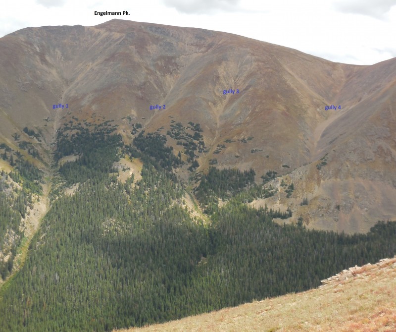
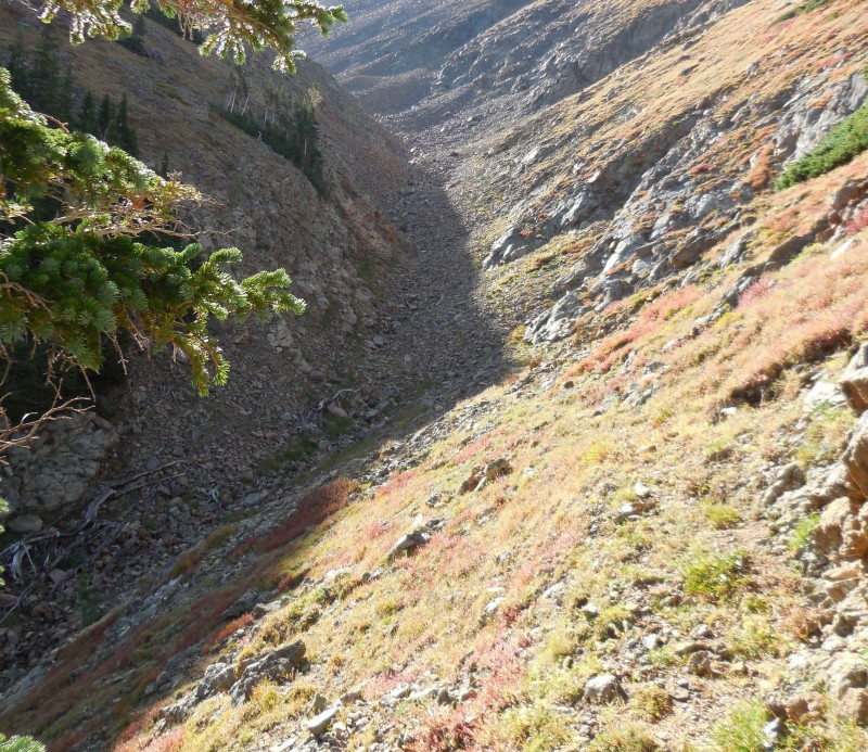
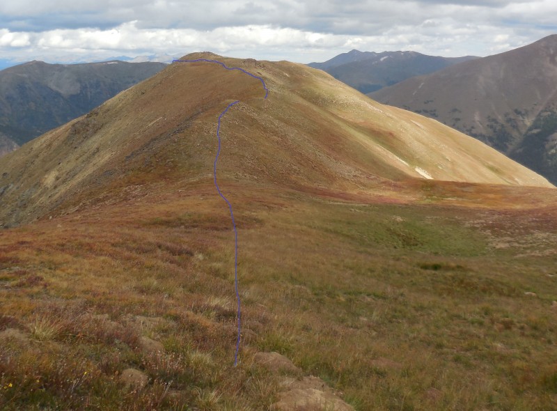
There are four prominent gullies that climb out of Ruby Creek up to the long connecting ridge between Engelmann, Robeson and Bard. I took the following picture on my descent from Woods Mountain and it shows these gullies in some detail.
View of the gullies
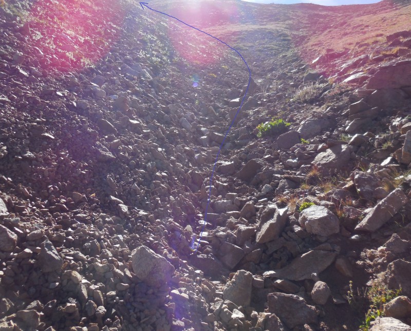
Having studied the terrain maps the night before, gully no. 3 seemed to be the best option to me; it is steep through most of the climb but relents as it reaches the ridge. Gully numero uno, I imagine, would be the sane choice for mountain goats; starts out steep and gets hairy and loose approaching the ridge - not recommended for those relying on traction from two contact patches! My actual ascent ended up going through gully no. 4, but not by choice...
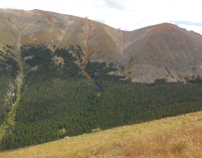
My route in blue; best option in red
My goal was to take gully no. 3 but a fateful mistake while leaving the main creek ensured that this would not happen.
My route in blue; better option in red
I was so focused on not taking the first or the second gully that I strayed too far up the hillside and away from the drainage.
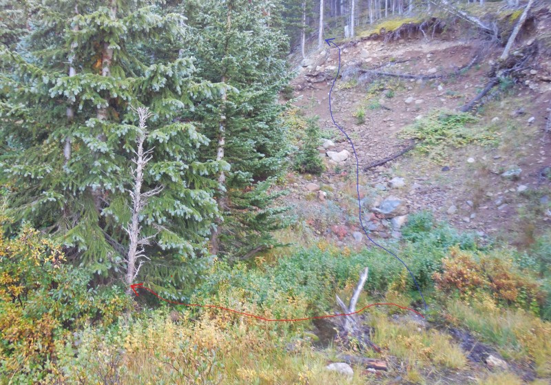
Climbing through the woods away from the drainage
By the time I realized my mistake, it made no sense to retrace my path so I just dropped down into gully no. 4 and started making my way up to the saddle between Engelmann and Robseson.
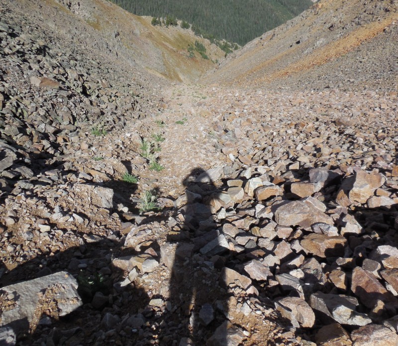
Gully no. 4
View down the gully
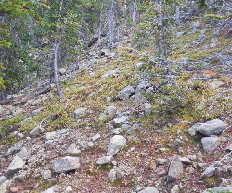
I stayed in the middle of the rocky gully except when tundra on the shoulder offered better traction.
Staying on the rocky midsection
Looking down the gully
Reviewing the maps, this gully is not as steep as the others for most of the ascent and in that regard may be a better choice for anyone looking for a more moderate climb. About two-thirds of the way up, another gully stretches up the hillside to the right but I stayed on the main one continuing toward the saddle.
Gully curves to the left
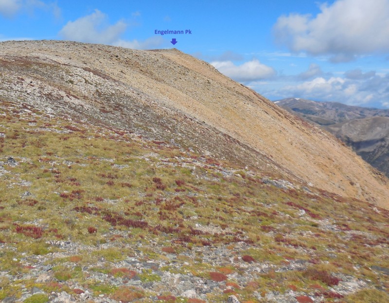
The ~1700 feet climb up this gully took me nearly an hour; not quite the pace I'd hoped to set since there was a lot of climbing left in the day. Upon reaching the saddle, it wasn't obvious exactly where Engelmann's summit was so I climbed the gentle grassy slope aiming for what I thought was the peak.
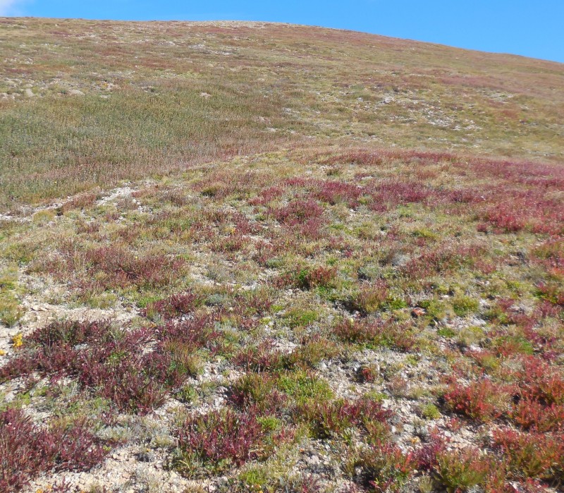
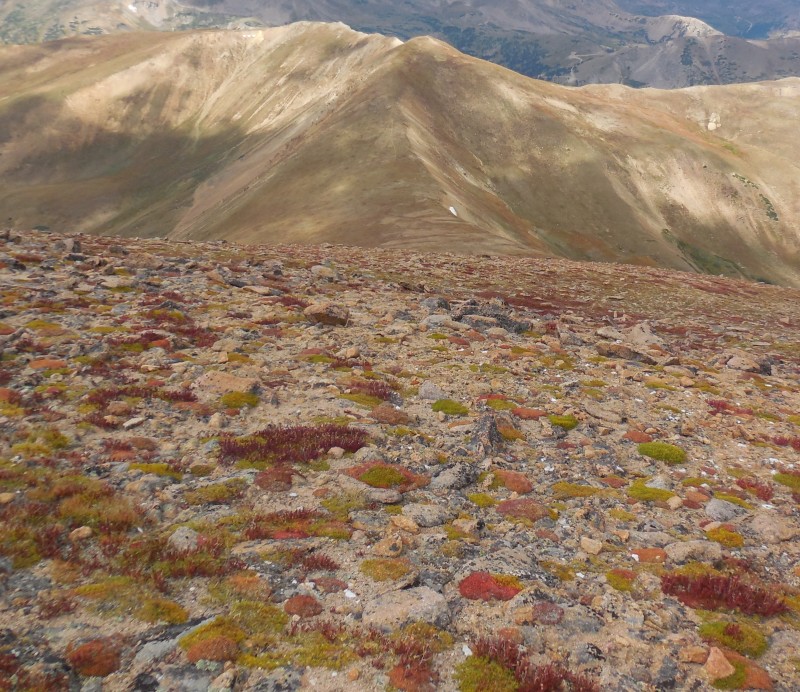
Colorful tundra on the broad ridge
As it turned out, I was a bit off the mark as the summit cairn did not come into view until I was on the broad summit.
The true summit of Engelmann Peak
An hour and fifty minutes for the first peak and four more to go meant that I would be racing against time for the remainder of the day, hoping to beat the weather. As it transpired, the clouds never delivered on their threat but the winds consistently scoured that lofty ridge between 20 and 30 miles per hour, getting worse as the day progressed. Not exactly pleasant, but I'll take those winds over thunderstorms any day!
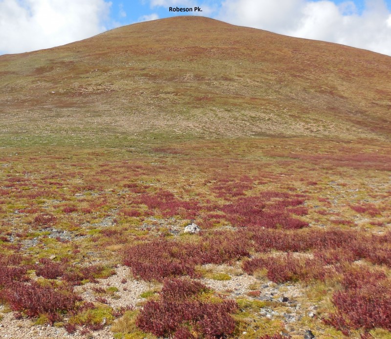
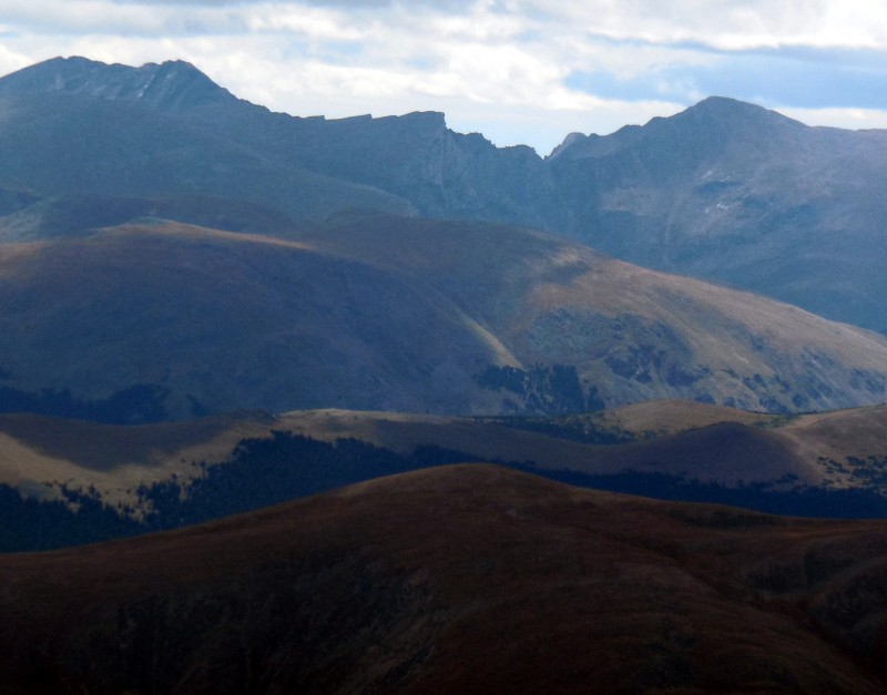
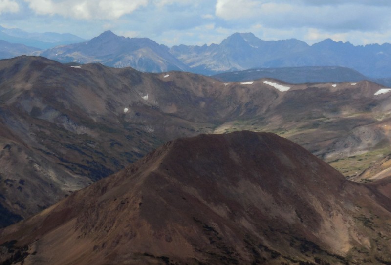
I surveyed the next leg of the hike, Robeson Peak, flanked by the two higher 13ers that would follow.
The upcoming threesome
Robeson is the only unranked peak on this ridge but it still manages to rise just over 300 feet from the saddle with Engelmann.
Gentle ascent to Robeson Peak
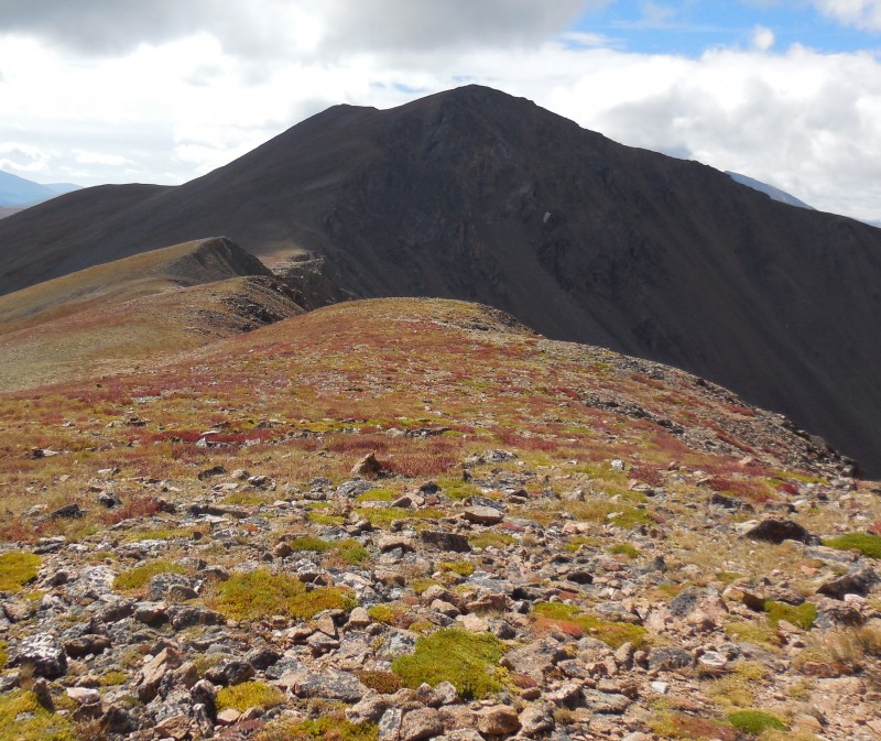
Ten minutes later, I was on the broad summit of Robeson checking out the connecting ridge to the third and highest peak of the day.
Ridge to Bard Peak
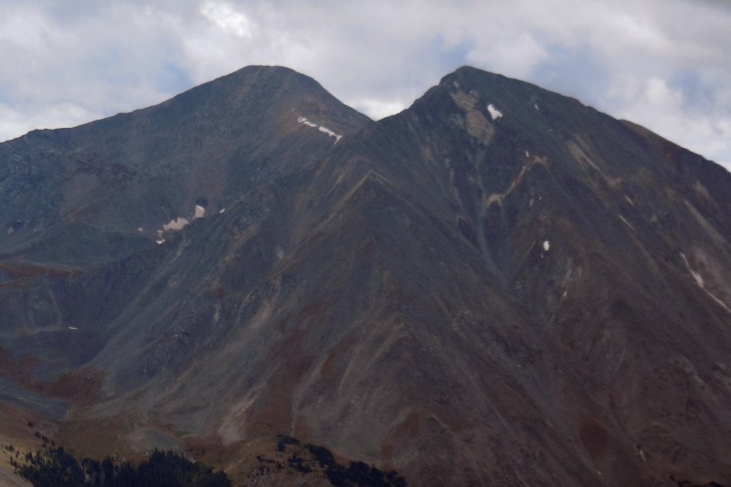
After a prominent bump en route to the saddle at ~12,900', the ridge features a solid 700+ vertical feet to Bard's summit.
Bard Peak from the saddle
When I was planning the hike the day before, I had figured that the gully ascent would be the crux of the hike, and the ridge traverse to cover all five peaks would be a cakewalk. While the gully ascent may have been the crux, there is a good bit of elevation gain and loss to be had on this ridge traverse to cover the remaining peaks.
Towers on the ridge to Bard
Speed, which is one of my few strengths, was somehow not part of my arsenal today, perhaps due to very little sleep the night before. I had to earn every one of those 700 odd vertical feet to Bard. Reward for the weary were the views, despite the mounting cloud cover over the high peaks.
The gnarly Sawtooth
Grays and Torreys
The winds were relentless but I was more concerned about the dark clouds. If there was a time to bail from the ridge, this was it; the traverse to Parnassus would mean that I was committed to the loop. And committed I was.
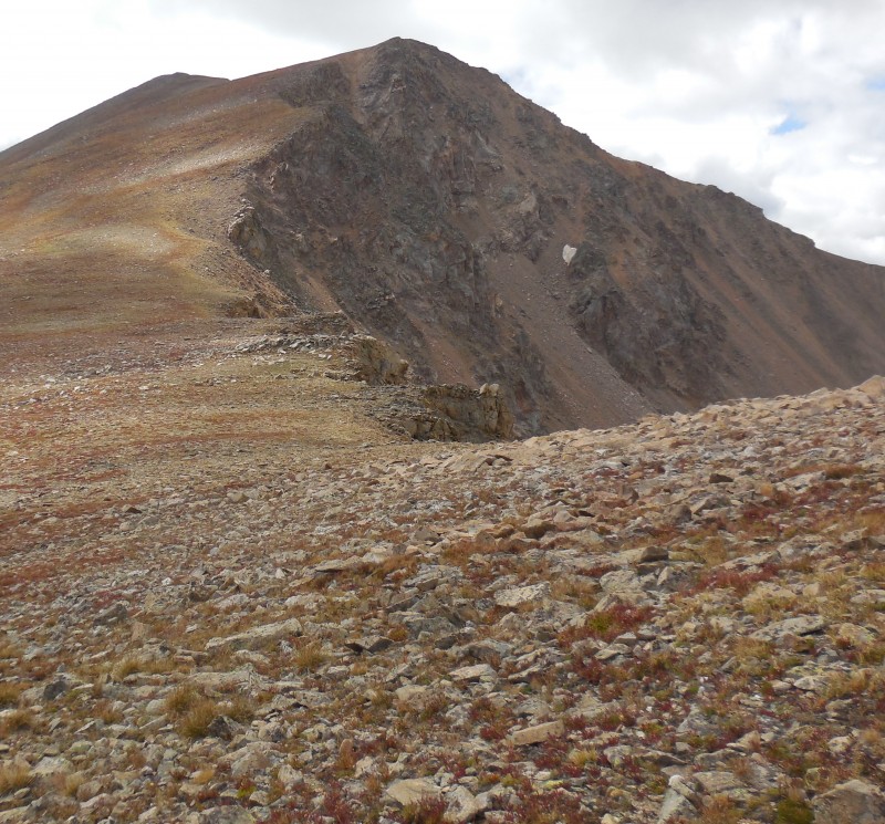
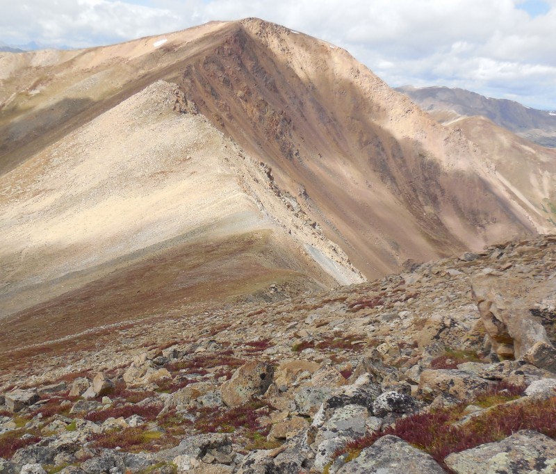
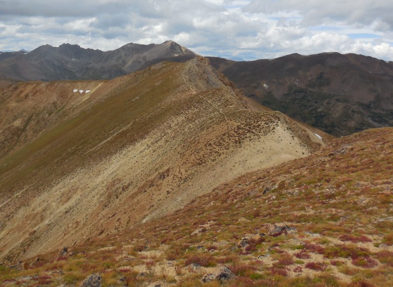
The connecting ridge to Parnassus was a bit less straightforward than the one I'd just covered mainly due to a couple of small towers.
Ridge to Parnassus
While these could be bypassed by skirting to hiker's left, I chose to stay on the ridge enjoying whatever the rocks had to offer.
Atop a tower on the ridge
Atop Parnassus looking back to Bard
Rugged peaks in the distnce
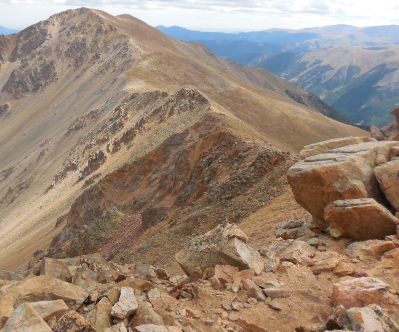
The saddle with Woods Mountain is a long way down a grassy slope that drops almost a thousand feet in about three-quarters of a mile.
Ridge to Woods Mtn.
I spotted a prominent trail going up Woods' southeast ridge and aimed directly for it. Any hopes I might've had of the winds subsiding were dismissed as soon as I got to the broad saddle. Good thing then, that the next pitch was a gentle ascent over easy terrain.
Parnassus from halfway up the ridge to Woods
Atop Woods, looking at the Pettingel-Haggar traverse
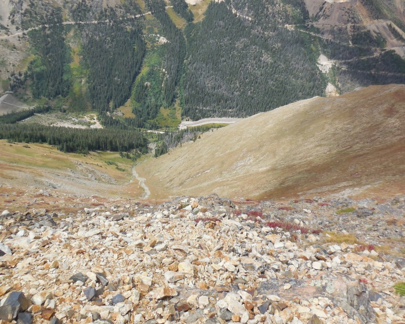
If there was a weakness in my planning for this loop, it was the descent off Woods Mountain. The best descent off Woods is to take a prominent gully just off the ridge around 12,400' that drops all the way down and connects with Woods Creek road.
This is the gully to take
This would require about an extra mile of trudging down the road to reconnect with my starting point, something I was loathe to do. So I decided to stay on the northeast ridge of Woods which would allow me to directly aim for the trailhead. In retrospect, this was not such a good idea. The ridge starts out easy as it navigates a few humps and stays that way down to about 12,200'.
Woods' NE ridge starts out gentle
Then it gets quite steep.
...then it gets steeper
will this cliff out?
Below treeline, this slope turns into a steep mess, getting worse as I descended lower into the dense pines.
The terrain was steep enough that I had to resort to using the trees, branches, roots, whatever I could find to brace myself through many sections. Sure, it had a bit of a treasure hunt aspect to it as I never knew if a certain slope would cliff out, or how I would detour around the rocks when it did.
Hillside gets stepper
Navigating through the hillside
It certainly shortened the loop considerably but I'd be lying if I said I wasn't relieved when I finally spotted the road. ~1800 feet drop in under 0.9 miles - there's some pucker factor for ya!
The trees were good handholds
Elevation plot
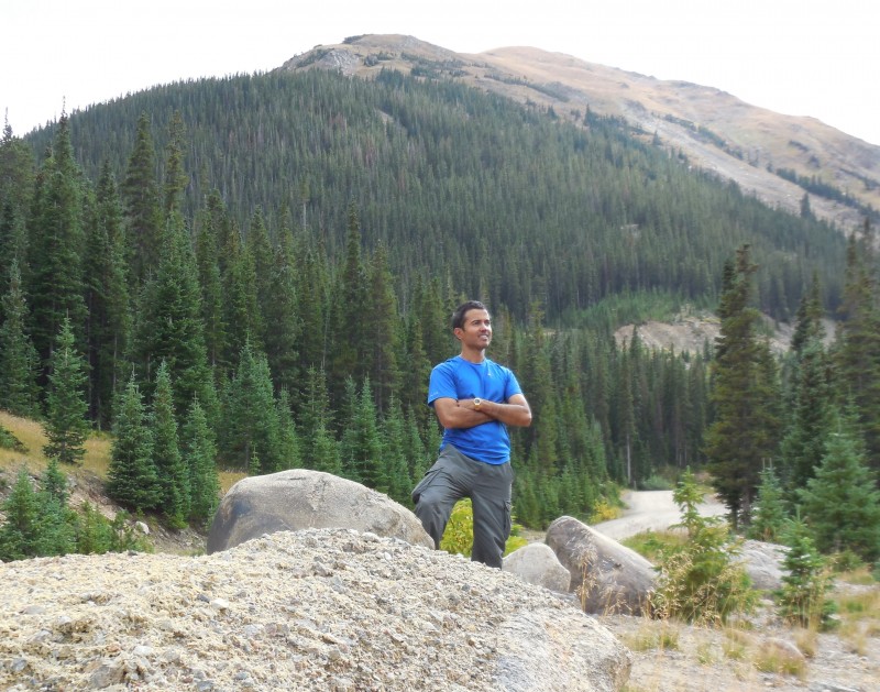
Yours truly
My GPS Tracks on Google Maps (made from a .GPX file upload):
I’ve done Parnassus and Bard from Watrous Gulch and have been wanting to go back and do Englemann––your avoidance of the road was EXACTLY what I would have done! Thanks for saving me from the misery! Glad the slip and slide ended well!
Another nice report, Raj. Way to link up the 5 mountains. I never thought to do that. Was the parking still way below the sign in your first picture? I seem to recall a sign a mile or so before that on the road that said it was all private and I parked at that sign and walked the road to where your first pic was taken. I also went up gully #4. Looser than hell as I recall.
ctlee: good to hear that my mistake may help! The gully off Woods’ NE ridge would be the right choice for the descent.
Jay: once again, your memory is spot on – the private land sign is just about a mile before the actual trailhead.
Thanks for the great beta as always, Rajz. Went and did this yesterday, but started with Parnassus. We descended off gully one on Engelmann and you’re right, not fun at all.
I’ve always planned to ski that west gully #1 (not just for goats!), hence why I orphaned Engelmann. But I find myself without a plan for the weekend and can’t camp with my elderly mother in the snow and cold, so this may just be the ticket!
Edit: Not sure why ya’ll chose the gullies. I don’t usually touch loose gullies unless there is nice firm snow in them. I went up the ridge to the south of gully 4 and then down the ridge directly off Engelmann’s summit between gully 1&2. There were even game trails for parts of it (usually a sign of the path of least resistance). It was infinitely more pleasant than ankle roll central for 2K.
Very cool to see that you managed to get all 5 peaks in. I think gully #3 was how I got up, and it really wasn’t bad at all. It was steep, but none of that loose rock that was in gully #4 (that I took down).
Caution: The information contained in this report may not be accurate and should not be the only resource used in preparation for your climb. Failure to have the necessary experience, physical conditioning, supplies or equipment can result in injury or death. 14ers.com and the author(s) of this report provide no warranties, either express or implied, that the information provided is accurate or reliable. By using the information provided, you agree to indemnify and hold harmless 14ers.com and the report author(s) with respect to any claims and demands against them, including any attorney fees and expenses. Please read the 14ers.com Safety and Disclaimer pages for more information.
Please respect private property: 14ers.com supports the rights of private landowners to determine how and by whom their land will be used. In Colorado, it is your responsibility to determine if land is private and to obtain the appropriate permission before entering the property.