Download Agreement, Release, and Acknowledgement of Risk:
You (the person requesting this file download) fully understand mountain climbing ("Activity") involves risks and dangers of serious bodily injury, including permanent disability, paralysis, and death ("Risks") and you fully accept and assume all such risks and all responsibility for losses, costs, and damages you incur as a result of your participation in this Activity.
You acknowledge that information in the file you have chosen to download may not be accurate and may contain errors. You agree to assume all risks when using this information and agree to release and discharge 14ers.com, 14ers Inc. and the author(s) of such information (collectively, the "Released Parties").
You hereby discharge the Released Parties from all damages, actions, claims and liabilities of any nature, specifically including, but not limited to, damages, actions, claims and liabilities arising from or related to the negligence of the Released Parties. You further agree to indemnify, hold harmless and defend 14ers.com, 14ers Inc. and each of the other Released Parties from and against any loss, damage, liability and expense, including costs and attorney fees, incurred by 14ers.com, 14ers Inc. or any of the other Released Parties as a result of you using information provided on the 14ers.com or 14ers Inc. websites.
You have read this agreement, fully understand its terms and intend it to be a complete and unconditional release of all liability to the greatest extent allowed by law and agree that if any portion of this agreement is held to be invalid the balance, notwithstanding, shall continue in full force and effect.
By clicking "OK" you agree to these terms. If you DO NOT agree, click "Cancel"...
Distance: ~11 miles
Gain: ~5500'
(from the private property sign)
After reading rajz06's report and awake's report for beta, I thought I'd add another to show my route and give a little more updated version. Rajz06 and awake's reports are great and definitely worth the read. Some info, including two pictures, are taken from their reports. Since they've already covered it, I won't repeat the straight forward, middle part of the hike and just focus on getting up Engelmann and coming down off of Woods.
Trailhead
After leaving Empire and turning off 40 to Henderson Mine Road, take a left towards the Urad mine. Shortly after that, there is a big sign that says the next 3 miles are private property and you cannot pull off on the road to park. Like awake, I parked at the sign for fear of being towed, but it looks like now they've made a parking lot for visitors. Its close to the high avalanche danger sign at the start of the trail. On the way out I saw a family hiking and their car was parked in this lot. Its looks like a safe bet to park there and the sign in certainly looks like its for visitors.
Route
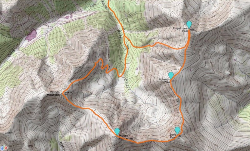
From the high avalanche danger sign, hike up the road until a fork appears:
To the left is Engelmann, to the right is the basin and Woods Mtn.
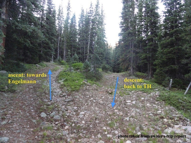
I took the left fork until it came to a dead end. My plan was to bushwack up the creek and get to treeline where I'd have a clearer view of where to go. Unlike rajz06, I stayed next to the creek and it worked out well. Below is taken from his report and shows my thicker blue line going up and over the little hill to get around the trees. I came back down to stay next to the creek and it looks like he went up that hill and stayed high.
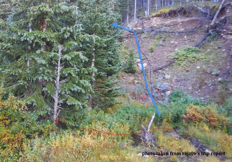
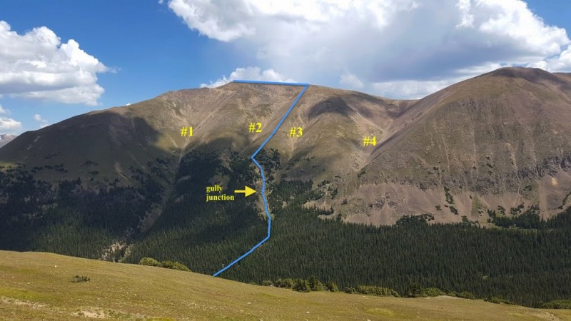
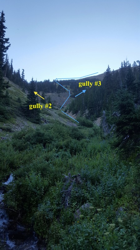
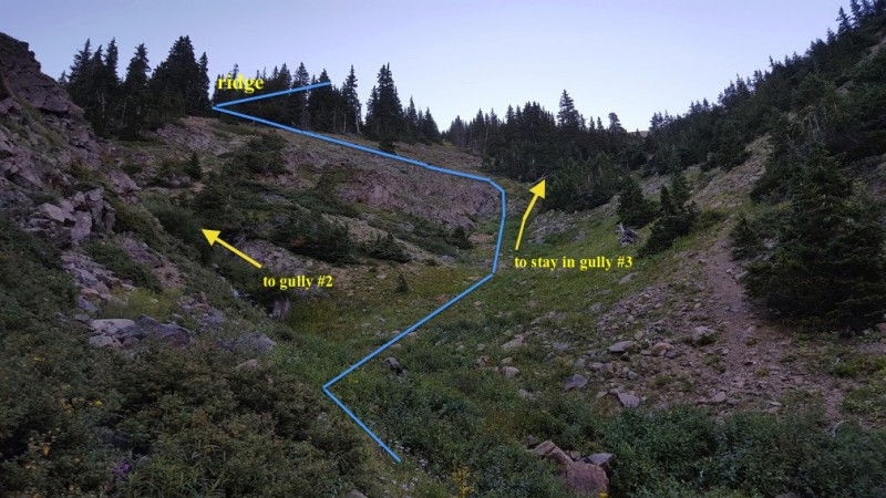
After going up the creek for a bit, I knew I wanted to get off the loose stuff and get on to a ridge. Using rajz06's gully numbering, below shows my route to get up on the ridge.
Up the creek, you'll find a junction of gullies 2 and 3 where I exited. Image 5 and 6 show the route I took. I decided to climb the little bit of steep rock for fun, but you could easily go around as shown. Going up to the ridge is pretty steep, but for me it was worth it to get out of the trees and to have some good traction.
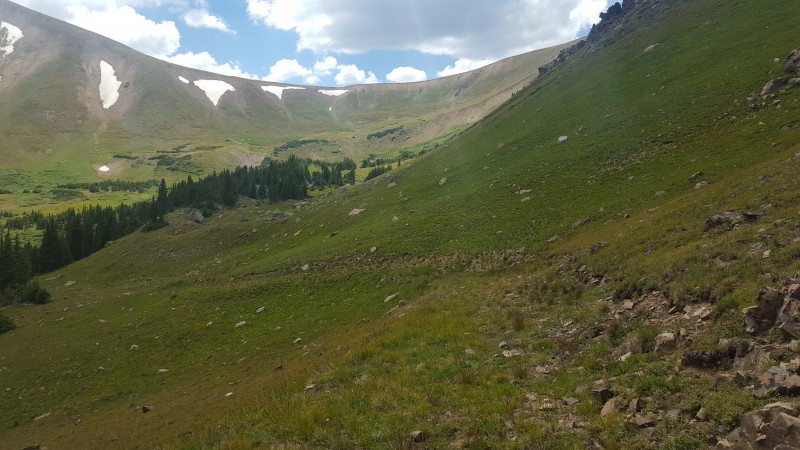
Once on the ridge, its a wonderful steep slog with the first views of the day to keep you going.
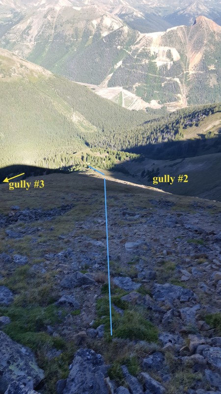
The route viewed from Parnassus gives a better idea of where you're at. After topping out on the ridge, hang a left to summit Engelmann.
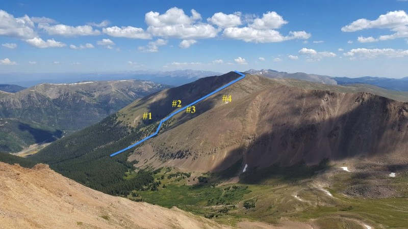
Once on the summit, its clear where you'll be going for the next few miles. Head down to the saddle (gully 4) and up to Robeson Peak. Before heading Bard, take a look at the weather and consider if its safe to be above treeline for the next 3-4 hours. If worse comes to worse, you can bail off to the north and hit the Bard Creek trail and hitch a ride from I-70.
The ascent to Bard is steep, but short...and nothing compared to the ridge ascent. Once on Bard, head down on the ridge to the saddle and up to Parnassus. The ridge up has an easy slope with a few short sections of class 2 rock. Coming down Parnassus and heading towards the broad saddle, aim for a trail that leads up to Woods. The trail dies out a few times, but its clear--just go up
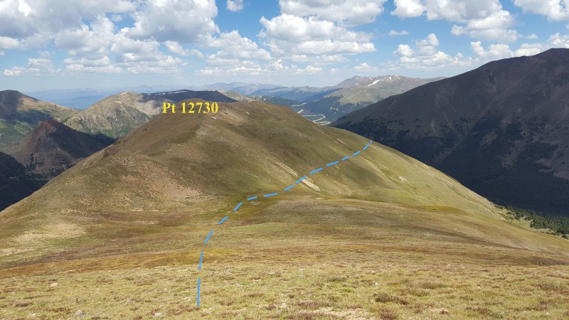
After topping out on Woods, head down to the last saddle of the day and look for a faint game trail on the side on Pt 12730.
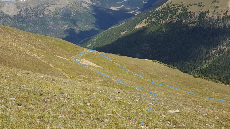
Take the trail around the bend where it enters a small, shallow gully. From the gully, go around another bend and look for the old mining road.
The mountain is erasing the road, but at this point its pretty clear
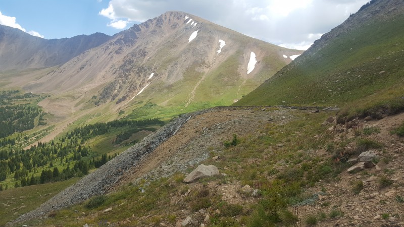
If you loose the road or just want to continue straight down, look for an old mine as reference point
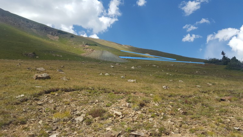
From here its hard to tell what's road and what's run-off, but head down and back into the basin, staying above the trees until the road appears again.
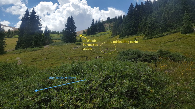
Its easy going until you hit the willows. Below shows where the road comes to an abrupt end at a wall of willows and an attractive carin can lead you astray. I'm not sure from what trail the carin marks, but if you head up the basin from here you'll be back at the Parnassus-Woods saddle. If you had to bail early or didn't want to hike the 12er, an option would be to drop into the basin from the saddle, hugging the north side until you see the carin. In any case, turn left (down) and stay in the willows to keep on the road.
Route finding is difficult in the willows, but if you just bushwack through there are enough patches of the road for you to connect the dots. Use the short games trails to head down until you cross a small creek and the road appears again.
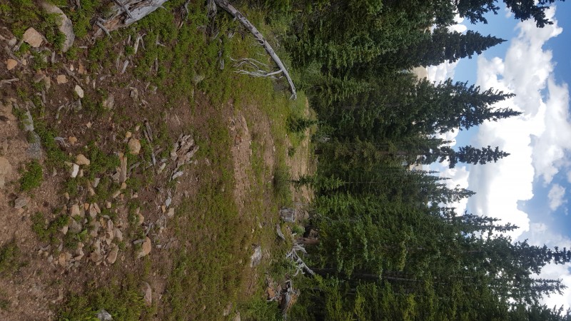
From here, the road is clear all the way back to the TH.
Thumbnails for uploaded photos (click to open slideshow):
...work! I believe bergsteigen had commented on my TR about the ease of ascending along a ridge rather than a gully, and you proved it as well. The mining road descent off Woods is another good find. As the saying goes, "many ways to skin a cat" but I like the finesse of your route vs. the brute force of mine. :)
Your report was really really helpful and hopefully with mine others will do these seldom hiked peaks. I wasn't sure the old mining road was actually there since I'd only seen it on certain maps, but glad it pulled through for me. It was fun going in not knowing... :lol:
The route seems fairly straightforward, but a .gpx would speed up the route finding in the intro and the outro.
Caution: The information contained in this report may not be accurate and should not be the only resource used in preparation for your climb. Failure to have the necessary experience, physical conditioning, supplies or equipment can result in injury or death. 14ers.com and the author(s) of this report provide no warranties, either express or implied, that the information provided is accurate or reliable. By using the information provided, you agree to indemnify and hold harmless 14ers.com and the report author(s) with respect to any claims and demands against them, including any attorney fees and expenses. Please read the 14ers.com Safety and Disclaimer pages for more information.
Please respect private property: 14ers.com supports the rights of private landowners to determine how and by whom their land will be used. In Colorado, it is your responsibility to determine if land is private and to obtain the appropriate permission before entering the property.