| Report Type | Full |
| Peak(s) |
Capitol Peak - 14,138 feet |
| Date Posted | 09/29/2020 |
| Date Climbed | 09/27/2020 |
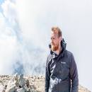
| Author | JQDivide |
| Additional Members | bmcqueen, Maverick6981 |
| Moon Lake Approach & NE Ridge |
|---|
Moon Lake Approach Chad (#52) and Shannon needed Capitol. Brad wanted Clark. I didn’t have any plans. So, why not go in from Moon Lake? We did just that. This TR is mostly about the approach which can be used for Capitol Peak or Clark Peak. All four of us spent Friday night at the Snowmass Creek Trailhead. It was completely full with numerous vehicles parked along the road. (Some not pulled over far enough.) You can get to the TH from two different routes, from Snowmass or Snowmass Village. Chad will have a better video soon... I'll post a link when he has completed it. But until then, here's my quick edit video... OneDrive Folder with Raw Videos 
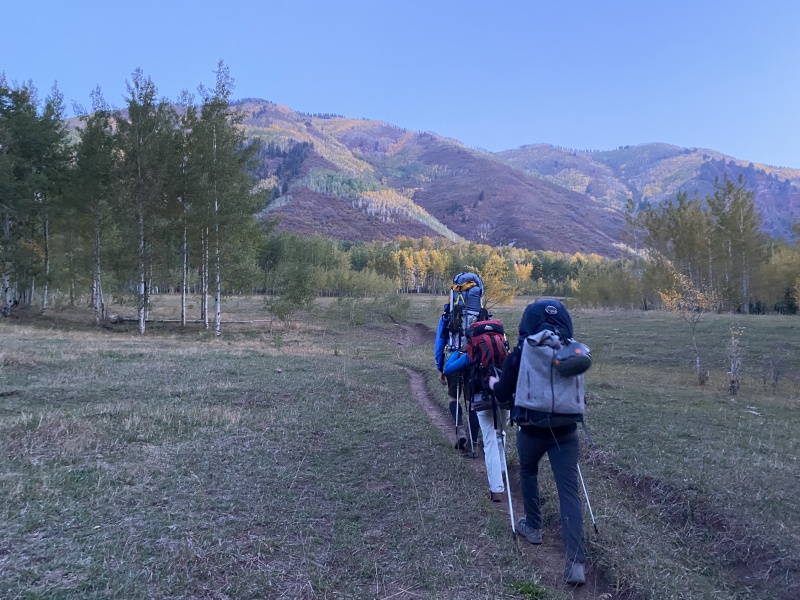
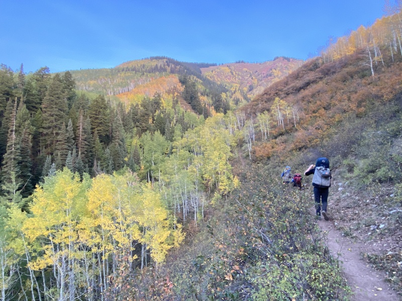
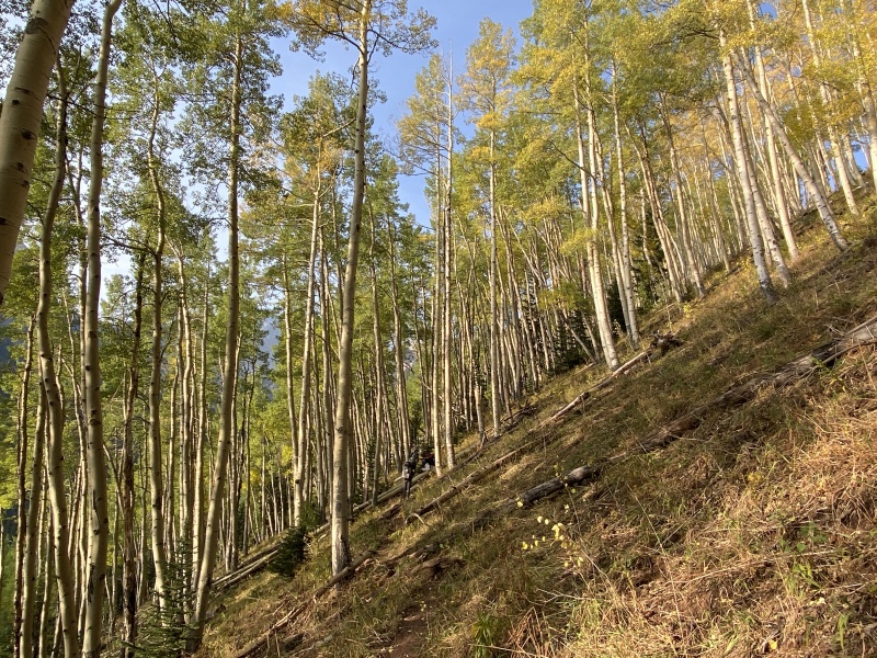
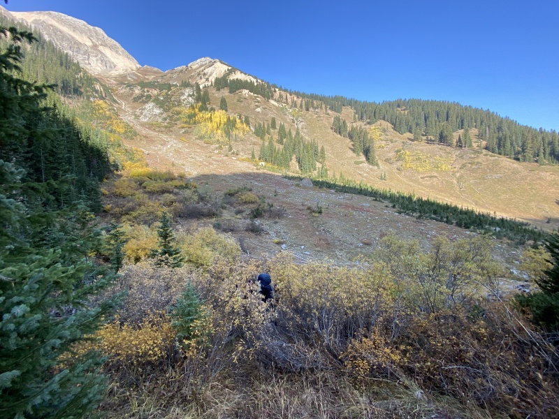
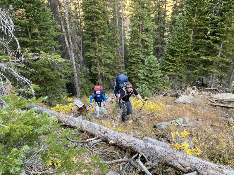
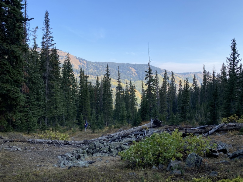
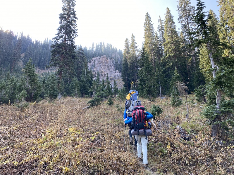
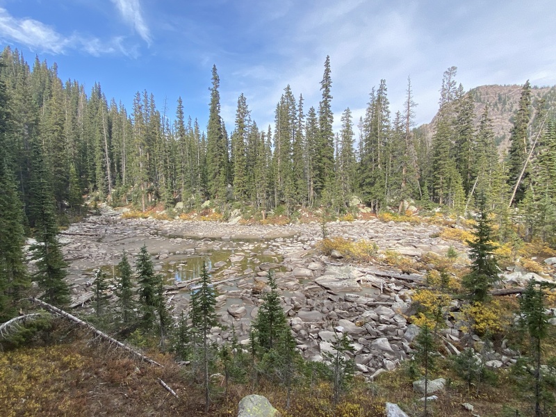
We woke up early on Saturday and were on the trail at 4:30 a.m. Follow the standard Maroon-Snowmass Creek Trail for about 1.25 miles (you’ll go through two gates) and you’ll come to an area that overlooks the valley and the creek (see photo at the bottom). The trail will continue straight-ish, but there is also a junction that goes to the right. Go right and this will take you to a creek crossing and the West Snowmass Creek Trail. The crossing can be kind of high during runoff and the summer, but an easy walk-through in the fall. Bring water shoes, flip flops, etc. If you hike early in the day, this can be a cold start to the hike. The trail crosses a meadow, the valley floor, and leads into a grove of aspens and another gate. (Shut those gates.) A few gentle switchbacks and you’re above the valley on the west side. The trail mellows and continues in a southwest direction and leads to where the views open up and the trail splits. The traditional route up the West Snowmass Creek drainage goes to the left and down. The other trail, the named trail, West Snowmass Creek Trail goes straight and then up toward Haystack Mountain and then over to Capitol Creek. We were told the lower creek route is a rough bushwhack along the drainage. So we went high toward Haystack. Shortly the trail will switchback: here is where we left the trail and followed another smaller trail. It’s more than a game trail, but not anything close to a maintained trail. The trail higher on the western slope seemed like a good idea. For the most part, it was. 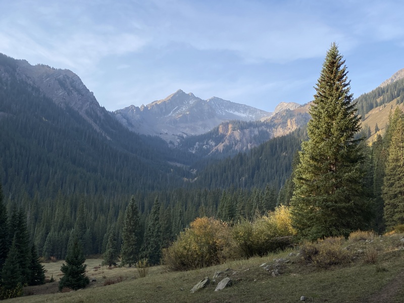
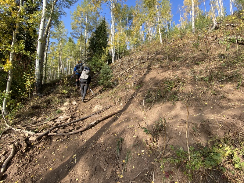
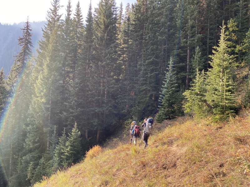
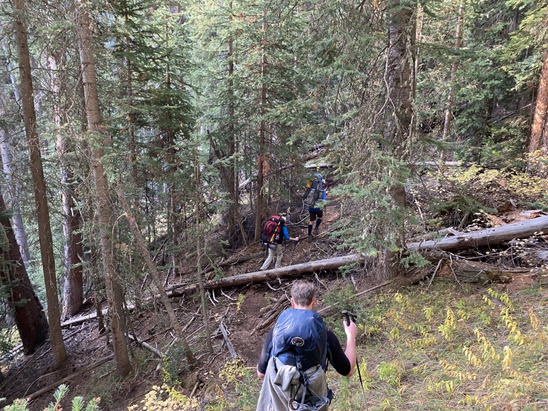
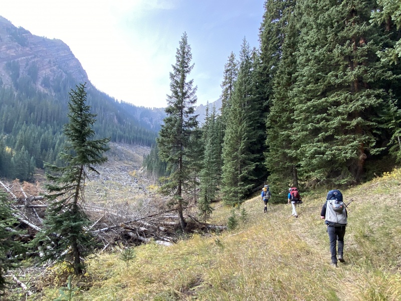
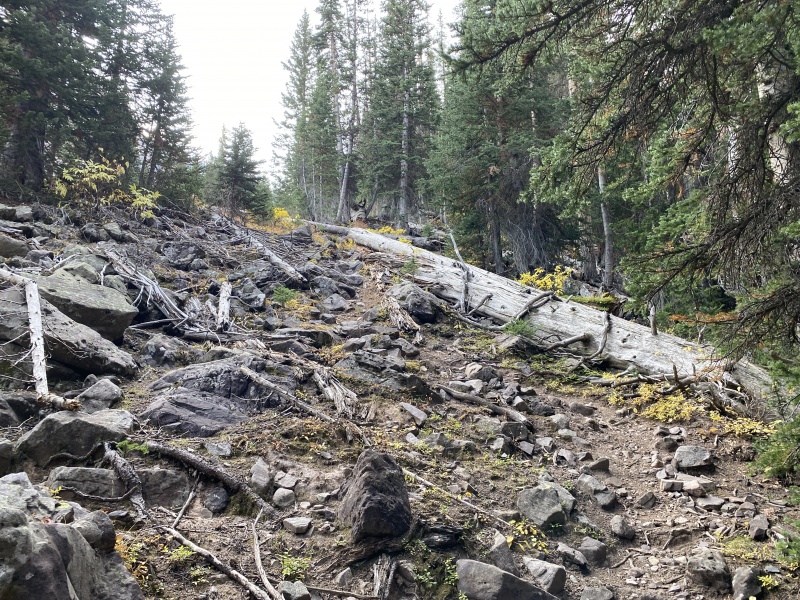
The trail itself was easy to follow. There were a dozen or more trees across the route we either had to go over or under. There were about six very short sections that were steep with loose dirt or slick mud. The footing was bad. But so short, they were tolerable. (But they really sucked with tired legs and heavy packs on the way out.) The trail crossed a few small streams. This section only lasted for a bit more than half a mile before opening up again. This time the scenery was a large spread of avalanche debris. We stayed right and crossed a few downed trees before finding a trail (maybe the traditional trail, or was that under the avy mess?) in the trees on the right. Again, visible, but not maintained. Could be hard to find in the dark. We weaved around trees, both alive and downed, crawled over and under fallen trunks until the trail left the trees near the end of the valley floor. Despite the modified bushwhacking and tree-scrambling, we kept saying, “at least there is a trail.” From here we could see the valley took a steep rise and narrowed a short distance away. The trail took us to the creek and crossed it. From here the trail did not follow the creek into the narrow ravine. Just after 10,400-feet on the topo, the trail crossed the creek and went left, southeasterly, and up a slope. We questioned the direction a couple times, but we gained elevation and thought we could make corrections higher up if needed. (Sometimes being on a trail is just better.) No corrections were needed. The trail gained 700 feet and took a right turn, west, into a boulder field and near the creek. Up and over the rocks we went (no trail or cairns) until we found a thin trail on the left slope. 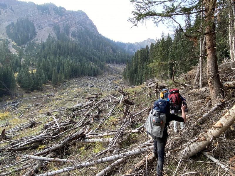
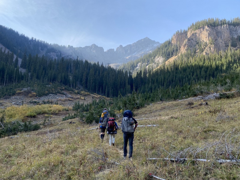
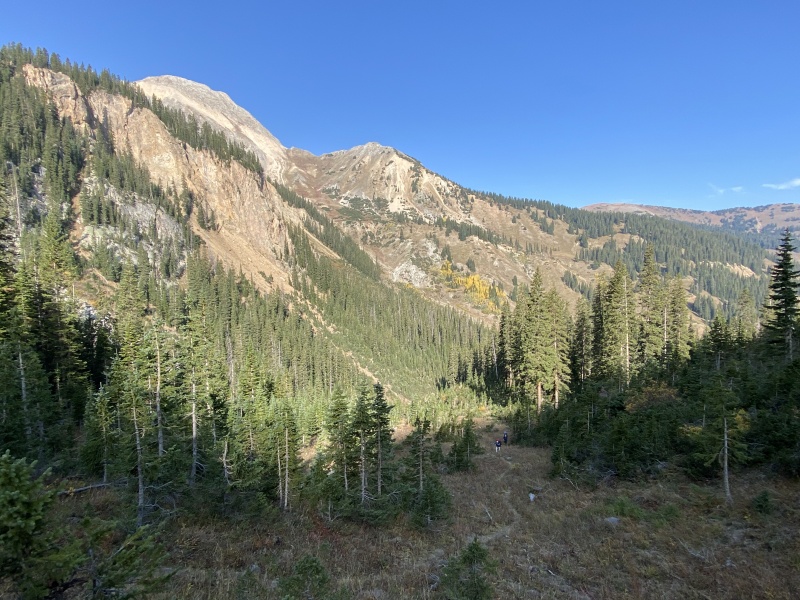
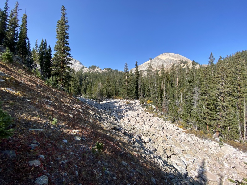
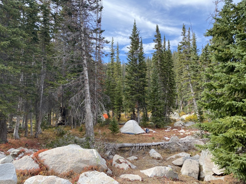
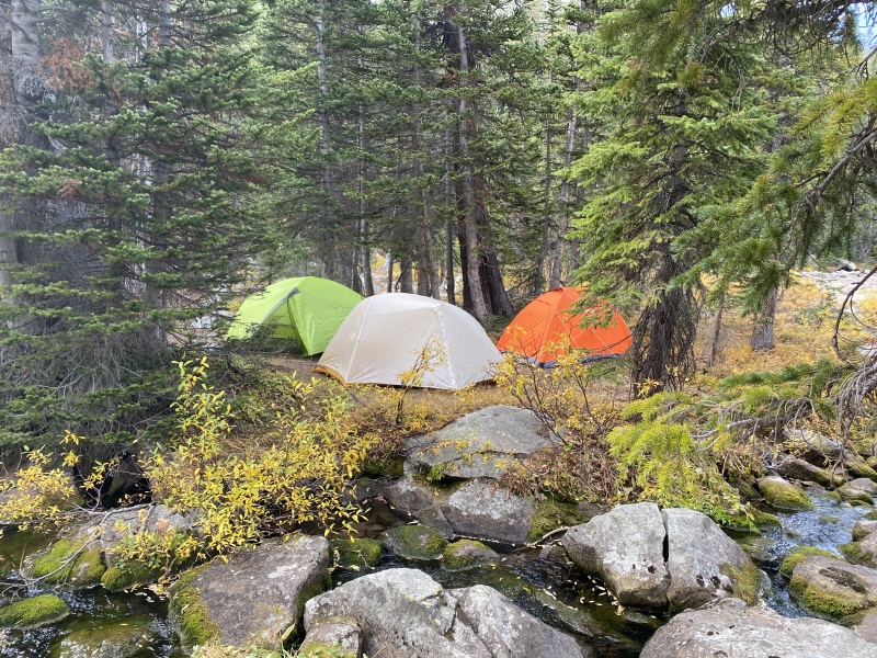
We followed this very short trail section which took us to 11,200 feet, near the lower of the two small lakes/ponds on the map. We scouted around to find a place to put up tents. It took us four hours of hiking to reach the camping area. We weren’t fast or slow and didn’t stop much. It’s about 6.25 miles, give or take depending on your GPS and 2,800 feet of gain. There are numerous spots for tents, some large, some only big enough for one. Though fairly flat on the topo, this area was very bumpy due to the boulders above and just under the soil. We actually camped close to the smaller, lower, pond, which was nearly dry. Plenty of water to filter in the creek. The creek, like most of the area, is filled with boulders. So much so, you can't see much water in some sections. This area is small enough you can walk around it quickly. I put waypoints at several of the possible camping areas. An area on the east side of the creek, next to the boulder field was the largest. But the trail goes through there. I only found two spots worthy of a single tent between the two small lakes/ponds. So many boulders. I didn’t see any spots around the upper lake, though I did not walk it. Again, lots of rocks/boulders. If you are into hammock camping, there are plenty of trees. One benefit to this route is the lack of people. Basically, no one else. We saw no one camping in the entire valley. We did see three day hikers come trough. And I saw three more people on the way out in the lower valley. We heard a forest ranger was checking backpackers on the Capitol Lake side. So, if you come this way, please keep it clean, "Leave No Trace," and help make it a great area for the next people to camp here. We set up camp, and Brad and Shannon went up and hiked/climbed Clark (that’s why we left so early this morning). Took them about 6.5 hours roundtrip from camp. Chad and I relaxed, took naps, hung out, and filtered water. I hiked up to the upper lake. 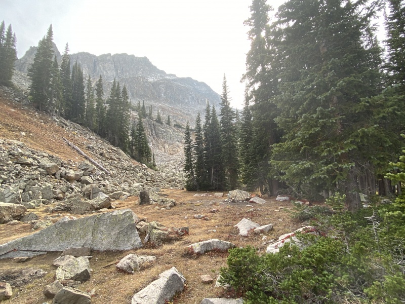
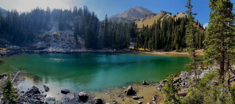
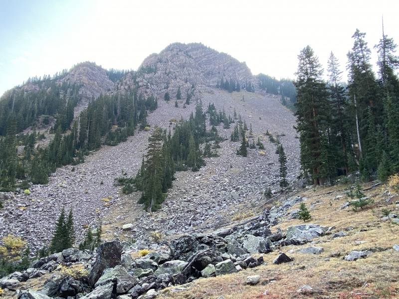
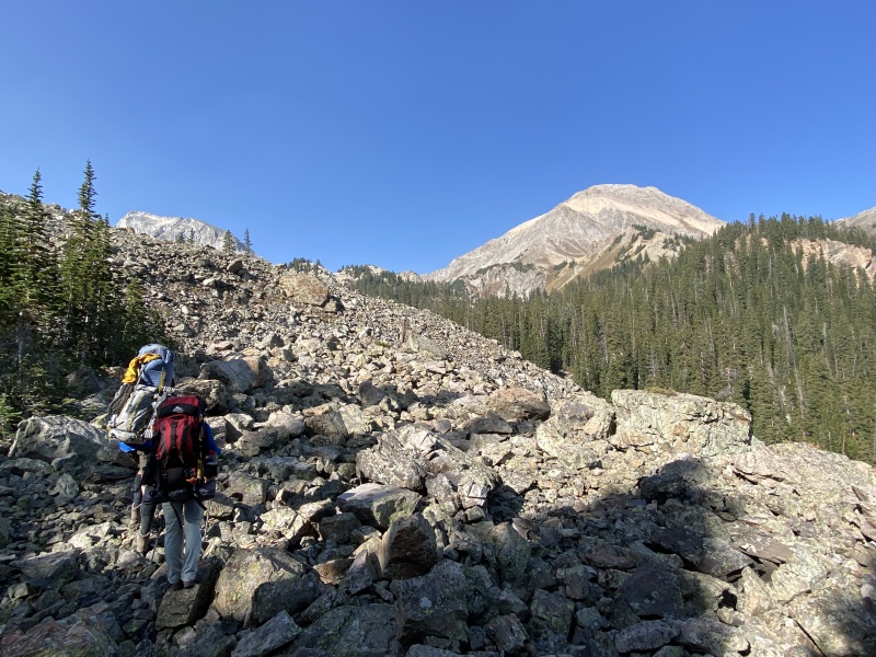
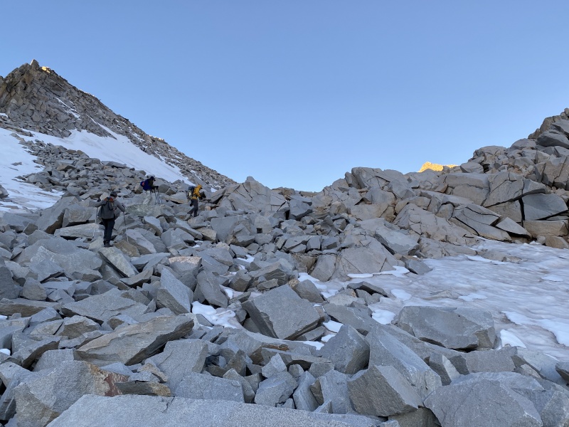
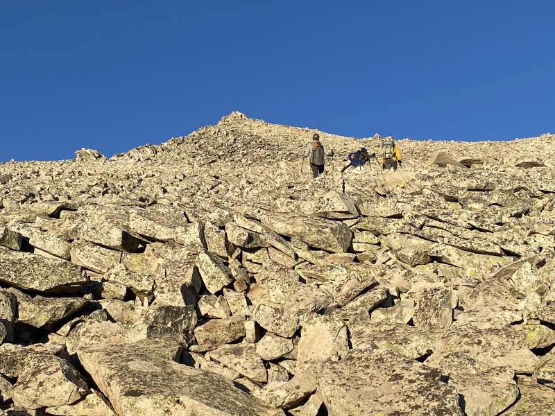
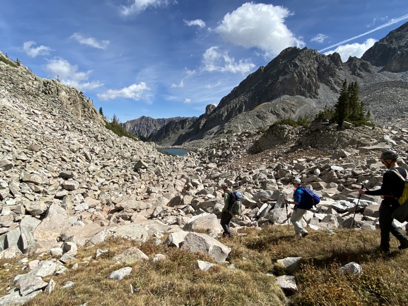
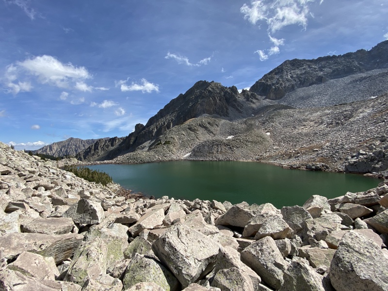
We had dinner and went to bed early to get ready for Capitol on Sunday. The wind blew hard most of the night, putting bad thoughts into our heads. But Sunday’s weather was great. Up and on the trail by 4:30 a.m. again. To reach Moon Lake, follow a faint trail through the camp spot next to the boulder field, cross a boulder filled creek and there is a slope with a trail. This takes you up to 11,400 and the start of a lot of suck. Boulders. Basically boulders from here until K2. No, really. Just boulders. This section of boulders leading to Moon Lake was like a Class 2+ scramble. Boulders varied in size from microwaves to passenger vans. In the dark we got turned around a bit, but quickly found our way around the lake, though we couldn’t see it in the dark. 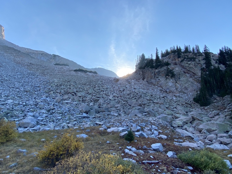

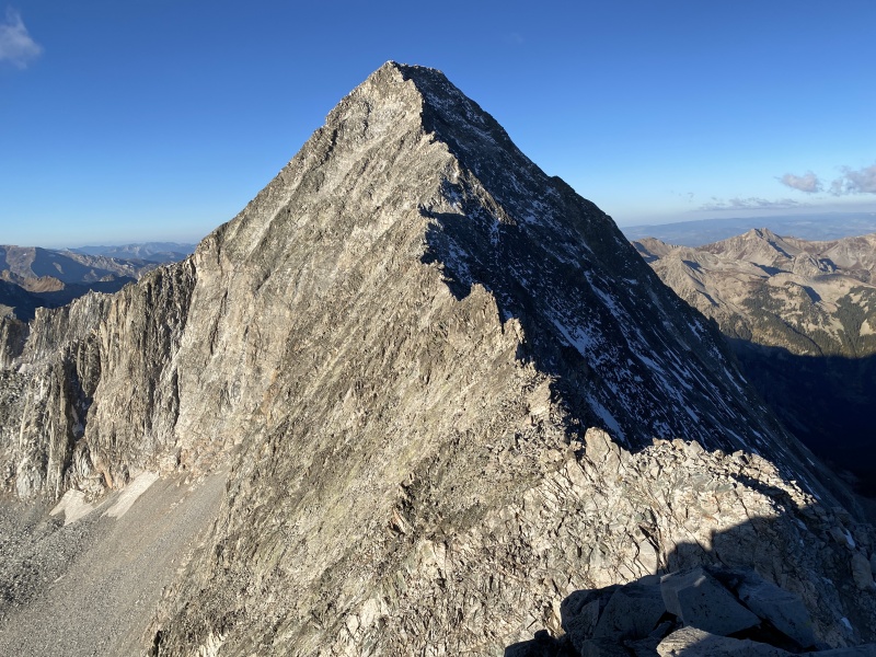
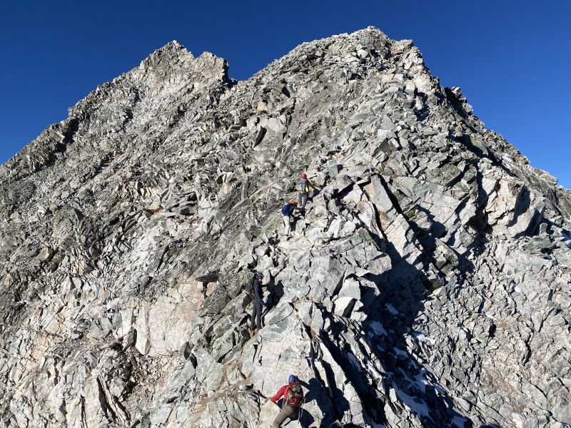
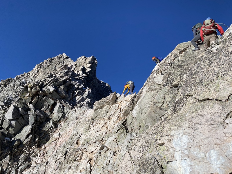
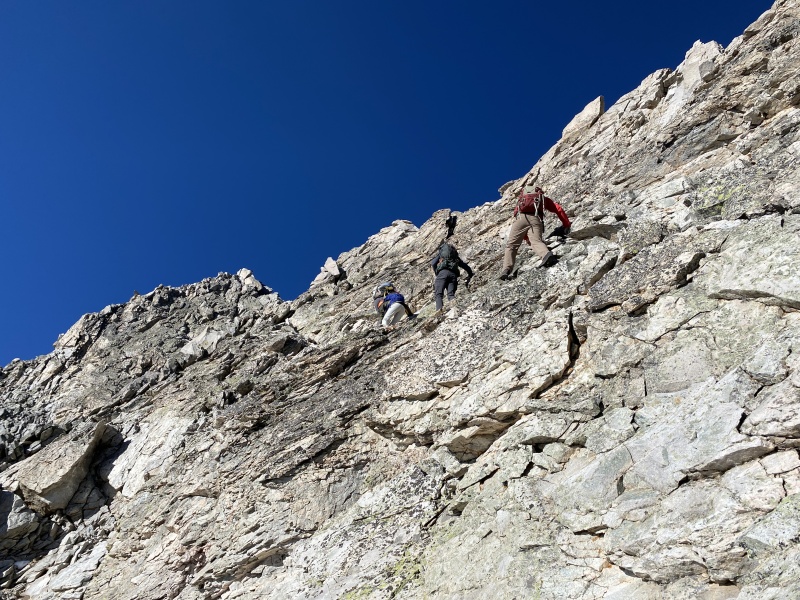
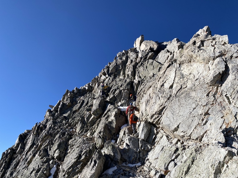
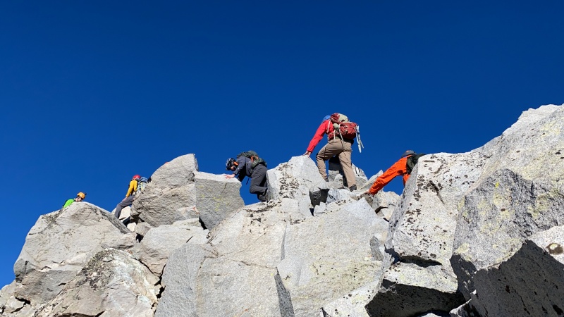
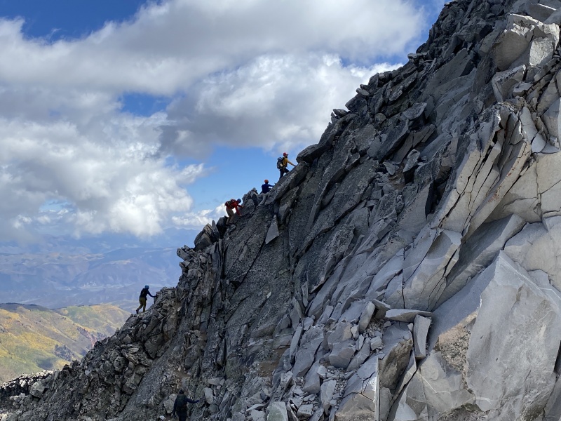
NOTE 1: You can’t go around the shore of Moon Lake on the right side, north side. There is a rock wall that blocks the way. So, we went up and over. NOTE 2: My GPX track is from us coming down below Moon Lake and goes into a gully to the north, of the boulder slope (right side going up). We went up the boulder slope, but came down the gully, less boulders, easier to descend. So, after Moon Lake we hiked on more boulders, and more boulders… had a very short stretch of tundra near 12,000 feet, directly in line with the Daly saddle to the west… then more boulders. We curved to the left, southwesterly, and hiked up more boulders until we connected with the standard Capitol route near 12,600. Think it took a little more than two hours to get to this this point. We stopped for a quick snack. From here we followed the route to K2, where we met up with Steve, Brooks and Chu. This was probably close to three (plus?) hours into the hike, so maybe between 7:30 to 8 a.m. Helmets on. Game on. Up the short Class 3 section to summit K2. Down the northwest face. We descended a bit differently than my last Capitol summit, though I saw someone go down that way. We dropped off, took a hard right and worked our way down and right to a cairn, then took a hard left and down. I thought way this was Class 3. One move might have been Class 4. There was snow in the bypass, so no one was using that route. 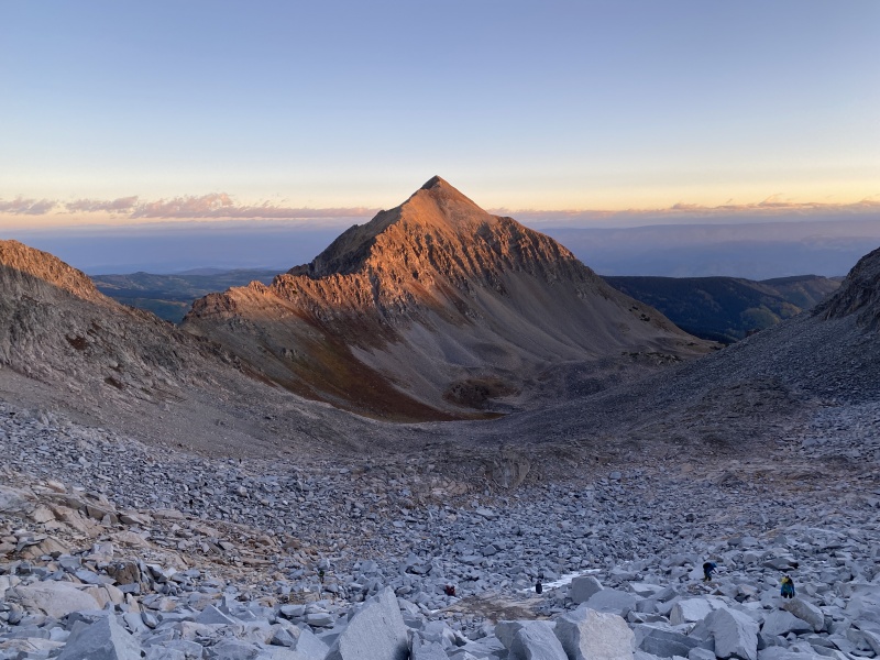
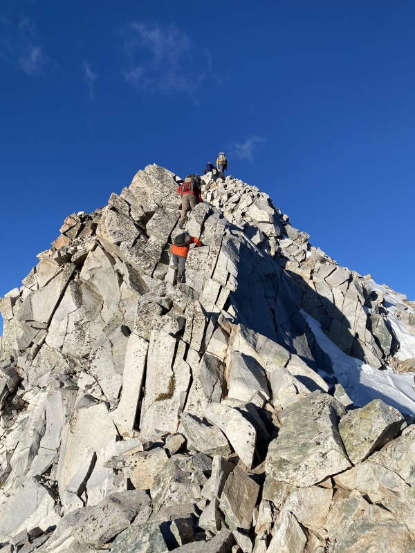
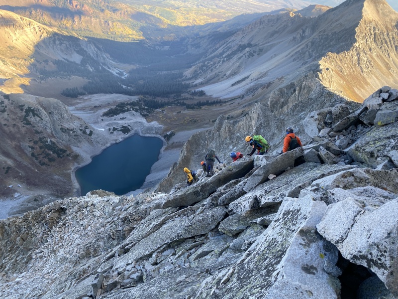
Across the Knife Edge. The standard route begins going up the Northeast Ridge, but then turns left onto the face. We continued up the Northeast Ridge. I’ve been told this route is more solid than the face. I think that is accurate. Brad wanted to go this way to scout out a winter attempt. The Northeast Ridge route has more Class 4 moves, more exposure, more vertical and more knife edgy sections. The route was a challenge, but it was also fun. We connected to the summit ridge and hit the top about 9:30 a.m., 5 hours from the camp. We spent half an hour eating and taking photos. The group voted to return via the standard route. I think this was the faster option for us. At some point on the face, I think we missed a cairn, because we did a Class 4 down climb I don’t remember doing before. 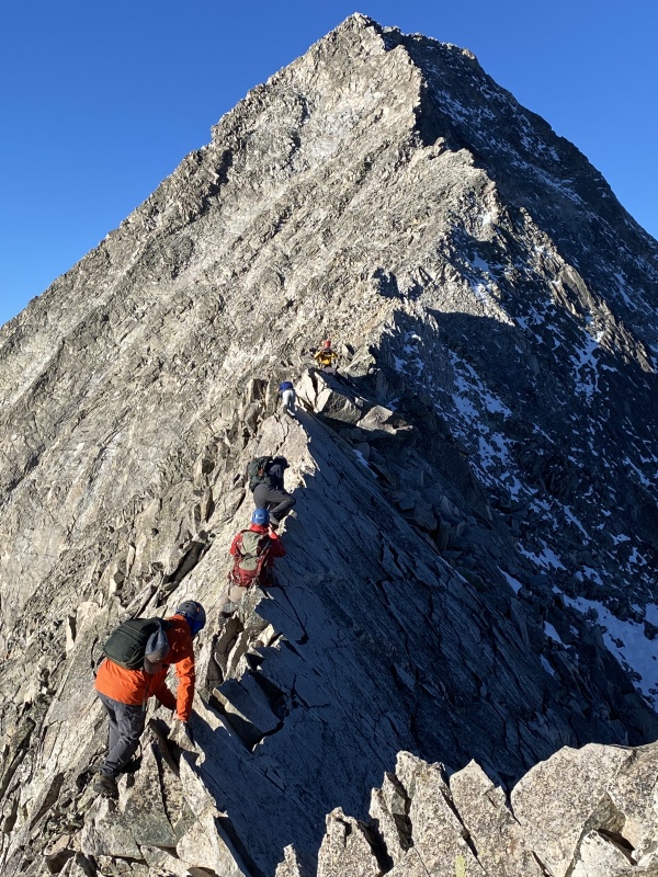
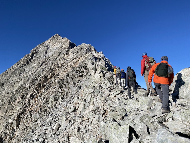
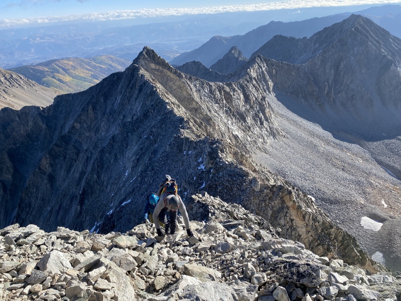

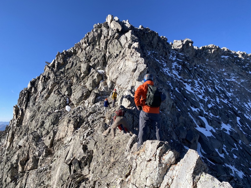
Left the summit about 10 a.m., and we were back down to the saddle about 11 a.m. Back across the Knife Edge. Up and over K2 by 11:35 a.m. It was time to celebrate. The climb of Capitol doesn’t relent. You have to be mentally aware the entire time. You have to watch your partners and others on the peak. Who is above? Who is below? The peak is physically demanding and draining, including the backpack in and out. Once you get back to K2, there is sense of relief and accomplishment. But the day is far from over. 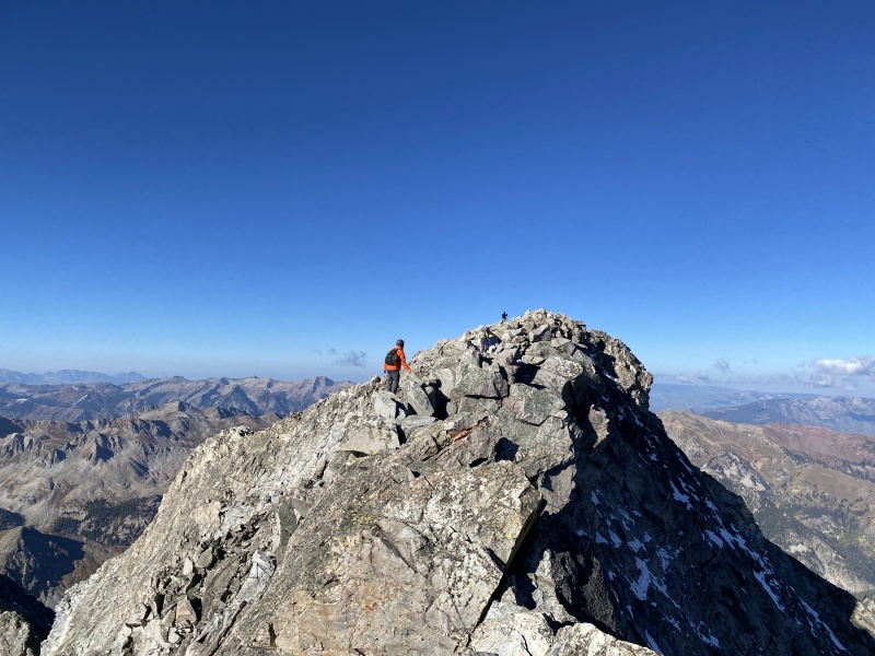
It was time to boulder hop a couple thousand feet back to camp. That was so exhausting. We split up with Steven, Brooks and Chu near 12,600 as they went back towards Capitol Lake. We worked our way down to Moon Lake and were able to see it for the first time today. Pretty lake with no shore, just boulders. Back at camp about 2:15 p.m. and it was time to eat and rehydrate. Then we took a leisurely lunch and began to pack up. Chad, Shannon and I were heading down. Brad was staying for one more night and another 13er, 13,060 B. Three long hours on tired legs, we were back at the trailhead just after sunset with light fading and sore backs. 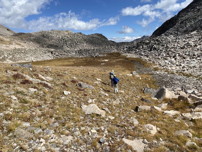
Quick Stats TH to Camp: About 6.25 miles, one way. (12.5 roundtrip). Camp to Summit: About 5.5 miles, round trip (because you can't walk in a straight line). My other Elk TRs. Maroon: https://www.14ers.com/php14ers/tripreport.php?trip=18668 North Maroon: https://www.14ers.com/php14ers/tripreport.php?trip=18745 Pyramid: https://www.14ers.com/php14ers/tripreport.php?trip=18775 Capitol, standard route: https://www.14ers.com/php14ers/tripreport.php?trip=19129 Thumbnails for uploaded photos (click to open slideshow): ")
")
")
")
")
")
")
")
")
")
")
")
")
")
")
")
")
")
")
")
")
")
")
")
")
")
")
")
")
")
")
")
")
")
")
")
")
")
")
")
")
")
")
")
")
")
")
")
")
")
|
| Comments or Questions | |||||||||||||||
|---|---|---|---|---|---|---|---|---|---|---|---|---|---|---|---|
|
Caution: The information contained in this report may not be accurate and should not be the only resource used in preparation for your climb. Failure to have the necessary experience, physical conditioning, supplies or equipment can result in injury or death. 14ers.com and the author(s) of this report provide no warranties, either express or implied, that the information provided is accurate or reliable. By using the information provided, you agree to indemnify and hold harmless 14ers.com and the report author(s) with respect to any claims and demands against them, including any attorney fees and expenses. Please read the 14ers.com Safety and Disclaimer pages for more information.
Please respect private property: 14ers.com supports the rights of private landowners to determine how and by whom their land will be used. In Colorado, it is your responsibility to determine if land is private and to obtain the appropriate permission before entering the property.