Download Agreement, Release, and Acknowledgement of Risk:
You (the person requesting this file download) fully understand mountain climbing ("Activity") involves risks and dangers of serious bodily injury, including permanent disability, paralysis, and death ("Risks") and you fully accept and assume all such risks and all responsibility for losses, costs, and damages you incur as a result of your participation in this Activity.
You acknowledge that information in the file you have chosen to download may not be accurate and may contain errors. You agree to assume all risks when using this information and agree to release and discharge 14ers.com, 14ers Inc. and the author(s) of such information (collectively, the "Released Parties").
You hereby discharge the Released Parties from all damages, actions, claims and liabilities of any nature, specifically including, but not limited to, damages, actions, claims and liabilities arising from or related to the negligence of the Released Parties. You further agree to indemnify, hold harmless and defend 14ers.com, 14ers Inc. and each of the other Released Parties from and against any loss, damage, liability and expense, including costs and attorney fees, incurred by 14ers.com, 14ers Inc. or any of the other Released Parties as a result of you using information provided on the 14ers.com or 14ers Inc. websites.
You have read this agreement, fully understand its terms and intend it to be a complete and unconditional release of all liability to the greatest extent allowed by law and agree that if any portion of this agreement is held to be invalid the balance, notwithstanding, shall continue in full force and effect.
By clicking "OK" you agree to these terms. If you DO NOT agree, click "Cancel"...
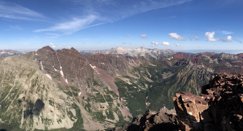
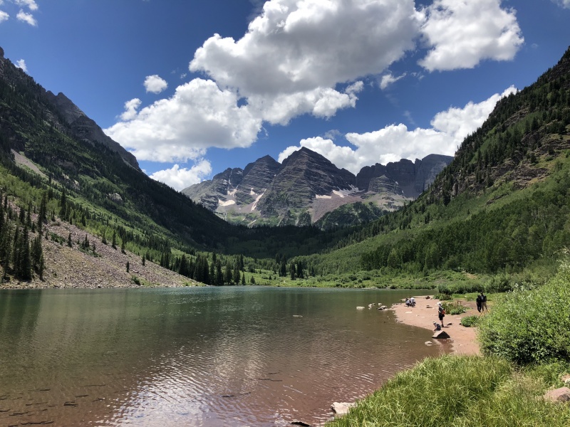
We had other plans for the weekend, but the weather didn’t look good for the hike in the basin. So, we went for Pyramid. One more time hiking from Maroon Lake, as we've hiked Maroon Peak and North Maroon recently.
I don’t have any interesting stories, details or unique perspectives on this one. The Route Description and the other TRs pretty much tell it like it is. A few more photos won’t hurt. The TR and photos are a little out of order, more by section than actual time of day.
We started before 3 a.m., in case the rains did come in the afternoon. It was pretty rainy the day before. Due to the change of plans we had extra time that evening so we hung out at Maroon Lake for a while before camping. The lake area was nearly vacant. Only a few people around instead of the crowds during the day. The rainy day provided a cool evening with fresh mountain smells.
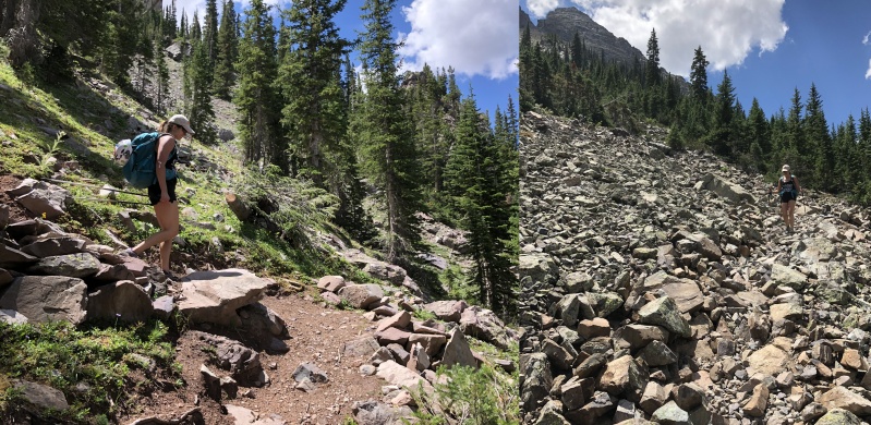
Lower Trail
Having been on the trail a couple of times we had a good idea where the turn off was. From there it was a case of “where’s the trail - oh, there’s the trail, where’s the trail - oh, there’s the trail” in the lower section. The trail is there, but not so well defined in some areas. A good head lamp was essential here.
(Speaking of - because of our other plans, I had left my headlamp in my backpacking pack. Offered to buy one off someone at the TH, but they didn’t have a spare. Then I found my spare in the bottom of our food box. My wife had tossed it in there just by chance. Lesson: when switching packs, make sure to get every thing out.)
This area was kind of a no-man’s land. Just a curvy trail to get to the slope.
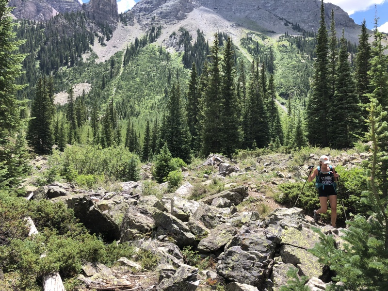
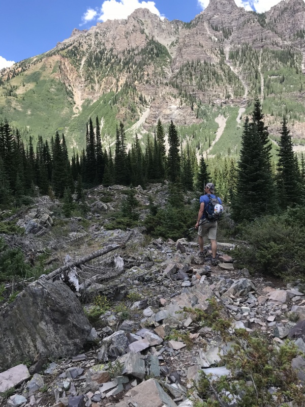
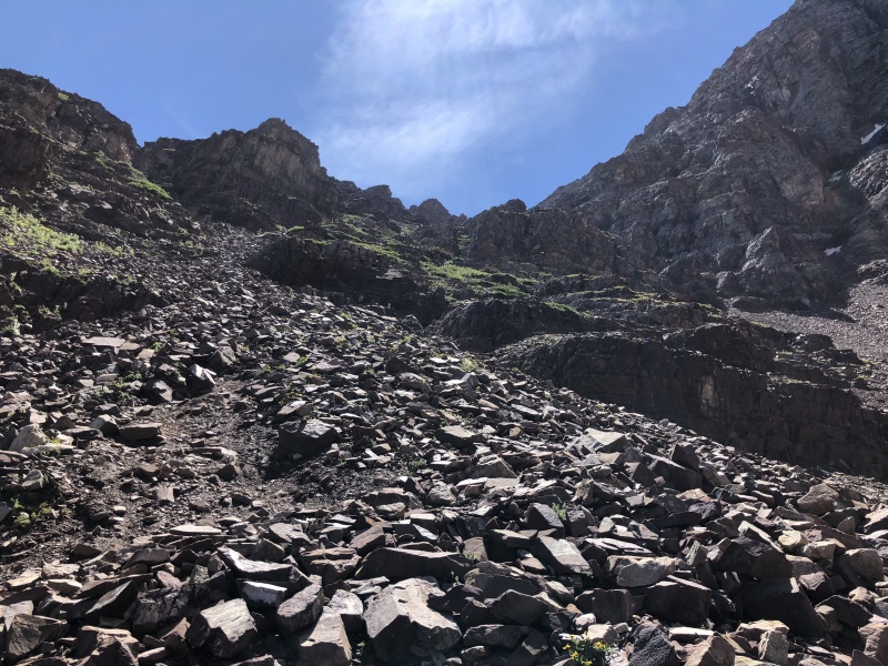
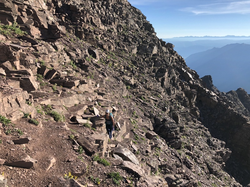
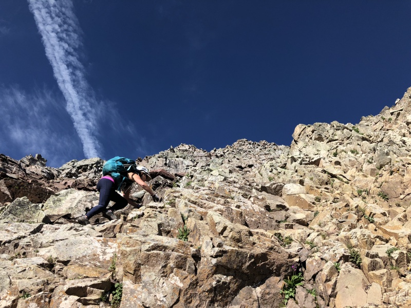
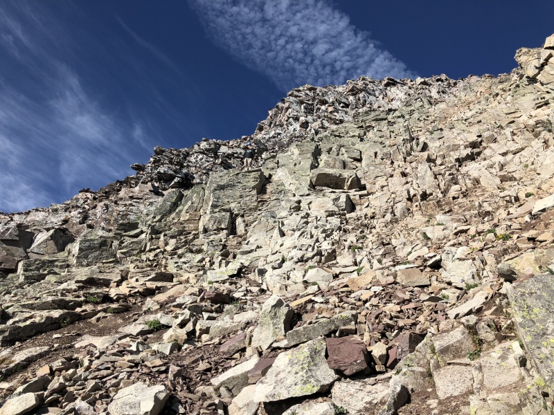
The trail in this section traversed through thin forested areas and open rocky vistas as it switchbacked up 1,000 feet. It transitioned from rocks to dirt and back numerous times. Several areas had stairs. Love the work CFI and other organizations do.
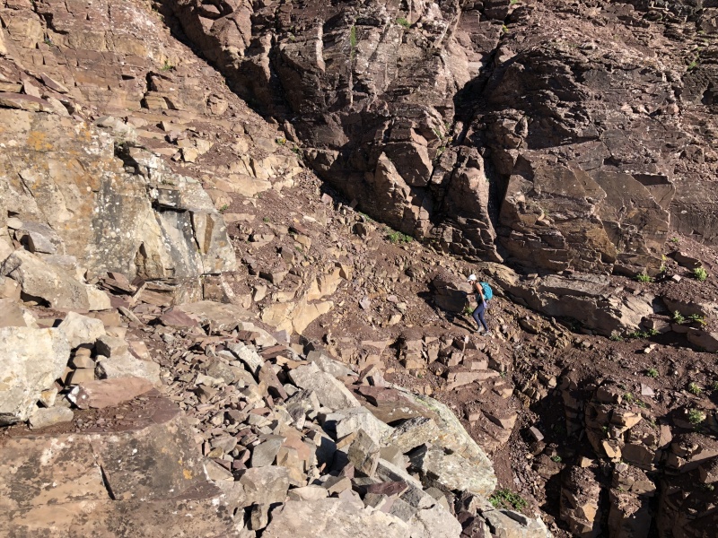
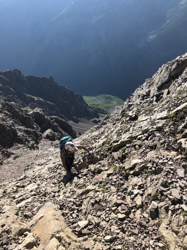
Between Crater Lake trail and the SlopeBetween Crater Lake trail and the SlopeThe slopeTrail on the slope is a mix of dirt and rocks
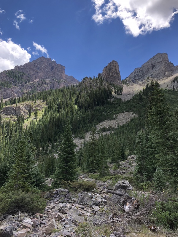
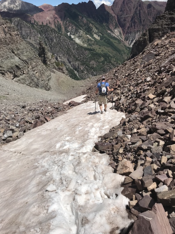
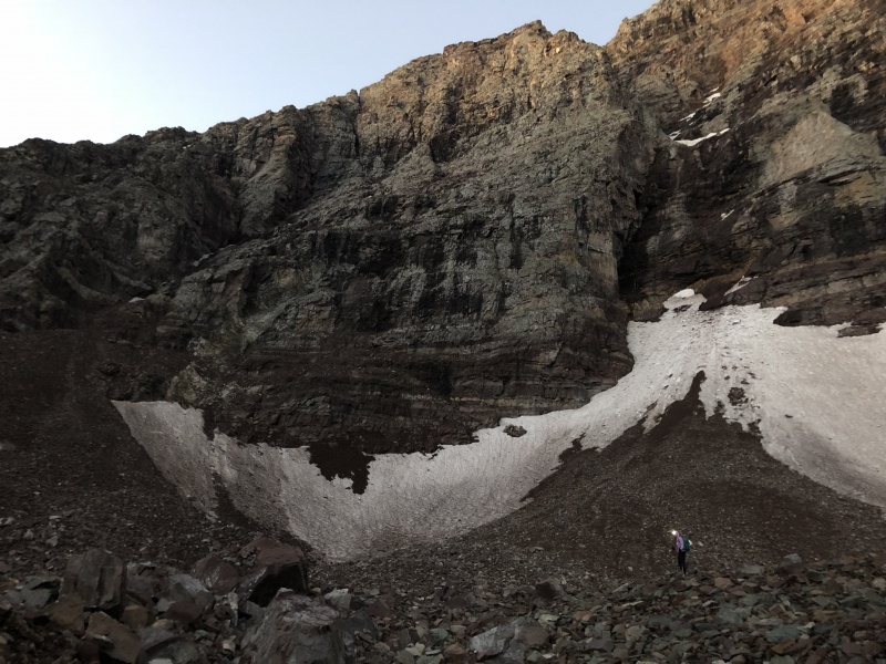
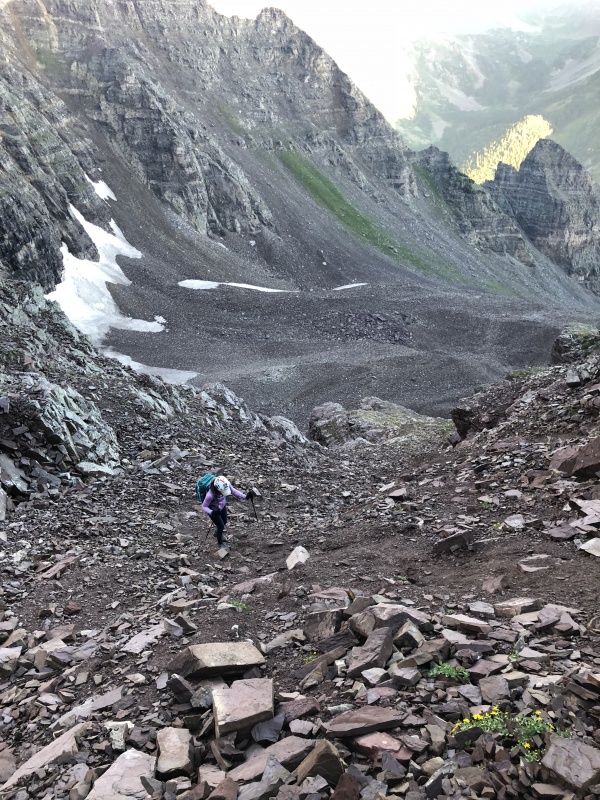
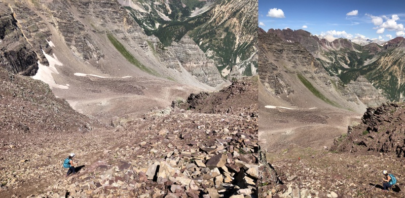
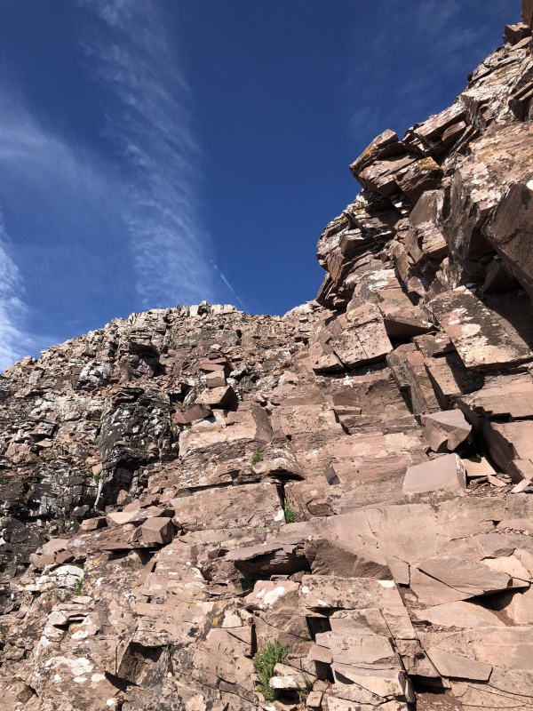
Rock Glacier
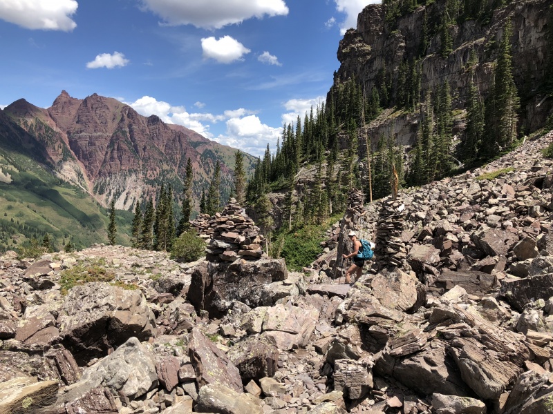
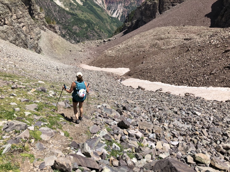
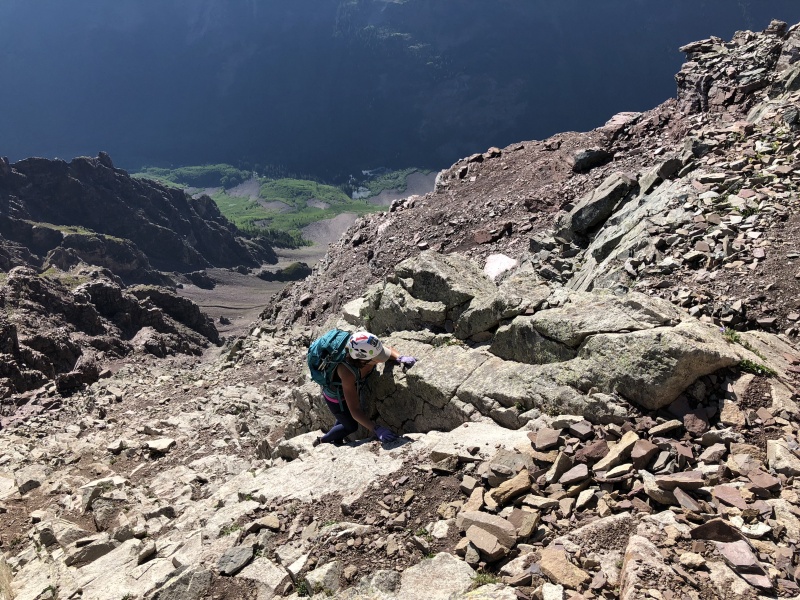
At we entered the lower rock glacier area. It was kind of movie-set like with four towering cairns to welcome you into the new area. The large boulders and hidden trail was a complete change from the slope both physically and mentally. This area could have used a few more cairns to help guide at night. But in the day, they aren’t needed.
The rock glacier was a slog of walking on rocks. Most stayed in place. A few didn’t. Just takes more time to walk on this terrain. We spotted a few occasional cairns that kept us going in the right direction. As the night sky became lighter we could see the rock glacier on the left with a line of snow separating us from it. I wondered if crampons would have been worth the weight today.
Later, on the way down, we used the snow to descend for several hundred yards, until we saw a trail. Yes, a real trail on the west side just above the rocks. Once you hit 11,500 feet start moving right and look for a cairn or two. The trail starts (or ends depending on which direction you’re going) near here. This would have been so much easier on the way up. I’m not sure how far it goes up, but it might go to the left turn into the amphitheater. It goes to at least 11,800.
The four huge cairns near 11,200The route into the amphitheater, hiker right of center, probably on the faint trailRoute upWe took the easy way down, until we saw the trail on our left.On the trail on the way downNearing the bottom of the rock glacier area, almost to 11,200
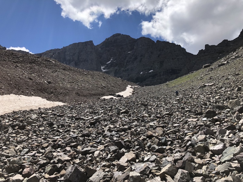
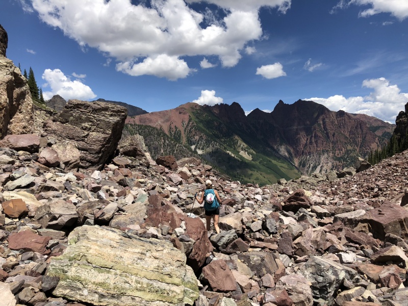
Amphitheater
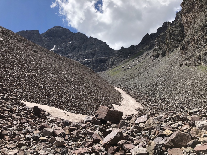
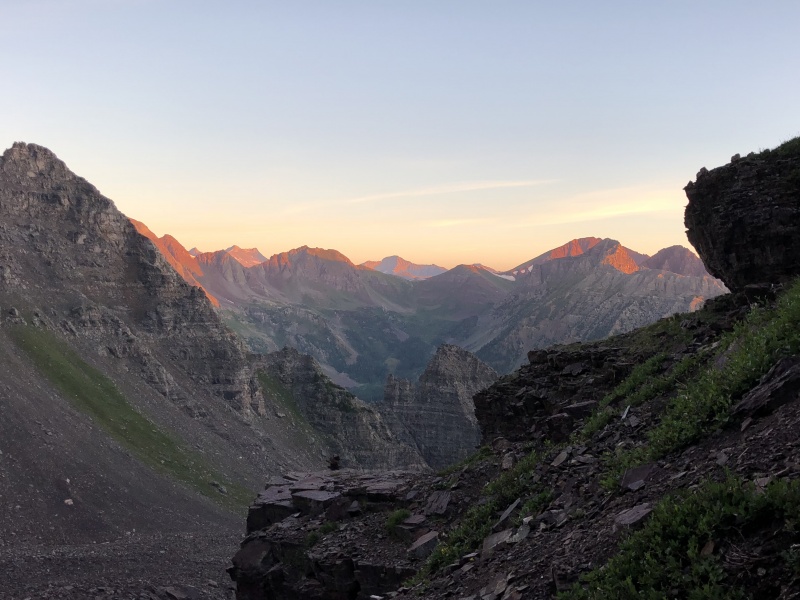
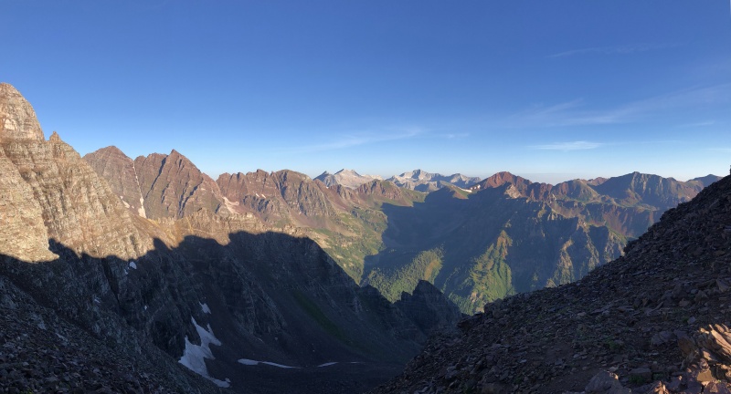
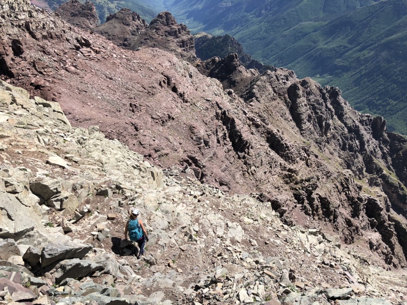
Once we were far enough into the amphitheater, following the .com’s GPS file, we turned left and crossed the snow and hiked a small rise to see the land before us. It’s a huge rocky plateau with small hills and gullies. Kind of cool. But no trail. We could see the next section, the gully, and walked toward it. We got a glimpse of true alpine glow on the south ridge of the amphitheater. That was cool too.
One the way down, we could see some cairns that marked a trailless route across the amphitheater from the gully to the rock glacier route. We followed it, but didn’t seem to do much for us.
A wet and snowy face of the amphitheater provided some excitement. Rocks dropped out of that thing all day. Some shattering on impact, echoing against the stone walls. Some sounding like gun shots.
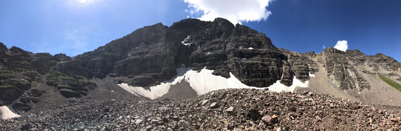
Pano of the amphitheater. In the morning, I was surprised by the sound of birds within the rock walls.
A hint of alpen glow at the top and a headlamp below. She is on one of the many 'hills' in the floor of the amphitheater.Rocks were falling out of here all day. Route was far enough away not to be a concern, but the sound was pretty cool.
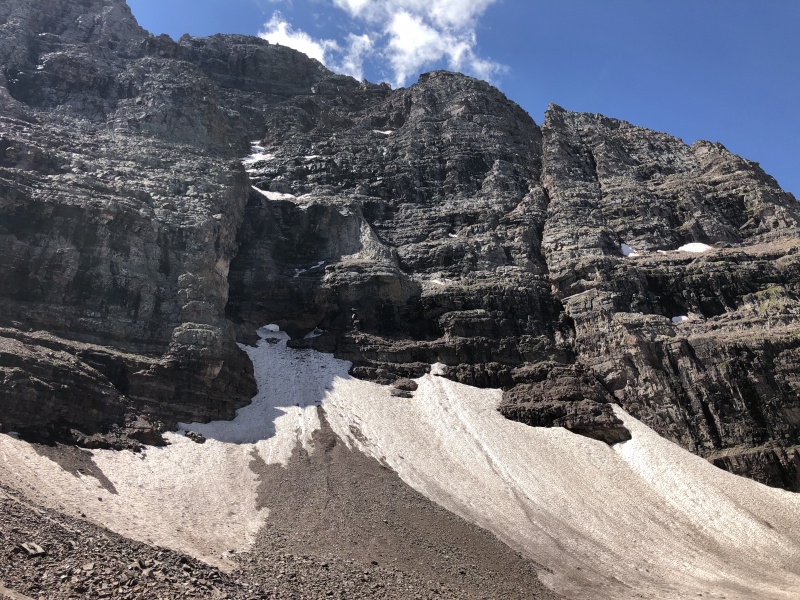
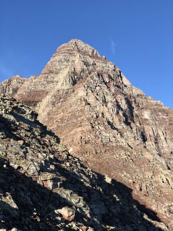
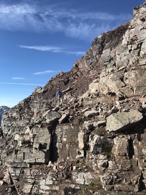
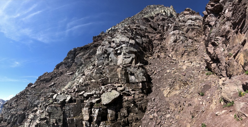
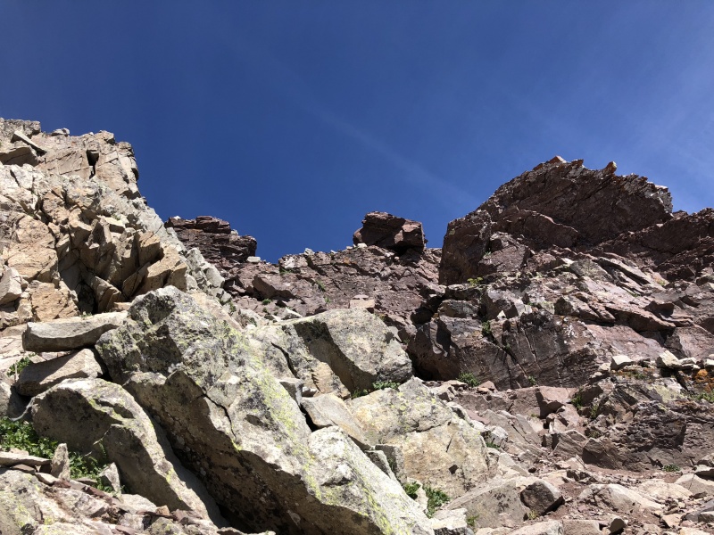
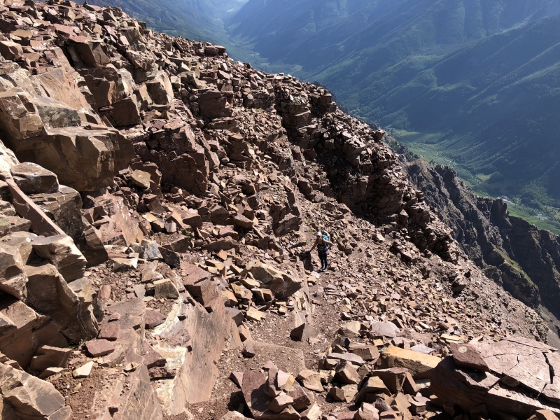
The Gully
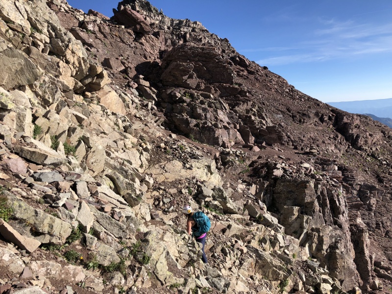
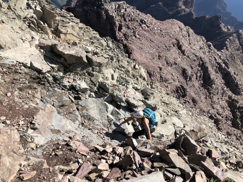
Yep, it’s steep. Looking at the gully from across the amphitheater, it’s hard to believe there is a trail. Perception is interesting. With all the rain the day before, it wasn’t very loose. Sweet! I’ve been on few “loose” gullies that had recently seen rain, and they were not as loose as expected, nor were they muddy. The gully had a typical mix of changing dirt, scree, braided switchbacks and rocks. Towards the top, there seemed to be a “short cut” to the right to skip the saddle, but we went for the saddle anyway.
We took a break at the saddle. It took us 4 hours to get here. I was hoping for 3, but was expecting 3.5. We need to move faster.
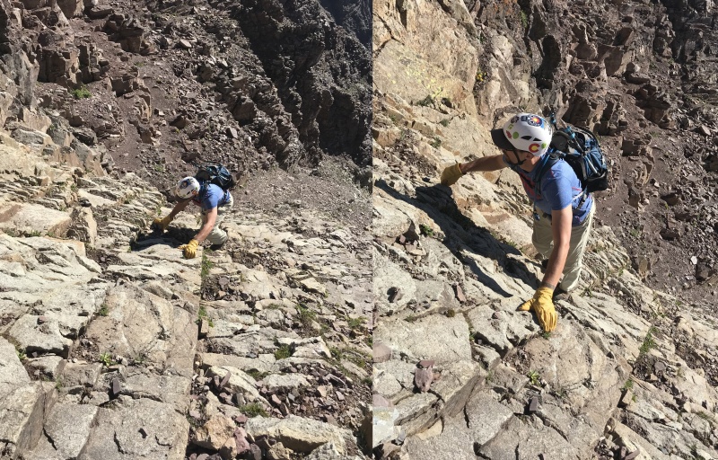
Going up the gully 12-13KLooking up at the gully near the bottom in the afternoon.Going down the gully Staci wore microspikes to help with the loose terrain. It worked.Sun rising and lighting up the peaks. Taken from the gully.
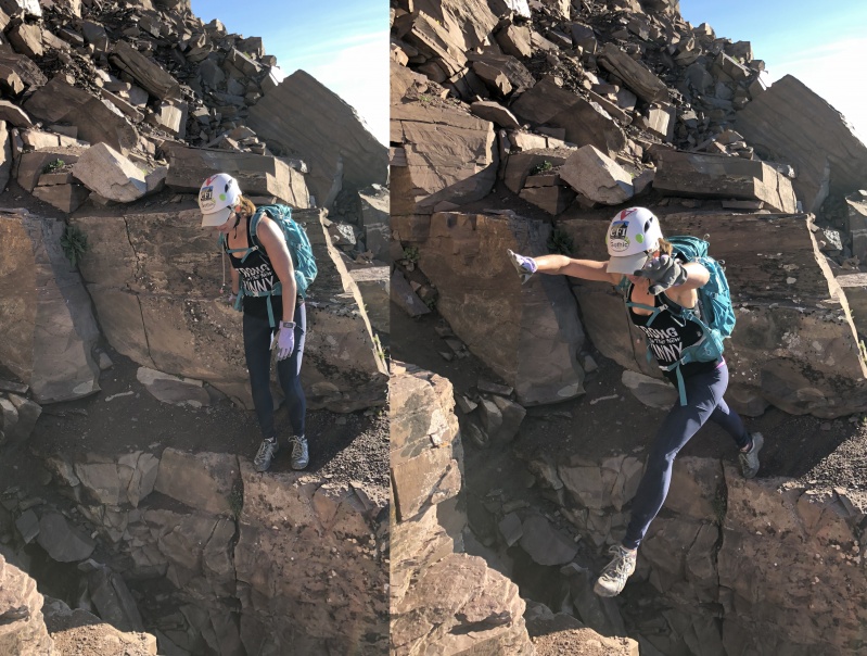
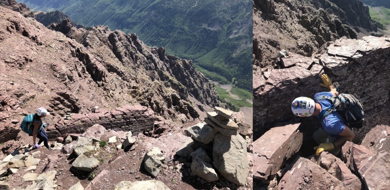
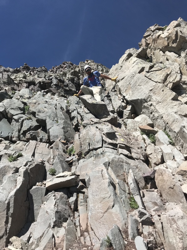
13,000-13,400
We followed the GAIA and cairns and hit the leap section near 7:30 a.m. My wife jumped. I stepped.
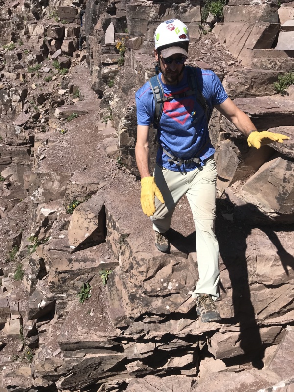
Pyramid and the Bells all have the same layers and ledges you must scramble and climb without knocking off rocks.
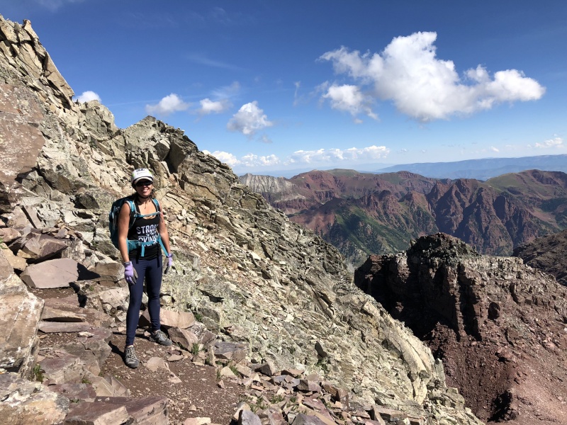
View from the saddle at 13,000Photo from the saddle has a great view of the mountain top.Just like the Bells, ledges and loose rocks.Ledges and loose rocks"The Leap" It was a long step for me.Great form on "The Leap"
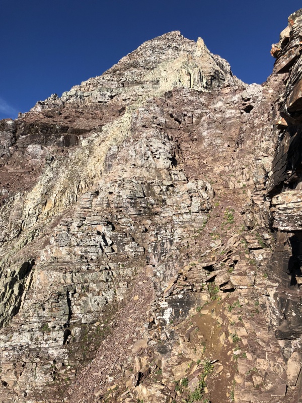
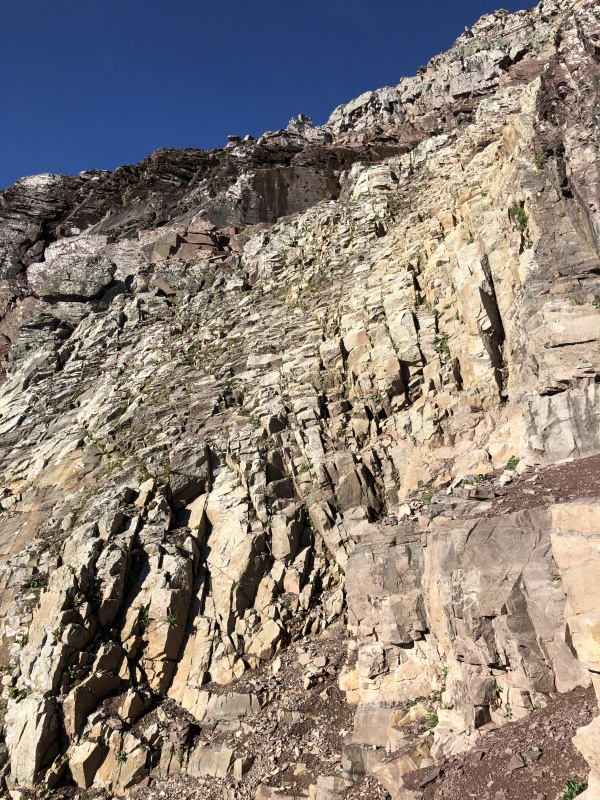
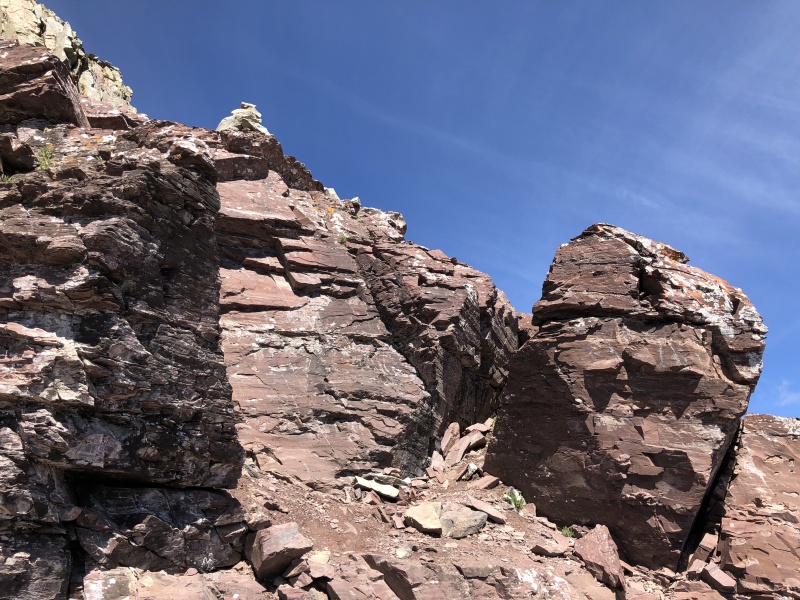
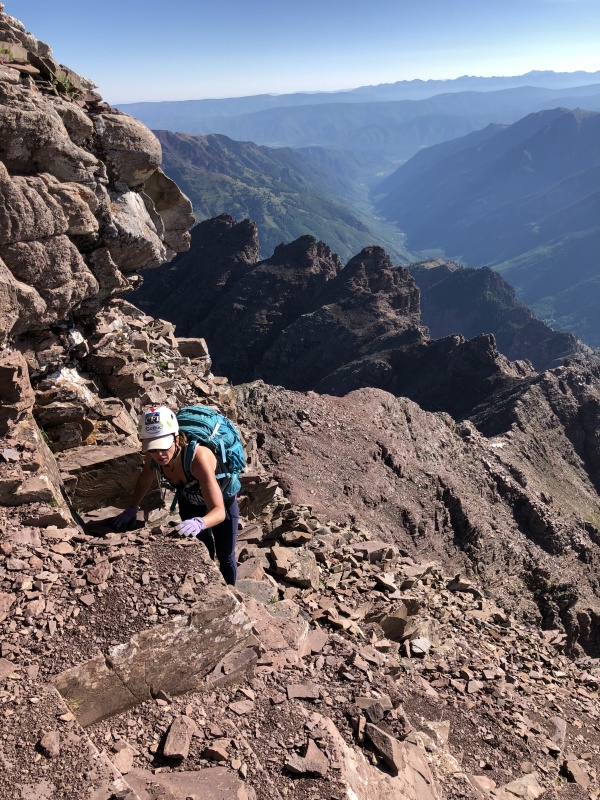
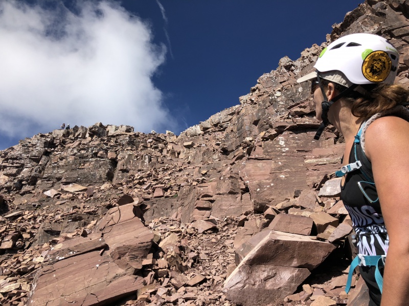
The Green Wall
We entered the Green Wall about 7:45 a.m. It reminded me of an English Muffin, lots of nooks and crannies. None too deep, and nothing very flat. Lots of places for hands and feet. But still a bad place to tumble. About halfway up, near 13,500 we saw some cairns to our right. We went that way and we kind of left the wall, just on the edge. I found a Class 4 corner to climb. Staci walked around it to find a Class 3 boulder. I followed her and was glad I did. The corner was doable, but once above it I saw a pile of loose talus at the exit. Not sure how that would have gone. Back into the Green Wall we made it up the exit near 13,600.
On the down climb, we did a lot of crab crawling on the Green Wall.
At the small gully before the Green WallGully and route to the Green Wall, route above the flat boulder in center of image, cairn to the left on the ridgeGully and Green WallEntry area to the Green WallGreen WallGreen Wall... a lot like an English Muffin, nooks and cranniesGreen WallNear 13,500Near 13,500 we moved into here. There were a few cairns that led this wayWe went into the space between the wall and the boulder.The boulder from above (notice the cairn)Green WallGreen WallThe Green Wall. Eli Boardman is up above, he passed us going up and coming down. We're about to exit the GW.Green WallThis is near the cairn to exit/enter at 13,600 of the Green WallThe exit for the Green Wall at 13,600Down climbing the Green WallDown climbing the Green Wall
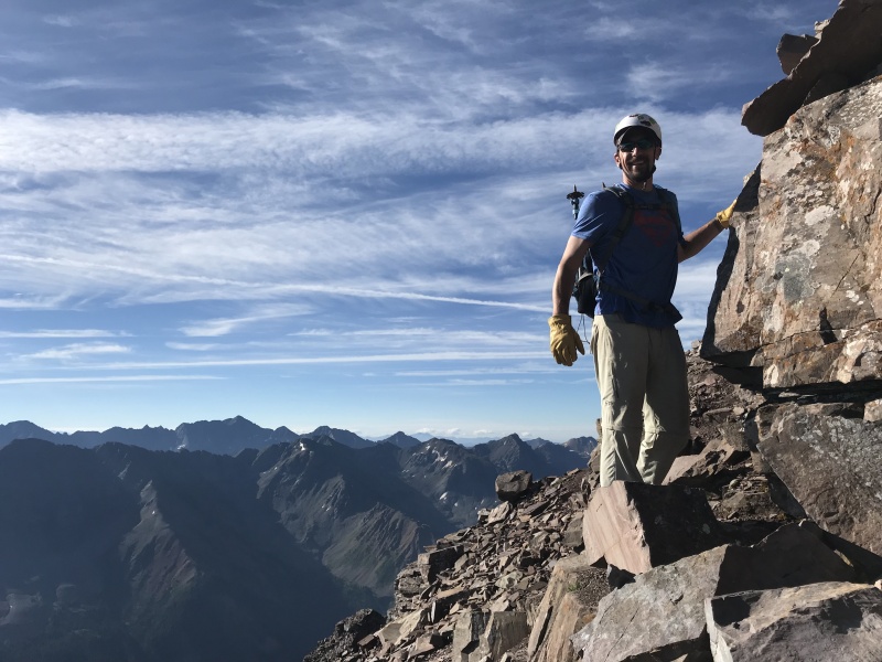
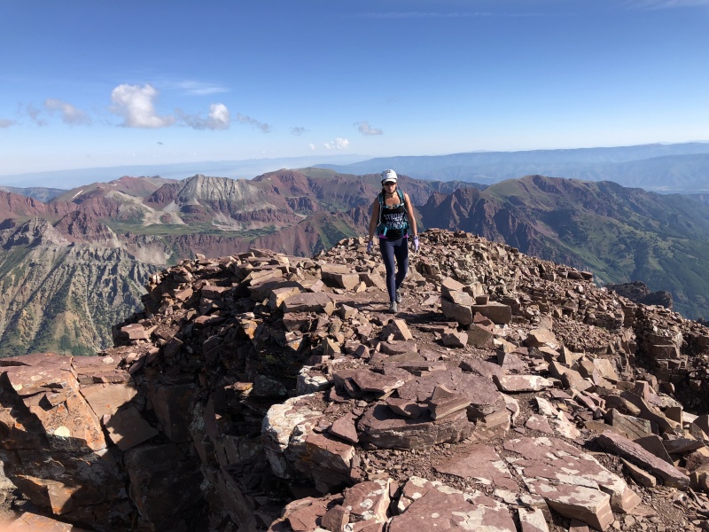
13,600 to Summit
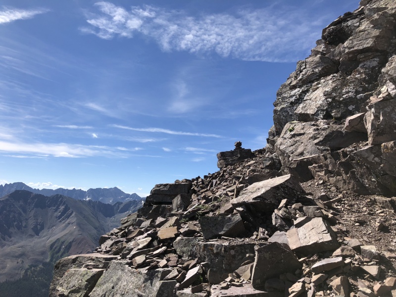
Lots of ledges and cairns between here and the summit. Not all of the cairns were great indicators of the route. We went far left a few times and did some C4 moves that we really didn’t need to. You can do Pyramid and stay C3 if you take the time to find your way. Especially if you stay center and right. There were a few other hikers on the peak this day, and no one did the exact same route through this section.
We probably made route finding a bit harder than we should have from here to the summit. But like numerous people have said, the down climb is so much easier. The view from above and seeing cairns made it simple. There was maybe once or twice we “faced in” for a down move, but it was only one move or step.
The day stayed warm and clouds started to build as expected. We spent some time at the TH relaxing. I ask a forest service worker about swimming in Maroon Lake, but she said it was closed to swimming though there were no signs. So I took a dip in the creek.
Ledges and cairnsLedges and cairnsCairn in center of image, with the summit ridgeRoute finding?The summitLooking back at the summit: people and goats at the top
GAIA stats
2:45 a.m. Start at TH, at 9,500
3:30 a.m. turn of Crater Lake trail to Pyramid
4:20 a.m. top of slope, enter rock glacier area, at 11,200
Brings back memories (except the part where the goats were kicking rocks down the green wall on our group while staring into our eyes) and is really thorough in explaining each section. Thanks for posting.
Your timing of this report could not have been better and your pictures and description will do a lot to help me, I'm sure. Thank you for posting this!
So much info so concisely! And great pics to boot.
The trail to climber's right of the rock glacier does continue essentially all the way to the left turn in the amphitheatre. It meanders along parallel to the snow band, and then abruptly turns left and leads directly into the snow. But we found no better trail than you did over the rock glacier to the base of the gully.
The north face was shedding rocks on a regular basis when we climbed Pyramid too, in August. Being safely distant from the line of fall, I found it entertaining and very appealing. Gave the entire peak a kind of menacing aura, making the summit all the more satisfying.
Thanks for the nice write-up! Out of curiosity: how would you compare this to North Maroon? I have done Pyramid and found it pretty easy (minus the goats kicking rocks down on you part), but neither of the bells. Thanks!
I really love your trip reports. it's fun and useful for my trip also. My most left ones are in Elk range. Thank you for all of your detailed and fun reporting. When you and your wife hike next one, I would love to join also. I met you at the cripple creek butt theater last year shortly if you still remember it. Let me know what is your plan, I really love to join if my work schedule work with yours.
Caution: The information contained in this report may not be accurate and should not be the only resource used in preparation for your climb. Failure to have the necessary experience, physical conditioning, supplies or equipment can result in injury or death. 14ers.com and the author(s) of this report provide no warranties, either express or implied, that the information provided is accurate or reliable. By using the information provided, you agree to indemnify and hold harmless 14ers.com and the report author(s) with respect to any claims and demands against them, including any attorney fees and expenses. Please read the 14ers.com Safety and Disclaimer pages for more information.
Please respect private property: 14ers.com supports the rights of private landowners to determine how and by whom their land will be used. In Colorado, it is your responsibility to determine if land is private and to obtain the appropriate permission before entering the property.

")
")
")
")
")
")
")
")
")
")
")
")
")
")
")
")
")
")
")
")
")
")
")
")
")
")
")
")
")
")
")
")
")
")
")
")
")
")
")
")
")
")
")
")
")
")
")
")
")
")


