| Report Type | Full |
| Peak(s) |
Capitol Peak - 14,138 feet |
| Date Posted | 09/29/2018 |
| Modified | 09/29/2020 |
| Date Climbed | 09/16/2018 |
| Author | JQDivide |
| Additional Members | Sanjainthemountains, FoodieHiker |
| Thoughts on Capitol |
|---|
|
Capitol Peak 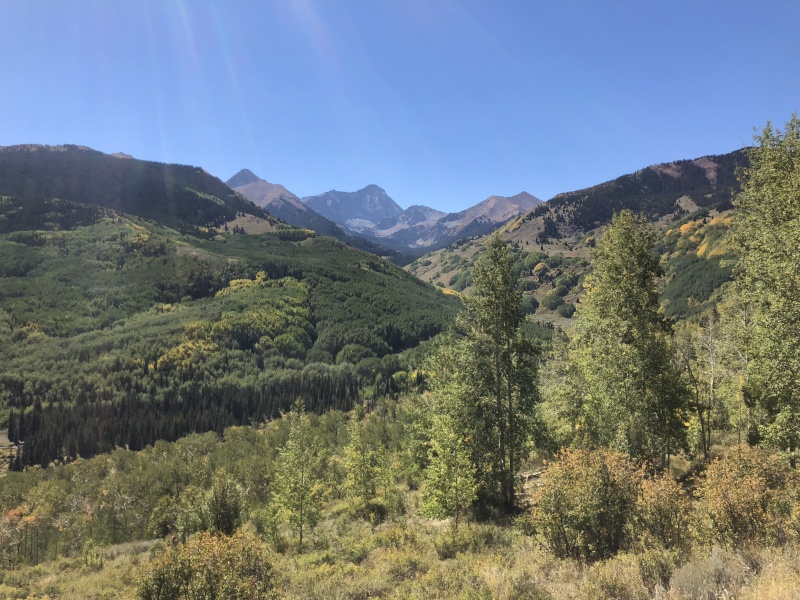
Capitol Peak lived up to the hype of being a hard peak. Not so much a technical climb, but it takes a lot of effort both mentally and physically to reach the summit and return. Brad McQueen once told me the key to successful summits in the Elk Range is to stay on route. I have taken that advice to heart. Staci and I had Capitol on the schedule a couple of times this summer, but weather changed our plans twice. We wanted two clear days for the approach hike and summit day. Backpacking in the rain, simply sucks. And we didn’t want to get to camp wet. We had planned to hike in on a Sunday and hit the summit on a Monday to limit the number of people on the peak. As the summer went on, Capitol became one of the few 14ers we had left of the 58. 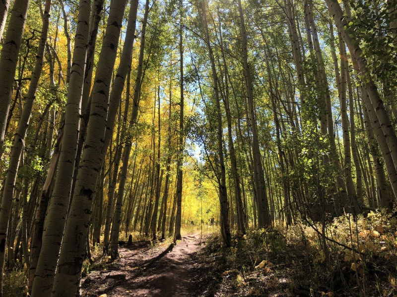
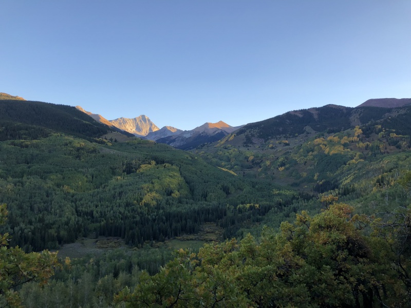
We decided to give a Sat/Sun schedule a shot after Labor Day hoping the number of hikers would be lower. We left the house on Saturday morning. The aspens were turning gold in the BV area, but not so much on the west side of Indy Pass. We stopped at PoppyCock’s for breakfast in Aspen. (I’d eat there again.) The drive to the trailhead was beautiful, like so many drives in Colorado. The aspens were still green, but a few were changing. We arrived at the TH after 11 a.m. The TH parking area was full, so we parked down the road just a bit. Wow. We could see Capitol from the TH. What an awesome view of the journey ahead. The valley was full of aspen trees, something similar to the valley that leads to Mt. Lindsey. That’s a good reason to wait to do these peaks when the aspens are in prime fall colors. 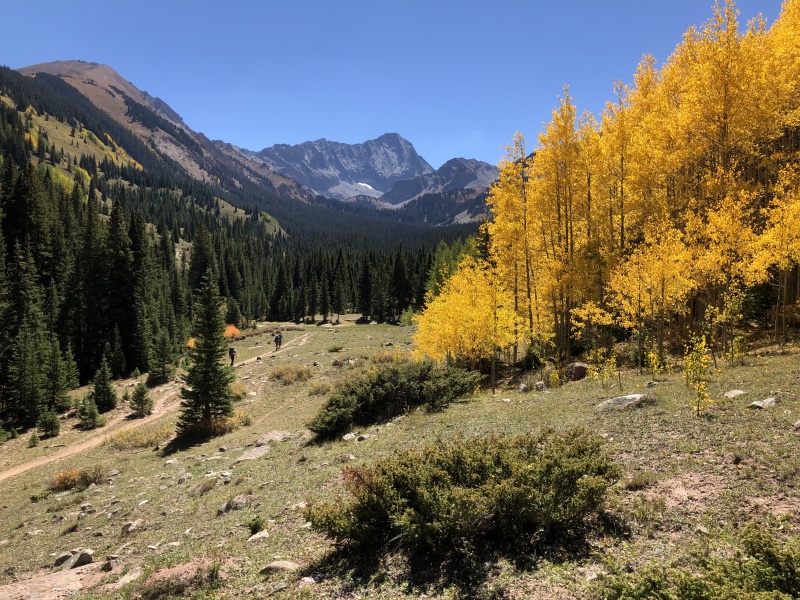
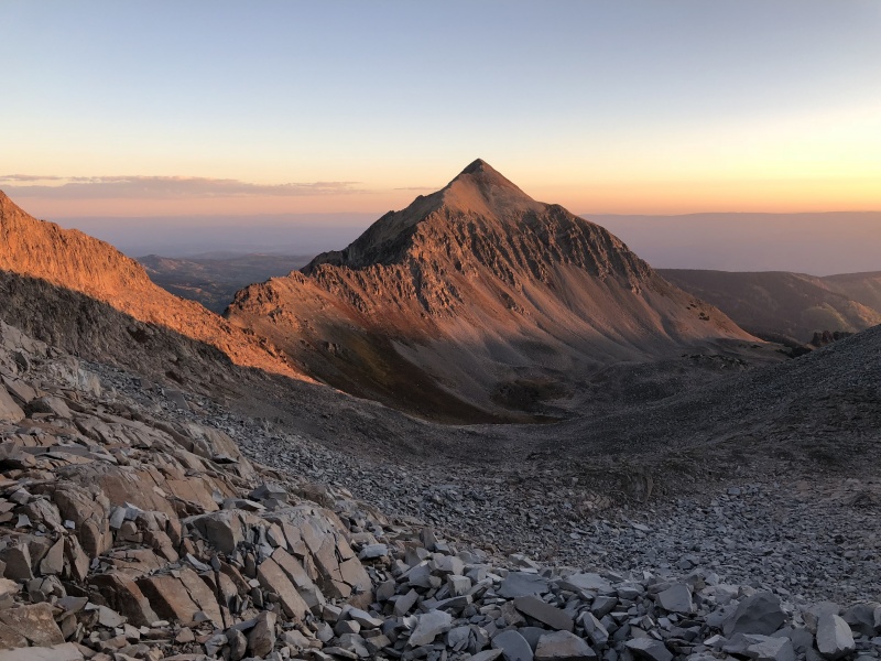
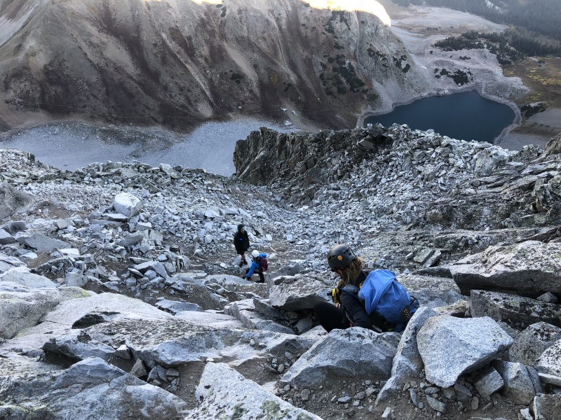
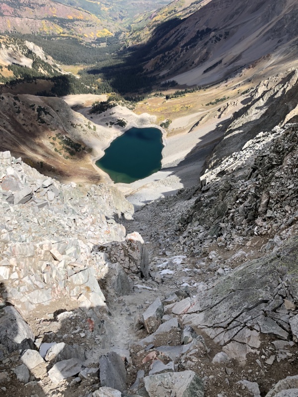
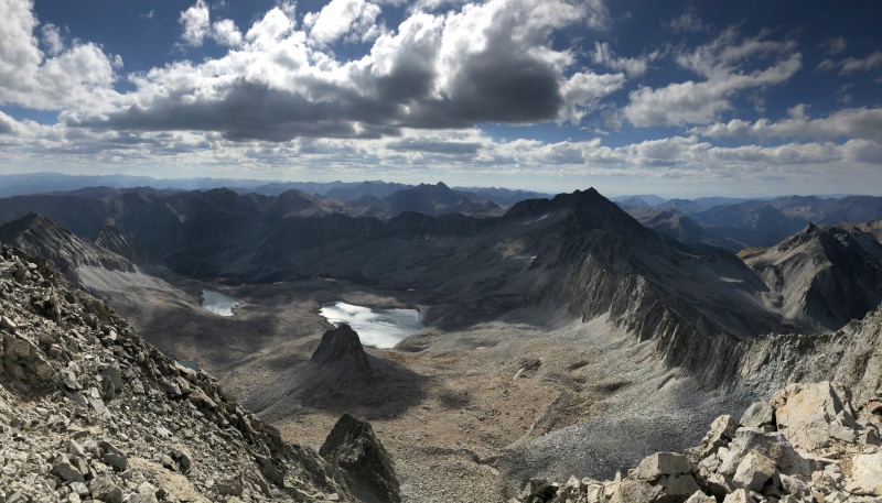
We strapped on our backpacks and headed out. It was warm. Nearly too warm to carry heavy for a 6-mile hike. If I did this again, I would drive to the TH the day before, sleep at the TH and start hiking earlier. I do think the afternoon heat slowed us down a bit. I was expecting it to about three hours to get to the camp sites, but it took an extra 30-40 minutes. We set up camp and took a short walk to view Capitol Lake. Looking at the peak from the lake, I can’t imagine thinking there is safe alternative down that face. In 2017, three people thought there was and were wrong. 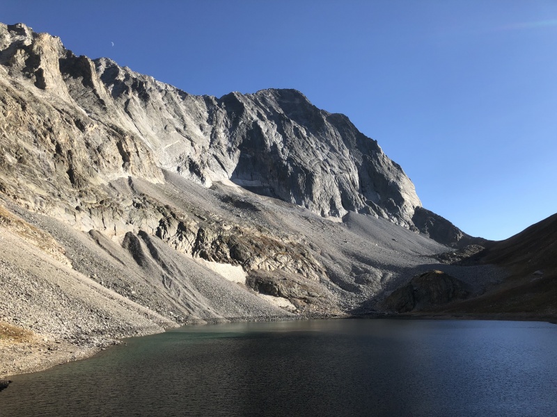
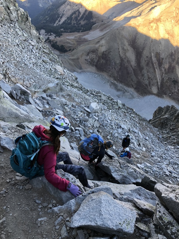
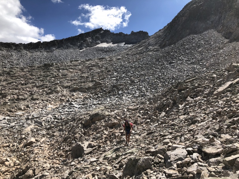
The campsites areas were full. Our thinking Capitol wouldn’t be as busy was a bit naïve as it was a beautiful weekend with no rain predicted. There were at least 30 people on the peak, several of which we actually knew or had met on previous peaks. This is a small and well connected 14er community. We had planned on getting an early start the next morning to beat the crowds. That didn’t work out so well. We slept in later than we should have, and we were moving slow. I think the heat from the hike in drained our energy. The slope from the lake to the saddle has a good trail, but it’s still 1,000 feet of elevation gain. As we made our way up, there were headlights above us, and headlights coming out of the campsites below us. 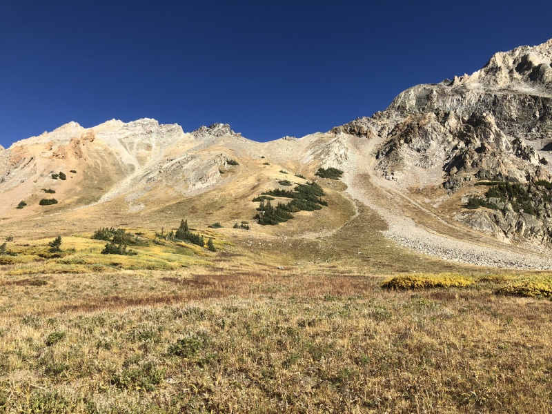
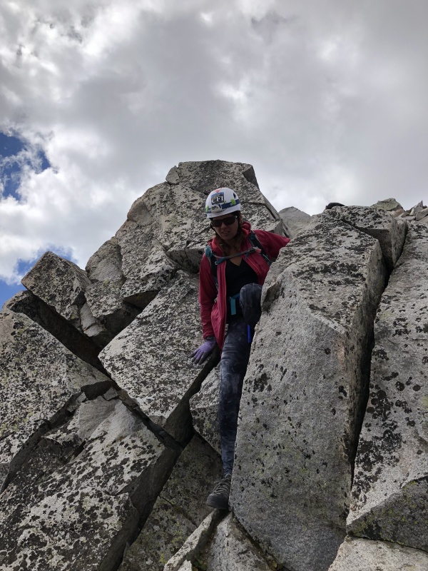
We topped out on the saddle and made our way on a trail over to the first major gully. Two headlights were near the bottom. A group of about 4-5 were at the top. They said two women, one who had been on Capitol before, thought that descending was the best option. At this point I looked at the GAIA app and the two routes I had. The routes said go up. We did and found a cairn pretty quick. An obvious trail began to reveal itself to us. We decided to put on helmets shortly after we crossed the first gully. We didn’t think there would be people above us, but there were slopes and rocks above us. Anyone below us, really needed helmets. (On the way back we were on a trail, about 20 feet below this trail.) 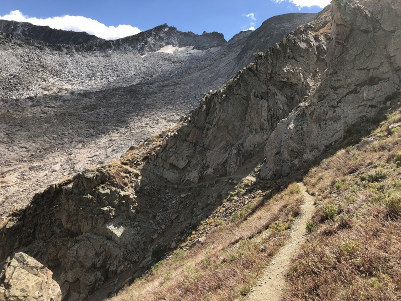
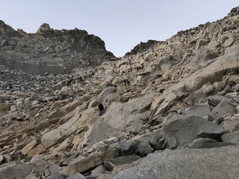
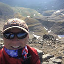
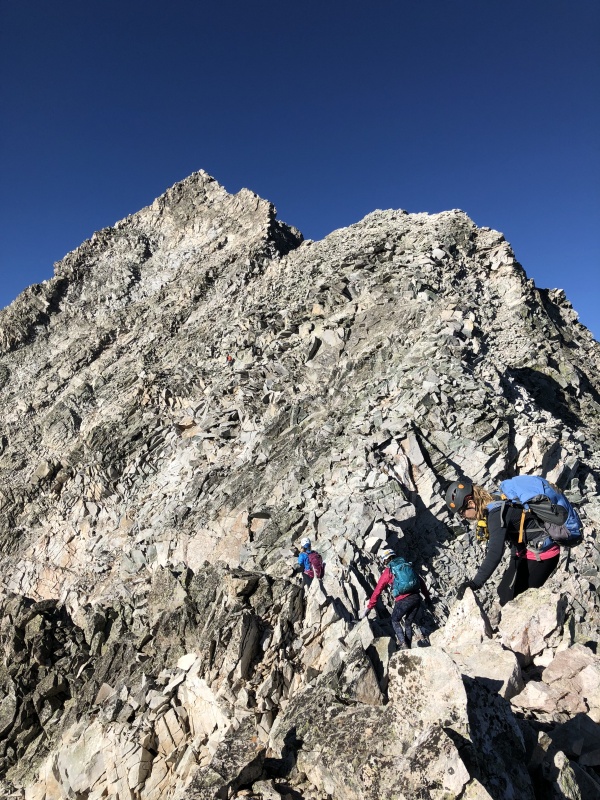
We followed the route which was a mix of dirt, rocks and a few spots to scramble. There were plenty of cairns to keep us on track. The steepness of the slope yielded and became more of a boulder field. Soon after this we made the turn west near 13,000 feet. The boulders got bigger and dawn was in full light. Several people stopped for small breaks and to put away headlamps. We saw one tent in this area. As slow as we were moving, most people passed us by now. And shortly after this we heard… “I know you, you’re the one who brought the cobbler to the Spring Gathering.” Yes, Staci is known for sharing her delicious food. From here we joined Sanja N. and Sheryl M. on the trip up Capitol. Sanja had summited once before. 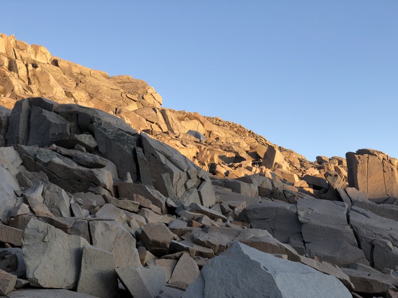
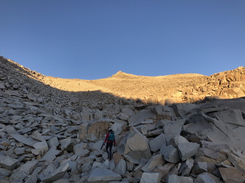
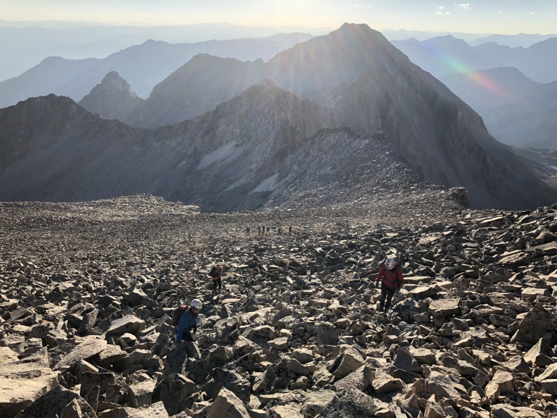
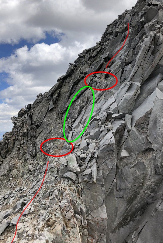
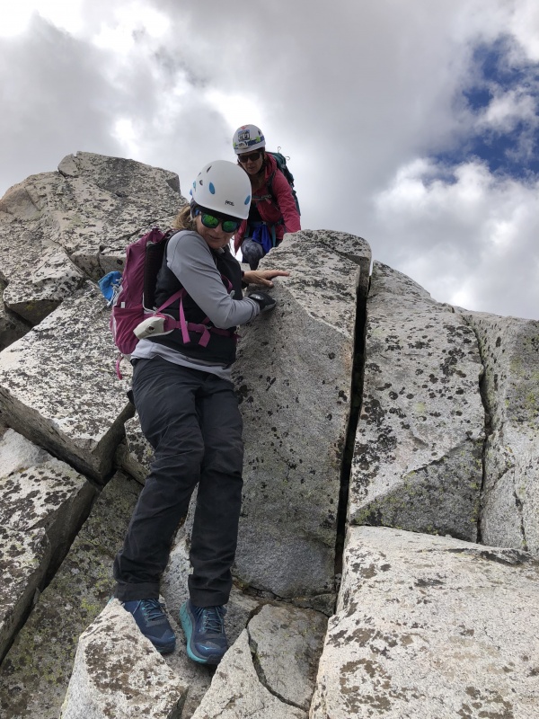
The four of us continued toward K2. The size of the boulders decreased and became more the size of talus, and at times, there was actually a trail. The view opened up and we saw the “photo” of the rocky slope with K2 at the top. I was surprised at the lack of size of K2. From this side, it’s like a 20-30 foot bump on the ridge. We followed a line of people up a short section of what I would call Class 3, maybe hard C3, but not C4 to K2’s summit. When I first started thinking about this peak, descending K2 was my biggest concern. Turns out, it wasn’t that bad. Sanja went first, having been here before. But once she started down, the route was obvious. Like so many routes, find the dirt. There were two spots of dirt down to the right, west, that marked the route, with a minor face-in Class 4 move in between them. And K2 was done. Definitely an easier and quicker task than I had anticipated. The group that was on K2 with us, took an alternative route down. Taylor C, who had done Capitol eight times, said it wasn’t the route “around K2,” but something in between the two. Looked Class 3ish, and ended up were we descended. Sheryl went down this way and we met up with her pretty quick. It took us a little more than three hours to get from the lake to K2. 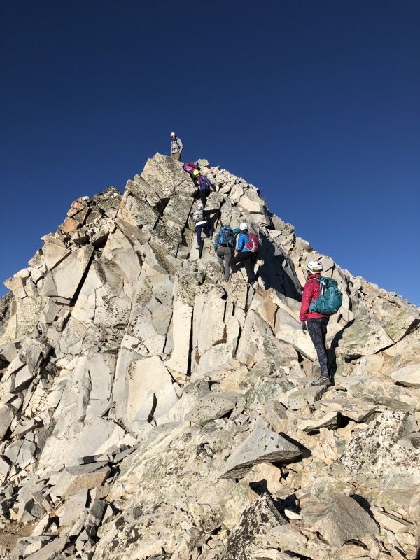
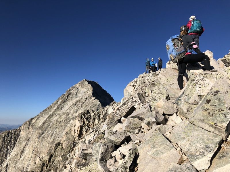
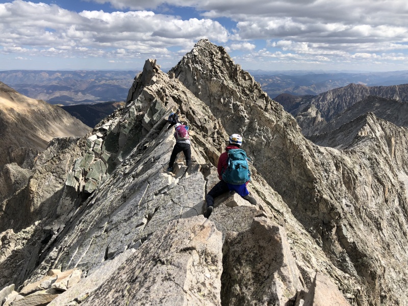
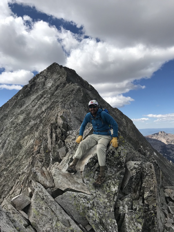
The route to the ridge was easy to follow. We stayed to one side or the other until it narrowed into the Knife Edge. We straddled it. The gouch scoot. It was awkward movements. Used feet and knees to keep my balance, and to move forward. But it was really hands and arms that lifted the body and moved it forward. Sometimes both hands in front, sometimes one in front and one behind. And this too ended quickly. I could imagine this would be a difficult task, mentally, in strong winds. 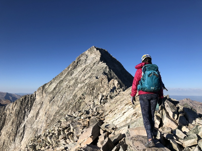

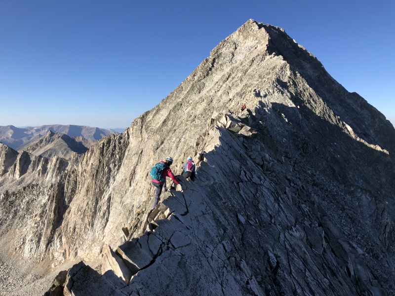
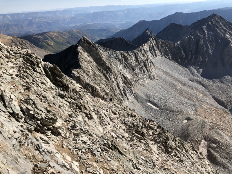
We continued on the ridge, until a narrow ledge with gullies on each side. This is where I assume people tried to take a shortcut off Capitol. The gully looks like a mess, but doable. But you can only see a short distance. I wonder what it looks like over that edge that would encourage people to continue down? 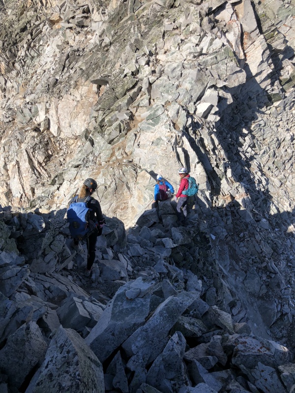
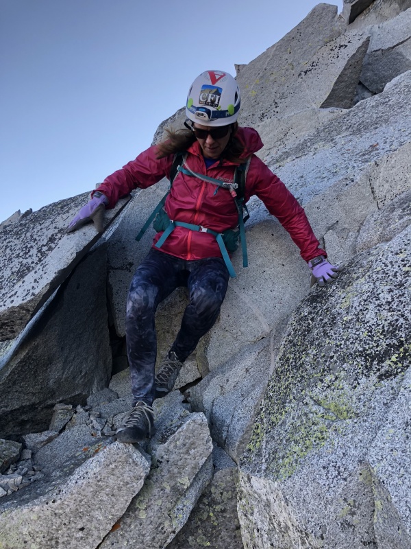
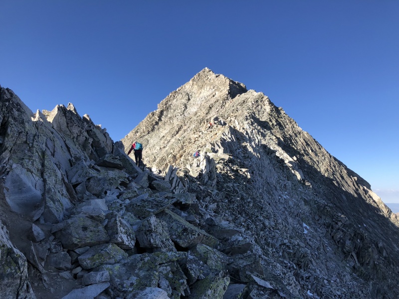
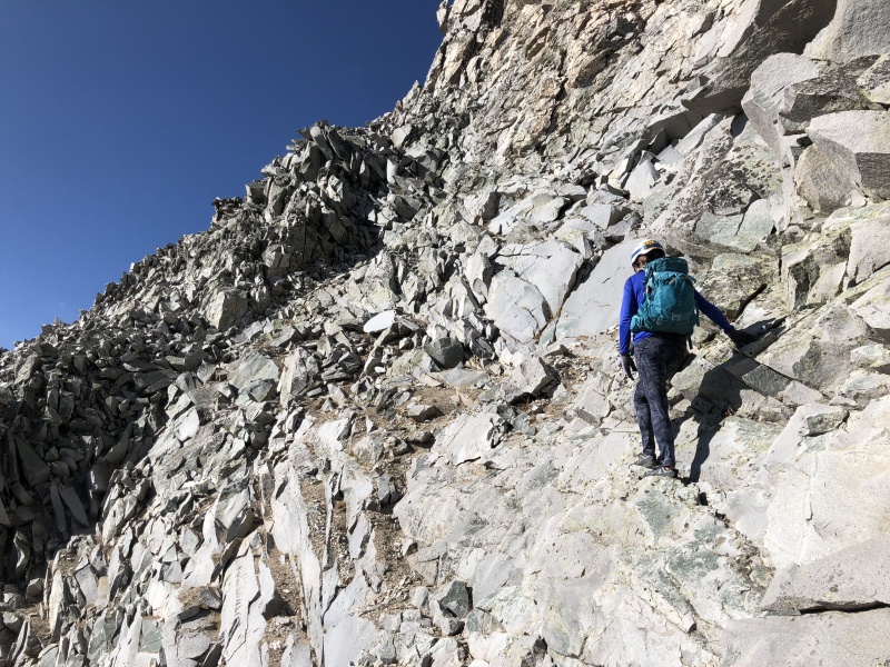
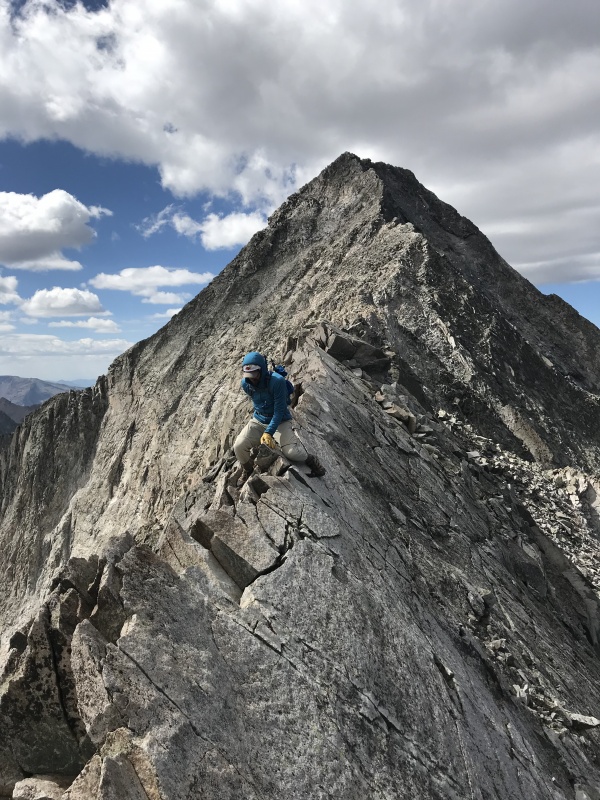
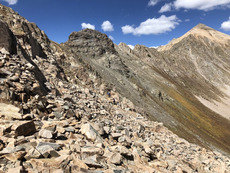
From here, we were on the face of Capitol. This was very similar to the other Elk peaks: a rocky trail that meandered across gullies and rocky ledges. Pictures make this look like a hot mess. But the trails and cairns are plentiful. This would be a hard peak to summit without either. This was the section that worried me the most, not because of the route, but because of other hikers and the danger of rock fall. We were lucky, despite the number of people on the peak, we weren’t near any other groups except for one time. We had a bottle neck in one section as we were going to cross a gully. A larger group was coming down, so we let them finish. A few loose rocks got knocked around, but nothing of too much concern. There are probably several cairned routes on this face. If we saw a cairn above us, we went up, then over. And that worked out for us all day. (We had debated going straight up the ridge from the Knife Edge. I understand this is the winter route. But we had two groups of friends that recommend this way, despite a few C4 and possibly an exposed C5 move. Though both people we talked to said this route is more solid than the face. We played it safe and crossed the face instead of “going off route” and getting stuck or hurt. Would hate to have that conversation.) 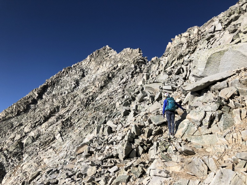
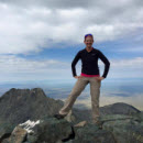
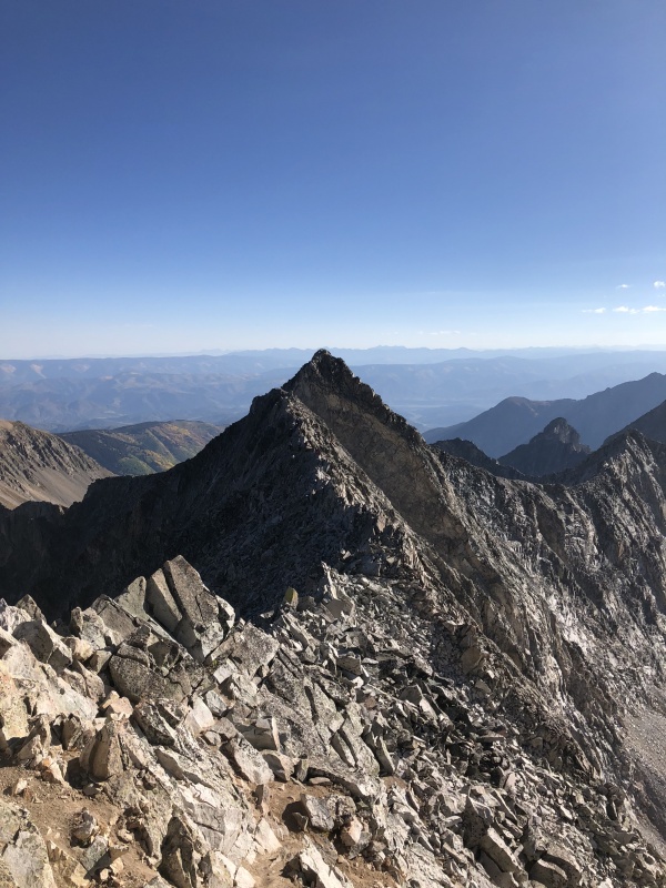
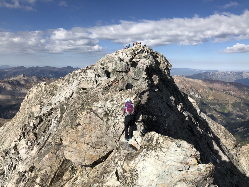
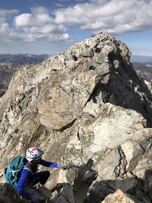
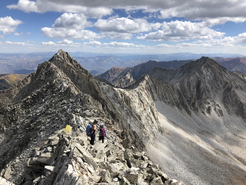
We came to the East ridge and climbed up, Class 3ish, until we reached the summit ridge. The summit was still a short distance away along this ridge with numerous short up and downs. On the left side, it looked like there was a loose dirt trail below us. But the top was solid, so we stayed up. We “undulated” this ridge until the summit. It took us about 5:30 to reach the summit from the lake, a little slower than expected, but not too bad given how slow we were in the early morning. The views from the summit, like most 14ers, were pretty nice. After several photos and a few snacks later we headed down. 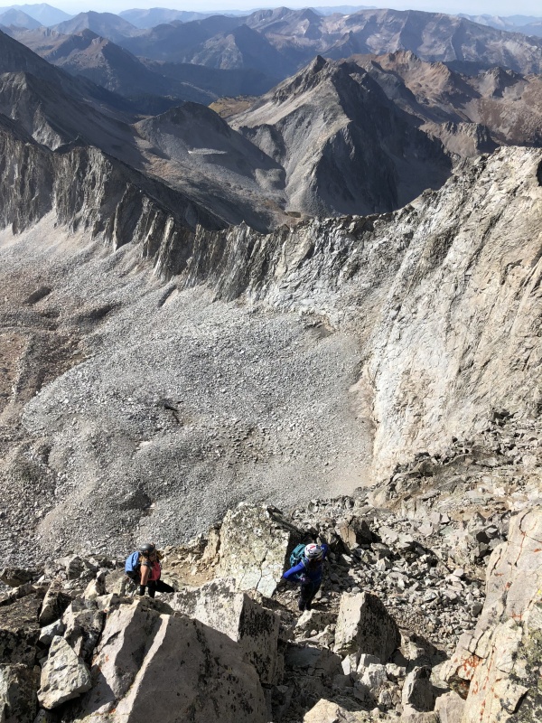
We stayed true to our ascent route on the way down the face, for the most part. As we arrived at the Knife Edge, two guys were coming across. We waited. One was in running shorts… he said he didn’t recommend that for the gouch scooting. Sheryl said we didn’t scoot this section, but were down a little to the north side. For the rest of us, I think our tired minds didn’t comprehend this. So we scooted across this section. And then realized we had to scoot a second section. We only scooted one section on the way up. Returning along the Knife Edge was tiring. Hours of hiking and the mental game of staying safe was wearing on us. Many people say the Knife Edge is the easiest part because it’s solid. Well, I’d agree on that if you don’t have issues with exposure. I have issues with exposure. As long as I’m moving and not really thinking about it, I’m OK. But when I'm tired and exposed, I’m not that happy. Staci took this time to stop and turn around to try to take a photo of me. I wanted nothing to do with that. “Keep moving.” She says I have ‘diva’ moments. 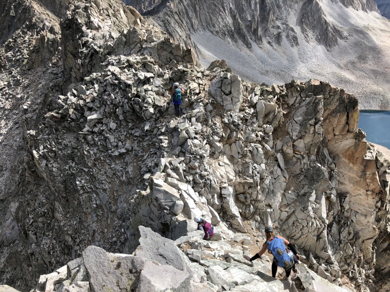
We crossed safely and approached K2. Instead of going up the C4 route we came down, we opted to go the alternative C3ish route that the other group came down. Sheryl led the way, as she had come down this. Back on top of K2 we took a moment to look back at Capitol’s summit. 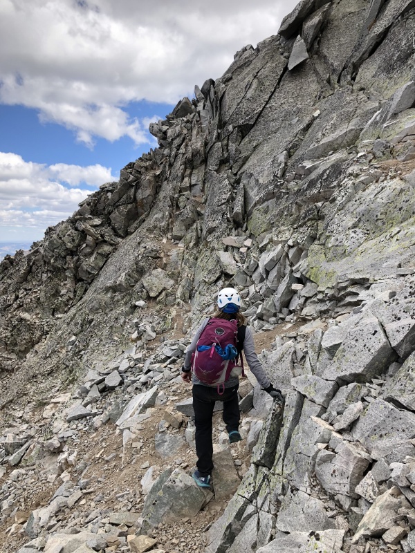
From here we followed our path back down to about 13,000 feet and took a break in a nice spot between some large boulders to block the wind. We probably rested and ate for at least 30 minutes. Shortly after this, Staci took a bad step on a small boulder that rolled on her, pinning her ankle. Sanja was close by and helped her get free. Despite the fear of a major injury, Staci was only a little bruised. It was a good reminder that, even after the hard part of a route, a hike can still be dangerous. We turned the corner and followed cairns back toward the Mt. Daly saddle. Once we neared the last gully, we figured we were on the route 20-30 feet below the path we took in the morning. 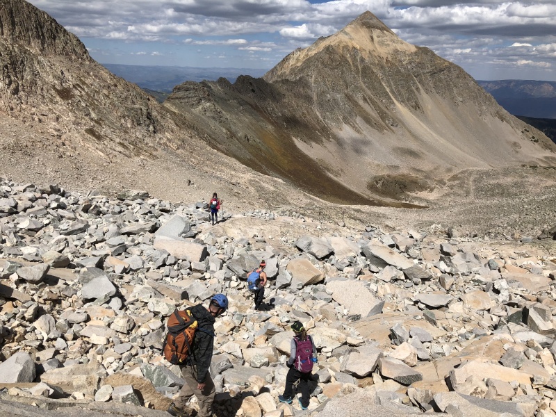

We arrived at the saddle and had a great view of the lake and basin below. I had a new goal… swimming. I hurried down to the lake hoping to get a break in the moving clouds. By the time I arrived the clouds were back, but I still went for a dip. So refreshing! The sun came back out to help me dry off. 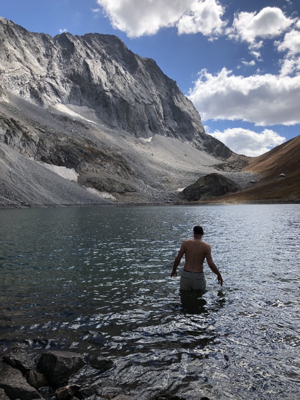
Staci and I headed back to camp, we saw Sanja, but missed saying good-bye to Sheryl. We took a break at camp and ate a good lunch. In no hurry to pack up, we relaxed a bit before loading up the backpacks for the hike out. The first half went by quick, but by the time the last mile was in front of us, we were exhausted. So tired, Staci didn’t even take the time to put on her flipflops when we got to the Jeep. We grabbed a burger in Aspen and headed over Indy Pass for the drive home. For such a hard peak, I always wondered why the Route Description was so limited compared to other peaks. The answer is pretty simple, the route is simple. It’s just a difficult 14er. Capitol has a reputation for being dangerous. But if you stay on the route, pick a good weather window and watch for other hikers… it probably isn’t any more dangerous than any other difficult peak. But I can see how easy it would be for a simple hike to turn into a serious situation on this peak. Staci said all the hype had her on edge during the climb and was relieved to be both on the summit and then down below K2. Yes, it is a route that needs your full attention. But it wasn’t as intense as many of the reports had made it out to be. Despite the fact she hates backpacking, she would like to climb Capitol again, just to enjoy it. We’ll be back. 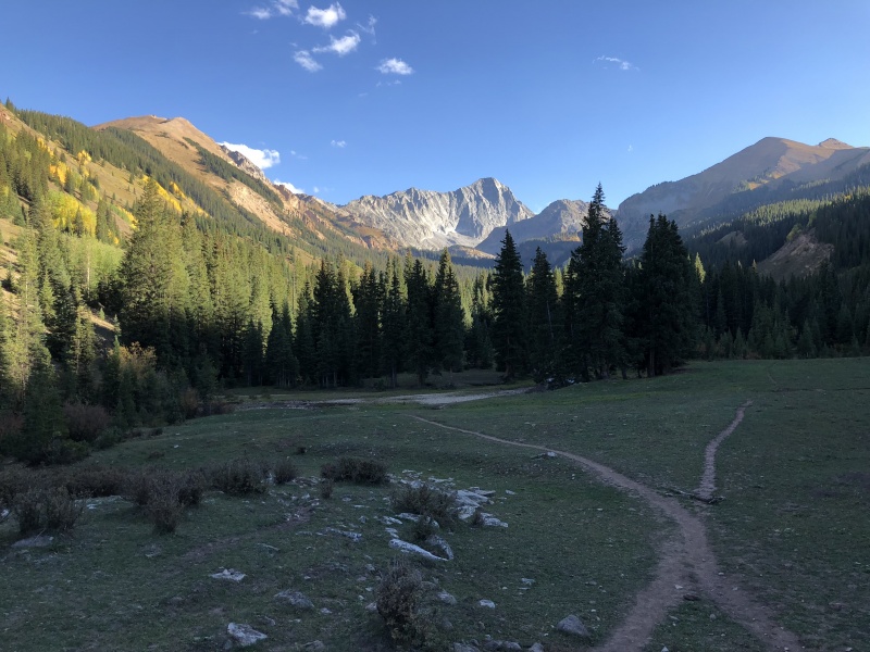
My other Elk TRs. Maroon: https://www.14ers.com/php14ers/tripreport.php?trip=18668 North Maroon: https://www.14ers.com/php14ers/tripreport.php?trip=18745 Pyramid: https://www.14ers.com/php14ers/tripreport.php?trip=18775 Capitol, Moon Lake Approach and NE Ridge (with video links): https://www.14ers.com/php14ers/tripreport.php?trip=20754 Thumbnails for uploaded photos (click to open slideshow): ")
")
")
")
")
")
")
")
")
")
")
")
")
")
")
")
")
")
")
")
")
")
")
")
")
")
")
")
")
")
")
")
")
")
")
")
")
")
")
")
")
")
")
")
")
")
")
")
|
| Comments or Questions | ||||||||||||
|---|---|---|---|---|---|---|---|---|---|---|---|---|
|
Caution: The information contained in this report may not be accurate and should not be the only resource used in preparation for your climb. Failure to have the necessary experience, physical conditioning, supplies or equipment can result in injury or death. 14ers.com and the author(s) of this report provide no warranties, either express or implied, that the information provided is accurate or reliable. By using the information provided, you agree to indemnify and hold harmless 14ers.com and the report author(s) with respect to any claims and demands against them, including any attorney fees and expenses. Please read the 14ers.com Safety and Disclaimer pages for more information.
Please respect private property: 14ers.com supports the rights of private landowners to determine how and by whom their land will be used. In Colorado, it is your responsibility to determine if land is private and to obtain the appropriate permission before entering the property.