Download Agreement, Release, and Acknowledgement of Risk:
You (the person requesting this file download) fully understand mountain climbing ("Activity") involves risks and dangers of serious bodily injury, including permanent disability, paralysis, and death ("Risks") and you fully accept and assume all such risks and all responsibility for losses, costs, and damages you incur as a result of your participation in this Activity.
You acknowledge that information in the file you have chosen to download may not be accurate and may contain errors. You agree to assume all risks when using this information and agree to release and discharge 14ers.com, 14ers Inc. and the author(s) of such information (collectively, the "Released Parties").
You hereby discharge the Released Parties from all damages, actions, claims and liabilities of any nature, specifically including, but not limited to, damages, actions, claims and liabilities arising from or related to the negligence of the Released Parties. You further agree to indemnify, hold harmless and defend 14ers.com, 14ers Inc. and each of the other Released Parties from and against any loss, damage, liability and expense, including costs and attorney fees, incurred by 14ers.com, 14ers Inc. or any of the other Released Parties as a result of you using information provided on the 14ers.com or 14ers Inc. websites.
You have read this agreement, fully understand its terms and intend it to be a complete and unconditional release of all liability to the greatest extent allowed by law and agree that if any portion of this agreement is held to be invalid the balance, notwithstanding, shall continue in full force and effect.
By clicking "OK" you agree to these terms. If you DO NOT agree, click "Cancel"...
Not many people talk about both the physical and mental exertion it takes for this peak. It is a taxing mountain. And seems to have more left turns than a NASCAR race.
The weather was awesome. There were some windy spots here and there, but mostly a warm gentle day. The summit was nearly windless.
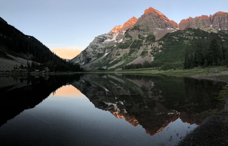
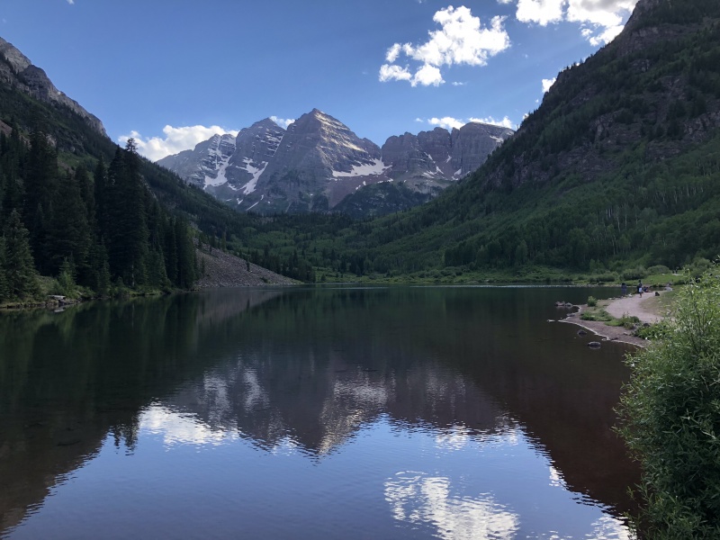
We started a little late, but before 5 a.m. Several other hikers were already on the trail or getting ready in the parking lot. A few photographers were setting up next to Maroon Lake in the dark, waiting on the sunrise.
The mystique of the Maroon Bells, the Deadly Bells, wasn’t lost on us as we made plans. We knew we wanted a nearly perfect weather day, which we got. We read and reread the route description and several trip reports to prepare. It was also the first peak for me to use my new Gaia app on my phone.
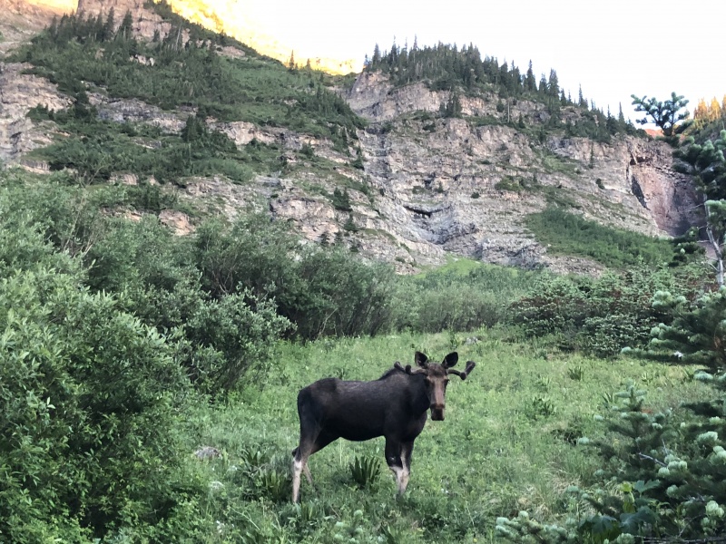
Moose near Camp Sites 10 & 11 at Crater Lake
The night before we slept in the back of the Suburban in an undisclosed spot on Indy Pass so we didn’t have to take the chance of getting kicked out of the trailhead in the middle of the night.
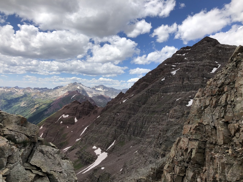
The Trail: When we started on the trail that morning I thought about just how nice it was. A clean level dirt path. But that didn’t last long. As soon as we got past the lake and turned for Crater Lake, the trail changed. It was an uneven rocky mess. The mental game started early and never relented. Headlamps blazing, we did our best not trip on the rocks. Only around Crater Lake did the trail smooth out, but that only lasted for a short section. Rocks. And more rocks. This is one of the trails where on the descent you couldn’t let your guard down, or you’d stub your toe and trip. I was surprised how bad this trail was since so many people use it to at least Crater Lake. Passed the lake the trail continued until an obvious cairn, and a large boulder, at the Slope Junction.
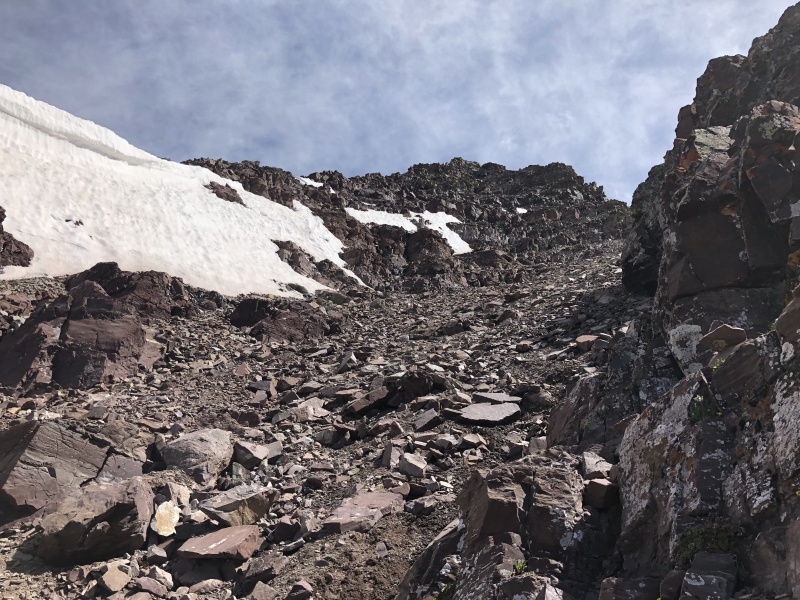
The Slope: snow field near 11,800 needs to be bypassed easily. It is all up hill.
SlopeSlope is an ass kicker
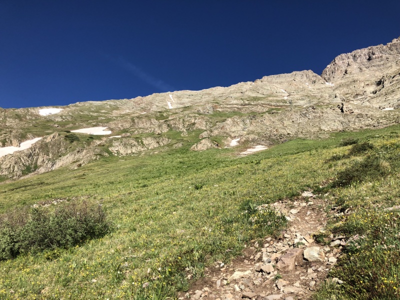
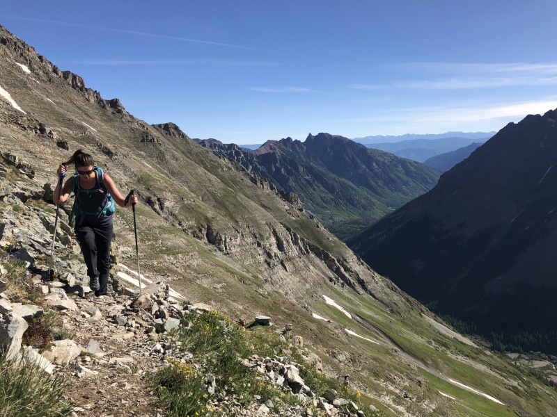
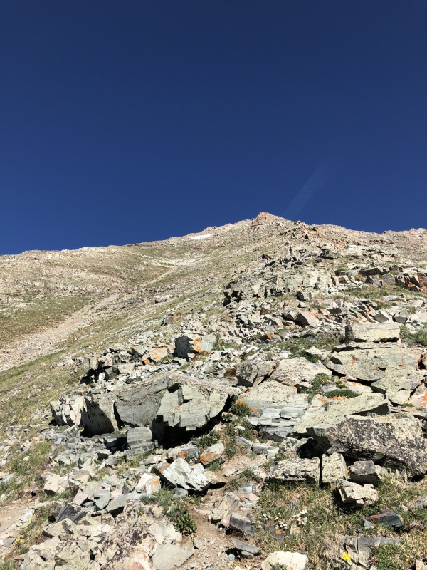
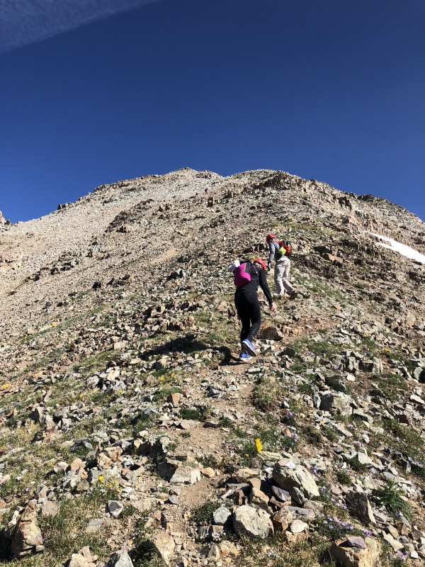
The Slope: 2,800 of up. The beginning was fairly gradual on a well developed trail, but still rocky. Even had some large rock steps. But the trail soon turned to loose dirt and rocks. Very similar to a lot of other trails as it meandered through short aspens and willows. Once it crosses a gully it steepens. And as the route description says, near 11,000 it really steepens and doesn’t stop until 13,200. I kept thinking, slopes and gullies, a take on the child’s game, chutes and ladders.
SlopeSlope: hard to see but there are people in all these slope photos.
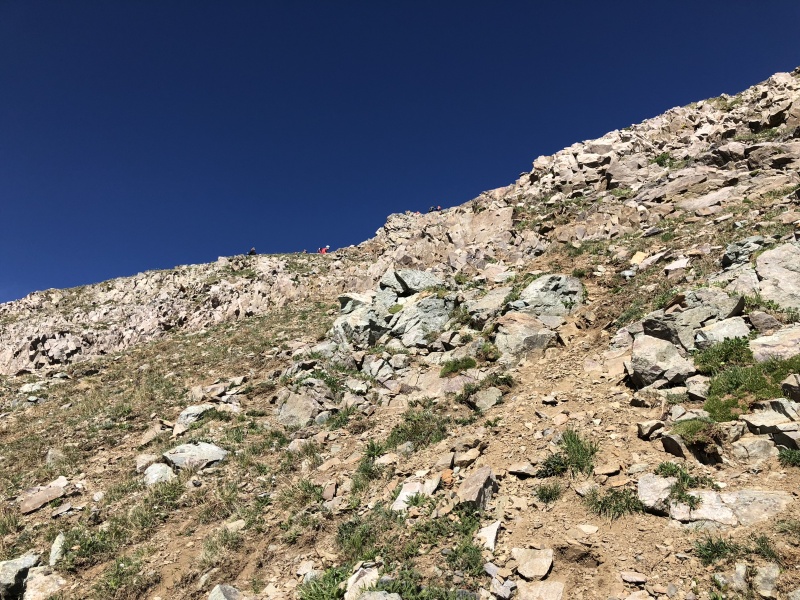
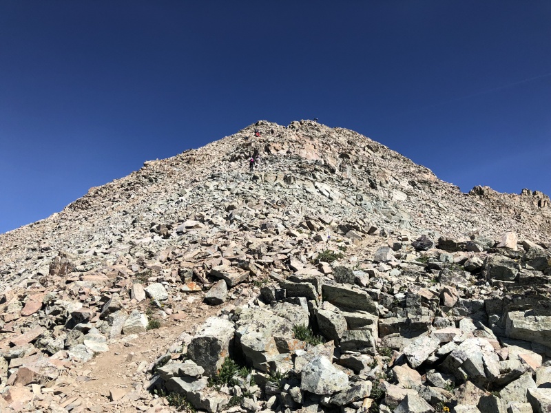
This slope is an ass kicker. It’s a grind. If you’re not in good hiking shape, this might be the end of your day. We watched several groups struggle, while others motored right on by. Trekking poles were great helpers. Parts of the trail were so loose. Other parts were looser. Near 12,000, we went straight up one gully that was nearly solid rock. A nice change of pace that didn’t last.
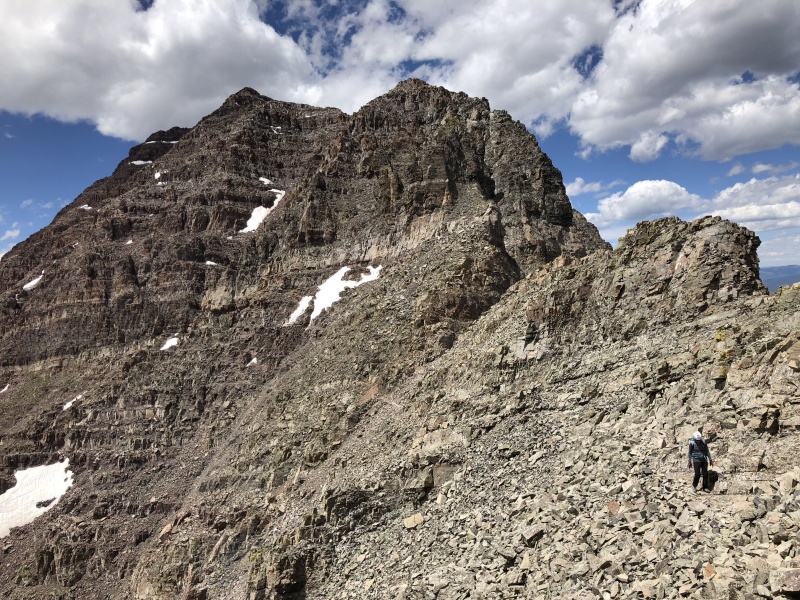
Saw several groups stop at 13,000 for a quick rest and to put on helmets. The next 200 feet had loose rocks to go along with the steep terrain, and the ridge was about to start. So we stopped at this point to catch our breath. Up above we heard… “Don’t f…ing move!” Someone was already knocking rocks down. So we put on helmets. I actually slipped and knocked a few rocks loose in this section.
Looking up at 13,000Slope nearing 13,000At 13,000From 13,000 looking up at 13,200, it's loose.Looking up at 13,200
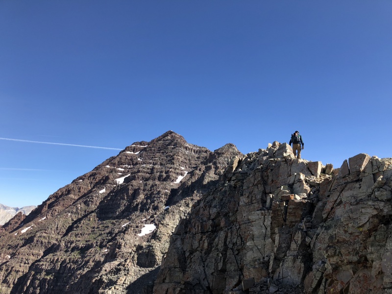
The Ridge to the Summit:
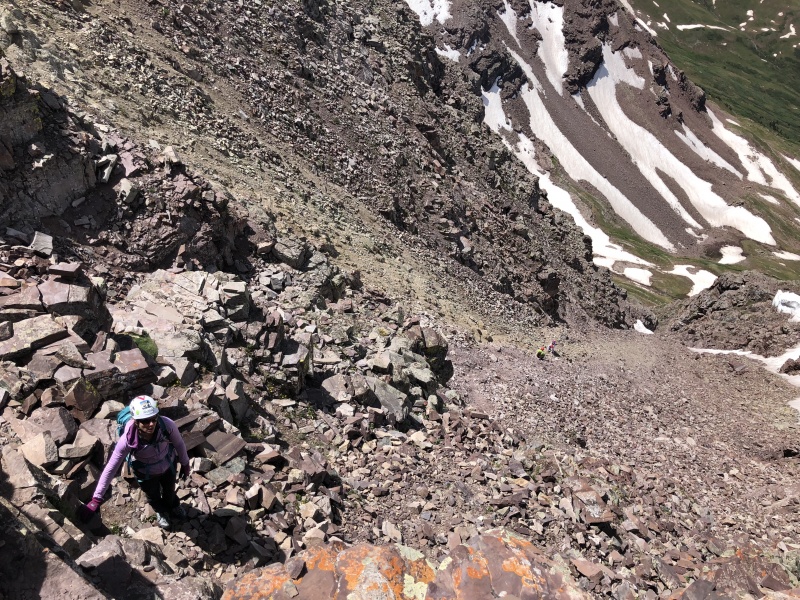
Maroon Peak did not live up to the scary loose mountain of its Elk reputation. I thought the footing and handholds were solid. Someone told me, all the loose stuff has already been kicked off. I believe it. Now, with that being said, there are plenty of loose rocks and things that look solid that really aren’t solid. I felt confident in the places I needed to put hands and feet… but I checked them, kicked them, had three points of contact. There were other loose rocks on or near these spots which could easily fall or get knocked over. If someone was in a hurry, reckless or just uneducated about the looseness of the mountain, that could certainly be a dangerous situation. And yes, there is geologic time, where any rock can go. Staci said she checked every questionable rock two and three times before committing. But in general the rocks that needed to stay in place, stayed.
At 13,200 you get the first view of the route (photo taken on the way down)13,200 catwalk
The route description says it can take two hours to reach the summit from the start or the ridge at 13,200. Believe it. Route finding can be an issue in a couple spots. But the biggest slow down is other people. Other hikers just being slow. Other hikers being tentative. Other hikers knocking down rocks. Waiting on other hikers for safety concerns.
The ridge started with a narrow catwalk, or you could bypass it on the right.
Go up and turn left. Go around a corner.
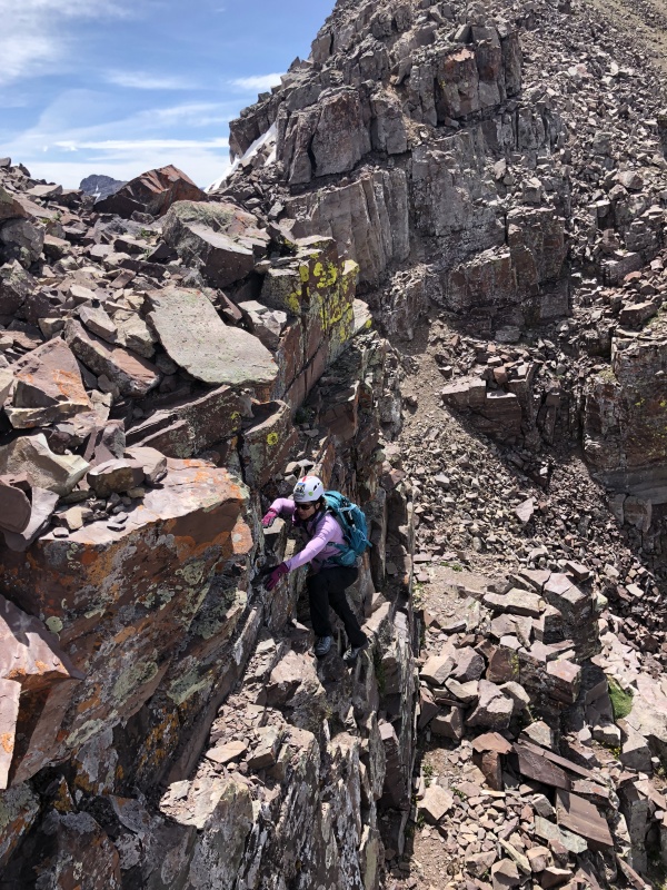
Chimney, easy Class 3
Coming down the Chimney
The Chimney was a typical short Class 3 section. No frills. But we got stuck behind some slower folks that were being cautious.
Go up and turn left. Go around a corner.
The numerous ledge type walk ways weren’t bad. Nothing sketchy. Just watch your footing.
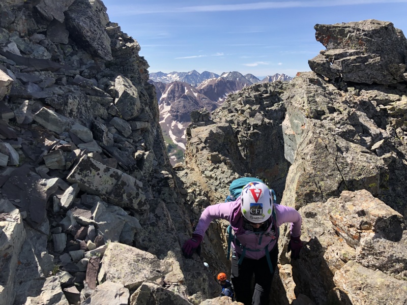
The “Two Gullies”: (Route Photo #16)we went for the second gully. We should have gone for the first, for the sake of time. I looked around the corner and someone was nearly down the second gully. We hollered back and forth and let him finish. Then his hiking partner had to finish… but before he reached the bottom, a large rock slide came through. It lasted nearly a minute. Small pebbles to hat-size rocks came through the gate. We hollered up at him but he didn’t answer. I peaked around the corner and he was nearly out. “It wasn’t me. It came from above.” Yep, two more people were coming down. That must have been scary to be in the gully as those rocks went by.
(I didn't take any photos of the Two Gullies area... waited too long to take the time.)
By now, eight people were waiting at the bottom of the gully. The two people coming down were so slow. We waited. Didn’t want them kicking more rocks on us. Yes, uphill hikers have the right-of-way. We should have asked them to wait. But that rock slide could happen again. Waiting in a gully is not safe. With that said there were a few spots that would have been safe from the center slides, but it was probably just as fast for them to finish than to get into those spaces. We let them know people were waiting. We probably waited 30-plus minutes for all four of them to clear the gully.
Staci and I decided to go up close together instead of a big space between. Helped speed things along. The center of the gully was so loose you could not stand on it without sending rocks down. The right side of the gully had solid rock C3 scrambling. The solid rock, covered in loose rock, was an easy scramble up and down, even venturing several feet away from the center of the gully. We stayed on the right side wall for about three quarters of the way up, then we crossed to the left at a narrow spot. Stayed on a loose rocky footpatch on the left at the bottom edge of the wall, and we were out pretty quick. A large obvious cairn directed us to… Go up and turn left. Go around a corner.
Wide gully, 13,400 to 13,600, looking up itWide gully, 13,400 to 13,600, looking down it. Two people are in the gully.
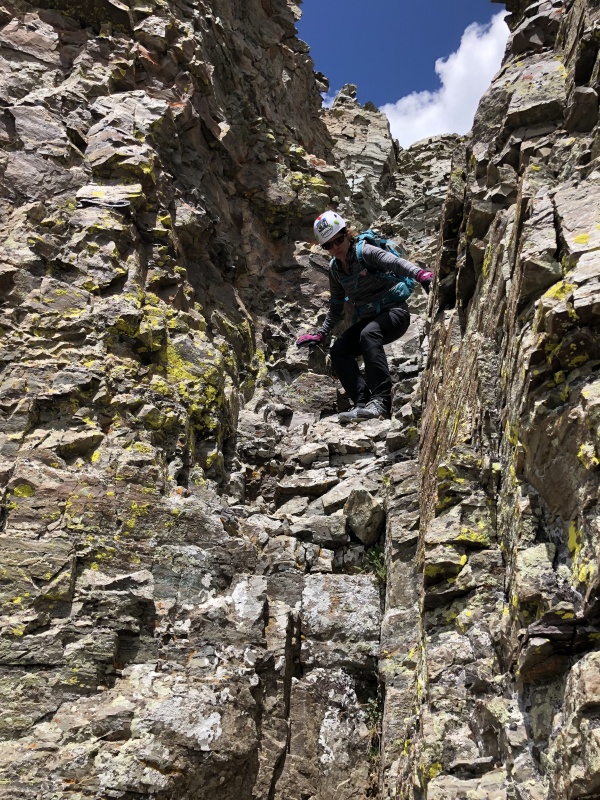
The next obstacle was the large Wide Gully, 13,400 to 13,600. Again we stayed on the right side, but this gully didn’t have the solid wall to scramble. There were sections that had good footing, but it was mostly loose.
At the notch we went up and left, a bit of C3 scrambling…
View from the Notch at the top of the wide gully...Climbing out of the wide gully. Staci saw this photo and was like, "Where was that? That was a lot easier than it looks."
A couple corners later we were near 13,800 or at what I believe is the section in Route Photo #23 of the route description. This was the only time we had trouble with route finding. We probably spent 30-40 minutes figuring this part out. Ended up doing a short C4 climb to reach a cairn that really didn’t go anywhere. Ugh. Anyway we made it through.
On the return, we went down this section a different way… basically went straight across the top of this section and then zigzag down, only using a quarter of the right side of the wall to reach the lower corner. A group was coming up doing the same, only using a quarter of the wall, and we met in the middle, then followed each other’s route.
So, on the way up… Spot the cairn up on the far corner, sitting on some gray rocks. Then start zigzagging up the right side of the wall, never going all the way to the center, until you reach the ledge at the same height as the cairn. In other words…go up and turn left. Go around a corner.
This is the last corner… but you still have to go up and turn left to get on the summit ridge. There are several cairns, easily spotted, to guide you up to the ridge.
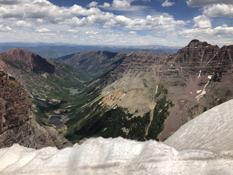
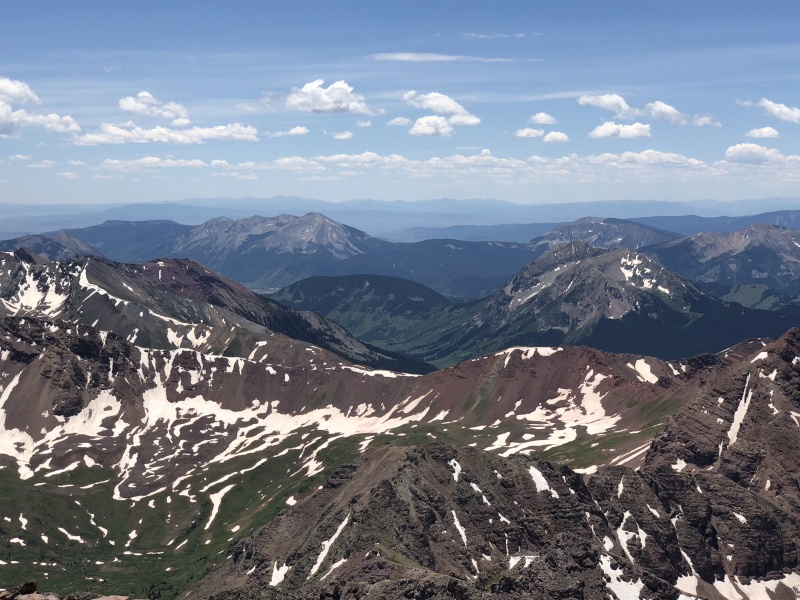
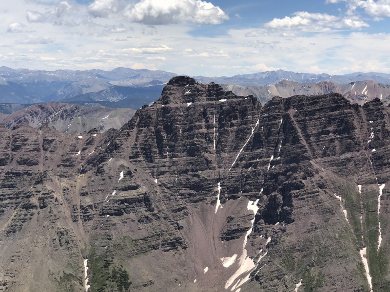
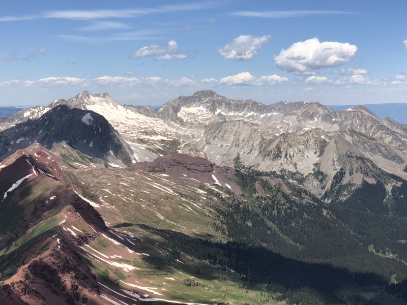
Summit Views: Crested Butte AreaSummit Views: PyramidSummit Views: Snowmass and CapitolSummit Views: North Maroon
We had the summit to ourselves for a while. The summit has amazing views. You can see the entire Elk Range from the middle. We were excited to see the Crested Butte area and surrounding peaks.
Going down was much faster, but you still need to be aware of your footing and potential loose rocks. The mental game never relents.
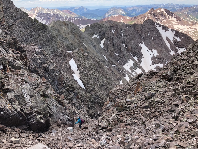
We got to the top of the “Two Gullies” and had to wait on another pair going down. We didn’t wait until they finished, but talked to them about moving together. We were always 20 to 30 feet above them, until the last section. Though the gully is very loose, the two people below us were far to the side, in the nooks and crannies, away from the center of the gully. But still added up to at least another 20 minutes of waiting.
Top of the Two Gullies, waiting for other hikers to move to a safe location.
We talked to them for a bit at the bottom, then made it as quickly down as we could. Tired legs prevented any speed. The Slope wore at our feet and toes, lots of friction. Nearing the creek trail, I had some energy so I stopped to take photos of wildflowers on the way out. Evening hikers were coming up to see Crater Lake. “How far to the lake?” Maroon Lake had numerous visitors, including a wedding party.
Footwear: Choose wisely. Your feet are dealing with a lot on this route. The unending rocks are from start to finish -- 11 miles of it. Every point, edge, slip will wear you down. The steep slope will tighten your calf muscles and foot muscles on the way up. The friction will wear on the balls of your feet and toes on the way down. My feet didn’t feel so good after this one.
Almost done with the ridgeBack at 13,200 and a successful summit.
Gaia: It’s a great app. But my track looks like a little kid scribbled all over Maroon. I need to figure out the best setup for it. But the interesting thing was Moving Time vs the Stopped Time. It took us more than 13 hours for this route. A solid two hours longer than I expected. Our Moving Time was just at 9 hours. Our Stopped Time was 4:40. But once you figure in the ‘waiting’ we did, the route finding, talking to people, and the 45 minutes we spent on the top that extra time makes sense.
My overall thoughts on Maroon Peak… It took more physical effort than I expected. It took much more mental concentration than I expected, and never provided any mental rest. The Maroon Creek Basin is gorgeous. It would be worth just hiking this section of the Four Pass Loop trail just to see the Bells and Pyramid. Seeing “The Photo” -- you know the one -- the Bells from Maroon Lake, yep looks just like it does in the pictures, only better. The view of the Bells from Crater Lake is great too. The panoramic from the top was great. The Slope sucked. The Class 3 wasn’t all that much fun, always wondering if a rock was going to move. Not a great hike. Not a great peak. There are better 14er hikes/routes.
Had to stop and take "THE PHOTO" of the Bells.... How many millions of photos have been taken here?
Go up and turn left. Go around a corner. Repeat. Repeat, again. Seems to be the way of this peak.
I’ll eventually hike this peak again. But my wife said she wouldn’t. But there is always that traverse to do.
I was up there the day before you and felt Maroon lived up to its loose reputation, particularly the slope and the gullies. However, in gully two in the first set of gullies, I stayed left, whereas you stayed right. What a difference 10 feet can make!
I still feel like this peak is a great 14er. The scenery, wildife, and views make up for an occasionally less-than-enjoyable trail. Nevertheless, awesome report and amazing pictures!
Yes, great photos, many of which are instructive. You are quite right about this peak being taxing.
The route up the long slope seems to be a lot more worn. To be expected. When I last climbed Maroon, probably 20 years ago, the lower part of that long slope was very grassy, and very tricky, esp. when damp.Coming down, you had to plan on a lot of time bouncing on your butt.
I think I may have passed you on way out on the hike back down to Maroon Lake, good job on finishing a tough peak. I was on Thunder Pyramid that day and it also took much longer than expected (3-4 hours more). Thunder felt a lot like Maroon, a steep slog. FWIW, I liked North Maroon MUCH better than South. Maroon fell into the middle of the favorite rankings for me, but North made it into the top ten.
I vowed to never climb the Bells on a weekend and this TR only solidified my sentiments. Thanks for the report!
Caution: The information contained in this report may not be accurate and should not be the only resource used in preparation for your climb. Failure to have the necessary experience, physical conditioning, supplies or equipment can result in injury or death. 14ers.com and the author(s) of this report provide no warranties, either express or implied, that the information provided is accurate or reliable. By using the information provided, you agree to indemnify and hold harmless 14ers.com and the report author(s) with respect to any claims and demands against them, including any attorney fees and expenses. Please read the 14ers.com Safety and Disclaimer pages for more information.
Please respect private property: 14ers.com supports the rights of private landowners to determine how and by whom their land will be used. In Colorado, it is your responsibility to determine if land is private and to obtain the appropriate permission before entering the property.


")
")
")
")
")
")
")
")
")
")
")
")
")
")
")
")
")
")
")
")
")
")
")
")
")
")
")
")
")
")
")
")
")
")
")
")
")
")
")
")
")
")
")


