Log In 
Peak(s):  Mt. Adams  -  13,937 feet
Challenger Point  -  14,086 feet
"The Prow"  -  13,994 feet
Kit Carson Peak  -  14,167 feet
Columbia Point  -  13,986 feet
"Kitty Kat Carson"  -  13,973 feet
"Obstruction Peak"  -  13,812 feet
Date Posted:  09/08/2020
Modified:  03/28/2021
Date Climbed:   09/03/2020
Author:  Eli Watson
 Crestone Centennial Circuit (Part I)   

CRESTONE CENTENNIAL CIRCUIT
Eli Watson
2020-09-03 Thursday
Unsupported

Summits and Route Overview
Mt Adams A (13,931’) Northeast Ridge from Horn Creek Trailhead
Challenger Pt (14,081’) North Slope from Willow Creek
“The Prow” (13,980’) via Kit Carson Avenue
Kit Carson Pk (14,165’) via Kit Carson Avenue
Columbia Pt (13,980’) via Kit Carson Avenue
“Kitty Kat Carson” (13,980’) from Columbia Pt
“Obstruction Pk” (13,799’) from "Kitty Kat Carson"
“Northeast Crestone” (14,250’) via North Buttress from Bears Playground
“East Crestone” (14,260’) via Crestone Pk's "Red Gully"
Crestone Pk (14,294’) via "Red Gully"
Crestone Needle (14,197’) via Crestone Traverse
Humboldt Pk (14,064’) West Ridge from South Colony Lakes

Stats
(Strava) 32.2 miles, 19,206' - recorded elapsed time 24:41:51

Start: 4:43:57 AM, Thursday
Finish: 5:26:17 AM, Friday

Introduction
This Report will describe a single push from the Horn Creek Trailhead near Westcliffe, CO in which I successfully summited all of the Centennial peaks in the Crestone Group, plus a few extras. While many other individuals have summited all of the Crestone Group 14ers (Crestone Pk, Crestone Needle, Kit Carson Pk, Challenger Pt, and Humboldt Pk) along with a few 13ers along the route (Columbia Pt, “Kitty Kat Carson”, and “Obstruction Pk”), still fewer have summited all of the Centennial peaks in a single day including Justin Simoni’s “Crestone Centennial Enchainment” completed from a campsite near Mt Adams A. To the best of my knowledge, I believe this is the first reported ascent of these peaks in a single push from a trailhead. If that is not the case, I respectfully welcome such evidence to be provided. As of now I will claim such a first ascent and name this route the “Crestone Centennial Circuit”.

I will begin by admitting that I am not the best at remembering individual minutiae of beta beyond exceptionally noteworthy landmarks or issues with route-finding and the general overview of a route. I find this especially difficult in the Crestone conglomerate, which can begin to blur together over the course of such a long day. When preparing myself for a climb, I usually stick to memorizing only key features of the route. Once actually on the route, I generally rely on route-finding skills to follow previously traveled terrain or the path of least resistance while scanning ahead to ensure I don’t work myself into a compromised position. Furthermore this Circuit is more of a compilation of established routes which have already been documented by other individuals with much greater detail, instead of an entirely new route. For both of these reasons, I will focus more on telling the story of this effort rather than providing exhaustive beta. Due to the limitations of the number of summits able to be included in a single Trip Report on this site, I will be splitting my account into two parts: the first of which will include travel between the Horn Creek trailhead to Bears Playground beneath Crestone Pk’s North Buttress, and the second will describe that point back to the Horn Creek trailhead.

Background
After delving deeper into the foray of the Colorado 14ers and completing a few days out in the mountains which included multiple summits, I started to think beyond the standard routes. Days in which I would be able to link up multiple summits became increasingly attractive, and much more personally fulfilling. This was in part fueled by my necessity to be highly efficient in my precious little free time away from Fort Collins as a graduate student in a doctorate chemistry program, as well as my personal enjoyment of experiencing multiple summits in a single effort. This loop first crossed my radar after reading Conor’s Trip Report describing his “Sangre Sixpack” as well as the routes described in Gerry Roach’s Colorado Fourteeners. From there, I also sought further information which led me to the Trip Reports written by mojah, and handonbroward. I initially mentioned my interest to climb all of the Crestone Group 14ers in a single day to another experienced climber who had previously sectioned all of this route with the exception of Humboldt to the Rainbow Trail. At that time I was made aware of the possibility to include Mt Adams A in the mix by way of its Northeast Ridge from Horn Lakes, and the Circuit could then be completed by taking the Rainbow Trail north from the East Ridge winter route of Humboldt Pk rather than south to the more South Colony Lakes road. Most recently polar sparked a detailed conversation requesting beta on the ascent and descent lines off of “Northeast Crestone”, which would undoubtedly be the crux of any completion of the Crestone Group 14ers link-up using the North Buttress over the Northwest Couloir. He then went on to provide an excellent Trip Report and more accurate beta on the details of ascending Crestone Pk’s North Buttress.

What I found most exciting about including Mt Adams in such a route would be the ability to keep any back-tracking to a minimum. Any such combination route to complete the Crestone Group 14ers without venturing north of “Obstruction Pk” would require a tedious doubling of the ridge connecting Challenger Pt to Humboldt Pk in some capacity, which I found less attractive. Thus early mapping and planning of this route yielded that this would indeed by a huge effort, and require a great deal of training on my part to ensure my conditioning would be sufficient for such a day without stopping. My planning for this route was centered around the most conducive route conditions, including minimal snow but a forgiving weather forecast. Although I initially wanted to complete this Circuit over the July 4th weekend - including a full moon and far more daylight than would be available in early September, I had not yet taken the opportunity to scout out the portions of the route I felt were critical to a success and an unforeseen obstacle in my training interrupted my conditioning such that I could not responsibly make an attempt. With August weather feeling too unpredictable for such a lengthy effort, my sights were set on the September full moon scheduled to occur late Tuesday night, September 1st, into Wednesday morning. Due to my hesitation to commit without better knowledge of how the forecasted snow dustings the day prior would linger on northern aspects, notably the North Buttress of Crestone Pk, I pushed to get started early Thursday morning.

20658_68
Gear packed for Crestone Centennial Circuit (12" Subway meatball sandwich not pictured).

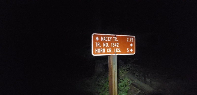
Part I

Horn Creek Trailhead - Official Start Time Thursday 4:43 AM (0:00)
Despite my efforts earlier in the week to shift my circadian rhythm to allow for a full night’s rest prior to my alarms, my plans to awake for a tidy 2:00 AM start time did not come to fruition. I’ve had successful mountain days with 0 - 2 hours sleep before, but such nights leave me feeling drained and foggy the following day, which I could not afford on a day with such severity of consequence. I think I finally fell asleep at the Horn Creek campground around 9:45 PM to the tune of an RV camper repeatedly starting their ATV and shining their headlights directly into my tent while it idled. My back-up alarms at 3:00 AM rolled around, and I sat in my tent for much longer than intended. All of the “I don’t want to do this” second thoughts flooded my mind, but I knew this was the day. My conditioning and fitness for mountain climbing has never been stronger in my life, and my successful taper had afforded my legs to feel primed for such an effort. After tossing my tent back in the car, I forced down a cold-cut turkey sandwich with liquids, turned my bag of 12 scoops of dry Hammer Nutrition “Perpetuem” into a paste by adding water, double-checked my gear one last time, listened to some music, and prepared myself for the day ahead. Rather than start from the trailhead sign near the bathrooms at the Horn Creek campground and almost immediately turn to the right towards the Rainbow Trail on a social path, I found it more appealing to start from the sign a few hundred yards down the road from the campground which reads “Rainbow Trail 5”. As such I began my day by walking down the road from the parking lot.

20658_69
Trailhead sign for the Rainbow Trail.
20658_71
Sign indicating the turn-off towards Horn Creek Lakes.

Mt Adams A - 8:21 AM (3:38)
Having left the Horn Creek trailhead, I continued up towards the Rainbow Trail. It didn’t take long before I realized that I was heading south, while I needed to be continuing almost directly east towards the obvious Horn Pk on the Horn Creek trail. Using my GPS, I quickly redirected myself through a short bushwhack to get on the right trail that I had taken in early July. This small mistake cost very little time as it was more of an annoyance that not only would my GPX track already be wrong and likely need to be corrected for any future referencing of this Circuit, but also I had already made a mistake so early in the day and on a section I had previously scouted out. I arrived at the correct trail junction towards “Horn Creek Lakes”, signs saying 5 mi, at 5:03 AM. The hike up to the Horn Lakes was largely uneventful as most approaches in the dark are in my experience. Any time I have started my approach well before dawn, it almost feels as if that time doesn’t exist without the visual memory to accompany them. I enjoyed the bright moonlight illuminating the portions of the trail which were less densely covered by trees, and tried to keep my headlamp off as much as possible in the forest. My own shadow was clearly visible. Trying to gauge the moisture I may encounter further on in my day, I noticed in the infant dawn light that the ground was damp in places as I continued up the mellow path to reach the stream crossing below the Horn Lakes at 6:22 AM. 20 minutes later, I had reached the base of the southeastern slope leading to Adams’ ridge. In July I had committed to wandering through a stand of willows to reach the steep slope’s eastern crest, but now I tried to be a bit more deliberate. I selected a rib of talus that afforded a more direct ascent to the tundra, and stopped for a spot of breakfast while I enjoyed the familiar red alpenglow against the eastern rock faces above the peaceful lake.

The ascent was steep, but enjoyable. I felt strong, and before long I had reached the Northeast Ridge. The ridge is mostly class 2/2+ ‘scampering’, to borrow a term from Mr. Roach, bobbing and weaving to the left or right to navigate more adventurous terrain. The ridge only requires the use of hands for vertical movement in a few places if you choose not to drop too low. Before long I stood atop Adams for my first summit of the day at 8:21 AM, and paused for a few gulps of my paste along with a healthy swig of water, per the directions. Remembering where my water source would be located along the stream flowing south into Willow Creek from the basin below me, I knew it would be in my interest to drink generously prior to then.

Without much delay I hung right down the summit ridge to join the West Ridge of Adams. Staying inside the first cliff band on skiers’ right afford a steep slope dotted with stable rocks and talus. Previously traveled footpaths can be readily identified and followed easily to a saddle point between Adams and Peak 13,546’. From there any reasonable line of descent will do, but I chose a nearly directly southern shot, curling around rocks and talus. My line in July was again a bit more direct, so I’ll likely stitch that into the GPX track for future reference. I couldn’t remember how high I had sourced water during my scouting, so I contoured skiers’ left a bit earlier than I should have and found my way into marshy willows. After getting myself back on track, I stopped to source at an excellent waterfall along the stream at 9:26 AM. I followed a familiar social trail through the willows to the eastern side of the stream, and began my descent to Willow Creek.

20658_65
The steep slope up the southeast face to crest the Northeast Ridge of Mt Adams A, photo taken 2020-07-10.
20658_66
The Northeast Ridge of Mt Adam A, photo taken 2020-07-10.
20658_92
Looking back at the Mt Adams A summit from its West Ridge, photo taken 2020-07-10.
20658_76
Looking back at the descent from the Mt Adams A - Peak 13,546’ saddle.

Challenger Pt - 11:47 AM (3:26)
During my July scouting I tried to stay as high as possible to avoid unnecessary regain to the Challenger intersection, only to turn around at the obvious rock garden before the ascent of its North Slope and realize my miscalculation. While I had only saved myself less than 100’ of re-gain, I had subjected myself to much slower terrain through a series of willows and traversing beneath rock bands. I’m a believer in accepting a few extra feet of re-gain to drop down to faster terrain when reasonable, and descending from a game/social trail down a steep, sparsely vegetated slope to intersect the Willow Creek trail at 9:39 AM was entirely worth it in this case. I passed by a grazing deer, and thanked it for its work in forming some of the clearing for the willows I was surely using.

By 9:51 AM I had reached the shaded rock garden, and allowed myself some time to take off my shoes and socks to let my feet breathe, source water from the nearby Willow Creek stream from the Upper Willow Creek Lakes, lounge in the morning sun, and eat 6” of a meatball Subway. Here I had my first encounter with another trail user heading up Challenger. After 45 minutes of lounging, I started up the Challenger stair steps. The CFI has done so much work to improve this trail this year alone, and I expressed my gratitude for them as I passed. Zig-zagging through the gray talus, I passed another set of hikers navigating a small chockstone tunnel which was holding a bit of fresh snow. I made a mental note of this, thinking ahead to the possibility of northern aspects holding fresh dustings on the impending Crestone Pk North Buttress. Shortly after I was on the summit ridge of Challenger, topping out at 11:47 AM. I chatted with the individual that had passed me during my lounge with whom I had shared my intentions for the day, and we both mentioned the more serious terrain that the North Buttress would hold. I was still having fun with the route, and learning how to best take a picture of my watch face to include the memorial plaque to the Challenger shuttle launch.

“The Prow” - 12:02 PM (0:15)
Kit Carson Pk - 12:23 PM (0:21)
After a brief rest for water and paste, I ambled my way towards Kit Carson Avenue and reached the start of it at 11:56 AM. I kept charging up the easy trail to a quick spur to the summit of “The Prow” at 12:02 PM. Back to the Avenue, and a gentleman coming the other way and I had a chuckle about that likely being the only way either of us would ever summit “The Prow”. I continued on to find my familiar broad, stable gully up to the summit of Kit Carson Pk. I hung climbers’ right to stay on the solid rib, passing a few cairns along the way. Within a few short minutes I was standing atop Kit Carson Pk at 12:23 PM. I stopped for a brief rest to send out a few updates to my friends and family, and I was amazed at the words of encouragement that loaded once I turned my phone off airplane mode. I’ve never been one to spray very hard about my accomplishments in the mountains, and I was overwhelmed at the level of support I was receiving. It was incredibly heart-warming, and encouraging. Having never experienced that level of “cheer-leading” in the mountains, it reminded me of my athletic days as a competitive swimmer. Despite this being the first clear view of the North Buttress which awaited my across Bears Playground, I felt empowered to press on knowing that the degree of difficulty would only increase from this point forward. I returned to the Avenue at 12:42 PM, riding high and feeling strong.

20658_93
Kit Carson Pk from "The Prow" summit.

Columbia Pt - 1:06 PM (0:43)
“Kitty Kat Carson” - 1:13 PM (0:07)
“Obstruction Pk” - 1:55 PM (0:42)
At the summit of Kit Carson Pk, I was a little over 7.5 hours into my 12 summit day having only topped four. However I knew that the next three would come one after another, before my real test would begin. The ribs up Columbia Pt are where this route really starts to get fun. I picked my way across the first rib to the second, remembering some awkward movements I had to make to redirect myself back in July. The rock is amazingly solid, with plenty of large handholds to make it pure fun. I followed my way up, noticing a few cairns I hadn’t previously seen while scouting. They seemed to lead me a bit further towards climbers’ right, though I remember taking a very direct line on my last trip up here. Sure enough, the cairns lead me around the backside to sneak up on the summit from the east. That didn’t seem entirely necessary, as I usually favor taking the direct line when available. I’ll likely take another opportunity to substitute in my July track for future referencing. A few quick snaps of the memorial plaque honoring those aboard the Columbia shuttle, and I was off over “Kitty Kat Carson”. I was old enough to remember that tragedy at the time. The view of Crestone Pk’s brutal northern relief with the very edge of the Great Sand Dunes peeking behind it, and the enormous Sierra Blanca Massif making itself known before the San Luis Valley extends far beyond is without question one of my favorites in all of Colorado.

Bopped over “Kitty Kat Carson” at 1:13 PM using the easy trail, and looked ahead towards the looming Crestone Pk. Despite my minor wonderings seeing the snow on Challenger Pt, I could not see any fresh dustings save for the Northwest Couloir and the northern face below the summit of Crestone Pk. The relative ease of Columbia Pt and “Kitty Kat” from the Avenue makes looking ahead towards the actual descent and re-ascent of the ranked “Obstruction Pk” serve as a reminder that not all summits come so quickly. I felt stronger than I had in July, likely from a combination of an earlier start with cooler temperatures and a more mature point in my training regime.

Cruising up the easy class 2 trail of “Obstruction” to its undulating summit ridge, I remembered that I always have a hard time deciphering which bump of rocks is the true summit without checking my position on CalTopo. I tricked myself and overshot the true summit in July, but my pursuit of the 74 highpoints of the Colorado 14ers has taught me to go ahead and put my foot on top of every rock that looks the highest for each bump of the summit ridge. Sure enough, I overshot the true summit again, and had to waste a few extra minutes back-tracking to make sure my waypoints were accurate at 1:55 PM.

Bears Playground awaited below me, and I followed the summit ridge a bit to avoid the loose talus face that hangs below the summit of “Obstruction Pk”. The talus was tediously slow, but soon enough I was waltzing down the easy tundra at 2:17 PM towards the gentle ridge which transforms into the magnificent North Buttress of Crestone Pk. I took the opportunity to stop for lunch on the remainder of my meatball sub, and mixed an electrolyte packet into one of my water bottles. I would have to be careful with my water. I remembered the snowfield hanging on the other side of the ‘Red Gully’ of Crestone Pk that I would cross by on my way down to the Crestone Traverse. I hope it was still there; I did not want to have to wait until South Colony Lakes to source again. I rested there allowing myself to calm my nerves and savor the moment. At 2:34 PM, I rose and steeled my nerves for what lay ahead...

Read Part II here.

Attached to this report is my raw .gpx file from the day. I edited the track to make it more tidy for someone else to follow, but for whatever reason when I try to upload that file it says invalid file formatting. The file works fine when I load it into multiple different .gpx file applications, so I guess if you want the Master file just send me a PM.

20658_84
Kit Carson Pk from Columbia Pt summit.
20658_87
Kit Carson Pk from "Obstruction Pk" summit.
20658_88
Mt Adams A from "Obstruction Pk" summit.
20658_91
Crestone Pk North Buttress and Northwest Couloir from "Kitty Kat Carson" summit. Great Sand Dunes and Sierra Blanca Massif in background, photo taken 2020-07-10, edited.

My GPS Tracks on Google Maps (made from a .GPX file upload):


Thumbnails for uploaded photos (click to open slideshow):
65 66 68 69 70 71 72 73 74 75 76 77 78 79 80 81 82 83 84 85 86 87 88 89 90 91 92 93


Comments or Questions

   Not registered?


Caution: The information contained in this report may not be accurate and should not be the only resource used in preparation for your climb. Failure to have the necessary experience, physical conditioning, supplies or equipment can result in injury or death. 14ers.com and the author(s) of this report provide no warranties, either express or implied, that the information provided is accurate or reliable. By using the information provided, you agree to indemnify and hold harmless 14ers.com and the report author(s) with respect to any claims and demands against them, including any attorney fees and expenses. Please read the 14ers.com Safety and Disclaimer pages for more information.


Please respect private property: 14ers.com supports the rights of private landowners to determine how and by whom their land will be used. In Colorado, it is your responsibility to determine if land is private and to obtain the appropriate permission before entering the property.