| Report Type | Full |
| Peak(s) |
"Northeast Crestone" - 14,251 feet "East Crestone" - 14,298 feet Crestone Peak - 14,299 feet Crestone Needle - 14,196 feet Humboldt Peak - 14,068 feet |
| Date Posted | 09/08/2020 |
| Modified | 03/28/2021 |
| Date Climbed | 09/03/2020 |
| Author | Eli Watson |
| Crestone Centennial Circuit (Part II) |
|---|
|
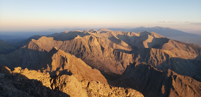
CRESTONE CENTENNIAL CIRCUIT Summits and Route Overview Stats Start: 4:43 AM, Thursday Before I begin the details of this next section, I will admit I am not a rock climber. I have never been on a rope outdoors save for a midnight ride tied into a Tyrolienne zipline across a 400’ canyon in southern Nevada, and the subsequent rappel down. I barely make it out bouldering anymore, now that my usual climbing partners and I see each other much less often in the wake of the COVID-19 pandemic. While I have previously completed both the Maroon Bells Traverse with a partner and the Crestone Traverse solo as scrambles, my only experience on 5th class rock that has been officially graded as such was a solo ascent of the Longs Peak Cables route (5.4 - 5.5) in my La Sportiva Raptors. Even then I believe I bypassed most of the actual crack climbing itself by slabbing up the rough granite face to reach the crux for only maybe ten feet of committed climbing. I have previously gotten myself into some fairly spicy situations in the mountains - a committed ascent and descent of Elkhead Pass to avoid an avalanche prone headwall after noon in June 2019, alternative lines up Wetterhorn Pk with a friend, and an exposed downclimb of “North Snowmass” to reach the snowmass directly from the ridge without going back over Snowmass Mtn proper. I know that I’m not very prone to exposure, as I barely noticed the moves required to top the famed summit blocks of Sunlight Pk and Mt Wilson. Nevertheless “Northeast Crestone” had me worried. Having read all of the hype over the incredible exposure required to ascend not only the North Buttress but also the direct ascent of “NE Crestone”, I was nervous. I knew that there would be little hope of turning back to downclimb the North Buttress if the ascent of “NE Crestone” proved to be too much for me, and thereby to ascend much above the safety of Bears Playground may very well have represented a point-of-no-return. Still I believed in myself, and accepted the consequences should I falter. After all the pursuit of this Circuit felt a bit like chasing lightning, knowing that I would need to grab tight and hold on in order to achieve what I desired. I studied for this route unceasingly, more than every other portion of this day combined. I knew all the different lines up this North Buttress, and I could clearly envision those red, blue, and yellow lines drawn on the jagged rocks above me. I like to believe I have a healthy sense of my mortality. Having experienced enough days that I was really glad to make it back to the car and enjoy the precious moments in life afterwards, I made my peace with those hazards. I remembered the words of those recounting recovery missions off this rock in which individuals “fell 200’ before they hit the ground’. In a dark, twisted sense of humor, I wondered if a Subway meatball sub would be my last meal. Sitting there in Bears Playground, I had to face the other way to relax. The closer I had gotten to the North Buttress, the more I could make sense of what appeared to be a terrible massif of sheer rock from atop Columbia Pt. Nevertheless I knew that sitting there dissecting the rock preemptively would have little benefit. As I got moving again at 2:34 PM after packing away my bag and bracing myself for what awaited, I told myself, I can do this. I can be safe. I can make small moves, one at a time. 
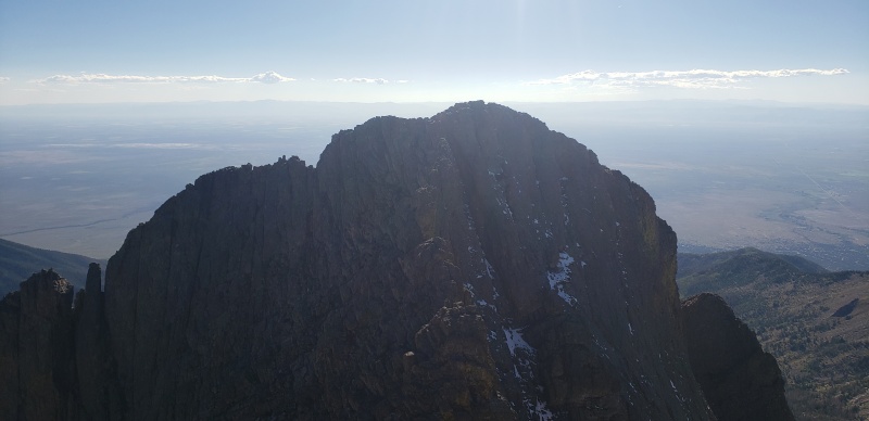
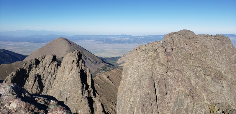
Part II “Northeast Crestone” - 4:32 PM (2:37) The scrambling got markedly more serious after this point, noting my watch at 3:07 PM. I slipped on my La Sportiva Finale rock shoes, and studied the rocks ahead of me. I had a hard time making out exactly which peak was “NE Crestone”, until I saw the sheer 1500’ eastern face plummeting away from an exceptionally pointy summit. There was one downclimb that was a little too close for comfort to the abyss to my left, so rather than descending directly into a notch I hung a bit to the right and made what felt like some class 4 moves to land below a spire which I ascended directly. Man, this is heady. If these are only the final moves of the North Buttress, I can’t imagine what it will be like to take the direct line up “NE Crestone”... Those were by far the most committed moves of the day. From there I had an unfettered view of what I thought was “NE Crestone”, with its obviously 5th class ascent ridge staring back at me. My heart sank into my knees. No way. I’m taking the traverse route around to the right and sneaking up the backside. I downclimbed a class 4 ridge with plenty of large hand- and footholds. Finally back on what felt like solid ground, I turned and peered around the corner to see… the Red Gully? That can't be right… because "East Crestone" is directly connected to the red gully… does that… does that mean I was on "NE Crestone"? That can't be right… I spun to double-take. What I had downclimbed looked eerily similar to a video I saw of an individual downclimbing the class 4 backside of “NE Crestone”... but it was too short, or was it? I furiously checked my maps. I likely burned through 10% of my phone battery refreshing CalTopo over and over with compromised service, at which point I plugged in my external battery (I was not interrupting this track!). Could that really be it? Did I take the direct line up without realizing I was on it? I didn't take any photos of my watch or set a waypoint on Gaia... Maybe I can place a waypoint on where I'm sure I was on the summit and my GPX track will be evidence enough? The photos of Crestone Pk should support my claim... I couldn't do it. I couldn't trust that I actually summited it and had a waypoint unless I was physically standing on what I knew was the highpoint. I looked for the little spire that can be distinctly seen in pics of "NE Crestone" from Crestone Pk, but I couldn’t make it out from that angle. So back up the class 4 scrambling I went, but this time in my Mutants. I still couldn't believe it as I set the "NE Crestone" waypoint on the Gaia track at 4:32 PM. Interpolating from my Gaia track afterwards, I estimate I initially summited “NE Crestone” at approximately 3:51 PM. I had already wasted almost 45 minutes with this double-backing, and I needed to keep moving. I felt confident I would beat 24 hr still, simply as an arbitrary benchmark goal. Making my way back to the Red Gully, the easy scramble up to “E Crestone” saw me to the summit at 4:56 PM. Then I saw it: the spire, the shape, and CalTopo was more accurate than it had been on the other side of the rocks. I had done it. I had accidentally summited "NE Crestone" thinking it was part of the North Buttress. Sent out a few texts saying the scariest part of my day was over. I was flying high. I felt bulletproof, unstoppable. Arguably the second or third hardest 14er subsummit and I had done it. Following a quick scramble over to Crestone Pk to summit at 5:18 PM, a few more texts, and I was off down to the Traverse feeling like a bolt of lightning. Looking at "NE Crestone" from Crestone Pk, and I definitely summited it twice. I saw the characteristic angle and spire clear as could be, remembering all the red, blue, and yellow lines drawn on it. The northern face of “E Crestone” was what I had mistaken for the direct ascent ridge of “NE Crestone”. That looked like something worth soiling your shorts over. The snowfield was gone, favorite four-letter words. Of course that snowfield on a southern aspect didn't survive late July and August in the Sangre. There would be no use in stressing about it, and there would be no water or snow on the Traverse. My best bet was getting to South Colony Lakes as fast as possible; I knew I would be dehydrated. 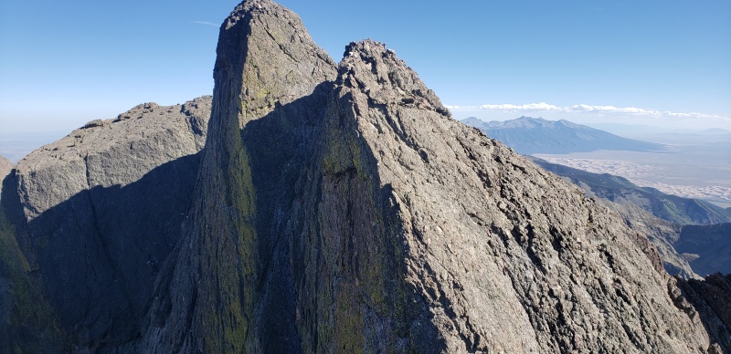

Crestone Needle - 7:15 PM (1:57) The animals know summer is over. 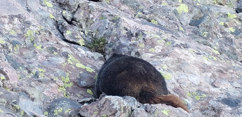
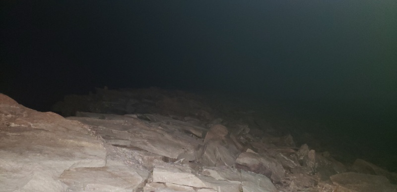
At the entrance of a ‘pass-through’ - a narrow alley between two rocks - there was an unattended backpack full of supplies. That was… concerning. I hollered out a couple Hello's and peered down the gullies as best I could, steeling myself for something grotesque... nothing. I kept chugging without issue and arrived at the base of the Headwall. The Crestone Traverse is probably the least intuitive of the three Great Traverses I've completed, even the Bells. The blur of ‘Crestone Conglomerama’ began to set in, and the Traverse felt like it was over as soon as it began. The Headwall felt like the Headwall for a 7:15 PM summit. I tried to compare it back to what I experienced on the North Buttress, but that felt so long ago by then and I was starting to get hazy. The light was dying, and I knew I needed to get moving as fast as possible down the Needle. I wanted to get to solid ground by true nightfall before the crest of Broken Hand Pass. Standard operating procedure down the Needle: play cairn tag, get in the right gully. Light was dying fast, and I knew I was racing the last moments of twilight. Those 45 minutes on "NE Crestone" in addition to the extra time I spent lounging on “E Crestone” and Crestone Pk in disbelief began to feel very costly. 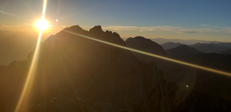
Humboldt Pk - 11:36 PM (4:24) As the trail improved, I blitzed down as quickly as I could safely manage. I knew from this point forward all I had left to do was put miles through my feet, so that was reassuring compared to the last several hours. But I needed to get to that water as soon as possible... “Hey!” a voice called out above me. It was the headlamp, downclimbing the wet gully climbers’ right of the rock feature face-out, flashlight in hand as well. The individual yelled that they were having “serious problems”, and requested that I hang back. I needed to get to that water as soon as possible, and my car was over 15 miles away at that point… but I had to help. I instructed the individual to make their way to the right, at which point they descended to me. The individual was badly fatigued and having a less than pleasant experience with the loose rocks. They asked for me to hang back until we returned to a more defined trail. I agreed, somewhat reluctantly, but mentioned that I needed to get moving as quickly as possible to get back to my car. I knew I couldn’t responsibly leave this person in a dangerous position, but that I also couldn’t afford to endanger myself too much. One of the first rules of my former first responder training is that you can’t help someone by putting yourself in danger. Those 45 minutes on “NE Crestone” began to work their way back into my mind. We moved down the trail slowly, and I had to stop frequently to wait for them to catch up. While I sat and watched the moon rise over the basin, my dehydration increased as my patience waned. I could not afford to keep this pace much longer. After getting back to gentler terrain, the individual informed me they could take it from there. We exchanged pleasantries, and they thanked me graciously for my help. “The important thing is that we both make it back to our tents tonight,” I responded before I dashed off. I was severely dehydrated, and trying to remember how high I had sourced from an excellent waterfall in July among the trees. I made my way across a stand of willows to an open clearing between the South Colony Lakes. I tried to follow the social trails through the willows, but they were interconnected and confusing the dark. Finally I found my way through to the established trail and began charging again. As I ascended I heard the sound of my crashing waterfall fade behind me, and I noticed there were no trees ahead of me. I gambled knowing there was still water above me, and hoped for a waterfall to draw clean water from. I knew I would be in survival mode before long. I found it behind the perch rock all the bighorn sheep like to lounge on. At 9:51 PM, I sourced both of my now very empty water bottles and shook them as hard as I could to dissolve my purification tablets. As soon as I felt comfortable I downed all 40 oz with the Hammer paste, and repeated to draw more water. I knew that wouldn’t be enough to re-hydrate me, but I could not afford to sit and slowly drink this late. Chugging another 40 oz in ten minutes would do little more than force me to relieve myself off the trail in thirty minutes, and I needed to get moving. I knew I wouldn’t be able to source anything until I was back on the Rainbow Trail on the other side of Humboldt, and I didn’t trust my minimal purification system to handle anything below cattle grazing. I set off for Humboldt regardless. There was no way I was orphaning this peak after what I had been through today, and there wasn’t a cloud in the sky. I was touching lightning tonight - I only had to hold on. 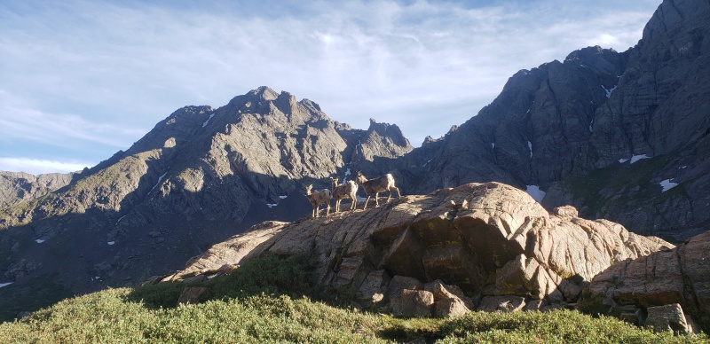
The easy trail up Humboldt to the saddle was a welcome relief after the scrambling of the afternoon and evening. I was able to forego the headlamp once again, having risen high enough to utilize the moon. Despite my fatigue, I kept a great pace. When the trail turned to rock as it hooked right along the ridge, I followed it as best I could in the moonlight. My gut usually tells me to stay on the ridge crest proper, but the Humboldt West Ridge trail weaved across it multiple times. Soon enough I could tell my legs were shot, and I paused considerably more than usual - partially stopping to pick out the silhouettes of cairns against the night sky and partially because my endurance was waning. Looking into the valley east of the Sangre, I could tell the air had also become much more smoke-filled than it had been that morning and I struggled to breathe easily. When I go into death-march survival mode, I stop checking my GPX navigation if I’m staying on an established trail as heavily trafficked as this. Memories of slogging out of the Chicago Basin for over eight miles with a torn rear derailleur hanger came haunting back. That was a 19.5 hour effort, and I never hallucinated or worried about poor decision-making delirium. I knew where I was, and there was an obvious trail that would lead me to where I needed to be. I only had to follow it and stop thinking; checking the miles wouldn’t help. Similarly, the only measurement I allowed myself up Humboldt was to visually gauge my elevation against the illuminated Ellingwood Arête of the Crestone Needle across the Lake. Even in the moonlight, it was a magnificent rock face. I knew the profile of Humboldt well enough to know I had two false summits to crest, so there would be no surprises. After a while, I saw it: the summit. It was actually there. At 11:36 PM there was no yell, no exclamation, no primitive chest-beating despite how I envisioned myself topping out on my 12th summit of the day, what felt like a lifetime ago. I let out a hoarse ‘woo’, my throat dry and raw from dehydration and smoke-filled air. That was all the celebration I could manage. A few texts to update, mark a waypoint, take a picture, and I was off. I humorously thought to myself that even if there was an 800-fill down jacket, a mattress, and a bacon cheeseburger with an over-easy egg, I wasn’t spending another second on that summit. I was finishing this f***ing thing. I ambled down the familiar wide-open slope of Humboldt’s East Ridge in the moonlight. It was surreal. I was actually going to do it, as long as I made it back to the car. I didn’t want to think about those nine miles of the Rainbow Trail. They would be brutal. My endurance was gone, my knees and quads were pounding. I had been reduced to one foot in front of the other. All I could think about was the half-gallon of chocolate milk, juice, and pizza waiting for me at Horn Creek. At some point I tripped and tumbled a few yards, and I could tell I was losing my footing in the dark. That was scary: a broken bone would be fatal this late and this cold. When I packed my bag, I did not anticipate hiking much after midnight. I thought at worst I would maybe hike for a few hours after sunset. I had no idea what I was in for. 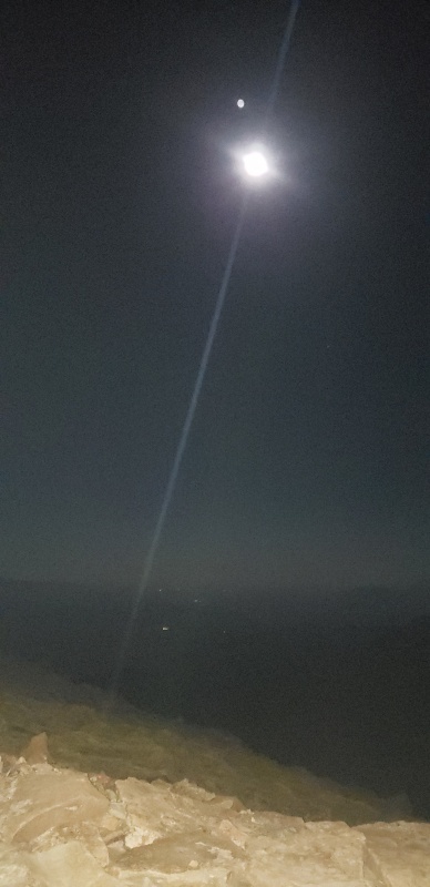
Horn Creek Trailhead - Official Return Time 5:26 AM (5:50) Not good. Thinking fast, I tied my gaiter - my favorite gaiter - around my shin using a spare piece of paracord I always carry and kept moving. I would worry about that at the car. I finally reached a semblance of a trail shortly before the Rainbow Trail intersection. What felt like a mile later at 2:01 AM, I turned north onto the Rainbow Trail towards the faraway Horn Creek campground instead of south to the South Colony Lakes road. This was it: the homestretch. I tried to run the quick calculations of when I would return back, assuming a 2-3 mph pace. It was useless. I was full on death-mode survival mode. I felt every chill and warmth of the air as I ascended in and out of valleys and across ridges. While my legs groaned, my chest warmed at the slightest uphill. Back in July I desperately looked to the east for the lights of Westcliffe or the Horn Creek Ranch, some sign of knowing where I was. I did none of that. All I cared about was to keep moving. I would know where I was when I started seeing signs for Horn Creek. Those signs were soul-wrenching in July. What looked like five miles point-to-point came out to nine with all the switchbacks and turns. I would not allow myself such false hope this time. Left, right, left, right... I'm not sure if I started hallucinating. I definitely started to become more wary of shadows, but I think that can be expected when hiking after dark for so long keeping an eye out for wildlife. I was using my headlamp again once the tree cover was far too strong for the moonlight to shine through, and I could not afford another trip and fall. It never caught the glint of any eyes out in those trees. There were a few clumsy flutters of wings and branch knocks from grouse and owls taking flight when I approached, but nothing more. My stomach was trying to eat itself alive, but all I had left was peanut M&Ms and I could only handle a couple mouthfuls of those at time - too much salt. I had to take my water very sparingly. The miles dragged on endlessly. I could only pull out my GPX a handful of times. I wouldn’t die, but it was brutal. Am I a third of the way? Half? It wouldn't do any good to continue watching my arrow crawl up the track painstakingly slow; I marched on. The signs on this trail would be deflating, and each one would tease me more than the last. I knew not to expect anything until I saw the first one: "Horn Cr. Tr. 2.75". I had no idea what "Horn Creek Trail" meant. Was that the start of the spur? The turn off from the Rainbow Trail? I kept moving, passing by a private property sign off to the right in the woods, signalling I was crossing back near the ranch. My pace was abysmal. After what felt like an hour and a half, the next one: Horn Creek Spur 0.5 I trudged on. Finally, the last one: Horn Creek Trailhead 0.25 I was there. I saw the fence of the ranch. After what felt like the longest quarter mile of my life that would never end, it did. There was no victorious climax, no elation. I turned around to take my last picture and shuffled up the road to the campground. At 5:26 AM, it was over. 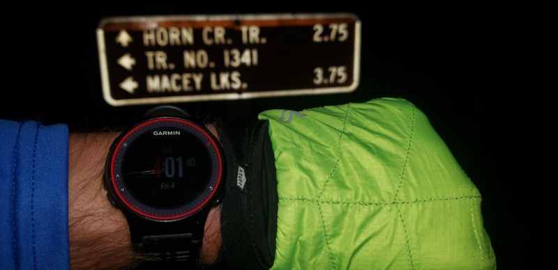

Conclusion It felt rather… lackluster knowing I had left at least an hour or two out there that I could have been faster. I know I wasted close to an hour in the “NE Crestone” to Crestone Pk region, and still more assisting that individual down Broken Hand Pass. With my frustrations over missed turns, back-tracking, and indirect route-finding, a portion of me wants to do this route again at the next available opportunity. But any thoughts of that were dashed on those nine miles back up the Rainbow Trail. I’m sure I will repeat this route again at some point in my life, but I’ll have to let the memory of this effort fade a bit more first. I know I can be in the 21 - 22 hour window simply by mitigating my obstacles. Despite my frustration in the moment I know now that if I hadn't wasted that time on "NE Crestone", it's unlikely I ever would have come across that individual and there was a real possibility they would have had a very bad night coming down the Pass. I took solace in that, and tempered my frustration. It would have been horribly selfish to worry about beating the 24 hour mark for some arbitrary claim over their safety, despite however long I had left in my night. The congratulatory texts and messages were heart-warming. I'm not as comfortable putting myself out on social media as others, but I had no idea how many of my friends and acquaintances were following me that day until I saw their messages. That was really cool, if a bit overwhelming at first. I know that my choice of gear was horribly reckless, but sometimes when you’re trying to wrestle lightning you make some gambles. I got nine stitches in my shin on Friday, and my physicians and I all had a lot of fun talking about my day and their own 14er experiences. It helped that I was pretty loopy from lack of sleep and exceptionally chatty. I had to resist embedding the photo directly into this report, but it's available in the full list of pictures. Attached to this report is my raw .gpx file from the day. I edited the track to make it more tidy for someone else to follow, but for whatever reason when I try to upload that file it says invalid file formatting. The file works fine when I load it into multiple different .gpx file applications, so I guess if you want the Master file just send me a PM. Ride the Lightning. Thumbnails for uploaded photos (click to open slideshow): ")
")
")
")
")
")
")
")
")
")
")
")
")
")
")
")
")
")
")
")
|
| Comments or Questions | |||||||||||||||
|---|---|---|---|---|---|---|---|---|---|---|---|---|---|---|---|
|
Caution: The information contained in this report may not be accurate and should not be the only resource used in preparation for your climb. Failure to have the necessary experience, physical conditioning, supplies or equipment can result in injury or death. 14ers.com and the author(s) of this report provide no warranties, either express or implied, that the information provided is accurate or reliable. By using the information provided, you agree to indemnify and hold harmless 14ers.com and the report author(s) with respect to any claims and demands against them, including any attorney fees and expenses. Please read the 14ers.com Safety and Disclaimer pages for more information.
Please respect private property: 14ers.com supports the rights of private landowners to determine how and by whom their land will be used. In Colorado, it is your responsibility to determine if land is private and to obtain the appropriate permission before entering the property.