| Report Type | Full |
| Peak(s) |
Crestone Needle - 14,196 feet Crestone Peak - 14,299 feet Kit Carson Peak - 14,167 feet Challenger Point - 14,086 feet Columbia Point - 13,986 feet "Kitty Kat Carson" - 13,973 feet "Obstruction Peak" - 13,812 feet "Northeast Crestone" - 14,251 feet |
| Date Posted | 07/13/2018 |
| Modified | 07/17/2018 |
| Date Climbed | 07/08/2018 |
| Author | handonbroward |
| Sangres In A Day - Sans Humboldt |
|---|
|
Summits: Obstruction, Kitty Kat Carson, Columbia Point, Kit Carson, Challenger Point, NE Crestone, Crestone Peak, Crestone Needle Time: 12 hours 25 min car to car Distance: 17.22 miles Vertical: 9,468 Strava Link: https://www.strava.com/activities/1690152048 So last year I got this idea in my head that I was going to take a shot at doing all of the Sangres 14ers in a day, plus whatever else I needed to tag along the way to make it happen. Unfortunately I was not taking enough care of my IT band, even though it had shut me down for the whole end of the 2016 season. I made great time up to the summit of Humboldt, but as soon as I started descending, my knee started tweaking. I barely made it across Obstruction before I realized that I couldn't continue, and had to turn back. It was my second failed long day attempt last year, with my other being my attempt at Lindsey to Gash and around to California, which I screwed up with bad route finding in the dark. I was super bummed heading back from the Sangres, and the 3.5 hour drive with my knee in pain was just a bitter reminder the whole way home. I was cashed out for the season again, and had not hit any of my goals for the season beside the LB -> Blanca traverse. Fast forward to 2018. I started doing some long distance running late winter, hoping to maybe take a shot at a 50 miler this summer, but more importantly to see if I could actually push my days longer without my knee being an issue. It has been going pretty well. Not sure about a race this year because of the time commitment for the training due to my travel schedule for work, but my knee has been doing really well. I decided to take my gf up to Longs and give the NW Couloir a shot on the 4th. Unfortunately the top of the couloir was absolutely soaked with freezing water, I didn't want risk it with her. We decided to bail, but it was about 15 miles and I felt good. Looking at the weather I decided I was going to take a shot at my Sangres in a day again on Saturday, sans Humboldt. Something came up Friday night, but the weather window held for Sunday, so I packed my gear and headed down Saturday afternoon. I arrived to the trailhead about 745pm, and got one of the nice platforms to set my tent up on. 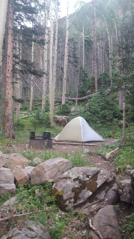 I crashed quickly. The alarm went off at 2am, I finally got up about 225. Made some coffee, changed clothes, doubled checked my kit and headed for the trail. Official start time of 245am. I booked it up the trail towards South Colony Lakes. I made it to the split before the lakes in 1:06, to the actual lower lake in 1:13. As I started towards the Humboldt saddle, I thought that I finally saw some headlamps just over the rise in front of me on the trail at one point. I crested the slight rise only to realize that the "headlamps" I thought I was seeing were actually a family of deer/goats! And only a matter of about 5-10 feet away! The stampeded directly up hill by me, passing within a few feet. It was an adrenaline rush to say the least. I don't know exactly what they were, but they were the same type of deer/goat that I saw a pack of later on my descent. I was feeling pretty good, not sweating too much, and was able to keep good pace up to the Humboldt saddle, arriving there in about 1:50, at 435am. I didn't waste any time and immediately started up across the ride towards Bear's Playground, just at the sun was starting to come up. 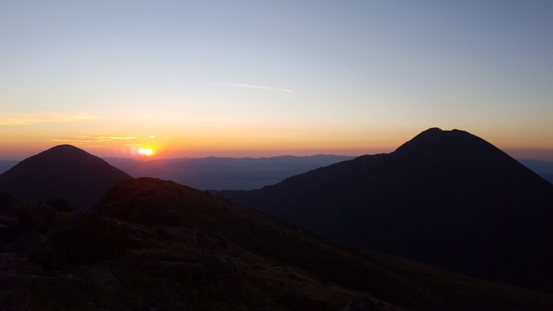 I had been across the ridge to Bear's Playground last year, so it went pretty quickly. I was able to jog/run most of it. I made it to Bear's Playground at about the 2:35 mark, at 5:20am.  My plan from here was the same as last year, stash some gear to lighten the load over to KC and Challenger and pick it up on the way back. I buried my helmet, my extra liter of water and my peanut butter jar under a whole bunch of rocks and started jogging towards Obstruction. The further to the right you head up the ridge towards Obstruction, the easier it is. Sticking to the grass makes ascending to the ridge easier. I powered hiked to the ridge, caught my breath, and took off across the ridge of Obstruction. I know that most people are not huge fans of the up and downs of the Obstruction ridge, but I love it. The drop off to the right is sheer, and running along the ridge feels like you are running on top of the world. Especially right at sunrise, it was an inspiring stretch. The routefinding up to Kitty Kat Carson was a breeze, I didn't actually stop on top, but moved right past to the top of Columbia Point. Super cool that they have the plaques on Columbia and Challenger Point, I didn't know they were up there. I hit Columbia Point in 3:30, at 6:15am. 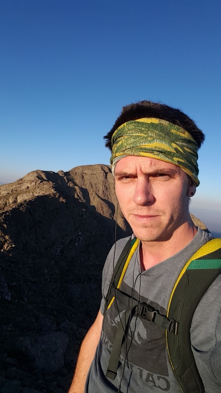 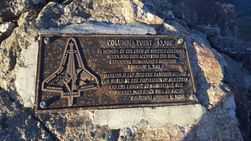 The routefinding from here got a little tricky. I went too far along the ridge, as my gpx track shows, and had to double back to get down towards the 3 gullies that are noted on the route description. Overall, the routefinding from Columbia Point over to KC is kind of a mess. Not necessarily difficult, but more of a "create your own adventure" kind of deal, with any type of terrain from 3rd class up to low 5th available. I was able to follow most of the route description from the page here, with a bit of low 5th downclimbing involved, but it was fun. I got past the difficulties relatively quickly and started working my way up the broken 3rd class ledges and grassy slopes towards the KC summit. Excuse all of my summit pics from this day, I somehow only managed to save the pics of me, not the scenic ones from each summit. 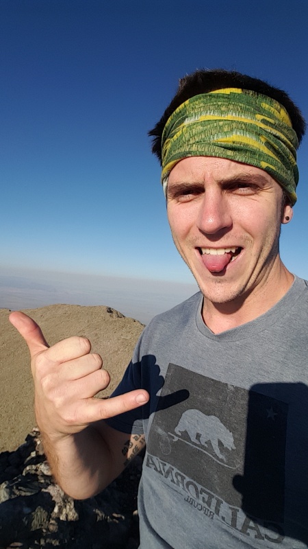 I hit the Kit Carson summit at 7:05am and was feeling good. Total time stood at 4:20 so far. I popped a couple advil and headed down towards the avenue. The descent to the avenue was pretty fun, 3rd class on pretty clean and steep rock, it made for a quick trip down. I cruised up the Avenue to the corner, ran down the other side to the saddle with Challenger, and power hiked my way to the summit of Challenger Point. I didn't realize how much of a difference there is in height between KC and Challenger, it is quite substantial. I hit the summit at 7:40am, total time of 4:55. My goal for summit time of Challenger was 7:30, so I was pretty much right on track. 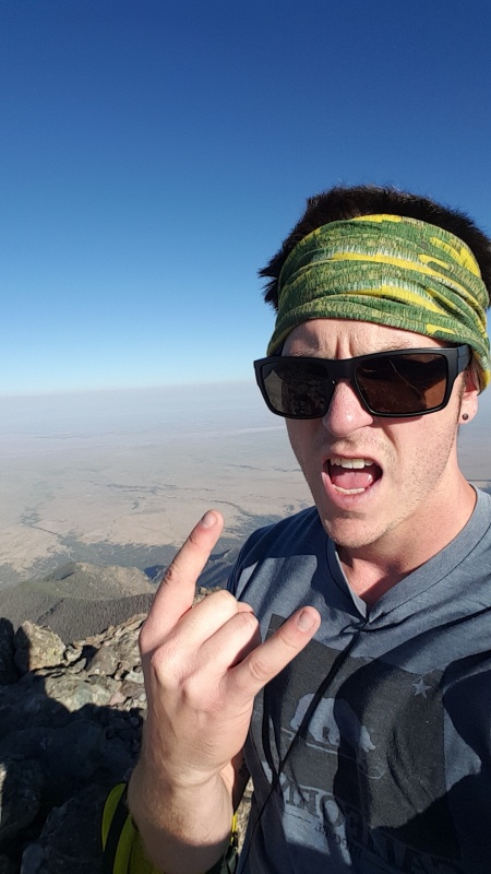 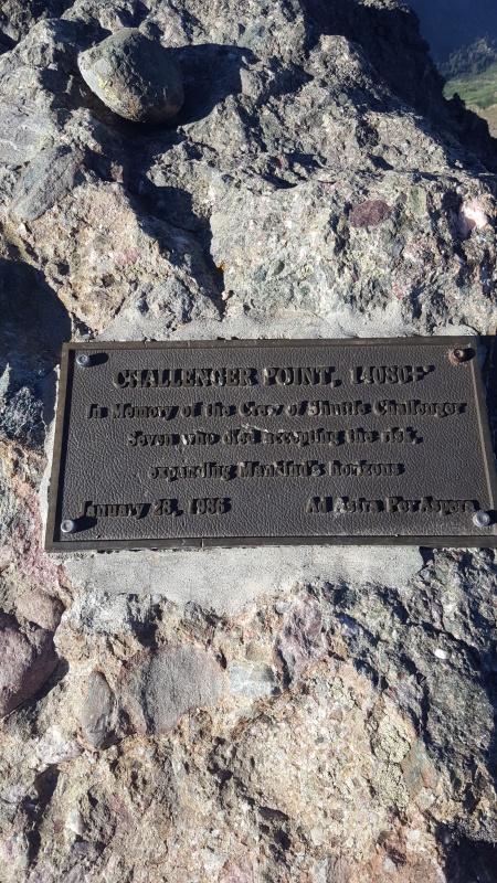 My goal was to be back at Bear's Playground by 9:30am, so I had just under 2 hours, which I figured was about the time it would take to get back. I headed back up the avenue and down the east side, wondered where the hell the 2 guys that had passed me heading up KC had gone. The were at the top of the avenue as I had started back up from the bottom on the west side, and not moving super fast. I turned the corner and they were gone. I was a bit concerned, but in the end I didn't hear of any incidents in the Sangres this weekend, so they must have been fine. Going back up Columbia I had yet some more routefinding issues. I had come across so high initially that when I came back around from the avenue lower down, I had no idea where my initial route had been. I followed some cairns down low and across, and ended up in some 3rd-ish class gully further east that the standard routes. It seemed ok until I got to the top. There were a couple badly placed cairns. I ended up in some pretty sketchy terrain, thinking that I could climb over one of the small towers to resummit Columbia. Instead I ended up in some low 5th terrain, overlooking a sheer drop of hundreds of feet. Oops. Little bit of a downclimb, little bit of backtrack, and I was able to find a 3rd class back up and over Columbia. I resummitted Kitty Kat as well, trying to style the route as much as possible. I headed back up and over Obstruction as well. I know that Conor said he had no trouble taking the lower route back around Obstruction, but I side hilled it on my retreat during my failed attempt last year and it was miserable for me. I crossed back across the summit ridge to the grassy slopes on the east side of Obstruction and headed straight back down to Bear's Playground and my cache. I arrived back there at about 9:15am, for a total time of 6:30 so far. 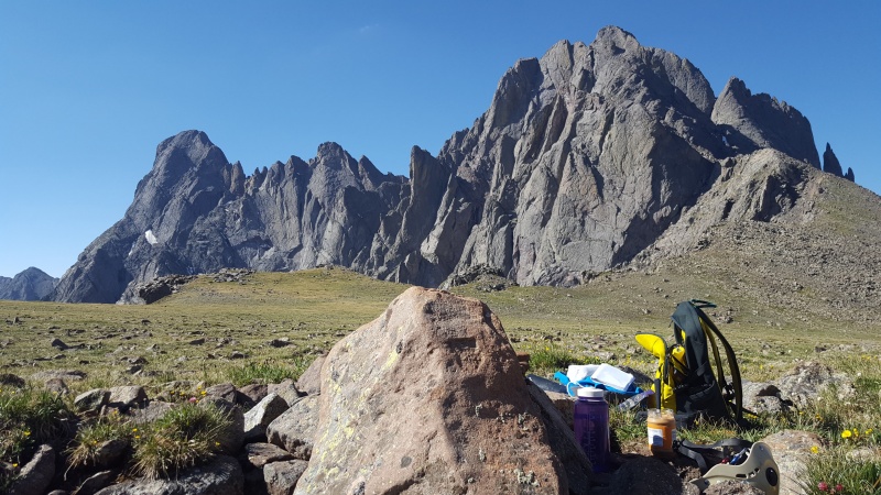 I tapped into my second liter of water with a few sips, ate some peanut butter, and loaded back up with my full kit. It was heavy with everything in my pack, and my nerves were running pretty high. I knew the that NW Buttress and traverse to Crestone Peak proper was going to be the crux of the route. Probably not truly close to beyond my limit, but arguably one of the most challenging objectives I had taken on solo, even if it was pretty short overall. I made good time up to the shoulder, approaching the N/NW Buttress area pretty quickly and trying to scope out exactly where the route was supposed go. To be honest, there isn't really A route up the NW Buttress. It is much more of a "make your own adventure" area as well, similar to the west side of Columbia. There are a few cairns up there, but typically at the top of a gully of some sort, and hard or impossible to see from below. I took my time ascending, trying to make sure I could keep an eye on the summit of NE Crestone, and not wandering too far right or left. Even though you can wander quite a bit, getting off route is pretty much impossible as there is sheer exposure if you go too far to either side. I hit the summit of NE Crestone right at 10:30am, with a lump in my throat. The summit is pretty small, and you are immediately starting down the challenge of finding a route across to the top of the red gully. Total time 7:45. 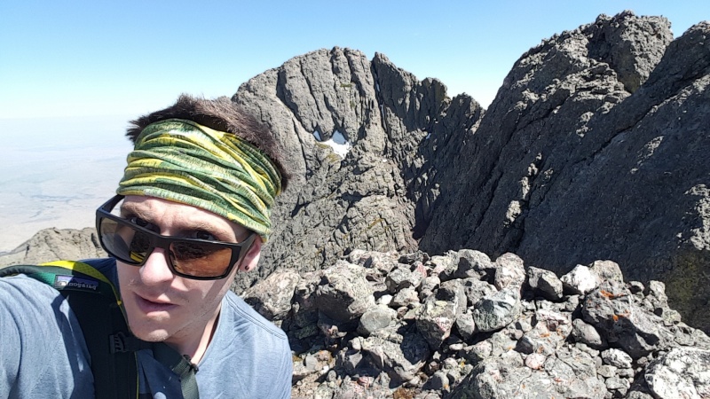 I figured rather than wait around and work myself up, I should go right for it. I checked on a direct route right over the summit, no go. I climbed back to the west a bit and checked around the northeast side, no go. I checked directly east over the top, where the "notch" supposedly is, not a chance I was downclimbing that, and it did not look like the notch. Even though everyone says do not downclimb to the southwest, from above it looked like there was a weakness that lead down to the traverse area. I scooted down that way a bit, worked my way back east around the corner, and was able to step down and into the small gap. Deep breath, exhale, try to not overthink it. Keep moving on. The pic below details my route off of NE Crestone, in BLUE. The recommended route from other TRs is in RED. 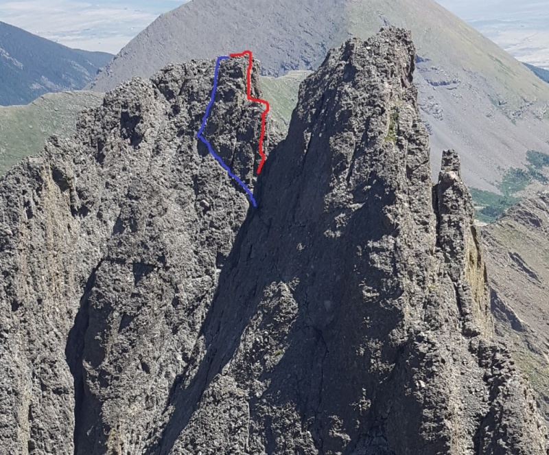 Honestly, even with the exposure, my line highlighted in blue probably is not much more than 3rd class. Maybe a move or two of 4th class, but not too bad overall. Way less hair-raising than I expected. If you were to continue down, to the southwest, where my line cuts back right in the photo, it would get dangerous very quickly, as other TRs note. Regardless, I still had the very exposed traverse across to the notch & red gully. It is 100% a "no fall" zone, but after what I assumed was the worst behind me, it was a blast. Cobbles and cracks, having to trust your feet and friction the whole way across. It is best to trend downwards as you cross towards the Peak. The higher you stay, the more difficult it gets, and you wander into 5th class territory very quickly. Twice I had to downclimb low 5th to get back to a spot where I could progress further. Soon I was in the red gully, know as the NW Couloir of Crestone Peak, which is actually split into 2 separate gullies up high. The wider (what I assume is standard) one is on the right. I ended up going up the left, however. It is very narrow, and has some loose, semi-sketchy 4th class-ish climbing right at the top. I crossed over into the right side at the top, and moved to the summit of Crestone Peak pretty quickly. I hit the summit at 11:20, and was pumped! I had knocked off what was most definitely the hardest part of my day, and had loved every minute of it. Plus, I was still on schedule. I did not want to start the traverse to the Needle later than 11:30, as I still had to get back to my truck and Denver at a reasonable enough hour that I could convince myself to go to work Monday morning. Total time 8:35. 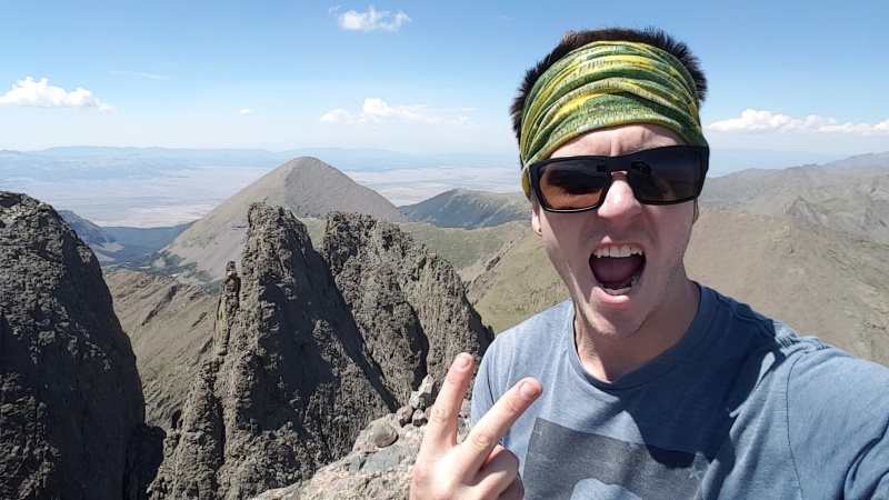 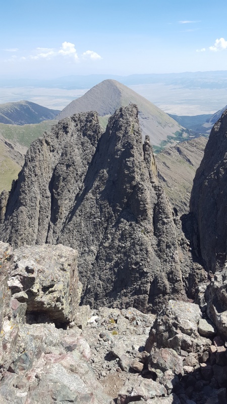 I chatted for about 2 minutes with the two women who were on the summit as I came up. Drank some water, ate some more peanut butter, and prepped for the traverse. I was pretty sure that it was not going to be as much of a challenge as what I had just come across, but I was about 10.5 miles in and starting to feel the heat of the midday sun. I caught one shot to the west and packed my kit back up. 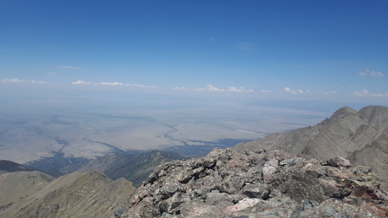 I dropped off the summit at 11:35am, only 5 minutes behind what my goal was. I was able to see the cairn designating the start of the traverse from the summit of Crestone Peak, and I made quick time down to it. Personally, I thought that the traverse from Peak to Needle was pretty easy, short of the Black Gendarme and the last pitch to the Needle. You need to be able to spot cairns well, and have a good nose for routefinding, but it is pretty much the past of least resistance, with knowing when to look for a cairn down low when you need to traverse instead of ascend whatever is above you. Once you get far enough along, the Black Gendarme is impossible to miss, and you just aim for the gully that leads up into it. Before I knew it, I was at the base of "the move." I stepped up left, found a good jug, and pulled myself up and over. Definitely a bulge pull, but pretty easy as long as you get your feet up, which is pretty much the mantra for all low 5th climbing. That being said, it appears that there is definitely the ability to 4th class around "the move" to the left side. I was going to downclimb and give it a shot, but I was making good time and didn't want to slow down, so I moved on. I turned right at the knife edge, as described in the route description, headed up the split gully on the right side, and arrived at the base of the money pitch. I had spent the past half hour looking up at its glory, and was psyched to get on it. It lived up to its rep. An amazing pitch to the top on knob and conglomerate heaven, with a few loose rocks here and there. Before I knew it, I was whooping as I pulled over on to the top. I could have done 1000 feet of the climbing it was so good. I scooted the last 50 feet to the summit of the Needle and checked my watch. 12:40pm. 1:05 to complete the traverse, total time of 9:40. Total distance of just under 12 miles. 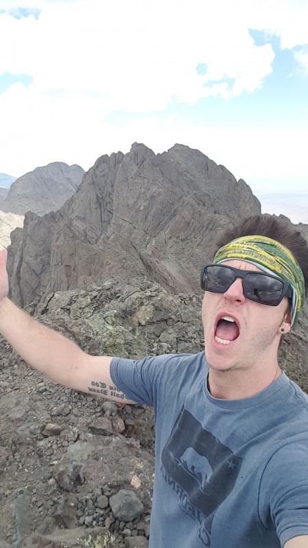 I was surprised by how good I felt at this point, but I knew that I had 5-6 miles left back to my truck, plus the descent of Broken Hand Pass, which I had never stepped foot in before. I drank some water, ate a bit more peanut butter, signed the summit register and headed off the summit. It is easy to see how people get a bit confused coming off the summit of the Needle. The cairns for the west gully head due south out a ridge that looks like it disappears into nowhere. In contrast, the cairns that lead to the east gully for a descent skipping the west gully are quite easy to see for a ways down. I opted for a descent of the complete east gully. It is quite wide, and somewhat well cairned. Honestly, I don't think that it is 4th class unless you choose for it to be. Difficult 3rd class, and quite steep and exposed at parts, but doable as 3rd class. You have more than a plethora of routes to choose from with how big the gully is. Definitely some loose stuff that you could knock onto parties below, but fortunately I was the only one in the gully during my whole descent. As I got towards the bottom, I could see the trail over to Broken Hand Pass. However, I was descending a bit too fast and missed where it joins the gully higher up. I could see another trail linking to it at the very base of the gully, but I was doing my best to avoid having to regain any elevation at this point. I scrambled left over some slightly hairy terrain, making some low 5th class moves around some bulges and ledges until I was finally able to drop onto the trail and head towards Broken Hand Pass. My plan initially was to attempt Broken Hand Peak as well, but I was out of time. If I hadn't gotten delayed and pushed my trip to Sunday, I absolutely would have knocked it off. However, I still had 3.5 hour drive back to Denver after I got done, so I rightfully decided to head down the pass. So, I had never been up Broken Hand Pass before, and after descending it, I don't know if I ever will make an ascent of it. Even if I were to come back and do the traverse again, I think I would rather repeat my route or approach from Cottonwood Lakes rather than Broken Hand Pass. It is very loose, it is very steep, and often times early in the morning it is packed with people as you can see the trail of headlamps lining it. Overall, I have done much worse, but it is still arguably my least favorite type of terrain, along with everyone else I suppose. I made pretty good time down the lakes, hoping to be able to find the cut through to the "pack trail," rather than having to take the Broken Hand Pass "approach" trail all of the way, which goes out and around quite a bit. I was slightly delayed at the lakes, as there was a huge pack of the deer/goats hanging out on and around the trail. Quite a few little babies amongst them, pretty cute! I wanted to just cruise right through, but there were about 5-7 other people standing around watching them, so I didn't want to be the dick disturbing the wildlife. I waited around about 5 minutes until they had moved off the trail and got moving again. I was able to find a cut through across the stream, below the lower lake, that took me right through the biggest cluster of the lower camp sites, and connects back to the trail that leads up to the Humboldt saddle. You can see it on my GPX track. I figured it would help cut maybe 10-15 minutes off at most, but anything helps during a day as long as this. As soon as I was confident I was on the right trail, I picked up my pace and started running. The slog back down from the lakes is never quite as fun. The faster it was over for me the better. And it was HOT. I was ready to be done. My goal for the entire day was a sub 12 hour time. I realized during my descent of Broken Hand Pass that I was not going to hit that goal without pushing the pace too much and being too risky. But, I figured I could still make 12:30 round trip time. I was trying not to check my watch on the way down, but it was difficult knowing I was pushing to be just half an hour off my time. Suddenly, the bridge appeared! I stopped my clock at 3:10pm, 12:25 total time, 17.22 total mileage, as I entered the lot. Success! I have no doubt I could have come in at under 12 hours, but I took quite a bit of time ascending the NW Buttress of NE Crestone and descending the Needle, as it was my first time on either of those routes and I knew routefinding would be tricky. I realized that I had not checked in with my GF at the top of the Needle, so I gave a quick call to let her know I was down. Packed up my stuff, changed clothes, drank about 2 liters of all different types of fluids, hopped in my truck and headed down the road. The most frustrating part of the 4WD road is that there is no speeding up the pace. Slow and steady is the only way. However, I was rewarded with a stunning sight about 3/5 of the way down. Out of nowhere, an Infiniti Q50 sedan was coming directly up the road at me! How he had already managed to get to where he was, I will never know. It was a suicide mission. I pulled over, and in the 30 seconds it took for him to pass me I head numerous clunks and slams as he bottomed out. I could not resist catching a shot of him. Even though it looks like he is on relatively easy terrain, there was a very, very step rise that he conquered just before I took the picture. As he drove by he looked at me and said "did you just take a picture of me?" Yes, yes I did. 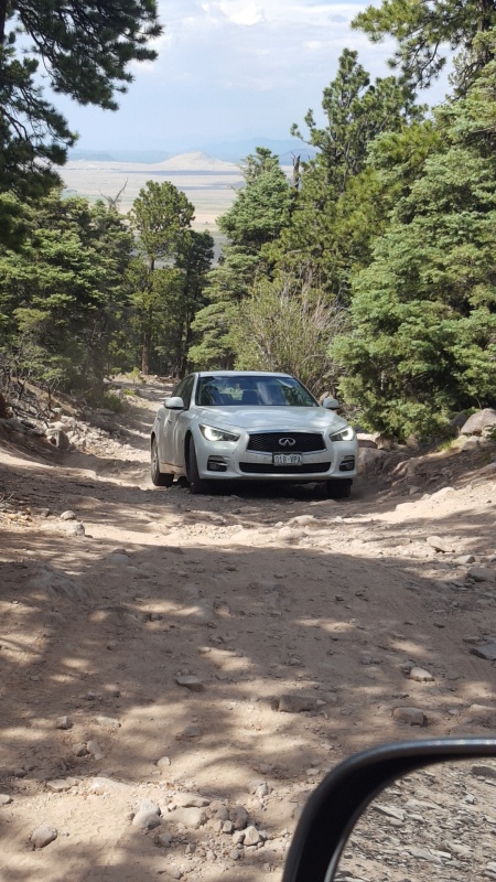 I made my way down the rest of the road and towards Denver. I felt surprisingly good. My knee didn't hurt at all, my legs felt pretty good, and I had stayed hydrated enough that I was not completely burned out. I could not have been happier with the result, and it bodes well for future plans. The only area for improvement that was noticeable was the weight of my kit. I need to learn to slim it down a bit more, and analyze my actually calories that I am carrying vs what I could get away with at a bare minimum. The same goes for water, which was especially challenging on this trip with the only refill spots being at the lakes, close to the extreme beginning and ends. Definitely looking forward to some more long days before the end of the season! 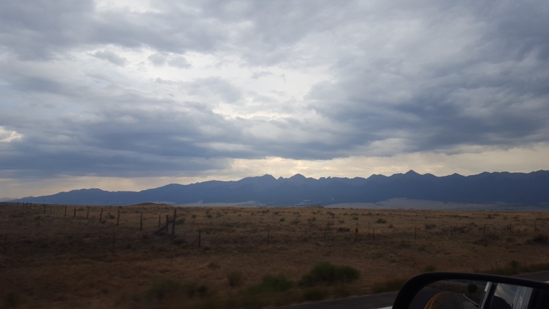  Thumbnails for uploaded photos (click to open slideshow): ")
")
")
")
")
")
")
")
")
")
")
")
")
")
")
")
")
")
|
| Comments or Questions | |||||||||||||||
|---|---|---|---|---|---|---|---|---|---|---|---|---|---|---|---|
|
Caution: The information contained in this report may not be accurate and should not be the only resource used in preparation for your climb. Failure to have the necessary experience, physical conditioning, supplies or equipment can result in injury or death. 14ers.com and the author(s) of this report provide no warranties, either express or implied, that the information provided is accurate or reliable. By using the information provided, you agree to indemnify and hold harmless 14ers.com and the report author(s) with respect to any claims and demands against them, including any attorney fees and expenses. Please read the 14ers.com Safety and Disclaimer pages for more information.
Please respect private property: 14ers.com supports the rights of private landowners to determine how and by whom their land will be used. In Colorado, it is your responsibility to determine if land is private and to obtain the appropriate permission before entering the property.